Self-Guided Walking Tour of Cannes (2026)
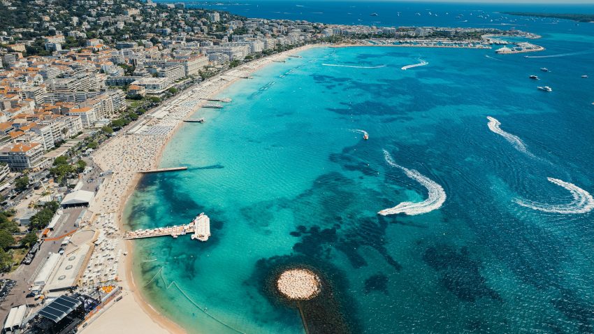
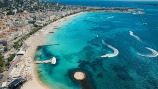
Aerial view of Cannes Beach
Self-Guided Walking Tour of Cannes

This website uses affiliate links which earn a small commission at no additional cost to you.

Cannes is one of the French Riviera's most recognisable resorts, known for La Croisette, sandy beaches, luxury hotels, marina life, and its close association with international cinema. The Palais des Festivals et des Congrès is the city's best-known modern landmark and hosts a large programme of events throughout the year, with Cannes promoting itself as a major business and cultural destination on the Côte d'Azur.

For visitors, Cannes works best as a polished coastal base rather than a museum-heavy city. The seafront, old quarter of Le Suquet, Forville Market, harbour, beach clubs, and boat trips to the Îles de Lérins give it more variety than its film-festival image suggests. It suits travellers who want Riviera glamour, sea views, restaurants, shopping, and easy access to Antibes, Nice, Grasse, and the wider Côte d'Azur.

How to Get to Cannes

By Air: The main airport for Cannes is Nice Côte d'Azur Airport, which is the most practical choice for most international and domestic arrivals. From there, you can continue to Cannes by train, airport bus/coach connections, taxi, private transfer, or hire car, and the onward journey is usually straightforward. Cannes also has Cannes-Mandelieu Airport, but it is mainly used for business and general aviation rather than regular commercial flights. For the best deals and a seamless booking experience, check out these flights to Cannes on Booking.com.

By Train: Cannes is easy to reach by rail and is a convenient option if you are travelling from other cities in France. The main station is Cannes station, which is well placed for reaching the centre on foot, and routes typically connect through major hubs such as Nice, Marseille, and Paris depending on your starting point. Train travel is often one of the simplest ways to arrive if you want to avoid parking and start exploring soon after you get there. You can use SNCF Connect to check schedules, compare routes, and purchase tickets for National (SNCF ) and regional trains (TER). For a more streamlined experience, we recommend using Omio, which allows you to easily compare prices, schedules, and book tickets for both National and Regional travel across all of Europe, all in one place.

By Car: Driving to Cannes can work well if you are exploring more of the French Riviera, travelling with luggage, or planning day trips before or after your visit. Road access is straightforward via the motorway network, but traffic and parking can be more challenging in peak periods and during major events, so it helps to plan ahead. Long-distance buses and coaches can also be a useful budget alternative on some routes, especially from nearby cities and airports. If you are looking to rent a car in France I recommend having a look at Discover Cars, first, as they compare prices and review multiple car rental agencies for you.

A Short History of Cannes

Early Cannes and the Origins of Le Suquet

The earliest history of Cannes is tied to a small settlement that developed around the hill now known as Le Suquet, where the city's oldest quarter still preserves its historic character. This elevated position offered a defensive advantage, and over time it became the focus of religious and civic life. Landmarks such as Notre Dame d'Espérance and the site that now houses the Musée des Explorations du Monde reflect this early phase of Cannes, when the town was far smaller and more closely tied to maritime activity and local agriculture.

Below the hill, the shoreline and harbour area gradually became more important as trade and fishing developed. What is now the Vieux Port grew in significance as a working waterfront, linking Cannes to regional commerce and seafaring networks. The old town streets that survive today, including the area around Rue Meynadier, preserve something of this earlier urban pattern, where daily life centred on markets, workshops, and the port.

Medieval and Early Modern Cannes

During the medieval period and into the early modern era, Cannes remained a modest but active coastal town shaped by religious institutions, local power structures, and the practical demands of defence and trade. The hilltop quarter continued to dominate the settlement, while the lower town expanded slowly around routes that connected homes, small commercial spaces, and places of worship. The historic fabric of Le Suquet still hints at this period, with narrow streets and a compact layout that contrasts with later urban development.

Cannes did not yet have the grand seafront image it is known for today. Instead, it functioned as a local town with a working harbour, modest civic life, and a close relationship to surrounding rural production. The enduring importance of market culture, now represented by Marché Forville, has roots in these earlier patterns of exchange, when food supply, local trade, and everyday commerce were central to the town's identity.

19th-Century Cannes and the Rise of a Resort City

The 19th century transformed Cannes dramatically, as improved transport and growing international interest turned it into a fashionable destination for winter visitors and wealthy travelers. This was the period when the city expanded beyond its old core and developed elegant new districts, wider streets, and promenades designed for leisure as much as movement. Boulevard de la Croisette became the defining symbol of this new Cannes, reshaping the shoreline into a prestigious seafront lined with hotels, villas, and social spaces.

At the same time, commercial streets such as Rue d'Antibes grew in importance as the city's modern retail and urban life expanded. Cannes evolved from a small port town into a place associated with comfort, style, and seasonal high society, while still retaining the older districts around the port and hill. This layering of old and new is still one of the most interesting aspects of the city's history and cityscape.

20th-Century Cannes and the Global Image of Cannes

In the 20th century, Cannes developed an international cultural identity that extended far beyond its Riviera setting, largely through cinema and major events. The creation and later expansion of the Palais des Festivals et des Congrès made Cannes globally recognised as a centre of film culture, conferences, and international gatherings. This changed the city's economy and image, reinforcing its role as both a resort destination and a major events city.

Modern Cannes also continued to invest in culture and public identity in other ways, including visual art in the urban landscape such as Les Murs Peints, which celebrate film and local character through large painted murals. While the city became more famous and more polished, its history remained visible in the contrast between the Vieux Port, the old quarter around Notre Dame d'Espérance, the market traditions of Marché Forville, and the modern glamour associated with the Croisette and the Palais des Festivals.

Cannes Today and the Layers of Its Past

Today, Cannes presents a city shaped by many distinct eras, from its early hilltop origins and working port to its 19th-century resort expansion and 20th-century global cultural profile. Walking between the Vieux Port, Rue Meynadier, Rue d'Antibes, and Boulevard de la Croisette reveals how each period added a new layer rather than fully replacing what came before. Historic religious and civic landmarks coexist with luxury shopping, event venues, and contemporary public spaces.

This blend of continuity and reinvention is a key part of Cannes's appeal. The city's past is not confined to one monument or district, but spread across its churches, museums, markets, streets, and waterfront. From the older character of Le Suquet to the modern prominence of the Palais des Festivals et des Congrès, Cannes tells a story of adaptation, ambition, and changing identity over centuries.

Where to Stay in Cannes

To make the most of visiting Cannes and this walking tour, then you should consider staying overnight near the centre so you can start early, explore on foot, and take breaks without needing transport between most stops. The best base for convenience is the central area around the Palais des Festivals, the train station, and the lower end of Rue d'Antibes, where you are close to the port, shopping streets, and the seafront. Good options here include Hôtel Barrière Le Majestic Cannes, Hotel America, and Five Seas Hotel Cannes.

If you want a more atmospheric stay with easier access to the old-town part of the route, look around Le Suquet and the streets near Marché Forville and the Vieux Port. This area suits travellers who want to be close to historic lanes, local restaurants, and a quieter evening feel while still being able to walk to the Croisette and central sights. Strong choices include Hôtel LE SUQUET CANNES, Chanteclair, and Hôtel & Spa Belle Plage.

For a stay that balances walking-tour access with beach time and shopping, the Rue d'Antibes and mid-Croisette area is an excellent option. You will be well placed for boutiques, cafés, and seafront strolls, and it is still an easy walk back toward the old town and port stops on the route. Good picks in this part of Cannes include Hotel Le Canberra, Cannes Croisette Prestige Appart'Hôtel, and Eden Hôtel & Spa Cannes.

Your Self-Guided Walking Tour of Cannes

Discover Cannes on foot with our walking tour map, which guides you between each stop as you explore the city at your own pace. Because this is a self-guided walking tour, you are free to skip places and take coffee stops whenever you want.

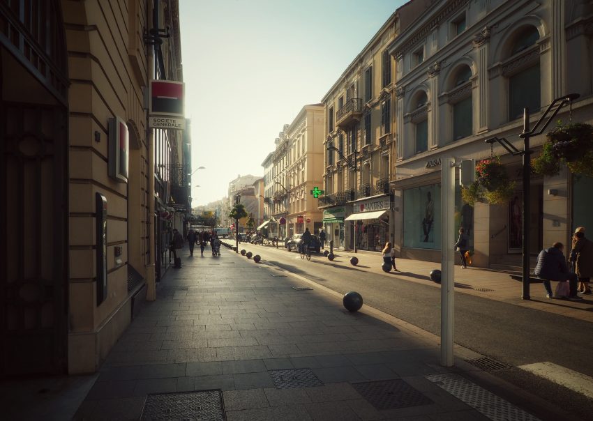
1. Rue d'Antibes
Rue d’Antibes
Rue d’Antibes
CC BY-SA 2.0 / Ștefan Jurcă

Rue d’Antibes is one of the central streets in modern Cannes and has played a major role in the city’s development as a resort and shopping destination. Named for the direction it leads, it evolved into a major urban artery as Cannes expanded in the 19th and early 20th centuries. Today it stands as a historic-commercial counterpart to the seafront Croisette, reflecting the city’s growth inland from the shoreline.

The street is now known as the epicentre of shopping in Cannes, with a very high concentration of boutiques and brands. Official tourism sources emphasize both the scale of retail here and its open-air format, which makes it more than just a shopping strip; it is one of the main urban promenades in the city centre. Its importance is not only commercial but also social, as it links multiple districts and side streets.

When visiting, what to see depends on your interests: fashion and international brands, local specialty shops, and the changing architecture and passages that branch off toward the Croisette and adjacent streets. Even if you are not shopping, Rue d’Antibes is useful for understanding the everyday energy of central Cannes and how the city balances luxury tourism with mainstream urban life.


Location: Rue d'Antibes, 06400 Cannes, France | Hours: 24 Hours. | Price: Free.

We recommend to rent a car in France through Discover Cars, they compare prices and review multiple car rental agencies. Book your rental car here.

2. Boulevard de la Croisette

Boulevard de la Croisette
CC BY-SA 4.0 / Txllxt TxllxT

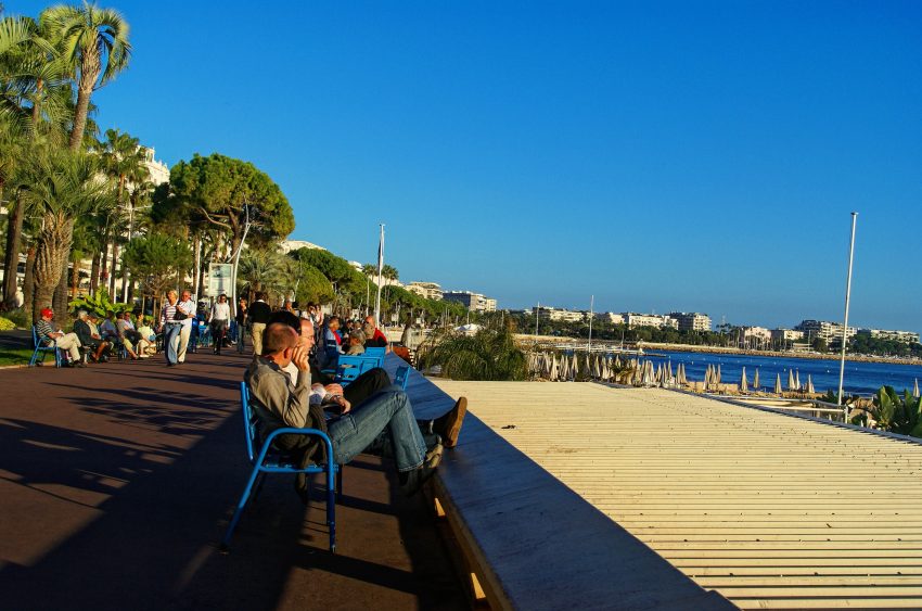
Boulevard de la Croisette is the most famous promenade in Cannes and one of the key reasons the city became internationally known. Its development in the 19th century accompanied Cannes’ rise as a fashionable seaside resort, and over time it became lined with grand hotels, beaches, and leisure spaces. The Croisette’s history is therefore closely tied to Cannes’ shift from a small coastal town to a Riviera destination of prestige.

It is also inseparable from film history because the Cannes Film Festival became associated with this waterfront area, first through earlier venues and later through the present Palais des Festivals at one end of the boulevard. The Croisette is where the city’s global image is performed most visibly: cinema, luxury, sea views, and ceremonial spectacle all meet here.

What to see on the Croisette includes the promenade itself, the line of historic and luxury hotels, beach clubs, palm-lined sea views, and the changing public spaces along the waterfront. It is worth paying attention to both old and new elements, as recent redevelopment has aimed to modernise the boulevard while highlighting its historic identity. More than a single sight, the Croisette is an experience of Cannes’ public face.


Location: Bd de la Croisette, 06400 Cannes, France | Hours: 24 Hours. | Price: Free.

Here is a complete selection of hotel options in Cannes. Feel free to review each one and choose the stay that best suits your needs.

3. La Malmaison

La Malmaison
La Malmaison
CC BY-SA 3.0 / bynyalcin

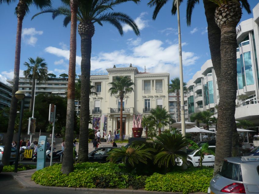
La Malmaison is one of Cannes’ most important heritage buildings on the Croisette, and its history reflects the city’s rise as a Riviera resort. Built in the 19th century as an annex to the Grand Hôtel, it later evolved through different uses before becoming a municipal contemporary art venue. This layered past is part of its appeal: it is not just a gallery space, but a surviving Belle Époque landmark in a part of Cannes that has changed dramatically over time.

In recent years, La Malmaison entered a new phase after a major renovation and extension, reopening in early 2025 as an expanded international contemporary art centre. The redevelopment preserved the building’s heritage character while significantly increasing exhibition space, which has strengthened its role in Cannes’ cultural life beyond the film festival. It is now presented as a flagship art venue on the Croisette, combining historic architecture with a modern exhibition programme.

What to see when visiting depends on the current temporary exhibition, as La Malmaison focuses on rotating contemporary art shows rather than a fixed permanent collection. Beyond the artworks, the building itself is worth attention, especially the contrast between the historic façade and the renewed interiors. If accessible during your visit, the panoramic terrace overlooking the Croisette and the Mediterranean is also a highlight, adding a strong sense of place to the art experience.


Location: 47 Bd de la Croisette, 06400 Cannes, France | Hours: September – June: Tuesday – Sunday: 10:00–13:00 & 14:00–18:00. September – June: Closed on Monday. July – August: Daily: 10:00–19:00. | Price: Adults: €6.50; Reduced: €3.50; Free (with proof) for eligible visitors and on the 1st Sunday of each month (November – March). | Website

Traveling to a country with a different currency? Avoid ATM transaction fees and pay in local currency with a Wise Card. Having used it for over 5 years, we've saved loads on fees!

4. Palais des Festivals et des Congrès
Palais des Festivals et des Congrès
CC BY-SA 3.0 / Kazimierz Mendlik

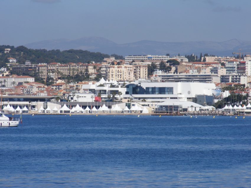
The Palais des Festivals et des Congrès is one of the defining symbols of modern Cannes, but its story is tied to the longer history of the Cannes Film Festival itself. The festival’s roots go back to the late 1930s, with the first proper post-war edition held in 1946, and the event later moved through earlier festival buildings before the current Palais became the main venue in the early 1980s. The present complex represents Cannes’ transformation from a fishing town and winter resort into a global events capital.

What most visitors come to see first is the famous staircase and forecourt associated with the Cannes Film Festival. Even outside festival season, people stop here for photos, to look at the handprints nearby, and to get a feel for the city’s cinema identity. The building itself is a major conference and exhibition venue, so the atmosphere changes depending on what is on, from film-related events to trade shows and cultural gatherings.

When you are here, also pay attention to the setting rather than only the façade. The Palais sits beside the Croisette and close to the Old Port, so it is a useful place to take in Cannes’ contrasts: luxury waterfront, working marina activity, and the old quarter rising behind. If the interior is accessible for a public event or exhibition, it is worth stepping inside; otherwise, the exterior steps and seafront views are the main draw.


Location: Palais des festivals et des congrès de Cannes, 1 Bd de la Croisette, 06400 Cannes, France | Hours: Check official website. | Price: Prices vary by show. | Website

5. Vieux Port
Vieux Port
Vieux Port
CC BY-SA 4.0 / Jer Crunc

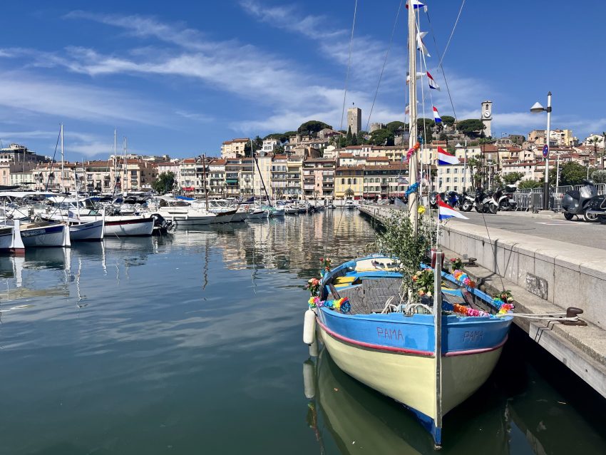
Cannes’ Vieux Port preserves the maritime side of the city that existed long before red carpets and luxury boutiques. The port developed from the small fishing settlement at the foot of Le Suquet, and it remains one of the clearest reminders of Cannes’ original identity. Over time it expanded and modernised, but it still functions as a historic threshold between the old town, the sea, and the later glamour of the Croisette.

Today, the main pleasure of visiting the Vieux Port is watching the mix of boats and the movement around the quays. You can see everything from local craft and ferries to larger yachts, depending on the season, and the masts create one of the classic Cannes views. It is also a key departure area for boats to the Lérins Islands, which gives the port a practical role as well as a scenic one.

The best things to notice are the relationship between the harbour and the surrounding landmarks: Le Suquet above, the quays below, and the Palais des Festivals across the waterline. If you visit during major boating events, the atmosphere can be especially lively, but even on an ordinary day the port is one of the easiest places to read Cannes as a city shaped by both sea trade and tourism.


Location: Jetée Albert Edouard, 06400 Cannes, France | Hours: 24 Hours. | Price: Free. | Website

6. Les Murs Peints
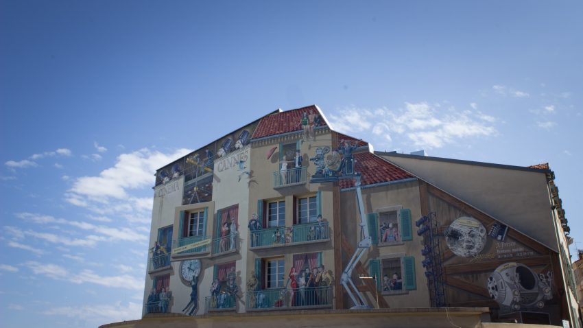
Les Murs Peints
Les Murs Peints
CC BY-SA 4.0 / V4nco

Les Murs Peints are a more recent layer of Cannes’ cultural identity, created to celebrate the city’s long association with cinema beyond the festival period. Rather than one single monument, they are a series of large painted murals spread across Cannes, each turning an ordinary wall into a tribute to film history, iconic actors, or memorable scenes. They show how the city has woven cinema into everyday streets and neighbourhoods.

What makes them interesting is the variety of styles and locations. Some murals are in well-trafficked areas, while others appear in quieter corners, so seeing them feels a bit like discovering an open-air gallery. The official Cannes material highlights that they are scattered from the Croisette to Le Suquet, which means they also help you notice different parts of the city while following the film theme.

When visiting, look closely at the artistic details and the way each work uses the building surface and surrounding street. Some murals focus on classic cinema references, while others are more playful or nostalgic. Even if you do not recognise every character, the murals are worth seeing because they capture Cannes’ public image—cinema, spectacle, and visual storytelling—outside the formal festival venues.


Location: 1 Quai Saint-Pierre, 06400 Cannes, France | Hours: 24 Hours. | Price: Free.

7. Notre Dame d'Esperance
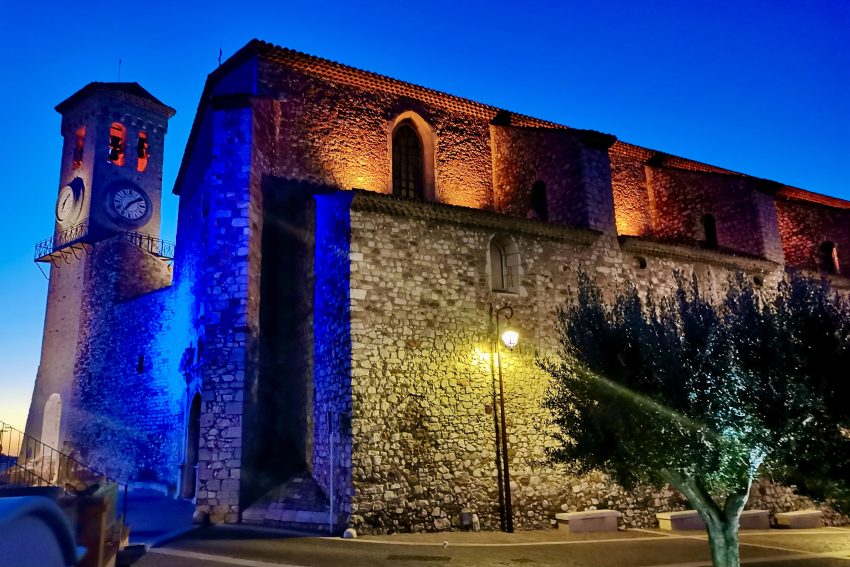
Notre Dame d’Esperance
CC BY-SA 4.0 / Gillesmangiantini

Notre-Dame d’Espérance is one of the most important historic religious buildings in Cannes and a major landmark of Le Suquet. Built on the hill above the old quarter, it replaced an earlier chapel and was constructed over a long period from the 16th into the 17th century, with interruptions linked to instability and epidemics. That extended construction history helps explain its layered Gothic and Renaissance character.

Inside, the church is valued for its calm atmosphere and its architectural details rather than overwhelming grandeur. Sources describe a single nave with side chapels and a semicircular choir, and many visitors come as much for the historic interior as for the sense of continuity with old Cannes. It is one of the places where the city feels older, quieter, and less tied to the modern Riviera image.

What to see here includes both the church itself and the views around it. Because of its elevated position in Le Suquet, the area offers some of the best perspectives over Cannes, including the old quarter, the port, and the bay. It is especially rewarding to take your time in the square and nearby lanes after visiting the church, as the setting is part of what makes the site memorable.


Location: 1 Rue de la Castre, 06400 Cannes, France | Hours: Daily: 09:00–17:00. | Price: Free; donations appreciated.

8. Musée des Explorations du Monde
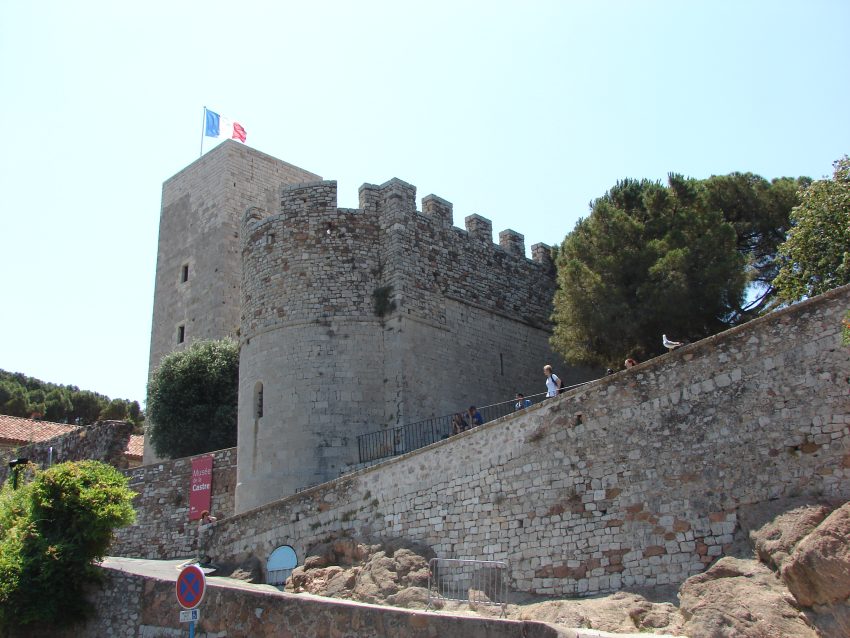
Musée des Explorations du Monde
CC BY-SA 3.0 / M.Strīķis

The Musée des Explorations du Monde is housed in a historic hilltop complex above Le Suquet and is one of Cannes’ most distinctive cultural sites. Formerly known as the Musée de la Castre, it was renamed at the beginning of 2021, but the museum’s role remains rooted in displaying collections that connect Cannes to wider world cultures and historical eras. The city acquired the buildings in 1919 to house collections previously kept in the Town Hall.

The museum’s setting is part of its historical appeal. The former convent/fortified complex has defensive walls and a tower, reflecting the strategic hilltop position above the old town. That gives the museum a very different atmosphere from a modern gallery: you are exploring collections inside a place that is itself an artifact of Cannes’ earlier urban history.

In terms of what to see, the museum is known for varied collections including musical instruments from around the world, Mediterranean antiquities, non-European art, and 19th-century landscape painting, along with temporary exhibitions. Many visitors also come for the grounds and panoramic views as much as the exhibits, so it is worth allowing time to enjoy both the displays and the site’s elevated outlook over Cannes.


Location: 6 Rue de la Castre, 06400 Cannes, France | Hours: (October – March) Tuesday – Sunday: 10:00–13:00 & 14:00–17:00; Closed on Monday. (April – June) Tuesday – Sunday: 10:00–13:00 & 14:00–18:00; Closed on Monday. (July – August) Daily: 10:00–19:00. (September) Tuesday – Sunday: 10:00–13:00 & 14:00–18:00; Closed on Monday. | Price: Adults: €6.50; Reduced: €3.50. | Website

9. Marche Forville
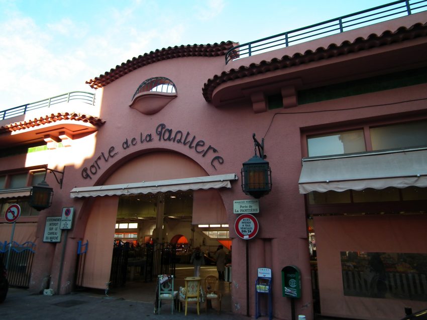
Marche Forville
Marche Forville
CC BY-SA 3.0 / Alkhimov Maxim

Marché Forville is one of the places where Cannes feels most connected to daily local life rather than festival glamour. It has long served as the city’s principal produce market, and modern descriptions still present it as a central meeting place for local growers, fish sellers, and shoppers. Its importance comes from continuity: this is where the food culture of Cannes is visible in a very direct way.

Historically and architecturally, Forville is associated with the covered market hall, which gives it a more permanent civic character than a temporary street market. The market has become a culinary landmark in Cannes, known for local produce from the surrounding area and seafood from the Bay of Cannes. It is often described as a place that supplies both residents and serious cooks, including chefs.

When you visit, the main things to see are the produce displays, fish counters, flowers, and the overall rhythm of the market rather than a single monument. Look for seasonal items and the interaction between traders and regular customers, which gives the market much of its character. Even if you are not shopping, it is one of the best places in Cannes to understand local flavours and everyday city life.


Location: Rue du Marché Forville, 06400 Cannes, France | Hours: (Summer) July 1 – August 31; Monday – Sunday: 07:00–13:00. (Winter) September 1 – June 30; Tuesday – Sunday: 07:00–13:00. | Price: Free. | Website

10. Rue Meynadier
Rue Meynadier
Rue Meynadier
CC BY-SA 4.0 / Jorge Franganillo

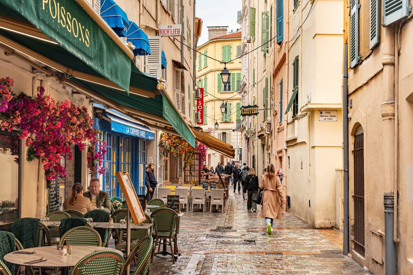
Rue Meynadier is one of the oldest commercial streets in Cannes and offers a clear link to the city before it became synonymous with luxury tourism. It developed as a practical market and trade street near the foot of Le Suquet and close to Forville, and its long commercial role is still visible today. Cannes tourism material explicitly describes it as the historical street of the city’s commerce.

Its historical character differs from the more polished shopping avenues nearby. Rue Meynadier has traditionally been associated with food shops, everyday purchases, and older local businesses, and it keeps more of a Provençal street feel than the prestige-focused retail zones. That contrast is part of its appeal, especially if you want to see a version of Cannes shaped by residents as well as visitors.

What to see here is less about formal sights and more about atmosphere: narrow pedestrian stretches, shopfronts, specialist food stores, and the flow between market, old town, and central Cannes. It is a good place to look for local snacks, sweets, or gourmet products, and to observe how older commercial Cannes still survives within a city better known internationally for glamour.


Location: Rue Meynadier, 06400 Cannes, France | Hours: 24 Hours. | Price: Free.
Powered by GetYourGuide
Moira & Andy
Moira & Andy

Hey! We're Moira & Andy. From hiking the Camino to trips around Europe in Bert our campervan — we've been traveling together since retirement in 2020!

Read our full story here

This website uses affiliate links which earn a small commission at no additional cost to you.

Walking Tour Summary

Distance: 4 km
Sites: 10

Walking Tour Map
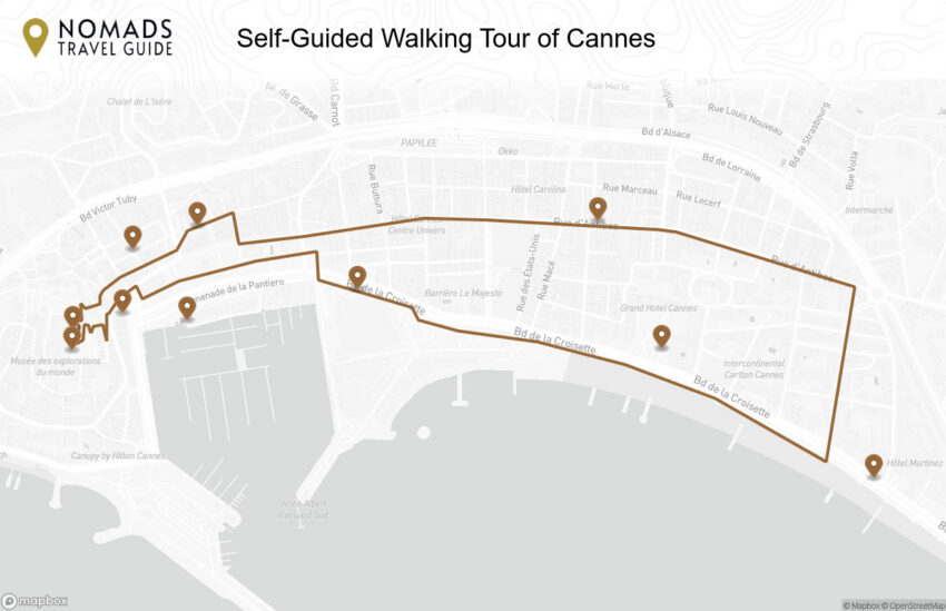
Map of the Self-Guided Walking Tour of Cannes walking route with 10 stops in Cannes.
Preview map of the Self-Guided Walking Tour of Cannes route in Cannes, showing 10 stops. Use the interactive map to zoom and tap markers.

More from this area

Self-Guided Walking Tour of Calais (2026)

Self-Guided Walking Tour of Calais

This website uses affiliate links which earn a small commission at no additional cost to you.

Calais is a northern French port city with a strong Channel identity, shaped by trade, crossings, war history, lace production, and its position on the Opal Coast. One of its most distinctive cultural sites is the Cité de la Dentelle et de la Mode, a lace and fashion museum housed in a former 19th-century collective factory, with displays and loom demonstrations dedicated to Calais-Caudry lace.

For visitors, Calais is often treated as a transit point, but it rewards a short stop. The town offers beaches, the seafront, the town hall and belfry, Rodin's Burghers of Calais, the lace museum, seafood restaurants, and easy access to the cliffs and landscapes of the Côte d'Opale. It works especially well for travellers crossing between Britain and France who want to turn the journey into part of the trip.

How to Get to Calais

By Air: Calais does not have a major commercial airport, so most visitors arrive via nearby airports and continue overland. The most practical options are usually airports in Paris, Lille, Brussels, or London, depending on your route and onward transport plans. From the airport, you can continue to Calais by train, coach, or hire car, and the journey is generally straightforward if you plan connections in advance. For the best deals and a seamless booking experience, check out these flights to Calais on Booking.com.

By Train: Calais is well connected by rail, with services linking it to other French cities and onward connections from larger hubs such as Lille and Paris. Depending on your route, you may arrive at Calais-Ville (closer to the town centre) or Calais-Fréthun (used by some high-speed and international connections). Train travel is one of the easiest ways to reach the city if you want to avoid driving and arrive close to the main sights. You can use SNCF Connect to check schedules, compare routes, and purchase tickets for National (SNCF ) and regional trains (TER). For a more streamlined experience, we recommend using Omio, which allows you to easily compare prices, schedules, and book tickets for both National and Regional travel across all of Europe, all in one place.

By Car: Calais is one of the easiest cities in France to reach by road, especially if you are arriving from the UK via ferry or the Channel Tunnel, and it also has good motorway links to northern France, Belgium, and beyond. Driving gives you the most flexibility if you plan to explore the Opal Coast or nearby towns before or after your visit. Long-distance coach and bus services can also be a budget-friendly option on some routes, usually arriving near the centre or transport hubs. If you are looking to rent a car in France I recommend having a look at Discover Cars, first, as they compare prices and review multiple car rental agencies for you.

A Short History of Calais

Early Calais and Medieval Foundations

Calais began as a small fishing and trading settlement that grew in importance because of its coastal position and access to maritime routes. Over time, it developed defensive structures and a more organised urban core, with places such as the area around Place d'Armes reflecting its role as a commercial and civic meeting point. The Tour du Guet, one of the city's oldest surviving landmarks, points to the need for watchfulness and defence in a town whose fortunes were closely tied to trade, conflict, and control of the coast.

During the Middle Ages, Calais became increasingly significant in regional power struggles. Its port activity and fortified character made it strategically valuable, and this led to repeated contests for control. The old street pattern and key religious buildings, including the early foundations of what became Eglise Notre-Dame de Calais, grew out of this period, when the city was shaped by merchants, sailors, clergy, and military interests all at once.

Calais Under English Rule and the Early Modern Period

One of the defining chapters in the history of Calais came in the 14th century, when it was taken by the English after a long siege during the Hundred Years' War. This moment left a deep mark on the city's memory and identity, later immortalised in the story commemorated by Les Bourgeois de Calais. Under English rule, Calais served as a major continental stronghold and trading outpost, and its political and military importance remained high for more than two centuries.

Even after the city changed hands again in the 16th century, Calais continued to evolve as a fortified town with a strong commercial character. Streets such as Rue Royale reflect the later urban development of the city, while churches and civic spaces were reshaped by changing regimes, warfare, and reconstruction. This long period gave Calais a layered identity, with medieval, military, and mercantile influences all visible in the historic fabric.

Calais in the 19th Century and the Rise of Civic Identity

The 19th century brought major transformation, as Calais expanded, modernised, and developed a stronger civic and cultural identity. Public buildings, boulevards, and institutions became symbols of urban ambition, and this was the period in which many of the city's grander architectural statements took shape. Boulevard Lafayette and other planned streets reflected changing ideas about movement, public space, and modern city life.

Calais also became internationally known for its lace industry, which transformed the local economy and social structure. The story of textile craftsmanship and industrial skill is central to understanding the city's modern history, and it is now preserved through the Museum of Lace and Fashion. At the same time, institutions linked to art and performance, such as the Fine Arts Museum and the Grand Theater de Calais, show how the city developed beyond trade and defence into a place with a confident cultural life.

Calais in the 20th Century to Today

The 20th century brought both hardship and rebuilding, with war causing severe damage to parts of Calais and forcing another period of renewal. Many historic areas were affected, but key landmarks and civic symbols continued to anchor the city's identity. Eglise Notre-Dame de Calais, the Hôtel de Ville, and the monument of Les Bourgeois de Calais became especially important as places through which memory, resilience, and public life could be expressed.

In the decades since, Calais has continued to reinvent itself while preserving links to its past. Historic squares, older streets, museums, and public buildings tell the story of a city shaped by conflict, trade, industry, and culture over many centuries. Walking through places such as Place d'Armes, Rue Royale, and the civic quarter around the Hôtel de Ville reveals how Calais carries its history in layers, with each era still visible in the cityscape.

Where to Stay in Calais

To make the most of visiting Calais and this walking tour, then you should consider staying overnight near the centre so you can start early, walk at a relaxed pace, and easily pause for meals or coffee. For the most atmospheric base, Calais-Nord and the streets around Rue Royale work especially well, as you are close to several historic stops on the route and can explore on foot without relying much on transport. Good options here include ibis Styles Calais Centre, Hôtel Meurice, and Citadel Hôtel.

If you want a practical base with easy rail access, the area around Calais-Ville station and the Hôtel de Ville quarter is a strong choice for this walking tour. It is convenient for arriving by train, and you can still walk to the main sights while having more choice for quick stopovers and onward travel. Two reliable picks in this area are Metropol'Hôtel Calais Centre and B&B HOTEL Calais Centre Saint-Pierre, which suit travellers looking for a straightforward overnight stay before or after exploring the city on foot.

If you are arriving by car, ferry, or the Channel Tunnel and prefer easier parking and road access, staying just outside the historic centre in the Coquelles/Cité Europe area can make the logistics simpler, even if you will need a short drive or local transport into town to begin the walk. This area is especially useful for road trips and short stopovers, and a popular option is Holiday Inn Calais - Coquelles. You can use it as a comfortable base, then head into central Calais for the walking tour itself.

Your Self-Guided Walking Tour of Calais

Discover Calais on foot with our walking tour map, which guides you between each stop as you explore the city at your own pace. Because this is a self-guided walking tour, you are free to skip places and take coffee stops whenever you want.

1. Citadelle de Calais

Citadelle de Calais
Citadelle de Calais
CC BY-SA 3.0 / Lionel Allorge

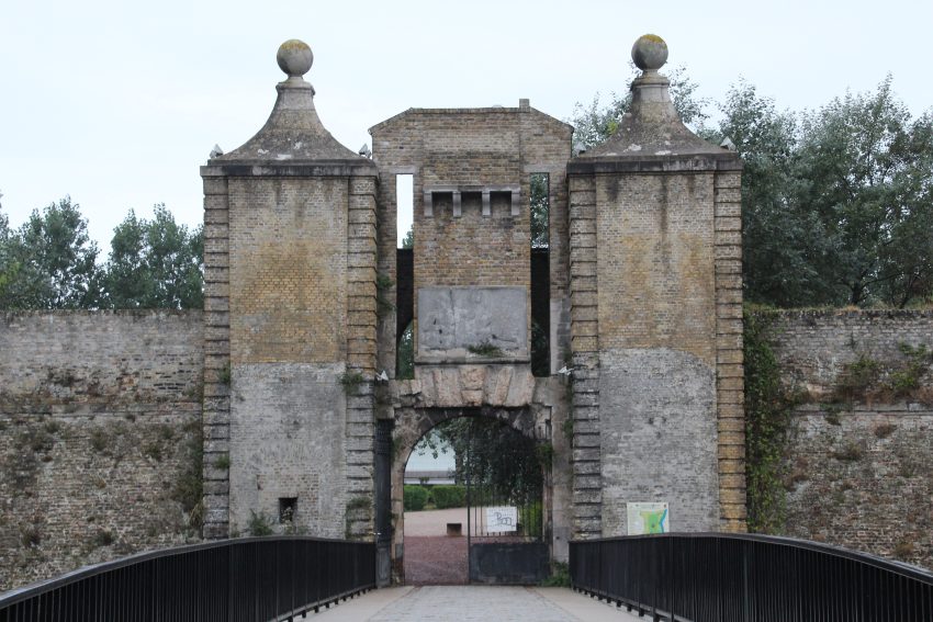
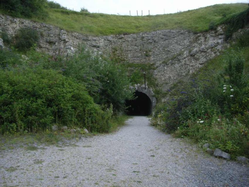
The Citadelle de Calais is one of the city’s key defensive sites, with origins tied to the French recovery of Calais from English rule in 1558. The medieval castle that once stood here was replaced by a new artillery-era fortress better suited to gunpowder warfare, and construction began in the 16th century as the French crown worked to secure this strategically vital Channel port. Over time, the site was reinforced and adapted, including later improvements associated with Vauban-era military planning, which reflects how important Calais remained in French border defense.

Its history is layered and often violent. The citadel was caught up in major conflicts, including the 1596 Spanish capture of Calais, and it continued to serve military functions for centuries, later housing barracks, magazines, and other installations. During the Second World War, the citadel was heavily damaged in the 1940 siege and fighting around Calais, and much of what had stood inside was destroyed. That wartime destruction is an important part of the site’s identity today, because the citadel is not just a Renaissance fortress but also a place of remembrance.

What to see today is a mix of surviving fortification elements and the broader landscape of the old defensive enclosure. The gates, ramparts, ditches, and remaining masonry help you read the shape of the fortress, even where inner structures no longer survive, and the setting gives a strong sense of Calais as a fortified frontier city. The site has also been reused as a public and sporting area, so it feels less like a sealed monument and more like a lived part of the city. When visiting, focus on the surviving entrances and earthworks, and take time to imagine how the citadel once anchored the defense of Calais alongside the other fortifications.


Location: Av. Pierre de Coubertin, 62100 Calais, France | Hours: Daily: Daylight hours. | Price: Free.

We recommend to rent a car in France through Discover Cars, they compare prices and review multiple car rental agencies. Book your rental car here.

2. Phare de Calais

Phare de Calais
Phare de Calais
CC BY-SA 4.0 / Alexey Komarov

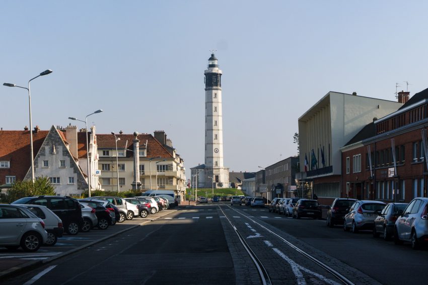
The Phare de Calais is one of the city’s most recognizable landmarks and an important part of its maritime history. The current lighthouse entered service in 1848, replacing the earlier light that had operated from the medieval Tour du Guet, and it was built as shipping traffic through the Strait of Dover increased and safer navigation became more urgent. Its construction reflects Calais’s long role as a strategic port facing one of the busiest sea passages in Europe.

The lighthouse is also interesting because of how it combines engineering function with the city’s layered urban history. It was built on the remains of old fortifications, which helps explain why it rises so prominently even though it stands within the town rather than directly on an exposed pier. Over time it was modernized, including electrification in the 19th century and later automation, but it remains a strong symbol of the period when Calais was expanding its port infrastructure and modern civic identity.

What to see here is both the tower itself and the views it offers. The octagonal masonry tower, white shaft, and dark lantern make it visually distinctive, and if it is open you can climb the 271 steps for wide views over the port, the city, and the coastline. Even from ground level, it is worth visiting for the setting and for the way it connects Calais’s port activity, defensive past, and 19th-century modernization in a single monument.


Location: Pl. Henri Barbusse, 62100 Calais, France | Hours: (Summer) June 1 – September 30; Daily: 10:00–12:00 & 14:00–18:00. (Winter) October 1 – May 31; Wednesday, Saturday, Sunday: 10:00–12:00 & 14:00–17:30. | Price: Adults: €6; Children under 15 (with an adult): €2; Family pass (up to 2 adults + 4 children under 15): €12; Under 5: free. | Website

Here is a complete selection of hotel options in Calais. Feel free to review each one and choose the stay that best suits your needs.

3. Eglise Notre-Dame de Calais

Eglise Notre-Dame de Calais
CC BY-SA 3.0 / Velvet

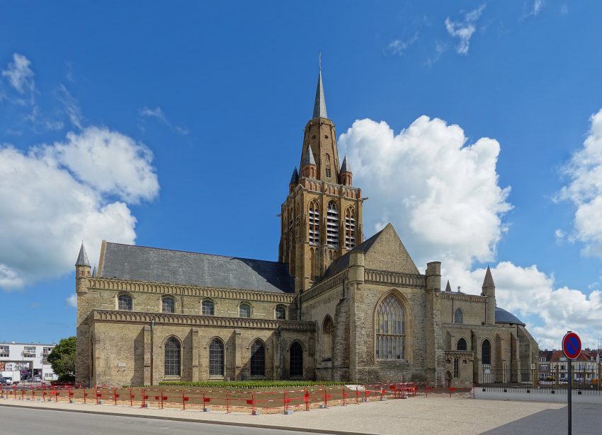
Eglise Notre-Dame de Calais is one of the city’s most historically distinctive churches, with roots in the late medieval period and major phases of construction and rebuilding over time. It is especially notable because it was built during the period of English occupation, and its architecture is often described as showing strong English Perpendicular Gothic influence, something unusual in France. This makes it one of the most interesting buildings in Calais for anyone curious about the city’s cross-Channel past.

The church also carries important personal and national associations. It is known as the place where Charles de Gaulle married Yvonne Vendroux, which adds a modern historical layer to a much older monument. Inside, the building reflects centuries of additions and restorations, with a mix of Gothic and regional influences that tell the story of a port city shaped by trade, conflict, and reconstruction. Its survival and restoration history is part of the broader story of Calais itself.

When you visit, pay attention to the overall silhouette, the tower, and the interior atmosphere rather than rushing through. The church is best appreciated as a place where architecture and memory meet: medieval foundations, cross-Channel influences, and 20th-century historical associations all in one space. It also sits close to other key landmarks, so it works well as part of a deeper look at central Calais.


Location: 17 Rue Notre Dame, 62100 Calais, France | Hours: Daily: 14:00–17:30. | Price: Free; donations appreciated. | Website

Traveling to a country with a different currency? Avoid ATM transaction fees and pay in local currency with a Wise Card. Having used it for over 5 years, we've saved loads on fees!

4. Fine Arts Museum

Fine Arts Museum
Fine Arts Museum
CC BY-SA 4.0 / Bycro

The Fine Arts Museum of Calais (Musée des Beaux-Arts) represents a different chapter of the city’s history: postwar reconstruction and cultural renewal. The current museum building dates from the reconstruction era (opened in the 1960s), and the institution evolved over time, especially after the lace collections were transferred to the separate Lace and Fashion museum in 2009. That shift helped define the museum more clearly as a fine arts venue while preserving the city’s industrial textile heritage elsewhere.

The museum is particularly important in Calais because it connects local identity with wider art history. It is known for collections spanning several centuries and for works linked to Auguste Rodin, whose connection to Calais is central because of Les Bourgeois de Calais. The museum’s position near other historic sites also reinforces how art, civic memory, and urban reconstruction are closely tied in the city. Official and tourism sources also highlight the building itself as a noteworthy example of modern architecture.

When you are there, focus on two things: the Rodin-related material and the sense of the museum as a reconstruction-era landmark. The galleries give context to Calais beyond its port image, showing the city as a place of artistic collecting and cultural ambition. If you have limited time, even a shorter visit is worthwhile because it adds depth to what you see at the town hall square and the Burghers monument.


Location: 25 Rue Richelieu, 62100 Calais, France | Hours: (Summer) April 1 – October 31; Tuesday – Sunday: 13:00–18:00. (Winter) November 1 – March 31; Tuesday – Sunday: 13:00–17:00. | Price: Check official website. | Website

5. Parc Richelieu

Calais Parc Richelieu
CC BY-SA 1.0 / Antoine Rex

Parc Richelieu is one of the oldest public green spaces in Calais and has a history that is closely tied to the city’s former defenses. The park was created in the 19th century (commonly dated to 1862) on the old ramparts of Calais-Nord, so it is not just a landscaped garden but a reused military space shaped by the city’s fortified past. It was later redesigned in the mid-20th century, which helps explain why it combines historic foundations with a more modern public-park layout.

Its historical significance also comes from the memorial landscape within the park. Parc Richelieu is linked to remembrance in Calais, including monuments associated with the world wars, and it sits within a part of the city where public memory and reconstruction are especially visible. The park also has an indirect connection to one of Calais’s most famous artworks: Rodin’s Les Bourgeois de Calais was originally unveiled near Parc Richelieu before being moved to its current position by the town hall.

What to see here is the combination of greenery, memorials, and traces of the old fortification setting rather than one single landmark. It is a good place to slow down and notice how Calais has turned defensive ground into civic space, with trees, paths, and quieter corners that contrast with the city’s busier streets. As you walk through, pay attention to the monuments and the overall shape of the park, because they help tell the story of Calais as a city of fortifications, war, rebuilding, and everyday local life.


Location: France, 185 Rue Richelieu, 62100 Calais, France | Hours: 24 Hours. | Price: Free.

6. Museum of Lace and Fashion

Museum of Lace and Fashion
CC BY-SA 3.0 / Serge Ottaviani

The Museum of Lace and Fashion (Cité de la Dentelle et de la Mode) is essential for understanding Calais because lace-making was one of the industries that shaped the city’s economy, identity, and international reputation. The museum is housed in a former lace factory complex, which already tells part of the story before you even enter: this is industrial heritage preserved in the place where it actually happened. The site reflects the rise of Calais as a major lace center over the 19th and 20th centuries.

The museum also bridges industry and design in a very effective way. It presents the technical side of lace production, including machinery and know-how, while connecting it to fashion history and contemporary creation. Sources describing the museum emphasize both the restored factory building and the modern extension, which visually express the link between heritage and innovation. That combination is one of the reasons it stands out among textile museums.

When visiting, focus on both the architecture and the collections. The building itself helps you imagine the scale and organization of lace production, while the exhibits explain why Calais lace became globally valued. If you want to understand the city beyond its port and war history, this is one of the most informative places to spend time because it reveals the industrial craftsmanship that defined Calais for generations.


Location: 135 Quai du Commerce, 62100 Calais, France | Hours: (Summer) April 1 – October 31; (Winter) November 1 – March 31. Monday: 10:00–18:00. Wednesday – Sunday: 10:00–18:00. Closed on Tuesday. (Winter) Monday: 10:00–17:00. Wednesday – Sunday: 10:00–17:00. Closed on Tuesday. | Price: Adults: €7 (permanent collections + temporary exhibition); Reduced: €5; Temporary exhibition only: €4 (reduced €3); Under 5: free. | Website

7. Grand Theater de Calais

Grand Theater de Calais
CC BY-SA 4.0 / Jiel Beaumadier

The Grand Théâtre de Calais (Théâtre Municipal) belongs to the Belle Époque and reflects the city’s cultural ambitions in the early 20th century. It was built in the first years of the 1900s and opened shortly afterward, during a period when Calais was developing major civic and cultural institutions after the merger of Calais and Saint-Pierre. Its presence in the city center shows that Calais was investing not only in commerce and industry, but also in public culture and performance.

The theater’s setting is part of its appeal. It stands in the boulevard district and is associated with a more elegant urban ensemble, including period residences and monuments linked to the lace industry, such as the Jacquard monument nearby. This makes it an excellent example of how Calais’s artistic life and industrial history were not separate worlds but developed side by side in the same urban spaces.

When you are there, take time to study the exterior details and the wider streetscape around it, not just the entrance. The theater is one of those buildings that helps you read the aspirations of a city at a particular moment in time. If you can attend a performance, even better, but the building is worth seeing for its façade and historical presence alone.


Location: Pl. Albert 1er, 62100 Calais, France | Hours: Tuesday – Friday: 13:00–18:30. Saturday: 10:00–13:00. Sunday: Closed. Closed on Monday. | Price: Prices vary by show. | Website

8. Les Bourgeois de Calais

Les Bourgeois de Calais
CC BY-SA 3.0 / Lionel Allorge

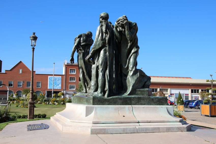
Les Bourgeois de Calais is one of the city’s most famous monuments and one of the most powerful public sculptures in France. Created by Auguste Rodin and installed in Calais in the late 19th century, it commemorates the six burghers who, according to the medieval account associated with Jean Froissart, offered themselves to Edward III during the siege of Calais in 1347. The monument turns a legendary episode of sacrifice into a deeply human scene rather than a triumphal one.

What makes this work so important is Rodin’s interpretation. Instead of heroic poses, he emphasized uncertainty, grief, and moral weight, which was strikingly modern for a public monument. In Calais, that emotional realism fits the city’s wider history of siege, war, destruction, and survival. The sculpture does not just tell a medieval story; it has become part of how the city represents courage and loss across different eras.

When you see it, spend time walking around the sculpture rather than viewing it from the front only. Each figure has a different expression and posture, and the composition is designed to be experienced in the round. Its placement near the Hôtel de Ville is also significant, creating a dialogue between civic authority, public memory, and one of the defining historical narratives of Calais.


Location: Pl. du Soldat Inconnu, 62100 Calais, France | Hours: 24 Hours. | Price: Free.

9. Hôtel de Ville

Hôtel de Ville
Hôtel de Ville
CC BY-SA 3.0 / Radler59

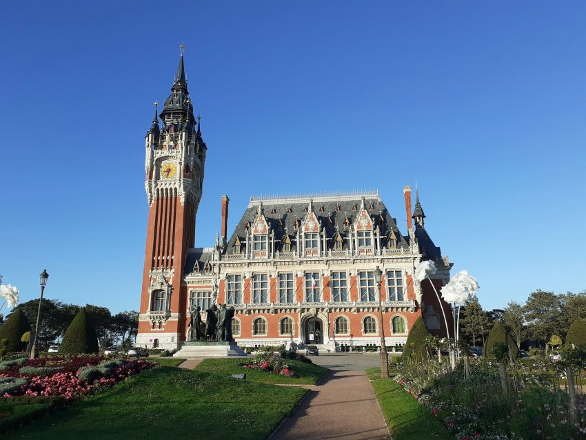
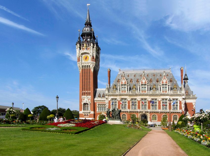
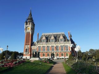
The Hôtel de Ville of Calais is one of the city’s architectural showpieces and a symbol of modern Calais as much as historic Calais. Built in the Flemish Renaissance Revival style between 1911 and 1925, it commemorates the unification of Calais and Saint-Pierre-lès-Calais (merged in 1885). That makes it not just a town hall, but a statement building marking a new civic identity for a growing and industrializing city.

Its style is important to notice: ornate, highly visible, and designed to impress. The building and belfry reflect regional architectural influences while also expressing municipal ambition in the early 20th century. In a city often associated with ferries and crossings, the town hall reminds visitors that Calais developed a strong civic and cultural center of its own, especially in the period before the world wars reshaped the region.

When you visit, take in the full façade and the belfry, then look at how the square in front is organized around the Rodin monument. This area is one of the best places in Calais to understand how architecture, memory, and public space are staged together. If you can, view it from a little distance first, then move closer to appreciate the decorative details.


Location: Pl. du Soldat Inconnu, 62100 Calais, France | Hours: Monday – Friday: 08:30–12:00 & 14:00–17:30. Saturday: 10:00–12:00. Sunday: Closed. | Price: Free. | Website

10. Musée Mémoire 39-45 de Calais

Second World War Museum, Calais
CC BY-SA 3.0 / Bodoklecksel

The Musée Mémoire 39-45 de Calais is one of the city’s most important historical sites for understanding the Second World War, and its setting is a major part of its significance. The museum is housed inside an authentic German bunker in Parc Saint-Pierre, built in 1941 and used as a command post by the German navy during the occupation. Because the bunker survived the wartime bombing that damaged so much of Calais, the museum preserves not just wartime objects but the atmosphere of a real military structure from the period.

What makes this museum especially compelling is the way it tells the story of Calais as a frontline Channel city facing England, where occupation, military control, and civilian hardship were part of daily life. The museum presents the war chronologically through a series of exhibition rooms in the former bunker, with period photographs, newspapers, posters, uniforms, weapons, and everyday objects that help explain both military events and civilian experience. Local tourism descriptions highlight the scale of the site and the exhibition layout, which is one reason it feels more immersive than a standard gallery museum.

When you visit, the main thing to see is the bunker itself as much as the collections inside it. Pay attention to the long corridor, the room layout, and the heavy concrete construction, because the architecture helps you understand how the site originally functioned. Then take time with the exhibits on occupation and liberation, which give context to many other places in Calais linked to wartime history. Set within Parc Saint-Pierre near the town hall area, it also fits well into a broader visit to the city’s civic and memorial landmarks.


Location: Parc Saint Pierre, 62100 Calais, France | Hours: (Summer) April 1 – November 11: Daily: 10:00–18:30. (Winter) Christmas & February school holidays (French zones B & C; except official holidays): Daily: 10:00–18:00. | Price: Adults (17+): €8.50; Children (6–16): €5.50. | Website

11. Rue Royale

Rue Royale, Calais
Rue Royale, Calais
CC BY-SA 3.0 / (GRAD)

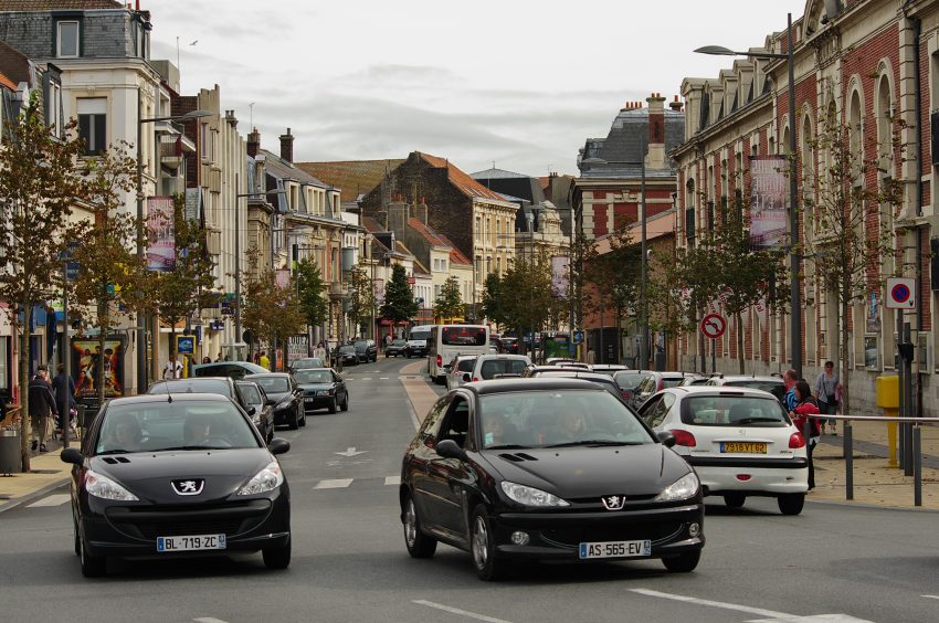
Rue Royale is one of the historic streets of Calais-Nord and has long functioned as an important commercial and urban route within the older part of the city. Streets like this matter in Calais because they preserve the lived texture of the town beyond the headline landmarks. In a port city shaped by trade, travel, and repeated rebuilding, principal streets such as Rue Royale were the places where daily business, social life, and movement between squares and quays played out.

Historically, Rue Royale reflects Calais’s role as a gateway city between France and England. Even when specific buildings have changed, the street’s importance as part of the old center helps explain how visitors and locals moved through the city. It is also part of the story of Calais as more than a transit point: a place with its own urban identity, markets, shops, and civic life rooted in the older town.

When visiting, the best approach is to treat Rue Royale as a street to observe slowly. Look at the shopfronts, façades, and junctions with nearby historic spaces, and notice how it links the old-town landmarks. It is a good place to understand everyday Calais rather than only monument Calais, and it often gives a stronger feel for the city’s character than a single museum or square alone.


Location: Rue Royale, 62100 Calais, France | Hours: 24 Hours. | Price: Free.

12. Place d’Armes

Place d'Armes, Calais
Place d’Armes, Calais
CC BY-SA 4.0 / Selbymay

Place d’Armes has been one of the historic hearts of Calais for centuries, and its importance goes back to the medieval period when this part of the city was the main civic and commercial center. During the long period of English rule in Calais (1347–1558), the square functioned as the market square, and after the French reconquest it continued to play a central role in public life, including fairs and regular markets. Its long continuity as a gathering place is one of the reasons it still feels like a “real” city square rather than just a monument space.

What makes the square especially interesting is how it brings together layers of Calais history in one compact area. It sits beside the Tour du Guet, and the surrounding streets still preserve the atmosphere of old Calais-Nord more than many parts of the city rebuilt after wartime destruction. If you are interested in understanding the older urban fabric of Calais, this is one of the best places to start because the square’s scale and layout still reflect its historic role.

When you are there, take time to look beyond the open space itself. Watch the rhythm of local life, look at the façades around the square, and then pair your visit with the nearby watchtower and Notre-Dame church to see how military, religious, and civic history overlap in the same district. It is also a good place to pause and absorb the contrast between medieval origins and the modern city that grew around it.


Location: Pl. d'Armes, 62100 Calais, France | Hours: 24 Hours. | Price: Free.

13. Tour du Guet

Tour du Guet
Tour du Guet
CC BY-SA 4.0 / Selbymay

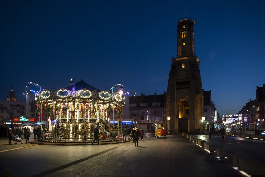
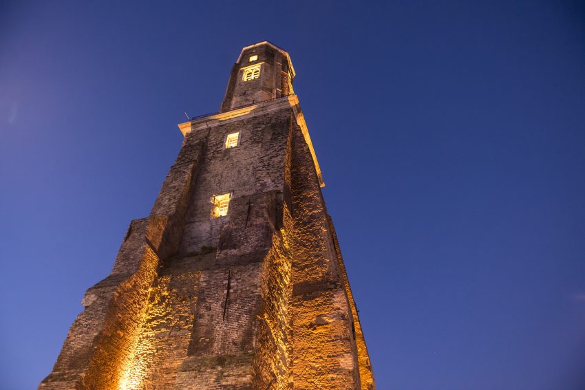
The Tour du Guet is one of the oldest surviving monuments in Calais and one of the rare structures that connects directly to the medieval fortified town. Its origins go back to the 13th century, and it formed part of the city defenses. Over time, it took on several roles, including use as a lookout and, later, as a lighthouse before a newer lighthouse replaced that function in the 19th century. The tower’s long working life makes it more than just a relic; it was an active part of how Calais watched the sea and protected itself.

The tower’s history is marked by damage and repair, which is part of what makes it compelling. It reportedly suffered structural damage from an earthquake in 1580 and later from fire, but it was restored and continued to serve the city in practical ways. That survival story matters in Calais, where so much of the older town was lost or rebuilt over time, especially after the destruction of the Second World War. The tower stands as a visible reminder of the city’s endurance.

When visiting, look up at the tower from different angles in Place d’Armes, because its form is easiest to appreciate in relation to the square. It is not only a monument to photograph but also a useful landmark for reading the old town. Even if you cannot go inside, seeing it in context with nearby historic streets and buildings gives a strong sense of medieval Calais and the city’s maritime vigilance.


Location: Pl. d'Armes, 62100 Calais, France | Hours: 24 Hours. | Price: Free.
Powered by GetYourGuide
Moira & Andy
Moira & Andy

Hey! We're Moira & Andy. From hiking the Camino to trips around Europe in Bert our campervan — we've been traveling together since retirement in 2020!

Read our full story here

This website uses affiliate links which earn a small commission at no additional cost to you.

Walking Tour Summary

Distance: 5.5 km
Sites: 13

Walking Tour Map
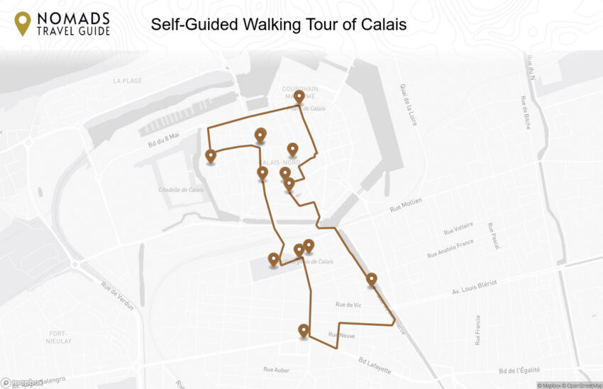
Map of the Self-Guided Walking Tour of Calais walking route with 13 stops in Calais.
Preview map of the Self-Guided Walking Tour of Calais route in Calais, showing 13 stops. Use the interactive map to zoom and tap markers.

More from this area

Self-Guided Walking Tour of Avignon (2026)

Self-Guided Walking Tour of Avignon

This website uses affiliate links which earn a small commission at no additional cost to you.

Avignon is one of southern France's most important historic cities, famous for the Palais des Papes, the Pont d'Avignon, medieval walls, and its role as the seat of the papacy in the 14th century. UNESCO describes the historic centre, including the Papal Palace, episcopal ensemble, and Avignon Bridge, as an outstanding example of medieval architecture and a site linked to a major episode in European religious and political history.

For visitors, Avignon combines monumental architecture with a lively Provençal atmosphere. The palace, cathedral, bridge, old streets, squares, markets, museums, and Rhône viewpoints can all be explored on foot, while the city also works well as a base for Arles, Nîmes, Orange, the Luberon, Châteauneuf-du-Pape, and Pont du Gard. It is especially useful for travellers who want history and Provence without needing a car for every part of the trip.

How to Get to Avignon

By Air: Avignon has a small airport (Avignon-Provence), but most travelers fly into larger hubs for better routes and prices. Marseille Provence Airport is usually the most convenient major gateway, with frequent onward connections into Avignon by train or coach; you can also consider Nîmes, Montpellier, Nice, or Lyon depending on where you're coming from and what fares look like. Once you land, the simplest approach is to head straight to the nearest main station and continue to Avignon Centre (for the old town) or Avignon TGV (for high-speed services). For the best deals and a seamless booking experience, check out these flights to Avignon on Booking.com.

By Train: Avignon is one of the easiest places in southern France to reach by rail, with two useful stations. Avignon TGV sits a few kilometres outside town on the high-speed network, making it fast from Paris and other major cities, while Avignon Centre is right by the ramparts and ideal if you want to step straight into the old town. If you arrive at Avignon TGV, you can transfer into town quickly by local train, shuttle bus, taxi, or rideshare-so choose the station that best matches your accommodation and itinerary. You can use SNCF Connect to check schedules, compare routes, and purchase tickets for National (SNCF ) and regional trains (TER). For a more streamlined experience, we recommend using Omio, which allows you to easily compare prices, schedules, and book tickets for both National and Regional travel across all of Europe, all in one place.

By Car: Driving to Avignon is straightforward, with quick access from the A7 (Autoroute du Soleil) and good links across Provence and the Luberon for day trips. The main thing to plan for is parking: the historic centre has restricted access and narrow streets, so it's usually easier to aim for a large paid car park near the ramparts and explore on foot from there. If you're staying overnight, check whether your hotel offers reserved parking or guidance for access rules, as routes and permissions can vary within the old city. If you are looking to rent a car in France I recommend having a look at Discover Cars, first, as they compare prices and review multiple car rental agencies for you.

By Bus: Long-distance coaches can be a cost-effective option, especially from nearby cities in Provence or from farther afield if you book ahead. Services typically arrive near central Avignon or at/near the main stations, which makes it easy to connect into the old town on foot or by local bus. Buses can take longer than trains, but they're useful if you're traveling on a tight budget or coming from places with limited rail links. [bus]

A Short History of Avignon

Avignon in Antiquity and the Early Middle Ages

Avignon’s earliest urban story is one of a strategic settlement that grew into a fortified town shaped by trade routes and river life. Over centuries, successive rulers and local powers strengthened its defences and institutions, laying the groundwork for the walled city that still defines the historic core. Even today, the city’s older street patterns feel medieval in their logic: narrow lanes, small squares, and routes that naturally funnel towards key civic and religious centres.

As Avignon developed through the early medieval period, religious authority became increasingly visible in the city's fabric. The hilltop presence of Avignon Cathedral reflects that long rise of ecclesiastical influence, with the surrounding precinct evolving as a focal point for worship, processions, and the city's most important ceremonies. Nearby, the Rocher des Doms Gardens sit on ground that has witnessed centuries of spiritual and civic life, later transformed into a place of calm with panoramic viewpoints that still help you read the city's geography and history in a single glance.

Avignon in the Papal Era

Avignon’s defining transformation came in the 14th century, when the city became the seat of the papacy and a centre of European power. The construction of the Palais des Papes was both a practical necessity and a statement: a vast, fortress-like complex designed to project authority, protect the papal court, and house administration on a scale few cities could match. Place du Palais became the ceremonial stage for this new order, where the rhythms of court life, diplomacy, and public spectacle played out beneath the palace walls.

This period also pulled artists, scholars, financiers, and builders into Avignon, accelerating cultural life and leaving behind a legacy of ecclesiastical art and refined patronage. The Musée du Petit Palais connects directly to that atmosphere, reflecting the tastes and networks that flourished around the papal court. Close by, La Mirande evokes the prestige of the historic quarter, where proximity to power shaped architecture, social standing, and the daily choreography of the elite.

Avignon from the Late Middle Ages to the Early Modern City

After the height of papal rule, Avignon continued to evolve as a regional centre with strong religious institutions and a lively urban economy. The Pont Saint-Bénézet became a lasting emblem of the city's relationship with engineering, commerce, and the river-its partial survival turning practical infrastructure into legend and symbol. Meanwhile, parish life and civic identity strengthened through churches such as Église Saint-Pierre d'Avignon, whose Gothic presence speaks to a city investing in local devotion, guild life, and communal pride.

Commerce and craft shaped daily life as much as monuments did. Streets like Rue Peyrolerie recall the dense network of medieval trades that once clustered by speciality, while the canalside atmosphere of Rue des Teinturiers preserves the memory of textile work and water-powered industry. The Hôtel des Monnaies points to a city embedded in wider economic systems, where money, regulation, and administration were central to maintaining influence and stability over time.

Avignon in the 18th and 19th Centuries

As modern ideas of citizenship and municipal governance took firmer hold, Avignon’s civic spaces became the settings for political life, public gatherings, and the performance of authority. Place de l’Horloge emerged as a key focal point, with the Hôtel de Ville d’Avignon reinforcing the city’s administrative identity and its shift toward modern civic institutions. The square’s role as a social stage-markets, announcements, celebrations-helped anchor a more outward-facing urban culture.

Urban change also came through infrastructure and planning, particularly in how people moved through the city. Rue de la République represents that push toward straighter, more connective streets that linked quarters and encouraged commerce, while still feeding into the older, more intricate medieval lanes nearby. These changes didn’t replace Avignon’s historic character so much as layer new movement patterns onto it, giving the city the mix of grandeur and intimacy that defines it now.

Avignon in the 20th Century to Today

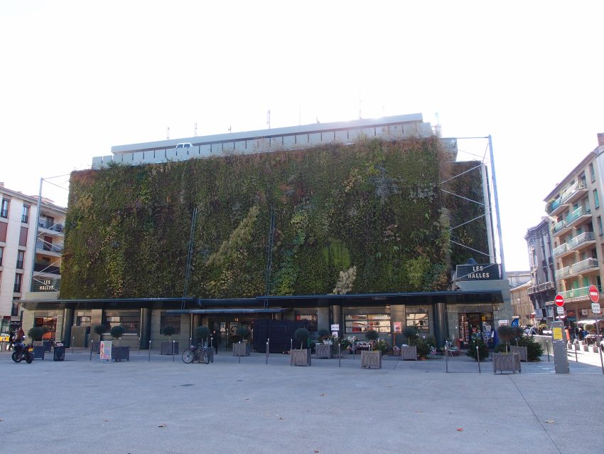
In the modern era, Avignon has balanced preservation with reinvention, keeping its historic core vibrant rather than museum-like. Traditional food culture remains a living thread, and Les Halles d'Avignon captures that everyday continuity-locals shopping, seasonal produce, and the city's Provençal identity expressed through what's on the stalls. At the same time, former working areas have shifted roles as the city adapted to new economies, new residents, and new ways of using old spaces.

You can still see this layered story when moving between neighbourhoods and functions: places tied to storage, supply, and urban industry have evolved, and areas like Quartier de la Manutention hint at those practical foundations beneath the postcard image. The result is a city where medieval power, civic pride, craft tradition, and modern culture sit close together-best understood on foot, street by street, square by square.

Your Self-Guided Walking Tour of Avignon

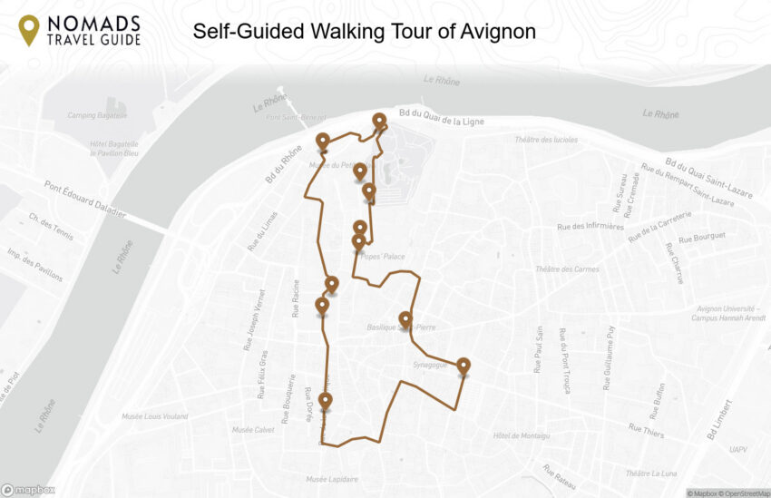
Explore Avignon on foot with our walking tour map, which guides you from one stop to the next as you discover the city at your own pace. Because this is a self-guided walking tour, you can skip places that do not interest you and stop for coffee whenever you like.

1. Rue de la Republique

Rue de la Republique
CC BY-SA 4.0 / Txllxt TxllxT

Rue de la République is Avignon’s principal modern axis through the historic center, created and reshaped in periods when French cities pushed for broader streets and improved circulation. Its character reflects a more “planned” urban moment, contrasting with the tight medieval lanes elsewhere in the old town.

The street’s history is written in its alignment and storefront rhythm: it connects key nodes and channels movement, making it a practical artery for residents and visitors alike. While it may feel more contemporary, it’s also a useful way to understand how Avignon adapted to new economic and social realities.

What to see here is partly architectural—facades, passageways, and the way side streets suddenly peel back into older medieval fabric—and partly experiential. Use it to move between major squares and monuments, but also duck into intersecting lanes to feel the abrupt shift from broad boulevard to intimate old-town street life.


Location: Rue de la République, 84000 Avignon, France | Hours: 24 Hours. | Price: Free.

We recommend to rent a car in France through Discover Cars, they compare prices and review multiple car rental agencies. Book your rental car here.

2. Hôtel de Ville

Hôtel de Ville
Hôtel de Ville
CC BY-SA 4.0 / Holger Uwe Schmitt

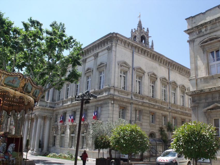
Avignon’s Hôtel de Ville represents the city’s municipal authority, reflecting the transition from papal dominance to civic administration. The building’s presence near Place de l’Horloge anchors the square as a political and social hub, and its architecture communicates order, ceremony, and governance.

Historically, town halls like this were more than offices: they were sites of negotiation, record-keeping, public proclamation, and civic ritual. In a city with such a strong ecclesiastical legacy, the Hôtel de Ville also signals balance—an urban identity that is not exclusively religious.

When you visit, study the façade and its relationship to the square. Look for emblematic details that express civic pride—inscriptions, coats of arms, and formal symmetry. Even if you don’t go inside, the building is best appreciated as part of the wider civic ensemble of the square.


Location: Pl. de l'Horloge, 84000 Avignon, France | Hours: Monday – Friday: 08:00–17:30. Closed on Saturday, Sunday. | Price: Free. | Website

Here is a complete selection of hotel options in Avignon. Feel free to review each one and choose the stay that best suits your needs.

3. Place de l’Horloge

Place de l’Horloge
Place de l’Horloge
CC BY-SA 2.0 / Elliott Brown

Place de l’Horloge developed as Avignon’s civic living room, shaped by the rhythms of commerce, theatre, and municipal life as the city evolved beyond its papal peak. The “clock” reference signals a public space organized by time and gathering—where announcements, meetings, and everyday social life centered.

Architecturally, the square reflects civic identity rather than ecclesiastical power. Facades, arcades, and prominent public buildings give it an ordered, ceremonial feel, but it remains a place designed for people to linger. It’s also a useful lens on Avignon’s later history: the city as a functioning municipality, not only a papal stage set.

To see it well, walk the perimeter and look up—balconies, window rhythms, and the way buildings frame the open space matter as much as what happens at ground level. If the theatre is open, it’s worth noting how performance and public space reinforce each other here, continuing a tradition of spectacle in a more civic key.


Location: Pl. de l'Horloge, 84000 Avignon, France | Hours: 24 Hours. | Price: Free.

Traveling to a country with a different currency? Avoid ATM transaction fees and pay in local currency with a Wise Card. Having used it for over 5 years, we've saved loads on fees!

4. Pont Saint-Bénézet

Pont Saint-Bénézet
Pont Saint-Bénézet
CC BY-SA 1.0 / gillag

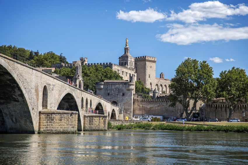
Pont Saint-Bénézet, famously associated with the “Pont d’Avignon,” began in the late 12th century and became a symbol of medieval engineering and devotion. The bridge’s story is inseparable from the Rhône itself: floods repeatedly damaged it, and by the 17th century much of the structure was abandoned, leaving the partial span that defines the site today.

What remains is powerfully evocative. The broken arches reaching into the river read like a historical diagram of what once connected Avignon across a difficult, shifting waterway. The bridge also carried a religious dimension, with the Chapel of Saint Nicholas embedded into the structure, reflecting how infrastructure and faith often overlapped in medieval life.

When you visit, focus on the surviving arches, the chapel, and the views back toward the palace skyline. From the bridge you can grasp the scale of the Rhône and the challenge it posed, and you’ll get some of the most iconic perspectives of Avignon’s fortified silhouette.


Location: Bd de la Ligne, 84000 Avignon, France | Hours: Daily: 10:00–17:00. | Price: Adults: €5; Reduced: €4; Under 8: free. | Website

5. Rocher des Doms Gardens

Rocher des Doms Gardens
CC BY-SA 2.0 / Nikater

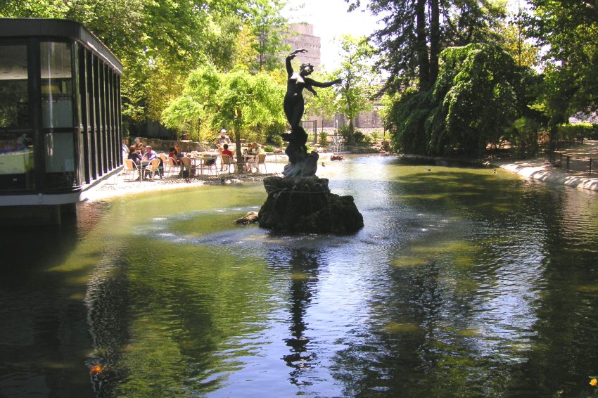
The Rocher des Doms is the rocky promontory that gave Avignon its natural defensive advantage, and the gardens on top were later shaped into a landscaped public retreat. This is where geology and history meet: long before formal paths and benches, the rock controlled movement, visibility, and access along the Rhône.

As a garden space, it balances calm with vantage. Shaded walks, terraces, and small water features soften the hard edge of the stone platform, while the elevated viewpoints remind you you’re standing on Avignon’s strategic high ground. The setting also connects visually to the palace and cathedral, reinforcing the idea of an upper city of power.

For what to see, treat it as a sequence of viewpoints. Look out over the Rhône, the Pont Saint-Bénézet, and the broad plain beyond, then turn back toward the old town’s rooftops. Visit at different times of day if you can: the change in light transforms the pale stone architecture and the river’s surface.


Location: 2 Mnt des Moulins, 84000 Avignon, France | Hours: Check official website. | Price: Free.

6. Musée du Petit Palais

Musée du Petit Palais
CC BY-SA 3.0 / Marianne Casamance

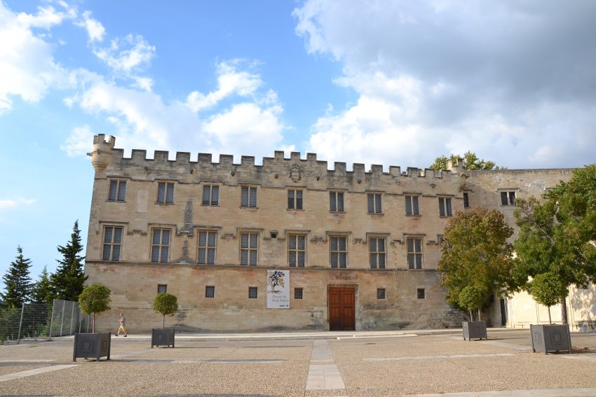
The Musée du Petit Palais occupies the former archbishops’ palace, a fitting setting for a collection shaped by Avignon’s religious and cultural prestige. The building’s history is intertwined with ecclesiastical power, and its reuse as a museum continues the site’s role as a place of patronage and art.

The museum is best known for early Italian painting and medieval works, offering a bridge between Avignon’s papal chapter and the broader artistic currents of Europe. You’ll see how devotional imagery evolved in technique and emotion, and how gold-ground traditions gradually gave way to more spatial realism and human expression.

Prioritize the galleries of Italian Primitives and medieval sculpture, then work outward to appreciate how the building frames the art—courtyards, stone stairways, and quieter rooms help the collection feel intimate rather than overwhelming. It’s an ideal counterpoint to the palace: less spectacle, more close-looking.


Location: Palais des archevêques, Pl. du Palais, 84000 Avignon, France | Hours: (Summer) April 1 – October 31; Tuesday – Sunday: 10:00–18:00. (Winter) November 1 – March 31; Tuesday – Friday: 11:00–18:00; Saturday – Sunday: 10:00–18:00; Closed on Monday. | Price: Free. | Website

7. Notre-Dame des Doms

Notre Dame des Doms
Notre Dame des Doms
CC BY-SA 4.0 / Holger Uwe Schmitt

Notre-Dame des Doms is Avignon’s cathedral, rooted in Romanesque origins and expanded over centuries alongside the rise of the papal court. Its comparatively restrained exterior contrasts with the nearby palace’s fortress drama, but the cathedral’s presence is older and more continuous, reflecting Avignon’s long religious history before, during, and after the papal era.

The interior rewards a slower pace. Romanesque structure, later additions, and devotional spaces sit together, creating a sense of accumulated worship rather than a single “finished” design. The cathedral’s position on the Rocher des Doms also gives it a natural prominence, making it feel anchored to the rock itself.

Look for key sculptural and architectural details, and pay attention to the atmosphere: cool stone, softened light, and the way sound carries. Step outside to appreciate the cathedral in context—its relationship to the palace complex and the elevated setting is part of the experience, especially when you move between the cathedral, the square, and the gardens nearby.


Location: Pl. du Palais, 84000 Avignon, France | Hours: Tuesday – Sunday: 08:30–17:30. Closed on Monday. | Price: Free; donations appreciated. | Website

8. Place du Palais

Place du Palais
Place du Palais
CC BY-SA 4.0 / Holger Uwe Schmitt

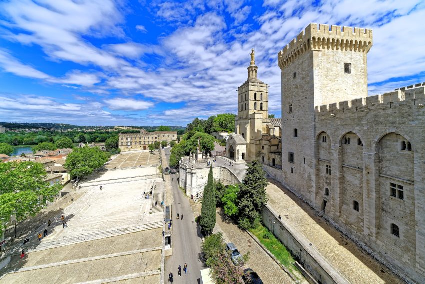
Place du Palais is the historic forecourt of Avignon’s papal complex, formed as the city’s political and ceremonial heart during the 14th century when the popes resided here. The square’s layout reflects layers of medieval urban life: clergy, merchants, and civic authorities all converged at the foot of the palace, and public announcements, processions, and markets would have spilled into this space.

What you see today is a dramatic “stone stage” framed by monumental façades, with the Palais des Papes dominating one side and the cathedral rising nearby. Take time to read the architecture: fortress-like walls, narrow medieval sightlines, and the way the buildings funnel you toward the palace entrances.

Look for viewpoints that capture the palace, cathedral, and surrounding old-town streets in one sweep, then linger to notice details you might miss at first glance: worn paving, old signage, and the constant interplay of light and shadow on Avignon’s pale stone. It’s also a practical starting point for nearby museums, gardens, and riverward routes.


Location: Pl. du Palais, 84000 Avignon, France | Hours: 24 Hours. | Price: Free.

9. Palais des Papes

Palais des Papes
Palais des Papes
CC BY-SA 4.0 / Holger Uwe Schmitt

The Palais des Papes is one of Europe’s most important Gothic monuments, built largely in the 14th century when Avignon became the seat of the papacy. Part palace, part fortress, it embodies a period of extraordinary power and anxiety: high walls, towers, and controlled access were as essential as grand halls for ceremony and administration.

Inside, the scale is the main event. You move through immense rooms that once handled diplomacy, governance, and liturgical life, with a progression from public, formal spaces to more private papal quarters. Even where decoration has faded, the architecture still communicates authority through height, acoustics, and sheer mass.

Focus your visit on the great ceremonial rooms, the chapel spaces, and the circulation routes that show how the complex functioned. Seek out surviving frescoes and painted fragments where they remain, and don’t skip the ramparts and terraces: the views over Avignon’s rooftops and the Rhône plain help you understand why this was a strategic as well as spiritual capital.


Location: Pl. du Palais, 84000 Avignon, France | Hours: (January 1 – January 4) Daily: 10:00–18:00. (January 5 – February 6) Daily: 10:00–17:00. (February 7 – February 28) Daily: 10:00–18:00. (March 1 – November 1) Daily: 09:00–19:00. (November 2 – December 18) Daily: 10:00–17:00. (December 19 – December 31) Daily: 10:00–18:00. | Price: Adults: €12; Reduced: €10; Children (8–17): €6.50; Under 8: free. | Website

10. St. Peter's Basilica

St. Peter’s Basilica
CC BY-SA 4.0 / Jorge Franganillo

Avignon’s Saint-Pierre is a Gothic church closely tied to the city’s medieval religious landscape, distinct from the great cathedral nearby. It reflects the dense network of parish churches that served local communities while the papal court operated at a larger political scale.

The church is particularly known for its richly carved late-Gothic wooden doors, a showpiece of craftsmanship that signals how even “non-cathedral” churches could display serious artistic ambition. Inside, you’ll find a quieter, more intimate sacred space where details—chapels, altarpieces, and structural lines—reward close attention.

Spend time with the portal carvings first, then step inside and let your eyes adjust to the interior’s scale and light. Look for the interplay of stone structure and devotional art, and notice how the church sits within the surrounding streetscape: it feels woven into daily life rather than set apart on a grand forecourt.


Location: Pl. Saint-Pierre, 84000 Avignon, France | Hours: Monday – Saturday: 09:30–13:00 & 14:30–17:00. Sunday: Closed. | Price: Free; donations appreciated. | Website

11. Les Halles d’Avignon

Les Halles d’Avignon
CC BY-SA 2.0 / Guilhem Vellut

Les Halles is Avignon’s central covered market, rooted in the long Provençal tradition of local trade in produce, oils, cheeses, and seasonal specialties. While the current structure is modern compared to medieval Avignon, the function is ancient: a civic space where agriculture from the surrounding region becomes daily city life.

Markets like this are historical documents in motion. They reflect what grows locally, what people value, and how food culture expresses regional identity. In Avignon, that means a strong connection to the Rhône valley and nearby terroirs, with a practical emphasis on freshness and seasonality.

What to see is, above all, the stalls themselves—scan for what’s abundant that day, then notice the smaller artisans and specialty counters. Go with a shopper’s mindset: observe, taste if possible, and look for regional staples that tell you where you are, not just what’s popular everywhere.


Location: 18 Pl. Pie, 84000 Avignon, France | Hours: Tuesday – Sunday: 06:00–14:00. Closed on Monday. | Price: Free. | Website
Powered by GetYourGuide
Moira & Andy
Moira & Andy

Hey! We're Moira & Andy. From hiking the Camino to trips around Europe in Bert our campervan — we've been traveling together since retirement in 2020!

Read our full story here

This website uses affiliate links which earn a small commission at no additional cost to you.

Walking Tour Summary

Distance: 2.5 km
Sites: 11

Walking Tour Map
Map of the Self-Guided Walking Tour of Avignon walking route with 11 stops in Avignon.
Preview map of the Self-Guided Walking Tour of Avignon route in Avignon, showing 11 stops. Use the interactive map to zoom and tap markers.

More from this area

Self-Guided Walking Tour of Sorrento (2026)

Self-Guided Walking Tour of Sorrento

This website uses affiliate links which earn a small commission at no additional cost to you.

Sorrento is one of southern Italy's classic coastal bases, set above the Bay of Naples and associated with citrus groves, sea views, cliffside terraces, and easy access to some of Campania's most famous places. Italia.it presents the Sorrento Peninsula as a landscape of emerald water, lemons, coves, Capri access, and historic coastal towns, with Sorrento itself closely tied to the wider beauty of the Gulf of Naples.

For visitors, Sorrento is practical as well as scenic. The old centre, marina, viewpoints, restaurants, shops, and bathing platforms make it pleasant in its own right, while ferries, trains, and tours connect it with Capri, Pompeii, Naples, the Amalfi Coast, Herculaneum, and Mount Vesuvius. It suits travellers who want a comfortable base with strong transport links rather than staying somewhere more isolated along the coast.

How to Get to Sorrento

By Air: The nearest major airport is Naples International Airport, and from there Sorrento is a straightforward onward journey. The simplest approach is to travel into central Naples (usually Napoli Centrale / Piazza Garibaldi) and continue by rail or road depending on your timing and comfort level. If you're arriving with luggage, allow extra time for transfers, especially in summer when queues and traffic are common. For the best deals and a seamless booking experience, check out these flights to Sorrento on Booking.com.

By Train: Sorrento is most commonly reached by rail from Naples via the Circumvesuviana line, which runs from Napoli Porta Nolana and Napoli Centrale (Piazza Garibaldi) to Sorrento at the end of the line. It's inexpensive and frequent, but it can be crowded and has limited luggage space, so try to travel outside peak commuter hours if you can. For a more comfortable experience, some travellers choose the Campania Express (seasonal, with fewer stops) or take a mainline train to Naples and then switch to a private transfer if they prefer. Use Omnio to easily compare schedules, book train tickets, and find the best prices all in one place for a hassle-free journey across Italy.

By Car: Driving to Sorrento can be scenic, but it's often slower than you expect because the roads are narrow, winding, and busy-particularly in high season and on weekends. Parking in and around the historic centre is limited and can be expensive, so this option works best if you're staying outside the centre, have pre-booked parking, or plan to continue exploring the Amalfi Coast and surrounding areas. If you do drive, build in time for traffic and consider dropping bags first, then parking once you're settled. If you are looking to rent a car in Italy I recommend having a look at Discover Cars, first, as they compare prices and review multiple car rental agencies for you.

A Short History of Sorrento

Sorrento in the Ancient Era

Sorrento’s earliest centuries were shaped by seafaring trade, fertile hinterland agriculture, and the constant need to protect a valuable coastline. Reminders of that defensive mindset echo today in the Ancient Walls and Parsano Bastion, which hint at an older urban edge where access could be controlled and lookout points mattered. Even the town’s dramatic natural cuts in the landscape feel like part of its early story-nowhere more evocative than the Valley of the Mills, where waterpower and industry later took hold in a deep gorge that still reads like a geological footnote to the past.

Sorrento in the Medieval Period

During the medieval centuries, Sorrento's identity became increasingly defined by faith institutions, local patronage, and a tightening of the historic core. The spiritual heart of the town can be traced through places such as the Chiesa di Sant'Antonino, associated with civic devotion and local legend, and the Cattedrale di Sorrento, which gathered authority and community life around its evolving complex. Elements like the Cathedral's Bell Tower speak to this period's priorities: visibility, ritual timekeeping, and a skyline punctuated by structures that were both religious and quietly strategic.

Sorrento in the Renaissance and Early Modern Centuries

As Renaissance ideas and early modern prosperity filtered through the region, Sorrento saw a gradual refinement of its civic spaces and elite meeting places. Sedile Dominova and Sedile di Porta reflect traditions of local governance and communal gathering-spaces where decisions, status, and social life converged. Religious architecture continued to expand in parallel, with churches such as the Church of Carmine and Chiesa Del Rosario adding to a landscape where confraternities, processions, and neighbourhood identity left a lasting imprint on the town's built fabric.

Sorrento in the 18th and 19th Centuries

By the 18th and 19th centuries, Sorrento’s public realm increasingly took on the character visitors recognise today: walkable promenades, viewpoints, and a more outward-facing civic pride. The Villa Comunale Park and Piazza della Vittoria capture that shift toward curated public spaces designed for strolling and social display, while Marina Grande remained tied to working life on the water even as the idea of leisure travel grew. Over time, the town’s central arteries began to formalise into the routes that still organise movement and commerce, setting the stage for the modern “main street” feel that defines the centre.

Sorrento in the 20th Century to Today

In the 20th century, Sorrento's historic core evolved into a lively blend of everyday town life and visitor culture, with the main spaces acting as both local meeting points and landmarks. Piazza Tasso became the emblematic crossroads-part orientation point, part social hub-while Corso Italia carried the town's commercial pulse and daily rhythm. Smaller lanes like Via San Cesareo preserved an older street texture of workshops and local shopping, and cultural venues such as Teatro Tasso reinforced the idea of Sorrento as a place that performs its identity as much as it lives it, balancing tradition with an economy increasingly shaped by travel.

A Short History of Sorrento

Sorrento in the Ancient Era

Sorrento’s earliest centuries were shaped by seafaring trade, fertile hinterland agriculture, and the constant need to protect a valuable coastline. Reminders of that defensive mindset echo today in the Ancient Walls and Parsano Bastion, which hint at an older urban edge where access could be controlled and lookout points mattered. Even the town’s dramatic natural cuts in the landscape feel like part of its early story-nowhere more evocative than the Valley of the Mills, where waterpower and industry later took hold in a deep gorge that still reads like a geological footnote to the past.

Sorrento in the Medieval Period

During the medieval centuries, Sorrento's identity became increasingly defined by faith institutions, local patronage, and a tightening of the historic core. The spiritual heart of the town can be traced through places such as the Chiesa di Sant'Antonino, associated with civic devotion and local legend, and the Cattedrale di Sorrento, which gathered authority and community life around its evolving complex. Elements like the Cathedral's Bell Tower speak to this period's priorities: visibility, ritual timekeeping, and a skyline punctuated by structures that were both religious and quietly strategic.

Sorrento in the Renaissance and Early Modern Centuries

As Renaissance ideas and early modern prosperity filtered through the region, Sorrento saw a gradual refinement of its civic spaces and elite meeting places. Sedile Dominova and Sedile di Porta reflect traditions of local governance and communal gathering-spaces where decisions, status, and social life converged. Religious architecture continued to expand in parallel, with churches such as the Church of Carmine and Chiesa Del Rosario adding to a landscape where confraternities, processions, and neighbourhood identity left a lasting imprint on the town's built fabric.

Sorrento in the 18th and 19th Centuries

By the 18th and 19th centuries, Sorrento’s public realm increasingly took on the character visitors recognise today: walkable promenades, viewpoints, and a more outward-facing civic pride. The Villa Comunale Park and Piazza della Vittoria capture that shift toward curated public spaces designed for strolling and social display, while Marina Grande remained tied to working life on the water even as the idea of leisure travel grew. Over time, the town’s central arteries began to formalise into the routes that still organise movement and commerce, setting the stage for the modern “main street” feel that defines the centre.

Sorrento in the 20th Century to Today

In the 20th century, Sorrento's historic core evolved into a lively blend of everyday town life and visitor culture, with the main spaces acting as both local meeting points and landmarks. Piazza Tasso became the emblematic crossroads-part orientation point, part social hub-while Corso Italia carried the town's commercial pulse and daily rhythm. Smaller lanes like Via San Cesareo preserved an older street texture of workshops and local shopping, and cultural venues such as Teatro Tasso reinforced the idea of Sorrento as a place that performs its identity as much as it lives it, balancing tradition with an economy increasingly shaped by travel.

By Bus: Long-distance and regional buses can be a practical alternative when trains are crowded or you're travelling from places without a simple rail connection. Services commonly run between Sorrento and Naples, and you'll also find routes linking Sorrento with towns on the Sorrentine Peninsula and parts of the Amalfi Coast, though frequencies can vary by season and road conditions. Buses are often more comfortable for luggage than the Circumvesuviana, but journey times can be unpredictable in summer due to traffic, so it's best to travel early in the day and keep a little buffer if you're connecting with a ferry, tour, or dinner booking. [bus]

Where to Stay in Sorrento

To make the most of visiting Sorrento and this walking tour, you should consider staying overnight in or very near the centre so you can start early, walk everywhere, and easily return for a break in the heat. For the most convenient base, look for accommodation around Piazza Tasso and the lower part of Corso Italia, where you'll be within minutes of the old town lanes, viewpoints, cafés, and the main transport hubs. Good, walk-first options here include Hotel Plaza Sorrento, Grand Hotel De La Ville, and Hotel Antiche Mura.

If you want the classic Sorrento atmosphere with restaurants right outside your door, staying inside the historic centre is ideal. You'll have the tight grid of lanes, small shops, and many key sights on your doorstep, which suits an early-morning or late-evening stroll when the crowds thin out. In the heart of the old town, consider Hotel Palazzo Jannuzzi Relais, Hotel La Favorita, and Maison Tofani.

For a more local, waterfront feel, base yourself near Marina Grande. It's quieter at night than the centre, you're close to the sea, and the walk up into town gives you those cliffside views that make Sorrento special-just note you'll be tackling steps or a steeper climb each time you return. Strong choices in this area include Grand Hotel Excelsior Vittoria, Bellevue Syrene, and Hotel Del Mare.

If you want better value while still being close enough to walk into town, look just east or west of the centre along Corso Italia, including the Sant’Agnello side. You’ll typically get slightly larger rooms, a calmer feel, and an easy 15-25 minute walk to the start points of most central routes, often with good bus and train access too. Practical picks for this base include Majestic Palace Hotel, Hotel Villa Garden, and Grand Hotel La Pace.

For a quieter stay with a more residential vibe, consider the neighbouring towns of Piano di Sorrento and Meta. You'll usually find better prices, more space, and a less touristic evening scene, while still being a short train, bus, or taxi ride from the centre to begin the walking tour. Suitable options in this corridor include Hotel Albatros, Sisters Hostel, and Hotel Mega Mare.

If you're prioritising views, pools, and a more resort-like feel, the hillside outskirts above Sorrento can be excellent, especially in warmer months. The trade-off is that you'll likely rely on hotel shuttles or taxis to reach the centre to start the walking tour, so it works best if you're happy to “commute in” once per day and then retreat back to quieter surroundings. Consider Grand Hotel Aminta, Hotel La Vue d'Or, and Relais Regina Giovanna.

Your Self-Guided Walking Tour of Sorrento

1. Piazza Tasso

Piazza Tasso   Sorrento
Piazza Tasso Sorrento
CC BY-SA 2.0 / Berthold Werner

Piazza Tasso is Sorrento’s modern “front room,” laid out in the late 19th and early 20th centuries as the town expanded beyond its older core. Named for the poet Torquato Tasso, it sits on ground shaped by Sorrento’s dramatic geology: parts of the square edge a deep natural gorge that once carried water and mills below.

What makes it memorable is the contrast between everyday bustle and sudden views. Stand by the railings and you can look down into the cleft where the town drops away, a reminder that Sorrento is built on a tufa plateau. Around you, cafés and hotels occupy buildings that reflect Sorrento’s turn-of-the-century confidence as a resort town.

For things to see, treat it as a hub rather than a monument. Look for the small civic details—church façades at the edges, old hotel frontages, street life under the plane trees—and use the viewpoints to get your bearings. Early morning is calm; in the evening it’s at its liveliest, with the best atmosphere for a drink and people-watching.


Location: Piazza Tasso, Sorrento, Metropolitan City of Naples, Italy | Hours: 24 Hours | Price: Free

We recommend to rent a car in Italy through Discover Cars, they compare prices and review multiple car rental agencies. Book your rental car here.

2. Valley of the Mills

Valle dei Mulini Sorrento
CC BY-SA 3.0 / Mentnafunangann

The Valley of the Mills is a quiet, overgrown ravine that preserves one of Sorrento’s most evocative industrial traces. Flour mills operated here for centuries, powered by water and sheltered by the steep, damp walls of the gorge. When transport routes and industry shifted, the mills were gradually abandoned, and nature took over.

Its particular microclimate is part of the story. Moist air lingers in the valley, encouraging ferns, mosses, and dense vegetation that make the ruins feel almost theatrical. The scene is less about a single building and more about a whole landscape reclaiming human work—stone arches, broken walls, and mill structures softened by greenery.

The main “sight” is the view itself, typically enjoyed from street-level lookout points above the ravine. Bring a zoom lens if you like details: you can pick out masonry, window openings, and the line of former water channels. Go after rain for the most atmospheric effect, but keep expectations realistic—this is a viewpoint experience, not a site you wander through.


Location: Vallone dei Mulini, Sorrento, Metropolitan City of Naples, Italy | Hours: 24 Hours | Price: Free.

Here is a complete selection of hotel options in Sorrento. Feel free to review each one and choose the stay that best suits your needs.

3. Cattedrale di Sorrento

Duomo di Sorrento
Duomo di Sorrento
CC BY-SA 2.0 / MatthiasKabel

Sorrento Cathedral is rooted in the town’s early Christian past, though what you see today reflects centuries of rebuilding and stylistic change. Like many southern Italian cathedrals, it evolved in layers—medieval foundations, later renovations, and decorative updates that mirror Sorrento’s shifting fortunes and tastes.

Inside, the appeal is the calm and craftsmanship. Look for the interplay of architectural lines and devotional art, and note how chapels and altars often reflect local patrons, confraternities, and long-standing religious traditions. Even if you’re not focused on art history, the cathedral gives you a sense of Sorrento as more than a seaside resort: it’s a living town with deep rituals.

Spend time on the exterior too, especially where the cathedral meets the surrounding lanes of the historic centre. Notice the contrast between quiet ecclesiastical space and the hum of nearby streets. If you visit around a service time, the experience feels more grounded—less “attraction,” more part of daily Sorrentine life.


Location: Cattedrale di Sorrento, Via Santa Maria della Pietà, Sorrento, Metropolitan City of Naples, Italy | Hours: Daily: 08:00–12:30 & 16:30–20:30. | Price: Free. | Website

Traveling to a country with a different currency? Avoid ATM transaction fees and pay in local currency with a Wise Card. Having used it for over 5 years, we've saved loads on fees!

4. Corso Italia

Corso Italia, Pisa
Corso Italia, Pisa
CC BY-SA 2.0 / Dimitris Kamaras

Corso Italia is Sorrento’s main artery, shaped by modern development and the town’s role as a gateway to the peninsula. As tourism grew in the 19th and 20th centuries, this became the commercial spine—where hotels, transport, and retail naturally clustered to serve visitors and locals alike.

What to “see” here is the urban rhythm: storefronts, patisseries, ceramics and inlay-wood shops, and the steady flow of people. Architecturally it’s a mix—some older façades, plenty of later frontages—so it’s not a street you visit for one historic monument, but for the sense of Sorrento in motion.

Pick your moment. In the afternoon it can feel busy and practical; later it becomes a promenade with a more relaxed, evening energy. Dip into side streets for older corners and quieter courtyards, then return to Corso Italia when you want cafés, shopping, and an easy, central route between key parts of town.


Location: Corso Italia, Pisa, Province of Pisa, Italy | Hours: The street itself is always open, but individual shops usually close for a few hours at lunchtime and in the evening, so plan shopping for standard Italian business hours. | Price: There is no entrance fee; Corso Italia is a public street that you can explore freely at any time.

Where to Stay in Sorrento: An Area by Area Guide!

5. Via San Cesareo

Via San Cesareo
Via San Cesareo

Via San Cesareo runs through the historic centre and still feels like an older Sorrento—narrower, more intimate, and layered with small-scale commerce. Streets like this formed the everyday network of the town long before modern boulevards, linking homes, workshops, churches, and small markets within the defensive footprint of the old settlement.

The street’s character comes from its textures: stone thresholds, shop signs, and the way buildings press close overhead. Many businesses here specialise in local food products, limoncello, and artisan goods, and even when it’s busy the street can feel more “local lane” than “main drag” because of its proportions.

To make the most of it, look beyond the merchandise. Watch for old doorways, small shrines, and glimpses into courtyards when doors are open. It’s also one of the best places to pick up edible souvenirs—citrus treats, olive oil, and confectionery—then pause at a small bar for an espresso before continuing into the quieter backstreets.


Location: Via S. Cesareo, 80067 Sorrento NA, Italy | Hours: 24 Hours. | Price: Free.

6. Chiesa di Sant'Antonino

Church of Saint Antonino sorrento
CC BY-SA 2.0 / Berthold Werner

The church dedicated to Sant’Antonino honours Sorrento’s patron saint and reflects the town’s long continuity of local devotion. The site and cult grew over centuries, tying the community’s identity to a figure associated with protection and intercession—exactly the kind of relationship coastal towns often developed with their saints.

Inside, the atmosphere tends to be more intimate than grand. Look for devotional objects, side chapels, and the sense of a living sanctuary used by residents rather than curated for visitors. The building’s details—stonework, marble, carved elements—often reveal incremental patronage over time, with additions and restorations that mark different eras.

When you visit, slow down and pay attention to the quieter corners: votive offerings, candle stands, and the way locals move through the space. It’s also worth stepping outside and observing how the church fits into the surrounding streets and piazzas—religious life here is woven into daily movement, not separated from it.


Location: Basilica di Sant'Antonino, Piazza Sant'Antonino, Sorrento, Metropolitan City of Naples, Italy | Hours: (Summer) Daily: 07:00-21:00. (Winter) Daily: 07:00-19:00. | Price: Free.

7. Chiostro di San Francesco

Chiesa di San Francesco dAssisi Sorrento
CC BY-SA 3.0 / Mentnafunangann

The Cloister of San Francesco is one of Sorrento’s most atmospheric historic spaces, reflecting monastic life and the quiet order of religious architecture. Cloisters were designed as places of reflection and circulation—an in-between world of arcades and gardens—linking church, monastery, and community functions.

Architecturally, it’s the arches and columns that draw you in. Over time, restorations and adaptations have layered different styles, giving the cloister an eclectic but harmonious look. Even if you arrive with no interest in monastic history, the geometry and shade make it an easy place to linger.

What to see is both structural and sensory: the stonework, the courtyard garden, the play of light, and the framing of views through the arcades. Visit when it’s quieter to hear the ambience—footsteps, distant bells, a muted hush that contrasts with nearby streets—then step into the adjacent church spaces if you want a fuller sense of the complex.


Location: Chiostro di San Francesco, Via San Francesco, Sorrento, Metropolitan City of Naples, Italy | Hours: Daily: 07:00–19:00. | Price: Free entry (some exhibitions may charge a small fee).

8. Piazza della Vittoria

piazza della vittoria sorrento
© Andrew Ashton

Piazza della Vittoria is a smaller, calmer square that feels more like a viewpoint and a pause than a central hub. Its name reflects a broader Italian tradition of commemorative “Victory” spaces, many of which gained symbolic weight in the modern era, even when the physical square itself remained modest.

What distinguishes it is its position near the cliff edge and gardened areas, giving it a more open, airy feeling than the tighter lanes of the historic centre. It’s the kind of place locals pass through routinely, but it rewards visitors who slow down and notice the setting.

For things to see, focus on the outlook and the framing of the landscape. From nearby edges you can often catch sea views and look toward the marina area below. It’s also a good place to sit briefly—less crowded than the main squares—before you continue into the old town streets or back toward the terraces.


Location: Piazza della Vittoria, Sorrento, Metropolitan City of Naples, Italy | Hours: 24 Hours | Price: Free.

9. Marina Grande

Marina Grande Sorrento
CC BY-SA 4.0 / Davidhermanns

Marina Grande is Sorrento’s historic fishing harbour, and it preserves a stronger sense of the town’s pre-tourism life. Before Sorrento became a celebrated resort, the shoreline was where work happened: boats, nets, and the daily rhythm of fishing and coastal trade.

The setting is picturesque, but the appeal is also cultural. The cluster of pastel buildings, waterfront restaurants, and small boats gives you a layered scene—part working harbour, part lived-in neighbourhood, part visitor-friendly shore. It’s easy to imagine how this area once connected Sorrento to nearby coastal communities long before modern roads dominated movement.

When you visit, look for the details that signal continuity: boat names, net repairs, shrines, and the way locals use the waterfront outside peak dining times. The best “sights” are the harbour views and the shoreline perspective back toward the cliffs of Sorrento. If you’re there around golden hour, the light on the water and façades is often the highlight.


Location: Marina Grande, Sorrento, Via Marina Grande, Sorrento, Metropolitan City of Naples, Italy | Hours: 24 Hours | Price: Free. | Website

10. Teatro Tasso

Teatro Tasso
Teatro Tasso
CC BY-SA 3.0 / Mister No

Teatro Tasso reflects Sorrento’s cultural confidence as a town that attracted visitors and cultivated civic entertainment. Small Italian theatres often emerged in the 19th and early 20th centuries as places for opera, drama, and community events—spaces where local identity and broader Italian cultural life met.

Its significance is less about lavish scale and more about function: a local venue that ties Sorrento to the tradition of Italian performance. The name again nods to Torquato Tasso, reinforcing how the town foregrounds its literary heritage in public life.

What to see depends on access and programming. If you can go inside, pay attention to the classic theatre proportions—auditorium layout, decorative elements, and stage framing. Even from outside, it’s worth noting as part of the town’s cultural landscape: a reminder that Sorrento isn’t only scenery, but also social and artistic life.


Location: Piazza Sant'Antonino, 25, 80067 Sorrento NA, Italy | Hours: Tuesday – Saturday: 10:00–14:00. | Price: Prices vary by show. | Website

11. Sedile Dominova

Sedile Dominova
Sedile Dominova
CC BY-SA 2.0 / Elliott Brown

Sedile Dominova is one of Sorrento’s most distinctive survivals of medieval and early modern civic life. “Sedili” were meeting places associated with local nobility or governing groups, and this one retains a strong sense of continuity—an echo of a time when municipal identity was enacted through relatively small, well-defined institutions.

What makes it visually appealing is its pavilion-like form and decorative details. It’s not a grand palace, but it has presence: a compact civic monument that’s both functional in concept and symbolic in survival. Its location within the old town fabric underlines how governance once sat physically amid everyday streets rather than in a distant administrative district.

When you visit, spend time on the exterior details and the setting. Look at the roofline, any heraldic or decorative elements, and how the structure frames the small square around it. It’s also a good place to pause and imagine the social boundaries of the past—who gathered here, who didn’t, and how civic power was spatially expressed.


Location: Via S. Cesareo, 70, 80067 Sorrento NA, Italy | Hours: Monday: 11:00–15:00 & 19:00–23:59. Tuesday: 11:00–15:00 & 19:00–23:59. Wednesday: 11:00–15:00 & 19:00–23:59. Thursday: 11:00–15:00 & 19:00–23:59. Friday: 11:00–15:00 & 19:00–23:59. Saturday: 11:00–15:00 & 19:00–23:59. Sunday: 11:00–15:00 & 19:00–23:59. | Price: Free. | Website

12. Church of Carmine

Church of Carmine
Church of Carmine
Public Domain / Steven Chiefa

The Church of Carmine reflects a familiar Italian pattern: a local church tied to Carmelite devotion and to neighbourhood-level religious life. Over centuries, such churches often served particular communities—sailors, artisans, confraternities—becoming anchors for festivals, processions, and private devotion.

Architecturally, churches like this often combine restrained exteriors with richer interior elements. Look for altars, painted devotional imagery, and any distinctive chapels that hint at patronage by local families or religious groups. The details can be subtle, but they tend to reward close viewing.

To decide what to see, give yourself a few minutes inside rather than a quick glance. Observe the atmosphere—light, silence, candle glow—and check for any notable artworks or memorials. Step back outside and take in how the church sits within its streetscape; in Sorrento, these smaller churches often feel like punctuation marks in the town’s daily flow.


Location: Corso Italia, 193, 80067 Sorrento NA, Italy | Hours: Monday – Sunday: 07:00–12:00 & 16:30–19:00. | Price: Free; donations appreciated.

13. The Cathedral’s Bell Tower

The Cathedral’s Bell Tower
CC BY-SA 3.0 / Mister No

The Cathedral’s bell tower is a vertical marker of Sorrento’s religious and civic history. Bell towers were more than architectural flourishes: they regulated time, called communities to worship, and served as audible symbols of presence. In historic towns, the sound of bells stitched together neighbourhood life long before modern clocks and phones.

As an architectural element, a bell tower often preserves older construction phases even when the adjoining church changes. Details like stone type, openings, and proportions can hint at different periods of repair or enhancement. It’s also a helpful orientation point—once you spot it, you can navigate the centre more intuitively.

For what to see, study it from multiple angles. Look for changes in masonry, the profile of the belfry openings, and how it meets the roofline of the cathedral complex. If you’re nearby when bells ring, pause and listen—the experience connects architecture to lived function in a way that static viewing doesn’t.


Location: Via Santa Maria della Pietà, 44, 80067 Sorrento NA, Italy | Hours: Monday – Friday: 10:00–11:30 & 17:30–19:00. Saturday: Closed. Sunday: Closed. | Price: Free; donations appreciated. | Website

14. Chiesa Del Rosario

Chiesa Del Rosario
Chiesa Del Rosario
CC BY-SA 3.0 / Mentnafunangann

Chiesa Del Rosario reflects the widespread devotion to the Rosary that intensified in various periods of Italian religious life, often tied to confraternities and community prayer. Churches dedicated to the Rosary frequently served as neighbourhood anchors, hosting regular devotions and sometimes processional traditions that connected faith to public space.

The interest lies in its devotional character: a place built to support repeated, rhythmic prayer rather than monumental display. Interiors commonly emphasise Marian imagery, side chapels, and artworks that reinforce the themes of protection and intercession associated with Rosary devotion.

For what to see, pay attention to altars and iconography—especially any paintings or sculptures that local worshippers return to over generations. If it’s open and quiet, sit for a moment to absorb the atmosphere; these smaller churches often convey Sorrento’s spiritual life more directly than larger, more visited sites.


Location: Via Calata Punta Capo, 5, 80067 Sorrento NA, Italy | Hours: Check official website. | Price: Free; donations appreciated.

15. Ancient Walls and Parsano Bastion

Ancient Walls and Parsano Bastion
CC BY-SA 3.0 / Витольд Муратов

Sorrento’s ancient walls and the Parsano Bastion speak to the town’s long history of defence. Perched above the sea, Sorrento needed protection from coastal raids and conflict, and fortifications were a practical response: controlled entry points, thick masonry, and strengthened corners where attackers might test the perimeter.

Over time, defensive structures were modified to match changing threats and technology. Bastions reflect a later phase of fortification thinking—angular forms designed to better resist artillery and improve lines of sight. Even when only fragments remain, they tell you where the town’s edge once was and how tightly the historic centre was organised.

When you visit, focus on reading the town through its edges. Look for surviving stonework, changes in wall thickness, and the way modern streets align with older defensive lines. The best experience comes from connecting the pieces—spot a wall segment, then trace how it relates to gates, lanes, and viewpoints—so you see Sorrento not only as a scenic place, but as a settlement shaped by strategy and survival.


Location: Via degli Aranci, 18, 80067 Sorrento NA, Italy | Hours: Daily: 10:00–13:00 & 19:00–23:00. | Price: Free.
Powered by GetYourGuide
Moira & Andy
Moira & Andy

Hey! We're Moira & Andy. From hiking the Camino to trips around Europe in Bert our campervan — we've been traveling together since retirement in 2020!

Read our full story here

This website uses affiliate links which earn a small commission at no additional cost to you.

Walking Tour Summary

Distance: 1.5 km
Sites: 15

Walking Tour Map
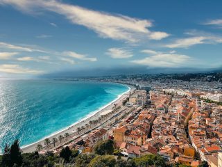
Map of the Self-Guided Walking Tour of Sorrento walking route with 15 stops in Sorrento.
Preview map of the Self-Guided Walking Tour of Sorrento route in Sorrento, showing 15 stops. Use the interactive map to zoom and tap markers.

More from this area

Self-Guided Walking Tour of Siena (2026)

Self-Guided Walking Tour of Siena

This website uses affiliate links which earn a small commission at no additional cost to you.

Siena is one of Tuscany's great medieval cities, famous for its Gothic streets, sloping brick lanes, cathedral, contrade traditions, and the shell-shaped Piazza del Campo. UNESCO describes the historic centre as the embodiment of a medieval city, noting that Siena preserved its Gothic appearance from the 12th to the 15th centuries and played an important role in the development of Italian and European art.

For visitors, Siena has a more intimate and atmospheric feel than Florence, though it is still rich in major sights. The cathedral, Torre del Mangia, Palazzo Pubblico, civic museum, old streets, city gates, and viewpoints make it easy to spend a full day or longer. It also works well as a base for the Chianti region, San Gimignano, Monteriggioni, Val d'Orcia, and other Tuscan hill towns.

How to Get to Siena

By Air: Siena doesn't have its own commercial airport, so you'll fly into one of Tuscany's larger hubs and continue overland. Florence Airport is the closest major option, while Pisa Airport often has more low-cost and international routes; Rome's airports can also work if flights are significantly cheaper, but the onward journey is longer. From any of these airports, the simplest next step is a train or bus to Siena, or a rental car if you plan to explore the surrounding countryside. For the best deals and a seamless booking experience, check out these flights to Siena on Booking.com.

By Train: Siena is well-connected by rail, but most routes involve a change, commonly at Empoli when coming from Florence, and sometimes at Chiusi-Chianciano Terme when coming from Rome. Trains arrive at Siena station, which sits below the historic centre; from there you can take local buses, a taxi, or use the escalator system and walking paths to reach the old town without tackling a steep climb all at once. For day trips, trains are reliable, but factor in transfer times and check schedules if you're traveling early morning or later in the evening. Use Omnio to easily compare schedules, book train tickets, and find the best prices all in one place for a hassle-free journey across Italy.

By Car: Driving is convenient if you want flexibility for wineries, hill towns, and rural stays, but it’s not the easiest way to approach the medieval core. The historic centre is a ZTL (limited traffic zone) and fines are common, so plan to park in one of Siena’s paid car parks outside the walls and walk or take an escalator/bus up. If you’re staying overnight, confirm with your accommodation whether they can register your plate for limited access, then treat the car as a base tool rather than something you’ll use inside the centre. If you are looking to rent a car in Italy I recommend having a look at Discover Cars, first, as they compare prices and review multiple car rental agencies for you.

By Bus: Buses are often the most straightforward option from nearby cities, especially Florence, with frequent services that can be quicker than the train once you include rail transfers. Coaches typically arrive closer to the old town than the train station, which makes arrival and departure easier if you're doing Siena as a day trip with minimal luggage. If you're arriving from smaller Tuscan towns, regional buses can be more direct than rail, but schedules can thin out on Sundays and holidays, so it's worth checking timings in advance.

A Short History of Siena

Siena in Etruscan and Roman Times

Siena’s earliest roots lie in a landscape shaped by pre-Roman settlement and later absorbed into the Roman world. The city’s identity was never purely imperial in character; even when Roman influence settled in, Siena’s story remained tied to local networks of trade, agriculture, and small-scale urban life rather than the monumental stamp of a single conquering vision. This layered beginning matters because it set the pattern that repeats throughout Siena’s history: a strong civic personality, built as much from local institutions and patronage as from outside powers.

As centuries passed, Christianity gradually reshaped the city's rhythms and spaces, laying the groundwork for Siena's medieval ascent. The earliest religious foundations evolved over time into the great ecclesiastical complex that would later culminate in the Duomo di Siena, with the Battistero di San Giovanni and the artistic riches now gathered in the Museo dell'Opera del Duomo and the Facciatone. The physical fabric of Siena began to turn inward and upward, shaped by devotion, craft, and the ambitions of a community learning to express itself through stone and ceremony.

Siena’s Medieval Rise and the Making of a City-State

From the 1100s onward, Siena grew into a self-confident commune, increasingly governed by civic bodies that treated the city as a shared project. Power, pride, and public life focused on spaces created specifically for government and ceremony, most famously the Piazza del Campo. The Campo wasn't just a convenient open area; it was an architectural statement about Siena's civic order, designed as a stage where government, religion, commerce, and festival life could intersect in plain sight.

The city-state's institutions took on physical form in the Palazzo Pubblico, whose frescoes and painted cycles-today central to the Museo Civico-were not simply decorative, but didactic. Art in Siena often carried the weight of political theory, moral instruction, and civic aspiration. Above it all rose the Torre del Mangia, a vertical emblem of communal authority and competitive prestige, signaling Siena's place among the proud cities of medieval Italy. Nearby, the Fonte Gaia added another layer of meaning: the idea that public works, water, and beauty belonged to the community, not just the elite.

Siena in the 1200s and 1300s

The 1200s and early 1300s marked Siena's high medieval confidence, when wealth, banking, and international connections fed an extraordinary burst of building and artistic production. This is the period when Siena's religious heart took on its most dramatic form, with the Duomo di Siena becoming a showcase of faith and competitive grandeur. The artistic culture that flourished here wasn't only about piety; it was also about status, civic pride, and Siena's desire to speak in a visual language as powerful as its political voice.

It is also the era that reveals Siena’s complex relationship between spiritual life and practical care. Santa Maria of Scala Hospital Museum preserves the memory of a medieval institution that was simultaneously charitable, medical, administrative, and symbolic-an embodiment of the city’s belief that civic responsibility included caring for the vulnerable. In the same centuries, daily life flowed along arteries such as Via di Città, where commerce, noble residences, and civic movement wove together a lived city beneath the grand facades and sacred spaces.

Siena from Renaissance Splendour to Shifting Power

As the Renaissance unfolded, Siena absorbed new currents of taste and learning while still protecting its distinct artistic voice. Humanist patronage and ecclesiastical ambition enriched the cathedral complex, and the Biblioteca Piccolomini stands as one of the clearest expressions of that era's ideals-learning, lineage, and the use of art to project refined authority. Siena's Renaissance was not a clean break from the medieval past; it layered new cultural ambitions onto older civic and religious frameworks.

Yet Renaissance brilliance also arrived alongside growing external pressure and internal strain. Siena's political independence faced increasing challenges from larger regional powers, and the city's institutions had to navigate a changing Italy where survival depended on alliances, resources, and military realities. The impressive civic core-Campo, Palazzo Pubblico, and the surrounding fabric-remained Siena's symbolic anchor even as the practical balance of power shifted beyond its walls.

Siena in the Early Modern and Modern Eras

In the centuries that followed, Siena's pace of change slowed compared with rapidly industrialising centres, and that relative stillness helped preserve the city's historic character. Civic identity continued to revolve around long-established institutions, rituals, and neighbourhood loyalties, while art and architecture remained central to how Siena understood itself. Museums such as the Museo dell'Opera del Duomo and the Museo Civico became custodians of memory, gathering the artistic evidence of Siena's earlier centuries and reframing it for new audiences.

Modern Siena's history is also a story of continuity through reinvention: historic spaces adapted to new needs without losing their symbolic weight. The Piazza del Campo still operates as Siena's civic living room, a place where the city's layered past feels immediate rather than distant. Walk Siena today and the narrative is readable in its landmarks-the Torre del Mangia watching over the Campo, the cathedral complex expressing centuries of devotion and ambition, and routes like Via di Città linking the everyday to the monumental in a single, coherent urban story.

Where to Stay in Siena

To make the most of visiting Siena and this walking tour, consider staying overnight in the centre. If you base yourself within the historic core, you can start early at Piazza del Campo, return easily for breaks, and enjoy Siena after the day-trippers leave. For a classic, walk-everywhere stay close to the Campo and the main lanes, look at Hotel Athena, Grand Hotel Continental Siena - Starhotels Collezione, and Hotel Palazzo di Valli. These put you in a strong position for the city’s headline sights while still giving you easy access to restaurants and evening atmosphere.

If you want to be closest to the Duomo side of the old town and the museum cluster, the area around the cathedral and the upper streets makes a good base for an art-and-architecture-focused visit, with short walks to the Duomo complex, Biblioteca Piccolomini, and the viewpoints near the Facciatone. In this zone, consider Hotel Duomo, Albergo Cannon d'Oro, and B&B Palazzo Bulgarini, all of which keep you tightly connected to the most central lanes and make it easy to dip in and out of the route without relying on transport.

For a slightly calmer feel with easier arrival by car or taxi, staying just outside the walls or near the main parking areas can be the smartest compromise-still walkable to the centre, but often quieter at night and simpler if you have luggage. This works particularly well if you're combining Siena with countryside time and want straightforward access in and out. Options in this style include NH Siena, Hotel Italia, and Four Points by Sheraton Siena, which tend to suit travellers prioritising convenience while still keeping the walking tour comfortably within reach.

Your Self-Guided Walking Tour of Siena

Discover Siena on foot with our walking tour map, guiding you from stop to stop as you explore its medieval lanes, landmark piazzas, and hidden corners. Because this is a self-guided walking tour, you can set your own pace, skip anywhere that doesn't interest you, and pause for coffee, gelato, or photos whenever you feel like it.

1. Piazza del Campo

Piazza del Campo
Piazza del Campo
CC BY-SA 1.0 / Perituss

Piazza del Campo is Siena’s civic heart, laid out in its distinctive shell shape during the 13th and 14th centuries as the city’s mercantile wealth and self-confidence peaked under the Republic of Siena. The sloping pavement and nine main segments are traditionally linked to the Council of Nine, the governing body that oversaw Siena’s most prosperous medieval decades. Unlike many Italian piazzas that feel like open courtyards, the Campo reads like an outdoor amphitheatre, designed to gather crowds and stage public life.

Look closely at the paving as it falls towards the Palazzo Pubblico: that gentle incline is part of the drama, pulling your eye to Siena’s seat of power. Around the edge, the warm-toned palazzi form an almost continuous ring, punctuated by cafés and historic façades that make it easy to imagine the square as a medieval marketplace. The open space also reveals Siena’s urban planning at its most theatrical, with sightlines deliberately framed.

When you visit, take time to circle the perimeter and then stand mid-slope to appreciate how the architecture “holds” the square. From the Campo you can pick out key landmarks in seconds: the Torre del Mangia rising above the skyline and the Palazzo Pubblico anchoring the lower edge. Early morning and late afternoon are best for atmosphere and softer light, when the brick tones deepen and the square feels less hurried.


Location: Il Campo, 53100 Siena SI, Italy | Hours: 24 Hours. | Price: Free.

We recommend to rent a car in Italy through Discover Cars, they compare prices and review multiple car rental agencies. Book your rental car here.

2. Museo Civico

Museo Civico
Museo Civico

Museo Civico is housed inside the Palazzo Pubblico, and it preserves Siena’s artistic identity exactly where it was meant to function: in the chambers of government. The museum’s core is a set of civic rooms decorated at the height of Siena’s medieval power, when painting was used not just for devotion but for political messaging. This is where Siena’s leaders met, negotiated, and asserted the city’s values in imagery.

The standout is the Sala della Pace, famed for Ambrogio Lorenzetti’s fresco cycle on good and bad government, one of the most extraordinary works of secular medieval art in Europe. Rather than saints and miracles, you get a visual argument about justice, civic responsibility, prosperity, and the consequences of tyranny. It’s a rare chance to see how a 14th-century city state explained itself to those in charge.

Beyond the frescoes, move through the adjoining rooms for additional panels, allegories, and decorative schemes that show Siena’s stylistic confidence. Windows and viewpoints within the complex also help you connect the art to the city outside: you’re not in a detached gallery, but in a living civic monument. Give yourself time to absorb the details; these paintings reward slow looking.


Location: Il Campo, 1, 53100 Siena SI, Italy | Hours: (Summer) March 1 – October 31: Daily: 10:00–19:00. (Winter) November 1 – February 28: Daily: 10:00–18:00. | Price: Adults: €10; Reduced: €9; Under 11: free. | Website

Here is a complete selection of hotel options in Siena. Feel free to review each one and choose the stay that best suits your needs.

3. Palazzo Pubblico

Palazzo Pubblico
Palazzo Pubblico
CC BY-SA 4.0 / Z thomas

Palazzo Pubblico was begun at the end of the 13th century as Siena’s town hall, a deliberate statement that civic authority belonged to the community and its institutions rather than to a single ruler. Built in brick with elegant Gothic lines, it faces the Campo like a stage set for public power, with an architecture that is both imposing and surprisingly refined. Its form reflects Siena’s identity as a fiercely independent medieval republic.

From the outside, the palace’s curved façade mirrors the shape of the square, strengthening the sense that the Campo and the Palazzo are one unified civic space. The building is rich in emblematic details: coats of arms, carefully proportioned windows, and the overall harmony that Siena’s builders achieved with relatively simple materials. It’s worth stepping back across the Campo to see how the whole composition works together.

Inside, the atmosphere changes from open piazza to solemn government rooms, many still carrying the visual language of authority and virtue. Even if you focus on just a few key spaces, you’ll come away with a clearer sense of how Siena projected stability and order. Look out for the transition points—staircases, corridors, and thresholds—because they were designed to impress visitors moving from public space into the seat of administration.


Location: Il Campo, 1, 53100 Siena SI, Italy | Hours: (Summer) March 1 – October 31; Daily: 10:00–19:00. (Winter) November 1 – February 28; Daily: 10:00–18:00. | Price: Adults: €10; Reduced: €9; Under 11: free. | Website

Traveling to a country with a different currency? Avoid ATM transaction fees and pay in local currency with a Wise Card. Having used it for over 5 years, we've saved loads on fees!

4. Torre del Mangia

Torre del Mangia
Torre del Mangia
CC BY-SA 4.0 / José Luiz

Torre del Mangia was built in the 14th century to rival Florence’s great civic tower and to proclaim Siena’s strength in unmistakable vertical form. Its name comes from Giovanni di Balduccio, the first bell-ringer, nicknamed “Mangiaguadagni” (“eat-the-earnings”) for his alleged fondness for spending. Rising beside the Palazzo Pubblico, the tower reinforces the idea that the city’s identity was civic, communal, and publicly visible.

Architecturally, the tower balances brick with pale stone bands and culminates in a distinctive crown, giving it elegance rather than brute mass. The tower’s relationship to the Campo below is key: it marks time, calls attention, and anchors Siena’s daily rhythms, much as it would have in the medieval period when bells structured urban life. It also acts as a constant point of orientation as you move through the city’s winding streets.

Climbing the tower is about the view, but also about understanding Siena’s topography: the city’s ridges, dense brick skyline, and the surrounding Tuscan countryside spread out in every direction. From above, you can trace how Siena’s neighbourhoods interlock and how major landmarks align. If you go, pace yourself on the stairs and take pauses at the windows; the changing angles reveal the Campo and the Duomo complex in a way ground level never can.


Location: Torre del Mangia, 53100 Siena SI, Italy | Hours: (Summer) March 1 – October 31: 10:00–19:00. (Winter) November 1 – February 28: 10:00–16:00. | Price: Adults: €10 (Torre del Mangia ticket). | Website

Where to Stay in Siena: An Area by Area Guide!

5. Fonte Gaia

Fonte Gaia
Fonte Gaia
CC BY-SA 4.0 / Holger Uwe Schmitt

Fonte Gaia was commissioned in the early 15th century as a celebratory public fountain, reflecting Siena’s long-running investment in water engineering and urban display. The original marble decoration was created by Jacopo della Quercia, one of the most important sculptors of his time, and it set a new standard for expressive, monumental relief in the city. The fountain’s name is often linked to the joy (“gaia”) that supposedly greeted the arrival of fresh water at the Campo.

What you see today is a carefully made copy, placed to protect the original sculptures, but the composition still reads clearly: central figures, surrounding panels, and a rhythmic narrative structure that feels both devotional and civic. The fountain’s placement on the upper edge of the Campo is deliberate, functioning as both utility and ornament, and it becomes a natural focal point as you scan the square’s architecture.

Spend a few minutes reading the panels and comparing the crispness of the carving with the softer brick landscape around it. It’s also one of the best places in the Campo to pause and take in the full “theatre” of the square, with the Palazzo Pubblico and tower drawing you downhill. In the evening, the fountain area often feels calmer than the centre of the piazza, making it a good spot to appreciate the Campo’s proportions.


Location: Via Fontebranda, 50, 53100 Siena SI, Italy | Hours: 24 Hours. | Price: Free.

6. Battistero di San Giovanni

Battistero di San Giovanni
CC BY-SA 2.0 / sailko

The Baptistery of San Giovanni sits behind the Duomo and represents Siena’s late medieval and early Renaissance ambition in both architecture and sculpture. Constructed largely in the 14th and 15th centuries, it forms part of the cathedral complex and reflects the period when Siena was competing artistically with rival city states. Its setting, tucked into the folds of the cathedral’s terrain, can feel like discovering a hidden chapter of the same grand story.

Inside, the space is known for its baptismal font, a collaborative masterpiece involving leading sculptors of the era, with reliefs that bring biblical scenes to life in dense, energetic carving. The interior also carries an atmosphere distinct from the cathedral proper: more intimate, more focused, and often quieter, which suits its sacramental purpose. The architecture guides your attention towards the font and the ritual meaning of the room.

When visiting, look for the contrast between the building’s structural clarity and the sculptural richness at the centre. Pay attention to how light falls across the reliefs, because it sharpens the storytelling and makes the figures feel almost animated. Stepping back outside, take a moment to understand the Baptistery’s placement within the wider Duomo ensemble; it’s one of Siena’s best examples of how complex sites grow over centuries while still feeling unified.


Location: Piazza S. Giovanni, 1, 53100 Siena SI, Italy | Hours: (Winter) January 7 – March 31: 10:30–17:30. (Summer) April 1 – October 31: 10:00–19:00. | Price: Whole: €14 (January 1 – June 26; August 1 – August 17; October 16 – December 31); €16 during the Cathedral floor uncovering (June 27 – July 31; August 18 – October 15). Reduced (children 7–11): €3; Children up to 6: free. | Website

7. Museo dell'Opera del Duomo & Facciatone

Museo dell’Opera del Duomo & Facciatone
CC BY-SA 4.0 / Miguel Hermoso Cuesta

Museo dell’Opera del Duomo preserves artworks and architectural fragments connected to Siena’s cathedral, but it’s also inseparable from one of the city’s most dramatic “what if” stories. In the 14th century, Siena planned an enormous expansion of the cathedral that would have produced one of the largest churches in Christendom. The project stalled—financial strain, structural challenges, and the devastating impact of the Black Death all played their part—leaving behind the unfinished façade wall known as the Facciatone.

The museum context helps you read the cathedral not as a single finished masterpiece, but as a living project shaped by ambition and crisis. Collections typically include sculpture, painting, and liturgical pieces that once belonged to the Duomo complex, allowing you to connect artistry with the institution that commissioned it. The story of the halted expansion adds an edge of poignancy: you’re looking at evidence of Siena’s grandest aspirations and its abrupt limits.

The Facciatone viewpoint is a major reason people come here, because it turns an architectural remnant into a spectacular vantage point. From this angle, you see Siena’s dense medieval fabric at close range and the Duomo’s own striped marble surfaces in unusual perspective. Treat the experience as both museum visit and architectural excavation: the artefacts explain the site, and the unfinished masonry explains Siena’s history.


Location: Piazza del Duomo, 8, 53100 Siena SI, Italy | Hours: (Winter) January 7 – March 31 2026: Daily: 10:30–17:30. | Price: Adults: €14 (January 1 – June 26; August 1 – August 17; October 16 – December 31) or €16 (June 27 – July 31; August 18 – October 15); Children 7–11: €3; Under 7: free. | Website

8. Biblioteca Piccolomini

Biblioteca Piccolomini
CC BY-SA 4.0 / Miguel Hermoso Cuesta

The Piccolomini Library was created in the early 16th century to honour Enea Silvio Piccolomini, who became Pope Pius II, and it stands as a high Renaissance jewel within Siena’s cathedral complex. Commissioned by Cardinal Francesco Piccolomini (later Pope Pius III), the library was designed to house precious manuscripts and to project the family’s cultural prestige. It’s a reminder that Siena’s story is not only medieval republics and rivalries, but also humanist learning and papal connections.

The room is celebrated for its vivid fresco cycle, attributed to Pinturicchio and his workshop, illustrating episodes from Pius II’s life in richly coloured, detail-packed scenes. The imagery is theatrical, full of costume, architecture, and ceremonial pageantry, and it contrasts strikingly with Siena’s more austere civic Gothic spaces. The ceiling decoration and the overall colour saturation create an almost immersive effect.

When you’re inside, slow down and scan the frescoes as narratives rather than isolated pictures; they read like a visual biography. Look also at the manuscript displays, which underline the library’s original function as a treasury of learning. Because the space can get busy, try to position yourself where you can see the full length of the room at once; the intended impact is cumulative, like stepping into a painted world.


Location: Piazza del Duomo, 8, 53100 Siena SI, Italy | Hours: Monday – Saturday: 10:30–17:30. Sunday: 13:30–17:30. | Price: Included with Siena Cathedral/OPA SI complex admission; reduced ticket (children 7–11): €3; children up to 6: free. | Website

9. Duomo di Siena

Duomo di Siena
Duomo di Siena
CC BY-SA 4.0 / AntoineJoub

Siena’s cathedral is one of the most distinctive achievements of Italian Gothic, shaped over centuries and infused with the city’s competitive pride. Its black-and-white marble striping echoes Siena’s heraldic colours and creates an immediate sense of identity, inside and out. The Duomo’s long building history reflects shifting artistic tastes, political fortunes, and the steady desire to make a sacred space that could rival any in Italy.

The exterior rewards careful viewing: sculpted portals, layered decorative programs, and a façade that feels like an elaborate stone screen. Inside, the same striped marble continues, creating a rhythm that draws your eye through the nave and into the chapels. The cathedral also operates as a container for art across periods, with sculpture, painting, and decorative schemes that reflect Siena’s role as a major artistic centre.

What to see depends on your interests, but don’t rush past the basics: look up, look down, and look sideways. The floor is famously intricate, and the interior’s visual density can be overwhelming in the best way, with each bay offering another set of details to decode. Give yourself time for stillness: the Duomo is at its most impressive when you let your eyes adjust and start noticing how geometry, pattern, and narrative all work together.


Location: Piazza del Duomo, 8, 53100 Siena SI, Italy | Hours: (Winter) January 7 – March 31, 2026: Monday – Saturday: 10:30–17:30; Sunday & Public Holidays: 13:30–17:30. (Summer) April 1 – October 31, 2026: Monday – Saturday: 10:00–19:00; Sunday & Public Holidays: 13:30–18:00. | Price: OPA SI PASS (valid 3 consecutive days): Adults: €14 (January 1 – June 26; August 1 – August 17; October 16 – December 31); Adults: €16 (June 27 – July 31; August 18 – October 15); Children 7–11: €3; Under 7: free. | Website

10. Santa Maria of Scala Hospital Museum

Santa Maria of Scala Hospital Museum
CC BY-SA 3.0 / Sailko

Santa Maria della Scala began as a hospital and charitable institution opposite the cathedral, and it grew into one of Siena’s most important civic and religious foundations. For centuries it cared for the sick, sheltered pilgrims, and supported the poor, making it a practical expression of medieval Christian duty woven into the city’s everyday life. Its location—facing the Duomo—signals how closely Siena linked spiritual authority with public welfare.

Today, as a museum complex, it preserves the layered spaces of the former hospital: halls, chapels, corridors, and rooms that still communicate the scale of the institution. Frescoed interiors, where they survive, are especially evocative because they show how Siena visualised care, charity, and institutional pride. The building is also a physical record of how cities organised social services long before modern healthcare.

When you visit, focus on the atmosphere as much as the individual exhibits: the sense of depth, the worn thresholds, and the changing room volumes tell their own story. Look for surviving decorative cycles that depict hospital life and patronage, since they are unusually direct windows into medieval society. It’s also a good place to understand Siena beyond its headline monuments, because it connects art and architecture to the city’s social history.


Location: Complesso museale Santa Maria della Scala, Piazza del Duomo, 1, 53100 Siena SI, Italy | Hours: (Summer) March 15 – October 31; Daily: 10:00–19:00. (Winter) November 1 – March 14; Monday, Wednesday, Thursday, Friday: 10:00–17:00. Saturday – Sunday: 10:00–19:00. Closed on Tuesday. | Price: Check official website. | Website

11. Via di Città

Via di Città
Via di Città
CC BY-SA 4.0 / Palickap

Via di Città is one of Siena’s most storied streets, running through a corridor of noble palaces and historic institutions that reflect the city’s medieval and Renaissance elites. The street’s name itself speaks to its civic importance: it was, and remains, a central artery in the urban fabric. In Siena, streets are rarely just routes; they’re layered spaces shaped by centuries of commerce, ceremony, and local power.

As you move along, the architecture becomes the main attraction: tall brick façades, stone details, courtyards hidden behind heavy doors, and the occasional glimpse into a narrow side lane that drops away unexpectedly. Many buildings along this stretch belonged to powerful families, and the street still conveys that sense of contained wealth and hierarchy. Even without stepping inside anything, you can read the city’s history in the materials and proportions.

What to see here is less a single monument and more the cumulative experience of Siena’s urban character. Pay attention to small elements—family crests, gothic windows, changes in paving—because they mark shifts in period and status. It’s also a good place to pause in a quieter moment and listen: you’ll often hear the city before you see it, as sound carries through the tight street geometry.


Location: Via di Città, 53100 Siena SI, Italy | Hours: 24 Hours. | Price: Free.

12. Piazza del Mercato

Piazza del Mercato
Piazza del Mercato
CC BY-SA 3.0 / Demeester

Piazza del Mercato sits just behind Siena’s Palazzo Pubblico, effectively acting as the Campo’s older, more workaday counterpart. From the Middle Ages onward it functioned as a practical trading space for livestock and produce, positioned slightly out of the main ceremonial spotlight while still tightly connected to the city’s political core. Its role reflects how Siena separated showpiece civic space from the messier business of provisioning a dense hill city.

The square’s shape and level changes make it feel markedly different from Piazza del Campo: it’s more enclosed, more irregular, and more directly shaped by the surrounding buildings and retaining walls. One of the key historic features is the Fonte di Piazza del Mercato, a substantial public fountain supplied by Siena’s famed medieval waterworks, which underpinned daily life and market activity here. You also get strong views of the Palazzo Pubblico’s rear elevations, which helps you understand the town hall as a full architectural mass rather than a single theatrical façade.

When you visit, treat it as a place to read Siena’s “backstage” history. Walk the edges, look for the fountain and the texture of the brickwork, and notice how quickly the atmosphere shifts compared with the Campo—often quieter, sometimes surprisingly local. It’s also a useful spot to appreciate the city’s engineering: the way streets, stairs, and walls stitch together steep terrain into usable public space.


Location: Piazza del Mercato, 53100 Siena SI, Italy | Hours: 24 Hours. | Price: Free.
Powered by GetYourGuide
Moira & Andy
Moira & Andy

Hey! We're Moira & Andy. From hiking the Camino to trips around Europe in Bert our campervan — we've been traveling together since retirement in 2020!

Read our full story here

This website uses affiliate links which earn a small commission at no additional cost to you.

Walking Tour Summary

Distance: 1 km
Sites: 12

Walking Tour Map
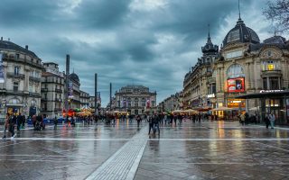
Map of the Self-Guided Walking Tour of Siena walking route with 12 stops in Siena.
Preview map of the Self-Guided Walking Tour of Siena route in Siena, showing 12 stops. Use the interactive map to zoom and tap markers.

More from this area

Self-Guided Walking Tour of Messina (2026)

Self-Guided Walking Tour of Messina

This website uses affiliate links which earn a small commission at no additional cost to you.

Messina is a Sicilian port city facing the Strait of Messina, often used as an arrival point but worth attention for its cathedral, harbour, fountains, churches, and dramatic position between sea and mountains. Its cathedral bell tower is especially famous for the Astronomical Clock, created in 1933 by Ungerer of Strasbourg; Visit Sicily describes the noon performance of its automatons and biblical scenes as one of the city's major spectacles.

For visitors, Messina is best approached as a working gateway city with a few strong landmarks rather than a polished resort. Piazza Duomo, the cathedral, bell tower, waterfront, regional museum, hill viewpoints, and ferry activity give it a distinctive rhythm. It is also useful for reaching Taormina, the north-east coast, the Aeolian Islands, and onward routes through Sicily.

How to Get to Messina

By Air: The closest airport is Reggio Calabria Airport on the mainland side of the strait, with transfers to the city typically involving a short ferry/hydrofoil hop plus local onward travel. The most common flight gateway for Sicily's east coast is Catania-Fontanarossa Airport, around 90 km away, where you can continue to the centre by coach or by a mix of bus/train. If your first stop on arrival is the waterfront (for example Messina Cruise Port) or the historic core (the Duomo di Messina area), aim to arrive in the city during daylight so you can get your bearings quickly. For the best deals and a seamless booking experience, check out these flights to Messina on Booking.com.

By Train: Messina's main station is Messina Centrale, which is well placed for walking into the centre and linking up with key streets like Via Giuseppe Garibaldi. From elsewhere in Sicily, you'll typically connect via regional services along the coast; from mainland Italy, the classic route funnels through Calabria to Villa San Giovanni, where trains interface with the strait crossing before continuing to Messina. Services between Messina and Villa San Giovanni are frequent and fast in timetable terms, but allow extra time overall for the crossing and any ferry operations. Use Omnio to easily compare schedules, book train tickets, and find the best prices all in one place for a hassle-free journey across Italy.

By Car: Driving is straightforward if you're already touring Sicily: the Autostrada A18 runs south towards Catania, while the Autostrada A20 runs west along the Tyrrhenian side towards the Palermo direction (via its connection onward). If you're arriving from mainland Italy, you'll cross the strait by car ferry from Calabria to Messina and emerge close to the harbour area, convenient for dropping into central sights soon after parking. In the centre, expect tighter streets and limited parking; it's often easiest to park once and then continue on foot through the cathedral zone and main avenues. If you are looking to rent a car in Italy I recommend having a look at Discover Cars, first, as they compare prices and review multiple car rental agencies for you.

By Bus: Long-distance and airport coaches are often the simplest transfer option from Catania-Fontanarossa Airport, with operators such as SAIS Autolinee running direct services into Messina. This can be the best “one-ticket” choice if you want to step off the plane and arrive near the centre without changing trains, especially with luggage. Once you're in town, you can walk into the historic core in a few minutes and begin your route around the cathedral precinct and main squares. [bus]

A Short History of Messina

Messina in the Ancient Greek Foundations and Early Maritime Growth

Messina's earliest urban story is inseparable from the sea: it developed as a strategic harbour city whose fortunes rose with navigation, trade, and control of shipping routes. From the start, maritime traffic shaped the city's identity and economy, a pattern that still reads clearly today in the working rhythms around the Messina Cruise Port.

As the settlement matured, civic life clustered around religion, commerce, and public display. Even in later rebuilding phases, Messina repeatedly returned to the idea of a monumental centre with emblematic landmarks, a tradition that helps explain why the city's key spaces feel designed to be approached on foot, in sequences of squares, churches, and thoroughfares.

Messina under Rome and Late Antiquity

Under Roman influence, Messina remained a port-driven city with a strong link between urban prosperity and maritime throughput. The city's public architecture and street life were tied to the practical needs of movement, storage, and exchange, while religious buildings and civic institutions reinforced local status in the wider imperial system.

In late antiquity, shifting political and religious realities brought cycles of disruption and adaptation. Churches became anchors of continuity, and the urban fabric evolved in response to changing powers, setting the stage for medieval Messina’s layered architectural character and the long pattern of rebuilding that would come to define the city.

Messina in the Medieval Centuries of Change and Continuity

The medieval period brought frequent transitions of rule, but Messina’s core role as a maritime gateway endured. Religious architecture in particular carried the city’s memory across these shifts; the Church of Most Holy Annunciation of the Catalans stands as a powerful reminder of medieval Messina’s architectural language and the persistence of worship sites through political change.

At the same time, Messina’s skyline and hilltop points began to matter as much as its waterfront, reflecting the era’s defensive priorities and the symbolic need to command views over the harbour approaches. Later devotional landmarks, including the Santuario della Madonna di Montalto, also speak to this elevated geography of faith and civic identity.

Messina in the Renaissance and Early Modern Period of Civic Splendour

As Messina grew in wealth and prestige, it expressed itself through urban decoration, palatial residences, and a stronger sense of ceremonial space. The Duomo di Messina became a focal point for both religious and civic life, helping structure the surrounding centre as the city's symbolic heart.

Public monuments reinforced this theatrical approach to urban identity. The Fontana di Orione reflects a tradition of showcasing engineering, artistry, and civic pride in the open air, turning daily movement through the city into an encounter with deliberate statements about power and cultural confidence.

Messina in the 1600s to 1700s of Baroque Culture and Unsettled Politics

In the early modern centuries, Messina’s elites continued to shape the city through prominent residences and institutions. Buildings such as Palazzo Calapaj-d’Alcontres and Palazzo Cerruti – Bisazza evoke a world in which architecture communicated lineage, influence, and taste, even as the city navigated broader political pressures and periodic instability.

This era also deepened the relationship between religious devotion and civic life. The Sanctuary of Montevergine represents the continuing importance of sanctuaries and confraternities, and how Messina’s communities used faith, processions, and patronage to reinforce cohesion in uncertain times.

Messina after the 1908 Earthquake and the Rebuilding of a Modern City

The defining rupture of modern Messina was the catastrophic earthquake of 1908, followed by a vast reconstruction that reshaped streets, squares, and building stock. The rebuild created a more regular, modern plan in many areas, while also provoking a renewed commitment to restoring emblematic sites, especially those tied to identity and continuity.

Messina's cathedral complex became central to this recovery narrative. The Bell Tower of the Cathedral of Messina, famous for its animated clock, reflects a rebuilt city's desire to celebrate ingenuity and communal pride in a highly visible, shared landmark.

Messina in the 20th Century of War, Recovery, and Civic Institutions

World War II brought further damage and disruption, followed by another phase of repair and institutional consolidation. Civic administration and provincial identity gained architectural expression, with Palazzo dei Leoni serving as a marker of modern governance and the city’s role as a regional centre.

Commercial life also found new forms during recovery and modernization. Galleria Vittorio Emanuele III represents the ambition to create refined urban interiors for shopping and social life, linking Messina’s older tradition of civic display with 20th-century notions of progress and public space.

Messina Today of Memory, Monuments, and the Waterfront City

Contemporary Messina is defined by the interplay of resilience and remembrance. The Sacrario di Cristo Re is central to the city's commemorative landscape, tying spiritual symbolism to collective memory and reinforcing how Messina marks loss and continuity in prominent, public-facing ways.

At street level, modern Messina is experienced through its main routes and waterfront monuments. Via Giuseppe Garibaldi continues the tradition of the city's primary axis as a stage for daily life, while the Fontana del Nettuno echoes the older civic language of myth, sea power, and identity-appropriate for a city whose past and present still turn on the harbour.

Where to Stay in Messina

To make the most of visitng Messina and this walking tour then you consider stay overnight at the centre. The most convenient base is around the Duomo and the streets just off Via Giuseppe Garibaldi, where you can walk straight into the historic core for the cathedral complex, fountains, and the main architectural set pieces without relying on taxis. Good, central options here include Jolly Charme Suite and B&B Il Galleone, with Sant'Agostino - Luxury Rooms also well placed if you want something compact and smart for quick returns between stops.

If you want maximum transport convenience, stay between the cruise port and Messina Centrale, which keeps arrival and departure simple and still leaves you within easy walking distance of the route's key sights. This area suits shorter stays and late arrivals, with reliable choices like Hotel Royal Palace, plus smaller properties such as Elysium B&B and Teatro sullo Stretto for a more local, guesthouse-style feel.

For a slightly more residential vibe (and often better value) while still being walkable into the centre, look around the mid-town streets near the university/law-courts side of town and the shopping corridors that feed into the main axis. This works well if you want evening restaurants nearby without feeling right on top of the busiest sightseeing pockets. Consider Hotel Messenion, Hotel La Residenza, or Residence San Martino if you prefer apartment-style flexibility.

If your priority is a quieter stay with easier parking (or you’re breaking up a longer Sicily drive), the southern outskirts can make sense, but you’ll likely taxi or use public transport into the walking-tour start. Two options that suit this style are Villa Pulejo for a more retreat-like feel and Europa Palace Hotel for straightforward road access and an easy in-and-out base.

Your Self-Guided Walking Tour of Messina

1. Messina Cruise Port

Messina Cruise Port
Messina Cruise Port
CC BY-SA 4.0 / AkakiBalanchivadze

Messina’s port has been the city’s front door since antiquity, valued for its position on the Strait of Messina and used by Greek, Roman, Byzantine, Norman, Spanish, and Bourbon powers as a naval and trading base. The modern cruise facilities sit on a shoreline rebuilt after the devastating 1908 earthquake and tsunami, which levelled much of the city and reshaped its waterfront.

What you see today is a working harbour with ferries, cargo traffic, and cruise berths, framed by the long curve of the strait and the hills rising behind the city. The setting is part of the experience: the constant movement of ships and the close view across to Calabria make it clear why Messina has always mattered strategically.

From the port area, look for the broad sea views, the city’s waterfront monuments and fountains, and the quick access into the historic core. Even a short wander gives you a feel for Messina’s maritime identity: the strait panorama, the rebuilt civic centre nearby, and the steady rhythm of ferries cutting back and forth.


Location: Via Vittorio Emanuele II, 96, 98122 Messina ME, Italy | Hours: 24 Hours. | Price: Free. | Website

We recommend to rent a car in Italy through Discover Cars, they compare prices and review multiple car rental agencies. Book your rental car here.

2. Church of Most Holy Annunciation of the Catalans

Church of Most Holy Annunciation of the Catalans
CC BY-SA 4.0 / Effems

This small medieval church is one of Messina’s most important survivals from before 1908. Often linked to the city’s multi-layered Middle Ages, it reflects a period when Sicily sat at the crossroads of Latin, Byzantine, and Arab artistic traditions, and later came under the influence of Aragonese “Catalan” rule.

Architecturally, it’s compact but unusually rich: look for the blend of Romanesque massing with details that feel Byzantine in spirit, plus carved stonework and a restrained, fortress-like exterior. Its survival makes it a rare window into a Messina that largely disappeared in the early twentieth century.

Inside, focus on the atmosphere and the structural details rather than sheer scale. The appeal is the sense of age, the mingled styles, and the contrast between this intimate building and the grander post-earthquake reconstruction elsewhere in the city.


Location: Via G. Garibaldi, 111, 98122 Messina ME, Italy | Hours: Monday – Saturday: 09:30–16:00. | Price: Free; donations appreciated.

Here is a complete selection of hotel options in Messina. Feel free to review each one and choose the stay that best suits your needs.

3. Palazzo Cerruti - Bisazza

Palazzo Cerruti – Bisazza
CC BY-SA 3.0 / Maria lo sposo

This palace represents the era when Messina’s elite families expressed status through urban palazzi, especially in the centuries when the city prospered as a commercial hub connecting Sicily to mainland Italy and the wider Mediterranean. Many such residences were damaged or lost in 1908, so surviving or reconstructed palazzi help trace how civic life was re-established afterward.

What to look for is the façade language typical of aristocratic city houses: formal symmetry, decorative stonework, and details around portals, balconies, and cornices that signal wealth and taste. Even if you only view it externally, it reads as part of the city’s “public face” architecture—built to be noticed from the street.

When you visit, treat it as an architectural stop: slow down for the craftsmanship, street-level viewpoints, and how it sits in the surrounding urban fabric. Palazzi like this are best appreciated in context, as part of the rebuilt city centre’s rhythm of façades and civic spaces.


Location: Via Lepanto, 1, 98122 Messina ME, Italy | Hours: 24 Hours. | Price: Free.

Traveling to a country with a different currency? Avoid ATM transaction fees and pay in local currency with a Wise Card. Having used it for over 5 years, we've saved loads on fees!

4. Palazzo Calapaj-d'Alcontres

Palazzo Calapaj-d’Alcontres
CC BY-SA 2.0 /

Palazzo Calapaj-d’Alcontres is commonly associated with Messina’s pre-1908 aristocratic landscape and is often cited among the city’s notable historic residences. Its name points to noble lineages that shaped local politics, patronage, and the social life of the city over generations.

The main draw is its architectural character—an urban palace designed to communicate lineage and stability. Look for the formal composition, the framing of windows and balconies, and any heraldic or ornamental elements that hint at family identity and period style.

As a visitor, the most reliable experience is appreciating the exterior and the way the building contributes to Messina’s historical layering. Even without extensive interiors on display, it’s a useful stop for understanding how the city’s elite once lived and how fragments of that world remain visible in the streetscape.


Location: 98122 Messina, Metropolitan City of Messina, Italy | Hours: 24 Hours. | Price: Free.

5. Duomo di Messina

Duomo di Messina
Duomo di Messina
CC BY-SA 4.0 / SonoGrazy

Messina’s cathedral has deep roots, with a long history of rebuilding that mirrors Sicily’s turbulent past. Over centuries it absorbed Norman and later influences, but the 1908 earthquake caused catastrophic destruction, leading to extensive reconstruction that sought to restore the cathedral’s historic presence while using modern methods.

What you see today is a grand landmark with a broad façade and a powerful position in the city’s symbolic geography. Pay attention to the overall massing, the sculptural details, and the sense of a civic heart: this is the anchor for Messina’s main square and one of the clearest statements of the city’s recovery.

Inside, focus on the scale, the restored decorative programme, and the way the space balances reverence with the story of survival. Even if you’re not an architecture specialist, the cathedral communicates Messina’s identity: continuity after disaster, pride in tradition, and a central gathering place for religious and civic life.


Location: P.za Duomo, 98122 Messina ME, Italy | Hours: Check official website. | Price: Free; donations appreciated. | Website

6. The Bell Tower of the Cathedral of Messina

The Bell Tower of the Cathedral of Messina
Public Domain / Pinodario

The cathedral’s bell tower is famous for its monumental astronomical clock, a product of the era when European cities showcased modern engineering through public timekeeping. In Messina, the tower and its mechanisms became part of the city’s post-1908 narrative—an emblem of reconstruction and civic confidence.

Visually, the tower is best appreciated from the square, where you can take in its height, proportions, and the clock’s theatrical elements. The animated figures and moving parts are designed for public spectacle, turning time into a performance that draws locals and visitors into the piazza at key moments.

When you’re there, time your visit to watch the clock’s display if possible, then linger to study the details: sculptural groups, symbolic imagery, and the way the tower and cathedral work together as a single civic stage set. It’s one of Messina’s most distinctive “see it to understand it” sights.


Location: Zona pedonale, P.za Duomo, 98122 Messina ME, Italy | Hours: Check official website. | Price: Check official website. | Website

7. Fontana di Orione

Fontana di Orione
Fontana di Orione
CC BY-SA 4.0 / AntoninoRaffa

The Fountain of Orion is one of Messina’s great Renaissance monuments, traditionally linked to the city’s pride in its water supply and civic engineering. Its iconography draws on classical mythology, reflecting the humanist taste of the period and the desire to present Messina as a sophisticated, well-ordered city.

Up close, the fountain rewards attention: look for layered basins, carved figures, and the narrative quality of the sculpture. Mythological references, allegorical details, and fine stonework combine to create a piece that is both decorative and symbolic—public art intended to express civic identity.

As a visitor, circle it slowly and view it from multiple angles, since the composition is designed to reveal different groupings and motifs. It also works well as a “centre point” sight because it sits amid major landmarks, making it easy to connect the fountain’s Renaissance confidence to the city’s broader history of resilience.


Location: P.za Duomo, 98122 Messina ME, Italy | Hours: 24 Hours. | Price: Free.

8. Palazzo dei Leoni

Palazzo dei Leoni
Palazzo dei Leoni
CC BY-SA 4.0 / Jeanne Griffin

Palazzo dei Leoni is a significant civic building in Messina, associated with the city’s modern administrative identity after the immense disruption of 1908. In a rebuilt city, prominent public buildings helped reassert continuity and provide a visible framework for governance and civic services.

Architecturally, it presents a formal, institutional face, with design choices meant to convey authority and stability. The name and emblematic lion imagery connect to longstanding European civic symbolism—strength, guardianship, and dignity—making the building read as more than just an office block.

When you visit, the main interest is the exterior presence and any accessible public areas. Look for sculptural details, coats of arms or symbolic motifs, and how the building anchors its surroundings, reinforcing the sense of Messina as a functioning civic capital rather than only a port city.


Location: Corso Cavour, 98122 Messina ME, Italy | Hours: Check official website. | Price: Check official website.

9. Galleria Vittorio Emanuele III

Galleria Vittorio Emanuele III
CC BY-SA 4.0 / Derbrauni

This covered gallery belongs to the tradition of grand Italian commercial arcades built in the late nineteenth and early twentieth centuries, inspired by Milan’s famous model and shaped by the optimism of modern urban life. In Messina, such structures reflect the city’s aspirations toward elegance, commerce, and a cosmopolitan identity.

The appeal is the architecture: a light-filled interior, rhythmic arches, decorative ironwork, and a sense of indoor “street theatre.” Even if you’re not shopping, the space is designed for strolling—an urban living room that turns everyday movement into something a bit ceremonial.

Go for the atmosphere and the details: look up at the roof structure, study the ornamental flourishes, and notice how the gallery frames views outward to the surrounding streets. It’s especially enjoyable at quieter moments when you can hear the echo of footsteps and appreciate the space as a piece of urban design.


Location: Galleria Vittorio Emanuele III, 18, 98122 Messina ME, Italy | Hours: 24 Hours. | Price: Free.

10. Santuario della Madonna di Montalto

Santuario della Madonna di Montalto
CC BY-SA 2.0 / Vito Manzari

The Sanctuary of Madonna di Montalto is tied to Messina’s devotional traditions and its relationship with the hills above the city. As with many Marian sanctuaries in Italy, its significance blends faith, local identity, and the protective symbolism of a high, watchful site overlooking daily life.

What stands out most is the setting and the views. The climb or approach is part of the experience, and once you arrive you get a strong sense of Messina’s topography: the dense urban grid below, the curve of the waterfront, and the strait beyond.

At the sanctuary, take time for the peaceful interior (when open) and then focus on the panoramic terraces or viewpoints nearby. It’s a place that naturally encourages slowing down—less about ticking off “must-see” objects and more about absorbing Messina as a landscape shaped by sea, hills, and history.


Location: Via Dina e Clarenza, 16, 98122 Messina ME, Italy | Hours: Check official website. | Price: Free; donations appreciated.

11. Sacrario di Cristo Re

Sacrario di Cristo Re
CC BY-SA 4.0 / Marzia Campagna

The Shrine of Christ the King is a prominent memorial and religious complex that speaks to the twentieth century’s imprint on Messina. Like other sacrari in Italy, it combines commemoration with sacred architecture, creating a space where civic memory and spiritual reflection meet.

Visually, it’s striking for its scale and its elevated position, which turns the site into both a landmark and a lookout. The architecture tends to emphasise symmetry and monumentality, reinforcing the idea of solemn remembrance and collective identity.

When you visit, expect a quieter, more contemplative atmosphere than the busy central square. The panoramic views are a major highlight, but the deeper experience comes from noticing how the memorial design directs movement and attention, encouraging visitors to consider the city’s losses and resilience in a single, powerful setting.


Location: Sacrario Cristo Re, 98122 Messina ME, Italy | Hours: Monday – Saturday: 09:00–12:30. | Price: Free; donations appreciated.

12. Fontana del Nettuno

Fontana del Nettuno
Fontana del Nettuno
CC BY-SA 4.0 / Exoduspedia

The Fountain of Neptune is a major sculptural landmark on Messina’s waterfront, anchored in the long tradition of using mythological sea imagery to express a city’s maritime power and identity. Neptune, as ruler of the seas, is an obvious symbol for a port defined by the strait and constant ship traffic.

The fountain’s impact is both artistic and geographic: it sits in a setting where the water, the open sky, and the movement of the harbour amplify the sculpture’s meaning. Look for the dynamism in the figures, the compositional drama, and how the fountain is meant to be seen in relation to the sea.

When you visit, take time to view it from multiple distances—close for sculptural detail, farther back for the full silhouette against the waterfront. It’s also a good place to pause and take in the strait itself, because the fountain makes most sense when you connect the mythic imagery to the real maritime landscape in front of you.


Location: Via G. Garibaldi, 98122 Messina ME, Italy | Hours: 24 Hours. | Price: Free.

13. Via Giuseppe Garibaldi

Via Giuseppe Garibaldi
CC BY-SA 1.0 / Nino Manfredi

Via Giuseppe Garibaldi is one of Messina’s principal arteries, shaped significantly by the city’s twentieth-century reconstruction. After 1908, Messina was rebuilt with a more rational, ordered street plan in many areas, and major avenues became showcases for civic life, commerce, and architecture designed to project modernity.

Walking along the avenue (without treating it as a “route” or itinerary) is a way to read the rebuilt city: the façades, the spacing of blocks, and the presence of public buildings reflect planning choices made to create a safer, more coherent urban core. It’s a different experience from older Sicilian centres with tightly medieval street patterns.

What to see is the streetscape itself: shopfronts, civic landmarks, and the shifting views toward the cathedral area and the waterfront. Pay attention to architectural details at upper levels—balconies, cornices, and decorative elements—because the avenue is best appreciated by looking beyond ground-floor retail to the city’s reconstructed identity.


Location: Via Giuseppe Garibaldi, Messina ME, Italy | Hours: 24 Hours. | Price: Free.

14. Teatro Vittorio Emanuele

Teatro Vittorio Emanuele II
CC BY-SA 4.0 / AntoninoRaffa

Teatro Vittorio Emanuele in Messina is one of the city’s key cultural institutions, closely tied to the late-19th century moment when Italian cities invested in grand public theatres as symbols of civic pride. Messina’s older urban fabric and many historic buildings were devastated by the 1908 earthquake, and the theatre’s story sits within that broader pattern of loss, reconstruction, and the city’s determination to reassert itself as a serious cultural centre.

From the outside, focus on the building’s formal, “representational” architecture: a façade designed to read as important even at street level, with a sense of symmetry and ceremony that fits its role. The theatre stands as part of Messina’s rebuilt civic core, so it also helps you understand how the city reshaped its public spaces after 1908—more ordered, more monumental, and consciously modern.

If you can go inside, the main draw is the interior volume and performance setting: the auditorium proportions, decorative detailing, and the atmosphere that only working theatres have. Even without seeing a show, it’s worth looking for programme posters, foyer spaces, and any visible historic elements; if you do catch a performance, it’s the best way to experience the building as it was intended—an active piece of living culture, not just an architectural relic.


Location: Via G. Garibaldi, 98122 Messina ME, Italy | Hours: Tuesday – Saturday: 09:00–13:00 & 16:00–18:40. Sunday: Open only on performance days: 16:00–18:40 and/or 1 hour before the show. Closed on Monday. Closed on public holidays (except performance days). | Price: Prices vary by show. | Website

15. Sanctuary of Montevergine

Sanctuary of Montevergine
CC BY-SA 3.0 / Mentnafunangann

The Sanctuary of Montevergine in Messina reflects the city’s layered religious geography, where shrines and churches often occupy meaningful urban or hillside positions tied to local devotion. The name “Montevergine” connects to a broader Italian tradition of Marian veneration, even when local expressions differ in history and ritual.

What to see depends on access and opening times, but typically the draw is a combination of devotional art, a calm interior, and the sense of being slightly removed from the city’s busiest streets. These sanctuaries often preserve a more intimate scale than the cathedral, which can make the experience feel personal and grounded.

Approach it as a place to absorb atmosphere and detail: altars, iconography, and the way light falls in the interior. If the setting offers any elevated viewpoints or adjacent terraces, those are worth seeking out, since Messina’s sanctuaries often reward visitors with both spiritual and scenic perspective.


Location: Via XXIV Maggio, 161, 98122 Messina ME, Italy | Hours: Thursday: 09:00–12:00 & 16:00–17:30. Sunday: After Mass (10:30). Other days: Check official website. | Price: Free; donations appreciated. | Website

16. Palazzo Zanca

Palazzo Zanca
Palazzo Zanca
CC BY-SA 4.0 / Effems

Palazzo Zanca is Messina’s city hall, and its history is inseparable from the disasters that repeatedly reshaped the waterfront. The earlier municipal seat formed part of the monumental Palazzata along the sickle-shaped harbour, a 17th-century frontage associated with Simone Gullì; it was badly damaged in the 1783 earthquake and then obliterated by the 1908 earthquake. The present building is a post-1908 statement of recovery: reconstruction began in December 1914 under the direction of the Palermo architect Antonio Zanca and was completed in 1924, giving the palace its name.

What you see today is a large neoclassical complex on Piazza Unione Europea, designed to project stability and civic authority after the city’s near-total destruction. Spend time on the façades: they’re layered with Messina’s symbols and memory. Look for the pediment sculpture of the “Queen of Peloro” with a trident and flanking sirens, reliefs depicting the legendary heroines Dina and Clarenza, and the many commemorative plaques integrated into the exterior.

If access is possible, the interiors add depth beyond the monumental shell. Sources note surviving archaeological traces inside, including remains of ancient defensive walls, alongside representative rooms used for civic life. Highlights mentioned include the Salone delle Bandiere, the council and administrative spaces, and a dedicated display linked to the Vara tradition; there is also reference to a major canvas of the Last Supper attributed to Alonso Rodriguez in the Sala della Giunta.


Location: Via Argentieri, 30, 98122 Messina ME, Italy | Hours: Monday – Friday: 08:30–12:30. Monday & Wednesday: 14:30–16:30. Closed on Saturday – Sunday. | Price: Free | Website
Powered by GetYourGuide
Moira & Andy
Moira & Andy

Hey! We're Moira & Andy. From hiking the Camino to trips around Europe in Bert our campervan — we've been traveling together since retirement in 2020!

Read our full story here

This website uses affiliate links which earn a small commission at no additional cost to you.

Walking Tour Summary

Distance: 4.5 km
Sites: 16

Walking Tour Map
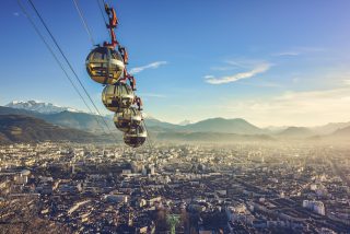
Map of the Self-Guided Walking Tour of Messina walking route with 16 stops in Messina.
Preview map of the Self-Guided Walking Tour of Messina route in Messina, showing 16 stops. Use the interactive map to zoom and tap markers.

More from this area

Self-Guided Walking Tour of Matera (2026)

Self-Guided Walking Tour of Matera

This website uses affiliate links which earn a small commission at no additional cost to you.

Matera is one of southern Italy's most extraordinary historic cities, known for the Sassi cave districts and rupestrian churches cut into the limestone landscape of Basilicata. UNESCO describes the Sassi and the Park of the Rupestrian Churches as a complex of houses, churches, monasteries, and hermitages built into natural caves, with more than a thousand dwellings within a remarkable troglodyte settlement.

For visitors, Matera feels unlike almost anywhere else in Italy. The cave streets, rock churches, viewpoints over the Gravina ravine, restored cave hotels, museums, stairways, and evening lighting create a powerful sense of place. It works best with at least one overnight stay, as the atmosphere changes strongly between day, sunset, and night.

How to Get to Matera

By Air: Matera doesn't have its own airport, so you'll typically fly into Bari and continue overland, with Brindisi and Naples also workable depending on schedules and prices. From Bari Airport you can usually reach Matera by shuttle bus, private transfer, or by heading into Bari Centrale first and switching to a regional service; the total journey is commonly around 1-2 hours depending on the connection and where you're staying in Matera. If you're arriving with luggage, note that the historic Sassi area is partly pedestrianised and steep, so plan for a short walk or a taxi drop-off point near your accommodation. For the best deals and a seamless booking experience, check out these flights to Matera on Booking.com.

By Train: Train travel to Matera is a bit non-standard compared with other Italian cities because services are split between networks. The most common rail approach is via Bari, then taking the Ferrovie Appulo Lucane (FAL) line to Matera (typically to Matera Centrale or Matera Sud), which is convenient but can be slower than the fastest buses. If you're coming from elsewhere in Italy, aim for a mainline train to Bari Centrale (or sometimes Ferrandina/Metaponto depending on route), then connect onward; checking the operator and station names matters here because not all services appear in the same journey planner. Use Omnio to easily compare schedules, book train tickets, and find the best prices all in one place for a hassle-free journey across Italy.

By Car: Driving is often the simplest option if you want flexibility, especially for adding nearby viewpoints, cave churches, or day trips in Basilicata and Puglia. Matera is well connected by road from Bari and the Adriatic coast, but once you reach town you'll want to plan parking carefully: the Sassi has ZTL limited-traffic zones and narrow lanes, so most visitors park in designated lots/garages and walk down into the historic areas. If your accommodation is inside or near the Sassi, contact them in advance for the best drop-off instructions and any access permissions. If you are looking to rent a car in Italy I recommend having a look at Discover Cars, first, as they compare prices and review multiple car rental agencies for you.

By Bus: Direct buses can be the most straightforward public-transport option, particularly from Bari (including the airport), and they often beat the train on time and simplicity. Long-distance coaches may also run from major hubs such as Naples or Rome depending on season, and local buses are useful for reaching Matera's modern districts if you're staying outside the Sassi. Timetables vary a lot by operator and day of week, so it's worth checking schedules and booking ahead in peak periods.

A Short History of Matera

Prehistory and Rock-Cut Beginnings in Matera

Matera’s story starts with habitation in and around the ravine landscape, where natural caves and soft tufa made it possible to carve shelter directly into the rock. Over time these early dwellings evolved into a complex, vertical settlement: caves widened into rooms, rooms linked by stairways and terraces, and water management became a defining skill. To understand how this layered environment developed, Sassi in Miniatura offers a useful visual bridge between the earliest rock-cut logic and the later, denser neighbourhood patterns.

Medieval Matera and the Rise of the Civic and Sacred City

As Matera consolidated through the medieval period, religious institutions and civic authority reshaped the urban core above the older cave districts. The Cattedrale di Matera reflects this shift in power and prestige, anchoring the skyline and signalling an era when stone-built churches and formalised parishes sat alongside the older rupestrian life below. Chiesa di San Giovanni Battista adds another marker of this religious and artistic flowering, showing how craftsmanship and devotion translated into architecture that still frames the city's historic identity.

Early Modern Matera, Nobility, and Changing Fortunes

In the late medieval and early modern centuries, Matera’s social hierarchy and political pressures left tangible traces in palaces, institutions, and ambitious construction projects. Castello Tramontano is the clearest symbol of this moment-an assertion of control that also hints at instability, resistance, and unfinished plans. Nearby, Palazzo dell’Annunziata speaks to later institutional confidence and reforming impulses, as elite patronage and public functions increasingly shaped the city’s prominent buildings and main thoroughfares.

Matera’s Water, Markets, and Everyday Life in the Sassi

Daily life in Matera depended on managing scarcity, especially water, and that necessity produced some of the city's most impressive engineering. Palombaro Lungo, accessed from Piazza Vittorio Veneto, embodies this practical genius: a vast underground cistern system that turned seasonal rain into a reliable reserve for households, workshops, and animals. Spaces like Piazza San Pietro Caveoso, by contrast, show how community life unfolded at street level-part gathering point, part threshold between built neighbourhoods and the rock-cut world, with churches and homes pressed tightly into the terrain.

Twentieth-Century Matera, Evacuation, and Rethinking the Sassi

The twentieth century brought a severe reassessment of living conditions in the cave districts, and the Sassi became a national symbol of hardship as overcrowding and poverty intensified. The forced relocations that followed ended an old way of life abruptly, leaving many dwellings abandoned while debates about identity, dignity, and preservation continued for decades. Casa Noha is particularly effective at explaining this period, connecting policy decisions and lived experience to the physical fabric of the city.

Contemporary Matera, Restoration, and Cultural Renewal

From the late twentieth century onward, Matera's reputation shifted again as restoration, scholarship, and careful reuse turned abandonment into renewal. Casa Grotta di Vico Solitario offers a grounded sense of how domestic cave life once worked, while Museo di Palazzo Lanfranchi presents the broader cultural and artistic context that helped reframe Matera as a place of heritage rather than stigma. The modern city's rhythm also runs through Via Ridola and out to Belvedere Piazzetta Pascoli, where the viewpoints and promenades make clear how the old stone landscape has become central to Matera's contemporary identity, tourism, and pride.

Where to Stay in Matera

To make the most of visitng Matera and this walking tour then you consider stay overnight at the centre. The most atmospheric base is within the Sassi itself, where you can step straight into the stairways, viewpoints, and cave-lined lanes early or late in the day, before the day-trippers arrive. For a classic cave-stay feel with strong location, look at Sextantio Le Grotte della Civita, Aquatio Cave Luxury Hotel & Spa, Sant'Angelo, Matera, and Locanda di San Martino Hotel & Thermae Romanae. These keep you close to the core Sassi lanes and the main panoramic edges, so the walk flows naturally without needing taxis.

If you want easier access, flatter streets, and quick transport links while still being walkable to the Sassi, base yourself in the Civita ridge/old town just above the cave districts. You’ll be close to key churches and overlooks but with simpler arrivals and fewer steps dragging luggage. Good options in this zone include Palazzo Gattini Luxury Hotel, Hotel San Domenico al Piano, Basiliani Hotel, and Pianelle Resort. This area is a strong compromise: central, scenic, and generally more practical for check-in and parking access than the deepest parts of the Sassi.

For value, space, and a more local, modern-city feel, consider staying in the newer districts around the central avenues and squares, then walking down into the Sassi for the route. You’ll often get larger rooms, simpler parking, and straightforward dining options, while still being within a manageable walk (or a short taxi) of the historic core. Try UNA HOTELS MH Matera, Hilton Garden Inn Matera, Hotel Del Campo, or Hotel Nazionale. This approach suits travellers who want comfort and logistics first, then dip into the Sassi for the walking tour highlights.

Your Self-Guided Walking Tour of Matera

Discover Matera on foot with a simple walking tour map that guides you from stop to stop as you explore its stone lanes, dramatic viewpoints, and cave-carved districts. Because it's a self-guided route, you can set your own pace-skip any sights that don't interest you, linger where the views are best, and take coffee breaks whenever you feel like it.

1. Piazza Vittorio Veneto

Piazza Vittorio Veneto Matera
CC BY-SA 4.0 / Bernard Gagnon

Piazza Vittorio Veneto is the modern civic heart of Matera, shaped largely by the city’s late-19th- and early-20th-century expansion beyond the Sassi. As Matera grew, this space became the everyday “front room” of the new town: a place for markets, gatherings, and the routines of a city increasingly connected to regional trade and administration.

Historically, its importance is also tied to the edge it forms between two Materas: the orderly, street-based “piano” above and the labyrinthine, rock-cut neighborhoods below. That threshold matters in Matera, because the city’s story is one of constant negotiation between building upward in stone and carving inward into tufa.

When you visit, take time to read the square as a viewpoint as much as a plaza. Look for terraces and sightlines that open toward the Sassi, note the mix of architectural eras around the perimeter, and pay attention to the subtle changes in level that hint at the underground world beneath your feet.


Location: Piazza Vittorio Veneto, 75100 Matera MT, Italy | Hours: 24 Hours. | Price: Free.

We recommend to rent a car in Italy through Discover Cars, they compare prices and review multiple car rental agencies. Book your rental car here.

2. Palombaro Lungo

Palombaro Lungo
Palombaro Lungo
CC BY-SA 4.0 / Holger Uwe Schmitt

Palombaro Lungo is a monumental cistern system created to solve Matera’s fundamental challenge: storing water in a landscape with limited surface supply. Over centuries, the city engineered an intricate network of channels and reservoirs, collecting rainwater from rooftops and streets and directing it into rock-cut storage spaces lined to reduce seepage.

Its history sits within a broader tradition of hydraulic ingenuity in southern Italy, where communities relied on cisterns, wells, and carefully managed runoff. In Matera, that knowledge compounded over generations, producing large-scale public infrastructure that supported dense habitation long before modern plumbing.

Inside, what to see is the sheer scale and geometry: high vaults, reflective surfaces, and the tactile evidence of excavation and maintenance. Look closely at the wall textures, the lining techniques, and the way light behaves in the cavernous space, because those details make the engineering legible, not just impressive.


Location: Piazza Vittorio Veneto, 75100 Matera MT, Italy | Hours: Daily: 10:00–13:00 & 15:00–18:00. | Price: Adults: €3; Minors: free; School groups: €1.50. | Website

Here is a complete selection of hotel options in Matera. Feel free to review each one and choose the stay that best suits your needs.

3. Palazzo dell'Annunziata

Palazzo dell'Annunziata
Palazzo dell’Annunziata
CC BY-SA 2.0 / Superchilum

Palazzo dell’Annunziata reflects Matera’s institutional and charitable history, linked to religious confraternities and public welfare that shaped many southern Italian cities. Buildings like this often anchored networks of assistance, education, and devotion, and their presence signaled both civic pride and the Church’s long role in social life.

Architecturally, the palace belongs to the period when Matera’s “upper city” was consolidating a more formal urban identity. As the town’s administrative and cultural functions grew, prominent palazzi served as markers of stability, patronage, and the local elite’s relationship with religious institutions.

When you’re there, focus on the façade and how it communicates status: portals, symmetry, and stonework details. If interiors are accessible, pay attention to spatial hierarchy (courtyards, staircases, representative rooms), because these features were designed to choreograph movement and convey authority.


Location: Palazzo dell'Annunziata, Piazza Vittorio Veneto, 1, 75100 Matera MT, Italy | Hours: Monday – Thursday: 08:30–18:30. Friday – Saturday: 08:30–13:30. Closed on Sunday. | Price: Free. | Website

Traveling to a country with a different currency? Avoid ATM transaction fees and pay in local currency with a Wise Card. Having used it for over 5 years, we've saved loads on fees!

4. Chiesa di San Giovanni Battista

Chiesa di San Giovanni Battista
CC BY-SA 4.0 / Velvet

Chiesa di San Giovanni Battista is one of Matera’s key medieval churches, rooted in the centuries when the city’s religious architecture helped organize urban life. In a landscape defined by rock-cut dwellings and shifting political control, stone churches asserted permanence, doctrine, and community identity.

Its history is intertwined with the city’s wider medieval development, when monastic orders, local patrons, and skilled masons contributed to a distinctive regional vocabulary. The building stands as evidence of how Matera adapted broader Romanesque and later influences to local materials and craftsmanship.

What to see is the sculptural language: portals, capitals, and the way stone surfaces catch light. Step back to take in the church’s massing, then move close to inspect carved details and any surviving interior elements that reveal how devotion, art, and architecture were integrated.


Location: Via San Biagio, 75100 Matera MT, Italy | Hours: Check official website. | Price: Free; donations appreciated. | Website

5. Cattedrale di Matera

Matera Cathedral rises from the city’s highest spine, embodying the era when ecclesiastical power and urban prestige were inseparable. Built in a medieval context, it reflects Matera’s role as a significant religious center and the desire to anchor the city’s identity in a commanding sacred landmark.

Historically, cathedrals also functioned as civic stages: sites of ceremony, authority, and communal memory. In Matera, the cathedral’s placement is especially meaningful because it presides over the Sassi, visually tying the ancient habitation zones to the institutional “upper city” above.

What to see starts with the exterior: its setting, silhouette, and stonework. Inside, look for how space is composed to guide attention toward the altar, and pay attention to artworks, chapels, and any elements that reveal later refurbishments, since cathedrals often accumulate layers from multiple periods.


Location: Piazza Duomo, 75100 Matera MT, Italy | Hours: Daily: 09:00–18:00. | Price: Adults: €3.50 (Cattedrale + MATA Museo Diocesano cultural route); free entry may apply during Mass. | Website

6. Casa Noha

Casa Noha
Casa Noha
©

Casa Noha is a restored historic house used to interpret Matera’s social history, especially the lived reality of the Sassi and the city’s transformation in the modern era. Rather than focusing only on monuments, it frames Matera as a place shaped by everyday life, hardship, and adaptation.

Its narrative context is the dramatic mid-20th-century turning point when the Sassi came under national scrutiny for living conditions, leading to relocation and later restoration. Matera’s story is not just ancient; it is also a story of modern policy, identity, and the ethics of preservation.

What to see is the way the building is used to tell that story through spaces, materials, and curated interpretation. Notice the domestic scale, the relationship between rooms, and how presentation connects personal life to broader changes in health, infrastructure, and cultural recognition.


Location: Recinto Cavone, 9, 75100 Matera MT, Italy | Hours: Thursday – Tuesday: 10:00–17:00. Closed on Wednesday. | Price: Adults: €7; Reduced (6–18): €3; Students (up to 25): €5; Family (2 adults + 2 children): €18; Under 6: free. | Website

7. Piazza San Pietro Caveoso

Piazza San Pietro Caveoso
CC BY-SA 4.0 / Bernard Gagnon

Piazza San Pietro Caveoso sits at one of the most dramatic edges of the Sassi, where open space meets the dense carved-and-built texture of the ravine-side district. Places like this often emerged organically, shaped by footpaths, church forecourts, and the practical need for small gathering areas in a steep environment.

Its historical importance lies in its role as a threshold space: part devotional, part social, part scenic. In the Sassi, churches and their surrounding areas acted as anchors of neighborhood life, and the piazza reflects that pattern in a city where “streets” can be stairways and terraces.

When you’re there, what to see is the composition of views and surfaces. Take in the church frontage and the amphitheater-like drop toward the canyon, then watch how the Sassi’s stacked facades create a sense of depth. It’s also a good place to notice how stone paving and steps manage slope and movement.


Location: Piazza S. Pietro Caveoso, 75100 Matera MT, Italy | Hours: 24 Hours. | Price: Free.

8. Chiesa dei Santi Pietro e Paolo

Chiesa dei Santi Pietro e Paolo
CC BY-SA 4.0 / Diego Baglieri

Chiesa dei Santi Pietro e Paolo belongs to Matera’s long tradition of churches integrated into the city’s complex topography. In the Sassi environment, sacred buildings often served multiple purposes: worship sites, community markers, and architectural counterpoints to domestic cave spaces.

Historically, dedications to Peter and Paul carry strong symbolic weight, and such churches commonly reflect periods of consolidation in religious organization. In a region shaped by shifting rulers and cultural influences, churches frequently preserved continuity through liturgy, patronage, and local identity.

What to see will depend on access, but the main focus is typically the dialogue between structure and setting. Look at how the church fits into the surrounding stone fabric, observe any carved details or interior iconography, and pay attention to how light enters the space, because illumination often shapes the experience of rock-adjacent architecture.


Location: Piazza S. Pietro Caveoso, 75100 Matera MT, Italy | Price: Free; donations appreciated. | Website

9. Casa Grotta di Vico Solitario

Casa Grotta di Vico Solitario
CC BY-SA 4.0 / Holger Uwe Schmitt

Casa Grotta di Vico Solitario is an interpretive cave dwelling that preserves a snapshot of how people lived in the Sassi before large-scale relocations. Its value is historical and social: it makes tangible the domestic realities that underpinned Matera’s identity for generations.

The broader history is complex. The Sassi were once a functional, tightly knit urban system, but by the 20th century they were also associated with overcrowding and inadequate sanitation, prompting state intervention. Today, presenting a furnished cave home is part of how Matera confronts that past without romanticizing it.

What to see is the material culture of daily life: furniture, tools, storage solutions, and how humans and animals sometimes shared space in a constrained environment. Notice how the architecture is less “built” than “adapted,” and how the arrangement of objects reveals strategies for warmth, food preservation, and work.


Location: Vico Solitario, 11, 75100 Matera MT, Italy | Hours: (Winter) January 1 – March 31; Monday – Friday: 09:30–18:00; Saturday – Sunday: 09:30–19:00. (Summer) April 1 – December 31; Monday – Friday: 09:30–19:00; Saturday – Sunday: 09:30–20:00. | Price: Adults: €5; Reduced: €3; Ages 11–18: €2; Under 11: free. | Website

10. Museo di Palazzo Lanfranchi

Museo di Palazzo Lanfranchi
CC BY-SA 4.0 / Acquario51

Museo di Palazzo Lanfranchi is housed in a significant historic palace, and its very setting speaks to Matera’s institutional and cultural evolution. Palazzi like this reflect periods when religious orders, local elites, and civic structures invested in prominent architecture to signal education, authority, and taste.

Historically, the museum represents the city’s modern commitment to preserving and contextualizing its heritage through curated collections. Matera’s international profile grew not only through its urban landscape but also through the effort to interpret regional art, archaeology, and local history in a structured way.

What to see includes both the building and the displays. Pay attention to how galleries are arranged within the palace’s rooms, look for works that anchor Basilicata’s identity, and take time with any standout pieces that connect local narratives to broader Italian artistic movements.


Location: Piazzetta Pascoli, 1, 75100 Matera MT, Italy | Hours: Monday: 09:00–20:00. Tuesday: 09:00–14:00. Wednesday: 09:00–20:00. Thursday: 09:00–20:00. Friday: 09:00–20:00. Saturday: 09:00–20:00. Sunday: 09:00–20:00. | Price: Adults: €10; Students: €2; Under 18: free. | Website

11. Belvedere Piazzetta Pascoli

Belvedere Piazzetta Pascoli
CC BY-SA 4.0 / Lamiogiancarlo

Belvedere Piazzetta Pascoli is a viewpoint shaped by Matera’s geography: a city defined by dramatic drops, opposing ridges, and the visual density of the Sassi. The idea of a “belvedere” in Italy is historically tied to framing landscape as a cultural asset, and Matera’s modern story includes the deliberate creation and enhancement of such vantage points.

Its context is the 20th-century and later revaluation of the Sassi as heritage rather than blight. As Matera shifted toward conservation and cultural tourism, viewpoints became essential infrastructure for understanding and appreciating the city’s spatial complexity.

What to see is straightforward but never redundant: the layered facades, terraces, stairways, and rock churches of the Sassi laid out like a carved amphitheater. Spend a few minutes tracking lines of movement—where paths likely run, where roofs become walkways—because the belvedere is best used as a tool for reading the city.


Location: Piazzetta Pascoli, 75100 Matera MT, Italy | Hours: 24 Hours. | Price: Free.

12. Via Ridola

Via Ridola, Matera
Via Ridola, Matera
CC BY-SA 4.0 / Palickap

Via Ridola is a key street in the “upper” part of Matera, reflecting the city’s transition into a more conventional urban form beyond the cave districts. Streets like this often became cultural corridors, lined with institutions, cafés, and residences that signaled Matera’s modernization and shifting social life.

Its historical role is tied to how Matera expanded and rebalanced: from the intimate, vertical micro-neighborhoods of the Sassi toward a town structured by boulevards, storefronts, and administrative buildings. This is where Matera’s 19th–20th century identity is easiest to feel in the urban fabric.

What to see is the street as an ensemble rather than a single monument. Look at façades and doorways, note small palazzi and civic buildings, and watch how the street mediates between viewpoints, piazzas, and museum spaces. It’s also a useful place to notice how local stone is dressed differently in newer construction.


Location: Via Domenico Ridola, 75100 Matera MT, Italy | Hours: 24 Hours. | Price: Free.

13. Castello Tramontano

Castello Tramontano
Castello Tramontano
CC BY-SA 4.0 / AntonioMT88

Castello Tramontano is one of Matera’s most striking symbols of feudal ambition and political instability. Begun in the early 16th century under a powerful count, it reflects a period when fortifications were as much about projecting authority as they were about defense.

Its history is famously unfinished, linked to local resentment toward heavy-handed rule and taxation. The castle stands as a kind of architectural “what-if,” a reminder that power projects can be interrupted by politics, economics, and popular resistance, leaving ruins that later generations reinterpret as heritage.

When you visit, what to see is the raw presence of masonry: walls, towers, and the incomplete sections that make the building’s story legible at a glance. Walk around the exterior to understand its intended footprint, then focus on views outward toward the city to appreciate why commanding positions mattered as much as thick stone.


Location: Via del Castello, 75100 Matera MT, Italy | Hours: 24 Hours. | Price: Free.

14. Chiesa di San Francesco d'Assisi

Chiesa di San Francesco d’Assisi
CC BY-SA 4.0 / Velvet

Matera’s church of San Francesco d’Assisi reflects the long expansion of Franciscan spirituality across Italy from the 13th century onward, when mendicant orders established prominent urban churches that were both devotional centers and engines of civic life. In Matera, the Franciscans’ presence aligns with a broader pattern: churches positioned to serve growing communities beyond the older rock-cut quarters, helping shape a more “street-based” city alongside the Sassi.

Over time, the church accumulated layers that speak to Matera’s changing artistic and religious priorities, with rebuilding and refurbishment typical of active urban churches. Like many Franciscan sites, it tends to balance public visibility with an interior atmosphere oriented toward preaching, communal worship, and accessible devotion, rather than the secluded character of monastic complexes.

When you visit, start by reading the façade and its setting in the surrounding streetscape, then step inside to look for the contrast between structural elements and later decorative interventions. Focus on side chapels, altars, paintings, and any sculptural details that reveal patronage across different periods, and take a moment to notice how light and proportion shape the nave’s sense of calm.


Location: Piazza S. Francesco, 75100 Matera MT, Italy | Hours: Daily: 08:00–12:00 & 16:30–20:00. | Price: Free; donations appreciated.
Powered by GetYourGuide
Moira & Andy
Moira & Andy

Hey! We're Moira & Andy. From hiking the Camino to trips around Europe in Bert our campervan — we've been traveling together since retirement in 2020!

Read our full story here

This website uses affiliate links which earn a small commission at no additional cost to you.

Walking Tour Summary

Distance: 3.5 km
Sites: 14

Walking Tour Map
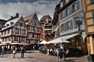
Map of the Self-Guided Walking Tour of Matera walking route with 14 stops in Matera.
Preview map of the Self-Guided Walking Tour of Matera route in Matera, showing 14 stops. Use the interactive map to zoom and tap markers.

More from this area

Self-Guided Walking Tour of Lecce (2026)

Self-Guided Walking Tour of Lecce

This website uses affiliate links which earn a small commission at no additional cost to you.

Lecce is the great Baroque city of Salento, known for honey-coloured limestone, ornate church façades, Roman remains, elegant piazzas, and a lively southern Italian street life. Italia.it describes it as the beating heart of Salento, with an unmistakable style shaped by Roman monuments and especially 17th-century buildings in local blonde stone.

For visitors, Lecce is both architectural and atmospheric. Piazza del Duomo, the Basilica di Santa Croce, the Roman amphitheatre, old gates, palaces, cafés, and evening passeggiata give the centre a strong rhythm. It is also one of the best bases for exploring southern Puglia, with beaches, Otranto, Gallipoli, coastal villages, and inland Salento towns all within reach.

How to Get to Lecce

By Air: Lecce does not have its own commercial airport, so the usual approach is to fly into Brindisi Airport (the closest) or Bari Airport (with more route options), then continue overland to Lecce. From Brindisi you can typically reach Lecce fastest by train from Brindisi Centrale or by a pre-booked transfer/taxi; from Bari you have more frequent onward trains but a longer ground journey. If you are arriving late, check the last train times and have a backup (taxi or transfer) to avoid being stranded. For the best deals and a seamless booking experience, check out these flights to Lecce on Booking.com.

By Train: Lecce is one of the main rail hubs in Salento, with direct and frequent services to/from major cities in Apulia (including Bari), plus longer-distance services that connect onward to the rest of Italy via Bari. The main station is Lecce Centrale, which is walkable to the historic centre for many travellers, or a short local bus/taxi ride if you have luggage or your accommodation is outside the core. Booking ahead is most useful in peak season and for faster services; regional trains are generally flexible but can be busy at weekends. Use Omnio to easily compare schedules, book train tickets, and find the best prices all in one place for a hassle-free journey across Italy.

By Car: Driving to Lecce is straightforward if you are already in southern Italy, and it's most useful if you plan to explore the wider Salento coast and small towns. Expect limited access and scarce parking inside the central areas, so it's usually best to target a public car park at the edge of the centre and walk in. If you are coming from Bari or Brindisi, the fastest routes are typically via the main highways/arterial roads toward Salento, with the final approach taking you onto city streets that can slow down at peak times. If you are looking to rent a car in Italy I recommend having a look at Discover Cars, first, as they compare prices and review multiple car rental agencies for you.

By Bus: Long-distance coaches can be a good-value alternative, especially if flight schedules don't line up with trains or you're travelling late. Buses often connect Lecce with Bari and other regional cities, and some services run from Rome or Naples depending on season and operator; journey times are longer than the fastest trains but can be convenient if you want a direct one-seat ride.

A Short History of Lecce

Lecce in the Ancient Era (before the 3rd century BCE)

Lecce's earliest urban story is tied to the long arc of settlement in southern Italy, when local peoples developed fortified communities, agriculture, and coastal-to-inland trade. Over time, the settlement gained strategic value as networks expanded across the wider Mediterranean, drawing it into the orbit of larger powers and making it a place where cultural layers accumulated rather than being replaced cleanly.

Those early centuries left fewer obvious “street-level” traces than later periods, but they set the conditions for Lecce’s Roman transformation: a town that could be reorganised, monumentalised, and plugged into imperial systems of roads, taxation, and civic life.

Lecce in the Roman City Period (3rd century BCE-5th century CE)

Under Rome, Lecce developed the classic civic core you can still read in the modern streetscape. The most visible anchors are the entertainment buildings: the Anfiteatro Romano di Lecce and the Teatro Romano di Lecce, both physical reminders that public spectacle and civic identity were central to Roman urbanism.

That Roman imprint is strongly felt around Piazza Sant’Oronzo, where layers of later life grew up around the ancient core rather than erasing it. Even when the empire weakened, these large-scale structures shaped what came after: medieval and early modern building often had to negotiate, reuse, or build around the Roman fabric.

Lecce Through Late Antiquity and the Medieval Centuries (6th-15th centuries)

As authority shifted after Rome, Lecce moved through phases of instability and reorganisation typical of many Italian towns, with governance changing hands and defensive priorities rising. The Christianisation of public space became more pronounced, and ecclesiastical institutions increasingly acted as stabilising forces-administratively, socially, and architecturally.

This long medieval span also included the presence of minority communities and shifting tolerances. The Museo Ebraico di Lecce is a useful reference point for that layered religious and social history, pointing to periods when Jewish life was visible within the urban economy, and other periods when pressure, restrictions, or forced change narrowed that space.

Lecce in the Age of Fortification and City Gates (16th century)

The 16th century brought a more militarised urban logic, with stronger defences and more controlled access reflecting a broader era of insecurity and rivalry. The fortress that defines this phase is Castello Carlo V, a statement of authority as much as a practical defensive work, shaping movement and power within the city.

The monumental gates also belong to this defensive and ceremonial worldview. Porta Napoli and Porta San Biagio signal a city that managed entry, displayed status, and choreographed arrival-turning what could be purely functional infrastructure into civic theatre.

Lecce in the Baroque Zenith (17th century)

Lecce’s most recognisable architectural identity was forged in the 1600s, when religious orders, civic elites, and church institutions drove a building boom that prioritised dramatic façades, sculptural stonework, and showpiece interiors. The pairing of the Basilica di Santa Croce and the Palazzo dei Celestini captures this moment: an assertive blend of spirituality, power, and public display.

Baroque Lecce is also a story of competing commissions and distinctive stylistic voices. Churches such as Chiesa di San Matteo, Chiesa di Santa Chiara, and Basilica di San Giovanni Battista al Rosario reflect the Counter-Reformation impulse to inspire devotion through architecture that felt immersive, emotional, and unmistakably “present” in the street.

Lecce From the 18th Century to the Modern City (18th century-present)

After the peak Baroque phase, Lecce's evolution became less about creating a new signature style and more about adapting what already existed: reshaping spaces, managing growth, and integrating modern infrastructure while retaining the density and drama of the historic core. The Lecce Cathedral stands as the clearest symbol of continuity through these changes-an anchor of civic-religious identity as political frameworks and daily life modernised around it.

In the modern era, Lecce’s historic fabric has become both a lived environment and an asset that requires careful stewardship. What visitors experience today is the result of repeated reinvention: Roman public life, medieval resilience, early modern defence, and Baroque ambition, all preserved and reinterpreted as the city’s economy and cultural priorities shifted toward heritage, education, and tourism.

Where to Stay in Lecce

To make the most of visiting Lecce and this walking tour, then you consider stay overnight at the centre. The best base is the Centro Storico, because you can step out early for quieter streets, return easily for a rest between stops, and enjoy the historic core after day-trippers leave. For a characterful stay inside (or right on the edge of) the old town, look at Patria Palace Hotel, Risorgimento Resort, and La Fiermontina Urban Resort-all strong picks if you want atmosphere, walkability, and an easy start/finish point for the route.

If you prefer somewhere slightly calmer but still effectively “central,” staying near Porta Napoli / the northern edge of the old town is a smart compromise: you’re close enough to walk into the historic lanes in minutes, but you’ll often get better value and easier vehicle access for luggage. Options around this side that work well for walking-tour convenience include Grand Hotel Tiziano e dei Congressi, 8Piuhotel, and B&B Palazzo Bignami, which suit travellers who want quick access to the centre without being right in the busiest evening lanes.

For a more modern, shopping-and-dining neighbourhood with lots of choice and a straightforward walk into the old town, the area around Piazza Mazzini is a practical base. It’s good if you like wider streets, more contemporary cafés, and easier taxi pick-ups, while still being close enough to join the tour on foot. Consider Mercure Hotel President Lecce, Hotel Delle Palme, and Hilton Garden Inn Lecce for comfort, reliable facilities, and an easy walk or short taxi ride to the historic core.

If you’re arriving by train or planning day trips, staying near Lecce’s station can be convenient, but it’s best to choose somewhere that still keeps you within a manageable walk of the old town so the tour remains effortless. This area suits shorter stays, early departures, and travellers who want logistics to be simple, especially with luggage. Look at Hotel Cappello, Grand Hotel di Lecce, and Eos Hotel as workable options that balance transport convenience with walkability for your route.

Your Self-Guided Walking Tour of Lecce

Explore Lecce on foot with our walking tour map, guiding you from stop to stop as you discover the city's highlights. Because it's self-guided, you can set your own pace, skip any places that don't interest you, and pause for coffee whenever you feel like it.

1. Castello Carlo V

Castello Carlo Vjpg
Castello Carlo Vjpg
CC BY-SA 3.0 / Velvet

Castello Carlo V is Lecce’s statement of early-modern military architecture, built as artillery and geopolitical pressure forced cities to rethink medieval walls and towers. Associated with Charles V’s defensive programs in the 16th century, the castle embodies the transition from picturesque fortification to angular, bastioned geometry designed for cannon warfare.

Unlike a romantic hilltop castle, this is an urban fortress: thick walls, bastions, controlled access, and an emphasis on dominating approaches rather than providing palatial comfort. Over time, many such structures gained layered uses—administration, storage, detention—so the castle’s history is as much about civic control as it is about external defense.

When you visit, pay attention to the plan: corners, bastions, and how lines of fire would have worked. Inside, look for exhibition spaces and reused rooms that reveal later adaptations; outside, walk the perimeter to feel how the structure sits in the city grid and why it was placed exactly where it is.


Location: Castello Carlo V, Via XXV Luglio, Lecce, Province of Lecce, Italy

We recommend to rent a car in Italy through Discover Cars, they compare prices and review multiple car rental agencies. Book your rental car here.

2. Porta San Biagio

Porta San Biagio
Porta San Biagio
CC BY-SA 3.0 / Lupiae

Porta San Biagio is another of Lecce’s historic gates, associated with the city’s fortified perimeter and the controlled movement of people and goods into the urban core. Gates like this are practical infrastructure, but they are also symbols—announcing authority, identity, and the boundary between civic order and the outside world.

Compared to the city’s peak Baroque monuments, the gate’s appeal is its clarity: an urban marker that still does what it was built to do, even after walls and defensive functions receded. Its dedication to Saint Blaise ties it into Lecce’s devotional geography, where saints and routes often map onto older movement corridors.

When you’re there, treat it as a “hinge point” for understanding the city plan. Stand on both sides to feel the shift from broader approach roads to tighter historic streets, and look for remaining traces of how the gate once connected to walls, ditches, or controlled entry systems.


Location: Piazza D'Italia, 73100 Lecce LE, Italy | Hours: 24 Hours. | Price: Free.

Here is a complete selection of hotel options in Lecce. Feel free to review each one and choose the stay that best suits your needs.

3. Chiesa di San Matteo

Chiesa di San Matteo a Lecce
CC BY-SA 4.0 / Fabrizio Garrisi

Chiesa di San Matteo is a concentrated dose of Baroque design, reflecting Lecce’s appetite for architectural drama in the 17th century. Churches here often served not only devotional functions but also as markers of patronage and artistic competition—stone-carvers and architects pushing the local style forward.

The façade is the key feature: it plays with concave and convex forms to create motion and tension, a spatial trick that makes the building feel animated as you approach. This kind of sculptural frontage is meant to engage you emotionally before you even step inside.

Inside, look for how the Baroque directs attention—toward the altar, through framed chapels, and via contrasts of light and shadow. Even a short visit is rewarding if you pause at the center and let your eyes move deliberately from architectural lines to carved details to the overall spatial “theater.”


Location: Chiesa di San Matteo, Via dei Perroni, Lecce, Province of Lecce, Italy

Traveling to a country with a different currency? Avoid ATM transaction fees and pay in local currency with a Wise Card. Having used it for over 5 years, we've saved loads on fees!

4. Chiesa di Santa Chiara

Chiesa di Santa Chiara
CC BY-SA 4.0 / Fabrizio Garrisi

The Church of Saint Clare reflects Lecce’s 17th-century religious building boom, when new façades and richly staged interiors expressed both devotion and local artistic ambition. As with many churches tied to female religious orders, its history is also a social one—connected to education, charity, enclosure, and patronage networks in the city.

Architecturally, you’ll often notice a compact footprint and an interior designed for focused impact rather than sheer scale. Lecce’s Baroque tends to emphasize sculpted surfaces and spatial dynamism, and Santa Chiara typically rewards visitors who look closely rather than expecting vastness.

What to see is the interplay of geometry, ornament, and light. Pause in the nave and observe how the eye is directed; then move toward side elements and decorative programs that reveal the church’s identity and the city’s stone-carving culture.


Location: P.za Vittorio Emanuele II, 73100 Lecce LE, Italy | Hours: (Summer) April – September; Daily: 09:00–21:00. (Winter) October – March; Daily: 09:00–18:00. | Price: Adults: €11 (LeccEcclesiae single ticket for multiple sites); Reduced (12–17): €5; Family: €24. | Website

Where to Stay in Lecce: An Area by Area Guide!

5. Teatro Romano di Lecce

Amphitheatre Lecce
Amphitheatre Lecce
CC BY-SA 1.0 / Bernard Gagnon

Lecce’s Roman Theatre is smaller and more intimate than the amphitheater, linked to staged drama, music, and civic performances rather than mass spectacles. It speaks to Lecce’s role as a Roman city with the cultural infrastructure expected of an urban center—places not just for commerce and administration, but for performance and public identity.

Because it sits within the dense fabric of the old town, the experience is almost surprising: you turn a corner and suddenly find stepped seating and stage remnants tucked behind later buildings. That embeddedness is historically honest—cities rarely preserve antiquity in isolation; they absorb it.

When you visit, focus on the layout: seating arc, stage area, and how performers would have faced the audience. Also notice the juxtaposition—Roman stone against later walls—because that contrast is essentially Lecce’s story in miniature: continuity through reuse.


Location: Roman Amphitheater, Piazza Sant'Oronzo, Lecce, Province of Lecce, Italy

6. Lecce Cathedral

Cattedrale dellAssunzione della Virgine Lecce
CC BY-SA 4.0 / Holger Uwe Schmitt

Lecce Cathedral is the centerpiece of the city’s ecclesiastical power, with roots in the medieval period and a major Baroque rebuilding that gave it the appearance most visitors recognize today. Cathedrals in southern Italy often reflect cycles of rebuilding after earthquakes, fires, or changing liturgical tastes, and Lecce’s cathedral complex expresses that long institutional timeline.

The setting matters as much as the church: the cathedral stands within a composed precinct, where the surrounding buildings and open space create a sense of ceremony and controlled grandeur. The architecture emphasizes vertical accents and strong façades, and the warm local stone ties the cathedral visually to the rest of the historic center.

On site, take time in the square first, then enter. Outside, walk the perimeter to see how the building presents different faces; inside, look for chapels and altars that showcase local craftsmanship, and pay attention to how the space uses light to guide attention toward the liturgical focus.


Location: P.za del Duomo, 1, 73100 Lecce LE, Italy

7. Basilica di San Giovanni Battista al Rosario

Basilica di San Giovanni Battista al Rosario
CC BY-SA 3.0 / Chiocciolasud

The Basilica del Rosario e di San Giovanni Battista reflects the devotional and confraternal culture that shaped Lecce in the early modern period, when churches multiplied and specialized dedications anchored community identity. The Rosary dedication typically points to post-medieval Catholic renewal, while the association with Saint John the Baptist brings an older, widely venerated saint into the same sacred frame.

Architecturally, expect the Lecce pattern: local stone used to carve an exterior that may read restrained at first glance, then reveals sophistication in portals, cornices, and sculptural programs. Inside, churches with Rosary dedication often emphasize altars, chapels, and imagery tied to Marian devotion and structured prayer.

When you’re there, look for the narrative logic of the decoration—how artworks and altars guide you through specific themes—and notice craftsmanship in carved stone and liturgical fittings. Even if it’s not as famous as Santa Croce, it contributes to the fuller picture of Lecce as a city where artistry and devotion were mutually reinforcing.


Location: Via Giuseppe Libertini, 5, 73100 Lecce LE, Italy | Hours: Check official website. | Price: Free; donations appreciated.

8. Porta Napoli

Porta Napoli
Porta Napoli
CC BY-SA 3.0 / Patrick Nouhailler's

Porta Napoli is one of the most recognizable entrances into Lecce’s historic center, built in the era when the city reinforced its defenses under Spanish rule. The gate is commonly associated with the 16th-century refortification program connected to Emperor Charles V, and it functions as a statement piece: less a fortress element than a ceremonial threshold announcing Lecce’s status and prosperity.

Architecturally, it reads like a triumphal arch, with classical language that contrasts with the more exuberant Baroque you’ll see deeper in town. Look for the symmetry of the composition, the heraldic and dedicatory elements, and the way the gate frames the street beyond—this “framing” is part of the intended experience.

When you’re there, treat it as both a monument and a viewpoint marker. Walk around it rather than only passing through: the side angles clarify its massing, and the open space nearby makes it easy to appreciate proportions and decorative details without visual clutter.


Location: Piazzetta Arco di Trionfo, 73100 Lecce LE, Italy | Hours: 24 Hours. | Price: Free.

9. Palazzo dei Celestini

Palazzo dei Celestini
CC BY-SA 1.0 / Bernard Gagnon

Palazzo dei Celestini originated as part of a major monastic complex associated with the Celestine order, then evolved into one of Lecce’s most prominent civic-looking façades. Its history reflects a broader pattern in southern Italian cities: religious institutions accumulated wealth and urban presence, and later many of these spaces shifted to administrative or representative functions.

The exterior is the main event. The façade is a showcase of Lecce’s local stonework traditions and the city’s confident 17th-century aesthetic—rhythmic windows, carved ornament, and an overall sense of controlled richness rather than pure excess.

On site, spend time scanning the façade from left to right as if reading it like a text: portals, window surrounds, and cornices are where the stone-carving virtuosity concentrates. Even if you don’t enter, the building rewards slow looking, especially in changing light when the stone picks up warm tones.


Location: Via Umberto I, 73100 Lecce LE, Italy | Hours: Monday – Friday: 10:00–12:00 & 16:00–17:30. Saturday: Closed. Sunday: Closed. | Price: Free. | Website

10. Basilica di Santa Croce

Lecce S. Croce 2
Lecce S. Croce 2
CC BY-SA 4.0 / Bultro

The Basilica di Santa Croce is the defining monument of Lecce Baroque, begun in the late Renaissance period and completed across the 17th century as tastes shifted toward theatrical, surface-rich architecture. It sits on the footprint of earlier religious structures and became a kind of civic-religious showpiece—an announcement of local craftsmanship and patronage power.

Its façade is among the most elaborate in Italy: densely carved stonework, layered columns and niches, and a strong central emphasis anchored by the great rose window. The decoration isn’t random; it’s staged to pull your eye upward and inward, balancing symmetry with a sense of movement and depth.

Inside, focus on how the interior “calms down” relative to the façade, then notice where ornament returns—altars, side chapels, and the handling of light. Outside, step back far enough to take in the full façade, then move closer to appreciate individual carvings that can disappear from a distance.


Location: Basilica di Santa Croce, Via Umberto I, Lecce, Italy

11. Museo Ebraico di Lecce

museo ebraico lecce
museo ebraico lecce
© Comune Lcce

The Lecce Jewish Museum is tied to the story of the city’s medieval Jewish community, which was active in southern Italy’s commercial and cultural networks before expulsions and forced conversions reshaped the region’s demography. The museum’s setting is part of its meaning: it anchors memory in the fabric of the old town rather than treating it as an abstract chapter.

What you’re typically coming for is below street level: spaces associated with domestic and ritual life, often including elements interpreted as part of a mikveh (ritual bath) complex. The experience is intimate compared to Lecce’s grand churches—more about small-scale traces and reconstruction than monumental architecture.

When visiting, take time with interpretive material so the stones don’t feel mute. The value here is context: how a minority community fit into a port-linked economy, how neighborhoods worked, and how later urban layers preserved (and obscured) earlier footprints.


Location: Jewish Museum Lecce, Via Umberto I, Lecce, Province of Lecce, Italy | Hours: Monday – Saturday: 10.00 am – 8:30 pm Sunday: 10:30 am - 1:30 pm | Price: € 9,00 | Website
Powered by GetYourGuide

12. Piazza Sant'Oronzo

Piazza SantOronzo Lecce
CC BY-SA 1.0 / Bernard Gagnon

Piazza Sant’Oronzo is Lecce’s public living room, layered over centuries of urban change. The square’s identity ties to Saint Orontius, the city’s patron, but its deeper historical structure is Roman: Lecce’s ancient core still surfaces here in dramatic fragments.

The most striking “what to see” is the exposed portion of the Roman amphitheater embedded into the square’s edge, a reminder that today’s café culture sits on top of an entertainment district built for imperial crowds. Around the piazza, you also read later periods: civic buildings, commemorative elements, and the steady reshaping of public space for ceremony and daily life.

Spend time here at two speeds: fast for orientation, slow for details. Circle the amphitheater viewing areas, then look outward at how modern façades and older civic structures negotiate the square’s geometry. It’s also one of the best places to understand Lecce’s rhythm—morning errands, afternoon pauses, evening passeggiata.


Location: Piazza Sant'Oronzo, Lecce, Province of Lecce, Italy | Hours: Always accessible. | Price: Free

13. Anfiteatro Romano di Lecce

Amphitheatre Lecce
Amphitheatre Lecce
CC BY-SA 1.0 / Bernard Gagnon

The Roman Amphitheater of Lecce dates to the imperial period, when Roman urban life revolved around mass spectacle—gladiatorial combats, animal hunts, and civic ceremonies staged for thousands. Its survival is partial because later Lecce built over it, which is precisely what makes it compelling: it’s an archaeological “cut” through the living city.

What you see today is a segment of seating and arena perimeter revealed by excavations, with the rest still hidden beneath later streets and buildings. That incompleteness helps you imagine the original scale, while the visible stonework shows the practical engineering of Roman entertainment architecture—tiers, access routes, and the shaping of crowd movement.

On site, use the surrounding piazza as your viewing platform: change angles to understand curvature and depth. If you can, visit at a quieter hour so you can read the structure without the square’s noise; then return later to see how modern Lecce coexists with the ancient footprint.


Location: Roman Amphitheater, Piazza Sant'Oronzo, Lecce, Province of Lecce, Italy

14. Teatro Romano di Lecce

Lecce   Teatro Romano
Lecce Teatro Romano
CC BY-SA 3.0 / Simone Macchia Simone

The Teatro Romano di Lecce is a compact but historically significant remnant of the Roman city, dating to the imperial period when towns across the region invested in permanent venues for drama, music, and civic performances. Its survival is the result of both chance and Lecce’s habit of building “over” earlier layers: for centuries the theater sat hidden within the dense medieval and early modern fabric, and only later excavations brought it back into view. That buried-and-revealed story is part of what makes the site useful for understanding Lecce’s long urban continuity rather than treating Roman remains as isolated ruins.

What you see today is the characteristic semicircular cavea (seating) arranged around the performance space, with the most legible elements being the stepped seating tiers and the outline of the stage area. Compared to the nearby amphitheater, which speaks to mass spectacle, the theater is about controlled sightlines and acoustics: a more intimate civic experience designed to focus attention on performers and scripted events. The setting—tucked behind later buildings—also emphasizes how Roman Lecce remains structurally embedded in the modern city plan, not separated from it.

When you visit, spend a minute mapping the geometry: stand where you can see the curve of the seating and imagine the full semicircle continuing beyond what is preserved. Look for how entrances and circulation would have moved audiences into their sections, and note the relationship between the seating and the stage footprint. Because the site is confined, small shifts in position change what you can “read,” so walk the perimeter slowly and use different angles to reconstruct the original scale and the theater’s role within the ancient city.


Location: teatro romano di Lecce, Via Del Teatro Romano, Lecce, Province of Lecce, Italy
Powered by GetYourGuide
Moira & Andy
Moira & Andy

Hey! We're Moira & Andy. From hiking the Camino to trips around Europe in Bert our campervan — we've been traveling together since retirement in 2020!

Read our full story here

This website uses affiliate links which earn a small commission at no additional cost to you.

Walking Tour Summary

Distance: 3 km
Sites: 14

Walking Tour Map
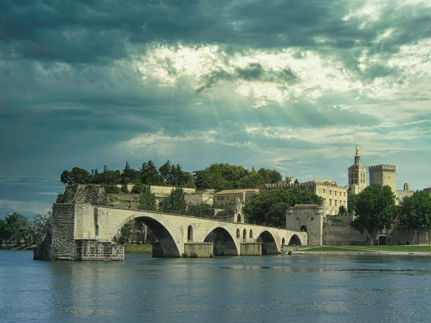
Map of the Self-Guided Walking Tour of Lecce walking route with 14 stops in Lecce.
Preview map of the Self-Guided Walking Tour of Lecce route in Lecce, showing 14 stops. Use the interactive map to zoom and tap markers.

More from this area

Self-Guided Walking Tour of Mahon (2026)

Self-Guided Walking Tour of Mahon
CC BY-SA 2.0 / Jorge Franganillo

This website uses affiliate links which earn a small commission at no additional cost to you.

Mahon, or Maó, is the capital of Menorca and one of the island's most distinctive towns, known for its huge natural harbour, historic centre, waterfront restaurants, and traces of British-period influence. The Balearic Islands tourism site describes Mahón's historic centre as standing on a rocky outcrop above the harbour, with remains of medieval walls and houses with English-style interiors.

For visitors, Mahon works well as a relaxed island capital rather than a beach resort alone. The harbour, old streets, markets, churches, museums, viewpoints, restaurants, and boat trips make it a good base for understanding Menorca's history and maritime character. It is especially useful for travellers arriving by air or ferry who want culture, food, and easy access to the rest of the island.

How to Get to Mahon

By Air: The fastest way to reach Mahon is by flying into Menorca Airport (Aeropuerto de Menorca / Maó, MAH), which sits roughly 10 minutes by road from central Mahon. From the airport you can take a taxi directly into town, or use public buses that run between the airport and Mahon (and often onward to other parts of the island) depending on season and timetable. If you're arriving with luggage and want the simplest transfer, taxis are straightforward; if you're travelling light, the bus is usually the cheapest option. For the best deals and a seamless booking experience, check out these flights to Mahon on Booking.com.

By Car: If you're already on Menorca, Mahon is easy to reach by car via the island's main roads, with straightforward drive times from most resorts and beaches. If you're bringing a vehicle from mainland Spain, you'll need to take a car ferry to Menorca (typically arriving at Ciutadella), then drive across the island to Mahon; it's a manageable cross-island trip on well-maintained roads. Parking in the centre can be tight, so it's often easier to use public car parks on the edge of the old town and walk in. If you are looking to rent a car in Spain I recommend having a look at Discover Cars, first, as they compare prices and review multiple car rental agencies for you.

By Bus: Menorca has an island-wide bus network that connects Mahon with Ciutadella and many of the main towns and resorts, with services generally more frequent in summer. For budget travellers or anyone who prefers not to drive, buses are a practical way to arrive, but do check timetables in advance-some routes are limited on Sundays or outside peak season, and late-evening services can be sparse.

A Short History of Mahon

Early Mahon and the Medieval Townscape

Mahon's earliest urban rhythm was shaped by a fortified settlement pattern: a compact centre, defensive edges, and a daily life tied to craft, worship, and local trade. Remnants of this defensive mindset survive in landmarks such as Portal de Sant Roc, a historic gate that signals the old town's former thresholds and the need to control access in uncertain times. As institutions strengthened, civic authority became more visible in the built environment, a story that later culminates in spaces like Ayuntamiento de Mahon, where administration and public life anchored the town's evolving identity.

Mahon in the Age of Seafaring and Commerce

As maritime traffic intensified, Port Mahon became the engine of prosperity and the stage for shifting influence, wealth, and ideas. The waterfront pulled in merchants, supplies, and new tastes, and the town's economy diversified around provisioning, warehousing, and ship-linked services that left a lasting imprint on local business culture. That commercial lineage is still easy to read today in places associated with production and trade, including the Xoriguer Gin Factory, which reflects how local industry adapted to demand and built recognisable products into Mahon's economic story.

18th-Century Mahon and the British Imprint

The eighteenth century brought a period of pronounced external influence and administrative change, with Mahon's harbour value drawing sustained attention and investment. This era is often felt less as a single “event” and more as a reshaping of civic confidence-urban improvements, a more outward-facing mercantile class, and a cultural life that increasingly prized sociability and public display. Teatre Principal De Mao stands as a vivid expression of that confidence: a place where performance, language, and politics could overlap, and where Mahon signalled its modernity through shared public culture rather than purely defensive architecture.

19th-Century Mahon and Civic Religion

During the nineteenth century, Mahon’s institutions matured and its religious architecture became a strong marker of community identity and social order. Esglesia De Santa Maria is central to this period’s narrative, reflecting both the town’s devotional life and its preference for monumental, public-facing sacred spaces that reinforced communal cohesion. Alongside it, Church and Cloister of Saint Francesc evokes a different texture of religious presence-more inward, structured, and connected to education, charity, and the quieter rhythms of cloistered life that still echo in the atmosphere of the surrounding streets.

20th-Century Mahon and Everyday Modernity

In the twentieth century, Mahon’s centre adapted to modern routines while retaining a strong “street-level” economy built around markets, services, and sociable gathering points. Spaces such as Mercat de Peix and Mercat del Claustre capture that everyday continuity: places where local buying habits, seasonal produce, and informal conversation kept the town grounded even as lifestyles changed. Iglesia Del Carmen sits naturally within this daily circuit, reinforcing how faith, neighbourhood life, and commerce remained closely interwoven rather than separated into distinct zones.

Contemporary Mahon and Heritage in Living Streets

Mahon today treats its past as something you walk through rather than something sealed behind glass. Museu de Menorca plays a key role in that approach by providing context for the layers of rule, trade, and cultural change that shaped the town's institutions and aesthetics. At the same time, the story remains visible in the fabric of ordinary routes-Carrer Moreres, for example, where the scale, façades, and shopfront rhythm preserve the feeling of a working town centre, and where historical identity is carried forward through daily use rather than staged reconstruction.

Where to Stay in Mahon

To make the most of visiting Mahon and this walking tour then you consider staying overnight in the centre. If you base yourself in or just off the old town, you can start early, walk everywhere without relying on transport, and easily break the route with cafés and short detours without feeling “committed” to long transfers back to your room. For a central, character-led stay that keeps you close to the main civic sights, consider Boutique Hotel Sant Roc & Spa and Hotel Can Roca Nou, or for a simple, well-located option that’s practical for a walking-heavy itinerary, Hostal Jume - Urban Rooms.

If harbour views and an easier “downhill-to-dinner” rhythm appeal, stay on the slopes above the port or near the viewpoints that look over the water. This area is ideal if you want a calmer feel in the evenings while still being walkable to the historic centre, and it suits travellers who like to finish the day with sunset views and waterfront dining. Strong options around the port side include Catalonia Mirador des Port and Hotel Port Mahón, both of which put you in a good position to stitch the upper town and the harbour into one continuous day on foot.

For a more resort-style base with better facilities (pool, gym, bigger rooms) while still being close enough to join the walking tour easily, look at the modern edge of the centre where you can get space and comfort without losing walkability. This works well if you're doing Mahon as part of a longer Menorca trip and want a “recovery” hotel after beach days and stair-heavy sightseeing. Two reliable picks in this more contemporary zone are ARTIEM Capri and Seth Port Mahón, which keep you within easy reach of the old town while offering a more full-service stay.

Your Self-Guided Walking Tour of Mahon

Discover Mahon on foot with a walking tour map that guides you from stop to stop as you explore its streets, viewpoints, and historic landmarks at your own pace. Because it's self-guided, you can linger where you like, skip anything that doesn't interest you, and build in coffee breaks whenever you want.

1. Port Mahon

Port of mahon, Minorca
Port of Mahon, Minorca

Port Mahon’s long, sheltered natural harbour has shaped the town’s fortunes since antiquity, but its most visible layers are tied to the early-modern contest for Menorca between European powers. Under British rule in the 18th century, the harbour became a strategic naval base and commercial hub, and Maó’s urban fabric expanded in step with maritime trade. That mix of military utility and mercantile energy is still legible in the waterfront warehouses, fortifications across the inlet, and the town’s orientation toward the sea.

When you’re there, treat the harbour as a sequence of viewpoints rather than a single “place”: the upper-town lookouts give you the best sense of scale, while the quayside puts you close to the working-life details. Watch for old stone steps, mooring rings, and industrial façades that hint at the port’s 18th–19th century logistics role. If you enjoy architecture, the contrast between Georgian-influenced townhouses above and the utilitarian waterfront below is part of the appeal.

For things to do, the simple pleasures work well: a slow walk along the Moll de Ponent, stopping at terraces, and taking time to read the harbour’s geography from different angles. Look across to the defensive sites that once controlled access to the inlet, and notice how the harbour narrows and bends—an obvious reason it was so prized. If you have time, a short boat trip is the quickest way to understand how the port’s “inner” and “outer” reaches connect.


Location: Maó, Balearic Islands, Spain | Hours: 24 Hours. | Price: Free. | Website

We recommend to rent a car in Spain through Discover Cars, they compare prices and review multiple car rental agencies. Book your rental car here.

2. Mercat de Peix

Mercat de Peix
Mercat de Peix
CC BY-SA 3.0 / rene boulay

Mahon’s Fish Market sits at the intersection of daily life and the island’s maritime economy. Fish markets in harbour towns aren’t just places to buy food; historically, they were social and economic nodes where fishermen, restaurateurs, and households negotiated the terms of local abundance. Even as retail patterns change, the market remains a strong symbol of Maó’s relationship with the sea and with seasonal rhythms.

What you see can range from a traditional market atmosphere to a more contemporary, repurposed hall, but the best markets still feel anchored in place. Look for the spatial clues of original use: stall layouts, drainage patterns, hooks or counters, and the practical design choices that made trade efficient. Even if the offering is more oriented to food and drink today, the setting often retains that “working” character.

To enjoy it, go at a time when there’s genuine activity rather than just after-hours quiet. Sample local snacks if available and treat it as a low-pressure way to observe local routines—how people gather, how vendors present produce, and what feels distinctly Menorcan. It also pairs well with a harbour walk, because the market experience makes the port’s economy feel immediate rather than abstract.


Location: Pl. de España, 1, 07701 Maó, Illes Balears, Spain | Hours: Monday – Thursday: 11:00–23:00. Friday – Saturday: 11:00–23:30. Closed on Sunday. | Price: Free.

Here is a complete selection of hotel options in Mahon. Feel free to review each one and choose the stay that best suits your needs.

3. Mercat del Claustre

Mercat del Claustre
Mercat del Claustre
CC BY-SA 2.0 / Jorge Franganillo

The Cloister Market is a classic example of how historic religious spaces can be adapted into civic and commercial life. Cloisters were built for contemplation and community within a religious framework, but their enclosed courtyards and arcades also lend themselves naturally to market uses once the original institutional role shifts. In Maó, that adaptation highlights a broader theme: buildings survive when they remain useful, even if their purpose changes.

Architecturally, the cloister layout is the main attraction—repeating arches, shaded walkways, and a central open space that encourages browsing. The market environment brings these features to life in a different register: conversation replaces silence, and daily necessities replace devotional routine. The juxtaposition is part of what makes the visit more than a simple shopping stop.

When you’re there, walk the full perimeter first, then slow down and dip into stalls or small counters that catch your eye. Notice how the building frames views inward and outward, and how the acoustics and light make the space feel different from a standard market hall. It’s a strong place for a short break because it combines practical interest with a clear sense of historical continuity.


Location: Carrer del Claustre del Carme, 19, 07701 Maó, Illes Balears, Spain | Hours: Monday – Saturday: 08:00–21:00. Sunday: 08:00–14:00. | Price: Free. | Website

Traveling to a country with a different currency? Avoid ATM transaction fees and pay in local currency with a Wise Card. Having used it for over 5 years, we've saved loads on fees!

4. Iglesia Del Carmen

Iglesia Del Carmen
Iglesia Del Carmen
CC BY-SA 4.0 / Mateus2019

The Church of Carmen reflects a strand of Maó’s urban history connected to religious orders and the shaping of neighbourhood identity. Churches dedicated to Our Lady of Mount Carmel often carry associations with seafaring communities and protective devotion, which fits naturally in an island port setting. Over time, these churches can become focal points for local festivals, confraternities, and the kind of community memory that isn’t always visible in museums.

What to see includes the church’s interior composition—altarpiece, chapels, and the way the building’s proportions create a sense of procession toward the sanctuary. Decorative elements can vary widely, but even restrained interiors tend to reward attention to craftsmanship: stonework, wood carving, and devotional imagery. If there’s an adjacent conventual or community space, it can add context to how the site functioned beyond liturgy.

For a good visit, time it to catch the church open and relatively quiet, so you can read the space without interruption. Spend a few minutes looking at iconography and dedications, which often reveal local concerns—safety at sea, family milestones, memorials. It’s also a worthwhile stop to understand Maó as a lived town with neighbourhood institutions, not only as a harbour and a strategic prize.


Location: Plaça del Carme, 07701 Maó, Illes Balears, Spain | Hours: Check official website. | Price: Free; donations appreciated. | Website

5. Teatre Principal De Mao

Teatre Principal De Mao
CC BY-SA 4.0 / Josep Renalias (Lohen11)

Teatre Principal de Maó is frequently described as one of Spain’s oldest operating opera houses, and it embodies the cultural ambition that can flourish in a prosperous port town. Maó’s 18th–19th century growth created an audience for theatre and music, and the building stands as evidence that civic identity wasn’t limited to trade and defense. Over time, theatres like this also become archives of local social history—who attended, what was staged, and how the town presented itself.

What to look for is the classic theatre anatomy: auditorium shape, tiers of seating, stage framing, and decorative details that balance grandeur with intimacy. Even if you’re not catching a performance, guided access (when available) can reveal backstage mechanics and the way the building was engineered for sound and sightlines. The building’s position in the town also matters, because theatres were often placed to reinforce a sense of civic centre and evening promenade culture.

If you can, the best experience is to see it in use—concert, play, or recital—because the architecture makes most sense when it’s doing its job. Otherwise, focus on appreciating the interior volumes and the craft of ornamentation. It’s an ideal counterpoint to the harbour narrative: Maó wasn’t only strategic and commercial; it also invested in art, performance, and public life.


Location: Carrer d'en Deià, 40, 07702 Maó, Illes Balears, Spain | Hours: Tuesday – Saturday: 11:30–13:30. Thursday – Friday: 18:30–20:30. Sunday – Monday: Closed. | Price: Prices vary by show. | Website

6. Carrer Moreres

Carrer Moreres
Carrer Moreres
CC BY-SA 3.0 / rene boulay

Carrer Moreres is part of the old-town street network where Maó’s history is read at human scale. Streets like this often preserve the logic of earlier urban phases: narrow widths for shade and defense, alignments shaped by topography, and building plots that reflect incremental growth rather than a single master plan. In Maó, these streets also echo periods of prosperity when merchants and officials built townhouses that blended local materials with broader European influences.

What to see is less about single monuments and more about textures: façades, doorways, ironwork, shutters, and the way upper levels project slightly over the street. Notice how the street “paces” you—tight sections opening into small nodes, then tightening again—and how that rhythm encourages slow exploration. Small details like plaque stones, old shopfront proportions, or stairways can be the most revealing.

To make the visit worthwhile, walk it without rushing and keep looking up as well as ahead. If you’re interested in photography, early morning or late afternoon light often works best on narrow streets, bringing out stone colour and shadow. Pair it with nearby lanes rather than treating it as a standalone destination; the reward is the cumulative sense of Maó’s lived urban fabric.


Location: Carrer de ses Moreres, Maó, Illes Balears, Spain | Hours: 24 Hours. | Price: Free.

7. Esglesia De Santa Maria

Esglesia De Santa Maria
CC BY-SA 3.0 / rene boulay

The Church of Santa Maria is a key landmark in Maó’s historic centre and often functions as an “orientation point” as much as a place of worship. Churches like this typically reflect multiple phases of construction, repair, and embellishment, responding to changing tastes, resources, and the fortunes of the town. In a port city, a principal church also tends to mirror community identity—baptisms, festivals, memorials—across generations.

Inside, focus on the interplay between structure and decoration: the volume of the nave, the side chapels, and the altar area that draws the eye forward. Many visitors are especially interested in the church’s music tradition; if there is an organ or a reputation for performances, that element adds a living dimension to the building’s heritage. The calm interior can be a useful counterpoint to the busy harbour-front pace.

What to do there is simple but effective: take a slow circuit, pausing at chapels or artworks that show local patronage and devotional culture. If you can visit when the light is good, stained glass and high windows can transform the space. If the church hosts concerts or organ recitals, that’s often the most memorable way to experience it—architecture and sound reinforcing each other.


Location: Ajuntament, 07701 Maó, Illes Balears, Spain | Hours: Check official website. | Price: Check official website. | Website

8. Ayuntamiento de Mahon

Ayuntamiento de Mahon
CC BY-SA 3.0 / Gabino Bolívar Subirats

Mahon’s City Hall represents the civic side of the town’s history: administration, public ceremony, and the everyday machinery of local government. In places like Maó, the municipal building often sits in a symbolic urban position, reflecting periods when civic identity strengthened alongside commercial growth. Over time, such buildings can accumulate layers—renovations, stylistic shifts, and interior changes that track political and social evolution.

What to look for depends on access, but the exterior usually tells its own story: proportions, balconies for public announcements, coats of arms, and the way the façade addresses the square. City halls often act as architectural “backdrops” for civic life, so the surrounding space matters as much as the building itself. Pay attention to how people use the square—markets, gatherings, casual meeting points—because that usage is part of what the building exists to serve.

If you can go inside, look for formal rooms, staircases, and any displays that reference local history or notable events. Even if interior access is limited, it’s still worth visiting at different times of day to see how light and activity change the atmosphere. Pair it with nearby streets to get a feel for the administrative heart of the old town rather than the maritime edge.


Location: Plaça de la Constitució, 1, 07701 Maó, Illes Balears, Spain | Hours: Monday – Wednesday: 09:00–14:00. Thursday: 09:00–14:00 & 16:00–19:00. Friday: 09:00–14:00. Closed on Saturday, Sunday. | Price: Free. | Website

9. Portal de Sant Roc

Portal de Sant Roc
Portal de Sant Roc
CC BY-SA 4.0 / Américo Toledano

Portal de Sant Roc is one of the most tangible remnants of Maó’s historic defensive perimeter. Like many Mediterranean towns, Maó once relied on walls and controlled gates to manage security, taxation, and movement—especially important in a strategic harbour city. Over centuries, as fortification needs changed and the town expanded, many wall sections disappeared, making surviving gates especially valuable as “anchors” of the old urban outline.

Visually, the appeal is the contrast between old masonry and the surrounding city life. Gates are built to be functional and resilient: thick stone, narrow passages, and a sense of compression as you pass through. Even without extensive ornament, the structure carries a strong historical charge because it marks where the town once ended and the outside began.

When you’re there, treat it as both a photo stop and a navigation clue. Walk around it rather than only through it, looking for alignment with older street patterns and any fragments of wall line that might still be traceable. It’s also a good place to think about Maó’s defensive story in relation to the harbour—how control points on land complemented control points on the water.


Location: 36, Carrer de Sant Roc, 34, 07701 Maó, Illes Balears, Spain | Hours: 24 Hours. | Price: Free.

10. Museu de Menorca

Museu de Menorca
Museu de Menorca
CC BY-SA 4.0 / Tònia.Marti

The Museu de Menorca is central to understanding how the island sits at a crossroads of Mediterranean cultures. Menorca’s story runs from prehistoric communities and monumental stone sites through successive waves of outside influence and local adaptation, and the museum is where that long timeline is made legible. Its collections and interpretation typically emphasise continuity: how an island can be both a frontier and a home, repeatedly reshaped yet still distinct.

Inside, expect a structured journey across periods rather than a single-theme display. Prehistory is usually a major focus, because Menorca’s archaeological heritage is unusually visible on the landscape; the museum helps translate those ruins into daily life—tools, ceramics, burial practices, and social structure. Later sections tend to show how trade routes and political shifts affected material culture, from imported wares to changing tastes and technologies.

To get the most out of the visit, start with the earliest galleries and let the chronology build; it will make later objects feel less isolated. Spend extra time with any archaeological displays that connect directly to sites you may have seen elsewhere on the island, because the museum provides the missing context. If there are temporary exhibitions, they can also be worthwhile for local perspectives that go beyond the standard overview.


Location: Pla des Monestir, 9, 07701 Maó, Illes Balears, Spain | Hours: Tuesday & Thursday: 10:00–19:00. Wednesday, Friday, Saturday, Sunday: 10:00–14:00. Closed on Monday. | Price: Adults: €4; Reduced: €3; Sundays: free; Temporary exhibitions: free. | Website

11. Church and Cloister of Saint Francesc

Church and Cloister of Saint Francesc
CC BY-SA 3.0 / rene boulay

The Church and Cloister of Saint Francesc reflects the long role of religious orders in shaping Maó’s civic and architectural landscape. Franciscan communities across the Balearics historically contributed not only spiritual life but education and charity, and their buildings often became key urban anchors. Over time, many such complexes were altered by reforms, changing civic needs, and occasional periods of suppression or repurposing, leaving layered spaces that mix devotion with local history.

What you see today is typically a blend of church interior elements—altars, chapels, restrained ornament—and the quieter geometry of the cloister. Cloisters are designed for rhythm and reflection: arcades, courtyards, and a sense of enclosure that contrasts with the bustle of nearby streets. Even if you’re not focused on religious art, the spatial experience is often the highlight.

When you visit, move slowly and look for the details that survive transitions: inscriptions, tomb slabs, carved stonework, and the way light falls across the cloister walk. If access allows, step into the courtyard and read the building as a sequence of thresholds—from public nave to semi-private cloister. It’s a good place to pause and understand Maó beyond the port: quieter, institutional, and shaped by long-term community life.


Location: Pla des Monestir, 07701 Maó, Illes Balears, Spain | Hours: Tuesday: 10:00–14:00 & 18:00–20:00. Wednesday: 10:00–14:00. Thursday: 10:00–18:00. Friday: 10:00–14:00. Saturday: 10:00–14:00. Sunday: 10:00–14:00. Closed on Monday. | Price: Adults: €4; Under 18: free. | Website

12. Xoriguer Gin Factory

Xoriguer Gin Factory
CC BY-SA 3.0 / Santiago Lap

Xoriguer is closely linked to Menorca’s gin tradition, which developed during the period of British influence when gin became popular among soldiers and sailors. Local producers adapted the spirit using Mediterranean botanicals, and the style that emerged is distinct from many mainland gins, often associated with juniper-forward notes and a clean, maritime character. The factory is part of that living continuity: it’s less a museum piece than a working reminder of how an imported taste became local heritage.

On-site, the interest is in the process and the atmosphere: the scent of botanicals, the utilitarian charm of equipment, and the sense of a long-running craft in a compact space. Pay attention to how the production story is framed—raw ingredients, distillation, resting, and bottling—because it ties directly back to the port economy that supplied ships and taverns. Even if you’re not a spirits enthusiast, it’s a quick cultural snapshot of Maó’s trading-era identity.

What to see and do is straightforward: follow the explanation of the stills and production steps, then use the tasting to calibrate what “Menorcan gin” means in practice. If you want something more contextual, note how the brand connects to local drinking customs, especially the way gin is woven into Menorcan social life. It’s also a good stop to pick up a small bottle as a place-specific souvenir that actually reflects the island’s history.


Location: Moll de Ponent, 91, 07701 Maó, Illes Balears, Spain | Hours: (Summer) April 1 – October 31; Monday – Friday: 10:00–18:00; Saturday: 10:00–14:00. (Winter) November 1 – March 31; Closed. | Price: Check official website. | Website
Moira & Andy
Moira & Andy

Hey! We're Moira & Andy. From hiking the Camino to trips around Europe in Bert our campervan — we've been traveling together since retirement in 2020!

Read our full story here

This website uses affiliate links which earn a small commission at no additional cost to you.

Walking Tour Summary

Distance: 2.5 km
Sites: 12

Walking Tour Map
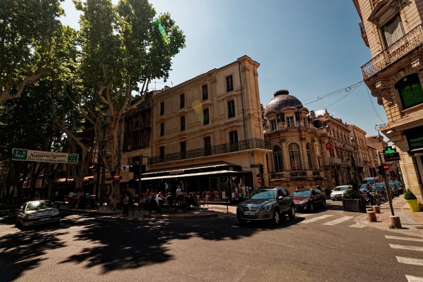
Map of the Self-Guided Walking Tour of Mahon walking route with 12 stops in Mahon.
Preview map of the Self-Guided Walking Tour of Mahon route in Mahon, showing 12 stops. Use the interactive map to zoom and tap markers.

More from this area

Exploring Roman Zaragoza

Exploring Roman Zaragoza
CC BY-SA 3.0 / Luis Miguel Bugallo Sánchez (Lmbuga)

This website uses affiliate links which earn a small commission at no additional cost to you.

Roman Zaragoza was Caesaraugusta, the Roman colony founded under Emperor Augustus and one of the most important cities in the Ebro valley. Its Roman past is still unusually visible beneath the modern centre, especially around Plaza de la Seo and Plaza del Pilar, where the civic heart of the ancient city once stood. The Forum Museum preserves remains from the time of Augustus and Tiberius, including traces of a market, water pipes, sewers, and shop walls, helping visitors understand Caesaraugusta as a functioning Roman city rather than just a collection of monuments.

The main Roman route in Zaragoza links the forum, river port, public baths, theatre, and Roman walls, making it possible to follow the structure of the ancient city on foot. The theatre is one of the most evocative remains, while the river port shows how the Ebro connected Caesaraugusta with wider trade networks. Together, these sites explain why Roman Zaragoza mattered: it was a planned colony, a commercial centre, a political space, and a public city of baths, performance, worship, and administration.

History of Roman Zaragoza (Caesaraugusta)

Before the Romans arrived, this bend in the Ebro River was Salduie, an Iberian settlement of the Sedetani people. But around 14 BC, the Emperor Augustus saw a strategic masterstroke: a colony for veteran soldiers from the Cantabrian Wars. He didn’t just build a town; he built a statement of Roman permanence.

Zaragoza is one of the few cities in the empire granted the full name of its founder: Colonia Caesaraugusta. This gave the citizens “Roman Right” (status equal to being in Italy itself). The city was laid out on a classic grid-a sharp, disciplined contrast to the winding Iberian paths.

The history of Caesaraugusta is inseparable from the river. In the 1st century AD, the Ebro was much deeper and more navigable. The city became a massive “dry port,” acting as the gateway for gold from the northern mines, olive oil from the valley, and luxury ceramics from across the Mediterranean. This wealth funded the white marble and fine mosaics that you can still see traces of today.

Where to Stay in Zaragoza

To make the most of visiting Zaragoza and this walking tour then you consider stay overnight at the centre. For a Roman Zaragoza focus, the best base is the historic core around the Roman Theatre area, Plaza de España, and the streets running toward the Ebro, because you'll be within an easy walk of the Teatro, the forum and port museums, and the broader Caesaraugusta archaeology cluster without needing taxis or transit. Strong, well-located options in this zone include Catalonia El Pilar, Hotel Alfonso, Vincci Zaragoza Zentro, and Hotel Goya.

If you want a central stay with a slightly calmer, more “new city” feel while still walking distance to the Roman sites, base yourself around Plaza Aragón, Paseo de la Independencia, and the Gran Vía corridor. This area works well if you like larger hotels, easy shopping and dining, and a straightforward stroll into the old town to start the Roman route early. Consider NH Collection Gran Hotel de Zaragoza, Hotel Palafox, Hotel Zaragoza Royal, and Hotel Gran Vía.

If you're arriving by train and want maximum logistical convenience, staying near Zaragoza-Delicias station can make sense, especially for short trips where you'll do one intensive day walking the Roman highlights. You'll typically need a quick taxi, bus, or tram to reach the Roman cluster, but you gain fast check-in/out, easy onward travel, and often better value for room size. Good options here include Eurostars Zaragoza, Exe Plaza Delicias, iStay by NH Zaragoza Sport Hotel, and Hotel Hiberus.

A Tour of Roman Zaragoza – Ruta de Cesar Augusta

The best way to approach Roman Zaragoza is as a connected system rather than isolated sights. A useful way to package the experience is via the Ruta de Caesaraugusta, the city's walkable archaeological circuit linking four underground museums: the theatre, forum, public baths, and river port. The format is part of the appeal: you descend beneath today's street level to see in-situ remains, then resurface back into contemporary Zaragoza before walking to the next stop. Done in sequence, it's one of the clearest ways to understand how Caesaraugusta functioned as a real city rather than a set of disconnected ruins.

Treat the route as modular. If you’re short on time, prioritise the Roman Theatre and one of the “infrastructure” sites (baths or river port) to balance spectacle with everyday life. If you have longer, the full circuit is still manageable because each museum is compact and designed for focused visits. Between stops, build in café time on purpose-those pauses help you notice the Roman layer in the street grid, distances, and sightlines as you walk.

1. Murallas Romanas de Zaragoza: The Threshold of Caesaraugusta

Roman Walls of Zaragoza
CC BY-SA 3.0 / Dorieo

Murallas Romanas de Zaragoza are the quickest way to see Caesaraugusta as a defended, planned city rather than a loose scatter of archaeological fragments. A Roman wall wasn’t just a military feature; it defined the city’s edge, controlled access through gates, and projected a sense of order and permanence. Even in short surviving sections, the walls help you picture the scale of Roman Zaragoza and the idea of an urban “inside” that was protected, administered, and symbolically distinct from the surrounding countryside.

What makes the walls satisfying on a walking day is how they sit in the flow of the modern city. You’re not stepping into a separate “ruins zone”; you’re catching the Roman boundary mid-stride, often with just enough preserved fabric to read construction and thickness. Take a moment to look at how the wall line relates to today’s street pattern and open spaces—these are often the accidental places where the Roman layer survived because later building didn’t completely erase it. It’s also a useful mental map tool: once you’ve seen the wall, you can imagine the footprint of Caesaraugusta and place the theatre, forum, baths, and port within a coherent perimeter.

Practically, treat the walls as a connective stop between museums rather than a standalone destination. They work best when you’ve already seen one or two of the underground sites, because you can start linking “what the city did” (forum, baths, trade) with “how the city was shaped and protected” (defence, controlled entry, defined limits). If you’re photographing, step back far enough to include some modern context in the frame—the contrast is the point, and it reinforces the core pleasure of Roman Zaragoza: the ancient city is still threaded through the everyday one.


Location: Plaza César Augusto, 3, Casco Antiguo, 50003 Zaragoza, Spain | Hours: Monday: Open 24 hours Tuesday: Open 24 hours Wednesday: Open 24 hours Thursday: Open 24 hours Friday: Open 24 hours Saturday: Open 24 hours Sunday: Open 24 hours | Website

We recommend to rent a car in Spain through Discover Cars, they compare prices and review multiple car rental agencies. Book your rental car here.

2. The Forum Museum: The Pulse of Power

Museo del Foro de Caesaraugusta
CC BY-SA 4.0 / GattoCeliaco

Museo del Foro de Caesaraugusta sits at the heart of what made Caesaraugusta feel like a proper Roman city: a planned civic centre where administration, commerce, and public life overlapped. The forum wasn’t just a “main square” in the modern sense; it was the engine room of the city’s identity, where power was displayed, decisions were made, and daily trade played out in the shadow of official buildings. Visiting this museum is a fast way to understand how Roman Zaragoza organised itself and why the historic centre still feels structured around a few key axes.

The experience works because it’s in-situ and below street level, so you’re looking at the Roman layer exactly where it belonged. You’ll see structural remains and foundations that suggest the scale of the forum complex and its market function, with interpretation that helps you visualise open space, surrounding porticoes, and the practical infrastructure needed to keep a busy civic-commercial zone operating. Pay attention to how the remains hint at movement and control—where people entered, where goods were handled, and how the built environment guided crowds.

As a stop on a walking route, it rewards a short, focused visit rather than a long museum session. Go in thinking about the forum as a “system”: politics and trade in the same footprint, public ceremony alongside everyday transactions. It pairs especially well with the river port museum because the two together connect the supply chain to the civic centre—goods arriving via the Ebro, then moving into the commercial life of the forum—making the Roman city feel coherent rather than fragmented.


Location: Pl. de la Seo, 2, Casco Antiguo, 50001 Zaragoza, Spain | Hours: Tuesday – Saturday: 10:00–14:00 & 17:00–21:00. Sunday: 10:00–14:30. Closed on Monday. | Price: Adults: €4; Reduced: €3; Caesaraugusta Route pass (4 sites): €7; Free entry for eligible visitors and on select free days. | Website

Here is a complete selection of hotel options in Zaragoza. Feel free to review each one and choose the stay that best suits your needs.

3. The River Port Museum: The Gateway to the World

Museo del Puerto Fluvial de Caesaraugusta
CC BY-SA 4.0 / Millars

The Museo del Puerto Fluvial de Caesaraugusta is one of the most illuminating Roman stops in Zaragoza because it explains the city through movement and trade, not monuments. In Roman Caesaraugusta, the Ebro wasn’t just a backdrop; it was infrastructure, a commercial corridor, and a reason the city mattered. This museum takes that big idea and makes it legible in a short visit, showing how goods and people were channelled through the riverfront edge of the Roman town.

Inside, you’re looking at in-situ archaeological remains presented below modern street level, so the experience is very much about stepping down into the Roman layer. Expect structural elements tied to port activity and river engineering, supported by clear interpretation that helps you picture loading and unloading, storage, and the day-to-day logistics behind a provincial capital. It’s a great counterbalance to the theatre or forum because it focuses on the practical machinery of the city: supply, distribution, and connectivity.

For a walking day, this is an easy “high-impact” stop because it doesn’t require a big time commitment to be worthwhile. Go in with one question in mind—what would Zaragoza have needed to import, export, and store to function—and the displays click into place quickly. Pair it with the forum museum to connect commerce on the river with commerce in the civic centre, and you’ll start reading the historic centre differently as you walk: not just as streets between sights, but as routes shaped by trade, access, and control.


Location: Pl. de San Bruno, 8, Casco Antiguo, 50001 Zaragoza, Spain | Hours: Tuesday – Saturday: 10:00–14:00 & 17:00–21:00. Sunday: 10:00–14:30. Closed on Monday. | Price: Adults: €3; Reduced: €2; Free for under 16 and 65+; Free entry on the first Sunday of each month. Ruta Caesaraugusta (4 museums): €7; Reduced: €5. | Website

Traveling to a country with a different currency? Avoid ATM transaction fees and pay in local currency with a Wise Card. Having used it for over 5 years, we've saved loads on fees!

4. Public Baths Museum: The Social Hub

Museo de las Termas Públicas de Caesaraugusta
CC BY-SA 4.0 / Ivanhercaz

Museo de las Termas Públicas de Caesaraugusta is the best place in Zaragoza to grasp Roman daily life at human scale. Roman baths were not a luxury add-on; they were a social institution tied to hygiene, health, gossip, business, and routine. This museum gives you a grounded sense of how ordinary citizens interacted with the city—less about grand statements of power, more about the habits and infrastructure that made urban life feel Roman.

What you see is the preserved bath complex presented in place, with interpretation that explains how the sequence of rooms and services worked. Even if you’re not an archaeology specialist, it’s easy to follow the logic: controlled movement through spaces, careful engineering, and the sheer practicality of maintaining water and heat at scale. Look for clues in the layout that suggest how people flowed through the baths and how much planning was required to keep them running day after day.

For a self-guided walk, the baths are a smart “reset” stop between bigger headline sites because they change the lens you’re using. After seeing civic spaces like the forum or spectacle spaces like the theatre, the baths make the Roman city feel lived-in—built for routines, not just display. Pair this museum with a slow wander through the surrounding streets afterwards and you’ll start noticing how much of a Roman city’s story is about services and logistics rather than monuments alone.


Location: Museo de las Termas Públicas de Caesaraugusta, Calle de San Juan y San Pedro, Zaragoza, Spain | Hours: Tuesday – Saturday: 10:00–14:00 & 17:00–21:00. Sunday & public holidays: 10:00–14:30. Closed on Monday. | Price: €3 (general); €2 (reduced). | Website

Explore Zaragoza at your own pace with our self-guided walking tour! Follow our curated route to discover must-see sights and local secrets that makes Zaragoza one of the best places to visit in Spain.

5. The Theatre Museum: The 6,000-Seat Time Machine

Roman Theatre of Caesaraugusta
CC BY-SA 2.0 / sergioski1982

Museo del Teatro de Caesaraugusta is the most immediately impressive Roman site in Zaragoza, because it translates straight into scale: seating, stage area, and the sense of a crowd-focused building designed for performance and public visibility. In Caesaraugusta, the theatre was a statement of urban sophistication and Roman cultural identity, a place where entertainment, status, and civic pride converged. It’s the stop that most quickly convinces you that this was a substantial Roman city, not a minor outpost.

The museum presentation is particularly effective because it helps you understand the building as architecture, not just “ruins.” You’ll be able to read the structure—how the audience was arranged, how sightlines worked, and how the stage complex framed performance—while also getting enough context to imagine the noise, ceremony, and social signalling that came with public spectacles. Spend a moment orienting yourself: where the best seats would have been, how people entered and exited, and what the theatre’s placement says about the city’s planning.

As part of a Roman Zaragoza walking day, the theatre is a natural anchor point: start here to set your mental scale, then move on to the forum, baths, and port to fill in the city’s civic and practical layers. If you visit later in the day, it works just as well as a “finale” because it brings together the idea of Caesaraugusta as a functioning city with public life and shared experiences. Either way, it’s the place where Roman Zaragoza feels most tangible, because you’re standing inside a space designed to be full of people.


Location: C. de San Jorge, 12, Casco Antiguo, 50001 Zaragoza, Spain | Hours: Tuesday – Saturday: 10:00–14:00 & 17:00–21:00. Sunday: 10:00–14:30. Closed on Monday. | Price: Adults: €4; Reduced: €3; Under 16: free; 65+: free. Combined ticket (4 Caesaraugusta museums): €7; Reduced: €5; Free entry on the first Sunday of each month. | Website

Reading Zaragoza Through Its Roman Layer

By the time you finish this route, you'll start “reading” Zaragoza differently. You'll notice how the narrow streets of the Casco Antiguo still follow the lines of the Roman grid, and how the “flow” of people toward the river is a habit thousands of years in the making.

Powered by GetYourGuide
Moira & Andy
Moira & Andy

Hey! We're Moira & Andy. From hiking the Camino to trips around Europe in Bert our campervan — we've been traveling together since retirement in 2020!

Read our full story here

This website uses affiliate links which earn a small commission at no additional cost to you.

Walking Tour Summary

Distance: 2 km
Sites: 5

Walking Tour Map
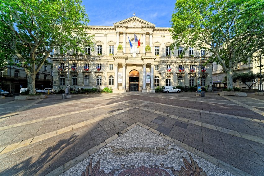
Map of the Exploring Roman Zaragoza walking route with 5 stops in Zaragoza.
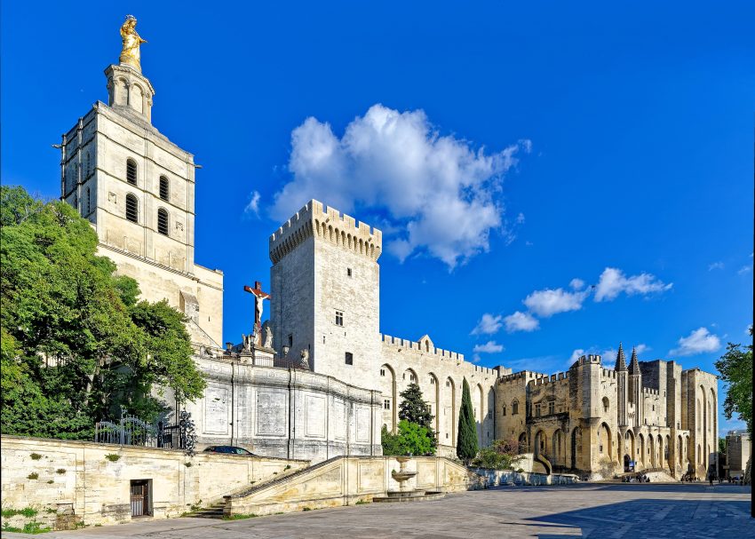
Preview map of the Exploring Roman Zaragoza route in Zaragoza, showing 5 stops. Use the interactive map to zoom and tap markers.
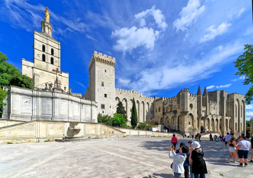
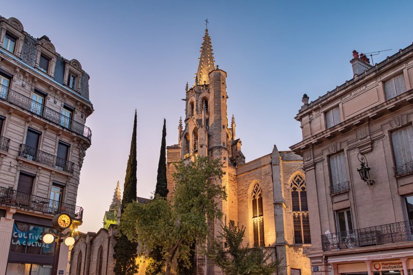
More from this area