Spain Travel Guide

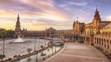
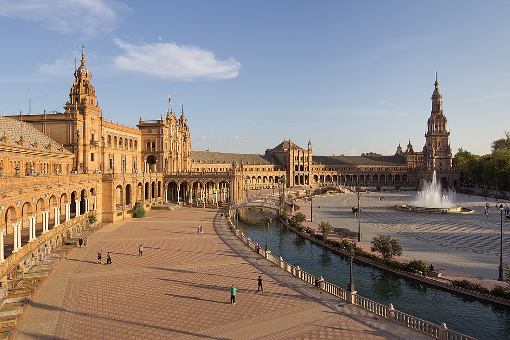
Plaza De España Sevilla Spain
CC BY-SA 4.0 / Carlos Delgado

Spain, country located in extreme south-western Europe, in the Iberian Peninsula, which it shares with Portugal. The country has a land border to the north across the Pyrenees Mountains with France and the tiny principality of Andorra, to the south with, Gibraltar and to the west with Portugal. Its east coast looks out over the Mediterranean Sea, the west by the Atlantic Ocean, and to the north by the Bay of Biscay. The Balearic Islands lie off Spain’s east coast and the Canary Islands lie to the west of Africa. Ceuta and Melilla are two small enclaves in North Africa that Spain has ruled for centuries.

Mainland Spain is a mountainous country, dominated by high plateaus and mountain chains.

Spain is a popular tourist destination blessed with a gentle climate, beautiful coastal beaches, mountains and plains, historic cities and, a spectacular number of World Heritage Sites to visit.

Region map of Spain

Madrid

Historically part of Castile, Madrid is now its own autonomous region and the most densely populated area in Spain. The metropolitan area is home to about 6 million people, making it a bustling and prosperous region with a strong service-based economy. The area has seen massive development in recent decades.Old Madrid is renowned for its urban architecture, ornate churches, and the world-famous Prado Museum and art gallery. Like the rest of central Spain, Madrid experiences a continental climate, with hot, dry summers and cold, largely dry winters. The city is situated at an altitude of almost 650 meters above sea level, making it the highest capital city among European Union member states.
Region map of Madrid

Extremadura

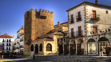
Extremadura, located on the western border with Portugal, has long been the poorest region in Spain. Historically, this poverty drove many of its inhabitants to seek better opportunities elsewhere, often in South America. Notably, two of the greatest Conquistadores, Pizarro and Cortés, hailed from this region. They, along with others, brought back immense wealth from South America, which they invested in large country estates and grand palaces in towns such as Cáceres and Trujillo. Further south, the regional capital Mérida, once a significant Roman city, boasts the finest Roman remains in Spain, including an impressive long Roman bridge and a large Roman theater, as well as the Spanish National Museum of Roman Art.Today, Extremadura remains sparsely populated. Large areas are too poor to cultivate and are used for subsistence farming. The landscape features olive groves, scrub oak, and in more fertile areas, rolling fields of wheat. The granite bedrock is often just below the surface and frequently emerges in rocky outcrops.The mountainous areas of Extremadura are very wild and attract bird-watchers and hikers, though the infrastructure for hikers remains relatively limited.
Region map of Extremadura

Castilla la Mancha

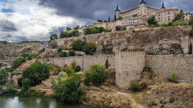
Situated in the heart of mainland Spain, this landlocked region is the second largest in the country and surrounds Madrid, the nation's capital. Characterized by arid, sparsely populated mountainous terrain, the area is dotted with vineyards and castles.It is also home to the former Spanish capital of Toledo, which is growing in popularity as a city break destination. Toledo offers a rich blend of museums, Renaissance buildings, and churches, including the impressive 13th-century High Gothic cathedral.
Region map of Castilla la Mancha

Basque Country

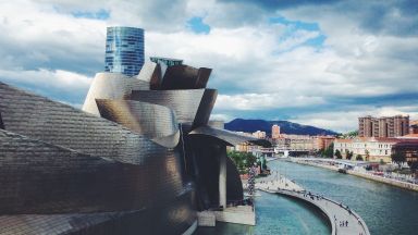
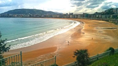
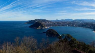
Though widely known for its violent separatist movement ETA, the Basque Country is actually the most prosperous region in Spain in terms of GDP per inhabitant, thanks to its industrial sector, tourism, and agricultural activities. The Basque Country has two official languages: Basque (Euskara) and Spanish (Castilian). With completely different origins, the Basque language is unlike Spanish, which explains why many places in the Basque area have two distinct names.The region boasts two major industrial and commercial cities, the ports of Bilbao and San Sebastian (Donostia). Between them, the rocky Atlantic coastline features several small resorts that have seen development in recent decades, though not to the extent of the Mediterranean coast.The northern half of the Basque Country is hilly, as the Basque hills are the westward extension of the Pyrenees. Unlike the Spanish Pyrenees, the Basque hill country receives more rainfall, making it a green and wooded area. The hills and valleys are dotted with small villages and isolated farmsteads, popular with ramblers and hikers. The southern part of the Basque Country, the province of Álava, lies south of the coastal mountains and enjoys a more continental climate. Most of the population in Álava is concentrated in the Vitoria-Gasteiz conglomeration. Beyond the capital city, the area is largely agricultural, particularly on the flat expanses of the upper Ebro valley.
Region map of Basque Country

Asturias & Cantabria

For most of its length, the coastline of northern Spain is hilly or even mountainous. Behind a narrow and fertile coastal plain, the terrain rises steeply into the mountains of Cantabria and Asturias, collectively known as the Cantabrian Mountains. These mountains culminate in the Picos de Europa, dramatic and rocky peaks with deep valleys and soaring summits. The area has earned the nickname "Switzerland on the Sea" due to the proximity of high mountain peaks, green valleys, and the Atlantic Ocean.Tourism developed slowly here, and the north coast of Spain has not experienced the urbanization that has affected long stretches of Spain's Mediterranean coast. Nevertheless, around the ports of Santander and Gijon, the coastline has seen a fair amount of tourist development in recent decades. Away from these areas, there are long stretches of relatively unspoiled coastline, with fields and meadows extending right to the water's edge—or, in most cases, the clifftops.Like Galicia, Cantabria and Asturias are part of what is known as "Green Spain" (España Verde) due to their oceanic climate. These small regions include the coastal areas and the northern slopes of the Cantabrian Mountains, offering lush landscapes and a unique blend of maritime and mountainous environments.
Region map of Asturias & Cantabria

Valencia & Murcia

The regions of Valencia and Murcia gaze steadfastly out to sea. In this dry, central eastern part of Spain, the majority of the population is concentrated along the coastal strip. This population has significantly expanded in recent decades with the development of numerous coastal resorts, "urbanizaciones," and their associated infrastructure. Despite this over-development, the coastline is extensive, and there are still relatively unspoiled sections of beach and rocky coves for those looking to escape the crowds.Apart from tourism, the main activity in this region is agriculture, particularly in the fertile valleys of Murcia, where vast areas are dedicated to the production of fruit and vegetables. Valencia is the heart of Spain's orange and citrus industry. The Moors introduced the cultivation of palm trees to this area, and the city of Elche, near Alicante, boasts Europe's only extensive palm groves.Generally speaking, this is a dry region, with arid and rocky hills inland from the coast, similar to much of Spain. Small villages and towns cling to hillsides or stand beside rivers or streams; however, this inland area is sparsely populated and a world apart from the bustling crowds of Benidorm or La Manga.Culturally, the region has plenty to offer, from the historic centers of Valencia and Murcia to the palm groves of Elche and the Moorish remains in Lorca and other locations.
Region map of Valencia & Murcia

Balearic Islands

Another single-province region, the Balearic Islands consist of Majorca, Menorca, Ibiza, and Formentera. While the islands are renowned for their nightlife and glamour, away from the party hubs, they reveal a different side with traditional villages offering a slow, leisurely pace of life. For hiking enthusiasts, Menorca's S'Albufera des Grau National Park, the island's largest wetland area, and the 115-mile-long Cami de Cavalls trail provide excellent opportunities for exploration. To escape the crowds, head to Formentera, the least-visited of the Balearic Islands, and relax on the serene Ses Illetes beach.
Region map of Balearic Islands

Andalusia

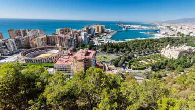
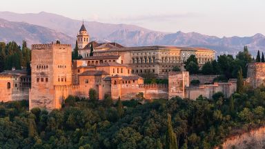
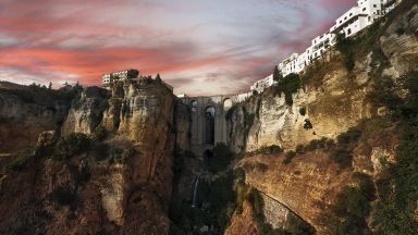
Andalucia, the southernmost region of continental Europe, is the largest region in Spain and has the highest population, mainly concentrated along the coast and in the Guadalquivir valley. While the coastline has been significantly altered by uncontrolled property development and intensive agriculture (known as "plasticultura"), the inland areas, often close to the coast, remain a stunning region of hills and plains with some of Spain's richest cultural heritage.Andalucia was the last European stronghold of the Moors, and "Al Andalus" boasts some of the finest historical remnants of Moorish culture. The Moors were not expelled from Andalucia until 1492, the same year Christopher Columbus arrived in the Americas. The Moorish legacy survives in many Alcazars and other buildings, most famously in the Mesquita of Cordoba and the Alhambra of Granada, among the most visited historic monuments in Europe.Mostly dry and hot, Andalucia is one of the poorest regions of Spain, especially away from the heavily touristed Mediterranean coast between Malaga and Marbella. Behind the coast, much of the region is hilly and mountainous, culminating in the snowy peaks of the Sierra Nevada. Between the Sierra Nevada and the coast lie the Alpujarras, where the last Moors in Spain were relocated. Today, the area, with its white villages clinging to hillsides, resembles parts of Morocco. The high Alpujarras and the Sierra Nevada offer excellent opportunities for hiking and other outdoor activities, especially in spring and autumn when the rest of Europe is cooler.Northern and eastern Andalucia are sparsely populated, with many areas characterized by endless olive groves, largely a result of EU subsidies rather than historic tradition. Other areas are dry and semi-desert. Just inland from the port of Almeria lies the Desierto de Tabernas, the only area in Europe officially designated as a desert.The most fertile part of Andalucia is the central valley of the Guadalquivir River, which flows through Sevilla and reaches the Atlantic coast west of the port city of Cadiz. Although the river's flow is highly seasonal, the Guadalquivir and its tributaries sustain agricultural activities throughout the area, including the production of Sherry, which comes from the region around Jerez de la Frontera.
Region map of Andalusia

Canary Islands

Lying off the northwest coast of Africa, the volcanic archipelago of the Canary Islands boasts beautiful, lunar-like landscapes. Coupled with its warm weather and inviting beaches, it is no surprise that they are a top-rated destination for holidaymakers.Tenerife, the largest, most populous, and most popular island, is renowned for its incredible beaches and stunning mountain scenery, dominated by El Teide – Spain’s tallest mountain. Each of the islands offers something unique: Lanzarote features breathtaking volcanic landscapes, La Gomera’s ravine-filled terrain is perfect for hikers, and Gran Canaria is known for its vibrant nightlife. Overall, the Canary Islands provide a fantastic holiday destination for a variety of interests.
Region map of Canary Islands

Castille-Leon

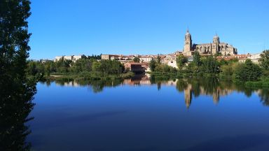
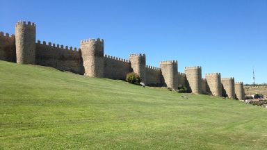
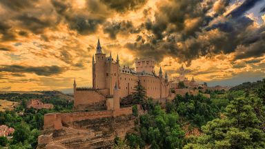
This region represents the core of Spain. Historically, the area around Madrid, known as Castile, formed the central part of Spain's identity. Today, Old Castile is divided into three regions, with Castile and León being the largest by land area, though not the most populous. Madrid, once the capital of Castile, is now a separate autonomous metropolitan region.Historically, Castile was a rugged and desolate land where inhabitants clustered in fortified cities or castles for protection. Many of these ancient fortresses still stand, including some of Spain's most treasured cities like Ávila, Salamanca, and Segovia, all recognized as UNESCO World Heritage sites. The region also includes cities rich in cultural heritage such as León, Valladolid, and Burgos, along with the exquisite Romanesque cloisters of the Santo Domingo de Silos monastery.The expansive plains of Castile are primarily used for agriculture, especially cereal farming. The region sits mostly at an elevation of 800 meters or higher, experiencing a dry, cold winter and a dry, hot summer. While the surrounding mountains support pine forests, much of the central region is sparsely wooded, with natural tree growth and irrigated farming confined to areas near watercourses.
Region map of Castille-Leon

Catalonia

Catalonia is the wealthiest region in Spain and, with nearly seven million residents, the second most populous. Visitors are often surprised to find that people in Catalonia predominantly speak Catalan, not Spanish. During Franco's regime, Castilian Spanish was enforced nationwide, but since gaining autonomy, Catalonia has reinstated Catalan as the primary language. In many places, such as museums, labels may be in Catalan and English, but not in Castilian Spanish, which can frustrate visitors from other regions of Spain. Despite this, Catalan and Castilian are similar enough that Spanish-speakers can generally understand road signs and other information.The area around Barcelona, Spain's second-largest city, is densely built-up and extends along the coast and into the valleys northwest of the city, where heavy industry is still present. Barcelona, a major Mediterranean port and bustling business hub, is connected to Madrid by the AVE, Spain's high-speed rail network. Soon, this network will extend to the French border, allowing direct high-speed train services between Barcelona and Paris.Catalonia, bordering France, is one of Spain's most accessible regions. The Costa Brava was the first area in Spain to embrace mass tourism. The coast, both north and south of Barcelona, is lined with suburban and holiday developments, encroaching on small seaside towns. However, some unspoiled spots remain, particularly in the north. The region's hinterland offers vast spaces and natural areas that attract those seeking to escape the crowds. The Catalonian Pyrenees, popular with hikers and outdoor enthusiasts, boast stunning rocky mountain scenery, dramatic gorges, peaks, and magnificent vistas. This area also holds a wealth of historical sites, including the UNESCO World Heritage-listed medieval churches in Tahull.
Region map of Catalonia

Aragon

Landlocked Aragon, where the people speak Spanish, is a sparsely populated province that is primarily rural, with agriculture thriving wherever possible. In its dry, hilly areas, economic activity is limited to grazing and, where accessible, forestry. The northern part of Aragon is dominated by the Pyrenees mountains, which are fairly dry and arid on this southern side. Narrow valleys with rocky gorges characterize this region. South of the Pyrenees, the wide Ebro Valley around Zaragoza is a fertile agricultural area. In the southeast, between the fertile agricultural plains and the coast, lies a dry, hilly region of Mediterranean pine forest and olive groves.This part of Spain is rich in history and culture, particularly visible in the Moorish and Mozarabic heritage of Zaragoza, the Mudejar heritage of Teruel, and ancient castles such as the Romanesque fortress at Loarre.
Region map of Aragon

Galicia

Galicia is located at the northwest tip of Spain. This Atlantic coastal region enjoys a temperate climate and adequate rainfall, making it the greenest region in Spain. The population is mainly concentrated along the coast and in the major port cities of Vigo and A Coruña. Vigo is notable as the largest fishing port in Europe and an industrial hub, known for shipbuilding and car manufacturing.Outside the urban areas, Galicia features a dramatic rocky coastline, with fjord-like inlets on the western side and a less indented northern coast. Inland, Galicia is a relatively poor agricultural region, characterized by small farms, hilly and rocky terrain, and dense forests in many areas.Galicia and Asturias, like Brittany, Wales, and Ireland, belong to Europe's Celtic fringe, sharing cultural traditions such as the use of bagpipes.
Region map of Galicia

Navarre & La Rioja

Navarra is a region that encompasses the foothills and central western section of the Pyrenees, bordering France and the Basque Country. Similar to Castile, parts of Navarra are very dry, even barren and inhospitable. The Bardenas Reales Natural Park offers spectacular semi-desert landscapes reminiscent of America's Wild West.Navarra is a leader in Europe regarding renewable energy, with a target of 100% renewable energy use by 2050. Nearly half of the region's electricity is generated by its 28 wind farms, with hydroelectricity being the second-largest source. Navarra's dry, sunny climate also holds significant potential for the development of solar power.To the south of Navarra lies the region of La Rioja, along the upper Ebro Valley. La Rioja is the smallest region in Spain and is particularly famous for its wines.
Region map of Navarre & La Rioja

Tours and Activities from Spain