Self-Guided Walking Tour of Cartagena (2026)

Self-Guided Walking Tour of Cartagena

This website uses affiliate links which earn a small commission at no additional cost to you.

Cartagena is a city made for walking: pastel-coloured colonial streets, shaded plazas, sea breezes on the ramparts, and a steady rhythm of cafés and courtyards that rewards slow exploring. This self-guided route focuses on the historic centre (the Walled City) with an optional extension into Getsemaní, letting you set your own pace while still hitting the major highlights. If you want a simple plan for the best things to see in xxx, this walk keeps you in the most atmospheric areas with minimal backtracking.

Expect a mix of landmark sights and small “in-between” moments: balconied townhouses draped in bougainvillea, churches that open onto lively squares, and lanes where the light changes constantly. The route works well early in the morning for cooler temperatures and softer photos, then again later in the afternoon as the city comes back to life and sunset approaches. Along the way you can build in stops for a cold drink, a museum visit, or a longer lunch without losing the thread of the walk.

To get the most out of Cartagena, treat this tour as a framework rather than a strict timetable. Start inside the walls, take your time around the main plazas, then decide whether to continue into Getsemaní for street art, local bars, and a more neighbourhood feel. With comfortable shoes, water, and a willingness to wander one street beyond the obvious, you will quickly see why this route captures the best things to see in Cartagena in a single, satisfying loop.

How to Get to Cartagena

By Air: Cartagena’s main gateway is Rafael Núñez International Airport (CTG), located close to the historic centre, which makes arrivals relatively straightforward compared with many large cities. You will typically find the widest choice of routes and fares via Bogotá, Medellín, and Panamá City, with additional seasonal or limited direct services from North America and Europe depending on the time of year. On arrival, plan for a short transfer into the Walled City, Getsemaní, or Bocagrande; official airport taxis are the simplest option, while pre-booked transfers can be good value if you are arriving late or travelling with luggage. For the best deals and a seamless booking experience, check out these flights to Cartagena on Booking.com.

By Train: Cartagena does not have a passenger rail network linking it to other Colombian cities, so travelling by train is not a practical option for reaching the city. If you are planning a wider Colombia itinerary, the realistic overland alternatives are long-distance buses between major hubs or flying to save time, particularly if you are moving between distant regions. In short, you should treat “by train” as unavailable and plan your route around air or road transport instead. Train schedules and bookings can be found on Omio.

By Car: Driving to Cartagena can work well if you are already on the Caribbean coast or building a road trip, but it is generally less efficient for long cross-country journeys due to distance, traffic, and variable road conditions. If you do drive, aim to arrive outside peak hours and be aware that parking inside or near the Walled City can be limited and expensive; many travellers choose accommodation with secure parking or leave the car and continue on foot. For day-to-day sightseeing, you will not need a car in the historic centre, so consider whether renting is only useful for side trips rather than for Cartagena itself. If you are looking to rent a car in Spain I recommend having a look at Discover Cars, first, as they compare prices and review multiple car rental agencies for you.

By Bus: Long-distance buses are a common way to reach Cartagena from other cities, with frequent services from major terminals, but journey times can be significant and comfort varies by operator and departure time. As a rule, overnight buses can save a hotel night but may be tiring, while daytime services are easier if you want to see the landscape and arrive rested. Once you arrive at the bus terminal, you will still need a short taxi or rideshare into the areas most visitors stay, so factor that last transfer into your timing and budget.

Where to Stay in Cartagena

To make the most of visiting Cartagena and this walking tour then you consider stay overnight at the centre. The most convenient base is inside the Walled City (Centro), where you can start early, return for a midday break, and finish the loop on foot without relying on taxis. Good options here include Hotel Casa San Agustín, Hotel Charleston Santa Teresa, and Hotel Boutique Casona del Colegio-all well-placed for plazas, museums, and the ramparts.

If you want the same “inside-the-walls” convenience but a slightly calmer, more residential feel, San Diego is a strong choice, particularly for evenings after the day-tripper crowds thin out. This area keeps you close to the main sights while giving you easy access to quieter lanes and plazas, with solid choices such as Sofitel Legend Santa Clara Cartagena and Casa Pestagua Boutique Hotel.

For a livelier atmosphere just outside the walls, Getsemaní is ideal if you want quick walking access to the Clock Tower area and the start of the historic centre, plus street art, bars, and a more local neighbourhood vibe at night. It is also practical for this walking tour because you can be at the edge of the Walled City in minutes. Consider Capellán de Getsemaní and Hotel Monaguillo de Getsemaní.

If you prioritise beach access, pools, or a more modern high-rise hotel experience, Bocagrande can work well, but you will typically use short taxi rides to reach the Walled City to begin and end the tour. This is a sensible trade-off if you are mixing sightseeing with downtime by the water. Two reliable picks are Hyatt Regency Cartagena and Hotel Almirante Cartagena.

A Short History of Aarhus

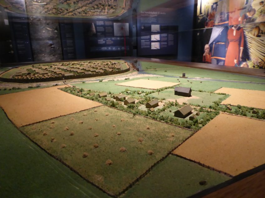
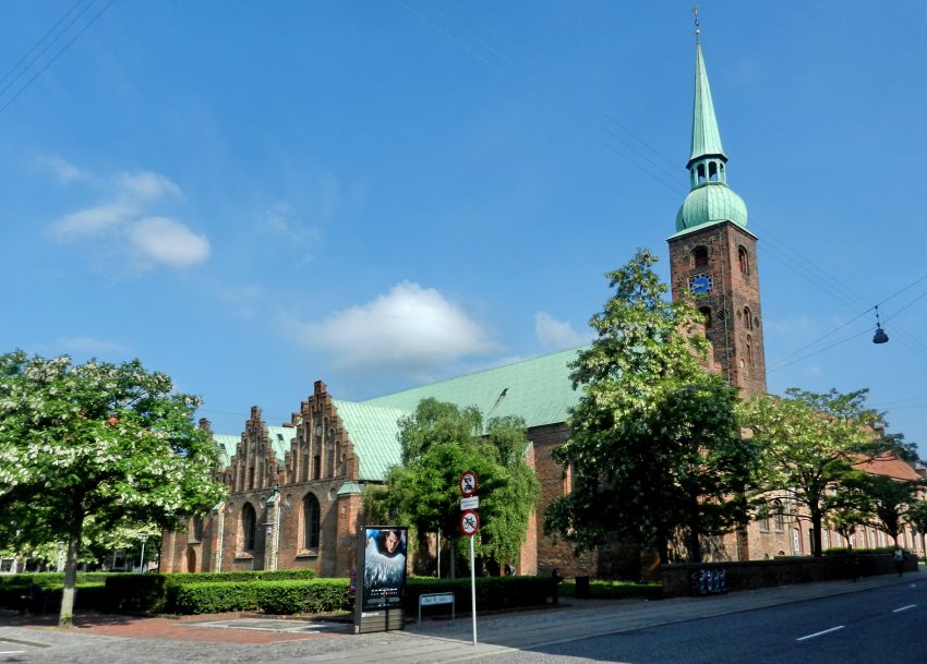
Aarhus is one of Denmark’s oldest urban centres, with roots reaching back to the Viking Age when it developed as a trading settlement on the east coast of Jutland. Over the medieval period, the city’s ecclesiastical and commercial importance was expressed in its main church: Aarhus Cathedral (St Clement’s), whose construction began in the late 12th century and gathered momentum under Bishop Peder Vognsen (ordained in 1191). The cathedral evolved over centuries into the large brick Gothic landmark seen today, anchoring the old town’s street pattern of squares, lanes, and waterfront connections.

By the late 19th and early 20th centuries, Aarhus expanded rapidly and commissioned major civic and cultural buildings that still define its architectural identity. Aarhus Theatre was designed by the architect Hack Kampmann and built from 1898 to 1900, signalling the city’s growing confidence as a regional capital. Kampmann also designed Marselisborg Palace, constructed between 1899 and 1902, which became a royal residence and remains a prominent symbol of Aarhus’s national status. In parallel, the city began institutionalising heritage: Den Gamle By (The Old Town) grew from preservation efforts led by Peter Holm and opened to the public in 1914 as an open-air museum of urban life.

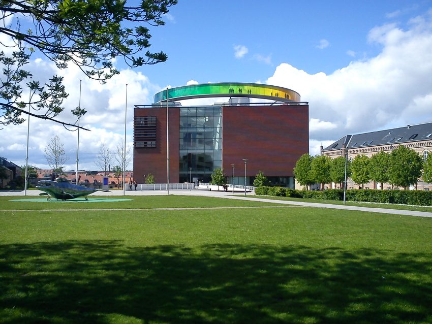
In the modern era, Aarhus continued to express its ambitions through landmark public architecture. Aarhus City Hall was inaugurated in 1941, designed by Arne Jacobsen and Erik Møller, and is widely regarded as a classic statement of Danish modernism in civic form. Cultural investment accelerated again in the 21st century: ARoS Aarhus Art Museum opened in a new purpose-built building in 2004 designed by Schmidt Hammer Lassen, and Moesgaard Museum’s striking exhibition building opened in 2014, designed by Henning Larsen Architects. Together, these projects reflect a city that balances deep historical layers with a deliberate, design-led approach to contemporary identity.

Your Self-Guided Walking Tour of Cartagena

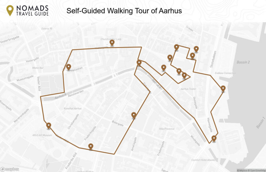
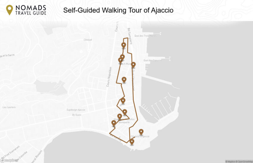
Discover Cartagena on foot with the interactive walking tour map guiding you between each pinned stop-its stone ramparts, grand plazas, colonial lanes, and colourful neighbourhoods. This walking tour traces the city's layered history-from the Walled City and its churches and fortifications to the lively streets of Getsemaní-blending Caribbean atmosphere with landmark sights, small courtyards, and sunset viewpoints, all within a city shaped by trade winds, maritime routes, and centuries of coastal defence.

1. National Museum of Underwater Archaeology
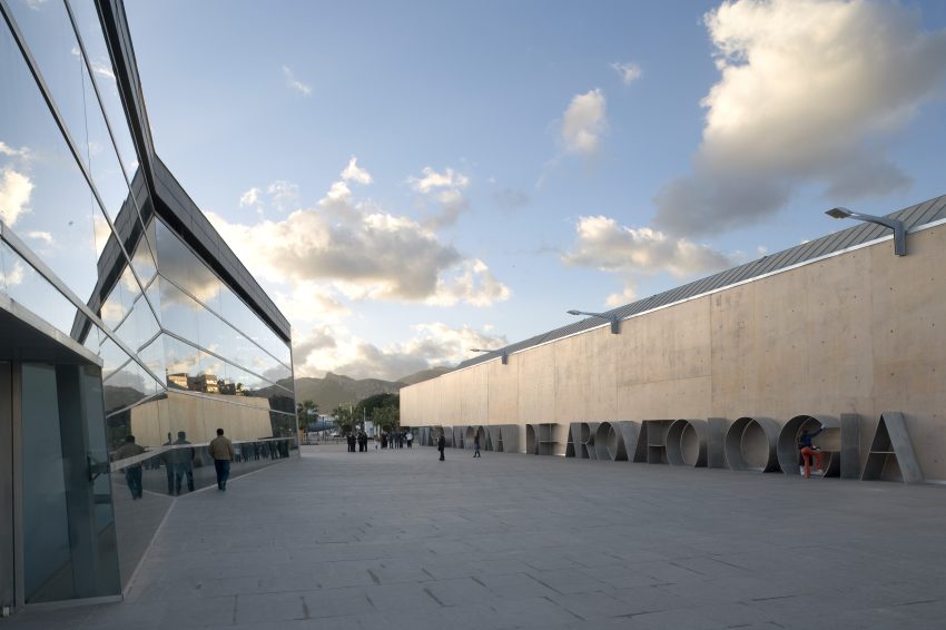
National Museum of Subaquatic Archaeology Cartagena
CC BY-SA 4.0 / Vazquezconsuegra

ARQVA exists because the sea has always been Cartagena’s archive. Trade, warfare, shipbuilding, and navigation have left an underwater record of wrecks and cargoes, and the museum was created to conserve and interpret those finds rather than letting them disappear into private collections or decay. It is also part of a broader Spanish effort to protect maritime heritage and explain why underwater archaeology is both scientifically demanding and culturally important.

Inside, you will see material that makes the ancient Mediterranean feel practical and physical: amphorae and trade goods, maritime equipment, and exhibits that explain routes, shipwreck contexts, and conservation. The museum is as much about method as treasure, so it spends time on how objects are recovered, stabilised, and studied, which helps you appreciate why these finds matter beyond their visual impact.

This is an excellent counterbalance to Cartagena’s open-air Roman ruins. If the day is hot or you want a more curated experience, ARQVA provides depth and air-conditioned pacing, and it connects the dots between the Roman city and the sea that fed it. It is especially rewarding if you have any interest in ships, trade networks, or the practical mechanics of archaeology.


Location: P.º Alfonso XII, 22, 30202 Cartagena, Murcia, Spain | Hours: (Summer) April 15 – October 15; Tuesday – Saturday: 10:00–21:00; Sunday & Public holidays: 10:00–15:00; Closed on Monday. (Winter) October 16 – April 14; Tuesday – Saturday: 10:00–20:00; Sunday & Public holidays: 10:00–15:00; Closed on Monday. | Price: Adults: €3.00 | Website


We recommend to rent a car in Spain through Discover Cars, they compare prices and review multiple car rental agencies. Book your rental car here.

2. Cartagena’s Panoramic Lift

Cartagena’s Panoramic Elevator overlooking Plaza de toros Cartagena
Cartagena’s Panoramic Elevator
CC BY-SA 2.0 / Puntin1969

Cartagena’s Panoramic Lift is a quick, comfortable way to reach the top of Concepción Hill, rising 45 metres from Gisbert Street to the area around Torres Park and Concepción Castle, where you get some of the best views over the city and bay. The base also acts as an entrance to the Civil War Museum-Refuge, set into the hillside shelters. In the glass cabin you can look out over key landmarks, including the Roman amphitheatre remains and the bullring above it, several 18th-century military structures, and the port area including Santa Lucía and the El Batel auditorium and congress centre. Opened in 2004, it has become a modern design landmark and a familiar reference point in Cartagena.


Location: Ascensor Panorámico, C. Gisbert, 10 30202 Cartagena, Murcia, Spain | Hours: (Summer) 1 July – 15 September: Monday – Sunday: 10:00–20:00. 15 March – 30 June; 16 September – 1 November: Tuesday – Sunday: 10:00–19:00. (Winter) 2 November – 14 March: Tuesday – Sunday: 10:00–17:30. 5 January; 24 December; 31 December: Daily: 10:00–14:00. | Price: €2 (Panoramic Elevator only); €6 (Castillo de la Concepción + Panoramic Elevator). | Website

Here is a complete selection of hotel options in Cartagena. Feel free to review each one and choose the stay that best suits your needs.

3. Castillo de la Concepción

Cartagena Castillo de la Concepcion 02 2017 05 27
CC BY-SA 4.0 / Rafa Esteve

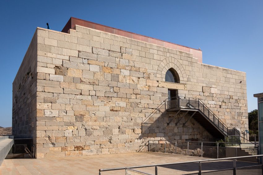
The Castillo de la Concepción crowns one of Cartagena’s key hills and is part of the city’s long tradition of fortifying high ground to control the port and approaches. The site has seen multiple defensive phases over the centuries, reflecting Cartagena’s value as a naval and commercial node. What stands today is associated with medieval fortification, later adapted as military needs evolved.

The appeal is a combination of masonry, views, and orientation. The castle area helps you understand Cartagena’s topography—why the city is shaped the way it is, how the harbour defines movement, and how the hills create natural lookout points. Even if the interior spaces are modest, the setting does most of the work.

For visitors, this is one of the best panoramic stops in town. Go up when the light is gentle and the heat is lower, and use it as a “map in real life” before you start ticking off Roman sites. It pairs well with a slow walk back down into the old centre, because you can connect what you saw from above with the streets, plazas, and monuments at ground level.


Location: Parque Torres, 30202 Cartagena, Murcia, Spain | Hours: (Summer) July 1 – September 15; Monday – Sunday: 10:00–20:00. (Winter) March 15 – June 30 & September 16 – November 1: Tuesday – Sunday: 10:00–19:00; November 2 – March 14: Tuesday – Sunday: 10:00–17:30. | Price: Adults: €5.00 | Website

Traveling to a country with a different currency? Avoid ATM transaction fees and pay in local currency with a Wise Card. Having used it for over 5 years, we've saved loads on fees!

4. Roman Theatre (Teatro Romano)

Roman Theatre Cartagena
CC BY-SA 4.0 / Holger Uwe Schmitt

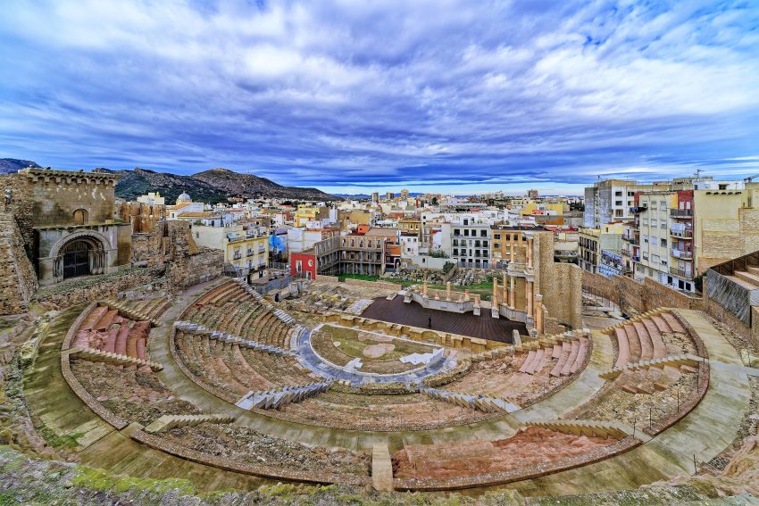
Cartagena’s Roman Theatre was built at the height of Roman power in the region, when public entertainment was both a cultural obsession and a political statement. Large theatres were not only places to watch drama; they were monuments to Roman identity, imperial patronage, and urban prestige. In Cartagena, the theatre’s placement and scale underline how important the city was in Roman Hispania.

What you see today is the result of careful excavation and restoration: the curved seating carved into the slope, the passages and stairways that managed crowds, and the stage area where performances took place with an architectural backdrop. Even without a performance, you can read the choreography of the space—the way people entered, how the seating tiers were organised, and how sound and sightlines were engineered.

Give yourself time to sit and look rather than simply snapping a photo and moving on. The best moments come when you imagine the theatre full and noisy, then notice how the city around it has changed. If you pair the theatre with the museum route, the visit feels complete: history, archaeology, and the emotional impact of standing inside a monument that was hidden for centuries.


Location: Palacio Pascual del Riquelme, Pl. Ayuntamiento, 9, 30202 Cartagena, Murcia, Spain | Hours: (Summer) May 1 – September 30; Tuesday – Saturday: 10:00–20:00. Sunday: 10:00–14:00. Closed on Monday. (Winter) October 1 – April 30; Tuesday – Saturday: 10:00–18:00. Sunday: 10:00–14:00. Closed on Monday. | Price: Adults: €7 | Website

5. Catedral de Santa María la Mayor
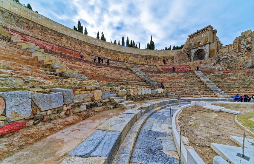
Catedral de Santa Maria La Mayor Cartagena
CC BY-SA 4.0 / Holger Uwe Schmitt

Cartagena’s old cathedral, Santa María la Mayor, is less a functioning cathedral today and more a powerful historic ruin that tells a complicated story of faith, urban change, and conflict. The site sits on an elevated, historically strategic part of the old city and reflects centuries of rebuilding and adaptation, including medieval phases that followed the Christian reconquest, and later alterations as Cartagena’s fortunes rose and fell.

What most visitors notice immediately is the sense of absence: roofless sections, exposed stone, and the quiet that comes with a place no longer used in the way it was intended. The cathedral suffered severe damage in the 20th century and was never fully restored, which means what you see now is a fragmentary shell—atmospheric, raw, and deeply evocative rather than polished.

Visiting works best if you treat it like a viewpoint into Cartagena’s layers. Look for surviving structural details and the way the ruins sit within the surrounding archaeology, then take time to read the landscape: you are close to major Roman sites, and the overlap between sacred space, civic space, and ancient entertainment districts becomes very tangible. It is also a good stop for quieter photos and a reflective pause between the busier museums.


Location: C. Segundilla, 7, 30202 Cartagena, Murcia, Spain | Hours: (Summer) May 1 – September 30; Tuesday – Saturday: 10:00–20:00. Sunday: 10:00–14:00. Closed on Monday. (Winter) October 1 – April 30; Tuesday – Saturday: 10:00–18:00. Sunday: 10:00–14:00. Closed on Monday. | Price: Adults: €7; Concessions: €6; Under 3: free. | Website

6. Museo del Teatro Romano
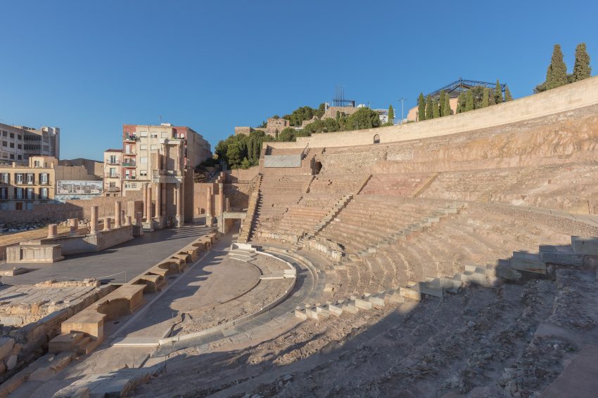
Roman Theater Museum of Cartagena
CC BY-SA 4.0 / Diego Delso

The Roman Theatre Museum is Cartagena’s modern gateway into one of Spain’s most significant Roman monuments, developed after the theatre’s relatively recent rediscovery in the late 20th century. The museum was conceived to explain not only the theatre itself but also how the ancient city evolved, was built over, forgotten, and then carefully revealed again through excavation and restoration.

The experience is designed as a narrative route rather than a simple gallery visit. You move through exhibits that introduce Roman Cartagena, theatrical life, and the archaeology, and then the building’s pathway guides you toward the theatre in a way that gradually increases anticipation. It is a well-judged mix of artefacts, interpretation, and architecture, with the finale being the first full view into the seating and stage area.

Plan to spend time here even if you think you “just want to see the theatre.” The museum gives the theatre context, and the route makes the reveal feel earned rather than accidental. It also works well in hot weather, because you get shade and structure before stepping out into the open stonework of the monument.


Location: Pl. Ayuntamiento, 9, 30201 Cartagena, Murcia, Spain | Hours: (Summer) May 1 – September 30; Tuesday – Saturday: 10:00–20:00. Sunday: 10:00–14:00. Closed on Monday. (Winter) October 1 – April 30; Tuesday – Saturday: 10:00–18:00. Sunday: 10:00–14:00. Closed on Monday. | Price: Adults: €7 | Website

7. Ayuntamiento Cartagena
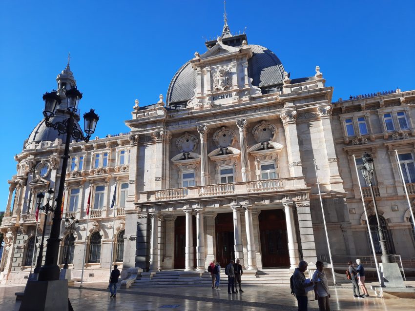
City Hall Cartagena
City Hall Cartagena
CC BY-SA 4.0 / Bybbisch94, Christian Gebhardt

Cartagena’s City Hall is one of the city’s most recognisable early-20th-century landmarks, built when the port and local industry were bringing new confidence and money into the city. Architecturally it sits firmly in the modernist tradition that spread around Spain in that era, and it was designed to project civic pride with lavish materials, curved façades, and a prominent corner presence facing the harbour.

Inside, the appeal is the building itself as much as the municipal function. Expect a grand staircase, decorative ironwork, stained glass, and polished surfaces that feel deliberately theatrical. Even from outside, the building repays a slow walk around it, because the details change with the angle: domes, balconies, sculpted ornament, and the way the light hits the pale stone.

As a visitor, this is a good “start point” for Cartagena’s historic centre: you can take photos with the port backdrop, then peel off into Calle Mayor and the Roman sites nearby. If it is open to the public when you arrive, a quick look inside helps you understand how Cartagena’s modern history sits on top of its ancient one—port city, military city, and administrative city all layered together in a few streets.


Location: C. San Miguel, 8, 30201 Cartagena, Murcia, Spain | Hours: Monday – Saturday: 10:00–13:30 & 16:30–18:30. Sunday: 10:30–13:30. | Price: Free (exterior viewing; interior access limited). | Website

8. Calle Mayor
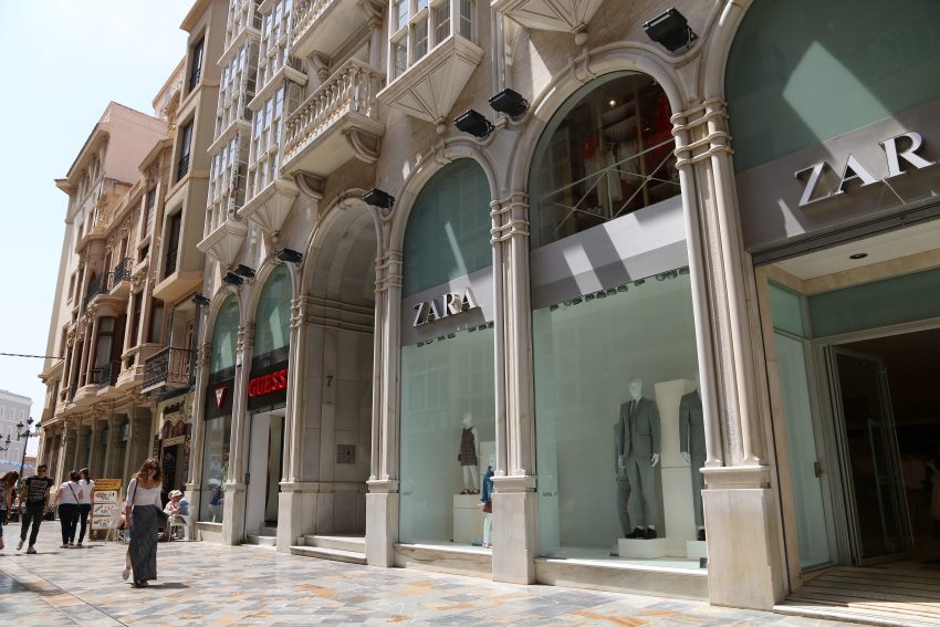
Calle Mayor Main Street Cartagena
CC BY-SA 4.0 / Øyvind Holmstad

Calle Mayor is Cartagena’s main historic shopping street and the city’s most enjoyable “between the sights” experience. Historically, this axis developed as the commercial and social spine of the centre, and its prominence reflects Cartagena’s identity as a port city that has always mixed sailors, merchants, officials, and locals in a relatively compact urban core.

What you see here is architecture as street theatre: elegant façades, balconies, and distinctive buildings that make the walk feel like a curated sequence, even though it is simply the city going about its business. Look up as much as you look into shop windows, because the details above street level often tell the story of Cartagena’s late-19th and early-20th-century confidence.

As a visitor, Calle Mayor is where you come to reset your pace. Use it for coffee, a shaded stroll, and people-watching, and to link major attractions without feeling like you are “commuting” between them. It is also one of the best areas for an evening walk, when the streetlights pick out architectural details and the city feels lively but not frantic.


Location: C. Mayor, 30201 Cartagena, Murcia, Spain | Hours: 24 Hours. | Price: Free

9. Columnata Romana
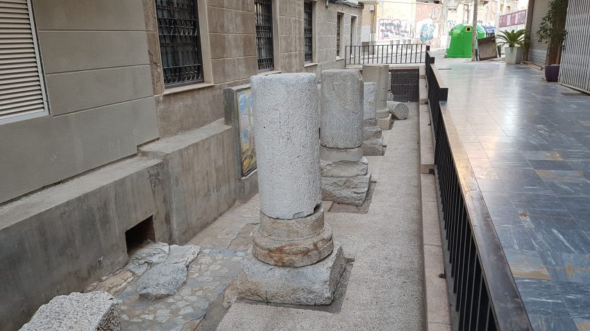
Roman Colonnade Cartagena
CC BY-SA 1.0 / P4K1T0

Cartagena’s Roman colonnade remains are a small but telling fragment of how Roman urban space was staged. Colonnades were not decorative extras; they were practical frameworks for shade, circulation, and status, creating structured public corridors that made a city feel ordered, wealthy, and unmistakably Roman. In a port city with heat and foot traffic, these covered or semi-covered routes mattered.

What you see today is typically a preserved stretch of columns and foundations that hints at a larger complex—possibly linked to a significant civic or commercial zone. Even when the surviving portion is limited, it helps you visualise the original scale: repetitive stone rhythm, long lines of perspective, and a deliberate sense of procession.

Treat this as a “connector” site in your Roman itinerary. It will not take long, but it adds texture to the bigger monuments by showing the mundane grandeur of Roman streetscape design. If you visit after the theatre or the Molinete complex, the colonnade reads as part of the same system: a city built for movement, display, and daily routines.


Location: C. Morería Baja, 4, 30201 Cartagena, Murcia, Spain | Hours: 24 Hours. | Price: Free

10. Museo Foro Romano Molinete
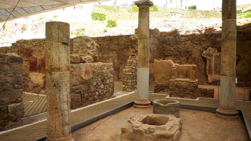
Roman Forum Molinete Museum Cartagena
CC BY-SA 3.0 / Nanosanchez

The Molinete archaeological complex opens a window onto the everyday and civic life of Roman Cartagena, centred on the remains of a neighbourhood that included public buildings and social spaces. The site’s importance lies in showing how the Roman city functioned beyond the headline monuments: not only theatres and grand façades, but also the places where people bathed, worked, ate, met friends, and participated in urban routines.

What you can see includes excavated streets and building footprints, with highlights often involving bathing complexes, architectural fragments, and spaces linked to the forum district. Because it is a hillside site, the walk naturally creates changing vantage points, and you get a good sense of how Romans used terrain to organise their city and make impressive public architecture feel even more dominant.

To enjoy it, take it slowly and imagine movement through the district: where noise would have gathered, where you would have queued, where conversation happened. It also pairs well with the theatre and the castle hill, because together they show three dimensions of Roman and post-Roman Cartagena: entertainment, civic life, and strategic geography.


Location: C. Adarve, 6, 30201 Cartagena, Murcia, Spain | Hours: (Summer) July 1 – September 15; Monday – Sunday: 10:00–20:00. (Winter) March 15 – June 30 & September 16 – November 1; Tuesday – Sunday: 10:00–19:00. (Winter) November 2 – March 14; Tuesday – Sunday: 10:00–17:30. | Price: Adults: €7; Reduced: €6; Under 3: free. | Website

11. Augusteum

Altar Salud Augusteum
CC BY-SA 2.0 / VIATOR IMPERI

The Augusteum is associated with the Roman imperial cult, reflecting how politics and religion were fused under the early emperors. Dedicating spaces to the emperor’s official veneration was a way for cities to demonstrate loyalty and align themselves with imperial power. In provincial cities like Cartagena, such buildings signalled status and connection to Rome’s centre.

Visually, the site tends to be about architectural remains rather than a complete building: foundations, walls, and structural elements that suggest formal rooms and a carefully planned public interior. Interpretation on-site usually does the heavy lifting, helping you translate surviving stone into a sense of ceremonies, civic gatherings, and the symbolic choreography that surrounded imperial worship.

For visitors, the Augusteum is best appreciated as an idea made physical: a reminder that Roman rule was reinforced not only by soldiers and law, but by ritual and public space. It is a worthwhile stop if you want your Roman walk to include more than engineering and entertainment—this is where the story shifts toward identity, power, and the messaging of empire.


Location: C. Caballero, 6, 30202 Cartagena, Murcia, Spain | Hours: (High season) Tuesday – Sunday: 10:00–15:00. (July 1 – September 15). | Price: Adults: €4 | Website

12. Casa de la Fortuna
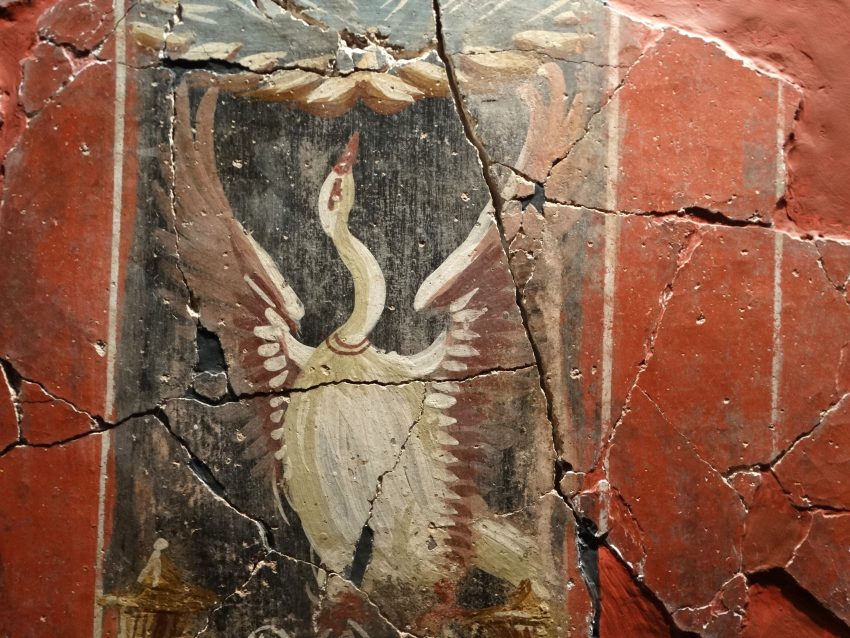
Roman Era Painting in Excavated House Casa Fortuna Cartagena Spain 14442749491
CC BY-SA 2.0 / Adam Jones

Casa de la Fortuna is one of the most accessible ways to imagine ordinary Roman domestic life in Cartagena. Roman houses were not purely private retreats; they were social tools where status was displayed, clients were received, and family identity was performed. The survival of a domestic site like this adds balance to a city otherwise dominated by public monuments.

What you can see typically includes the layout of rooms around internal spaces and, importantly, decorative elements that survive better than you might expect: fragments of wall painting, mosaics, and household features that show how colour and pattern shaped daily experience. Even partial remains can be surprisingly intimate because they sit at human scale—thresholds, corners, and surfaces designed to be lived with.

Visit with patience and imagination. Instead of rushing for a single photo, trace the routes someone would have walked from entrance to reception areas and deeper private zones. It pairs particularly well with the Molinete complex: one shows the neighbourhood and public life, the other shows how a household fitted into that urban fabric.


Location: Pl. de Risueño, 14, 30202 Cartagena, Murcia, Spain | Hours: Tuesday – Sunday: 10:00–15:00. Closed on Monday. Closed on January 1, January 6, December 25. Last entry: 15 minutes before closing. | Price: Adults: €4.00 | Website

13. Punic Wall of Cartagena
Muralla Punica de Cartagena
CC BY-SA 4.0 / María Rodriguez

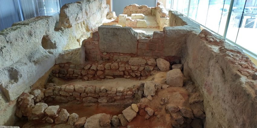
The Punic Wall is one of Cartagena’s most important pre-Roman survivals, tied to the era when the city’s fortunes were shaped by Carthaginian power in the western Mediterranean. Cartagena’s strategic harbour made it a prized stronghold, and fortifications like this were part of securing a base for control, supply, and defence in a contested region.

What you see is typically a preserved section of wall structure that emphasises mass and purpose rather than ornament. The value is archaeological and historical: you are looking at the bones of a defensive system from a period that often gets overshadowed by the later Roman layers. With good interpretation, the wall becomes a clear marker of “before Rome,” anchoring Cartagena’s story in a wider Mediterranean struggle.

As a visitor, this is an excellent place to start your ancient timeline. Seeing the Punic layer first makes the later Roman monuments feel like a deliberate transformation rather than the whole story. It is also a useful reminder that Cartagena is not a single-period destination; it is a city repeatedly remade by whoever controlled the sea routes, the harbour, and the hills.


Location: C. San Diego, 25, 30202 Cartagena, Murcia, Spain | Hours: (Summer) July 1 – September 15; Monday – Sunday: 10:00–20:00. (Mid season) March 15 – June 30 & September 16 – November 1; Tuesday – Sunday: 10:00–19:00. (Low season) November 2 – March 14; Tuesday – Sunday: 10:00–17:30. Closed on Monday. | Price: Adults: €4.00 | Website
Powered by GetYourGuide
Moira & Andy
Moira & Andy

Hey! We're Moira & Andy. From hiking the Camino to trips around Europe in Bert our campervan — we've been traveling together since retirement in 2020!

Read our full story here

This website uses affiliate links which earn a small commission at no additional cost to you.

Walking Tour Summary

Distance: 3.5 km
Sites: 13

Walking Tour Map
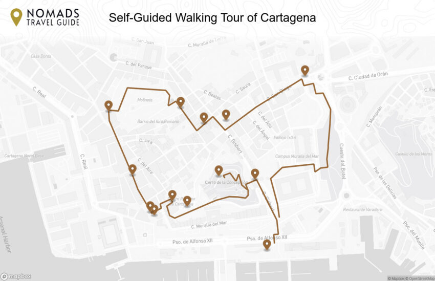
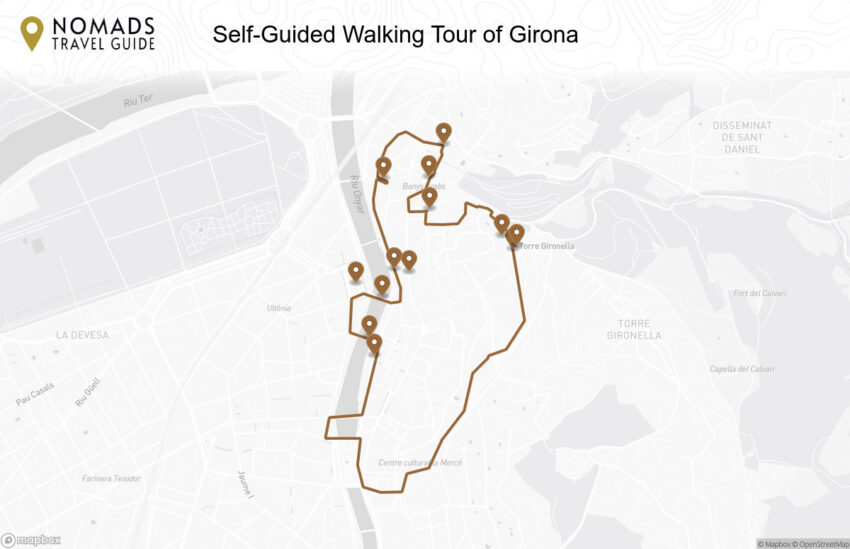
Map of the Self-Guided Walking Tour of Cartagena walking route with 13 stops in Cartagena.
Preview map of the Self-Guided Walking Tour of Cartagena route in Cartagena, showing 13 stops. Use the interactive map to zoom and tap markers.

More from this area

Self-Guided Walking Tour of Girona (2026)

Self-Guided Walking Tour of Girona

This website uses affiliate links which earn a small commission at no additional cost to you.

Girona is made for walking: a compact historic core, a dramatic hilltop Old Town, and a riverfront that keeps pulling you back to the views. In a single day on foot you can move from Roman-era foundations to medieval lanes, cross bridges lined with colorful facades, and climb to panoramic viewpoints that explain the city's geography at a glance. A self-guided route works especially well here because you can slow down in the most atmospheric streets and speed up where the terrain is steeper.

This walking tour is structured to feel logical and scenic, not like a checklist. You will thread through the Barri Vell, take in the cathedral and its grand stairway, and build in time for the walls so you can enjoy Girona's best outlooks without backtracking. Along the way you will naturally cover many of the best things to see in Girona, including the riverside viewpoints, the Jewish Quarter's quiet passageways, and the city's most memorable medieval corners.

Expect a mix of landmark moments and smaller details: carved stone doorways, shaded courtyards, and sudden glimpses of the Onyar houses between arches. If you start early you will have the lanes largely to yourself, while a late-afternoon start can be timed for golden light along the river and a relaxed finish with tapas. Either way, Girona rewards curiosity, and this walk is designed to help you experience the city's atmosphere as much as its headline sights.

How to Get to Girona

By Air: The most convenient airport for Girona is Girona-Costa Brava Airport (GRO), which is closest to the city and often served by seasonal and low-cost routes; from the terminal you can typically reach central Girona by bus or taxi, usually within about 25-35 minutes depending on traffic and schedules. Barcelona El Prat (BCN) is the main international gateway for Catalonia and can be a better choice for long-haul or year-round flight options, with onward travel to Girona by train or car generally taking around 1-1.5 hours. If you are building a wider Catalonia itinerary, flying into Barcelona and continuing by rail is often the simplest all-round plan. For the best deals and a seamless booking experience, check out these flights to Girona on Booking.com.

By Train: Girona is exceptionally well connected by rail, and for many travelers it is the easiest and fastest way to arrive, particularly from Barcelona. High-speed services link Barcelona to Girona in well under an hour, and longer-distance services can connect onward toward Figueres, the French border, and other major cities, making Girona a practical stop on a broader Spain-France route. Girona's main station is walkable to parts of the centre and a short taxi/bus ride to the Barri Vell, which is useful if you are staying inside the historic core where streets can be steep or cobbled. Train schedules and bookings can be found on Omio.

By Car: Driving to Girona is straightforward via the AP-7 motorway corridor and surrounding regional roads, and it can be especially useful if you plan day trips into the Costa Brava, the Garrotxa volcanic zone, or small medieval villages where public transport is limited. The main consideration is parking: the Barri Vell is not designed for through-traffic, so it is usually best to use a hotel with parking or aim for public car parks on the edge of the historic centre and walk in. If your main goal is the walking tour, you will likely want to park once and explore on foot, using the car mainly for arrival/departure and excursions. If you are looking to rent a car in Spain I recommend having a look at Discover Cars, first, as they compare prices and review multiple car rental agencies for you.

By Bus: Buses provide a budget-friendly alternative, with regular services linking Girona to Barcelona and other towns across Catalonia, and they can be useful when train times are inconvenient. The bus station is adjacent to or very close to the main rail station, so onward connections are simple, and you can usually reach the Old Town quickly by local bus or taxi. If you are traveling with lighter luggage, arriving by bus is generally smooth, though rail is often faster for the core Barcelona-Girona journey.

Where to Stay in Girona

To make the most of visiting Girona and this walking tour, consider staying overnight in the centre so you can start early, take breaks easily, and enjoy the Old Town once the day-trippers thin out. For the most immersive experience, base yourself in Barri Vell (the Old Town), where the lanes, cathedral steps, and river viewpoints are right outside your door, and the evenings feel especially atmospheric after sunset. Two strong options in this area are Hotel Històric for an intimate, characterful stay close to the cathedral, and Hotel Museu Llegendes de Girona for a boutique base at the edge of the medieval core with quick access to key sights.

If you want the same walkability with a slightly more open, café-and-plaza feel, look at Mercadal and the streets along the river opposite the Old Town, which make it easy to dip into Barri Vell while keeping you close to dining and the classic bridge views. Hotel Nord 1901 is a polished, central choice that puts you a short stroll from both the river and the Old Town lanes, while Hotel Ciutat de Girona is similarly well-placed for a practical, walking-first stay with quick access to the tour’s early stops.

For the most convenient logistics (especially if you are arriving by train, want straightforward taxi access, or prefer wider streets and easier parking), Eixample is a strong base that still keeps the Old Town within an easy walk. Hotel Gran Ultonia works well if you want a comfortable, full-service option close to the centre, while Hotel Carlemany Girona is a reliable pick near the station area, ideal for an efficient start and finish to the walking route.

Your Self-Guided Walking Tour of Girona

Discover Girona on foot with our interactive walking tour map guiding you between each pinned stop. With its medieval walls, riverside bridges, narrow Jewish Quarter lanes, and elegant civic squares this walking tour traces the city's layered past-from the Cathedral and the Roman and medieval fortifications to the atmospheric streets of the Barri Vell-blending Catalan character with landmark viewpoints, hidden courtyards, and skyline panoramas, all within a compact city shaped by frontier history, river trade, and centuries of strategic defence.

1. Plaza de la Independencia

Plaça de la Independència
CC BY-SA 4.0 / Enfo

Plaça de la Independència is Girona’s best-known 19th-century civic square, defined by a neat rectangular plan and continuous neoclassical arcades that give it a deliberately “European” sense of order. It sits in the Mercadal district and works as a natural gathering space, with terraces that fill quickly in the late afternoon and evening.

The square’s name and symbolism link directly to Girona’s resistance during the Peninsular War. At its centre stands the Monument to the Defenders of Girona, inaugurated in 1894 to commemorate the city’s 1809 defenders, created by sculptor Antoni Parera.

What to see is the full architectural “room” effect: stand at one corner to take in the arcades as a continuous frame, then move toward the monument to read the square’s commemorative purpose. The arcades also create excellent sightlines for photography, especially when the light falls under the arches and the cafés are active.


Location: Pl. de la Independència, 17001 Girona, Spain | Hours: 24 Hours. | Price: Free. | Website

We recommend to rent a car in Spain through Discover Cars, they compare prices and review multiple car rental agencies. Book your rental car here.

2. Pont de les Peixateries Velles

Pont de les Peixateries Velles

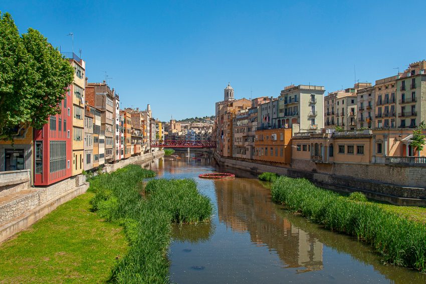
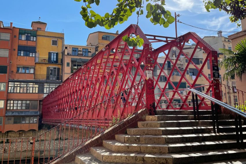
Pont de les Peixateries Velles is Girona’s iconic red iron bridge over the Onyar, often referred to as the Eiffel Bridge because it was built in 1877 by Gustave Eiffel’s workshop. Its latticework and industrial precision stand out against the older stone and stucco of the old town, making it one of the city’s most recognizable pieces of infrastructure.

Historically, the bridge reflects Girona’s late 19th-century modernization and the need to connect the historic centre with the Mercadal side of the city across the river. It has been strengthened and restored over time, which is typical for working metal structures that remain in constant use.

What to see is the view up and down the Onyar: pause at mid-span and look toward the coloured river houses, with church towers and the cathedral rising behind. The bridge is also at its best when you treat it as a viewpoint rather than a crossing, using the iron framing to “compose” the river scene.


Location: Pont de les Peixateries Velles, Girona, Spain | Hours: 24 Hours. | Price: Free.

Here is a complete selection of hotel options in Girona. Feel free to review each one and choose the stay that best suits your needs.

3. Rambla de la Libertad

Rambla de la Llibertat
CC BY-SA 4.0 / Joe Mabel

Rambla de la Llibertat is Girona’s classic promenade, a broad street lined with arcades, shops, and cafés that has long functioned as a commercial spine of the old city. It is one of the most atmospheric places to slow down and observe how Girona’s daily life moves through a historic setting.

The Rambla’s present-day layout dates to 1885, when municipal works widened and regularized the space to create a more continuous avenue, while preserving older buildings and arcaded elements. That blend of older fabric with 19th-century re-planning is part of what gives the street its distinctive rhythm and proportions.

What to see is the architecture at ground level and above: the shade and sequence of arches, the façades that hint at older Girona behind the storefronts, and the small landmarks along the way such as Casa Norat’s modernist frontage. It also provides a straightforward link to the Onyar bridges, including the red iron span nearby.


Location: Rambla de la Llibertat, 17004 Girona, Spain | Hours: 24 Hours. | Price: Free. | Website

Traveling to a country with a different currency? Avoid ATM transaction fees and pay in local currency with a Wise Card. Having used it for over 5 years, we've saved loads on fees!

4. Onyar River Colored Houses

Cases de l’Onyar
Cases de l’Onyar

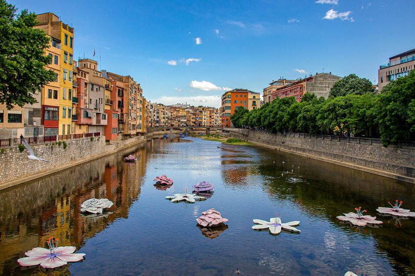
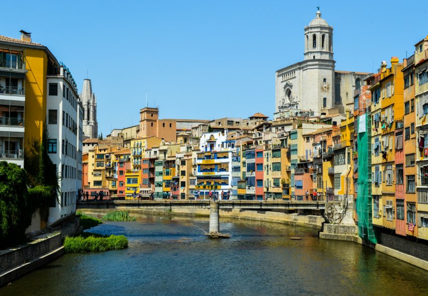
The coloured houses of the Onyar are Girona’s signature postcard image: tall, tightly packed façades that appear to hang over the river, with a skyline of spires and domes rising behind. They were not designed as a scenic set-piece; they are the result of dense historic building along the river edge, where space was limited and the city grew within constraints.

Their appearance today is partly the product of restoration. The riverfront façades deteriorated during the 20th century, and major rehabilitation and repainting programs, including work in the early 1980s, helped re-establish the coherent, colourful riverside identity people now associate with Girona.

What to see is the full river composition: find a bridge viewpoint where the façades, reflections, and background landmarks align, then look closer at how irregular the buildings are in height, alignment, and window patterns. That visual “messiness” is the history—incremental building and rebuilding over centuries rather than a single planned development.


Location: Rambla de la Llibertat, 23, 17004 Girona, Spain | Hours: 24 Hours. | Price: Free. | Website

5. Jewish History Museum

Museum of Jewish History, Girona
CC BY-SA 3.0 / Kippelboy

The Jewish History Museum is Girona’s key institution for understanding the city’s medieval Jewish quarter, known locally as the Call. Its core purpose is to preserve and interpret the history of Jewish communities in Catalonia, with an emphasis on the medieval period and Girona’s local evidence, objects, and memory.

The museum’s setting matters because the Call is one of Girona’s most evocative historic environments: narrow lanes, tight plots, and a street pattern that retains an older logic. The museum helps you translate that atmosphere into a historical narrative, clarifying what community life looked like and how it fit into the wider city.

What to see is the way the museum uses Girona-specific material to ground larger themes. Focus on objects and explanations tied directly to local Jewish life and the Call itself, then step back outside with a sharper eye for how the urban form preserves traces of that past.


Location: Museu d'Història dels Jueus Carrer de la Força, 8 17004 Girona Spain | Hours: (Summer) July – August: Tuesday – Saturday: 10:00–19:00; Monday, Sunday & public holidays: 10:00–14:00. (Winter) September – June: Tuesday – Saturday: 10:00–18:00; Monday, Sunday & public holidays: 10:00–14:00. Open on 24 December & 31 December: 10:00–14:00. Closed on 01 January, 06 January, 25 December & 26 December. | Price: €4 standard; €2 reduced; free entry for under 14s and selected passes/groups. | Website

6. Casa Masó

Fundació Rafael Masó / Casa Masó

Casa Masó is a house museum on the Onyar and the birthplace of architect Rafael Masó, a key figure in Catalan Noucentisme. It is notable not only for its design but also because it is the only one of the famous Onyar river houses open to the public, making it the most direct way to experience Girona’s riverfront architecture from the inside.

The building reflects both family history and architectural intent. Casa Masó is the result of joining multiple older dwellings, with Rafael Masó’s renovations in the early 20th century unifying the interior and refining the public-facing identity of the house; it is often presented as a symbol of Noucentisme’s disciplined elegance and civic-minded modernity.

What to see is the preserved interior character and the river outlook. Look for period furniture and decorative choices that communicate Noucentista taste, then pay attention to how the house frames the Onyar and the city beyond—those views explain why this stretch of Girona feels so visually distinctive from the bridges.


Location: Carrer de les Ballesteries, 29, 17004 Girona, Spain | Hours: Tuesday – Saturday: Guided visits at agreed times (advance reservation required). Closed on Sunday, Monday. Closed on local and national bank holidays. | Price: Adults: €10; Carnet Jove: €7; Reduced (50%): €5; Under 16: free (with an adult). | Website

7. Basilica de Sant Feliu

Basílica de Sant Feliu
CC BY-SA 3.0 / CARLETES

The Basilica of Sant Feliu is one of Girona’s most important churches and a defining element of the Barri Vell skyline. It has deep roots in the city’s early Christian history and is often described as Girona’s first cathedral before the cathedral complex took over that role, which immediately elevates its significance beyond “another old church.”

Architecturally, Sant Feliu is most associated with its Gothic character and its remarkably slender bell tower, developed across the 14th to 16th centuries. The building also preserves important early stonework and funerary material, including notable sarcophagi that underscore how long the site has held civic and religious importance.

What to see is the tower’s profile from outside and the interior’s key artworks and monuments. Give attention to the sarcophagi and the overall spatial feel, then step back into the surrounding streets to appreciate how Sant Feliu and the cathedral together create Girona’s most recognizable historic skyline.


Location: Carrer Trasfigueres, 4, 17004 Girona, Spain | Hours: Monday – Saturday: 10:00–18:00. Sunday: 13:00–18:00. | Price: Cathedral + Basílica de Sant Feliu: Adults: €7.50; Reduced: €5; Youth: €1.50 (includes audio guide). Free for children under 7 and Girona natives/residents. | Website

8. Museo de Arqueologia de Cataluna

Archaeology Museum of Catalonia in Girona
CC BY-SA 2.5 / Chosovi

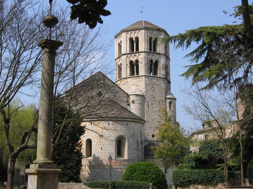
The Museu d’Arqueologia de Catalunya in Girona is housed in the former Benedictine monastery of Sant Pere de Galligants, one of the city’s most important Romanesque complexes. The monastery’s reuse as a museum site has a long lineage: it was already being used for museum purposes in the 19th century, and today it serves as the Girona branch of the Museum of Archaeology of Catalonia.

The museum’s strength is regional continuity. Its collections assemble archaeological material from the Girona area spanning prehistory through the Middle Ages, which helps you understand Girona not as a single “medieval moment” but as a settlement shaped by repeated phases of occupation, belief, trade, and defense.

What to see is both the container and the content: the Romanesque church and cloister architecture of Sant Pere de Galligants, plus selected collection highlights that connect most directly to Girona’s local timeline. Even if you are not a specialist, the setting alone communicates how older sacred spaces can become guardians of long-term civic memory.


Location: Carrer de Santa Llúcia, 8, 17007 Girona, Spain | Hours: (Summer) May 1 – September 30; Tuesday – Saturday: 10:00–19:00. Sunday: 10:00–14:00. Closed on Monday. (Winter) October 1 – April 30; Tuesday – Saturday: 10:00–18:00. Sunday: 10:00–14:00. Closed on Monday. | Price: Adults: €6; Reduced: €4. | Website

9. Banos Arabes

Arab Baths
Arab Baths
CC BY-SA 3.0 / Tim Adams

The Arab Baths are a 12th-century bath complex that survives as one of Girona’s most distinctive medieval sites, despite the “Arab” label reflecting architectural influence rather than a simple cultural origin story. The first mention of public baths on this site dates to 1194, placing it firmly within Girona’s medieval urban life.

Their history includes damage and rebuilding. The complex was partially destroyed during the 1285 siege and subsequently rebuilt in the 1290s under royal commission, which is a useful reminder that public facilities were valuable enough to restore, not discard, even during turbulent periods.

What to see is the sequence of rooms and the logic of medieval bathing: changing spaces, warm and hot areas, and the architectural details that make the complex memorable, especially the vaulted forms and the way light enters interior spaces. Move slowly and read the structure as a piece of everyday history, not merely a “pretty ruin.”


Location: Carrer del Rei Ferran el Catòlic, s/n, 17004 Girona, Spain | Hours: Monday – Saturday: 10:00–18:00. Sunday: 10:00–14:00. Closed on January 1, January 6, December 24, December 25, December 26. | Price: Adults: €3; Over 65: €2; Reduced: €1; Under 8: free. | Website

10. Catedral de Girona

Girona Cathedral
Girona Cathedral
CC BY-SA 4.0 / Михаил Бернгардт

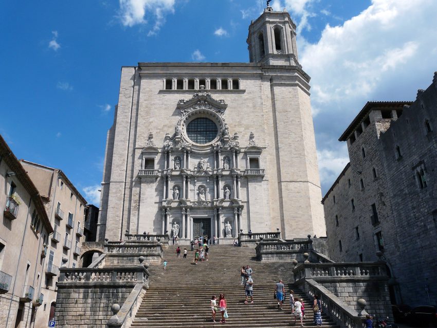
Girona Cathedral, dedicated to Saint Mary, is the city’s dominant monument, set above the old town with a powerful sense of elevation and ceremony. Construction began in the Romanesque era and continued through Gothic and later phases, producing a complex that reflects centuries of ambition rather than a single stylistic moment.

One architectural fact defines the interior experience: the cathedral’s nave is exceptionally wide and is widely cited as the widest Gothic nave in the world, which changes how the space feels compared with more typical multi-aisle Gothic churches. Remnants of the earlier Romanesque cathedral survive, notably in elements such as the cloister and bell tower, anchoring the later grandeur in older fabric.

What to see includes the exterior setting and the interior scale. Spend time on the approach and the way the cathedral commands surrounding streets, then step inside to register the breadth of the nave and the quieter, older atmosphere of the cloister areas if accessible. The contrast between the monumental public face and the more intimate historic elements is the cathedral’s real payoff


Location: Pl. de la Catedral, s/n, 17004 Girona, Spain | Hours: (Summer) June 15 – September 15; Monday – Friday: 10:00–19:00; Saturday: 10:00–20:00; Sunday: 12:00–19:00. (Winter) November 1 – March 14; Monday – Saturday: 10:00–17:00; Sunday: 12:00–17:00. | Price: Adults: €7.50; Pensioners & students: €5.00; Under 16: €1.50; Under 8: free. | Website

11. Passeig De La Muralla

Muralles de Girona
Muralles de Girona

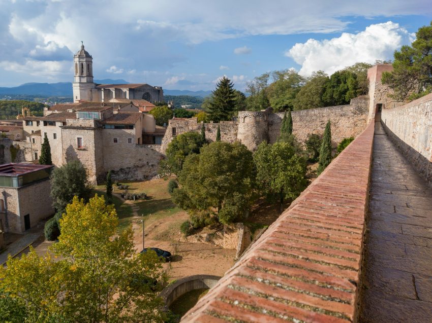
Passeig de la Muralla is Girona’s walkable city wall system, where Roman foundations and medieval expansions converge into one of the clearest “city-from-above” experiences in Catalonia. It is not a single continuous wall from one era, but a layered fortification history that shows how Girona defended itself, expanded, and later opened parts of its perimeter to civic use.

Parts of the walls date to the medieval period, including major 14th-century works, while other sections were lost during later urban expansion, particularly as the city grew beyond its historic boundary. That mixture of surviving towers, rebuilt segments, and missing stretches is itself historically meaningful: it reflects the constant trade-off between defense, growth, and modernization.

What to see is the sequence of viewpoints and towers. Aim to stop at several high points rather than rushing the length, because the views change: cathedral and old town rooflines, the Onyar corridor, and the Jewish quarter geometry become easier to read from different angles. It is one of Girona’s most effective places to understand the city’s shape in a single, coherent glance.


Location: Carrer dels Alemanys, 20, 17004 Girona, Spain | Hours: (September – May) Daily: 08:00–21:00. (June – August) Daily: 08:00–23:00. | Price: Free. | Website

12. Jardins dels Alemanys

Jardins dels Alemanys, Girona
CC BY-SA 4.0 / Enfo

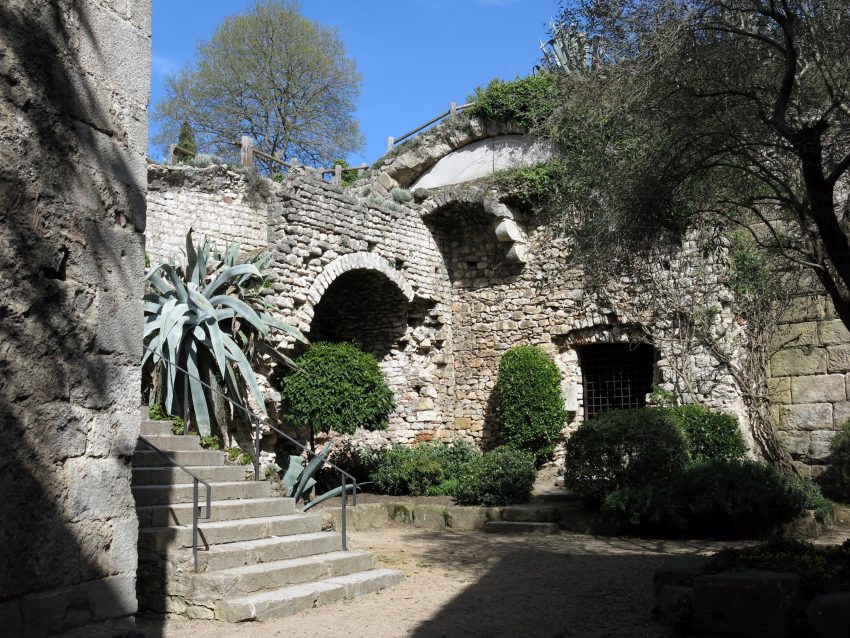
Jardins dels Alemanys is one of Girona’s quiet, leafy breaks from the city’s stone-and-steps intensity, tucked along the old defensive line near the cathedral and the city walls. The name nods to the area’s long military associations: this hillside and its approaches were shaped by centuries of fortification and conflict, including the periods when Girona’s defenses were reinforced, attacked, and rebuilt as the city guarded a strategic route between the Iberian interior and the French border. Today, the mood is entirely different—calm, shaded, and slightly elevated—so you feel you’re standing inside the city’s history while getting a pause from it.

What makes the gardens memorable is their setting rather than formal landscaping. You’ll find pines and Mediterranean greenery, stone paths and small terraces, and a sense of being suspended between the medieval core and the outer slopes. The gardens connect naturally with Girona’s iconic stone architecture: from here you’re close to the cathedral precinct, the old wall walk, and the steep lanes that define the historic quarter, yet the trees soften the sound and heat. It’s an ideal place to notice details you might miss when you’re rushing—old masonry, changing rooflines, and glimpses of towers through branches.

For things to do, treat Jardins dels Alemanys as a reset point on a walking day. Come mid-morning for softer light or late afternoon when the heat drops, sit for a while, and then continue along the nearby stretches of the city walls for some of Girona’s best viewpoints. Photographers will like the mix of shade and stone textures, and anyone exploring on foot will appreciate how the gardens break up the climb between major sights. If you’re visiting in peak season, it’s also a smart stop to step out of the busiest lanes, drink some water, and re-enter the Old Town feeling refreshed rather than rushed.


Location: Jardins dels Alemanys, Carrer de la Muralla, Girona, Spain | Hours: (Summer) 1 June – 31 August: Daily: 08:00–23:00. (Winter) 1 September – 31 May: Daily: 08:00–21:00. | Price: Free | Website

13. Torre Gironella

Torre Gironella
Torre Gironella
CC BY-SA 4.0 / Enfo

Torre Gironella sits on the highest part of Girona’s old fortified precinct, a place where the city’s defensive story is easiest to read in the landscape. The tower and its surrounding fortifications trace back to the medieval period, when Girona’s upper hill was the natural point to command approaches from the north and protect the cathedral-side ridge. Over centuries of conflict in this border region, the stronghold was reinforced and altered, most dramatically during the early 19th-century Peninsular War, when Girona endured devastating sieges and large parts of the defensive complex were damaged or left in ruins. What remains today feels like a sober, atmospheric reminder that Girona’s beauty has always been tied to its strategic position.

Visiting Torre Gironella is less about walking through an intact “castle” and more about experiencing a layered ruin with exceptional views. You’ll see thick stone walls, fragments of towers and ramparts, and a sense of how the fortification once stitched together the upper edge of the Old Town. The setting is dramatic: stonework emerging from greenery, sudden lookouts, and the city dropping away below you. Even if you’re not focused on military history, the place makes the geography of Girona instantly clear—why the city grew where it did, and how the hilltop controlled movement along the valley routes.

For things to do, come here as part of a slow circuit of the old walls and upper quarter rather than a standalone stop. The best experience is to wander, pause at viewpoints, and imagine the defensive line continuing along the ridge. It’s a strong spot for panoramic photos over the rooftops and toward the surrounding countryside, and it pairs naturally with nearby highlights like the wall walk and the cathedral area. If you time it for late afternoon, the light tends to be kinder on the stone and the city below, and you’ll get a quieter, more reflective Girona than the busy lanes down in the core.


Location: Carrer de la Muralla, 17004 Girona, Spain | Hours: (September – May) Daily: 08:00–21:00. (June – August) Daily: 08:00–23:00. | Price: Free. | Website
Powered by GetYourGuide
Moira & Andy
Moira & Andy

Hey! We're Moira & Andy. From hiking the Camino to trips around Europe in Bert our campervan — we've been traveling together since retirement in 2020!

Read our full story here

This website uses affiliate links which earn a small commission at no additional cost to you.

Walking Tour Summary

Distance: 3 km
Sites: 13

Walking Tour Map
Map of the Self-Guided Walking Tour of Girona walking route with 13 stops in Girona.
Preview map of the Self-Guided Walking Tour of Girona route in Girona, showing 13 stops. Use the interactive map to zoom and tap markers.

More from this area

Self-Guided Walking Tour of Cádiz (2026)

Self-Guided Walking Tour of Cádiz

This website uses affiliate links which earn a small commission at no additional cost to you.

Cádiz is one of Spain's most rewarding cities to explore on foot: compact, atmospheric, and wrapped on nearly all sides by the Atlantic. In a single stroll you can move from grand landmark squares to narrow lanes lined with pastel facades, then emerge onto breezy seafront walks with wide-open views. A self-guided route lets you set your own pace-lingering for a coffee in the shade, ducking into a church or market as you pass, and timing your coastal stretches for the best light.

This walking tour is designed to feel effortless, even if it's your first time in Cádiz. You'll weave through the Old Town's layers of history-Phoenician origins, medieval fortifications, and the golden age of Atlantic trade-without needing to constantly check your phone or rush between “must-dos.” Along the way, you'll naturally hit some of the best things to see in Cádiz, from cathedral panoramas and lively plazas to waterfront bastions and local food stops.

Expect a route that balances headline sights with the small moments that make Cádiz memorable: the sound of street life carrying through tight alleys, the salt air on the promenades, and the easy rhythm of tapas breaks. If you start in the morning, you'll catch the city as it wakes up; if you begin later, you can build toward golden hour on the seafront. Either way, this walk gives you a clear, satisfying snapshot of Cádiz-without feeling like you're ticking boxes.

How to Get to Cádiz

By Air: Cádiz does not have its own commercial airport, so most travelers fly into Jerez Airport (XRY) for the quickest transfer, or Seville Airport (SVQ) for a wider choice of routes; Málaga (AGP) can also work if you are combining Cádiz with a longer Andalusia itinerary. From Jerez, you can typically reach Cádiz by train or road in around 30-45 minutes depending on connections; from Seville, allow roughly 1.5-2 hours by train or car. For international arrivals, it is often simplest to book a flight into Seville and continue by rail, but if timing matters, Jerez is usually the most direct gateway. For the best deals and a seamless booking experience, check out these flights to Cádiz on Booking.com.

By Train: Trains are one of the most practical ways to arrive because Cádiz station is central and walkable for most Old Town and waterfront hotels. You will commonly connect via Sevilla-Santa Justa (including faster services on the Seville-Cádiz corridor), with additional long-distance routes at certain times from Madrid that either run through or connect in Seville. Booking ahead is recommended in peak periods, and if you are staying outside the core, consider choosing accommodation near the station or along a short taxi/bus ride to avoid dragging luggage through the narrowest streets. Train schedules and bookings can be found on Omio.

By Car: Driving to Cádiz is straightforward on the approach, but less convenient once you reach the historic center, where streets can be tight and parking limited or expensive. Most routes funnel in via the CA-33/AP-4 corridor (often via Jerez or Seville), and it is usually best to aim for a hotel with parking or to use a main public car park on the edge of the Old Town and walk in. If you are building Cádiz into a road trip, the car is useful for day trips along the Costa de la Luz, but for the walking-tour day itself you will likely want to leave it parked and explore on foot. If you are looking to rent a car in Spain I recommend having a look at Discover Cars, first, as they compare prices and review multiple car rental agencies for you.

By Bus: Long-distance buses also serve Cádiz, typically arriving at or near the main bus station area close to the rail station, which keeps onward travel simple. Services frequently link Cádiz with Seville, Jerez, and other Andalusian towns, and can be cost-effective when trains are limited or sold out. If you are traveling with light luggage, arriving by bus can be almost as convenient as arriving by train, since you can often walk straight into the center or take a short taxi hop to your accommodation. [bus]

Where to Stay in Cádiz

To make the most of visiting Cádiz and this walking tour, you should consider staying overnight in the centre, where you can start early, take breaks easily, and return on foot after sunset. For the most seamless experience, base yourself in the Old Town (Centro Histórico), especially around El Pópulo, the Cathedral area, and the Plaza de San Juan de Dios, where the key sights, tapas streets, and waterfront viewpoints are all close together. Good options here include Hotel Argantonio and Hotel Las Cortes de Cádiz, both well-placed for walking with plenty of atmosphere right outside the door.

If you want Old Town character with a more local, beach-adjacent feel, look at the La Viña quarter, which sits between the historic lanes and the Atlantic edge, making it ideal for combining monuments and sea views in the same day. This area is also excellent for an easy finish to the route, because you can drift toward the promenade and find relaxed places for dinner without needing transport. Consider Parador de Cádiz for its prime seafront position and quick access to both the core streets and the coastal walk, or Plaza de la Luz Cádiz if you prefer an apartment-style base that keeps you flexible on timing and meal stops.

If you prefer slightly more space, easier parking, and straightforward arrivals while still being close enough to walk into the Old Town, Puertatierra (the “newer” strip between the centre and Playa Victoria) is the practical choice. It works especially well if you are arriving by car or you want a modern hotel setup, then plan to do the tour as a full-day walk into and around the historic core. Two reliable picks here are Hotel Monte Puertatierra and Senator Cádiz Spa Hotel, both well-suited for a walking-tour day with simple logistics and good onward links.

Your Self-Guided Walking Tour of Cádiz

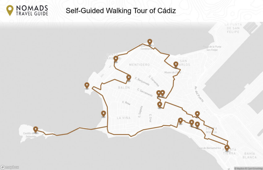
Discover Cádiz on foot with our walking tour map guiding you between each stop as you explore its Atlantic seafront, historic fortifications, elegant plazas, and lively local markets. This walking tour follows the city's layered story, shaped by seafaring trade, centuries of defensive architecture, and a distinctive Old Town atmosphere, taking you from cathedral viewpoints and landmark squares to coastal promenades and bastions, all within a compact peninsula city defined by the sea.

1. Puerta de Tierra

Puerta Tierra, Cádiz
CC BY-SA 3.0 / TheOm3ga

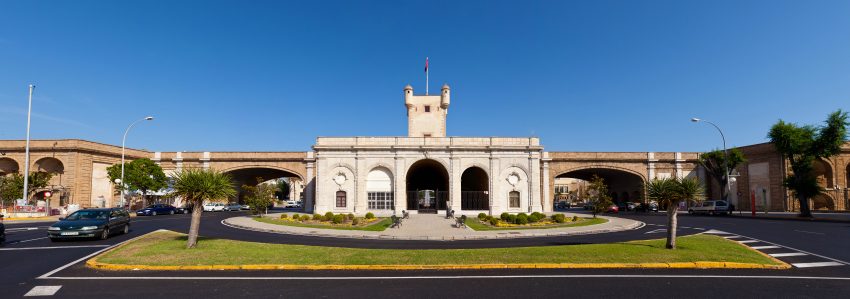
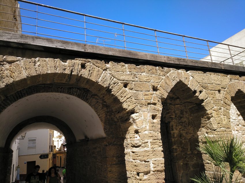
Puerta de Tierra is Cádiz’s historic landward gateway, built as part of the city’s defensive system when Cádiz was one of Spain’s most strategically important Atlantic ports. The current monumental gate largely reflects the early modern era, when fortification upgrades were essential to protect the city’s wealth, shipping, and naval infrastructure from attack.

The structure is both practical and symbolic: it marked the controlled point of entry into the old city, separating the fortified historic core from the mainland approaches. Its heavy masonry, layered defensive logic, and formal façade tell you Cádiz expected threats and designed the city to absorb them.

What to see is the gateway’s scale and its relationship to the city’s shape. Stand back to understand how it once functioned as a choke point, then move closer to appreciate the sculptural detailing and the way the architecture blends military purpose with civic pride.


Location: Plaza de la Constitución, s/n, 11004, Cádiz | Hours: (Summer) 01 June–30 September; 23 December–04 January. Tuesday – Saturday: 11:00–15:00 & 17:00–21:00. Sunday: 11:00–15:00. (Winter) 05 January–31 May; 01 October–22 December. Tuesday – Saturday: 11:00–14:00 & 16:00–20:00. Sunday: 11:00–14:00. Closed on Monday. | Price: Free | Website

We recommend to rent a car in Spain through Discover Cars, they compare prices and review multiple car rental agencies. Book your rental car here.

2. Ayuntamiento de Cadiz

City Hall of Cádiz
City Hall of Cádiz
CC BY-SA 4.0 / Wayne77

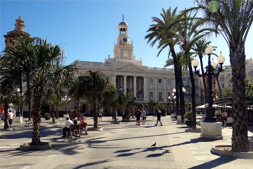
Cádiz’s Ayuntamiento is the civic face of the city, representing municipal authority in a place where governance has always been shaped by trade, defense, and public order in a constrained peninsula setting. Its presence underscores that Cádiz is not only historic and picturesque, but administratively serious: a city that had to manage people, port activity, and infrastructure with limited space and high strategic value.

The building’s significance is closely tied to its setting, where public space and government architecture reinforce one another. This is where Cádiz’s ceremonies, announcements, and civic rhythm become visible, and where the relationship between the old town’s street network and its institutional core feels most direct.

What to see is the façade, the way the building addresses the square, and the overall civic composition in its immediate surroundings. If the interior is accessible during your visit, it can add depth, but even from outside the Ayuntamiento works as a clear marker of Cádiz’s public identity and civic continuity.


Location: Casa Consistorial, pl. de San Juan de Dios, s/n, 11005 Cádiz, Spain | Hours: Tuesday – Friday: 09:00–18:00. Saturday: 09:00–14:00. Sunday: 09:00–14:00. Closed on Monday. | Price: Free. | Website

Here is a complete selection of hotel options in Cádiz. Feel free to review each one and choose the stay that best suits your needs.

3. Mercado Central

Mercado Central, Cadiz
© Turismo Cadiz

Mercado Central is one of the best places to experience Cádiz as a living, local city rather than a sequence of monuments. Markets in port cities are historically tied to supply chains, fishing, trade, and daily routine, and Cádiz’s market continues that tradition in a modern, practical form.

The market’s real history is its function: a place where the sea turns into food culture, where regional produce meets the Atlantic catch, and where everyday buying and selling sustains the rhythms of the old town. Even short visits add texture that churches and fortifications cannot provide.

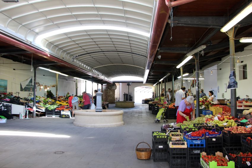
What to see is the seafood counters, the energy of the central hall, and the small details of local preference. Go slowly, watch what locals buy, and treat it as a sensory stop that helps you understand what Cádiz eats, sells, and values in daily life.


Location: Plaza de la Libertad, S/N 11005 Cádiz Spain | Hours: Central Market Hours: Monday to Saturday from 9:00 am to 3:00 pm Gastronomic Corner Hours: Monday: 9:00 am to 4:00 pm Tuesday to Friday: from 9:00 a.m. at 3.30 pm and from 19.00. at 00.00 Saturday: From 09.00. at 4:00 pm and from 8:00 pm at 01.00 | Price: Free

Traveling to a country with a different currency? Avoid ATM transaction fees and pay in local currency with a Wise Card. Having used it for over 5 years, we've saved loads on fees!

4. Torre Tavira

Torre Tavira, Cadiz
Torre Tavira, Cadiz
CC BY-SA 3.0 / Emilio J. Rodríguez Posada

Torre Tavira is Cádiz’s best-known watchtower, part of a skyline once crowded with lookout towers used by merchants to spot incoming ships and monitor port activity. Cádiz’s prosperity as a trading hub made visibility valuable, and these towers became a practical tool for commerce as well as a marker of status.

The tower is closely associated with the period when Cádiz was deeply connected to Atlantic trade routes and maritime exchange. From above, you can see why the city developed the way it did: a compact historic core ringed by sea, with sightlines that once mattered for security, navigation, and business.

What to see is the view and the tower’s interpretive features. The rooftop panorama is the headline, and the interior experience typically adds context about how Cádiz was watched, worked, and defended from above.


Location: Torre Tavira, Calle Marqués del Real Tesoro, 10 11001 Cádiz Spain | Hours: October – april: 10.00 – 18.00 hrs. May – september: 10.00 – 20.00 hrs. | Price: 7 Euro | Website

Click here to read our blog about A Day in Cádiz 2026: What to See, Do & Experience

5. Gadir Archaeological Site

Gadir Archaeological Site 6
© digitalavmagazine

Yacimiento Arqueológico Gadir is Cádiz’s key window into the city’s ancient roots, closely associated with the Phoenician and early settlement history that predates Rome. It is one of the most important stops for understanding Cádiz as a place that has been strategically inhabited for millennia, not simply a beautiful coastal city shaped by later centuries.

The site’s significance lies in continuity and density. Cádiz’s limited space encouraged rebuilding on top of earlier layers, and archaeology here often feels like looking straight down through time: foundations, structures, and traces of daily life preserved beneath the modern streets.

What to see is the way the site is presented and the clarity it brings to Cádiz’s origin story. Focus on how the remains fit into the broader narrative of Cádiz as an early trading hub, and use the visit to recalibrate your sense of the city’s timeline before moving back to later monuments.


Location: Calle San Miguel, 15, 11001 Cádiz, Spain | Hours: Tuesday to Sunday from 10.00 am to 5.00 pm. Visit every hour. Closed on Mondays. | Price: Free entrance | Website

6. Museum of Cádiz

Roman Artifacts at Museo de Cádiz
CC BY-SA 2.0 / VIATOR IMPERI

The Museum of Cádiz brings together the city’s three deepest identity layers under one roof: ancient settlement, Atlantic-era wealth, and local popular culture. The institution in its current form dates to 1970, when the provincial Fine Arts and Archaeology museums were merged, but its roots go back to the 19th century, beginning with an early Fine Arts collection that formed after ecclesiastical confiscations in the 1830s.

The archaeological section is the essential starting point because it explains Cádiz as a place of long continuity rather than a purely early modern port city. The museum is especially known for major Phoenician-era finds, including anthropoid sarcophagi, and for Roman material that situates Cádiz within wider Mediterranean networks of trade and culture.

In the fine arts galleries, the emphasis shifts to the visual language of Cádiz’s prosperity and religious patronage, with works spanning the early modern period through later centuries and notable holdings that include Zurbarán, Murillo, and Rubens. The museum also includes an ethnography dimension associated with Cádiz’s popular traditions, most famously the Tía Norica puppets, which add a distinctly local counterweight to the grandeur of archaeology and painting.


Location: Plaza de Mina, s/n, 11004, Cádiz. | Hours: Tuesdays to Saturdays from 9:00 AM to 9:00 PM; Sundays and public holidays from 9:00 AM to 3:00 PM. Closed on Mondays. | Price: Free | Website

7. Baluarte de la Candelaria

Baluarte de la Candelaria
CC BY-SA 4.0 / Axel Cotón Gutiérrez

Baluarte de la Candelaria is a sea-facing bastion built to protect Cádiz from naval attack, positioned to command the approaches along the coast. Its location reflects the city’s long history of living with both opportunity and threat: a port exposed to the Atlantic, wealthy enough to attract attention, and vulnerable enough to require serious defenses.

The bastion belongs to Cádiz’s broader system of walls, batteries, and strongpoints that were expanded and adapted across centuries. Even when you do not know the technical details of artillery range and angles, the geometry makes sense on site: thick walls, outward-facing platforms, and clear lines across the water.

What to see is the combination of military architecture and open sea views. Walk the perimeter to understand how the bastion “reads” the coastline, then take time to appreciate how these defensive spaces have become civic promenades, used today for exhibitions, events, and sunset walks.


Location: Alameda Hermanas Carvia Bernal, 6, 11003 Cádiz, Spain | Hours: Daily: Consult schedule (open during exhibitions and events). | Price: Check official website. | Website

8. Parque Genovés

Park Genoves, Cadiz
Park Genoves, Cadiz
CC BY-SA 3.0 / Solundir

Parque Genovés is Cádiz’s most beloved historic garden, offering a softer counterpoint to the city’s stone fortifications and dense streets. Urban parks in constrained coastal cities matter because they provide relief from heat, crowding, and hard surfaces, and this one has become a long-running civic refuge.

The park’s identity is shaped by landscaped design, shade, and a careful sense of enclosure that makes it feel calmer than the streets just outside. It is also a useful place to notice how Cádiz balances openness and protection: even leisure spaces feel curated and slightly sheltered, consistent with a city historically built for defense.

What to see is the garden composition, plantings, and the way paths frame small vistas. Walk slowly, sit for a few minutes to absorb the atmosphere, and use the stop as a reset before returning to the brighter, windier edges of the coastline.


Location: Parque Genovés Av. Dr. Gómez Ulla, s/n 11003 Cádiz Spain | Hours: Every day from 8:00a.m. to sunset. Summer from 8:00 a.m. to 10:30 p.m. | Price: Free | Website

9. Gran Teatro Falla

Teatro falla Cadiz
Teatro falla Cadiz
CC BY-SA 4.0 / Anual

Gran Teatro Falla is Cádiz’s signature performance venue, strongly associated with the city’s cultural life and especially with the traditions of music and theatre that shape Cádiz’s identity beyond tourism. Its architecture and presence signal that Cádiz has long invested in public culture as a civic asset, not an afterthought.

The theatre is also connected to Cádiz’s famous carnival culture, which gives performances here an additional layer of local meaning. Even when you do not attend a show, the building’s role as a focal point for major cultural moments makes it worth treating as more than a quick exterior photo.

What to see is the façade and the surrounding setting, which often feels lively and locally oriented. If you can go inside, the interior typically provides the deeper sense of scale and atmosphere, but even outside you can read the building as a statement about Cádiz’s pride in its performing arts.


Location: Plaza de Falla, s/n, 11003, Cádiz | Website

10. Castillo de Santa Catalina

Castle of Santa Catalina, Cádiz
CC BY-SA 3.0 / Francisco Manuel Esteban Moya

Castillo de Santa Catalina is a star-shaped coastal fortress built to strengthen Cádiz’s defenses after attacks highlighted the city’s vulnerability from the sea. Its design reflects early modern military thinking: low, angular walls intended to resist and return artillery fire, with bastioned corners that cover multiple angles of approach.

The castle’s story is closely tied to Cádiz’s role as a major maritime city, where fortification was not an abstract policy but a daily reality. Over time, the castle shifted from active defense to heritage site, and that change is part of what makes it interesting: you can read both the original purpose and the later civic reuse in how spaces are maintained and opened to the public.

What to see is the fort’s structure and coastal setting. Walk the ramparts to appreciate the star plan from within, explore the courtyards and galleries, and use the sea views to understand why this exact point mattered for controlling approaches and protecting the shoreline.


Location: Avenida Duque de Nájera, 11002, Cádiz | Hours: Every day from 11 am. to 7 pm. | Price: Free

11. Playa de La Caleta

Playa de La Caleta
Playa de La Caleta
CC BY-SA 4.0 / Emilio J. Rodríguez Posada

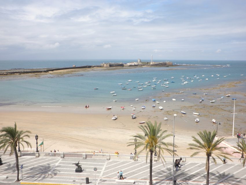
Playa de La Caleta is Cádiz’s most iconic city beach, tucked between historic fortifications and closely tied to the city’s maritime character. It is not simply a place to swim; it is a shoreline framed by history, where castles and seawalls make the setting feel uniquely Cádiz rather than generically Mediterranean.

The beach’s appeal comes from its sense of enclosure and its cinematic relationship with the old town. The surrounding structures remind you that Cádiz always treated the sea as both livelihood and exposure, and La Caleta sits right at that intersection: leisure today, strategic coastline yesterday.

What to see is the full curve of the bay and the changing light across the water and stone. Visit at different times if you can, because La Caleta shifts mood dramatically between bright daytime energy and the quieter, reflective atmosphere around sunset.


| Hours: 24 Hour

12. Castillo de San Sebastián

Castle of San Sebastián in Cádiz
CC BY-SA 2.0 / Emilio J. Rodríguez Posada

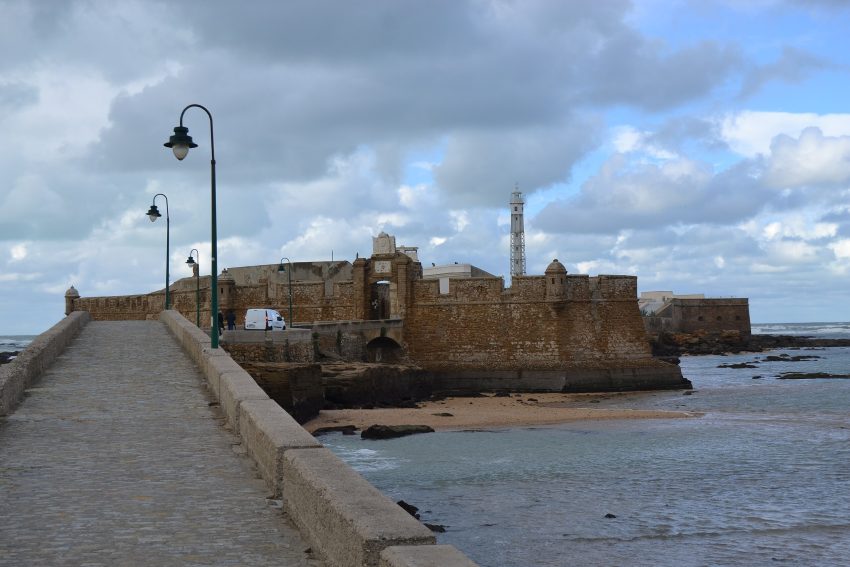
Castillo de San Sebastián sits dramatically on a small islet off La Caleta, connected to the city by a long causeway that turns the approach into part of the experience. The site has a long defensive and maritime history, with the fortress reflecting Cádiz’s need to guard key coastal points and manage threats arriving by sea.

The castle’s identity is shaped as much by its setting as by its walls. Its offshore position made it a natural lookout and defensive outpost, and it remains one of the best places to grasp Cádiz’s relationship with the water: the city is not merely near the sea, it is defined by it.

What to see is the causeway walk, the fortress exterior, and the views back toward the old town. Go when the light is strong and the tide and weather make the coastline vivid; the castle becomes a visual anchor for understanding how Cádiz’s defenses were layered across land and water.


Location: Castillo de San Sebastian, Fernando Quiñones, s/n 11002 Cádiz Spain | Hours: Monday to Sunday from 09:00 till 13:00 | Price: 2 € | Website

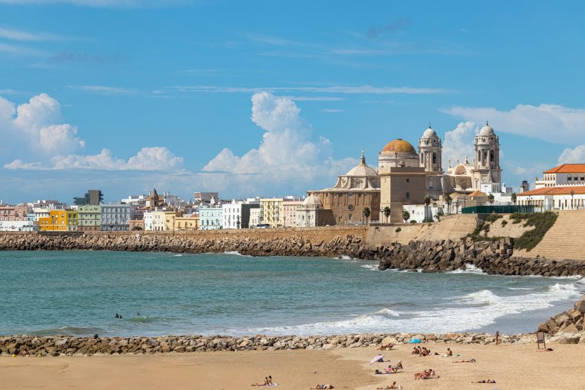
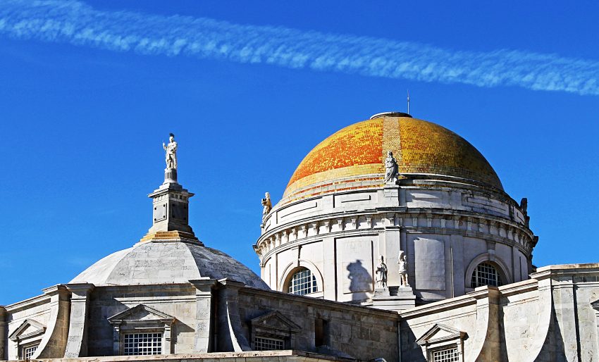
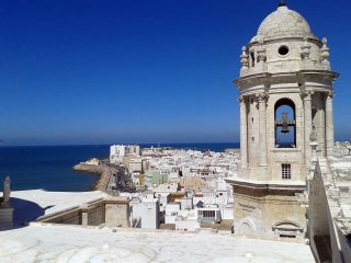
13. Cádiz Cathedral

Cupola de la Catedral de Cádiz
CC BY-SA 3.0 / Harlock20

Cádiz Cathedral is the city’s dominant religious landmark, built over a long period that left it with a layered character and a prominent presence on the skyline. Its position near the sea and the historic core makes it feel like both a sacred building and a civic symbol, visible from multiple approaches as you move through the old town.

The cathedral reflects Cádiz’s wealth and ambition during eras when the city was deeply connected to Atlantic routes and imperial commerce. Its architecture and scale communicate confidence, while its extended construction timeline helps explain why the building can feel like a blend of intentions rather than a single unified moment.

What to see is the exterior massing, the relationship to the surrounding streets, and the atmosphere of the square. Step inside to experience the shift in light and volume, then return to the plaza to appreciate how the cathedral “holds” the public space around it as a focal point.


Location: Plaza de la Catedral, s/n 11005 Cádiz Spain | Hours: Tue-Sat 10am-4:30pm

14. Teatro Romano

Teatro Romano with the domes of the Cádiz Cathedral in the background
Teatro Romano Cadiz
CC BY-SA 4.0 / Axel Cotón Gutiérrez

The Teatro Romano is one of the most significant archaeological sites in Cádiz, revealing the city’s deep Roman-era past beneath the later urban layers. Its survival is a reminder that Cádiz’s history is not only early modern and maritime; it stretches back into the classical world, when the city occupied a different role within the Mediterranean sphere.

Roman theatres were civic infrastructure as much as entertainment venues, expressing status, public culture, and urban organization. Seeing a theatre here helps you understand Cádiz as a long-lived city that repeatedly rebuilt itself on the same precious footprint, layering new streets and buildings over older foundations.

What to see is the exposed seating structure and the interpretive layout that helps you imagine scale. Take time to trace the curve of the cavea, look for how the site fits into the surrounding city fabric, and use the viewpoint to picture how performance space once sat within a dense ancient settlement.


Location: Calle Mesón, 11-13, 11005 Cádiz, Spain | Price: Free

15. Arco de los Blancos

Arco del Blanco Cadiz
CC BY-SA 4.0 / Axel Cotón Gutiérrez

Arco de los Blancos is one of the surviving medieval-style gateways tied to Cádiz’s old defensive perimeter and internal street network. It sits in the older quarter where the city’s Islamic-period and later Christian-era urban history is felt in tight lanes, small transitions, and sudden openings into plazas.

Historically, this kind of arch was not simply decorative: it marked movement, controlled access, and helped define neighbourhood boundaries in a dense port city that evolved within fortifications. Cádiz’s layered past is easiest to sense in places like this, where the street plan retains an older logic even as buildings have been renewed over centuries.

What to see is the arch as an urban threshold. Walk toward it from both directions to feel how it frames the approach, then look for the contrast between the gateway’s historic character and the everyday street life around it.


Location: Calle Mesón, 22, 11005 Cádiz, Spain | Hours: 24 Hours | Price: Free
Powered by GetYourGuide
Moira & Andy
Moira & Andy

Hey! We're Moira & Andy. From hiking the Camino to trips around Europe in Bert our campervan — we've been traveling together since retirement in 2020!

Read our full story here

This website uses affiliate links which earn a small commission at no additional cost to you.

Walking Tour Summary

Distance: 6.5 km
Sites: 15

Walking Tour Map
Map of the Self-Guided Walking Tour of Cádiz walking route with 15 stops in Cádiz.
Preview map of the Self-Guided Walking Tour of Cádiz route in Cádiz, showing 15 stops. Use the interactive map to zoom and tap markers.

More from this area

Self-Guided Walking Tour of Aarhus (2026)

Self-Guided Walking Tour of Aarhus

This website uses affiliate links which earn a small commission at no additional cost to you.

Aarhus is compact, walkable, and layered: a city where medieval street patterns, a working harbor, and contemporary Danish design sit within an easy stroll of each other. This self-guided route is designed to give you a strong sense of place quickly, combining landmark highlights with small details that make the city feel lived-in-courtyards, side streets, and viewpoints that you might otherwise miss if you only hop between the headline attractions.

The walk naturally threads together the city’s main neighborhoods and “chapters,” so you can pace it to suit your day. You can do it as a single continuous loop, or break it into sections with a café stop, a museum visit, or time by the water. It’s particularly well suited to travelers who want structure without a guide-clear direction, but plenty of flexibility to linger when something catches your attention.

Most importantly, it focuses on the best things to see in Aarhus without turning the experience into a checklist. Expect a balanced mix of history, culture, and waterfront atmosphere, with opportunities to detour into galleries, markets, and local eateries along the way. By the end, you should feel you've seen the city's essentials and understood how Aarhus fits together, both on the map and in everyday life.

How to Get to Aarhus

By Air: Aarhus is served by Aarhus Airport (AAR), located northeast of the city, and Billund Airport (BLL), which often offers a wider range of international routes and can be a practical alternative for many travelers. From Aarhus Airport you typically connect onward by airport bus or a combination of bus and local transport into the city center, while from Billund you can reach Aarhus by direct coach services or by linking into the Danish rail network via nearby stations. If you are arriving from abroad, compare total travel time door-to-door (flight plus transfer), as a cheaper flight can sometimes mean a longer ground connection. For the best deals and a seamless booking experience, check out these flights to Aarhus on Booking.com.

By Train: Aarhus is one of Denmark's main rail hubs, with frequent services linking it to Copenhagen and major cities across Jutland, plus convenient connections from airports and border routes via interchange stations. Trains arrive at Aarhus H (Aarhus Central Station), which is walkable to much of the inner city and well connected to local buses and the light rail for onward travel. For planning and tickets, use DSB (Danish State Railways) and check Rejseplanen for door-to-door public transport routing across Denmark. Train schedules and bookings can be found on Omio.

By Car: Driving to Aarhus is straightforward via Denmark's motorway network, with good access from both northern and southern Jutland and clear signage into the city. The main consideration is parking: the center has controlled zones and paid facilities, so many visitors find it easiest to use central parking garages or park-and-ride options and then continue on foot or by public transport. If you are road-tripping, aim to arrive outside peak commuter hours and confirm your accommodation's parking arrangements in advance, as rules and fees can vary by area.

By Bus: Long-distance coaches can be a cost-effective way to reach Aarhus, particularly from other Danish cities and some cross-border routes, and they typically arrive close to the central station area for easy onward connections. Timetables and operators vary by season and route, so it is worth checking journey duration and luggage policies before booking, especially if you are traveling at weekends or during major events.

Where to Stay in Aarhus

To make the most of visiting Aarhus and this walking tour then you consider staying overnight in the centre. The most convenient base is the Latin Quarter and the core around the cathedral and main shopping streets, because you can step straight into the route, do early-morning sights before day-trippers arrive, and finish the day with restaurants and bars within easy walking distance. Good, walkable picks here include Boutique Hotel Villa Provence and Hotel Royal, both well placed for the historic streets and harbour edge, along with Radisson Blu Scandinavia Hotel, Aarhus for a classic full-service option close to the station and many of the city’s major sights.

If you want an easy arrival and departure with minimal logistics, the area around Aarhus Central Station and Rådhuspladsen is a practical choice that still keeps you within a short walk of the old town lanes, the waterfront, and museums. It's particularly strong if you are arriving by train or planning day trips, and it tends to suit travelers who value efficient access over maximum “old streets” atmosphere. Consider Comwell Aarhus for modern comfort near the station, or Scandic Aarhus City for a central base that makes it simple to start the walking tour in either direction.

For a quieter feel with a local, residential edge-while still staying close enough to walk or use quick public transport-look at Frederiksbjerg or the harbourfront/Aarhus Ø side, depending on whether you prefer leafy streets and cafés or newer waterfront architecture and views. Frederiksbjerg works well if you like a calmer evening scene and easy access to parks, while the waterfront suits travelers who want a more contemporary Aarhus feel and quick access back into the centre. Options worth considering include Wakeup Aarhus for a simpler, good-value base near the station and Frederiksbjerg, and CABINN Aarhus if you want a budget-friendly spot that keeps you close to both the centre and the harbour.

Your Self-Guided Walking Tour of Aarhus

Discover Aarhus on foot with our walking tour map guiding you between each stop as you explore its historic Latin Quarter, lively pedestrian streets, waterfront promenades, and landmark museums. This walking tour traces the city's evolution from a medieval cathedral town to one of Denmark's most creative cultural hubs, linking atmospheric old lanes, modern harbour architecture, and standout galleries and food halls, so you experience both the classic highlights and the local rhythms that make Aarhus such a rewarding city to walk.

1. Aarhus Custom House

Aarhus Custom House
Aarhus Custom House
CC BY-SA 4.0 / Fugit hora

Aarhus Custom House, also known as the Told( T)oldboden, is a harbourfront landmark tied to the city’s maritime commerce and growth. Completed in 1898 and designed by Hack Kampmann, it reflects a period when Aarhus’s role as a port city demanded architectural confidence in state functions like customs and trade regulation.

Architecturally, the building is often singled out as one of Kampmann’s finest works in the city, with a richly composed historicist expression that stands out against the modern harbour district nearby. It represents the late 19th-century belief that public authority should look durable and highly crafted, even when the function is administrative.

What to see is the exterior: brickwork, massing, and the way it holds its presence at the waterfront. It is especially effective when viewed in context of the surrounding harbour transformation, where contemporary buildings and public spaces make the Custom House feel like a visible marker of the older port economy that shaped Aarhus.


Location: Toldboden, 8000 Aarhus, Denmark | Hours: 24 hours from outside | Price: Free to view from the street. | Website

Here is a complete selection of hotel options in Aarhus. Feel free to review each one and choose the stay that best suits your needs.

2. KØN – Gender Museum Denmark

Køn Gender Museum Denmark
CC BY-SA 4.0 / Leif Jørgensen

KØN is one of the few museums in the world dedicated specifically to the cultural history of gender, with a focus on how ideas about gender, the body, sexuality, and equality have shaped society over time. It is located in central Aarhus and occupies a historic civic building, which adds an institutional weight to a subject that is often treated as purely contemporary.

The museum began in 1982 as the Women’s Museum and later broadened its scope; the shift culminated in a name change to KØN in 2021, reflecting a mandate that extends beyond women’s history to gender more broadly. That background matters, because it explains why the museum combines classic social history with more provocative, debate-driven exhibition choices.

What to see depends on what is on, but the museum is designed for a structured visit across multiple floors, with both permanent and changing exhibitions plus a café. If you want a clear starting point, look for the permanent exhibition work that draws on the collection to show how gender norms are constructed and contested across themes like work, politics, the body, and activism.


Location: Domkirkepladsen 5, 8000 Aarhus, Denmark | Hours: Tuesday: 10:00–17:00. Wednesday: 10:00–18:00. Thursday – Saturday: 10:00–17:00. Bank holidays: 10:00–16:00. Closed on Monday & Sunday. Closed on bank holidays that fall on Sunday & Monday. Closed on December 23; December 31; January 1. | Price: Adults: DKK 125; Under 30: DKK 105; Retiree: DKK 105; Under 18: Free. | Website

Traveling to a country with a different currency? Avoid ATM transaction fees and pay in local currency with a Wise Card. Having used it for over 5 years, we've saved loads on fees!

3. The Occupation Museum

The Occupation Museum
CC BY-SA 2.0 / Villy Fink Isaksen

The Occupation Museum focuses on Aarhus during the German occupation of Denmark in the Second World War. It is set in a building that is part of the story: the former police station, which in the final years of the war served as Gestapo headquarters in the city. That setting gives the museum a gravity that is difficult to replicate elsewhere, because the spaces you move through are not reconstructed.

The museum’s narrative is deliberately local. It concentrates on how occupation played out in Aarhus, including resistance activity, sabotage, informants, and the pressures of everyday life under restrictions. In recent years it has also leaned more explicitly into the ethical dilemmas faced by ordinary people, rather than presenting the period as a simple binary of heroes and villains.

What to see is the preserved environment and the way it is interpreted: basement rooms and cells, period objects and documents, and the museum’s use of original spaces to explain interrogation, fear, and control. Take time to read the contextual material closely here; the power of the visit comes from how the building and the evidence reinforce each other.


Location: Mathilde Fibigers Have 2, 8000 Aarhus, Denmark | Hours: Monday: Closed Tuesday: Closed Wednesday: 1:00 – 5:00 PM Thursday: 1:00 – 5:00 PM Friday: 1:00 – 5:00 PM Saturday: 11:00 AM – 5:00 PM Sunday: 11:00 AM – 5:00 PM | Price: 75,00 DKK | Website

4. Hotel Royal

Hotel Royal
Hotel Royal
CC BY-SA 4.0 / RhinoMind

Hotel Royal is Aarhus’s oldest hotel, founded in 1838, and its location is part of its identity: it sits on Store Torv directly opposite Aarhus Cathedral. From the beginning it positioned itself as the city’s prestige address, linked to the square’s civic and ceremonial life rather than a peripheral traveller’s stop.

The hotel’s fabric reflects Aarhus’s growth through the 19th and early 20th centuries. It began as a luxury hotel created from existing buildings and was later expanded and reshaped, including major work around 1901 to 1902 that gave it much of the presence it has on the square today. This long, piecemeal evolution is typical of prominent city-centre hotels that have had to modernise without abandoning their historic status.

What to see is the setting and the details that signal continuity: the façade and corner presence on the square, the relationship to the cathedral opposite, and the interior atmosphere that trades on heritage rather than minimalism. Even if you are not staying overnight, it is worth pausing outside to read the hotel as part of the historic ensemble of Store Torv and Bispetorv.


Location: Store Torv 4, 8000 Aarhus, Denmark | Hours: Daily: Open 24 hours. | Price: Check official website. | Website

5. Aarhus Cathedral

Aarhus Cathedral, Aarhus
CC BY-SA 3.0 / Tanya Dedyukhina

Aarhus Cathedral, dedicated to St Clement, began taking shape in the late 12th century and continued evolving into a major Gothic brick landmark, reflecting centuries of ambition, rebuilding, and stylistic change. Its scale and setting express Aarhus’s growth from a medieval town into a regional centre with a strong maritime identity, reinforced by the dedication to a patron saint associated with sailors.

Architecturally, the cathedral is famous for its length and height, and the long nave gives the interior a strong processional feel. The brickwork and the overall massing are part of the appeal: this is a building that reads clearly as a product of Northern European medieval construction, rather than a stone cathedral transplanted from elsewhere.

Inside, focus on the sense of distance and vertical emphasis created by the Gothic form, and take time to look closely at details that reveal different phases of building and restoration. If you enjoy reading buildings as historical documents, this is one of the best places in the city to see how long-term construction leaves visible traces.


Location: Store Torv, 8000 Aarhus, Denmark | Hours: Opening hours: (Summer) 01 May – 30 September: Monday: 09:30–16:00; Tuesday: 10:30–16:00; Wednesday – Saturday: 09:30–16:00. (Winter) 01 October – 30 April: Monday: 10:00–15:00; Tuesday: 10:30–15:00; Wednesday – Saturday: 10:00–15:00. Closed to visitors on Sunday and public holidays (open for worship only). | Price: Free to enter the cathedral; tower access is 20 DKK for adults and 5 DKK for children. | Website

6. Aarhus Theater

Aarhus Teater
Aarhus Teater
CC BY-SA 2.0 / https://commons.wikimedia.org/wiki/File:Aarhus_Teater.jpg

Aarhus Theater is the largest provincial theatre in Denmark and a major cultural institution with a building that is itself a work of art. The current theatre house was designed by Hack Kampmann, with construction beginning in 1898 and the building inaugurated on 15 September 1900, reflecting Aarhus’s late 19th-century confidence as Jutland’s growing urban centre.

The architectural style is Art Nouveau with national romantic emphasis on natural materials, and the interior was completed with artistic contributions including Karl Hansen-Reistrup and Hans Tegner. That combination makes the theatre more than a venue: it is a total cultural statement where decoration and function are designed to reinforce the experience of performance.

What to see includes the façade’s sculptural richness and, if you go inside, the atmosphere of the historic interiors where craftsmanship is part of the spectacle. Even if you are not attending a show, the building is worth lingering over because it expresses a specific moment when Aarhus invested in culture as a civic identity, not merely as entertainment.


Location: Teatergaden 1, 8000 Aarhus, Denmark | Hours: Opens around 1 hour before performances (varies by showtime). | Price: Varies (performances typically from 160–525 DKK; public guided tours typically 125 DKK on selected dates). | Website

7. Bispetorv

Bispetorvet
Bispetorvet
CC BY-SA 2.0 / RhinoMind

Bispetorv sits at the historic heart of Aarhus, directly beside the cathedral precinct, and it functions as a civic “forecourt” where the city’s medieval church history meets later urban life. The square’s name, Bishop’s Square, reflects the long relationship between this part of town and ecclesiastical authority, even as the surrounding buildings span very different periods.

The most prominent feature is the equestrian statue of King Christian X, which anchors the open space and gives the square its focal point. Around the edges, you are framed by some of Aarhus’s most recognisable institutions, including the cathedral and the theatre, which makes the square feel like a compressed introduction to the city’s cultural and historical core.

Look for how the square operates as a connector: it is not only a place to stand and admire façades, but also a threshold to nearby heritage sites, including the Viking Museum area close by. The best experience comes from slowing down and reading the “edges” of the space, because that is where the city’s layers are most visible.


Location: Bispetorvet, 8000 Aarhus, Denmark | Hours: 24 Hours | Price: Free

8. The Viking Museum

Viking Museum
Viking Museum
CC BY-SA 4.0 / Leif Jørgensen

The Viking Museum in Aarhus is a small, in-situ underground museum in the city centre, set beneath the Nordea building at Skt. Clemens Torv. Its appeal is that you are not looking at Viking Age Aarhus in an abstract way; you are standing where parts of the settlement once existed, at roughly the same level below today’s streets. The museum is administered as part of Moesgaard Museum, which also helps explain its focus on archaeology and context rather than spectacle.

The museum grew out of archaeological excavations carried out in 1963–1964 during construction work on the site, with the museum established in 1968 to preserve and present what was uncovered. Those digs revealed traces of Viking Age structures and finds that speak to everyday life in early Aros, the Viking name associated with Aarhus. The museum has since been updated, including a renovation noted in the late 2000s, but its core identity remains the same: a small window into the earliest urban history of the city, anchored to the original ground.

What to see is the archaeological footprint and how it is interpreted for visitors. Look for the visible structural traces and the way the exhibition explains settlement life, trade, and the shape of the early town, often supported by models and selected artefacts or replicas that make the remains easier to “read.” Because the space is compact, the best approach is to slow down and focus on the story of place: how the modern square above relates to the Viking Age activity below, and how that continuity is still legible when you take the time to examine the details.


Location: Sankt Clemens Torv 6, 8000 Aarhus Centrum, Denmark | Hours: Monday – Friday: 10:15–18:00. Saturday – Sunday: 10:15–19:00. Closed on bank holidays. | Price: Adults: DKK 30; Under 18: Free. | Website

9. Vor Frue Kirke

Our Lady Church
Our Lady Church
CC BY-SA 3.0 / Tanya Dedyukhina

Vor Frue Kirke, the Church of Our Lady, is a layered religious site where the most remarkable feature is beneath your feet. The earliest stone crypt church dates to around 1060, making it one of the oldest surviving stone church structures in Scandinavia, while later expansions created the larger medieval church above.

The church’s medieval history includes the development of a Dominican priory established around 1240, with major building phases running through the late Middle Ages. After the Reformation, the surrounding former priory buildings were repurposed under royal decree for social welfare functions, reinforcing how church sites often anchored both spiritual and civic life.

What to see is the contrast between the main church and the crypt: the crypt’s small scale, heavy stone character, and sense of early medieval austerity feel radically different from the later brick structures above. If you want one “must-see” element, prioritise the crypt, because it turns the visit into a direct encounter with Aarhus’s earliest Christian building history.


Location: Frue Kirkeplads 3, 8000 Aarhus, Denmark | Hours: Monday – Friday: 10:00–16:00. Saturday: 10:00–14:00. Sunday: Closed. | Price: Free; donations appreciated. | Website

10. Møllestien

Arhus Mollestien
Arhus Mollestien
CC BY-SA 2.0 / Anosmoman

Møllestien is one of Aarhus’s most photogenic historic streets, known for small houses, cobblestones, and a scale that feels almost village-like in the middle of the city. The street has existed since before 1300, and its long continuity is part of its charm: it reads as an old route that the modern city grew around rather than replaced.

Most of the buildings you see today were constructed in the late 19th century, which explains the consistent small-house rhythm along the lane. The result is a streetscape that feels intimate and lived-in, with façades close to the pavement and details that reward careful looking rather than distant viewing.

What to see here is the street as a composition: repeating house forms, varied paint colours, and the way plants and seasonal growth soften the edges. Walk slowly and look for small differences—doors, windows, rooflines—because the pleasure of Møllestien comes from how many subtle variations exist within a very consistent scale.


Location: Møllestien, 8000 Aarhus, Denmark | Hours: 24 Hours | Price: Free

11. ARoS Aarhus Art Museum

ARoS Aarhus Art Museum
CC BY-SA 2.0 / RhinoMind

ARoS is Aarhus’s flagship art museum and one of the strongest examples of contemporary cultural architecture in the city. Although the institution dates back to the 19th century, the current museum building opened on 7 April 2004, designed by Schmidt Hammer Lassen as a ten-storey “art cube” with a dramatic central interior space.

The most famous feature is on the roof: Olafur Eliasson’s Your rainbow panorama, officially opened in May 2011, a circular walkway that reframes the city through coloured glass and makes the skyline part of the museum experience. This is not a decorative add-on; it is a defining piece of how ARoS links art, architecture, and the act of looking at Aarhus itself.

What to see depends on your time, but the building encourages a vertical journey: moving through galleries with changing light and perspective, then finishing with the rooftop panorama for a full “city plus art” conclusion. If you want one high-impact sequence, combine a focused gallery section with the rainbow walkway so the visit feels both substantive and unmistakably Aarhus.


Location: Aros Allé 2, 8000 Aarhus, Denmark | Hours: (Summer) 01 June – 30 September: Monday – Friday: 09:00–20:00. Saturday – Sunday: 09:00–17:00. (Winter) 01 October – 31 May: Tuesday – Friday: 10:00–20:00. Saturday – Sunday: 09:00–17:00. Closed on Monday. | Price: Adults €27. Under 31 years / Students €22. Children under 18 free. Groups (min. 20) €25. | Website

12. Aarhus City Hall

Aarhus City Hall
Aarhus City Hall
CC BY-SA 1.0 / Leonhard Lenz

Aarhus City Hall is one of Denmark’s most important modern civic buildings, designed by Arne Jacobsen and Erik Møller and inaugurated on 2 June 1941. It represents a period when municipal architecture aimed to look forward, using functionalist clarity and carefully integrated design as a statement of civic confidence.

A key part of its story is that early plans did not include a tower; it was added later after strong public pressure for a more monumental civic symbol. The building is also known for its refined materials and detailing, including extensive marble cladding, which reinforces how “modern” here was meant to feel both restrained and prestigious.

What to see is the exterior composition—clean volumes, the tower’s authority, and the way the building sits in its urban park setting—then, if you go inside, the total-design approach where furnishings and interior elements were conceived as part of the same architectural language. Even from outside, it is a clear expression of Aarhus as a modern administrative city, not only a medieval one.


Location: Aarhus Rådhus, Rådhuspladsen 2, 8000 Aarhus, Denmark | Hours: Saturday: 09:30–11:00. Friday: 15:30–17:00. Friday (tower climb only): 15:30–16:00. In school holidays: Tuesday: 09:30–11:00. Closed on Sunday. | Price: Adults 125 DKK; children under 18 50 DKK (guided tour including tower). | Website

13. Salling Rooftop

Salling ROOFTOP
Salling ROOFTOP
CC BY-SA 4.0 / Leif Jørgensen

Salling Rooftop is a contemporary landmark that has quickly become one of the most popular viewpoints in Aarhus, opened on 25 August 2017 above the Salling department store. It is designed as a public rooftop environment rather than a simple observation deck, combining views with social space and a distinctive urban atmosphere.

The main draw is the panorama over the city centre—rooftops, church towers, and the broader harbour direction—framed in a way that helps you understand how compact Aarhus is. The design encourages lingering, and the mix of seating areas and themed rooftop zones makes the space feel curated rather than purely functional.

What to see is the experience of elevation itself: the skyline read, the shifting light over the city, and the way Aarhus’s landmarks align from above. If you are timing visits, late afternoon often gives the most dramatic city colour and shadow, and the rooftop’s layout makes it easy to move between viewpoints without feeling crowded into one spot.


Location: Søndergade 27, 8000 Aarhus, Denmark | Hours: Monday – Friday: 10:00–20:00. Saturday: 10:00–19:00. Sunday: 10:00–18:00. | Price: Free. | Website

14. Åboulevarden

Boulevarden (River Boulevard), Aarhus
CC BY-SA 4.0 / Eduard47

Åboulevarden runs alongside the Aarhus River and shows how the city has re-centred public life around the water. It is both a street and a promenade, with the river forming the spine that shapes movement, views, and the rhythm of cafés and restaurants along the edges.

The boulevard’s modern character is closely linked to a major urban transformation: after periods when the river was covered, work to open it again began in September 2005, and the last sections were finished in 2015. That long project changed the city centre’s feel, turning what had been traffic-dominated space into a more recreational waterfront setting.

What to notice is how the river splits the boulevard into distinct sides, with pedestrian-friendly stretches that make the water feel like a public room rather than a boundary. Spend a few minutes watching how the space is used—especially where paths widen—because the best “sight” here is the city’s relationship with the reopened river corridor.


Location: Åboulevarden, 8000 Aarhus, Denmark | Hours: 24 Hours | Price: Free | Website

15. Dokk1

Dokk1
Dokk1
CC BY-SA 2.0 / RhinoMind

Dokk1 is Aarhus’s main library and a major civic hub on the waterfront at Hack Kampmanns Plads, created as part of the wider Urban Mediaspace Aarhus redevelopment that reshaped the harbour edge into a public-facing city centre. Designed by Schmidt Hammer Lassen Architects, construction began in 2011 and the building was inaugurated on 20 June 2015, marking one of the municipality’s largest modern construction projects and a clear statement about how the city wants public space to function in the 21st century.

What makes Dokk1 significant is the blend of functions under one roof. Beyond the library, it includes municipal citizen services, event and meeting spaces, and commercial areas, and it is tightly integrated with transport infrastructure, including a light rail connection and a large automated underground parking system. The result is a building that operates less like a quiet reading room and more like a working piece of city infrastructure, designed to pull people toward the harbour and keep them there.

What to see starts with the architecture and how it meets the public realm: broad steps, open terraces, and long sightlines that give you wide views of water and city. Inside, look for the building’s large, flexible interior zones that support studying, family areas, exhibitions, and events, then seek out the landmark artwork known as The Gong, a large tubular bell connected to Aarhus University Hospital that can be activated by new parents to mark a birth. Even if you do not spend long inside, Dokk1 is worth visiting as a viewpoint on modern Aarhus: civic design, harbour redevelopment, and public life all compressed into one place.


Location: Hack Kampmanns Plads 2, 8000 Aarhus Centrum, Denmark | Hours: Monday – Friday: 08:00–22:00. Saturday – Sunday: 10:00–16:00. Closed on public holidays. | Price: Free. | Website
Moira & Andy
Moira & Andy

Hey! We're Moira & Andy. From hiking the Camino to trips around Europe in Bert our campervan — we've been traveling together since retirement in 2020!

Read our full story here

This website uses affiliate links which earn a small commission at no additional cost to you.

Walking Tour Summary

Distance: 3.5 km
Sites: 15

Walking Tour Map
Map of the Self-Guided Walking Tour of Aarhus walking route with 15 stops in Aarhus.
Preview map of the Self-Guided Walking Tour of Aarhus route in Aarhus, showing 15 stops. Use the interactive map to zoom and tap markers.

More from this area

Self-Guided Walking Tour of Munich (2026)

Self-Guided Walking Tour of Munich

This website uses affiliate links which earn a small commission at no additional cost to you.

Munich is one of Germany's most distinctive cities, combining royal grandeur, historic churches, grand squares, and a strong sense of Bavarian identity. At its heart is the old city around Marienplatz, where the Gothic Revival Neues Rathaus, the medieval Altes Rathaus, Peterskirche, and the twin towers of the Frauenkirche create one of the country's most recognisable urban skylines. The city's long association with the Wittelsbach dynasty can still be seen in the Munich Residence, the Hofgarten, Max-Joseph-Platz, and the grand avenues and museums that reflect Munich's role as a centre of power, art, and culture.

Munich is also known for its relaxed public life, from the food stalls of Viktualienmarkt to the beer halls, gardens, and cafés that give the city much of its character. The English Garden offers one of Europe's great urban green spaces, while museums such as the Bavarian National Museum, the Münchner Stadtmuseum, and the Jewish Museum reveal different layers of the city's history. Although Munich is often associated with Oktoberfest and beer culture, it is much more than that: a city of architecture, memory, music, parks, and neighbourhood life, with enough depth to reward both first-time visitors and those who return slowly.

How to Get to Munich

By Air: Munich Airport is one of Germany's main international gateways, with extensive direct connections across Europe and long-haul routes from major global hubs. From the airport, the simplest transfer into the city centre is usually the S-Bahn (lines S1 and S8), which runs to key stations including München Hauptbahnhof and Marienplatz; for late arrivals or heavier luggage, taxis and app-based rides are also widely available, and the airport has clear onward-signage for regional trains and shuttles. If you are arriving for a specific event or have an early departure, consider staying near the airport or along an S-Bahn line to reduce transfer time. For the best deals and a seamless booking experience, check out these flights to Munich on Booking.com.

By Train: München Hauptbahnhof is a major rail hub with frequent high-speed and intercity services linking Munich to cities across Germany and neighbouring countries, making it one of the most straightforward ways to arrive if you are already in Europe. Deutsche Bahn (DB) operates most long-distance services, and you will also find strong regional connectivity into Bavaria; once you arrive, Munich's U-Bahn, S-Bahn, trams, and buses make it easy to continue to your hotel without needing a taxi. Booking in advance can reduce fares substantially, especially on popular routes, and seat reservations can be worthwhile at peak times. Train schedules and bookings can be found on Omio.

By Car: Driving to Munich can be convenient if you are touring Bavaria or travelling with a group, but the city's traffic and parking costs mean it is usually best approached with a plan. Use park-and-ride facilities on the outskirts to avoid inner-city congestion, then switch to the U-Bahn or S-Bahn to reach the centre, where many streets are pedestrianized and parking is limited. If you do drive into the city, check low-emission requirements and hotel parking arrangements ahead of time, and expect slower progress during commuting hours and major events. If you are looking to rent a car in Germany I recommend having a look at Discover Cars, first, as they compare prices and review multiple car rental agencies for you.

By Bus: Long-distance coaches can be a cost-effective option from many European cities, often arriving at Munich’s central bus station (ZOB) near the main railway station. This can be especially useful for budget travellers or routes that are less direct by rail, and local public transport links make it easy to connect onward once you arrive. Comfort levels vary by operator and journey length, so it is worth comparing travel times and luggage policies before booking.

1. Marienplatz

Marienplatz
Marienplatz
CC BY-SA 2.0 / oatsy40

Marienplatz has been Munich’s central square since the Middle Ages, when it served as the city’s main marketplace and civic gathering place. Its name refers to the Marian column at the centre of the square, erected in the 17th century after Munich survived Swedish occupation during the Thirty Years’ War.

The square is framed by some of Munich’s most important civic buildings, especially the Neues Rathaus and the Altes Rathaus. It remains the symbolic heart of the city, used for public celebrations, seasonal markets, political events, and gatherings.

When visiting, look for the Mariensäule, the ornate façade of the Neues Rathaus, and the lively movement of people across the square. The Glockenspiel in the tower of the New Town Hall is one of the best-known sights, with figures that perform scenes from Munich’s history.


Location: Marienplatz, 80331 München-Altstadt-Lehel, Germany | Hours: 24 Hours. | Price: Free.

We recommend to rent a car in Germany through Discover Cars, they compare prices and review multiple car rental agencies. Book your rental car here.

2. Neues Rathaus

New Town Hall
New Town Hall
CC BY-SA 3.0 / Diliff

The Neues Rathaus, or New Town Hall, dominates Marienplatz with its elaborate Gothic Revival façade. It was built from the second half of the 19th century into the early 20th century, at a time when Munich was expanding and needed a larger civic building.

Although it looks medieval, the building is comparatively modern and reflects the 19th-century fashion for historicist architecture. Its towers, statues, tracery, and decorative stonework were designed to give Munich’s municipal government a suitably grand setting.

The main feature to see is the Glockenspiel, where mechanical figures perform scenes linked to a ducal wedding and the Schäfflertanz, or coopers’ dance. Visitors can also admire the façade from Marienplatz or go up the tower for views over the old city.


Location: Marienplatz 8, 80331 München, Germany | Hours: Monday – Friday: 10:00–20:00. Saturday: 10:00–16:30. Sunday: 10:00–14:30. | Price: Tower: €7 (standard; discounts may apply). | Website

Here is a complete selection of hotel options in Munich. Feel free to review each one and choose the stay that best suits your needs.

3. Viktualienmarkt

Viktualienmarkt
Viktualienmarkt
CC BY-SA 3.0 / Helmlechner

Viktualienmarkt is Munich’s best-known food market and began in the early 19th century when the city’s main market moved from Marienplatz to this larger site. Its name comes from an older word for foodstuffs and provisions.

Over time, the market grew from a practical trading space into a central part of Munich’s daily life. It has survived major changes in the city and remains strongly associated with local produce, seasonal goods, and Bavarian food culture.

When visiting, look for fruit and vegetable stalls, cheese counters, flower stands, butchers, bakeries, and traditional snack stalls. The maypole and beer garden give the market a distinctly Munich character, especially at lunchtime or on a busy market morning.


Location: Viktualienmarkt, 80 München-Altstadt-Lehel, Germany | Hours: Daily: Open 24 hours. | Price: Free. | Website

Traveling to a country with a different currency? Avoid ATM transaction fees and pay in local currency with a Wise Card. Having used it for over 5 years, we've saved loads on fees!

4. Peterskirche

St. Peter
St. Peter
CC BY-SA 2.0 / Jorge Franganillo

Peterskirche, often called Alter Peter, is Munich’s oldest parish church and one of the city’s most familiar landmarks. Its origins go back to the early settlement around which medieval Munich developed.

The church has been rebuilt and altered several times, with Gothic, Baroque, and later restoration work shaping its present appearance. Its tower has long been a visual marker in the old city and remains one of the best places to understand Munich’s historic layout.

Inside, visitors can see rich Baroque decoration, altars, paintings, and sculptural details. The climb up the tower is demanding but worthwhile, offering views over Marienplatz, the Frauenkirche, and, on clear days, the Alps.


Location: Peterspl. 1, 80331 München, Germany | Hours: (Summer) April – October; Daily: 09:00–19:30. (Winter) November – March; Monday – Friday: 09:00–18:30. Saturday – Sunday: 09:00–19:30. | Price: Church entry: Free. Tower (Alter Peter): Adults: €5; Reduced: €3; Students (6–18): €2; Under 6: free. | Website

5. Altes Rathaus

Toy Museum Munich
Toy Museum Munich
CC BY-SA 2.0 / Pierre André Leclercq

The Altes Rathaus, or Old Town Hall, stands on the eastern side of Marienplatz and reflects Munich’s medieval civic past. Although much of the building has been restored after wartime damage, its history reaches back to the city’s earlier municipal government.

The building’s Gothic appearance recalls the late medieval period, when town halls were not only administrative centres but also places of ceremony and public authority. Its tower forms one of the traditional gateways between Marienplatz and the streets leading east.

Today, visitors can admire the historic silhouette of the building and its position beside the square. The tower also houses a toy museum, which adds a smaller, more intimate attraction to a building usually viewed from the outside.


Location: Marienplatz 15, 80331 München, Germany | Hours: 10:00–17:30. Closed on Tuesday. | Price: €8; Children (up to 17): €3; Family: €16. | Website

6. Alter Hof

Alter Hof
Alter Hof
CC BY-SA 1.0 / Fentriss

Alter Hof was one of the earliest residences of the Wittelsbach dynasty in Munich. The complex dates back to the medieval period and was associated with rulers including Ludwig IV, who became Holy Roman Emperor.

Before the Munich Residence developed into the main seat of power, the Alter Hof was an important ducal and imperial residence. Its courtyards and surviving architectural fragments give a sense of how Munich’s ruling centre looked before later Renaissance and Baroque expansion.

Visitors can walk through the courtyards and look for the restored medieval elements that remain. The site is quieter than nearby Marienplatz, making it a useful place to connect Munich’s present city centre with its early Wittelsbach history.


Location: Alter Hof, 80 München-Altstadt-Lehel, Germany | Hours: Monday – Saturday: 10:00–18:00. Sunday: Closed. Closed on public holidays. | Price: Free. | Website

7. Max-Joseph-Platz

Max-Joseph Platz, Munich
CC BY-SA 3.0 / Mister No

Max-Joseph-Platz is one of Munich’s grandest formal squares and reflects the city’s royal and cultural ambitions in the 19th century. It is named after King Maximilian I Joseph of Bavaria, whose monument stands in the square.

The square is closely linked with the Bavarian monarchy, the Munich Residence, and the National Theatre. Its architecture shows the influence of classical forms, especially in the theatre façade, which gives the space a ceremonial character.

When visiting, look at the National Theatre, the Residenz frontage, and the statue of King Max Joseph seated in the centre. The square is especially impressive in the evening when the theatre and palace buildings are lit.


Location: Max-Joseph-Platz 2 80539 München Germany | Hours: 24 hours | Price: Free.

8. Munich Residence

Munich Residence
Munich Residence
CC BY-SA 4.0 / Julian Herzog

The Munich Residence was the main palace of the Wittelsbach rulers from the early 16th century until the end of the Bavarian monarchy in 1918. It grew over several centuries, which explains its mix of Renaissance, Baroque, Rococo, and Neoclassical styles.

The palace was not a single planned building but an expanding seat of power, ceremony, art, and administration. Much of it was damaged during the Second World War and later restored, making the present museum both historic and reconstructed.

Inside, visitors can see the Antiquarium, state rooms, court chapels, treasuries, and richly decorated apartments. The scale of the complex makes it one of Munich’s most important historic attractions and a key place for understanding Bavarian royal culture.


Location: Residenzstraße 1, 80333 München, Germany | Hours: (Summer) April 1 – October 19; Daily: 09:00–18:00. (Winter) October 20 – March 31; Daily: 10:00–17:00. | Price: Residence Museum: €10 (regular), €9 (reduced); Treasury: €10 (regular), €9 (reduced); Combination (Museum + Treasury): €15 (regular), €13 (reduced); Under 18: free. | Website

9. Feldherrnhalle

Feldherrnhalle
Feldherrnhalle
CC BY-SA 3.0 / Michael Lang

The Feldherrnhalle was built in the 19th century under King Ludwig I as a monument to the Bavarian army. Its design was inspired by the Loggia dei Lanzi in Florence, reflecting Ludwig’s interest in Italian Renaissance architecture.

The monument also has a darker 20th-century history because it was the site of the failed Beer Hall Putsch confrontation in 1923. This later association makes it one of Munich’s more historically complex public monuments.

When visiting, look at the bronze lions, the military statues, and the way the loggia frames the end of Odeonsplatz. The site is best understood as both a royal monument and a place marked by the political violence of the early Nazi movement.


Location: Residenzstraße 1, 80333 München, Germany | Hours: 24 Hours. | Price: Free. | Website

10. Theatine Church

Theatine Church
Theatine Church
CC BY-SA 3.0 / Fczarnowski

The Theatine Church, or Theatinerkirche, is one of Munich’s most striking Baroque churches. It was commissioned in the 17th century by Elector Ferdinand Maria and his wife Henriette Adelaide after the birth of their long-awaited heir.

The church introduced a strong Italian Baroque influence to Munich, with its pale yellow façade, twin towers, and large dome. It later became closely associated with the Wittelsbach dynasty, and several members of the ruling family are buried there.

Inside, the white stucco decoration creates a bright and highly theatrical effect. Visitors should look for the high altar, the elegant dome, the rich plasterwork, and the contrast between the restrained white interior and the bold exterior.


Location: Theatinerstraße 22, 80333 München, Germany | Website

11. Hofgarten

Kriegerdenkmal im Hofgarten
CC BY-SA 3.0 / Oliver Kurmis

The Hofgarten is a formal court garden laid out in the early 17th century beside the Munich Residence. It was created under Duke Maximilian I and formed part of the royal landscape of the city.

The garden reflects Renaissance and early Baroque ideas of order, symmetry, and princely display. At its centre stands the Diana Temple, a small pavilion that gives the garden its formal focus.

Visitors can walk beneath the arcades, pause at the central pavilion, and enjoy the quieter atmosphere between the Residenz and the English Garden. The garden is especially appealing because it connects royal Munich with the city’s later public green spaces.


Location: Old Town, 80539 Munich, Germany | Hours: 24 Hours. | Price: Free.

12. English Garden

English Garden
English Garden
CC BY-SA 4.0 / Rosser1954

The English Garden is one of Europe’s largest urban parks and was created in the late 18th century. It followed the English landscape style, favouring natural-looking lawns, watercourses, and open vistas rather than rigid formal design.

The park was developed during a period when rulers and reformers were beginning to create public green spaces for recreation. Its association with Benjamin Thompson, Count Rumford, links it to Enlightenment-era ideas about urban improvement and public welfare.

When visiting, look for the Monopteros, the Chinese Tower, the meadows, streams, and shaded paths. The Eisbach wave, where surfers ride a standing river wave, has become one of the park’s most distinctive modern sights.


Location: Munich, Germany | Hours: 24 Hours. | Price: Free. | Website

13. Bavarian National Museum

Bavarian National Museum
CC BY-SA 4.0 / Fentriss

The Bavarian National Museum was founded in the 19th century by King Maximilian II to preserve and display Bavarian art, culture, and craftsmanship. It was part of a wider effort to define and celebrate Bavarian identity through history and material culture.

The museum building itself is historicist in style, with architectural references to different periods of Bavarian and European art. Its collections include sculpture, religious art, textiles, furniture, ceramics, arms, and decorative objects.

Visitors should look especially for the medieval and Baroque religious works, carved figures, ivory objects, and historic interiors. The museum is also known for its nativity scene collection, which is one of the most significant of its kind.


Location: Prinzregentenstraße 3, 80538 München, Germany | Hours: Tuesday – Wednesday: 10:00–17:00. Thursday: 10:00–20:00. Friday – Sunday: 10:00–17:00. Closed on Monday. | Price: Adults: €7; Concessions: €6; Under 18: free; Sunday: €1. | Website

14. Hofbräuhaus

Hofbräuhaus München
Hofbräuhaus München
CC BY-SA 4.0 / H.Helmlechner

Hofbräuhaus is Munich’s most famous beer hall and traces its origins to the royal brewery founded by Duke Wilhelm V in the late 16th century. It later became a public beer hall and developed into one of the best-known symbols of Bavarian beer culture.

The building has witnessed many phases of Munich’s history, from courtly brewing traditions to mass tourism and political gatherings. It was damaged during the Second World War and later restored.

When visiting, look for the large beer hall, painted ceilings, long communal tables, and traditional Bavarian music. It is busy and touristy, but it remains an important place for understanding how beer halls became part of Munich’s social identity.


Location: Platzl 9, 80331 München, Germany | Hours: Daily: 11:00–00:00. | Price: Free entry; food and drinks are paid separately. | Website

15. Isartor

Isartor
Isartor
CC BY-SA 4.0 / Chabe01

Isartor is one of the surviving medieval city gates of Munich and dates from the 14th century. It formed part of the city’s defensive walls when Munich was a walled settlement controlled by the Wittelsbach dukes.

Unlike many urban gates that disappeared as cities expanded, Isartor survived and was later restored. Its towers, central archway, and painted historical scenes recall Munich’s medieval fortifications and civic pride.

Visitors can walk through the gate and view it as a marker of the old city boundary. It also houses a museum connected with the comedian Karl Valentin, giving the medieval structure an unexpected link to Munich’s modern cultural history.


Location: 80331 Munich, Germany | Hours: 24 Hours. | Price: Free.

16. Beer and Oktoberfest Museum

Beer & Oktoberfest Museum
CC BY-SA 3.0 / Galaxylady1110

The Beer and Oktoberfest Museum is housed in one of Munich’s older townhouses, giving the museum itself a historic setting. It explores the history of brewing in Munich and the development of Oktoberfest from a royal wedding celebration in 1810 into a major annual festival.

Beer has played a central role in Munich’s economy, social life, and identity for centuries. The museum explains brewing traditions, beer purity regulations, tavern culture, and the changing character of Oktoberfest over time.

When visiting, expect a compact museum with displays on brewing equipment, festival history, and beer-hall customs. It is best suited to visitors who want context behind Munich’s beer culture rather than just the experience of drinking in a beer hall.


Location: Sterneckerstraße 2, 80331 München, Germany | Hours: Monday – Saturday: 11:00–19:00. Sunday: Closed. Closed on public holidays. | Price: Adults: €4; Reduced: €2.50; Groups (6+): €3. | Website

17. Münchner Stadtmuseum

Münchner Stadtmuseum
CC BY-SA 3.0 / Andreas Praefcke

The Münchner Stadtmuseum is Munich’s city museum and focuses on the history, culture, and identity of the city. It was founded in the late 19th century and is housed in a historic complex near the old centre.

The museum’s collections cover many aspects of Munich life, including urban development, theatre, music, photography, and local traditions. It is especially useful for understanding Munich beyond its royal palaces and churches.

When visiting, look for exhibits that explain how Munich changed from a medieval town into a modern city. The museum is also known for collections connected with puppetry, musical instruments, and visual culture.


Location: Sankt-Jakobs-Platz 1, 80331 München, Germany | Hours: Monday: Closed. Tuesday – Sunday: 11:00–18:00. | Price: Free. | Website

18. Jewish Museum

Jewish Museum
Jewish Museum
CC BY-SA 3.0 / Maximilian Dörrbecker (Chumwa)

The Jewish Museum Munich stands beside the city’s main synagogue and forms part of the modern Jewish Centre on St.-Jakobs-Platz. It opened in the 21st century but addresses a much longer history of Jewish life in Munich.

Jewish communities in Munich experienced periods of settlement, exclusion, persecution, and renewal. The museum covers this history carefully, including the destruction caused by National Socialism and the rebuilding of Jewish life after 1945.

Visitors can expect exhibitions on Jewish religion, culture, memory, and identity, often combining historical material with contemporary perspectives. The building’s modern design and its location beside the synagogue make it one of the city’s most important places of reflection.


Location: Sankt-Jakobs-Platz 16, 80331 München, Germany | Hours: Tuesday – Sunday: 10:00–18:00. Closed on Monday. | Price: Adults: €6; Concessions: €3.60; Under 18: free. | Website

19. Asamkirche

Asamkirche
Asamkirche
CC BY-SA 3.0 / Futterjäger

Asamkirche, officially the Church of St. Johann Nepomuk, is one of Munich’s finest examples of late Baroque and Rococo church decoration. It was built in the 18th century by the Asam brothers, Egid Quirin and Cosmas Damian, who were major artists of the period.

The church was originally intended as a private chapel, which helps explain its unusually intense and theatrical interior. Every surface seems designed to guide the eye upward through sculpture, painting, gilding, and dramatic light.

When visiting, look for the richly decorated high altar, ceiling frescoes, twisted columns, and expressive stucco figures. Although the church is small, it is one of the most visually powerful interiors in Munich.


Location: Sendlinger Str. 32, 80331 München, Germany | Hours: Monday: 08:00–17:30. Tuesday: 08:00–17:30. Wednesday: 08:00–17:30. Thursday: 08:00–17:30. Friday: 08:00–17:30. Saturday: 12:00–17:30. Sunday: 08:00–17:30. | Price: Free; donations appreciated.

20. Karlsplatz

Karlsplatz
Karlsplatz
CC BY-SA 4.0 / DerHexer

Karlsplatz, widely known by locals as Stachus, is one of Munich’s busiest squares. It developed around the western entrance to the old city and is closely associated with the Karlstor, one of the surviving medieval gates.

The square took its formal name from Elector Karl Theodor, but the older nickname Stachus remains more commonly used. Over time, it became an important transport and commercial hub as Munich expanded beyond its medieval walls.

When visiting, look for the Karlstor, the fountains, and the broad opening toward Neuhauser Straße. The square is less intimate than Marienplatz, but it gives a strong sense of Munich as a modern city built around older gateways.


Location: Karlsplatz, 80 München, Germany | Hours: 24 Hours. | Price: Free. | Website

21. Neuhauser Street

Neuhauser Straße
Neuhauser Straße
CC BY-SA 4.0 / M(e)ister Eiskalt

Neuhauser Straße is one of Munich’s main shopping streets and runs through the old city between Karlsplatz and Marienplatz. Its route follows one of the historic approaches into the medieval centre.

The street has changed greatly over time, from a traditional urban thoroughfare to a busy pedestrian shopping area. Despite modern shopfronts, it still contains important historic churches and façades that show the older layers of the city.

When visiting, look for the rhythm of historic buildings, church entrances, and side streets leading into quieter parts of the old town. It is also a useful place to appreciate how Munich combines commercial life with surviving religious and civic landmarks.


Location: Neuhauser Str. 12, 80331 München, Germany | Hours: 24 Hours. | Price: Free.

22. Frauenkirche

Frauenkirche
Frauenkirche
CC BY-SA 2.0 / Diliff

The Frauenkirche, or Cathedral of Our Dear Lady, is one of Munich’s defining landmarks. Built in the late 15th century, it became the city’s cathedral and remains instantly recognisable because of its twin towers with onion-shaped domes.

The church was built in a relatively restrained late Gothic style, with a vast brick structure and a spacious interior. Its towers have long shaped Munich’s skyline, and local planning rules have helped preserve their visual dominance in the old city.

Inside, visitors can see the large nave, historic tombs, stained glass, and the famous “Devil’s Footstep” near the entrance. The cathedral’s scale and simplicity make it very different from Munich’s more ornate Baroque churches.


Location: Frauenplatz 1, 80331 München, Germany | Hours: Monday – Sunday: 08:00–20:00. | Price: Free; tower access ticketed separately. | Website
Moira & Andy
Moira & Andy

Hey! We're Moira & Andy. From hiking the Camino to trips around Europe in Bert our campervan — we've been traveling together since retirement in 2020!

Read our full story here

This website uses affiliate links which earn a small commission at no additional cost to you.

Walking Tour Summary

Distance: 7 km
Sites: 22

Walking Tour Map
Map of the Self-Guided Walking Tour of Munich walking route with 22 stops in Munich.
Preview map of the Self-Guided Walking Tour of Munich route in Munich, showing 22 stops. Use the interactive map to zoom and tap markers.

More from this area

Self-Guided Walking Tour of Arnhem (2026)

Self-Guided Walking Tour of Arnhem

This website uses affiliate links which earn a small commission at no additional cost to you.

Arnhem is one of the Netherlands' most rewarding cities to explore on foot: compact in the centre, leafy at the edges, and layered with stories that range from medieval origins to pivotal moments of the 20th century. A self-guided walking tour lets you move at your own pace, duck into museums and courtyards when something catches your eye, and pause for coffee without worrying about keeping up with a group. It is also the most practical way to appreciate how the city shifts from lively shopping streets and historic pockets into broad, open spaces shaped by the Rhine.

This route is designed to feel intuitive rather than rushed, linking the best-known landmarks with quieter corners that give Arnhem its character. Along the way you will pass elegant streetscapes, cultural stops, and viewpoints that reveal the city's relationship with water, parks, and post-war rebuilding. If you are short on time, you can do a streamlined version in a couple of hours; if you want a fuller day, you can extend it with longer museum visits, a slower lunch, and detours into nearby green areas.

How to Get to Arnhem

By Air: Arnhem does not have its own commercial airport, so the simplest approach is to fly into one of the major hubs and continue overland. Amsterdam Schiphol (AMS) is the most common choice thanks to frequent international arrivals and excellent onward connections, while Eindhoven (EIN) can be convenient for low-cost carriers; Düsseldorf (DUS) is also practical if you are arriving from outside the Netherlands or western Germany. From any of these airports, you will typically continue to Arnhem by train (often via Utrecht or Nijmegen) or by hiring a car, depending on your plans and luggage. For the best deals and a seamless booking experience, check out these flights to Arnhem on Booking.com.

By Train: Arnhem Centraal is a major rail station in the eastern Netherlands with fast, frequent services that make rail the default option for most visitors. Trains from Amsterdam and Schiphol generally route through Utrecht, with good onward connections from Rotterdam, The Hague, and other Dutch cities; cross-border routes from Germany also make Arnhem an easy stop if you are coming from Düsseldorf, Cologne, or the Ruhr. Once you arrive, the city centre is immediately walkable from Arnhem Centraal, and local buses and taxis cover neighbourhoods farther out if your accommodation is not central. Train tickets and schedules are available directly through NS Dutch Railways and NS International for international services. However, for a smoother experience, we recommend using Omio, which simplifies the booking process and lets you compare prices and schedules all in one place.

By Car: Driving to Arnhem is straightforward, with the city well connected by Dutch motorways, but it is rarely the most efficient way to access the centre. Traffic can be busy at peak hours and central parking is limited and comparatively expensive, so a park-and-ride approach or using hotel parking on the outskirts can reduce both cost and hassle. If you are combining Arnhem with nearby nature areas or day trips into the Veluwe or along the Rhine, having a car can add flexibility; otherwise, consider arriving by train and only renting a vehicle for the segments where it clearly improves your itinerary.

Where to Stay in Arnhem

To make the most of visiting Arnhem and this walking tour then you consider stay overnight at the centre. The central area around Arnhem Centraal is the most practical base because you can start the route immediately, return easily for breaks, and have the widest choice of restaurants and cafés in the evenings. For a classic, full-service stay right by the station, consider Hotel Haarhuis or the well-located ibis Styles Arnhem Centre, both of which keep you within a short walk of the core sights.

If you want to be closer to the nightlife and the city’s main dining strips, aim for the city-centre streets around the Market area and the Korenmarkt. This puts you near bars, terraces, and late-opening spots, while still being walkable for the tour loop during the day. Two strong, central options here are Holiday Inn Express Arnhem and Bastion Hotel Arnhem.

For a quieter feel with more greenery and river views, look toward the Rhine-side edge of the centre, which works well if your walking tour includes museums and waterfront viewpoints. You will still be close enough to walk into the old town, but evenings tend to feel calmer than the busiest central streets. A reliable choice in this area is NH Arnhem Rijnhotel.

If you prefer a more local, design-led neighbourhood base, consider staying in Klarendal and the Modekwartier, known for creative studios and independent addresses. It is slightly away from the busiest centre but still close enough to walk or hop on quick public transport, and it can add a different texture to your Arnhem stay beyond the main shopping streets. The stand-out option here is Hotel Modez.

A Short History of Arnhem

Arnhem is first recorded in the late 9th century (as “Arneym”), and it developed at a strategic junction of routes between Nijmegen, Utrecht, and Zutphen. In 1233 the settlement was chartered and fortified by Otto II, Count of Guelders, a milestone that accelerated Arnhem's growth as a regional centre of trade and administration. By 1443 it had joined the Hanseatic League, tying the city into the commercial networks that shaped much of northern Europe's late-medieval economy.

Much of the historic core still reflects that medieval city: tight street patterns opening into market spaces such as today’s Korenmarkt, which echoes Arnhem’s long-standing role as a meeting point for merchants and everyday civic life. Defensive architecture also survives in fragments, most notably the Sabelspoort, a city gate whose origins date to 1357 and which signals the period when walls and controlled entry points defined the rhythm of movement, taxation, and security.

Arnhem’s religious and civic buildings track the city’s rise and repeated reinvention. The late-Gothic Sint-Eusebiuskerk (Eusebius Church) began construction in 1452 and became an emblem of the city’s prosperity and ambition; the church’s story is also inseparable from the patronage of the Gelderland dukes, including Karel van Gelre. Nearby, Arnhem’s town-hall complex includes the Duivelshuis tradition, strongly associated with Duke Charles of Guelders and later Maarten van Rossum, reflecting the city’s early-16th-century status politics and the consolidation of authority in prominent stone residences.

The Sint-Walburgis complex adds another layer: a community of canons settled in Arnhem in 1315, and the church that followed became one of the city's key Gothic monuments (often cited with a landmark date of 1422 in broader summaries). These ecclesiastical sites sit alongside later 19th-century additions such as the Koepelkerk, designed by city architect Antony Aytinck van Falkenstein and built in 1837-1838, which illustrates Arnhem's shift into a modernising, expanding provincial capital.

The 20th century brought Arnhem's most internationally known episode: the Battle of Arnhem during Operation Market Garden (September 1944), which devastated large parts of the city and heavily damaged landmark buildings including the Eusebiuskerk. The church was then substantially rebuilt during the post-war reconstruction period (1947-1964), underscoring Arnhem's broader narrative of loss and renewal. The city's green identity also took on new prominence through places like Sonsbeek Park-rooted in earlier estates and later shaped for public use-and the Nederlands Watermuseum, opened in 2004 in Sonsbeek, which connects Arnhem's urban story to the Netherlands' wider relationship with water and landscape engineering.

Your Self-Guided Walking Tour of Arnhem

Discover Arnhem on foot with our walking tour map guiding you between each stop as you explore its historic squares, landmark churches, atmospheric streets, and leafy parkland. This walking tour follows the city's layered story, from lively meeting points like Korenmarkt and hidden historic corners such as the Sabelspoort and the Duivelshuis to the soaring presence of Sint-Eusebiuskerk, before easing into the calm of Sonsbeek Park. Along the way you will see how Arnhem blends medieval roots, wartime resilience, and contemporary culture, all within a walkable centre shaped by the Rhine and the city's long tradition of green public spaces.

1. John Frost Bridge

John Frost Brug, Arnhem
CC BY-SA 3.0 / Jaap Mechielsen

The John Frost Bridge is Arnhem’s best-known landmark from the Second World War, inseparable from the Battle of Arnhem in September 1944 during Operation Market Garden. The original road bridge became the focal point of a desperate attempt by British airborne forces to hold a Rhine crossing long enough for reinforcements to arrive, a mission that ultimately failed but left a lasting imprint on the city’s identity and memory.

The bridge you see today is a postwar reconstruction, replacing the structure that was badly damaged in the fighting and subsequent events. It is named after Lieutenant Colonel John Dutton Frost, the commander whose battalion held the northern end of the bridge against overwhelming odds, an episode that shaped how Arnhem is remembered internationally and helped cement the bridge as both a functional crossing and a major commemorative site.

What to see is the bridge in its setting rather than as an isolated object. Start from the riverfront so you can appreciate the span and sightlines across the Rhine, then look for memorial markers and interpretive details around the approaches that link the modern structure to the 1944 battle. It is also worth pairing the visit with a stop at the nearby Airborne at the Bridge information centre so the geography, the street approaches, and the logic of why the bridge mattered become clearer on the ground.


Location: Nijmeegseweg, 6841 HG Arnhem, Netherlands | Hours: 24 Hours. | Price: Free.

Here is a complete selection of hotel options in Arnhem. Feel free to review each one and choose the stay that best suits your needs.

2. Airborne at the Bridge

Airborne at the Bridge Arnhem
CC BY-SA 4.0 / Paul Hermans

Airborne at the Bridge is a small, focused information centre dedicated to the Battle of Arnhem in September 1944, part of Operation Market Garden. It sits directly on the Rijnkade with a clear view of the John Frost Bridge, the spot most closely associated with the British airborne attempt to hold the bridge against overwhelming German resistance. The centre opened to the public in 2017 and operates as an annex of the Airborne Museum at Hartenstein in Oosterbeek.

What distinguishes this site is the way it frames the battle through individual experience rather than only strategy and chronology. The exhibitions use personal stories from multiple perspectives, including British, German, and Dutch figures connected to the fighting at the bridge, helping visitors understand how rapidly the situation escalated and how contested this stretch of riverfront became. That approach gives the site emotional clarity without requiring a long museum visit.

What to see begins with the view itself: stand at the windows and look out toward the bridge to anchor the narrative in real geography before you explore the displays. Inside, look for the story-led exhibition elements that explain why the bridge mattered, how the fighting unfolded around the immediate approaches, and how the events here relate to the wider Arnhem and Oosterbeek battlefield area.


Location: Rijnkade 150, 6811 HD Arnhem, Netherlands | Hours: Daily: 10:00–17:00. Closed on Christmas Day, King’s Day, New Year’s Day. | Price: Free. | Website

Traveling to a country with a different currency? Avoid ATM transaction fees and pay in local currency with a Wise Card. Having used it for over 5 years, we've saved loads on fees!

3. Sabelspoort

Sabre Gate Arnhem
Sabre Gate Arnhem
CC BY-SA 4.0 / Paul Hermans

Sabelspoort is one of Arnhem’s surviving city gates and a tangible reminder that the historic core was once defined by walls and controlled entry points. City gates were practical infrastructure for defence and administration, but they were also symbolic markers of status, announcing the threshold between the city’s protected interior and the wider region beyond.

The gate’s value lies in how clearly it signals an older Arnhem that was tighter, more regulated, and more defensive in posture. Even when the walls themselves no longer dominate the cityscape, a gate like this helps you reconstruct the historic boundary in your imagination and understand why certain streets run where they do.

What to see is the gate’s form and the way it frames movement. Approach from both sides to experience how it shapes perspective, then look closely at materials, masonry changes, and decorative elements that hint at different phases of use and later preservation.


Location: Markt, 6811 CG Arnhem, Netherlands | Hours: 24 Hours. | Price: Free. | Website

4. Sint-Eusebiuskerk

Saint Eusebius Church Arnhem
CC BY-SA 4.0 / Michielverbeek

Sint-Eusebiuskerk is Arnhem’s most prominent church and a defining landmark in the city skyline, reflecting centuries of religious and civic importance. As with many major churches in the region, it has been shaped by successive building phases, changes in patronage, and later restoration, which means the building is best understood as a long-lived civic project rather than a single moment in time.

The church is also closely tied to Arnhem’s modern history, including wartime damage and rebuilding, which adds a layer of poignancy to its presence in the city centre. The contrast between older architectural ambition and later repair work is part of what makes the structure feel honest rather than overly polished.

What to see includes the exterior massing, key interior spaces if open, and especially the tower experience if available. Elevated views provide a clear sense of Arnhem’s layout, the river landscape, and how the historic core is stitched into the wider city.


Location: Kerkplein 1, 6811 EB Arnhem, Netherlands | Hours: Daily: 10:00–17:00. Closed on: 1 January; King’s Day; Easter Sunday; Whit Sunday; 25–26 December. | Price: Adults €16.50. | Website

5. Duivelshuis

Arnhem Duivelshuis
Arnhem Duivelshuis
CC BY-SA 2.0 / Michielverbeek

Duivelshuis is one of Arnhem’s most distinctive historic buildings, known for its unusual decorative features and its long civic afterlife. Like many prominent town buildings, it has carried different functions across time, shifting with the city’s administrative needs and the repurposing of older structures as Arnhem modernised.

Its nickname and identity are closely tied to sculptural details that give the façade a memorable character. Buildings like this often become local reference points because they combine recognisable imagery with a central position in the city’s story, surviving as visual anchors even when surrounding streets change.

What to see is the façade and its sculptural ornamentation, best appreciated at a slower pace and from a slight angle that reveals depth. Also notice the building’s placement in the street network, because its prominence is not accidental; it sits where civic and commercial movement historically intersected.


Location: Koningstraat 38, 6811 CD Arnhem, Netherlands | Hours: Monday: 12:00–20:00. Tuesday: 09:00–17:00. Wednesday: 09:00–17:00. Thursday: 09:00–17:00. Friday: 09:00–17:00. Closed on Saturday, Sunday. | Price: Free. | Website

6. Rozet

Rozet Heritage Center Arnhem
CC BY-SA 3.0 / Henk Monster

Rozet is Arnhem’s flagship cultural building, combining the city library with learning spaces and the Heritage Centre that collects and presents Arnhem’s local history. Architecturally it is designed as a public “city interior,” with a long, stepped interior route that functions like a walk-through street rising through the building, turning the act of moving between floors into part of the experience.

The building was officially opened on 10 December 2013 by Princess Beatrix and was designed by Neutelings Riedijk Architects. The Heritage Centre within Rozet is positioned as an accessible bridge between past and present, using objects and stories to explain Arnhem and the surrounding area in a way that is more immediate than a traditional, label-heavy museum.

What to see starts with the building itself: the dramatic internal stairway and the continuous display walls that often host rotating exhibitions along the route upward, followed by the panoramic terrace on the upper floors for city views. In the Heritage Centre, look for locally specific objects and curated stories that connect Arnhem’s streets and neighbourhoods to the wider regional timeline, making it a strong stop if you want context before or after the older monuments in the centre.


Location: Kortestraat 16, 6811 EP Arnhem, Netherlands | Hours: Monday – Friday: 08:30–22:00. Saturday: 08:30–17:00. Sunday: Closed. | Price: Free. | Website

7. Stichting Historische Kelders Arnhem

Historical Foundation Arnhem Cellars
CC BY-SA 4.0 / Wouter Hagens

Stichting Historische Kelders Arnhem preserves and interprets Arnhem’s historic underground cellars, which are remnants of the city’s older fabric of storage, trade, and everyday urban infrastructure. In many Dutch cities, cellar systems developed because merchants and households needed cool, secure spaces for goods, and because dense building patterns encouraged the use of underground volume.

The historical value is less about a single spectacular chamber and more about what the network suggests: Arnhem as a working city with a layered built environment where commercial life was literally embedded beneath the streets. These spaces often survive in fragments, and guided access and conservation work are what make them legible rather than mysterious voids.

What to see is the construction itself: brick vaulting, structural arches, changes in masonry that suggest different phases, and the relationship between cellar and street level. Pay attention to how narrow lanes and older plots above ground correlate with the positioning and feel of the spaces below.


Location: Oude Oeverstraat 4A, 6811 JX Arnhem, Netherlands | Hours: Wednesday – Saturday: 12:00–17:00. (Special) First Sunday of the month: 12:00–17:00. Closed on Monday, Tuesday, Sunday. | Price: Adults: €6 (self-guided) or €10 (guided tour); Youth 13–18: €6 (self-guided) or €7.50 (guided tour); Children 4–12: €4.50 (self-guided); Children under 4: free (with paying adult). | Website

8. Korenmarkt

Grain Market Arnhem
Grain Market Arnhem
CC BY-SA 3.0 / Henk Monster

Korenmarkt is one of Arnhem’s liveliest historic squares, shaped by the city’s long role as a regional trading centre. The name points to its past as a grain market, and even though the commercial function has shifted over time, the square still reads as a meeting point where movement, commerce, and social life converge.

What makes Korenmarkt useful for understanding Arnhem is how it sits at the seam between the older street pattern and more modern city circulation. The surrounding façades and street widths hint at earlier market logistics, while the present-day terraces and bars show how the square has been reoccupied as a social hub.

To get the most from a stop here, look beyond the café scene and read the edges: how the streets feed into the square, how sightlines pull you toward the historic core, and how the square feels different at quieter hours when the urban form is easier to appreciate.


Location: Korenmarkt, 6811 Arnhem, Netherlands | Hours: 24 Hours. | Price: Free.

9. Park Sonsbeek

Sonsbeek Park Arnhem
CC BY-SA 1.0 / Gouwenaar

Sonsbeek Park is Arnhem’s most celebrated green space, valued for its landscape design, relief from dense urban streets, and the way it blends nature with curated park structure. Parks of this type often reflect a civic ideal: access to greenery and scenic walking space as part of a healthy, liveable city.

Historically, the park’s character is shaped by the traditions of landscaped estates and later public park development, where paths, water features, and viewpoints were arranged to create a sequence of experiences. The result is a space that feels both natural and intentionally composed, with enough variation to reward longer time on site.

What to see includes the broader landscape transitions, water features, and viewpoints, plus any notable structures or gardens encountered along the main paths. The park is also a strong place to observe Arnhem’s rhythm, with locals using it for everyday leisure rather than treating it as a one-off attraction.


Location: Zijpendaalseweg 24A, 6814 CL Arnhem, Netherlands | Hours: 24 Hours. | Price: Free. | Website

10. Nederlands Watermuseum

Watermuseum Arnhem
Watermuseum, Arnhem
CC BY-SA 2.5 / Ciell

The Nederlands Watermuseum focuses on the Netherlands’ defining relationship with water: management, engineering, ecology, and daily life in a country where water is both resource and constant risk. In Arnhem, it also makes contextual sense because the region’s landscape and river systems are closely tied to how the city developed, where it could expand, and how it protected itself.

The museum’s theme sits at the intersection of infrastructure and environment, which is a central Dutch story. Flood control, canals, drinking water, and the engineered landscape are not abstract topics here; they are the background conditions that made Dutch urban life possible and shaped national identity.

What to see is the way concepts are made tangible through exhibits and demonstrations. Focus on sections that connect engineering choices to lived outcomes, such as how water is cleaned, moved, and controlled, and how decisions about water shape cities, agriculture, and nature.


Location: Zijpendaalseweg 26-28, 6814 CL Arnhem, Netherlands | Hours: Tuesday – Friday: 12:00–17:00. Saturday – Sunday: 10:00–17:00. Closed on Monday. | Price: Check official website. | Website

11. Koepelkerk

Dome Church Arnhem
Dome Church Arnhem
CC BY-SA 3.0 / Ben Bender

Koepelkerk is notable for its domed form, which sets it apart within Arnhem’s church landscape and reflects a period when Protestant church architecture experimented with centralised plans and strong acoustics for preaching. Domed churches often emphasise the congregation gathered around the spoken word, and the geometry is usually intended to focus attention inward.

The building’s history is tied to Arnhem’s growth and changing religious life, when new neighbourhoods and new congregational needs shaped the city’s ecclesiastical footprint. Even when you are not deeply interested in denominational history, the architecture communicates a clear idea: space designed for assembly, clarity, and collective experience.

What to see is the exterior silhouette and the interior spatial effect if access is possible. Stand beneath the dome to appreciate scale and proportion, and notice how the plan directs sightlines compared with more traditional long-nave churches.


Location: Jansplein 60, 6811 GD Arnhem, Netherlands | Hours: Monday: Closed. Tuesday: 12:00–14:00. Wednesday: Closed. Thursday: Closed. Friday: Closed. Saturday: Closed. Sunday: 10:00–11:30. | Price: Free; donations appreciated. | Website

12. St. Walburgiskerk

Saint Walburgs Church Arnhem
CC BY-SA 3.0 / Michielverbeek

St. Walburgiskerk or Sint-Walburgisbasiliek is one of Arnhem’s important religious sites, associated with the older ecclesiastical landscape of the city and the continuity of Catholic presence through periods of change. The term basilica points to its status and significance rather than merely its size, and it typically signals a church with a recognised role in regional religious life.

Historically, churches like this served more than worship. They anchored neighbourhood identity, hosted confraternities and charitable activity, and acted as repositories of art, memory, and local patronage. Over time, renovations and liturgical shifts can alter interiors, which makes careful looking more rewarding than a quick visit.

What to see includes the spatial character of the nave and chapels, the quality of key artworks or altars if present, and the way the building’s atmosphere differs from more monumental Protestant church interiors. Quiet time inside often reveals details of craft and devotion that are easy to miss at first glance.


Location: Sint Walburgisplein 1, 6811 BZ Arnhem, Netherlands | Hours: Monday: 11:00–15:00. Tuesday: 11:00–15:00. Wednesday: 11:00–15:00. Thursday: 11:00–15:00. Friday: 11:00–15:00. Saturday: 11:00–15:00. Sunday: 11:00–15:00. Closed on Monday, Sunday. | Price: Adults: €10; Under 13: free; Students (13–18/CJP/student card): €5; Museumkaart: free. | Website

13. Ketelstraat

Arnhem Ketelstraat
Arnhem Ketelstraat
CC BY-SA 3.0 / Michiel1972

Ketelstraat is a historic street that illustrates Arnhem at human scale, where the interest is in the urban texture rather than one headline monument. Streets like this preserve the logic of older city life: narrow plots, façades that evolved incrementally, and a rhythm of doors, windows, and courtyards shaped by trade and domestic routines.

Its name hints at craft and commerce, the kind of specialised urban economy that once clustered by street and quarter. Even when the original trade has disappeared, the street often retains the spatial cues of that past, with building forms and street width reflecting earlier patterns of movement and work.

What to see is the continuity of the streetscape and the small details: façade variations, old brickwork, lintels, and the way the street bends or narrows. These details help you read Arnhem as an accumulated city rather than a set of separate attractions.


Location: Ketelstraat, 6811 Arnhem, Netherlands | Hours: 24 Hours. | Price: Free.
Powered by GetYourGuide
Moira & Andy
Moira & Andy

Hey! We're Moira & Andy. From hiking the Camino to trips around Europe in Bert our campervan — we've been traveling together since retirement in 2020!

Read our full story here

This website uses affiliate links which earn a small commission at no additional cost to you.

Walking Tour Summary

Distance: 3 km
Sites: 13

Walking Tour Map
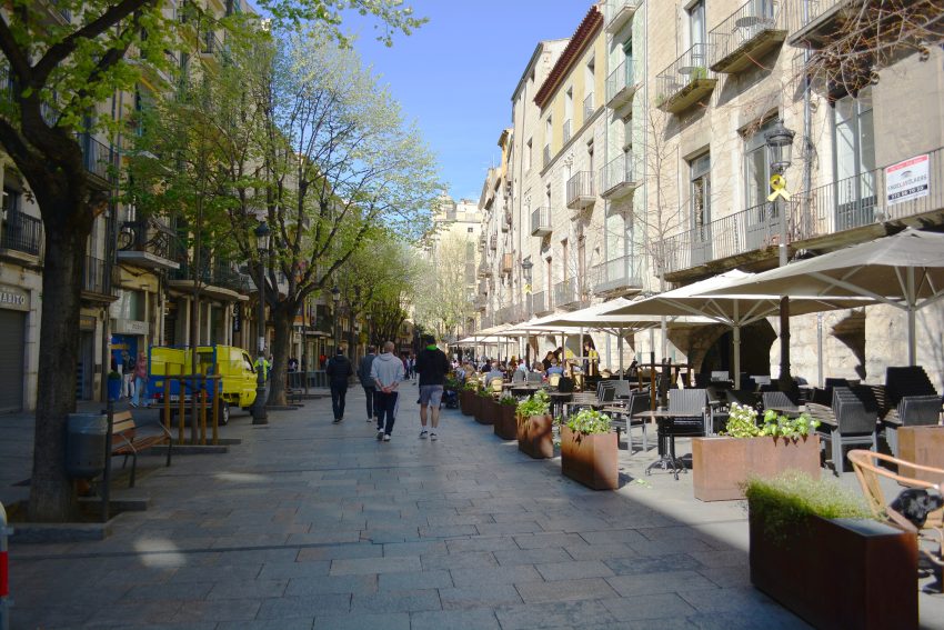
Map of the Self-Guided Walking Tour of Arnhem walking route with 13 stops in Arnhem.
Preview map of the Self-Guided Walking Tour of Arnhem route in Arnhem, showing 13 stops. Use the interactive map to zoom and tap markers.

More from this area

Self-Guided Walking Tour of Annecy (2026)

Self-Guided Walking Tour of Annecy

This website uses affiliate links which earn a small commission at no additional cost to you.

Annecy is made for exploring on foot. Its old town is compact, scenic, and threaded with canals that turn simple walks into postcard moments, while the lakefront opens into wide promenades and mountain views that feel surprisingly alpine for a small city. A self-guided route lets you move at your own pace-lingering on bridges, ducking into arcaded lanes, and stopping whenever a terrace or viewpoint looks too good to pass up.

This walking tour links the medieval and Renaissance heart of Annecy with its most atmospheric waterside corners, building from lively squares and market streets toward quieter canal paths and the lake. Along the way you'll pass landmark architecture, shaded quays, and elevated vantage points that put the city's layout into context. It is an efficient way to cover the best things to see in Annecy without turning the day into a checklist.

What makes Annecy especially satisfying is the variety packed into a short distance: stone gateways and pastel façades, waterways and gardens, and easy detours for museums, bakeries, or a quick swim in warmer months. By the time you reach the lakeside, you'll have a clear sense of how the old town's history connects to the modern promenade culture that defines the city today. With a flexible loop, you can keep it brisk in a couple of hours or stretch it into a full day with stops.

How to Get to Annecy

By Air: Annecy does not have a major commercial airport, so most visitors fly into Geneva Airport (GVA) or Lyon Saint-Exupéry Airport (LYS). Geneva is often the most convenient for international arrivals, with a short cross-border transfer into France, while Lyon can be a good option if you are continuing deeper into the Rhône-Alpes. From either airport, you can connect onward by train, coach/shuttle, or a private transfer depending on your budget and timing, and it is generally straightforward to arrive in Annecy without needing a car. For the best deals and a seamless booking experience, check out these flights to Annecy on Booking.com.

By Train: Annecy is well connected by rail, making the train one of the easiest and most predictable ways to arrive. Services typically link Annecy with hubs such as Lyon and Geneva, and there are also direct or one-change options from larger French cities depending on the season and timetable. The station sits close to the old town and canals, so you can often drop your bags and start walking within minutes, which is ideal for a self-guided itinerary. You can use SNCF Connect to check schedules, compare routes, and purchase tickets for National (SNCF ) and regional trains (TER). For a more streamlined experience, we recommend using Omio, which allows you to easily compare prices, schedules, and book tickets for both National and Regional travel across all of Europe, all in one place.

By Car: Driving to Annecy is simple if you are touring the region, but parking in and around the old town can be limited and expensive, especially in peak season and on weekends. The approach roads are scenic, and having a car is useful for lake circuits and nearby villages, but for the town itself you will likely prefer to park once and walk. If you are staying centrally, consider choosing accommodation with included parking or using a peripheral car park and entering the historic centre on foot. If you are looking to rent a car in France I recommend having a look at Discover Cars, first, as they compare prices and review multiple car rental agencies for you.

By Bus: Long-distance coaches can be a cost-effective alternative, particularly from Geneva, Lyon, or other regional cities, and they sometimes run at times that suit flight arrivals better than trains. The trade-off is that buses can be slower and more sensitive to traffic, especially around peak travel periods. If you are travelling on a budget or your schedule lines up neatly, it can be a practical way to arrive close to the centre without dealing with parking. [bus]

Where to Stay in Annecy

To make the most of visiting Annecy and this walking tour then you consider stay overnight at the centre. If you base yourself around the Old Town (Vieille Ville) you can start early before the day-trippers arrive, step straight into the canals and arcaded streets, and return easily for a break between sights. This is the most atmospheric area, but rooms can book out quickly in peak season, so it suits travelers who want to be in the middle of the scenery and do almost everything on foot. Good, walkable options here or on the Old Town edge include Palace de Menthon and Hôtel du Château.

If you want central convenience with a slightly calmer feel, look at the Station/Old Town fringe around the train station and the main shopping streets. You still have an easy walk into the historic centre and lakefront, but you gain quicker arrivals/departures and more choice at mid-range price points, which can be helpful if you are connecting by rail. This area works well if your plan is to walk the tour, then take day trips without moving accommodation. Consider Best Western Plus Hotel Carlton Annecy or Novotel Annecy Centre Atria for reliable comfort close to the route start points.

For lakeside views and a more “holiday” atmosphere, the Lakefront and Albigny/Impérial Palace area is ideal. You can begin or end your walk with the promenade, parks, and beaches, and it is especially appealing in warmer months when you will likely spend extra time by the water. The trade-off is that it can be a touch farther from the tight lanes of the Old Town, but it remains comfortably walkable and feels more spacious and restful in the evenings. Strong picks here include Impérial Palace and Rivage Hôtel & Spa Annecy.

A Short History of Annecy

Annecy grew from a strategic lakeside settlement into a fortified medieval town shaped by the rival powers of the Genevois and Savoy regions. The clearest symbol of that early authority is Château d'Annecy, built and expanded between the 12th and 16th centuries, which served as the residence of the Counts of Geneva and later the Dukes of Genevois-Nemours. Below the ramparts, the canal-side Palais de l'Isle preserves the town's administrative past: its oldest parts date from the 12th century, and across the centuries it functioned as a lordly residence, courthouse, mint, and prison-roles that reflect how governance and commerce were concentrated in the old town's tight waterways.

Annecy's religious architecture also maps its rise in regional importance. Église St. Maurice , the oldest church in town, began in 1422 as a Dominican convent chapel sponsored by Cardinal Jean-Allarmet de Brogny, and it later grew with chapels funded by local noble families and guilds. Annecy Cathedral was erected at the beginning of the 16th century by Jacques Rossel as a chapel for a Franciscan priory, and it was raised to cathedral status in 1822, reinforcing Annecy's position as a diocesan centre. Nearby, Église Saint-Francois was built on its present site in 1614, reflecting the Counter-Reformation era and Annecy's strong Catholic identity in a period when the wider region was marked by confessional change.

By the 19th and early 20th centuries, Annecy's identity broadened from fortified town to leisure city, with the lakefront becoming its public “front room.” Jardins de l'Europe took shape as an English-style landscape garden designed in 1863 by Henri Porreaux, creating a formal green link between the old town and the water. The elegant Pont des Amours followed, built to the plans of municipal architect Gaspard Fraüf and inaugurated on 9 June 1907, connecting the gardens to Le Pâquier, the wide lakeside esplanade whose name recalls its medieval use as grazing land and which tradition links to a 1613 donation by Count Bernard VI of Menthon. Together with the arcaded Rue Sainte-Claire , whose Renaissance-era covered walkways date largely from the 16th and 17th centuries, these spaces show how Annecy evolved into a walkable city built as much for strolling as for defence.

Your Self-Guided Walking Tour of Annecy

Discover Annecy on foot with our walking tour map guiding you between each stop as you weave through its canal-laced Old Town, arcaded medieval streets, and lakefront promenades framed by Alpine views. This walking tour traces the city's layered past and easygoing outdoor culture, from the Château d'Annecy and the storybook Palais de l'Isle to Rue Sainte-Claire's covered lanes, lively markets, and the broad greens of Le Pâquier, tying together historic landmarks, waterside viewpoints, and the prettiest corners of a city shaped by the lake.

1. Hotel de Ville

Hotel ville Annecy
Hotel ville Annecy
CC BY-SA 4.0 / Annecy-Hotel de ville

On a walking tour, Annecy’s Hotel de Ville is best approached as a civic “set piece” on the Esplanade de l’Hôtel de Ville, where the town’s administrative life meets the open-air rhythm of the centre. It is a useful waypoint between the Old Town lanes and the more open lakefront spaces, and it also helps you read Annecy beyond postcards: this is where decisions, ceremonies, and public life have been anchored for generations.

Annecy’s first town hall stood closer to the old parish core, beside the Notre-Dame-de-Liesse church on what is now around Rue Notre-Dame. That earlier building was originally constructed as a hospital and then repurposed for municipal use in 1770, with a design noted for features such as a grand exterior stair, ironwork balconies, and a pediment with an oculus; period visitors even remarked on a wrought-iron trout motif linked to the city’s coat of arms. As the town’s needs grew in the 19th century (during the Kingdom of Sardinia era), a larger neoclassical Hôtel de Ville was commissioned, designed by architect François Justin and completed in 1851, with a deliberately symmetrical ashlar-stone façade and an Ionic portico that signals institutional authority at a glance.

The building retained its prominence after Savoy was annexed to France in 1860, and the setting in front of it has continued to evolve, including a 1995 redesign of the square and water feature by Jean-Michel Wilmotte. A major interruption came on 14 November 2019, when an electrical fault caused a severe fire that damaged the upper floors and roof; the long-term restoration (associated with architect Pierre-Louis Faloci) has been planned as a major conservation-and-modernisation project, with timelines publicly discussed around work starting in 2025 and completion targeted for 2027. For your tour, treat it as an exterior architecture stop and a context marker for Annecy’s modern civic identity, rather than an interior visit.


Location: Espl. de l'Hôtel de ville, 74000 Annecy, France | Hours: Monday – Friday: 08:30–17:30. | Price: Free. | Website

We recommend to rent a car in France through Discover Cars, they compare prices and review multiple car rental agencies. Book your rental car here.

2. Eglise Saint-Francois

Eglise Saint Francois dAnnecy
CC BY-SA 4.0 / Tiia Monto

Eglise Saint-François offers a quieter, more local-feeling stop, and that contrast is valuable in a tour that can otherwise become a sequence of “pretty” views. The church sits within the lived-in fabric of Annecy, so arriving here feels less like entering a set piece and more like encountering a functioning part of the town’s daily rhythm. It is an ideal place to slow down and let the historic centre feel real rather than curated.

Architecturally, it is worth paying attention to the building’s modesty and the way its interior prioritises calm. You may notice how the light falls differently than in the cathedral, and how the atmosphere encourages a brief, unhurried visit rather than a rushed checklist. These quieter churches are often where you pick up on the subtler layers of a place—how it has been used, revisited, and reinterpreted across generations.

On your route, this stop works well as a transition between canal-watching and lakefront strolling. If you have already done the most photographed corners, Saint-François helps rebalance the experience with something more contemplative. From here, you can thread back toward the busier lanes with a fresh perspective, noticing details you might otherwise overlook.


Location: 1 Pl. Saint-François de Sales, 74000 Annecy, France | Hours: Daily: 09:00–19:00. | Price: Free; donations appreciated. | Website

Here is a complete selection of hotel options in Annecy. Feel free to review each one and choose the stay that best suits your needs.

3. Palais de l'Isle

Palais de lIsle
Palais de lIsle
CC BY-SA 4.0 / Zairon

Palais de l’Isle is Annecy’s most iconic building, and it earns that status the moment you see it anchored in the canal like a stone ship. On a walking tour, it functions as both a visual highlight and an orientation point, because many of the prettiest canal views radiate from the bridges around it. The best approach is to arrive via a narrow lane so the building appears suddenly, framed by water and railings.

Spend time walking a small loop around it rather than treating it as a single photo stop. Each angle tells a different story: the pointed end feels almost nautical, while the side façades reveal how tightly the old town was built around waterways and commerce. If you visit when light is changing—early morning or late afternoon—the stone textures and reflections become even more dramatic.

Once you have your fill of the canals, use Palais de l’Isle as the pivot toward either the uphill streets or the lakefront. It naturally sits at the seam between the old town’s medieval density and the more open spaces that follow. If you are pacing your tour, this is also a smart place for a short pause, because nearby benches and café terraces make it easy to stop without losing momentum.


Location: 3 Pass. de l'Île, 74000 Annecy, France | Hours: (Summer) June 1 – September 30; Wednesday – Monday: 10:30–18:00. Closed on Tuesday. (Winter) October 1 – May 31; Wednesday – Monday: 10:00–12:30 & 14:00–17:30. Closed on Tuesday. | Price: Adults: €4 (June 1 – June 30 & September 1 – December 31) / €5 (July 1 – August 31); Children: €2 / €2.50; Under 12: free. | Website

Traveling to a country with a different currency? Avoid ATM transaction fees and pay in local currency with a Wise Card. Having used it for over 5 years, we've saved loads on fees!

4. Basilique de la Visitation

Basilique_de_la_Visitation,_Annecy
CC BY-SA 2.0 / Guilhem Vellut

The Basilique de la Visitation is the “must see” you feel before you even reach it: it dominates Annecy’s skyline from its elevated position on the Crêt du Maure, and it is visible from many points along the lakefront and Old Town. On a walking tour, it works best as a deliberate climb—either a standalone detour for sweeping viewpoints or a finale after the flatter canal-and-lake circuit. The ascent is part of the experience, because the city gradually opens beneath you, and the basilica’s scale becomes more impressive the closer you get.

Unlike Annecy’s medieval core, the basilica is a 20th-century monument. The project is tied to the Order of the Visitation, founded in 1610 by Saint Francis de Sales and Saint Jeanne de Chantal, and the basilica also functions as a spiritual focal point for that tradition. Construction was begun in the early 20th century and the building was completed in 1930, based on plans associated with architect Alfred-Henri Recoura, with a crypt designed by Henri Adé beneath the nave. Inside, the tone is late-19th/early-20th-century in character, with a broad semicircular-arched vault and stained glass that narrates episodes from the lives of the two saints.

This is also a landmark for its vertical presence: the bell tower rises to roughly 275 feet (about 72 metres) and is topped by a prominent cross, and the tower contains a full carillon of 38 bells. The largest bell, Marie-Françoise, is often singled out for its weight and presence, and when the bells are active they reinforce the basilica’s role as a citywide signal point. For walking-tour planning, aim for clear weather if possible so the viewpoint pays off, and allow time to pause both outside (for the panorama) and inside (for the calmer, devotional atmosphere and the saints’ tombs).


Location: 11 Av. de la Visitation, 74000 Annecy, France | Hours: Monday – Friday: 07:15–18:30. Saturday: 07:15–12:00 & 14:00–18:30. Sunday: 09:00–18:00. | Price: Free | Website

5. Château d'Annecy

Château d'Annecy
Château d’Annecy
CC BY-SA 4.0 / Tiia Monto

Perched above the old town, Château d’Annecy is the natural place to start if you want immediate context for the city’s layout. The climb rewards you with expanding views over the rooftops, the canal grid, and Lake Annecy beyond, so it is worth timing this stop for clear weather if you can. Even if you do not go inside, the approach alone sets the tone for Annecy as a town shaped by both defence and trade.

Architecturally, the château is a patchwork of eras, which is part of its appeal on a walking tour: you can read the evolution from medieval stronghold to later residential use in its towers, walls, and courtyards. Take a slow circuit around the exterior first, then step inside with an eye for how the building frames views outward, almost like a deliberate promenade. It is one of the best spots in town for photographs that feel distinctly “Annecy,” because the skyline and lake share the frame.

From here, the descent into the old town becomes a satisfying transition from panoramic to intimate. Pick a route that funnels you toward the canal quarter so you can watch the city change scale from broad vistas to narrow lanes. If your tour is busy later in the day, this is also a strong morning stop, when the climb is cooler and the light is softer over the lake.


Location: Pl. du Château, 74000 Annecy, France | Hours: (Summer) June 1 – September 30; Daily: 10:30–18:00. (Winter) October 1 – May 31; Monday, Wednesday – Sunday: 10:00–12:30 & 14:00–17:30. Closed on Tuesday. | Price: Adults: €6.50 (July–August: €7); Reduced: €3.50 (July–August: €4); Under 12: free. | Website

6. Porte Sainte-Claire

Place Sainte-Claire, Annecy
CC BY-SA 1.0 / Pointe Twist

Porte Sainte-Claire is one of the most satisfying “threshold” moments on a walking tour of Annecy: you step through the old gateway and the city immediately tightens into arcaded lanes, canal-side corners, and the hum of the historic centre. A surviving remnant of Annecy’s former fortifications, the gate once helped control access into the medieval town and marked a key entry point on the approach from the surrounding routes, when walls and gates regulated movement and trade. Today it is a quick stop with real atmosphere—pause for a photo looking back through the arch toward Place Sainte-Claire, then continue along Rue Sainte-Claire or peel uphill toward the château for a natural old-town-to-viewpoint detour.


Location: Porte Sainte Claire, Rue Sainte-Claire, Annecy, France | Hours: 24 Hours | Price: Free | Website

7. Rue Sainte-Claire

Rue Sainte Claire in Annecy
CC BY-SA 4.0 / Krzysztof Golik

Rue Sainte-Claire is one of the most atmospheric stretches in Annecy because it combines everyday life with historic form. Its arcades create a sheltered corridor that feels inviting in any weather, and the street naturally draws you along the old town’s commercial spine. On a walking tour, it works as both a landmark and a connector, linking small squares, canal crossings, and side streets that invite detours.

The arcaded architecture is the main event here: look up at the repeated arches and the way shopfronts and façades sit in tight rhythm. You’ll notice how the street encourages strolling rather than rushing, with bakeries, small boutiques, and cafés filling the ground level. If you want to experience the street at its best, pass through twice—once in the morning when deliveries and locals set the pace, and again later when it becomes a social promenade.

Because it is central, Rue Sainte-Claire is also practical: it is a good place to schedule a brief pause without derailing your route. Step into an arcade recess to watch the flow of people, or take a short side turn toward the canals for a quieter contrast. If you are walking during peak season, treat it as a slow zone and enjoy it as a scene rather than a shortcut.


Location: Rue Sainte-Claire, 74000 Annecy, France | Hours: 24 Hours. | Price: Free.

8. Pont Morens

The Morens Bridge Annecy
CC BY-SA 4.0 / Chabe01

Pont Morens is one of those small, quietly photogenic canal crossings that rewards a brief, unhurried stop. On a walking tour, treat it as a “slow bridge”: step onto it, look both ways along the waterline, and take in how the façades, railings, and reflections compress Annecy into a tight, storybook scene. It is particularly effective as a short reset between busier lanes, because the view is naturally framed and encourages you to pause without needing a long detour.

For the best experience, approach from the old-town side at a relaxed pace, then turn back once you’ve crossed so you can see the canal receding behind you. Early morning and late afternoon tend to give the cleanest light and the most readable reflections; midday can be brighter but still works if you angle for texture in the stonework and water. If you are walking a loop, use Pont Morens as a natural pivot point to decide whether to continue along the canals toward the iconic viewpoints or peel off into the quieter backstreets for a calmer stretch before returning to the lakefront.


Location: Rue du Pont Morens, 74000 Annecy, France | Hours: 24 Hours. | Price: Free.

9. Annecy Cathedral

Cathedrale annecy facade
CC BY-SA 2.0 / Manu25

Annecy Cathedral (Cathédrale Saint-Pierre) is easy to miss if you are expecting a grand, open square, which is exactly why it makes a satisfying walking-tour stop. It sits a little apart from the canal bustle, offering a calmer pocket of the old town. Arriving here feels like stepping into a more reflective Annecy, where the pace drops and the streets narrow.

Inside, the cathedral’s atmosphere is defined by restrained elegance rather than excessive ornament. This is a place to notice proportions, light, and the gentle shift in acoustics as you move from street noise to interior hush. Even a short visit can reset your day, especially if your tour includes busier stops like the canal crossings and lakefront.

From the cathedral, you can stitch your route back toward the most photogenic waterways in minutes. Consider using this stop as a midpoint on the old-town circuit, balancing the visual intensity of canals and shopfronts with a quieter interior. It also pairs well with nearby churches, letting you compare styles and the different roles these buildings played in Annecy’s civic and spiritual life.


Location: 8 Rue Jean-Jacques Rousseau, 74000 Annecy, France | Hours: Daily: 09:00–18:00. | Price: Free; donations appreciated. | Website

10. Le Pâquier

Annecy Canal du Vasse Pont des Amours
CC BY-SA 4.0 / Zairon

Le Pâquier is Annecy’s great open green, and it changes the feel of the city the moment you step onto it. After the density of the old town, this broad esplanade gives you space, sky, and uninterrupted views toward the lake and mountains. On a walking tour, it is the place where Annecy feels less like a medieval town and more like a resort city built for outdoor life.

The best way to experience Le Pâquier is to walk it as a long, relaxed line, letting your gaze alternate between the water and the skyline. It is also where you will see Annecy’s daily rituals: morning jogs, picnics, people reading on the grass, and families using it as a meeting ground before heading to the lakeside paths. If you have time, it is worth sitting here briefly, because the stop deepens your sense of place more than another quick landmark tick.

Logistically, Le Pâquier is an excellent end point for your route. You can finish with an unhurried promenade, choose a terrace nearby, or continue along the lake toward quieter stretches if you want to extend your walk. If the old town felt busy, this is where the day often softens, giving you a spacious finale that balances the tour’s earlier detail and texture.


Location: Av. d'Albigny, 74000 Annecy, France | Hours: 24 Hours. | Price: Free.

11. Pont des Amours

Pont des Amours
Pont des Amours

Pont des Amours is a short crossing, but it is one of the most memorable “moments” in an Annecy walk because it concentrates views in every direction. From the bridge you can look back into the canal-like outflow, across the gardens, and out toward the lake, all within a few steps. That visual range makes it a natural pause point, and in peak season you will see nearly everyone stopping for the same reason.

To enjoy it properly, do not just cross once and move on. Step to one side, take in the framing, then cross and look back from the opposite end, where the perspective shifts and the scene often becomes more symmetrical. If you are travelling with someone, this is one of the easiest places to capture a classic Annecy photo without needing to plan it.

As a routing tool, the bridge marks a clean transition: on one side, the composed greenery of Jardins de l’Europe; on the other, the more open lakefront spaces that invite longer strolling. If your tour includes a loop, this is also a convenient “turning point” that lets you decide whether to continue lakeside or head back into the old town’s lanes.


Location: Pont des Amours, 74000 Annecy, France | Hours: 24 Hours. | Price: Free.

12. Jardins de l'Europe

Jardins de lEurope
Jardins de lEurope
CC BY-SA 4.0 / karlheinz klingbeil

Jardins de l’Europe is where Annecy’s old-town compactness opens into a more expansive lakeside mood. The gardens are designed for lingering, with shaded paths, lawns, and mature trees creating a gentle buffer between the historic centre and the water. On a walking tour, it is the ideal place to slow your pace and let the setting do some of the work.

The appeal here is not a single monument but the overall composition: greenery, lake views, and glimpses back toward the town. Walk the perimeter paths first, then drift inward toward benches and viewpoints where you can watch the movement of boats, cyclists, and families. It is also one of the easiest places to feel the Alpine setting, because the horizon opens and the mountains start to frame the scene.

Use the gardens strategically. If you are touring in summer, this is a smart stop for shade and recovery before you continue across the bridge and along the promenade. If you are here in cooler months, the gardens can be brisk but beautifully clear, with crisp views across the lake. Either way, it is the calm hinge between the old town and the lakefront highlights.


Location: Quai Napoléon III, 74000 Annecy, France | Hours: 24 Hours. | Price: Free.

13. Claude Louis Berthollet

Statue of Claude Louis Berthollet in Annecy
CC BY-SA 4.0 / GFreihalter

The statue of Claude-Louis Berthollet in Annecy is a worthwhile lakeside pause on a walking tour, quietly honoring the Savoyard-French chemist whose work helped shape modern chemistry and who is often associated with pioneering chlorine-based bleaching. You’ll find it in the Jardins de l’Europe, a leafy park right on the edge of Lake Annecy, where the promenade opens to wide views across the water and the mountains beyond. It is an easy stop to fold in as you transition between the Old Town and the lakefront circuit: take a minute to read the dedication, then continue on toward Pont des Amours or Le Pâquier, using the gardens as a calm reset point before the next cluster of sights.


Location: 1 Espl. de l'Hôtel de ville, 74000 Annecy, France | Hours: 24 Hours. | Price: Free

14. Eglise St. Maurice

Saint Maurice church in Annecy
CC BY-SA 4.0 / Krzysztof Golik

Saint Maurice is often described as Annecy’s oldest church, and whether you come for history or atmosphere, it is one of the most rewarding interior stops in the old town. The exterior blends into its surroundings more than you might expect, which makes stepping inside feel like discovering a hidden room in the city. On a walking tour, it is a strong counterpoint to the bright canal scenes outside.

Inside, look for the sense of continuity: the building’s form and chapels reflect centuries of community patronage and evolving religious life. Even if you are not deeply interested in ecclesiastical architecture, you can appreciate how the space was designed to hold a crowd, focus attention, and create a reflective pause in the middle of a busy commercial town. The quiet here tends to be genuine, especially outside peak service times.

Because it is centrally placed, Saint Maurice can be used to shape your tour’s cadence. Consider visiting after a dense sequence of bridges and lanes, when you need a change of sensory register. When you step back outside, the old town will feel sharper—the water brighter, the stonework more textured—because you have given your eyes and ears a reset.


Location: Rue Saint-Maurice, 74000 Annecy, France | Hours: 24 Hours | Price: Free; donations appreciated.

15. Église Notre-Dame-de-Liesse

Eglise Notre Dame Liesse Annecy 2
CC BY-SA 4.0 / Chabe01

Église Notre-Dame-de-Liesse is a strong stop on an Annecy walking tour because it sits slightly back from the canal spectacle, offering a quieter, more “local” pocket of the centre. The church is easy to fold into your route as you move between the Old Town lanes and the more open civic spaces, and it provides a useful contrast to Annecy’s postcard viewpoints: here, the emphasis is on community life and continuity rather than scenery. Take a moment outside to notice how the church anchors its small square and how the surrounding streets funnel foot traffic past it.

Inside, Notre-Dame-de-Liesse works best as a brief, reflective visit. The atmosphere tends to be calm, with softer light and a more intimate scale than some of the city’s headline monuments, making it a good mid-tour reset if the canals feel busy. When you leave, continue on foot toward Rue Sainte-Claire or the Hôtel de Ville area depending on your route, using the church as a transition point between the dense historic core and the more spacious parts of the centre.


Location: Passage Notre Dame, 74000 Annecy, France | Hours: Daily: 09:00–18:00. | Price: Free; donations appreciated. | Website
Powered by GetYourGuide
Moira & Andy
Moira & Andy

Hey! We're Moira & Andy. From hiking the Camino to trips around Europe in Bert our campervan — we've been traveling together since retirement in 2020!

Read our full story here

This website uses affiliate links which earn a small commission at no additional cost to you.

Walking Tour Summary

Distance: 3 km
Sites: 15

Walking Tour Map
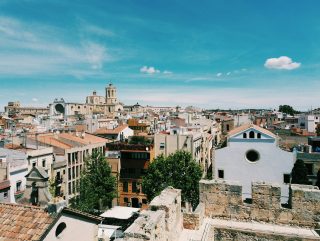
Map of the Self-Guided Walking Tour of Annecy walking route with 15 stops in Annecy.
Preview map of the Self-Guided Walking Tour of Annecy route in Annecy, showing 15 stops. Use the interactive map to zoom and tap markers.

More from this area

Self-Guided Walking Tour of Ajaccio (2026)

Phare de la Citadelle d'Ajaccio, Corse-du-Sud, France
Phare de la Citadelle d’Ajaccio, Corse-du-Sud, France
CC BY-SA 3.0 / Myrabella

This website uses affiliate links which earn a small commission at no additional cost to you.

Ajaccio is a city that rewards walking because its story is packed into a compact, coastal footprint: ferry docks and marina life on one edge, a tight Old Town of lanes and squares in the middle, and a ribbon of seafront that keeps pulling your gaze outward. A self-guided route lets you move with the city's natural rhythm-pause when the light is good, linger when a street feels alive, and keep momentum when you want to cover ground.

This walking tour is designed as a logical loop that starts near the harbour and threads through Ajaccio’s most characterful streets, cultural stops, and waterfront pauses. Along the way you’ll hit a strong mix of civic spaces, churches, museums, and shoreline viewpoints, with enough flexibility to shorten the route, add a museum visit, or fold in a market stop depending on the day.

If you're deciding what to prioritise, this route focuses on the best things to see in Ajaccio for a first visit: places that explain the city quickly, feel distinctly Corsican, and fit together without awkward detours. By the end, you'll have a clear sense of Ajaccio's layout and personality-where history sits in the streets, where the sea defines the mood, and where to slow down for a final, satisfying view.

How to Get to Ajaccio

By Air: Ajaccio Napoléon Bonaparte Airport (AJA) is the main gateway, with the quickest transfers into the city centre typically by taxi, rideshare, or seasonal shuttles, depending on arrival times. If flights are limited or expensive, Bastia Poretta Airport (BIA) can be a practical alternative, especially if you're already planning a wider Corsica itinerary, but it adds overland travel time. In peak season, book flights and airport transfers early, as availability and pricing can move quickly. For the best deals and a seamless booking experience, check out these flights to Ajaccio on Booking.com.

By Train: Ajaccio is served by Corsica's rail network (Chemins de fer de la Corse), linking the city with major inland and northern hubs such as Corte and Bastia via scenic, slower-paced routes that are more about comfort and landscape than speed. For a walking-tour itinerary, the key advantage is simple: Ajaccio's station is close enough to reach the Old Town and harbour area on foot, making rail a convenient, low-stress way to arrive without needing a car immediately. You can use SNCF Connect to check schedules, compare routes, and purchase tickets for National (SNCF ) and regional trains (TER). For a more streamlined experience, we recommend using Omio, which allows you to easily compare prices, schedules, and book tickets for both National and Regional travel across all of Europe, all in one place.

By Car: Driving works well if you want flexibility for beaches and day trips, but allow for slower mountain roads and seasonal congestion, especially on approach to the centre and waterfront. Plan to park once and then walk-Ajaccio’s historic core is better navigated on foot, and short one-way streets can make “just driving closer” counterproductive. If you are collecting a rental car, consider timing pickup for after your city walk so you avoid parking logistics on arrival day. If you are looking to rent a car in France I recommend having a look at Discover Cars, first, as they compare prices and review multiple car rental agencies for you.

By Bus: Intercity coaches and regional buses can be a cost-effective option from other Corsican towns, though timetables may be less frequent outside peak periods and travel times can be longer than expected due to terrain and traffic. If you arrive by bus, you’ll usually be dropped within easy walking distance of the centre, making it a workable choice for travellers building a car-free itinerary.

Where to Stay in Ajaccio

To make the most of visiting Ajaccio and this walking tour, you should consider staying overnight in the centre so you can start early, move between stops on foot, and return easily for a break before heading out again in the evening. The most convenient base is the Old Town/Citadel side of the centre, where you are closest to the historic lanes, cathedral area, and the harbourfront promenade; for this, look at Hotel San Carlu Citadelle or Le Dauphin Hôtel, both of which keep you within a short, straightforward walk of the core route.

If you want to be central but with a little more “city convenience” for cafés, shops, and easy route planning, the Rue Fesch/Cours Napoléon axis is a practical choice that still places you close to the museum and square sequence on the tour. In this zone, Hôtel Fesch & Spa is a strong option for being right in the middle of things, while Kallisté Hôtel works well if you value quick access between the station-side approaches and the waterfront end of the walk.

For travellers who prefer a more modern waterfront feel while still keeping the Old Town comfortably walkable, staying near the port/marina edge can be a smart compromise: you get an easy start at the harbour-side stops and a pleasant evening promenade without needing transport. Best Western Plus Ajaccio Amirauté is a reliable pick in this broader central waterfront area, particularly if you want a straightforward, full-service base.

If your priority is sea views, sunsets, and a calmer resort-like atmosphere after your walking day, consider the Route des Sanguinaires corridor on the western seafront; it is not “Old Town immediate,” but it can be excellent if you are happy using a short taxi or bus hop to begin the tour and then returning to a quieter coastal setting later. Sofitel Golfe d’Ajaccio Thalassa Sea & Spa is the classic option here for a sea-facing stay that feels like a destination in itself.

A Short History of Ajaccio

Ajaccio’s recorded story accelerates in the late 15th century, when the Republic of Genoa established the town as a fortified coastal base. The Citadelle d’Ajaccio, begun in this Genoese phase, still defines the city’s seaward edge and explains why the Old Town feels “contained” behind it. Just beyond that defensive line, today’s Gare Maritime d’Ajaccio and harbour frontage reflect Ajaccio’s enduring role as Corsica’s maritime gateway-modern infrastructure sitting in the same strategic coastal position that mattered to Genoa.

In the centuries that followed, Ajaccio’s historic core consolidated around churches and confraternities as much as around its port. The Cathédrale Notre-Dame-de-l’Assomption was built in the late 16th century under Genoese rule and remains one of the clearest architectural markers of that era in the old quarter. Nearby, the Oratory of Saint John the Baptist reflects the city’s tradition of lay religious brotherhoods and processional life, adding a quieter layer to the street network that visitors experience today as compact lanes opening into small squares.

Ajaccio's modern identity is inseparable from the Bonaparte story and the 19th-century civic investments that followed. Maison Bonaparte-an 18th-century family house made famous by Napoleon's birth-anchors the “Napoleonic Ajaccio” narrative, while Rue Cardinal Fesch is named for Cardinal Joseph Fesch (Napoleon's uncle), whose legacy culminated in the Musée Fesch, created from his major art bequest and housed in a purpose-built museum complex opened in the 19th century. The Chapelle Impériale, commissioned in the mid-19th century by Napoleon III as a mausoleum for the Bonaparte family, adds an explicit imperial monument to the city's fabric, and Place Foch and the Marché d'Ajaccio reflect the same period's push toward a more formal civic centre. Finally, Plage Saint-François sits at the edge of the old quarter as a modern, leisure-facing counterpoint to the citadel: a reminder that Ajaccio's shoreline has shifted from defence and departure to daily life and waterfront downtime.

Your Self-Guided Walking Tour of Ajaccio

Discover Ajaccio on foot with our walking tour map guiding you between each stop as you explore its harbourfront, historic lanes, and landmark Napoleonic sites, with the citadel and the sea never far from view. This walking tour traces the city's layered identity, Genoese fortifications, Corsican street life, and imperial-era history, from the port and central squares to cathedral stops and cultural highlights, all within a compact coastal city shaped by its waterfront.

1. Port d’Ajaccio

Celebrity Silhouette Ajaccio 2015
CC BY-SA 2.0 / JeanbaptisteM

Arriving at the Gare Maritime is your first “Ajaccio makes sense” moment: the city opens as a layered shoreline of ferry infrastructure, marina life, and the older centre rising just behind. Even if you are not arriving by boat, it is worth beginning here because the port explains Ajaccio’s orientation in one glance—water in front, the old town to your right, and the main civic axis pulling you inland.

On a walking tour, use the port as a slow warm-up rather than a rushed transit zone. Watch how locals move: commuters cutting across quays, delivery activity for cafés, and the steady choreography of boats and pedestrians. It sets a practical tone for Corsica, where the sea is not scenery, it is a transport network that still drives the city’s rhythm.

From here, your route naturally funnels toward the central streets via the waterfront and into the old quarter. Keep the sea at your back as you step away from the quays, and you’ll feel the shift from open harbour space to the tighter, more textured streets that define Ajaccio’s historic core.


Location: 20000 Ajaccio, France | Hours: 24 Hours. | Price: Free. | Website

We recommend to rent a car in France through Discover Cars, they compare prices and review multiple car rental agencies. Book your rental car here.

2. Citadelle d'Ajaccio

Citadelle dAjaccio
Citadelle dAjaccio
CC BY-SA 2.0 / Rotavdrag

The Citadel is the clearest statement Ajaccio makes about security, strategy, and shoreline control. Even when parts are not fully accessible, its presence matters on a walking tour because it shapes how you understand the city’s relationship to the sea: not only as beauty, but as exposure that once had to be managed.

Use the citadel zone for viewpoint walking. This is where you feel the edges of the old town—where streets thin out, the horizon widens, and the city becomes a boundary rather than a maze. It is also a strong place to discuss Ajaccio in “layers”: fortifications, port life, and modern promenade culture stacked along the same line.

As a stop, it works best when paired with a waterfront segment. The contrast is the point: the citadel represents constraint and control, while the nearby promenade represents leisure and openness. Moving between them is what makes the city’s story feel physical rather than abstract.


Location: 8-10 Bd Danièle Casanova, 20000 Ajaccio, France | Hours: Monday – Wednesday: 09:00–20:00. Thursday – Friday: 09:00–23:00. Saturday – Sunday: 09:00–20:00. | Price: Free. | Website

Here is a complete selection of hotel options in Ajaccio. Feel free to review each one and choose the stay that best suits your needs.

3. Plage Saint-François

Corsica Ajaccio Plage St Francoise Andrea panoramio
CC BY-SA 3.0 / jeffwarder

Plage Saint-François is the walk’s reward: a compact city beach that delivers that essential Corsican feeling of sea access without the logistics of leaving town. It is not necessarily the wildest or most dramatic beach, but it is one of the most useful because it is so close to the historic centre.

On a walking tour, this is where you let the day exhale. Even if you do not swim, it is worth stopping for a few minutes to take in the shoreline perspective back toward the city. It re-frames Ajaccio as a place you can inhabit casually, not just visit formally.

Use it strategically at the end of your route or as a mid-tour reset when the streets start to feel dense. A short beach pause restores energy, especially in warmer months, and it makes the rest of your walk feel more like a coastal day out and less like a sequence of stops.


Location: 6 Bd Pascal Rossini, 20000 Ajaccio, France | Hours: 24 Hours. | Price: Free.

Traveling to a country with a different currency? Avoid ATM transaction fees and pay in local currency with a Wise Card. Having used it for over 5 years, we've saved loads on fees!

4. Cathedral of Our Lady of the Assumption

Ajaccio cathedrale facade
CC BY-SA 2.0 / Myrabella

Ajaccio’s cathedral is a strong anchor in the old quarter, both visually and historically. It is a place where the city’s religious life, civic identity, and architectural presence converge, and it is worth visiting even if you generally do not prioritise churches, because it grounds the old town in a sense of permanence.

On a walking tour, approach it from the surrounding lanes so the cathedral feels “found” rather than scheduled. The experience is better when you arrive through the neighbourhood’s texture—small streets, shifting light, and the soft build-up of anticipation as the space opens.

Inside, keep your visit simple and attentive. Notice how the cathedral holds sound and light, and how it creates a pause in a day of outdoor movement. Then step back out and let it be a pivot point—either toward the citadel-side edges for a more defensive, maritime Ajaccio, or back into the squares for café life.


Location: Rue Forcioli Conti, 20000 Ajaccio, France | Hours: Monday – Saturday: 08:30–11:30 & 14:30–17:45. Sunday: 08:30–11:30. | Price: Free | Website

5. Oratory of Saint John the Baptist

Oratoire Saint Jean Baptiste dAjaccio panoramio 1
CC BY-SA 3.0 / Björn S.

The Oratory of Saint John the Baptist is a quieter, often underappreciated stop that adds spiritual texture to a city many people approach mainly through port views and Napoleonic history. It is the kind of place that rewards a short visit because it shifts your attention from movement to meaning.

On a walking tour, use it as a calm interior interlude. Step in briefly, let your eyes adjust, and take in how devotion is expressed here—through craft, atmosphere, and a sense of continuity that contrasts with the street’s faster tempo outside. Even a few minutes can change the emotional tone of your route.

This stop also helps balance your itinerary. A good Ajaccio walk is not only museums and monuments; it is also small sacred spaces that remind you the city has lived many lives in parallel—religious, civic, commercial—often within the same few blocks.


Location: Rue Roi de Rome, 20000 Ajaccio, France | Hours: Check official website. | Price: Free; donations appreciated. | Website

6. Maison Bonaparte

Korsika Ajaccio Rue Saint Charles Maison Napoleon Bonaparte panoramio 2
CC BY-SA 3.0 / giggel

Maison Bonaparte is Ajaccio’s signature historical stop, but it is most rewarding when you treat it as a story about place, not just fame. The power of the visit is its scale: the idea that a global figure’s origins are embedded in a relatively modest, walkable corner of town.

On a walking tour, it works best as a focused, intentional visit rather than a rushed detour. Arrive with one question in mind—what did Ajaccio look and feel like when this household was shaping its identity—and the rooms and objects become more than exhibits. They become a lens on Corsican society, family structures, and the city’s relationship to its most famous name.

When you step back outside, the surrounding streets feel different. You are no longer just “in the old town”; you are in the setting of a narrative that still colours Ajaccio’s identity, signage, and tourism economy, and you can see how history gets continuously repackaged into present-day city life.


Location: Rue Saint-Charles, 20000 Ajaccio, France | Hours: (Summer) April 1 – September 30; Tuesday – Sunday: 10:30–12:30 & 13:15–18:00. Closed on Monday. (Winter) October 1 – March 31; Tuesday – Sunday: 10:30–12:30 & 13:15–16:30. Closed on Monday. | Price: Adults: €7; Reduced: €5; Under 26 (EU residents): free. | Website

7. Place Foch

Ajaccio Bon Pl JPG
Ajaccio Bon Pl JPG
CC BY-SA 3.0 / Jean-Pol GRANDMONT

Place Foch is Ajaccio’s classic civic living room: open, central, and constantly in use. On a walking tour, it is one of the best places to pause because it gives you both atmosphere and orientation—an easy point to regroup, decide your next direction, and watch the city’s social rhythm.

Treat it as a place to notice layers. There is the formal element of a main square, but also the casual reality of Ajaccio: quick meet-ups, café time, families passing through, and travellers lingering longer than they planned. It is an excellent place for a short break that still feels like “doing the tour.”

From Place Foch, you can feed naturally toward the older lanes for Napoleon-related stops, or drift back toward the waterfront for air and views. That flexibility is the point: it is a hub, not an endpoint, and it helps your route feel effortless rather than forced.


Location: Place Foch, 20000 Ajaccio, France | Hours: 24 Hours. | Price: Free.

8. Marché d'Ajaccio

Ajaccio Marche JPG1
Ajaccio Marche JPG1
CC BY-SA 3.0 / Jean-Pol GRANDMONT

Ajaccio’s market is where the city becomes immediate: local produce, Corsican specialities, and the hum of daily transactions. It is a practical stop that also functions as cultural shorthand—what people eat, what they prioritise, and how morning life is structured in the centre.

On a walking tour, use the market as a sensory reset. Even if you are not shopping, do a slow loop and focus on what looks distinctly Corsican—cheeses, charcuterie, seasonal fruit, and jars of local products that are clearly not generic imports. It is also a good moment to hydrate and pick up something simple to keep you moving.

The market pairs well with the next civic spaces because it explains them. Squares and promenades can feel like scenery, but once you’ve seen the market’s everyday pulse, the rest of the city reads as a lived-in system rather than a collection of attractions.


Location: 7 Bd du Roi Jérôme, 20000 Ajaccio, France | Hours: Tuesday – Sunday: 07:00–13:00. Monday: 07:00–13:00 (summer only). | Price: Free. | Website

9. Chapelle Impériale

Chapelle imperiale 2
CC BY-SA 2.0 / Eveha

The Chapelle Impériale is a compact but high-impact stop, best approached as a quiet counterpoint to Ajaccio’s busy streets. Its appeal is not only architectural; it is emotional and symbolic, tied to the city’s Napoleonic identity and the way Ajaccio holds memory in small, concentrated spaces.

On a walking tour, this is where you slow your breathing and change gears. Step inside with the mindset of “ten attentive minutes” rather than “another checklist stop.” The chapel’s atmosphere rewards stillness—details, textures, and a sense of solemnity that contrasts with the easy coastal mood outside.

Use the chapel as a pivot point. After a reflective interior stop, Ajaccio feels more layered, and the tour becomes less about moving between places and more about moving between moods: civic life, art, devotion, and public space, all within a short walking radius.


Location: 50-54 Rue Cardinal Fesch, 20000 Ajaccio, France | Hours: (Summer) May 1 – October 31; Daily: 09:15–18:00. | Price: Adults: €9; Reduced: €6; Groups: €6. | Website

10. Musée Fesch

Ajaccio musee Fesch
Ajaccio musee Fesch
CC BY-SA 2.0 / Velvet

Musée Fesch is the cultural heavyweight of central Ajaccio, and it earns its place on a walking tour because it adds depth to the city beyond the waterfront and Napoleonic storyline. Even travellers who “aren’t museum people” often find it rewarding here, because the collection gives you a broader Mediterranean context—Ajaccio as a city connected outward, not just inward.

Treat the museum as a mid-tour anchor rather than an add-on. It works best when you arrive after a bit of street walking, when you are ready for a cooler, quieter pace and a shift from external scenery to curated detail. Plan your visit around energy levels: a focused highlights loop can be satisfying without consuming the whole day.

When you exit, the city feels sharper. You return to the street with better visual literacy—light, colour, and form—and that makes the next stops, especially churches and civic squares, more interesting because you start noticing design choices instead of just locations.


Location: 50-52 Rue Cardinal Fesch, 20000 Ajaccio, France | Hours: (Summer) May 1 – October 31; Daily: 09:15–18:00. (Winter) November 1 – April 30; Daily: 09:00–17:00. | Price: Adults: €9; Reduced: €6. | Website

11. Rue Cardinal Fesch

Korsika Ajaccio Rue Cardinal Fesch panoramio
CC BY-SA 3.0 / giggel

Rue Cardinal Fesch is one of Ajaccio’s most useful walking-tour spines: a straight, lively street that connects the port-side energy with the old town’s cultural centre. It is a place to walk slowly, not just to pass through, because the storefronts, cafés, and everyday foot traffic give you a clear sense of how Ajaccio actually functions day to day.

As you move along it, pay attention to the street’s scale and cadence. This is Ajaccio at its most practical—shaded patches, quick coffee stops, and the kind of urban texture that makes a city feel navigable. It also works as a reliable “reset corridor” if you get turned around in the smaller lanes nearby.

On a tour, Rue Cardinal Fesch is also your perfect staging point for museum time. It delivers you directly toward the Musée Fesch area, so you can pivot from street life into one of Corsica’s most significant art collections without breaking the flow of your walk.


Location: Rue Cardinal Fesch, 20000 Ajaccio, France | Hours: 24 Hours. | Price: Free.
Powered by GetYourGuide
Moira & Andy
Moira & Andy

Hey! We're Moira & Andy. From hiking the Camino to trips around Europe in Bert our campervan — we've been traveling together since retirement in 2020!

Read our full story here

This website uses affiliate links which earn a small commission at no additional cost to you.

Walking Tour Summary

Distance: 2 km
Sites: 11

Walking Tour Map
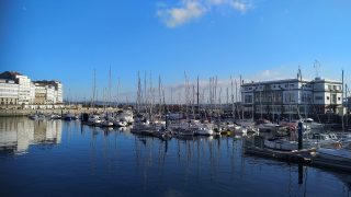
Map of the Self-Guided Walking Tour of Ajaccio walking route with 11 stops in Ajaccio.
Preview map of the Self-Guided Walking Tour of Ajaccio route in Ajaccio, showing 11 stops. Use the interactive map to zoom and tap markers.

More from this area

Self-Guided Walking Tour of Antibes, France (2026)

Self-Guided Walking Tour of Antibes

This website uses affiliate links which earn a small commission at no additional cost to you.

Antibes is one of the Côte d'Azur's most rewarding towns to explore on foot: compact, characterful, and stitched together by lanes that open suddenly onto sea views. A self-guided walking tour lets you move at your own pace, pausing for a market snack, a quick photo from the ramparts, or a detour into a gallery without feeling rushed. It is an easy place to build a satisfying half-day walk because the historic core, harbourfront, and coastal edges are all within a short distance of each other.

This route focuses on the best things to see in Antibes, starting in the Old Town where pastel facades, shuttered windows, and small squares create that classic Riviera atmosphere. As you weave through the medieval street plan, you will naturally pass key landmarks and local favourites, from the market area and centuries-old churches to viewpoints over the marina. The walk is designed to feel varied, mixing history and architecture with the everyday life that gives Antibes its appeal.

What elevates Antibes is how quickly the scenery changes: one moment you are in cool, narrow streets, and the next you are beside the water with open horizons and salty air. The ramparts and seafront paths deliver the town's signature views, while the port adds a modern contrast that still feels distinctly Mediterranean. By the end, you will have covered the essentials without backtracking, with plenty of natural stopping points if you want to extend the day for a swim, a museum visit, or a long lunch.

How to Get to Antibes

By Air: The closest major gateway is Nice Côte d'Azur Airport, which has extensive domestic and international connections and is the most straightforward option for reaching Antibes. From the airport you can typically transfer via public transport or a pre-booked shuttle/taxi to Antibes, with journey times varying by traffic and the exact connection you choose. If you are arriving with luggage or landing late, planning the onward transfer in advance can save time and reduce hassle. For the best deals and a seamless booking experience, check out these flights to Antibes on Booking.com.

By Train: Antibes is well connected on the French Riviera rail corridor, making the train one of the easiest and most reliable ways to arrive, particularly in peak season when road traffic can be slow. Services commonly link Antibes with Nice, Cannes, Monaco, and other coastal towns, and longer-distance trains can connect via Nice or Cannes depending on your origin. The station is a convenient walk or short taxi ride from the Old Town, which means you can arrive and start exploring with minimal logistics. You can use SNCF Connect to check schedules, compare routes, and purchase tickets for National (SNCF ) and regional trains (TER). For a more streamlined experience, we recommend using Omio, which allows you to easily compare prices, schedules, and book tickets for both National and Regional travel across all of Europe, all in one place.

By Car: Driving gives you flexibility for exploring nearby towns, beaches, and hilltop villages, but it is not always the fastest option in summer due to congestion around Nice, Cannes, and the A8. Parking in and around the Old Town can be limited and more expensive close to the centre, so it is usually worth identifying a car park before you arrive and considering leaving the car parked while you explore on foot. If you are staying outside the centre, a car can be useful for day trips, but for the walking-tour core of Antibes it is often simplest to park once and rely on walking. If you are looking to rent a car in France I recommend having a look at Discover Cars, first, as they compare prices and review multiple car rental agencies for you.

By Bus: Regional buses can be a cost-effective option, especially for shorter hops between Riviera towns, and they sometimes serve areas that are less convenient by rail. Travel times are generally longer than the train and can be affected by traffic, but buses can be useful if you are staying in a neighbourhood not close to a station or if you are aiming for a very budget-friendly itinerary. If you choose the bus, check timetables in advance and allow extra buffer time in summer. [bus]

A Short History of Antibes

Antibes began life as Antipolis, a Greek trading outpost established on this stretch of the Mediterranean coast for its natural harbour and easy maritime access. The Romans later developed the settlement, and traces of that long continuity still shape the town's compact footprint: the historic core sits close to the waterfront, with routes that still funnel you from inland approaches toward the sea. Today's walking routes through Rue de la République and around Place Nationale follow the logic of an old port town that grew in layers rather than by grand, straight boulevards.

From the Middle Ages onward, Antibes became increasingly defined by fortification and seigneurial power. The town's best-known historic complex is the Château Grimaldi, shaped over centuries by the Grimaldi family and later adapted to civic uses; it now houses the Musée Picasso, after Pablo Picasso worked here in 1946 and left a group of works that anchored the museum's identity. On the religious side, Antibes Cathedral (the Cathedral of Notre-Dame-de-l'Immaculée-Conception) has medieval origins and later additions, and it remains one of the key markers of how the town evolved from a fortified settlement into a lived-in civic centre.

The early modern period hardened Antibes into a strategic frontier town, particularly as competing powers contested the coast. Fortifications were strengthened in the 16th and 17th centuries, including the nearby Fort Carré, built under King Henri II as part of a broader program to secure key coastal positions, and later defensive works associated with the era of Vauban-style military engineering. These layers of defence are not just “background history” here; they directly frame some of the town's most atmospheric walks, especially where the old stone edges meet open sea.

In the 19th and 20th centuries, Antibes developed the civic spaces and everyday landmarks visitors now associate with the town centre. Place Général de Gaulle functions as a modern hub on the edge of the older street plan, while the market culture that defines daily life is concentrated around the Marché Provençal, a practical, working market embedded into the rhythm of the Old Town. Down by the water, the Pré-aux-Pêcheurs and the small crescent of Plage de la Gravette show how closely Antibes still lives with its shoreline, while the contemporary sculpture Le Nomade adds a modern landmark to the historic seafront-an intentional reminder that Antibes is not only preserved history, but a town that continues to reinvent its waterfront identity.

Your Self-Guided Walking Tour of Antibes

Discover Antibes on foot with our walking tour map guiding you between each stop as you explore its Old Town lanes, seaside ramparts, Provençal market culture, and harbourfront views. This walking tour follows the town's layered history and Riviera character, from the historic streets around Place Nationale and Rue de la République to the shoreline at Plage de la Gravette and the cultural highlights of the Musée Picasso, bringing together medieval heritage, coastal scenery, and everyday local life in a compact route shaped by the Mediterranean.

1. Place Général de Gaulle

General de Gaulle Square Antibes
CC BY-SA 3.0 / SchiDD

Place Général de Gaulle is a practical starting point for a self-guided walk because it sits at the threshold between modern Antibes and the tighter street network of the Old Town. The square functions as a local meeting point, with everyday Antibes life on display—commuters, café terraces, and shoppers moving between the centre and the surrounding neighbourhoods.

As you arrive, take a moment to orient yourself before diving into the lanes. From here, you can set your walking rhythm: it is close enough to the historic core that you will be in medieval-era streets within minutes, yet open enough to give you a clear sense of direction and bearings.

For the tour, use the square as your “reset” point if you are looping back later in the day. It is also a convenient place to grab water or a quick coffee before continuing toward Rue de la République and Place Nationale, where the atmosphere becomes distinctly older and more intimate.


Location: Pl. Général de Gaulle, 06600 Antibes, France | Hours: 24 Hours. | Price: Free.

We recommend to rent a car in France through Discover Cars, they compare prices and review multiple car rental agencies. Book your rental car here.

2. Pré-aux-Pêcheurs

Pre aux Pecheurs Antibes
CC BY-SA 2.0 / Tiia Monto

Pré-aux-Pêcheurs is a waterfront zone that connects the town’s historic relationship with the sea to its contemporary harbour life. It is less a single “monument stop” and more a place where you feel the working edges of Antibes—boats, harbour movement, and open sightlines that pull your attention outward.

On a walking tour, it works as a breathing space between dense Old Town streets and the more open seafront paths. The shift in scale is part of the experience: after narrow lanes and shaded squares, you are suddenly in brighter light with wider views.

Use this stop for photographs and orientation before you move on. From here you can link easily toward the ramparts, the beach at Plage de la Gravette, or the contemporary landmark of Le Nomade, depending on how you want to sequence the waterfront portion.


Location: 22 Av. de Verdun, 06600 Antibes, France | Price: Free

Here is a complete selection of hotel options in Antibes. Feel free to review each one and choose the stay that best suits your needs.

3. Port Vauban

Port Vauban Antibes
Port Vauban Antibes
CC BY-SA 1.0 / Pierre Blaché

Port Vauban is a logical addition to an Antibes walking tour because it sits between the historic core and the town’s working relationship with the sea. As one of the Mediterranean’s major marinas, it is where you see Antibes at its most contemporary—rows of masts, quay-side movement, and a constantly shifting scene of arrivals and departures—while still being only minutes from Old Town lanes.

Historically, the harbour has long been central to Antibes’ identity, even though what you see today reflects modern marina infrastructure rather than a purely traditional fishing port. Walking the edges of the port helps you understand the town’s geography: the Old Town is compact and defensive in feel, while the port opens outward, emphasising access, trade, and the Riviera’s nautical culture.

On a self-guided route, treat Port Vauban as a waterfront connector segment. It pairs naturally with stops like Pré-aux-Pêcheurs and Le Nomade, and it is also a practical waypoint if you are extending your tour to Fort Carré, which sits nearby. Aim to walk a full stretch of the quays rather than stopping in one spot—the changing perspectives are the point, and you will get the best photos by moving along the waterline.


Location: Av. de Verdun, 06600 Antibes, France | Hours: 24 Hours. | Price: Free. | Website

Traveling to a country with a different currency? Avoid ATM transaction fees and pay in local currency with a Wise Card. Having used it for over 5 years, we've saved loads on fees!

4. Le Nomade

Nomade Sculpture Antibes
CC BY-SA 2.0 / Miketnorton

Le Nomade is a contemporary sculpture that has become a modern landmark on the Antibes waterfront, offering a striking contrast to the town’s older stone architecture. Its open-lattice figure is designed to be visually bold against the sea and sky, which makes it a reliable “wayfinding” point on a self-guided walk.

What makes it effective in a walking-tour context is how it reframes the setting. After ramparts, cathedrals, and medieval street plans, this is a reminder that Antibes is not only preserved heritage; it also curates a present-day identity on its waterfront.

Plan to see it when the light is softer if you can, as the sculpture’s form reads differently depending on shadows and sun angle. It pairs well with a waterfront stroll from Pré-aux-Pêcheurs and works as a memorable “finish point” before you head back into the Old Town for dinner.


Location: 32 Quai Henri Rambaud, 06600 Antibes, France | Hours: Tuesday – Friday: 10:00–18:00. Saturday – Sunday: 10:00–18:00. Closed on Monday. (Summer) June 1 – August 31; Tuesday – Sunday: 10:00–23:00. (Winter) September 1 – May 30; Tuesday – Sunday: 10:00–18:00. | Price: Free. | Website

5. Plage de la Gravette

Gravette Beach Antibes
CC BY-SA 2.0 / Ștefan Jurcă

Plage de la Gravette is Antibes’ classic small-town beach moment: a sheltered curve of sand close to the Old Town, framed by the town’s built edges and calm water conditions. On a walking tour, it is a natural pause that changes the mood from sightseeing to seaside living within minutes.

Even if you are not swimming, it is worth stopping for the view and the atmosphere. This is where you see how closely Antibes is stitched to the water—families, locals taking a break, and the gentle rhythm of the shoreline right beside historic streets.

For route planning, it is a useful hinge point. You can stop here briefly, then continue to Le Nomade and the harbour perspectives, or loop back toward the cathedral and market area if you are structuring your tour as a compact Old Town circuit.


Location: Plage de la Gravette, France | Hours: 24 Hours. | Price: Free. | Website

6. Antibes Cathedral

Antibes Cathedral
Antibes Cathedral
CC BY-SA 2.0 / jimmyweee

Antibes Cathedral (Cathédrale Notre-Dame-de-l’Immaculée-Conception) is an essential stop for understanding the town beyond its postcard seafront. The cathedral reflects the continuity of Antibes as a lived-in community across centuries, with layers of construction and renovation that mirror changing tastes and needs.

What makes it work well on a walking tour is its sense of calm. Step inside and you will often find a quieter, cooler space that provides a natural break from sun and street noise, especially in warmer months. It is also a good point to notice how religious buildings traditionally anchor neighbourhood life in older towns.

From here, it is easy to stitch the next legs of your route together. You can head toward the Marché Provençal for a lively contrast, or continue toward the ramparts and coastal edge for the town’s most dramatic views.


Location: 1 Rue du Saint-Esprit, 06600 Antibes, France | Hours: Monday – Saturday: 08:00–12:00 & 15:00–19:00. Sunday: 08:00–12:00 & 15:00–19:30. | Price: Free; donations appreciated. | Website

7. Musée Picasso

Musee Picasso
Musee Picasso
CC BY-SA 3.0 / Miniwark

The Musée Picasso, housed in the Château Grimaldi, is one of Antibes’ signature cultural landmarks and a strong highlight for a walking tour. The setting matters: a historic structure with sea-facing views that immediately ties the town’s older layers to its modern artistic identity.

The museum’s story is closely linked to Picasso’s time working in Antibes in 1946, when he produced and left works that helped establish the collection’s character. Even if you are not planning a deep museum visit, the building and its position near the waterfront make it a meaningful stop in the narrative of the town.

On a self-guided route, consider timing your visit for when the light is good on the seafront side. You can combine the museum with a walk along the ramparts, turning this part of the tour into a sequence of culture, architecture, and coastal views without needing to detour far.


Location: place mariejol, 06600 Antibes, France | Hours: (September 16 – June 14) Tuesday – Sunday: 10:00–13:00 & 14:00–18:00. (June 15 – September 15) Tuesday – Sunday: 10:00–18:00. Closed on Monday. Closed on January 1, May 1, November 1, December 25. | Price: Adults: €12. | Website

8. Musée d’Archéologie d’Antibes

Archaeology Museum of Antibes
CC BY-SA 4.0 / Bengt Oberger

The Musée d’Archéologie d’Antibes is an excellent add-on for a walking tour if you want to connect Antibes’ pretty streets and seafront views to the deeper story of Antipolis, its ancient predecessor. The museum is housed inside the Bastion Saint-André, a coastal fortification built to the plans of Vauban in 1698, so the building itself is part of the experience: you are effectively stepping into a surviving piece of the town’s defensive seafront.

The collection focuses on archaeology recovered both on land and underwater, which suits Antibes’ identity as a port town shaped by maritime movement. Expect material linked to the Ligurian, Greek, and Roman presence in the area, with displays that help you picture how trade, settlement, and coastal life worked here in antiquity. Because it is arranged in compact galleries, it fits neatly into a self-guided route without dominating your day.

For walking-tour flow, this is best placed on your waterfront segment, either before or after stops like the ramparts, Plage de la Gravette, and Le Nomade. It gives you a “history anchor” that complements the scenery outside, and it is especially worthwhile if you want a brief, focused museum visit rather than a long indoor stop.


Location: Bastion Saint-André, 06600 Antibes, France | Hours: Monday: Closed. Tuesday – Sunday: 10:00–13:00 & 14:00–17:30. | Price: Adults: €5; Reduced: €3; Under 18: free. | Website

9. Marché Provençal

Provencal Market Antibes
CC BY-SA 4.0 / Jorge Franganillo

The Marché Provençal is where Antibes feels most immediate and local: a working market culture that is as much about daily routine as it is about sightseeing. For a walking tour, it delivers colour, scent, and sound—produce, cheeses, herbs, and the quick exchanges that bring a place to life.

Even a short pass through is worthwhile, but it is best experienced slowly. Use it as a tasting stop: pick up fruit, a small pastry, or something simple that travels well, then continue your route with a snack in hand for the seafront section.

As a practical matter, it is also a good place to plan your timing. Markets have rhythms—busier in the morning, calmer later—so if you want the most energy, aim earlier; if you prefer browsing with fewer crowds, try closer to the end of the day’s peak.


Location: Cr Masséna, 06600 Antibes, France | Hours: Tuesday – Sunday: 07:30–13:00. Monday: Closed. (June – August) Daily: 07:30–13:45. | Price: Free. | Website

10. Rue de la République

Rue de la Republique Antibes
CC BY-SA 4.0 / Abxbay

Rue de la République is one of the most straightforward pedestrian spines into the heart of Antibes, linking central movement with the Old Town’s smaller streets. Walking here gives you a good feel for how Antibes balances the practical needs of a living town with its historic fabric—everyday shops, façades with shutters, and the steady flow of locals.

Architecturally, it is less about a single monument and more about texture: doorways, balconies, and subtle shifts in street width that hint at centuries of adaptation. It is also a good place to notice how the town’s street plan naturally funnels you toward key gathering points, especially Place Nationale and the market area.

On a walking tour, this street works best as a connector segment rather than a long stop. Keep your pace easy, glance into side lanes for small squares and quieter corners, and treat it as the “transition walk” that brings you from the modern edges into the historic core.


Location: Rue de la République, 06600 Antibes, France | Hours: 24 Hours. | Price: Free.

11. Place Nationale

Place Nationale Antibes
CC BY-SA 4.0 / Helge Høifødt

Place Nationale is the Old Town’s social living room: a compact, shaded square where the pace slows and Antibes feels unmistakably Provençal. It is an ideal mid-walk pause because it sits near multiple lanes that branch out toward the cathedral, the market, and the ramparts, making it a natural junction point.

The square’s appeal is the atmosphere more than spectacle—plane trees, café seating, and that steady hum of conversation that makes it easy to linger. If you want a simple “sense of place” moment on your tour, this is one of the best spots to absorb it.

From a route-planning standpoint, it is also a useful pivot. You can pause here, decide whether to head first toward the cultural sights (Musée Picasso and the waterfront) or the food-and-daily-life sights (Marché Provençal), and then continue without backtracking.


Location: Pl. nationale, 06600 Antibes, France | Hours: 24 Hours. | Price: Free.

12. Chapelle Saint-Bernardin

Chapelle Saint Bernardin
CC BY-SA 3.0 / YKahite

Chapelle Saint-Bernardin is one of Antibes’ most rewarding “quiet stops” on a self-guided walking tour, tucked into the Old Town streets a short walk from the livelier squares and market lanes. From the outside it can feel understated, which is part of why it works so well on foot: you can fold it into your route naturally, without a major detour, and it gives you a distinct change of pace from the bustle of nearby shopping streets.

Historically, the chapel is linked to the medieval religious life of Antibes and is most often associated with the Penitents (lay religious brotherhoods) who used such spaces for worship and community functions. The building you see today reflects later periods of rebuilding and restoration rather than a single “one-date” construction story, but the value for visitors is clear: it preserves a sense of the town’s devotional and civic traditions that sits alongside the better-known headline sights like the cathedral and ramparts.

For your walking tour, treat Chapelle Saint-Bernardin as a short, reflective visit rather than a long museum-style stop. It is ideal to slot in between Place Nationale and the cathedral/market area, or as a brief pause before heading out toward the seafront. If you are touring in summer, it can also be a practical stop for a cooler interior moment before returning to the sunlit lanes.


Location: 14 Rue du Dr Rostan, 06600 Antibes, France | Hours: Tuesday – Thursday: 09:30–13:00 & 14:00–17:30. Friday: 10:00–13:00 & 14:00–17:30. Saturday: 09:30–13:00 & 14:00–17:30. Closed on Monday, Sunday. | Price: Free; donations appreciated. | Website

13. Rue de la République

Rue de la Republique Antibes
CC BY-SA 4.0 / Abxbay

Rue de la République is one of the clearest “spine streets” for a self-guided walk in Antibes, running as a practical link between the modern centre and the tighter lanes of the Old Town. It is the kind of street that quickly gives you your bearings: straight enough to feel navigable, but still lined with the everyday texture of Antibes—shopfronts, shuttered windows, and a steady flow of locals moving through the centre.

On a walking tour, the appeal is less about a single landmark and more about the gradual change in atmosphere as you move along it. Watch for the way side streets peel off into quieter pockets, often leading to small squares or older-looking corners where the street plan starts to feel more medieval. It is also a good place to notice how Antibes “works” as a living town rather than a museum set: deliveries, errands, and cafés that are used year-round.

Use Rue de la République as a connector segment that keeps your route efficient. It naturally funnels you toward key Old Town nodes such as Place Nationale and the market area, and it is convenient for linking onward to the cathedral and the seafront without unnecessary backtracking. If you are pacing the tour, it is also a sensible stretch to keep moving, saving your longer pauses for the squares, viewpoints, and waterfront stops that follow.


Location: Rue de la République, 06600 Antibes, France | Hours: 24 Hours. | Price: Free.

14. Fort Carré

Fort carre Antibes
Fort carre Antibes
Public Domain / Plyd

Fort Carré is one of the most distinctive historic sights to add to an Antibes walking tour, set on a rocky promontory with wide views over the coast and the approaches to the town. Commissioned in the 16th century under King Henri II, it was designed to strengthen Antibes as a strategic frontier and port-defence point on this stretch of the Mediterranean.

The fort’s angular geometry and elevated position make it easy to appreciate why it mattered militarily: from here you can read the landscape in defensive terms, with sightlines across the bay and back toward the old town and harbour. Over time, the fortifications were reinforced and adapted in line with evolving military engineering, and the site remains a strong “big-picture” complement to the tighter, street-level history you experience in the Old Town.

For a self-guided route, Fort Carré works best as an optional extension rather than a core Old Town stop, since it sits a little outside the historic centre. If you have the time and energy, it is a rewarding add-on for panoramic viewpoints and a deeper sense of Antibes’ strategic past; if not, you can keep your main loop focused on the Old Town, ramparts, and waterfront, and treat Fort Carré as a separate, later walk.


Location: Av. du 11 Novembre, 06600 Antibes, France | Hours: (Summer) July 1 – August 31; Tuesday – Sunday: 10:00–18:00. Closed on Monday. (Winter) September 1 – June 30; Tuesday – Sunday: 10:00–17:00. Closed on Monday. | Price: Adults: €5; Reduced: €3; Multi-site pass: €15. | Website
Powered by GetYourGuide
Moira & Andy
Moira & Andy

Hey! We're Moira & Andy. From hiking the Camino to trips around Europe in Bert our campervan — we've been traveling together since retirement in 2020!

Read our full story here

This website uses affiliate links which earn a small commission at no additional cost to you.

Walking Tour Summary

Distance: 3.5 km
Sites: 14

Walking Tour Map
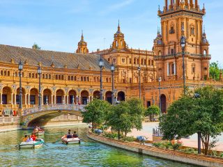
Map of the Self-Guided Walking Tour of Antibes, France walking route with 14 stops in Antibes.
Preview map of the Self-Guided Walking Tour of Antibes, France route in Antibes, showing 14 stops. Use the interactive map to zoom and tap markers.

More from this area

Self-Guided Walking Tour of Alghero (2026)

Self-Guided-Walking-Tour-of-Alghero
Self-Guided Walking Tour of Alghero

This website uses affiliate links which earn a small commission at no additional cost to you.

Alghero is one of those places where you can feel the sea in the city's rhythm. The Old Town is compact, walkable, and built for wandering: honey-coloured stone lanes, small squares that open unexpectedly, and long, breezy stretches along the ramparts where the water sits almost level with your view. A self-guided walking tour lets you move at your own pace, detouring for a coffee, a swim, or a quieter backstreet when the main lanes get busy.

This route is designed to stitch together Alghero’s historic centre with its most scenic edges, so you get both the landmark moments and the everyday atmosphere. You will pass fortified walls and bastions, churches and small museums, and the kind of shopfronts and gelaterias that make it easy to turn “a quick walk” into a whole afternoon. It is also a practical way to orient yourself, so later you can return to the spots you liked most for sunset, dinner, or photos.

If you are searching for the best things to see in Alghero, this walking tour covers the essentials without feeling rushed. Expect a mix of history and coastline, with plenty of opportunities to pause and take in the views across the bay. All you really need is comfortable shoes, a bottle of water in summer, and a little flexibility to follow your curiosity when Alghero inevitably tempts you off-route.

How to Get to Alghero

By Air: Alghero's main gateway is Alghero-Fertilia Airport (AHO), a short drive from the city, with seasonal and year-round flights that make it one of the easiest parts of Sardinia to reach from mainland Europe. From the terminal you can continue into town by taxi, rideshare where available, or scheduled airport buses that run to the centre and often stop near the main hotels. In summer, flight schedules can change frequently, so it is worth aligning your arrival time with onward transport options if you do not want to wait around. For the best deals and a seamless booking experience, check out these flights to Alghero on Booking.com.

By Train: Alghero does not have a central train station in the historic core, and rail is generally not the most direct way to arrive. The closest rail hub is usually Sassari, from where you would switch to a bus or taxi for the final leg to Alghero; this can work well if you are already travelling around Sardinia and do not mind a connection. If you prefer rail for part of the journey, treat it as a combined rail-and-bus trip, and plan for longer travel times than driving. Use Omnio to easily compare schedules, book train tickets, and find the best prices all in one place for a hassle-free journey across Italy.

By Car: Driving is often the most flexible option, particularly if you plan to explore the coastline, beaches, and nearby villages beyond Alghero. Roads into town are straightforward, but parking inside the Old Town is limited and traffic restrictions can apply, so it is usually easiest to park outside the historic centre and walk in. If you are arriving in peak season, consider booking accommodation with parking or identifying a reliable public car park in advance to avoid circling at busy times. If you are looking to rent a car in Italy I recommend having a look at Discover Cars, first, as they compare prices and review multiple car rental agencies for you.

By Bus: Intercity buses connect Alghero with key towns and airports across northern Sardinia and are typically the simplest public-transport alternative to driving. Services commonly link Alghero with Sassari and other hubs, and airport routes often operate timed to flight arrivals in high season. Buses usually terminate close to the centre, making them convenient if you are staying in or near the Old Town and want to avoid parking altogether.

Where to Stay in Alghero

To make the most of visiting Alghero and this walking tour, then you consider staying overnight in or very near the centre, so you can start early, take long pauses for coffee and sea views, and return easily for sunset along the bastions. The most convenient base is the Old Town (Centro Storico), where you can step straight into the historic lanes and ramparts within minutes. This area is ideal if you want everything on foot, including restaurants and evening strolls, with the only trade-off being tighter streets and limited parking. For an atmospheric stay right in the middle of the action, consider Hotel Catalunya or El Faro Hotel & Spa if you prefer a more resort-like feel (better for a taxi-in start to the walk) while still keeping Alghero close.

Just outside the walls, the harbour-front and marina area is a strong choice if you want quick access to the Old Town but prefer a slightly calmer feel, easier taxi pick-ups, and a more “open” layout. You will still be able to walk to the first stops in five to fifteen minutes, and you will be well placed for evening aperitivo along the water. Good options here include Hotel Regina Margherita and Hotel La Margherita & SPA, both of which keep you close to the bastions and the main promenade.

If you would rather pair the walking tour with beach time and a more relaxed, holiday base, look toward Lido San Giovanni and the long beach strip to the north-east of the centre. This area gives you a straightforward coastal walk into town (or a short taxi ride) and is especially appealing in warmer months when you want a swim before or after sightseeing. You can base yourself comfortably at Hotel Florida or Hotel Dei Pini, with the second option being better if you prioritise a classic beach setting and are happy to commute into the Old Town for the tour.

A Short History of Alghero

Alghero began as a small medieval port on Sardinia's north-west coast, established by Genoese interests in the early Middle Ages and then transformed decisively after the Crown of Aragon took control in the mid-14th century. Following the Aragonese conquest, the town was resettled with Catalan-speaking settlers, which is why Alghero still carries a distinct Catalan imprint in its language, street pattern, and identity. The historic core grew into a compact, fortified maritime town, with Piazza Civica (Civic Square) forming the civic heart where administration, trade, and daily life converged.

Much of what visitors recognise as “Old Alghero” was shaped between the late medieval period and the early modern era, when successive rulers strengthened coastal defences against raids and rival fleets. The sea walls and bastions, including the panoramic Bastioni Marco Polo, reflect this long defensive chapter, while towers such as Torre di Sulis are part of the same fortification system that guarded the harbour approaches. These structures were not simply military works; they also defined the city's most dramatic public spaces, creating the elevated promenades that are now integral to any walk through the centre.

Alghero’s major churches trace the town’s prosperity and changing styles across centuries. The Cattedrale di Santa Maria Immacolata (Cathedral of Saint Virgin Mary) developed primarily in the 16th century, blending Gothic roots with later additions that mirror Alghero’s evolving tastes and patrons. Nearby, the Chiesa di San Francesco (St. Francis Church) is one of the clearest reminders of the town’s Catalan Gothic phase, while the Chiesa di San Michele (St. Michael’s Church), associated with a later Baroque moment, signals the city’s early modern religious and artistic ambitions. To connect the architecture with the objects of worship and civic patronage, the Museo Diocesano d’Arte Sacra (Museum of Sacred Art) provides context for how local elites and church institutions commissioned art and liturgical treasures over time.

In the 19th and 20th centuries, Alghero expanded beyond the walls and developed the civic amenities that define a modern coastal town. Public life broadened from the medieval lanes into newer gathering spaces, including the Giardini Pubblici (Public Gardens), while markets and cultural venues reinforced Alghero's role as the service centre for the surrounding coastline and rural hinterland. Today, places like the Mercato Centrale (Central Market) and the Coral Museum tie Alghero's present-day rhythm to older economic foundations-food, fishing, and the long tradition of coral craftsmanship that remains one of the city's most recognisable local signatures.

Your Self-Guided Walking Tour of Alghero

Discover Alghero on foot with our walking tour map guiding you between each stop as you explore its honey-stone Old Town, sea-facing bastions, Catalan-influenced lanes, and lively piazzas. This walking tour follows the city's layered story as a fortified port, moving from the waterfront ramparts and marina to cathedral streets, small museums, and local markets, within a compact historic centre where the Mediterranean is never far from view.

1. Piazza Civica

Alghero Piazza Civica
CC BY-SA 2.0 / Gianni Careddu

Piazza Civica is the natural “start line” for Alghero’s old town, where café terraces and civic façades frame the everyday rhythm of the historic centre. It is a practical orientation point because several of the core lanes and landmark churches branch off within a few minutes’ walk.

As you stand in the square, look for the way the space acts like a hinge between the busier commercial streets and the quieter medieval lanes. It is also a good place to pause and decide whether you want to prioritise the seafront bastions first (for views) or the churches first (for shade and history).

From Piazza Civica, the most efficient walking-tour flow is to drift toward Piazza del Duomo for the cathedral, keeping your eyes on the street names that pull you deeper into the walled city. You will feel the town tighten and cool as the lanes narrow, which is part of the old town’s character.


Location: Piazza Civica, 07041 Alghero SS, Italy | Hours: 24 Hours | Price: Free

We recommend to rent a car in Italy through Discover Cars, they compare prices and review multiple car rental agencies. Book your rental car here.

2. Museum of Sacred Art

Alghero Museo Diocesano
CC BY-SA 2.0 / Sailko

The Diocesan Museum of Sacred Art is the best “deep context” stop for understanding Alghero’s religious life and craftsmanship, with objects connected to the cathedral and the wider diocese. It is typically housed close to the cathedral, so it fits neatly into the same walking segment. If it is open when you visit, give yourself time to slow down: the value here is in the detail—metalwork, devotional objects, and the way these pieces reflect Alghero’s Mediterranean links. It is the kind of small museum that rewards a focused, unhurried lap rather than trying to “see everything.” Be aware that the museum has been reported as temporarily closed at times, so treat it as a “check and slot in” stop rather than the single anchor of your route. If it is closed, keep moving—your next landmark is only a short walk away and the cathedral still gives you the big architectural moment.


Location: Piazza Duomo, 1, 07041 Alghero SS, Italy | Hours: Irregular Hours :( | Price: Adults: €5.00 | Website

Here is a complete selection of hotel options in Alghero. Feel free to review each one and choose the stay that best suits your needs.

3. Cattedrale di Santa Maria Immacolata

Alghero Katedra
Alghero Katedra
CC BY-SA 2.0 / Robert Ciekanowski

Alghero’s cathedral is the old town’s principal church and a key marker of the city’s long-standing Catholic identity, set in the historic core near the waterfront lanes. It also carries the “Catalan Alghero” story in its fabric, reflecting centuries of influence and rebuilding rather than a single, uniform style. In site, pay attention to the overall layering: this is a building that evolved over time, so the experience is partly about noticing transitions and additions. If you are able to access the bell tower, it is often highlighted as a rewarding viewpoint over rooftops and the sea-facing edge of town. Leaving the cathedral area, the walking-tour momentum typically shifts toward the sea walls and bastions for fresh air and wide angles. You are moving from enclosed lanes to an open promenade, which is a satisfying contrast if you have just spent time indoors.


Location: Piazza Duomo, 2, 07041 Alghero SS, Italy | Hours: Daily: 7:00 AM – 7:00 PM | Price: Free | Website

Traveling to a country with a different currency? Avoid ATM transaction fees and pay in local currency with a Wise Card. Having used it for over 5 years, we've saved loads on fees!

4. Bastioni Marco Polo

Bastioni Marco Polo, Alghero
CC BY-SA 2.0 / János Korom

Bastioni Marco Polo is one of Alghero’s most enjoyable stretches of sea-facing ramparts, where the historic defences have become a panoramic promenade. It is a high-impact, low-effort segment: you get views, breeze, and a clear sense of the fortified city’s outline in a short walk. As you walk, look outward for the coastline and inward for how the town sits behind the walls—tight, vertical, and textured. This is also a classic late-afternoon segment because the light tends to flatter both the sea and the warm-toned stonework. From here, keep following the bastions toward Piazza Sulis, where the route naturally funnels you to one of the old towers. This is the walking tour “spine” that links multiple highlights with minimal navigation effort.


Location: Bastioni Marco Polo, 07041 Alghero SS, Italy | Hours: 24 Hours | Price: Free (exterior viewing; interior access limited).

5. Teatro Civico (Civic Theater)

Teatre Civic Alguer
Teatre Civic Alguer
CC BY-SA 2.0 / Carlos Pino Andújar

Teatro Civico is one of Alghero’s most characterful cultural stops, notable not just for performances but for the building’s history as a civic project and symbol of local pride. It is often described as a rare survivor in Sardinia for the way it preserves original structural elements.

If you can step inside, focus on the intimacy of the space: smaller theatres often feel more immediate and human-scaled than grand opera houses, and that closeness is part of the charm. Even from outside, it works well as a quick “story stop” on a walking tour—one where your guide narrative can shift from fortifications and churches to everyday urban life and entertainment.

From the theatre area, it is easy to re-enter the medieval street grid and aim for the next pair of churches, which sit along or just off the main old-town routes. This is a good moment to slow your pace and let the lanes do the work of setting the atmosphere.


Location: Piazza del Teatro, 7, 07041 Alghero SS, Italy | Hours: 24 Hours | Price: Free (exterior viewing; interior access limited).

6. Chiesa di San Francesco (St. Francis Church)

Fontana di San Francesco, Modena
CC BY-SA 4.0 / Christine Guaetta

San Francesco is a strong anchor for anyone who enjoys quiet architectural details, particularly because of its cloister and the sense of an enclosed, contemplative world just beyond the busy lanes. It is one of the places in Alghero where the “stone and shadow” mood of the old town feels most concentrated. Inside the complex, the cloister is the highlight: keep an eye on the geometry of the arcades and the way the space frames sky and bell tower. This is also an excellent stop for a short reset in the middle of the walk—calmer, cooler, and typically less rushed than the seafront. When you leave San Francesco, continue along the old town’s main artery to pick up another distinctive church silhouette: San Michele’s dome is an easy “follow the landmark” navigation cue. The route between the two is part of the pleasure, with small shops and the old town’s everyday life filling the gaps.


Location: Chiesa di San Francesco d'Assisi, Piazza San Francesco D'Assisi, Modena, Province of Modena, Italy

7. Palazzo Simon (Simon Palace)Palazzo Simon (Simon Palace)

Alghero palazzo gotico catalano
CC BY-SA 2.0 / Sailko

Palazzo Simon is a useful “street-level architecture” stop—an elegant civic façade that reminds you the old town is not only medieval walls and churches, but also later layers of prestige and urban renewal. It stands well on a walking tour because it breaks up religious and military landmarks with a different kind of heritage. Pause to take in the proportions and the formality of the exterior, which reads as more classical and orderly than the older, irregular medieval fabric nearby. If you are walking with an architecture-minded group, this is a good moment to point out how Alghero’s built identity is a composite, not a single-era postcard. From Palazzo Simon, keep moving toward the churches and then back toward the waterfront edge, where the tour can return to big views and open air. This is a natural “transition point” before you shift into the tower-and-bastions segment again.


Location: Via Gilbert Ferret, 97/99, 07041 Alghero SS, Italy | Hours: 24 Hours | Price: Free.

8. Torre di Sulis (Sulis Tower)

Torre di Sulis (Sulis Tower), Alghero
CC BY-SA 2.0 / János Korom

Torre di Sulis is one of the key defensive towers on the seafront edge, visually anchoring Piazza Sulis and marking the start (or end) of the bastions walk. It helps you understand the old town as a fortified system rather than a collection of pretty streets.

This is an excellent “tell the story” stop: the tower’s identity is tied not only to coastal defence but also to the memory of Vincenzo Sulis, a Sardinian revolutionary associated with imprisonment here. Even if you keep the visit external, the narrative adds weight to what could otherwise feel like a simple photo point.

From Torre di Sulis, continue along the bastions for views or peel inland depending on your tour’s priorities. If you are building a balanced loop, this is the moment to pivot toward museums and markets to give the group a different sensory register.


Location: Piazza Sulis, 07041 Alghero SS, Italy | Hours: 24 hours | Price: Free. | Website

9. Coral Museum (Museo del Corallo)

Museo del corallo
Museo del corallo
CC BY-SA 4.0 / Ottantafame

The Coral Museum explains one of Alghero’s signature identities: its long connection with Mediterranean red coral and the trade and craftsmanship that grew around it. It is an especially useful walking-tour stop because it turns what you see in shop windows into a coherent story about place and livelihood.

Inside, focus on the “from sea to atelier” arc—how raw material becomes jewellery, art, and local status. Even for visitors who are not museum-first travellers, it tends to land well because the subject is specific to Alghero rather than generic “regional history.”

When you exit, the route pairs naturally with a market stop: you move from curated exhibits to living, local commerce. It is a good way to keep the tour grounded in real daily life rather than only monuments.


Location: Via XX Settembre, 8, 07041 Alghero SS, Italy | Hours: Monday: 4:30 – 7:00 PM Tuesday: 10:30 AM – 1:00 PM Wednesday: 4:30 – 7:00 PM Thursday: 10:30 AM – 1:00 PM Friday: 10:30 AM – 1:00 PM, 4:30 – 7:00 PM Saturday: 10:30 AM – 1:00 PM, 4:30 – 7:00 PM Sunday: 10:30 AM – 1:00 PM, 4:30 – 7:00 PM | Price: Adults: €4 | Website

10. Mercato Centrale (Central Market)

Mercato di Alghero
Mercato di Alghero
CC BY-SA 2.0 / Sailko

In Alghero, the central market (often referred to as the Mercato Civico) is the most immediate way to experience local produce, seafood, and the practical food culture of the city. It is a high-energy stop that contrasts nicely with the hush of churches and museums.

Walk it like a curator: do one full loop first, then decide what is worth a closer look—seasonal fruit, cured goods, or the day’s catch depending on time and appetite. If your walking tour includes a snack break, this is where you can make it feel distinctly Sardinian without committing to a full sit-down meal.

From the market, guide the group back into the old town lanes toward a green pause point. This is a sensible moment to ease the pace, especially in warmer months, before you finish with fortifications and open-air views.


Location: Via Sassari, 12, 07041 Alghero SS, Italy | Hours: Daily: 6:00 AM – 2:00 PM | Price: Free

11. Giardini Pubblici (Public Gardens)

Palazzo Dugnani, Giardini Pubblici Indro Montanelli, Milan
CC BY-SA 3.0 / Stefano Stabile

Giardini Pubblici is the old town’s convenient “breathing space,” a leafy buffer that helps separate the medieval centre from the modern town. Created in the 19th century, it is where your walking tour can soften from stone and history into shade and benches.

Use the gardens as a reset stop: a quick sit, water break, and an opportunity to recap what you have covered so far. For many groups, this is also where attention rebounds—people who were flagging inside museums often re-energise once the tour shifts to open air.

From the gardens, it is a short, logical continuation to the Maddalena fort area, which sits nearby and brings you back to Alghero’s defensive history. The physical closeness makes the transition feel intentional rather than like a detour.


Location: Giardini Pubblici Indro Montanelli, Via Palestro, Milan, Metropolitan City of Milan, Italy | Hours: October to April: 6:30 am to 9:00 pm; May: closed at 10:00 pm; June to September: closed at 11:30 pm. | Price: Free; the park itself is open to the public without charge

12. Forte della Maddalena (Maddalena Fort)

Alghero Forte Bastione della Maddalena
CC BY-SA 2.0 / Sailko

Forte della Maddalena is a key surviving piece of Alghero’s landward defences, dating to the late 16th century fortification effort that strengthened the city against attack. Even in partial remains, it helps visitors “see” the perimeter logic of a fortified settlement.

On site, orient yourself around the core footprint and imagine the lines of approach it was designed to protect. This stop works best when framed as part of a system: connect it verbally to the sea walls and towers you have already walked, so the group understands how layered the city’s defences were.

As a walking-tour finale, this area is strong because it leaves you with open space and a sense of the city’s edge, rather than ending in a crowded lane. From here, you can comfortably release the group toward the seafront promenade or back toward the cafés near Piazza Civica, depending on how you want the day to land.


Location: 07041 Alghero, Province of Sassari, Italy | Hours: 24 Hours | Price: Free
Powered by GetYourGuide
Moira & Andy
Moira & Andy

Hey! We're Moira & Andy. From hiking the Camino to trips around Europe in Bert our campervan — we've been traveling together since retirement in 2020!

Read our full story here

This website uses affiliate links which earn a small commission at no additional cost to you.

Walking Tour Summary

Distance: 2.5 km
Sites: 12

Walking Tour Map
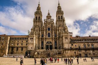
Map of the Self-Guided Walking Tour of Alghero walking route with 12 stops in Alghero.
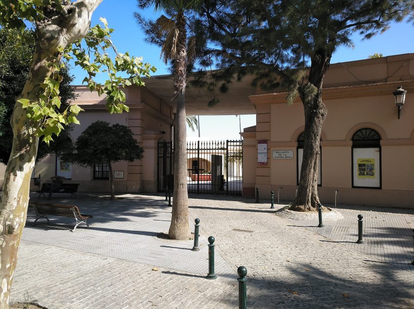
Preview map of the Self-Guided Walking Tour of Alghero route in Alghero, showing 12 stops. Use the interactive map to zoom and tap markers.
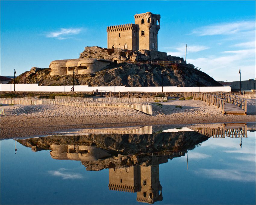
More from this area