Renting a car in Austria (2026)

This website uses affiliate links which earn a small commission at no additional cost to you.
Renting a car in Austria is not only a practical way to get around, it can be one of the great pleasures of a holiday. And when people say driving here is “a real pleasure,” they're usually not talking about the asphalt quality (though it is generally excellent). They mean the scenery: valleys opening into jagged peaks, lakes that appear and disappear between forested bends, and high roads that feel like you're driving through a postcard.
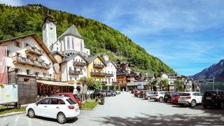
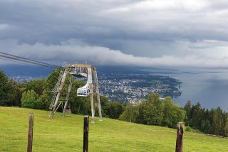
Austria's Alpine scenic roads are the sort of experience you do at least once. The headline route is the Grossglockner High Alpine Road, but it's not the only one that can carry a trip on its own. Drives like the Villach Alpine Road, the Turracher Höhe road, and the Zillertaler Höhenstraße all deliver that “slow down, pull over, take another photo” feeling. Some high roads are seasonal and can close in winter or temporarily with bad weather, so you plan with flexibility. The good news is Austria doesn't run out of alternatives: the Wachau Valley is a classic non-alpine drive through vineyards and Danube towns, and the lakes and spa areas around Salzburg and the Salzkammergut give you scenery without committing to high passes.
That freedom is the core advantage. With a rental car, you decide where to go, when to stop, and how long to stay, instead of following pre-set itineraries that often feel rushed or generic. It works equally well for a multi-stage itinerary (moving regions every few days) and for travellers who base themselves in one city or resort and do day trips out and back.
Table of Contents
- Choosing the Right Rental Company in Austria
- Car rental prices in Austria
- Why rent a car in Austria?
- Pick-up and drop-off locations
- Tips for renting a car in Austria
- FAQs for Visiting Car Rental in Austria
- Tips for driving in Austria
- Driving licence and ID
- What side of the road do they drive on?
- Seat belts
- Driving with children
- Blood alcohol limits
- Mobile phones
- Reflective vests, warning triangle, first aid kit
- Winter tyres, chains, and seasonal realities
- Congestion or accidents: the emergency corridor
- Parking rules
- On-the-spot fines and cash
- Horns and headlights
- Do you need a vignette for the motorway?
- Toll roads and tunnel tolls
- School buses
- Radars and dash cams
- Breakdown procedure
- Accidents
- Driving distances
Choosing the Right Rental Company in Austria
Austria has a strong mix of car hire providers, from the big international brands (Hertz, Avis, Europcar, Sixt, Enterprise) to smaller regional companies that can be good value, especially outside the main airports. As a rule, booking ahead is cheaper and gives you better choice, particularly in peak periods like summer (July-August), Christmas/New Year, and the winter ski season when demand in alpine regions rises sharply.
When you compare rentals, look beyond the headline daily rate. Check what insurance is actually included, the size of the excess, whether mileage is unlimited, and what the fuel policy is (full-to-full is usually the cleanest option). Also confirm the practical extras that matter in Austria: automatic transmission availability, whether winter tyres are fitted in season, cross-border permission if you plan to drive into Germany/Italy/Slovenia, and the deposit amount that will be held on your credit card. Finally, scan recent customer reviews for the specific pickup location you're using (airport desks and city offices can vary a lot), because this is where you'll spot recurring issues like slow queues, aggressive upselling, or disputed damage claims.
Top tip: Use a comparison site such as Discover Cars to quickly filter by transmission type, supplier rating, and insurance terms, and to spot genuine price differences across providers.
Car rental prices in Austria
Pricing varies mainly with season (summer and ski peaks cost more), location (airport is often pricier than city), transmission type (automatics typically cost more), and how early you book.
If you want the lowest realistic total cost, the biggest levers are:
- Booking earlier, especially for automatic cars and larger vehicles.
- Keeping pick-up and drop-off times aligned to full 24-hour periods, because many rentals price by the day, and being late can trigger an extra day.
- Avoiding expensive add-ons at the counter unless you genuinely need them (extra driver, child seat, GPS, “premium location” fees).
Why rent a car in Austria?
If your holiday is a weekend inside Vienna, you usually do not need a car. Vienna's public transport is strong, and the real downsides of driving (parking rules, short-term zones, traffic restrictions, hotel access) tend to outweigh the benefits.
In most other scenarios, a rental car is a major upgrade because it unlocks the country's “in-between” places: small mountain villages, valley trailheads, lake circuits, viewpoint pull-offs, and scenic roads that are attractions in themselves. Austria is one of those countries where the drive can be the highlight, not just the transfer.
It can also be a cost win in specific cases. Austrian trains are good, but they’re not always cheap once you add multiple segments, peak fares, and last-minute changes. For families or groups sharing costs, a car can be competitive, especially if you’re moving through regions where rail connections add time or complexity.
Pick-up and drop-off locations
You will find car rental desks at major airports and in the big cities, and you can also rent in some tourist towns and resort areas.
The “default” tourist choice is airport pick-up and airport return. It’s convenient if you land and immediately start a road trip, and airport staff are usually used to international visitors (and typically multilingual).
The main exception is when you're staying in your arrival city for several days. In that case, it often makes more sense to delay pick-up until you're ready to leave the city. You avoid paying for days when the car just sits, and you avoid city-centre parking headaches. Vienna is the most common example of this.
Tips for renting a car in Austria
- Understand the vignette (tolls) before you drive away
Most cars up to 3.5t need a vignette for motorways/expressways.
The most common mistake is the digital vignette validity delay: if you buy a digital 2-month or annual vignette online as a consumer, it only becomes valid from the 18th day after purchase. This does not apply to the 1-day or 10-day digital vignette.
If you’re in a rental car, ask at the desk whether the vehicle already has a valid vignette for your dates and where it is documented. - Choose the right car category for alpine travel
Small cars are fine for most summer routes and towns, and they’re easier to park. If you’re carrying ski gear, travelling with kids, or doing winter driving in mountainous areas, you’ll appreciate extra space and stability. - Manual vs automatic: decide early
Manual is common and cheaper. Automatics exist, but availability can tighten in peak seasons. If you’re not comfortable driving manual on steep roads or in winter, book an automatic upfront. - Winter rules are real (and situational)
Between 1 November and 15 April, winter tyres are required when wintry conditions are present (snow, slush, ice).
If you’re heading to alpine regions in that window, confirm winter tyres are fitted and ask about chains. - Credit card reality check
Most rental companies require a credit card in the main driver’s name for the security deposit. Prepaid/debit acceptance varies. The deposit can be substantial depending on car class and insurance/excess settings. Plan for that so you don’t get stuck at the counter. - One-way rentals can be worth it, but price them carefully
One-way drops can save hours, but fees vary by route and supplier. It’s often excellent value on a truly linear itinerary; it’s often poor value if you’re only trying to avoid a short backtrack. - Fuel policy: full-to-full is usually the cleanest deal
Full-to-full tends to be the fairest. “Pre-purchase fuel” options often look convenient but can be poor value unless you return the car almost empty (which most people don’t risk).
FAQs for Visiting Car Rental in Austria
Tips for driving in Austria
Driving in Austria is generally straightforward, but it is more rules-driven than many visitors expect, especially around tolls, equipment, and winter conditions. If you fold these checks into your pickup routine, you avoid most of the common problems.
Driving licence and ID (especially for UK drivers)
Carry your driving licence and a second form of photo ID. If you still have an older UK paper licence, bring photographic identification (typically your passport) alongside it, as rental desks and checks may expect photo ID.
What side of the road do they drive on?
Austria drives on the right and overtakes on the left. At roundabouts, traffic already on the roundabout has priority (follow the signage and lane markings), and trams/vehicles on rails often have priority even when they approach from the left, so treat tram corridors with extra caution.
Seat belts
Seat belts must be worn by all occupants if fitted. Enforcement is routine. Expect on-the-spot fines for non-compliance (commonly cited around €35, but fines can change).
Driving with children (car seats and booster rules)
Austria’s child restraint rules are strict. A practical rule of thumb that matches official guidance is: children under 14 who are under 150 cm must use an appropriate child restraint system rather than just the adult seat belt. If you are renting, do not assume the hire car includes the correct child seat. Pre-book it or bring your own, and confirm installation before leaving the car park.
Blood alcohol limits
Austria is strict on drink driving. The standard limit is 0.5 g/L (often expressed as 0.05%), with a significantly lower limit for novice drivers. The simplest, safest approach on a road trip is “if you're driving, don't drink.”
Mobile phones
Handheld phone use while driving is not permitted. Hands-free use is allowed, but the safest approach (and the least ambiguous) is to pull over before touching your phone. Austria’s official guidance describes fixed penalties and escalations if you refuse payment.
Reflective vests, warning triangle, first aid kit (and why this matters for rentals)
Carry (and confirm your hire car contains) a reflective vest, warning triangle, and first aid kit. This is not “nice to have” equipment in Austria; it is part of what's expected on the road, and it is your responsibility as the driver to ensure the vehicle has the required items.
Winter tyres, chains, and seasonal realities
Austria has a winter equipment season (1 November to 15 April) where winter tyres are required in wintry conditions (snow, slush, ice). If you are heading into alpine areas during that window, assume you will need winter tyres and confirm they're fitted before you leave the rental lot.
Even outside these dates, sudden snow at altitude happens. Chains can be required on specific roads when signed; if your itinerary includes high valleys, ask about chain availability.
Congestion or accidents: the emergency corridor (Rettungsgasse)
On motorways and dual carriageways, drivers must form an emergency corridor when congestion starts to form, not only when traffic is fully stopped. The general rule is: vehicles in the leftmost lane move left; vehicles in other lanes move right, creating a clear corridor between lanes.
Parking rules (and the Vienna reality)
Always park in the direction of traffic (do not park facing oncoming traffic). Parking rules are enforced and vary by city. Vienna is the most common pain point for visitors driving: large pedestrianised areas, limited street parking, and short-stay parking zones. If you're spending several days in Vienna, it is often easier and cheaper to delay picking up your rental car until the day you leave the city.
On-the-spot fines and cash
Austria can issue on-the-spot penalties for some infringements. In practice, it is sensible to have a small amount of cash available for routine situations, even if you mostly pay by card.
Horns and headlights
In cities (especially Vienna) horn use is restricted and socially frowned upon unless necessary for safety. Use dipped headlights in tunnels and whenever visibility is poor.
Do you need a vignette for the motorway?
Yes. Most vehicles up to 3.5t need a vignette to use Austrian motorways and expressways. You can buy 1-day, 10-day, 2-month, or annual products via ASFINAG (online/app or in person).
Two details matter for tourists:
- Many Austrian rentals already include a vignette, but you must confirm it is valid for your travel dates.
- Digital 2-month and annual vignettes bought online by private consumers are typically only valid from the 18th day after purchase; 1-day and 10-day digital vignettes can be valid immediately.
Toll roads and tunnel tolls (section tolls)
Even with a vignette, some routes require additional “section toll” payment (notably major tunnels and specific motorway segments). ASFINAG lists the key section toll corridors (including routes such as the A9, A10, A11, A13, and S16).
If your itinerary includes the Tauern/Katschberg tunnels, the Karawanken tunnel, the Brenner corridor, or the Arlberg tunnel, budget for these separately and decide whether to pay on the day or buy digitally in advance.
School buses
If a school bus is stopped with warning lights to let children on/off, do not overtake in the same direction. This is an easy way to pick up a serious offence.
Radars and dash cams
Radar detectors are a bad idea in Austria; rules and enforcement can be strict, and you do not want to test the boundary as a visitor. Dash cams are commonly described in travel guidance as prohibited in Austria due to privacy/data protection rules, so if you use one elsewhere in Europe, switch it off (or remove it) when driving in Austria.
Breakdown procedure
If you break down, get on a reflective vest before you exit, place the warning triangle behind the vehicle, and call your rental provider/roadside assistance number immediately. On high-speed roads, focus first on personal safety and getting to a safe position.
Accidents
If you have an accident, involve the police and obtain an accident report for insurance purposes, then contact the rental company to follow their procedure. In practice, missing paperwork is one of the fastest ways to have a claim refused or to be charged in full.
Driving distances (useful for itinerary planning)
These are realistic ballpark driving distances/times for trip planning (not accounting for traffic, weather, roadworks, or mountain-road speeds):

Moira & Andy
Hey! We're Moira & Andy. From hiking the Camino to trips around Europe in Bert our campervan — we've been traveling together since retirement in 2020!
This website uses affiliate links which earn a small commission at no additional cost to you.