Walking Cinque Terre’s Blue Trail 2026: Map, Sections & Tips

This website uses affiliate links which earn a small commission at no additional cost to you.
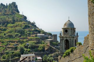
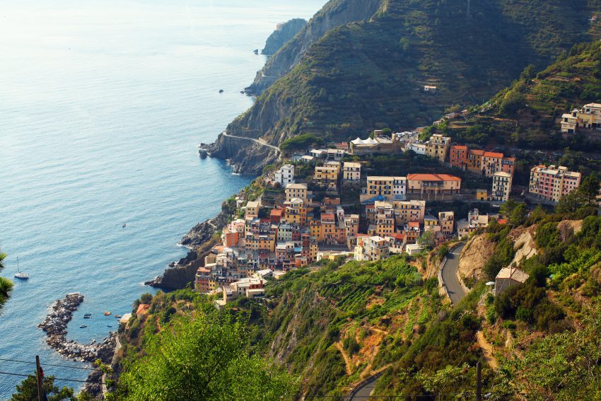
The Cinque Terre, designated as a UNESCO World Heritage Site, comprises a cluster of five enchanting towns nestled along Italy's striking coastline, slightly north of Pisa. These towns possess a distinctive charm, their pastel-hued edifices gracefully layered atop each other, surveying the tranquil harbours below. Each town bestows its unique allure, contributing to the delightful task of selecting a personal favourite. Embarking on a Cinque Terre hike stands as a premier method to immerse oneself in the exploration of these five captivating settlements.
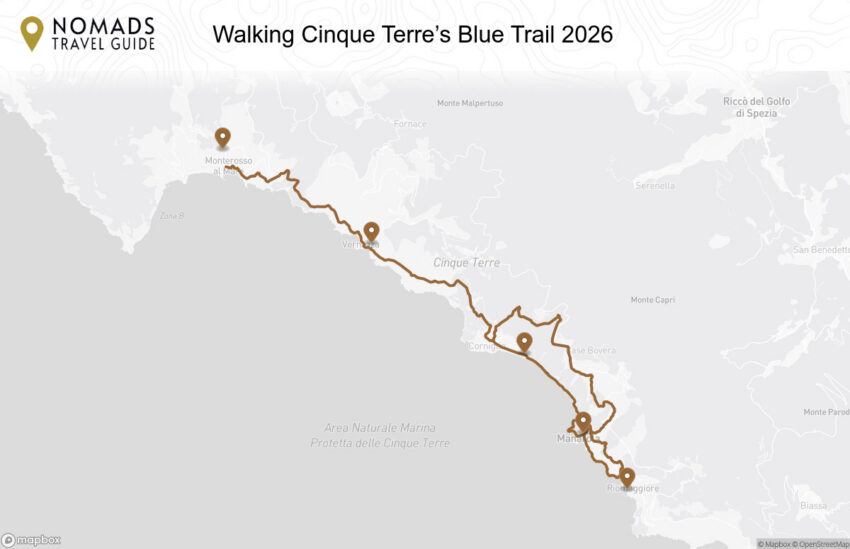
The Blue Trail
The towns are conveniently and swiftly connected by train, yet in our view, the most rewarding approach to experiencing Cinque Terre is to embark on the “Blue Trail.” The Blue Trail, is appropriately named after the blue colours of the ocean in panoramic view for a majority of the trail, it is also known as Sentiero Azzuro or Trail #2. spans 11 kilometres and directly interconnects the five villages. It takes about 5 hours to hike the entire distance, not counting the time to explore and linger in each town.
On the Blue Trail, as well as others, you’ll find little red and white markers on wooden signs, or painted upon trees or rocks, signposting the way.
Cinque Terre Trekking Card
In the high season it’s necessary to purchase the Cinque Terre Hiking Card (€7.50 per person for a one day hiking card, €4.50 for children, and other concessions available) in order to access the Blue Trail.
You will be required to show this card at the trail checkpoints upon entering / exiting each village and, if you haven’t bought it in advance, then you should carry cash in order to purchase there. If visiting in high season, then we highly recommend you buy the Cinque Terre Card in advance as this allows you to skip the queues at checkpoint cabins and just show your card. If travelling by train along the Levanto – La Spezia line, to Cinque Terre you can buy the combined Cinque Terre Train MS Card.
Some trails will be closed for maintenance, it is advisable to check on the National Park website before setting out.
Distances and Difficulty levels of the Blue Trail
- Riomaggiore to Manarola: 1.5 km, easy, 30 minutes, also called “Lover’s Lane” or Via dell’Amore
- Manarola to Corniglia: 3 km, easy, 1 hour
- Corniglia to Vernazza: 4 km, moderate, 1.5 hours
- Vernazza to Monterosso: 3.5 km, moderate, 1.5 hours
1. Riomaggiore to Manarola
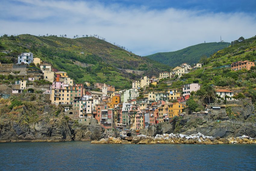
The pathway connecting Riomaggiore and Manarola goes by the name of Via dell’Amore – the Path of Love. This route is typically level and manageable for walking, yet its availability is frequently affected by landslides. It connects the picturesque villages of Riomaggiore and Manarola and is only about 1 km long. The trail carves its way through solid rock, meandering alongside the cliff’s edge that hovers above the sea.
The origins of the Via dell’Amore path trace back to the early 20th century, during the upgrading of the Genoa – La Spezia railway line. A pedestrian path was required for the railroad laborers to navigate between Riomaggiore and Manarola while the tunnel connecting the two villages was under construction. The tale goes that this footpath evolved into a rendezvous spot for romantics hailing from both towns.
Blue Trail: The journey commences near the Riomaggiore train station, where a staircase awaits on the left. After just a handful of steps, the sea unfolds before your eyes. Geomorphologically speaking, you’re treated to the spectacle of Riomaggiore’s sandstones and the visible remnants of marine erosion. Along the way, the vegetation showcases an array of plant life including agaves, sea fennel, wallflowers, and the rare Brassica robertiana. As you approach the trail’s conclusion, you’ll pass beneath terraced vineyards that command a view over Manarola’s railway station. To enter the town, a pedestrian tunnel approximately 150 meters in length leads the way.
High Trail: If this trail is closed, you have the option to take the train to Manarola or hike a much more difficult trail, the high route, to the next town. The starting point for the high route is situated a mere 5 minutes away from the Via dell’Amore. This trail involves a sequence of stone steps and steep ascents. Despite the demanding uphill stretches, the climb affords breath-taking vistas of the coastline.
Read our Riomaggiore Travel Guide2. Manarola to Corniglia
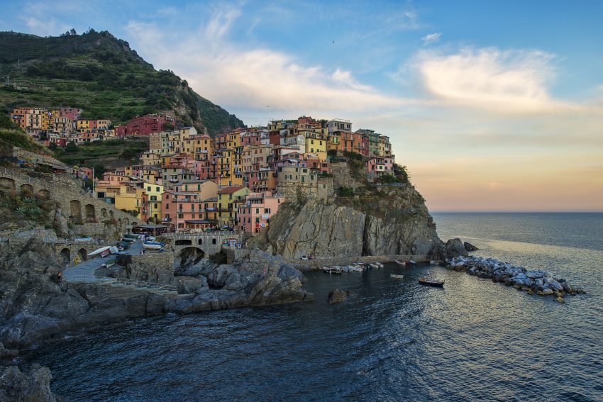
Blue Route: From Manarola, the route progresses towards Marina di Manarola before ascending towards the cemetery. Here, a crossroads emerges at the level of a Madonna chapel originating from 1860. Opting for the right path leads to the village of Volastra, via Poggio Le Croci. On the other hand, choosing the leftward route keeps you on track towards Corniglia, guided by a level pathway.
The final segment of the journey traces the course of an artificial beach formed during the construction of the erstwhile railway, spanning approximately a kilometer. Prior to arriving at the Corniglia train station, your path takes you through Valle Asciutta. Crossing the canal, the trajectory continues alongside Corniglia’s beach, culminating at the station. To reach the village itself, ascending the Lardarina staircase consisting of 377 steps, elevating you to 90 meters above sea level, is a necessity. The total elevation gain along the trail sums up to 120 meters.
High Trail: The first segment of the journey leads up to Volastra, followed by a path from Volastra to the junction with path near Case Pianca, and ultimately a path from Case Pianca to Corniglia. This route entails an estimated duration of approximately 3 hours and 30 minutes. Considered of moderate difficulty, the trail spans around 5.5 kilometers. Commencing from Manarola, ascend Via Discovolo towards the town’s exit. Proceed along a mule track to reach Pie di Fiesse, near the coastal road, briefly following the paved road in the direction of Groppo. Subsequently, ascend towards Volastra by taking the ancient municipal staircase on the left.From Volastra, the route traces along the provincial road of the Sanctuaries towards the northwest, winding through vineyards and dry stone walls, passing by Case Porciana. Upon traversing this diminutive hamlet, the path delves into a maritime pine forest, leading to the intersection with path 587 Corniglia-Cigoletta beneath Case Pianca.nFrom this point, the path descends towards Corniglia, leading through a pine forest and subsequently past terraced plots of vineyards and olive trees, many of which lie abandoned. Continue along a steep staircase and certain uneven sections until reaching the church of San Lorenzo.
Read our Manarola Travel Guide3. Corniglia to Vernazza
Blue Route: Starting from the church of San Pietro, follow Via Serra as it leads you out of the town via a narrow paved road. Cross the paved road and continue your descent, crossing over the Rio Groppo. From there, you will ascend once again, ascending through tall dry stone walls that enclose terraced strips of land adorned with olive trees. The ascent along the paved road persists, taking you to a bridge spanning the Fosso del Canaletto. The path transforms into a stone mule track, incorporating stairs in certain sections. At this juncture, a panoramic viewpoint materializes, revealing Corniglia below and the valley featuring the Guvano beach.
Persist with the climb until you arrive at the village of Prevo, situated at an elevation of 280 meters. Continue onward on a gentle incline, winding through olive groves until you encounter a stairway that descends towards the precipitous coast of Macereto. As you make your way downwards, Vernazza unveils its stunning magnificence, and you will remain on the descending trajectory until you reach Via Roma and the heart of the town square.
Read our Corniglia Travel Guide4. Vernazza to Monterosso
Blue Route: Embarking on the blue path connecting Vernazza and Monterosso, your journey begins from the charming port of Vernazza. Ascend Via Roma and swiftly veer left into a narrow alley, which soon transforms into a staircase. This path leads you to the Santa Margherita church. As you continue your ascent, the staircase transitions into an earthen trail, persistently guiding you uphill. Take care and stay observant as you cross a diminutive bridge spanning the Rio Riolo. Your upward journey leads you along a steep mule track, ultimately arriving at the panoramic expanse surrounded by olive trees at Costa Mesorano.
The course now takes you through a series of ascents and descents, guiding you amidst the Mediterranean vegetation, occasional pockets of precious wetlands, terraced vineyards, and the commencement of lemon groves. Eventually, you embark on a descent by way of a staircase lined with stone walls, eventually arriving at the breath-taking cliff of Punta Corone. From this vantage point, you can take in views of Monterosso and the hill of San Cristoforo.
Read our Vernazza Travel Guide5. Monterosso
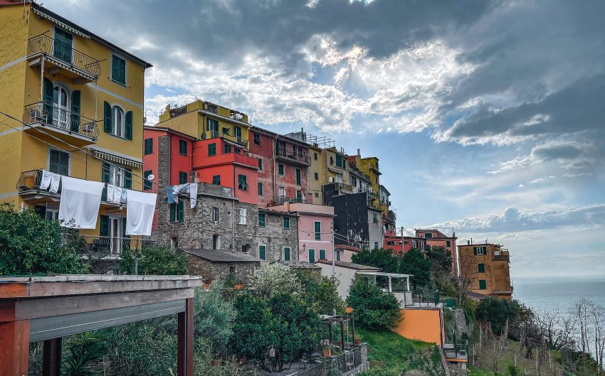
Among the five picturesque towns of Cinque Terre, Monterosso al Mare stands out with its resort-like ambiance. While it retains its enchanting historic core, the village differentiates itself with a more contemporary extension that stretches northward along the coastline. This modern facet, coupled with its distinction as the region’s prime beach destination, grants Monterosso a distinctive allure for travelers exploring the Cinque Terre. This village caters to a diverse audience, attracting Italian holidaymakers who relish the lido experience and drawing in international tourists as well.
Read our Monterosso al Mare Travel Guide
Moira & Andy
Hey! We're Moira & Andy. From hiking the Camino to trips around Europe in Bert our campervan — we've been traveling together since retirement in 2020!
This website uses affiliate links which earn a small commission at no additional cost to you.
Walking Tour Summary
Distance: 11 km
Sites: 5
Walking Tour Map