Hadrian's Wall - Roman Fort 16 - Mais (Bowness)
Roman Fort in Carlisle
Castle Maia, or Mais was a Roman auxiliary troops camp on the territory of the Parish of Bowness-on-Solway, District Allerdale, County of Cumbria, England.
It belonged to the chain of fortresses of Hadrian’s Wall (per lineam valli) , which consisted of 16 forts , was the second largest on the wall and secured its western end, although the defenses continue 40 miles south along the coast till just south of Maryport, consisting of turrets and milecastle, but no wall. It is at the point furthest west that the firth can be forded.
The site was initially a wood-earth mile fort secured. When the wall was rebuilt there in stone, it was demolished again and replaced by a larger wood and earth fort, which was also rebuilt in stone at a later date. Initially, it probably served as a supply port for the western sector of the wall. It should have been occupied by Roman troops until the late 4th century. There were some marching camps that were only used briefly in the vicinity. A larger civil settlement was found outside the fort. The castle ruins later formed the core for the development of today’s Bowness.
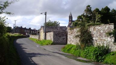
It is probable that the westernmost milecastle, Milecastle 80, was built on the north side of Bowness village but it has never been located. The Wall approached Bowness running north west towards the present east end of the village, but its exact course westwards from there has never been established. The fort is almost completely buried under the modern village and there are no visible remains.
Unlike most forts on the Wall, its long axis was parallel to Hadrian’s Wall and it faced east, in common with Great Chesters and Housesteads. This was dictated probably by the desire to make the best use of high ground. The clay knoll on which Bowness sits is longer east-west than north-south. The main street of Bowness, looking west, its route probably coincides with the via Principalis of the Roman fort.
Early references to Roman Fort Mais
The fort is mentioned in three ancient written sources. It appears in the Ravenna cosmography of the geographer of Ravenna (7th century) as “Maia” and “Maio”. The second and third written sources are two Roman vessels, the Rudge Cup and the Amiens Skillet , on which it is referred to as “corn”. Richmond / Crawford suggested a derivation from the (hypothetical) Celtic Maios . The name probably means “larger”, “bigger” or “the big one”.
Its dimensions were 610ft (186m) east-west and 420 ft (128m) north-south, giving it an area of 5.88 acres (2.38ha): this made it the second largest fort on Hadrian’s Wall by a narrow margin the next largest is Chesters (5.79 acres, 2.34ha).
Rivet / Smith believed that the ancient place name could refer to the height of the coastal cliff. In this context it would be remarkable that Maia is also the name of a Greek deity. She was the daughter of Atlas and Pleione and, in the belief of the ancient Greeks, formed the star circle of the Pleiades together with their six sisters . The units that were stationed in Maia are not yet known. It is possible that the first occupation force came from the east of the empire and named the fortress after this deity.
The name Solway comes from the Nordic sul (column) and vath (ford). The place name in use today also comes from the Nordic language ( bogi-nes , the rounded or arched headland).
Location of the Roman Fort Mais
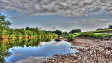
Maia was the sixteenth link in the fortress chain of Hadrian’s Wall (vallum aelium) . It stood on the crest of an approximately 12-meter-high, mainly clay, east-west facing coastal cliff on the north side of the Solway Firth , near the confluence with its southern fjord (Sandpath Fjord). There intersects the coast of Cumbria farthest to the northwest one ( “neck of Britain”). From this point there was an excellent view of the Irish Sea, the Solway Firth, the opposite Scottish coast and the coastal plain surrounding the fort (Solway Plains). Only to the south is the view somewhat restricted by a hill south of the rectory. Unlike the mouth of the Tyne in the east, the Solway funnel extends far into the coast there, but is not very deep and can easily be passed on foot at low tide. Road connections existed to the forts of Congavata (Drumburgh) in the east and Kirkbride ( Portus Trucculensis ) On Stanegate in the southwest. The latter was a little to the west of the route of today’s car road. In the late 2nd century the region belonged to the province of Britannia Inferior , from the 4th century to the province Britannia secunda .
Early History of Roman Fort Mais
Like the early Hadrian’s Wall, the original camp was built between the mid and late 120s using the wood and earth technique. Traces of this were found on the northeastern intermediate tower and the west gate (soil deposits and post holes).
When the wall was later replaced by a stone wall (around 160), the stone fort was also rebuilt. Like most of the mid-imperial forts, it had a rectangular floor plan with rounded corners (playing card shape). Its longitudinal axis was exactly aligned with the coastline and the wall from west to east (see forts of Housesteads and Great Chesters). The dimensions of the system were 128 meters from north to south and 186 meters from east to west. With an area of about 2.38 hectares, Maia was the second largest fortress on the Hadrian’s Wall after Uxelodunum (Stanwix).
The Hadrian's Wall - Roman Fort 16 - Mais (Bowness) appears in our Complete Guide to Visiting Carlisle!
This website uses affiliate links which may earn a commission at no additional cost to you!
Visiting Hadrian's Wall - Roman Fort 16 - Mais (Bowness)
Nearby Attractions
- Hadrian’s Wall – Milecastle 80 (0.0) km
Roman Mile Castle in Carlisle - St Michael's Church, Bowness-on-Solway (0.1) km
Church in Bowness-on-Solway - Solway Junction Railway (1.1) km
Historic Site in Bowness-on-Solway - Hadrian’s Wall – Milecastle 79 – Solway House (1.4) km
Roman Mile Castle in Carlisle - Port Carlisle (2.1) km
Village in Carlisle - Hadrian’s Wall – Milecastle 78 – Kirkland (2.6) km
Roman Mile Castle in Carlisle - Hadrian’s Wall – Milecastle 77 – EastonBurgh Marsh (3.9) km
Roman Mile Castle in Carlisle - Drumburgh Castle (5.2) km
Castle in Carlisle - Hadrian’s Wall – Milecastle 76 – Drumburgh (5.2) km
Roman Mile Castle in Carlisle - Hadrian’s Wall – Milecastle 75 – EastonBurgh Marsh (6.5) km
Roman Mile Castle in Carlisle