Hadrian’s Wall – Milecastle 76 – Drumburgh
Roman Mile Castle in Carlisle

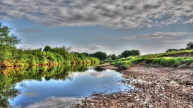
Milecastle 76 (Drumburgh) was one of a series of Milecastles or small fortlets built at intervals of approximately one Roman mile along Hadrian’s Wall. The mile fort was on the eastern outskirts of Drumburgh, probably about 200 meters east of the Concavata fort , on the slope above an abandoned railway line. The exact location has not yet been confirmed archaeologically. A slight, irregular elevation can be seen at the presumed location, but it is unclear whether it is actually the remains of the mile fort. In 1962, about 100 meters to the east, the remains of Hadrian’s Wall were still visible in the swamps of the Burgh Marsh.
The Hadrian’s Wall – Milecastle 76 – Drumburgh appears in our Complete Guide to Visiting Carlisle!
This website uses affiliate links which may earn a commission at no additional cost to you!
Visiting Hadrian’s Wall – Milecastle 76 – Drumburgh
Nearby Attractions
- Drumburgh Castle (0.1) km
Castle in Carlisle - Hadrian’s Wall – Milecastle 77 – EastonBurgh Marsh (1.3) km
Roman Mile Castle in Carlisle - Hadrian’s Wall – Milecastle 75 – EastonBurgh Marsh (1.4) km
Roman Mile Castle in Carlisle - Hadrian’s Wall – Milecastle 78 – Kirkland (2.6) km
Roman Mile Castle in Carlisle - Hadrian’s Wall – Milecastle 74– Burgh Marsh (2.9) km
Roman Mile Castle in Carlisle - Port Carlisle (3.1) km
Village in Carlisle - Hadrian’s Wall – Milecastle 79 – Solway House (3.9) km
Roman Mile Castle in Carlisle - St Michael's Church, Bowness-on-Solway (5.1) km
Church in Bowness-on-Solway - Hadrian's Wall - Roman Fort 16 - Mais (Bowness) (5.2) km
Roman Fort in Carlisle - Hadrian’s Wall – Milecastle 80 (5.2) km
Roman Mile Castle in Carlisle