Hadrians Wall - Day 2 - Carlisle to Hare Hill
This website uses affiliate links which earn a small commission at no additional cost to you.
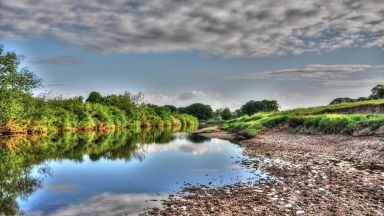
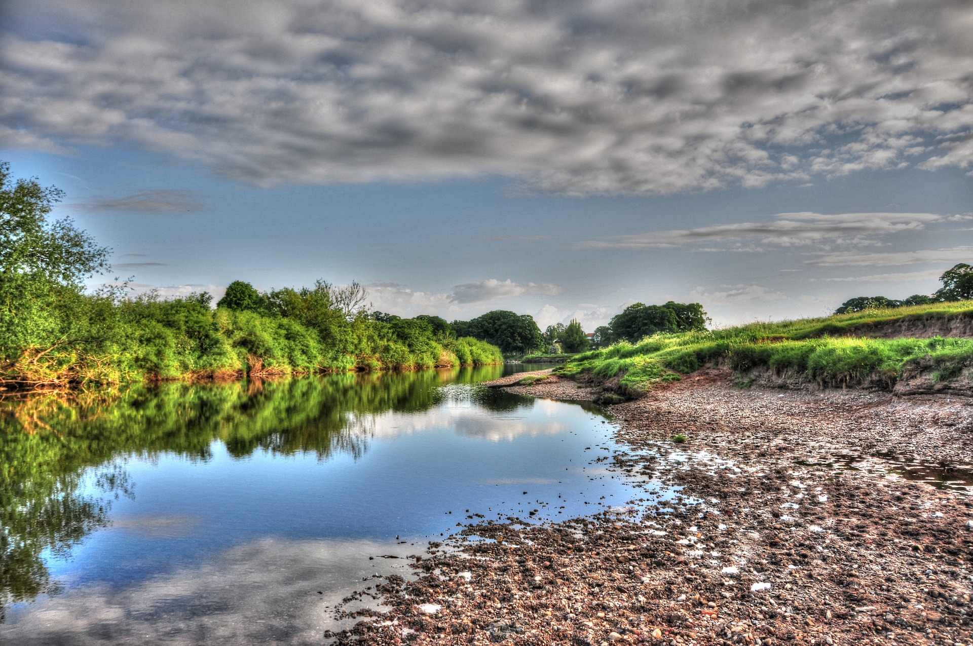
The River Eden is a prominent feature at the start of the days from Carlisle City Centre. The trail deviates away from the wall until you pass over the M6 Motorway.
Five miles from Carlisle you will come to the village of Crosby on Eden which although still south of the Wall but you walk along the line of the original Stanegate Roman Road, which was built some time before Hadrian’s Wall. The Stanegate Roman Road joined Carlisle in the West and Corstopium (Corbridge) in the East.
Although you don’t see much of the wall you do pass a few villages with “wall” in their name (Walby, Oldwall, Walton) with a grassy bank and nearby ditch that goes in a straight line. Towards the end of your day walking you will recieve your reward, above Walton, there’s a remarkably tall (3.5m) section of wall preserved at Hare Hill.
Below I have described the option for following the wall and following the trail.
Carlisle to Wallby - Along the Path
By the Sands Leisure Centre stop and admire the modern interpretation of a model of Hadrians Wall. If you have the Hadrians Wall passport you will need to pop in and get it stamped here. The certificate stamp is usually located at the end of the food counter.
Walk past the golf course, cross over the River Eden at the memorial bridge into Rickerby Park, and walk along the river. It may be worth taking the middle path up to the war memorial before turning right on the road.
The manor of Rickerby has been owned by a number of aristocratic families. In 1914 the estate was broken up and sold off. In 1920 was purchased as a public park and was dedicated as a memorial to the fallen of the Great War of 1914-1918.
The path joins a road that skirts past the Rickerby Hall, (eden school 1953/1993, now private residences, and the village of Rickerby. You will pass the ornate Gatehouse to Rickerby Park on your right, and as the road turns across the field on your left is Rickerby Park Tower, a Victorian folly. As you leave Rickerby you will pass Tower Farm, with another folly, which is located by the farm.
The next village you come to is Linstock. As you rise to go over the M6, look to your left for glimpses of Drawdykes Castle (see above). You bear left through the Village. After passing through a new estate you will come close to the river, over the field to your right is Linstock Castle. It is now a farmhouse, was formerly a tower house built in the 12th or early 13th century as a palace for the Bishops of Carlisle, with 17th-20th century additions and alterations.
We then walk alongside the River Eden for a short while to reach Crosby-on-Eden, which is the combined name for two small villages, High Crosby and Low Crosby. Stop at the Stag inn if it is open or the bench at St John’s Church, a gothic looking church built in 1854, at the end of the village.
Before you reach High Crossby you turn left to go over a bridge and cross over the A689. You join the pleasant sounding Sandy Lane and at the end of which you will join back up with the wall.
Carlisle to Wallby - Along the Wall (Alternative Route)
If you want to follow the wall cross over the bridge, on leave the road on the right hand side by the pretty Eden Bridge ornamental Gardens, following the path in Rickerby Park by the road.
These have been known locally for many years as the “Chinese Gardens” despite there being nothing in the design being Chinese. Built by Percy Dalton, the City’s Engineer, in the early 1930’s from a design by Edward Prentice Mawson, son of Thomas Mawson, who was famed for his grand Italianate designs.
When you get to Brampton road, cross over and enter the Churchyard. A sign in the churchyard tells us that the south corner and corner tower of Stanwix Fort were located here. The church was also built of Roman stone.
Stanwix Fort is the modern name of the largest fort on Hadrian’s Wall with around 800 troopers. It was originally called Petrianis (after a cohort that was stationed there) in the Notitia Dignitatum, and later it is referred to as Uxellodamo in the Ravenna Cosmography (which maybe the Latinisation of a celtic name meaning High Fort).
Walk past the Church and turn right onto Church Street, take the second left onto Knowe Terrace, and left again onto Mulcaster Crescent. At the end in the car park of the Cumbria Park Hotel the course of the fort north wall has been marked out and an explanatory plaque provided.
Head back the way you came – either retrace your steps all the way back to Rickerby Park, and join the official trail, just back to Kells Place, (an extension of Church Street), and turn left by the sign for the University of Cumbria. At the end of the road, carry straight on along a footpath, by the sign for Beech Grove.The footpath is along the is the line of the curtain wall. You pass the site of Milecastle 65 and the site that an altar of Cocidius was found – a pre-Roman hunting god who came to be identified with the war and hunting god Mars and the woodland deity Sylvanus. As you come to the hamlet of Tarraby, you will need to turn, left then right to get onto Tarraby Lane, which you follow round to the B6264. Walk along the slightly dangerous B6264, avoiding cars. You will come to the entrance of the Hadrian’s Camp – the former home of the Army Apprentice School, within which is Milecastle 64 (Drawdykes) on the western edge of the M6 embankment. As you proceed over the M6, on your right is Drawdykes Castle, although it might be hard to see.
Drawdykes Castle is a farmhouse which was originally a 14th century fortified tower house. The tower is built of red and yellow sandstone walls, mostly taken from Hadrian’s Wall. Built into the rear wall is a Roman altar. It stands on the line of the vallum of Hadrian’s Wall.
East of the A689, the Wall continues as a hedge line running towards the hamlet of Walby. We cannot follow this so are forced to proceed east along the A689, still following the Military Road until you reach Birky Lane on the left. The lane takes you past Walby Farm Park, at which point you are briefly back on the Roman Wall. When you are back in an easterly direction you are passing the site of Milecastle 62 (Walby East). Before the next milecastle you are joined by the official path coming up Sandy Lane.
Wallby to Walton
As the road turns to the left, across a cattle grid, carry straight on approach some fields. Just before the field opens up you cross over a stream called Baron’s Dike.
The Bishops or Barons Dyke is a Medieval boundary, separating the baronry of Gilsland from the Bishops Manor of Crosby, which is followed by a parish boundary. It was called the Bishops Dyke in of 1603; locally it is known as the Bar. It runs from Highfield Moor House to Newby, a distance of about 2 miles.
The wall becomes a little more apparent here. The curtain is the low causeway running across the pasture towards the farm at Bleatarn which the path leads you along, a depression to the left marks the course of the ditch and, quite a way to the right, the earthworks of the Vallum can be made out near the western field boundary.
As you approach Bleatarn Farm, which means blue pool, you will see a large depression to your right. This is the remains of a quarry to get the stone to build the wall, It is thought that it might have then been flooded and stocked with fish as a food source for the Roman army.
It the second field after the farm is Milecastle 60 (High Strand). Although its exact position not located in 1851 an altar was ploughed at its predicted location. The altar was again dedicated to Cocidius, and was erected by the Sixth Legion.
You continue straight along the wall until you reach the small village of Oldwall with the line of the wall, ditch and vallum can be clearly seen. The old building in Oldwall built from Wall stones.
About 1.5km to the south, partly beneath Carlisle Airport, lies Watch Cross temporary camp, along the line of the Stanegate. This was a prominent feature during the 18th and 19th centuries and was mistaken for being a Wall fort.
Past Oldwall you are heading to Newtown usually walking on the berm, with the wall to your right, and the ditch to your left.
The berm is the space, usually in the region of 6m wide, between the base of the curtain wall and the southern edge of the ditch.
At the top of the gentle hill is the site of Milecastle 59 (OldWall). The wall changes to the north east and you will pass over the probably locations of Turret 58B, 58A without knowing it before reaching Newtown. If you are running short on supplies look for hadrians wall snack shed, in the field opposite of which is the probably location of Milecastle 58. Carefully cross the A6071, the main road from Brampton to Longtown. The trail takes us through the farmyard, then left then right behind a low wall, and then left again, through somebody’s garden, before reaching the open countryside, with the ditch to our left.
Past Turret 57A, the stables at Headswood and then Turret 57A you will reach the edge of an escarpment with a set of stone-flagged steps leading down to the flood plain of the Cam Beck and the probably location of Milecastle 57 – Cambeckhill Farm.
To the south, among the trees on higher ground then the Cam Beck, lies the site of Castlesteads (Camboglanna), one of the detached forts immediately south of the Wall. Unfortunately the site is on private land and has effectively been razed by the formal garden of a late-18th-century listed building, Castlesteads, constructed by the Johnson Family on the site of an earlier Walton House belonging to the Dacre family. Camboglanna means “bank at the bend” or “Crook Bank”. It was 400 metres from Milecastle 57 and probably owes its placement to the position of an existing fort on the site.
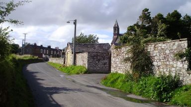
As you carry on past Cambeckhill Farm, the ditch is just a slight depression, and the curtain wall runs along the modern fence to the south of the Trail. The path crosses over Cam Beck, from the British cambaco meaning “crooked stream”. On the far side, the line of the ditch is very prominent. Milecastle 56 has never been located but its estimated position is under the southern part of Walton, beneath the now closed Centurion Inn.
Walltown to Hare Hill
The Wall leaves the eastern end of Walton and heads downhill, the ditch being clearly visible from the path.
Before crossing Dovecote Bridge you can see, beyond the gate on your left, the only visible part of Hadrian’s Wall made of Cumbrian red sandstone here, but due to weather erosion it is now protected under the earth mound you see. It was the westernmost visible portion of consolidated curtain wall. Located 40 metres west of Dovecote Bridge is Turret 55B (Townhead Croft).
You cross the bridge and leave the road, and climb past Turret 55A (Dovecote), which was located in 1933.
You cross back over the road and pass Milecastle 55 (Low Wall) found in 1900. Further on you pass Howgill House where another altar to Cocidius was found in the 18th century, which probably originated in the milecastle 55. A centurial stone was found built into the external wall of the east range of buildings at Farm in 1717, which records that the Celtic Catuvellauni tribe helped to rebuild this section of Hadrian’s Wall in AD 369.
The field after the farms has Turret 54b (Howgill) which was found in 1933. After another field you turn south for a short distance before joining back up to the path.
The next, Turret 54A (Garthside) was excavated in 1933 and two turrets were found here. The front wall of the first had collapsed and another built on firmer ground. The Wall can be seen here on your left, as a substantial turf covered bank at the base of a hedge.
As you continue the field slopes away and you can see Lanercost Priory is visible in the valley of the Irthing. At the bottom there is a small burn and before rise. Milecastle 54 (Randylands) was found here in 1934, and its position can be identified by some indistinct earthworks a large oak tree.
The path runs along the crest of Craggle Hill with the ditch seen to the north and the curtain wall marked by a modern drystone wall. You continue past the farm buildings at Hare Hill onto a narrow lane, where you come across an enclosure containing an impressive short stretches of curtain wall.
The wall at Hare Hill stands up to three metres high, making it the tallest remaining stretch of the Wall. It partially survived because it had been built into the wall of a medieval structure. In the 19th century it was substantially rebuilt at the behest of the Earl of Carlisle, using Roman masonry which was probably retrieved from the surrounding area. Have a look for the centurial building stone on the north face (nine courses down from the top, two stones in from the left). It reads ‘< P · P ·’ (centuria primi pili), or ‘the century of the senior centurion (of the legion)’. Found in 1894, west of Turret 53a, and built into the reconstructed face of the curtain wall.
Milecastle 53 (Banks Burn) lay just to the east of the Hare Hill stretch of curtain wall, beneath the present house.
That is the end of the walk for today. If you are walking down to Brampton then yo could look in at Lanercost Priory on the way.
This website uses affiliate links which earn a small commission at no additional cost to you.