Carlisle, England: The Ultimate Travel Guide 2026
Visiting Carlisle, nestled in the far north of Cumbria near the Scottish border, offers a unique experience that blends urban charm with striking natural surroundings. The city acts as a gateway to both the Lake District and Hadrian's Wall Country, making it an excellent base for exploring northern England's landscapes and heritage sites. Whether you're here for a weekend or just passing through en route to Scotland, Carlisle offers a compact yet diverse selection of cultural attractions, green spaces, and riverside walks.
The centre of Carlisle is easily walkable and home to a mix of historic and contemporary highlights. The red sandstone Carlisle Cathedral provides a peaceful respite in the middle of town, while nearby you'll find stylish cafés, independent shops, and a lively covered market. The Tullie Museum offers insight into local culture and has art exhibitions and Roman artefacts. The pedestrianised core of the city makes it easy to explore, and public squares often host live performances or markets throughout the year.
Carlisle’s location makes it ideal for day trips by car, bus or even bike. Hadrian’s Wall begins just a short distance from the city centre, with walking trails leading to forts such as Birdoswald. The Solway Coast Area of Outstanding Natural Beauty is also within easy reach, offering dramatic seascapes and birdlife. For those venturing into the Lake District, it’s just a 40-minute drive south, giving visitors the chance to enjoy both city comforts and the raw beauty of Cumbria’s countryside in a single trip.
History of Carlisle
Carlisle in the Roman Era
Carlisle’s recorded history begins with the Roman Empire, when the settlement of Luguvalium was established as a key military outpost. Its location near the western end of Hadrian’s Wall made it a vital centre for Roman administration and defence. A large Roman fort was built to house thousands of soldiers, and the town that developed around it supported military operations with bathhouses, temples, and civilian dwellings. Carlisle’s Roman roots are still evident today in excavated remains and museum artefacts that highlight its strategic role in controlling the northern frontier of Britannia.
Carlisle in the Medieval Period
During the early medieval period, Carlisle experienced cycles of conflict and rebuilding, especially with the rise of Anglo-Saxon and then Norman control. The construction of Carlisle Castle began in the 11th century under William II as a means of securing the borderlands and asserting Norman authority. Over time, the castle grew in strength and size, becoming both a royal fortress and an administrative hub. The foundation of Carlisle Cathedral followed in the 12th century, marking the town’s emergence as a religious centre. Throughout the Middle Ages, Carlisle was frequently attacked due to its border position, caught in the long-standing conflicts between England and Scotland.
Carlisle from the Early Modern Period to the 19th Century
Carlisle’s fortunes improved in the Tudor and Stuart periods, particularly after the union of the English and Scottish crowns, which reduced cross-border warfare. It remained a garrison town, with its castle playing roles during the English Civil War and later in the Jacobite uprisings, notably in 1745 when Bonnie Prince Charlie briefly held the city. The Industrial Revolution brought significant change: the arrival of the railways in the 19th century transformed Carlisle into a major railway hub, with extensive railway works and a growing population. The city’s economy diversified with textile mills, engineering, and food production, laying the foundation for modern Carlisle.

Moira & Andy
Hey! We're Moira & Andy. From hiking the Camino to trips around Europe in Bert our campervan — we've been traveling together since retirement in 2020!
Visiting Carlisle for the first time and wondering what are the top places to see in the city? In this complete guide, I share the best things to do in Carlisle on the first visit. To help you plan your trip, I have also included an interactive map and practical tips for visiting!
This website uses affiliate links which earn a small commission at no additional cost to you.
6 Best places to See in Carlisle
This complete guide to Carlisle not only tells you about the very best sights and tourist attractions for first-time visitors to the city but also provide insights into a few of our personal favorite things to do.
This is a practical guide to visiting the best places to see in Carlisle and is filled with tips and info that should answer all your questions!
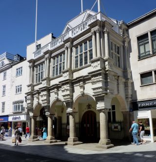
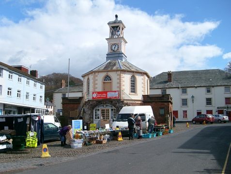
1. Guildhall Museum

| Price: Adult £5.90, Children: free | Website | Distance: 0.3km
2. Carlisle Cathedral
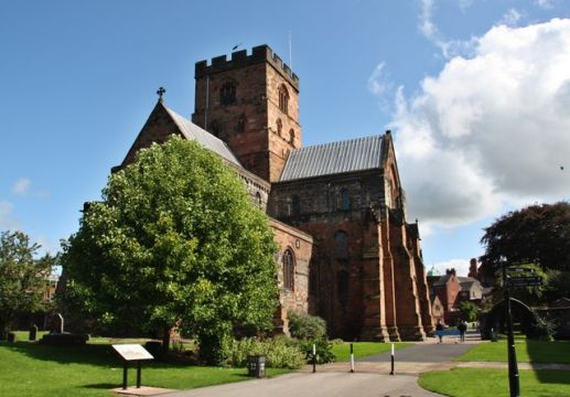
Location: Carlisle Cathedral 7 Abbey St Carlisle CA3 8TZ United Kingdom | Distance: 0.4km


3. Tullie House
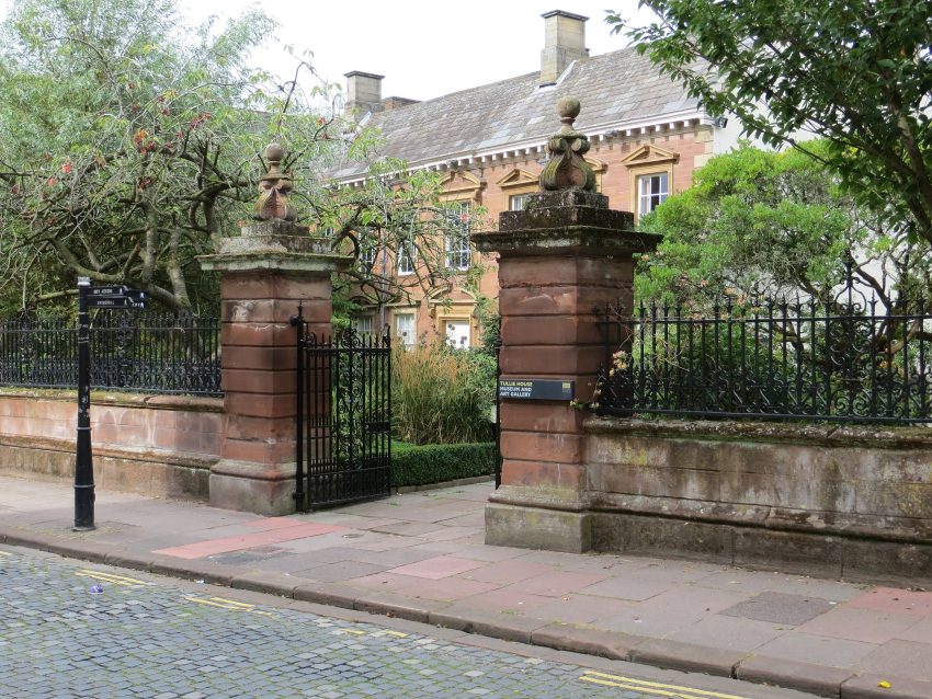
Location: Tullie House Museum And Art Gallery Castle St Carlisle CA3 8TP | Hours: 10am-5pm Mon-Sat, 11am-5pm Sun | Price: Adults £10 | Website | Distance: 0.6km
4. Cumbria Museum of Military Life
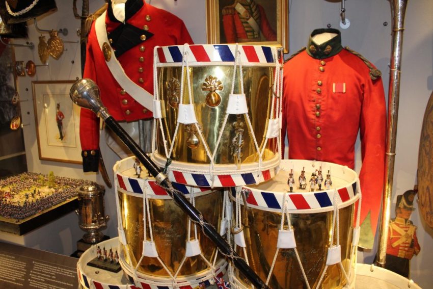
Location: Cumbria's Museum of Military Life The Castle Alma Block Carlisle CA3 8UR United Kingdom | Website | Distance: 0.7km
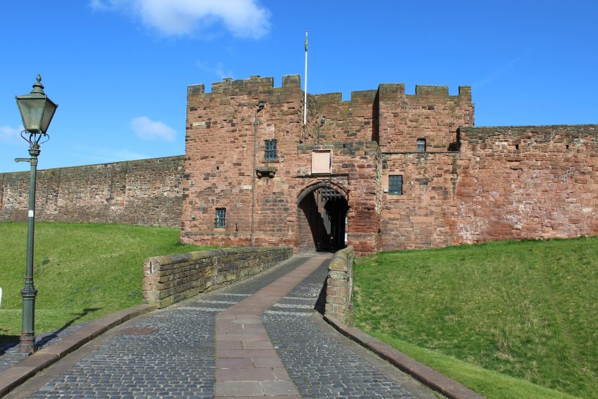
5. Carlisle Castle
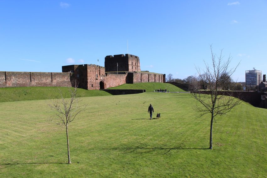
Location: Carlisle Castle Castle Way Carlisle CA3 8UR United Kingdom | Hours: 10am-6pm Apr-Sep, to 5pm Oct-Mar | Price: adult/child £8/4.80, combined ticket with Cumbria's Museum of Military Life £9.20/5.15 | Website | Distance: 0.7km
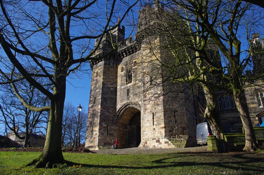
6. Rickerby Park Tower
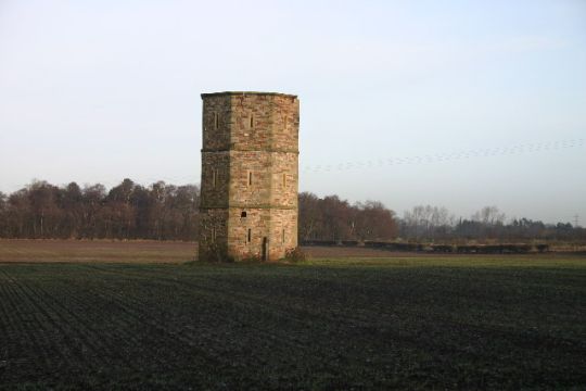
Location: Rickerby Gardens, Carlisle CA3 9AA, UK | Hours: 24 Hours (View from Road) | Price: Free | Distance: 1.9km
Best Day Trips from Carlisle
A day trip from Carlisle offers the perfect opportunity to escape the urban rhythm and discover the surrounding region's charm. Whether you're drawn to scenic countryside, historic villages, or cultural landmarks, the area around Carlisle provides a variety of easy-to-reach destinations ideal for a one-day itinerary.
1. Burgh by Sands
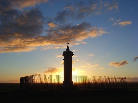
Location: Burgh by Sands, Carlisle, UK | Hours: 24 Hours | Price: Free | Distance: 8.2km
Visiting Burgh by Sands
2. Solway Aviation Museum

Location: Solway Aviation Museum Aviation House Carlisle Airport Crosby on Eden CA6 4NW United Kingdom | Hours: 10:30 am until 5:00 pm every weekend from 2 April 2021 until the 31 October 2021 | Price: Adult: £6.00, Children: £4.00 | Website | Distance: 10km
Visiting Solway Aviation Museum
3. Brampton, Carlisle
Visiting Brampton, Carlisle
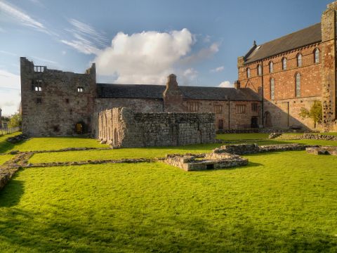
4. Drumburgh Castle
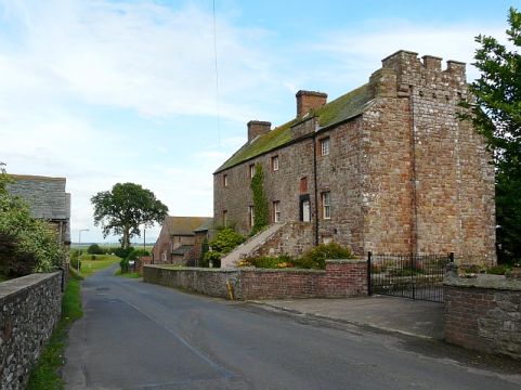
Location: Drumburgh Castle, Drumburgh, Wigton, UK | Distance: 14.2km
Visiting Drumburgh Castle
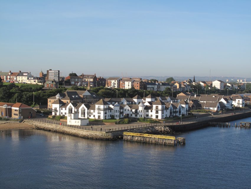
5. Port Carlisle
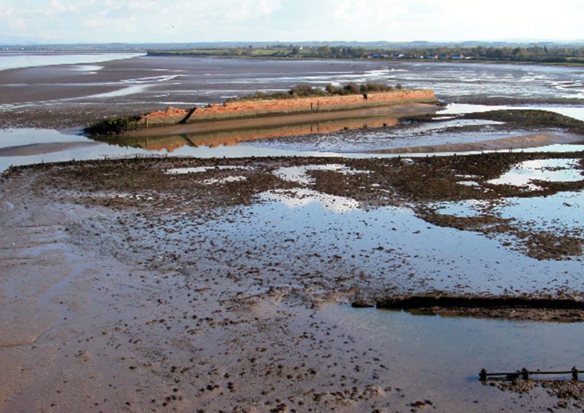
Visiting Port Carlisle
6. Lanercost Priory
Location: Lanercost Priory Lanercost Brampton CA8 2HQ United Kingdom | Hours: 10am-6pm Apr-Sep, 10am-5pm Oct, 10am-4pm Sat & Sun Nov-Mar | Price: Adult £5.90, Child £3.50 | Website | Distance: 17.3km
Visiting Lanercost Priory
7. Bowness-on-Solway
Visiting Bowness-on-Solway
8. Birdoswald Roman Fort
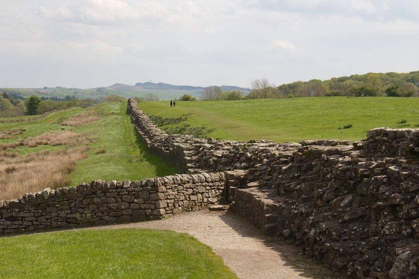
Location: Birdoswald Roman Fort - Hadrian's Wall, Hadrian's Wall Path, Brampton, UK | Hours: Saturday - Sunday 10am - 4pm. Between 26 December and 3 January, open daily 10am - 4pm. | Price: Adult: £9.00 Child (5-17 years): £5.40 | Website | Distance: 23.7km
Visiting Birdoswald Roman Fort
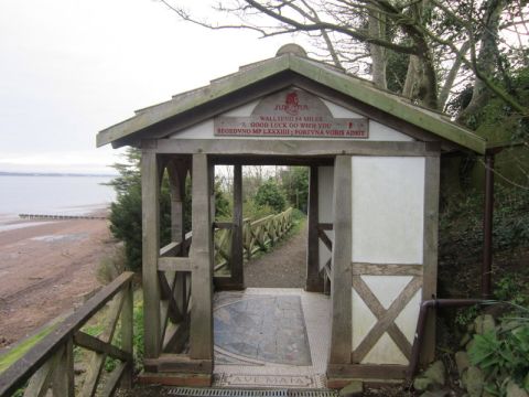
9. Hadrian's Wall
Visiting Hadrian's Wall
10. Hexham
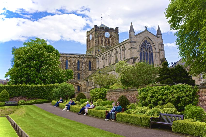
Visiting Hexham
11. Newcastle upon Tyne
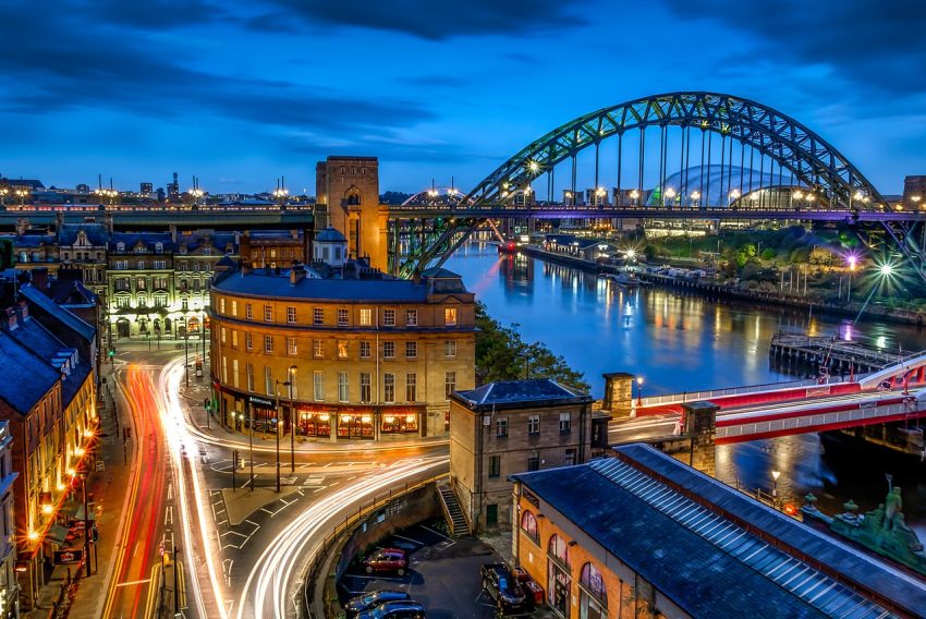
Visiting Newcastle upon Tyne
12. Gateshead
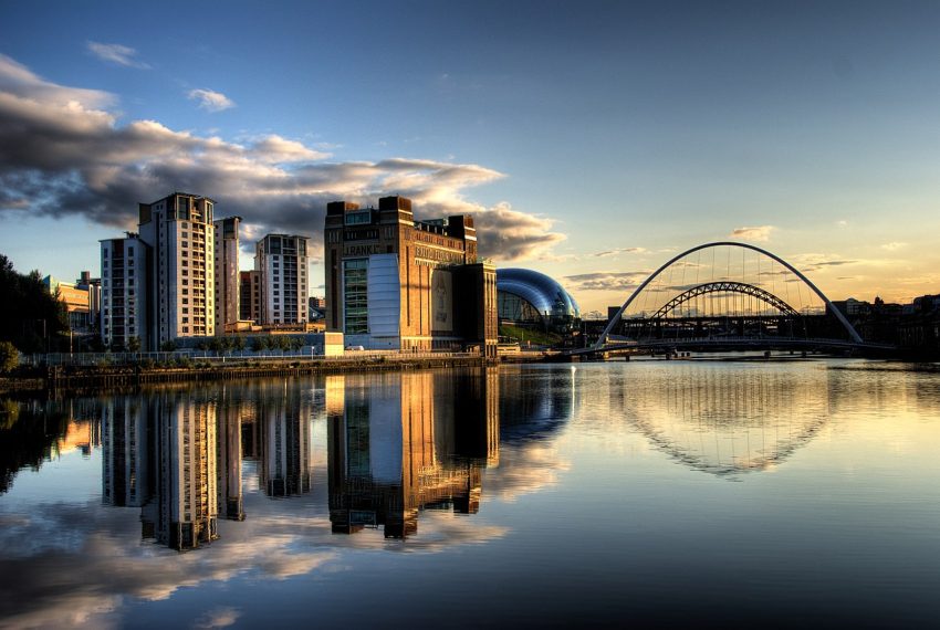
Visiting Gateshead
13. Durham
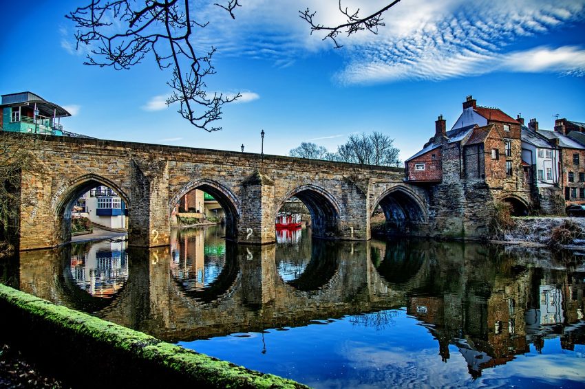
Visiting Durham
14. Lancaster
Visiting Lancaster
15. South Shields
Visiting South Shields
16. Sunderland
Visiting Sunderland
17. Edinburgh
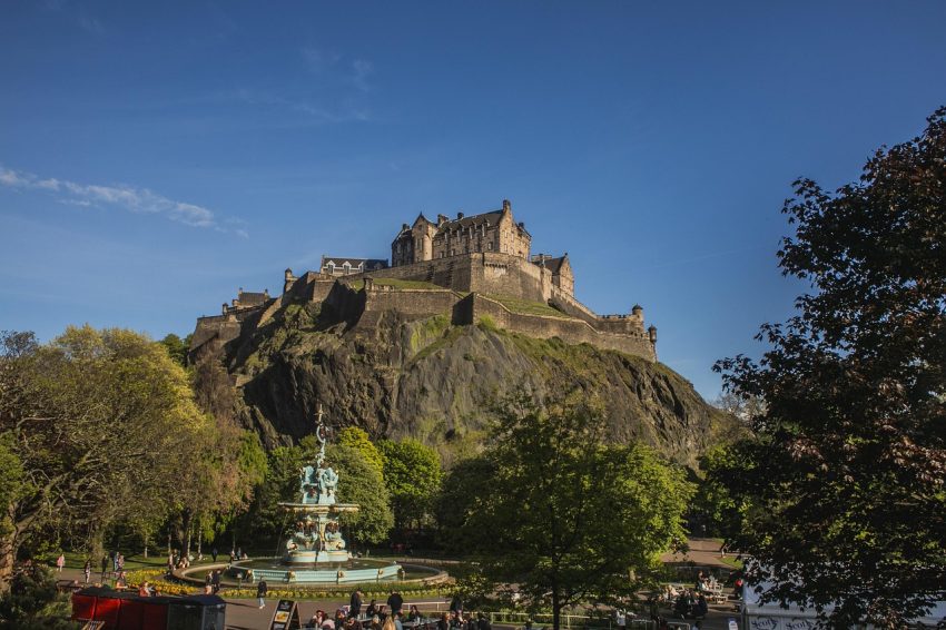
Visiting Edinburgh
Where to Stay in Carlisle
In Carlisle city centre, staying near the cathedral and historic quarter places you within walking distance of key sights like Carlisle Castle, Tullie House Museum, and the shopping precinct. This area is ideal for first-time visitors wanting easy access to restaurants and cultural attractions. A reliable choice here is Crown & Mitre Hotel, set in a grand Edwardian building with traditional décor, on-site parking, and a swimming pool. Another option nearby is The Halston, which offers chic serviced apartments and a stylish cocktail bar, perfect for a more modern stay.
For travellers arriving by train or looking for convenient onward travel, the area around Carlisle Station offers several well-connected accommodations. Ibis Carlisle City Centre is a budget-friendly, dependable hotel right next to the station, offering clean, comfortable rooms and easy access to local nightlife. Just around the corner, County Hotel provides a more traditional setting with period features and basic amenities suitable for short stays or overnight breaks between journeys.
If you’re seeking a quieter location with easy parking or a base for exploring Hadrian’s Wall and the Solway Coast, consider staying just outside the city in suburban areas like Stanwix or Scotby. Willowbeck Lodge is a boutique guesthouse set in landscaped gardens, offering a peaceful retreat with a luxury feel. Alternatively, Pinegrove Hotel provides a more affordable traditional inn experience with a friendly atmosphere and good road links to the M6 and A69.
Using the our Hotel and Accomodation map, you can compare hotels and short-term rental accommodations in Carlisle. Simply insert your travel dates and group size, and you’ll see the best deals for your stay.
Carlisle Accommodation Map
Best Time to Visit Carlisle
Carlisle in Spring
Spring in Carlisle, from March to May, brings mild weather and a renewed sense of life across the city’s green spaces and historic surroundings. The grounds of Carlisle Castle and Bitts Park bloom with colour, making it a pleasant time for walking and sightseeing. It’s also a quieter time to explore Hadrian’s Wall and the countryside without the crowds of summer. April and May often see local farmers’ markets return in full swing, along with community events and open garden days in the surrounding villages.
Carlisle in Summer (Best)
Summer is the most popular time to visit Carlisle, with long daylight hours and a full calendar of festivals and outdoor activities. July sees the return of the Carlisle Pageant and the Carlisle International Market, while Bitts Park and the city centre host open-air concerts, food fairs, and family events. The weather is generally warm but not extreme, perfect for hiking nearby stretches of Hadrian’s Wall or heading west to the Solway Coast. It’s also the best time for day trips into the Lake District or enjoying the buzz of riverside pubs and cafés.
Carlisle in Autumn
Autumn in Carlisle, from September through November, brings golden landscapes and fewer tourists. The city’s tree-lined parks, especially Rickerby Park and the Eden Valley, offer vibrant seasonal walks. It’s also a great time to visit museums and galleries like Tullie House without the summer crowds. The Carlisle Fireshow in early November is one of the largest free fireworks displays in the North, drawing big local audiences. Cooler weather sets in by late autumn, but the atmosphere remains welcoming, especially with harvest events and early Christmas markets appearing.
Carlisle in Winter
Winter in Carlisle is crisp and quiet, with shorter days but a festive spirit during December. The city’s Christmas lights and markets, held in the city centre and Market Hall, offer traditional stalls, mulled wine, and local crafts. The castle and cathedral often host carol services and seasonal events. While snowfall is possible, it tends to be light, and the city is still accessible for sightseeing. January and February are less busy and ideal for travellers seeking lower prices and a peaceful experience in the historical heart of Cumbria.
Annual Weather Overview
- January 5°C 45°F
- February 8°C 49°F
- March 9°C 53°F
- April 12°C 58°F
- May 14°C 62°F
- June 19°C 69°F
- July 19°C 70°F
- August 18°C 68°F
- September 16°C 64°F
- October 12°C 57°F
- November 9°C 52°F
- December 7°C 49°F
How to get to Carlisle
Getting to Carlisle by Air
Nearest airports: The closest major airport to Carlisle is Newcastle International Airport, located around 90 minutes away by car. This airport serves a wide range of domestic and international destinations. Other nearby options include Glasgow and Manchester Airports, both offering comprehensive connections and onward travel options to Carlisle.
From the airport to Carlisle: From Newcastle Airport, travellers can take the Metro into Newcastle Central Station and then catch a direct train to Carlisle. From Manchester Airport, there are direct train services operated by TransPennine Express, while from Glasgow, the journey may require a change depending on the route.
Getting to Carlisle by Train
Direct routes: Carlisle is a major stop on the West Coast Main Line, offering direct services from cities such as London (3h 20m), Glasgow (1h 15m), Manchester (1h 40m), and Newcastle (1h 30m). Regular services are operated by Avanti West Coast, Northern Rail, ScotRail, and TransPennine Express.
Rail operators:
Getting to Carlisle by Car
Carlisle is easily accessible by road, located at the junction of the M6 (north–south route) and A69 (east–west route from Newcastle). From Manchester, the drive takes just under two hours via the M6. From Glasgow, it's around 1 hour 30 minutes southbound on the same motorway. For those coming from the northeast, the A69 offers a scenic cross-country route.
Travelling around Carlisle
Carlisle’s compact city centre is very walkable, with most attractions no more than a 15-minute stroll apart. For destinations slightly further afield such as Hadrian’s Wall or the Solway Coast, local bus services operate from the central station and main bus terminal. Taxis are widely available, and cycling is an increasingly popular option with several safe routes around the city and along the River Eden. For regional rail travel, Northern Rail connects Carlisle with towns across Cumbria and southern Scotland.