Brampton, Carlisle, England: The Ultimate Travel Guide 2026
Brampton is a small market town, civil parish and electoral ward within the City of Carlisle district of Cumbria, England, about 9 miles (14 km) east of Carlisle and 2 miles (3.2 km) south of Hadrian's Wall. Historically part of Cumberland, it is situated off the A69 road which bypasses it. Brampton railway station, on the Newcastle and Carlisle Railway, is about a mile outside the town, near the hamlet of Milton.
Brampton, with a population of some 4000, is built of local sandstone, and situated in a hollow formed by glacial action which took place during the ice-age.
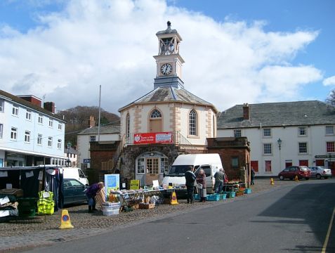
In the centre of the town is the octagonal Moot Hall, built in 1817, with an external staircase to its upper entrance, pointed windows and a square turret. The building now houses the Tourist Information Centre. East of the town is an exceptionally large motte, about 135 feet high. On it is a statue of the 7th Earl of Carlisle.
History of Brampton, Carlisle
Brampton has a rich history dating back to Roman times when the area was initially settled by the Romans, who established a fort named “Branodunum” around 72 AD. This fort played a strategic role in the Roman frontier defenses and served as a base for Roman soldiers guarding the nearby Hadrian’s Wall.
After the decline of the Roman Empire, Brampton continued to be inhabited by various peoples, including the Angles and the Saxons. It wasn’t until the medieval period that Brampton began to develop as a settlement of significance. The town grew around the Church of St. Martin, which was first mentioned in historical records in the 12th century.
Throughout the medieval period, Brampton thrived as a market town, serving as a center of trade and commerce for the surrounding rural communities. The town’s market charter was granted in 1252, allowing for the establishment of regular markets and fairs, further bolstering Brampton’s importance as a commercial hub.
During the 17th and 18th centuries, Brampton continued to prosper, with industries such as textiles, agriculture, and coal mining driving economic growth in the region. The town’s location along the main road between Carlisle and Newcastle also contributed to its prosperity, as travelers and merchants passed through Brampton on their journeys.
In the 19th century, Brampton saw further development with the arrival of the railway in 1836, which connected the town to Carlisle and Newcastle. This facilitated the transportation of goods and passengers, stimulating growth and industry in the area.
Today, Brampton retains much of its historic charm, with its picturesque streets lined with Georgian and Victorian buildings. The town’s rich history is evident in its architecture, including the Church of St. Martin, the Moot Hall, and several historic pubs and inns.

Moira & Andy
Hey! We're Moira & Andy. From hiking the Camino to trips around Europe in Bert our campervan — we've been traveling together since retirement in 2020!
Visiting Brampton, Carlisle for the first time and wondering what are the top places to see in the city? In this complete guide, I share the best things to do in Brampton, Carlisle on the first visit. To help you plan your trip, I have also included an interactive map and practical tips for visiting!
This website uses affiliate links which earn a small commission at no additional cost to you.
2 Best places to See in Brampton, Carlisle
This complete guide to Brampton, Carlisle not only tells you about the very best sights and tourist attractions for first-time visitors to the city but also provide insights into a few of our personal favorite things to do.
This is a practical guide to visiting the best places to see in Brampton, Carlisle and is filled with tips and info that should answer all your questions!
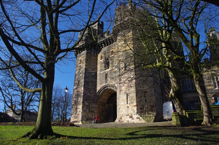
1. Naworth Castle
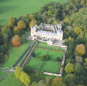
| Hours: Not open to the public | Website | Distance: 3.4km
2. Banks East Turret

Location: Pike Hill, Brampton, Cumbria, CA8 2BX | Hours: Open any reasonable time during daylight hours. | Price: £2 parking charge applies to non-members | Website | Distance: 5.8km


Best Day Trips from Brampton, Carlisle
A day trip from Brampton, Carlisle offers the perfect opportunity to escape the urban rhythm and discover the surrounding region's charm. Whether you're drawn to scenic countryside, historic villages, or cultural landmarks, the area around Brampton, Carlisle provides a variety of easy-to-reach destinations ideal for a one-day itinerary.
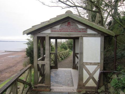
1. Piper Sike Turret
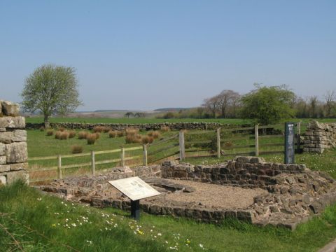
Location: Wall Bowers, Brampton, Cumbria, CA8 2BX | Hours: Open any reasonable time during daylight hours. | Price: Free | Website | Distance: 7.2km
Visiting Piper Sike Turret
2. Leahill Turret
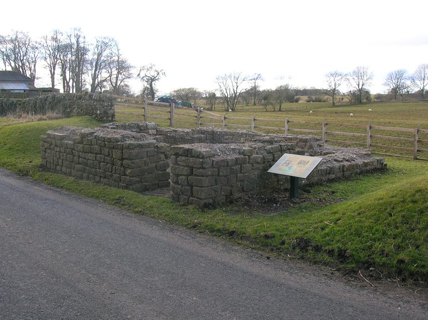
Location: Wall Bowers, Brampton, Cumbria, CA8 2BX | Hours: Open any reasonable time during daylight hours | Price: Free | Website | Distance: 10.1km
Visiting Leahill Turret
3. Carlisle
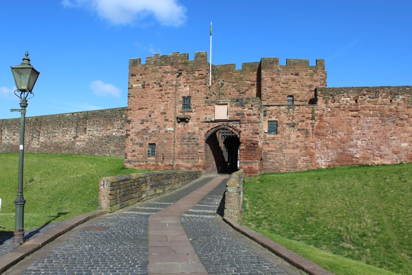
Visiting Carlisle
4. Roman Army Museum
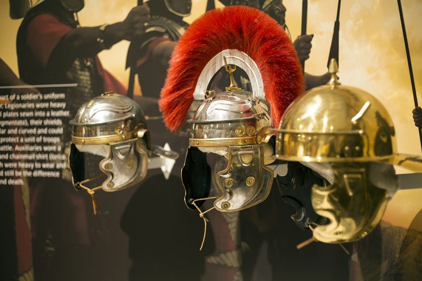
Location: Roman Army Museum Greenhead Brampton CA8 7JB United Kingdom | Hours: (Summer) 7 February – 30 November: Daily: 09:30–17:00. (Winter) 1 December – 6 February: Saturday – Sunday: 09:30–16:00. Closed Monday – Friday. | Price: Adults £8.00; Children (5–18) £5.00; Under 5s free; Family (2 adults + up to 3 children) £25.00. | Website | Distance: 14.6km
Visiting Roman Army Museum
5. Bowness-on-Solway
Visiting Bowness-on-Solway
6. Hexham
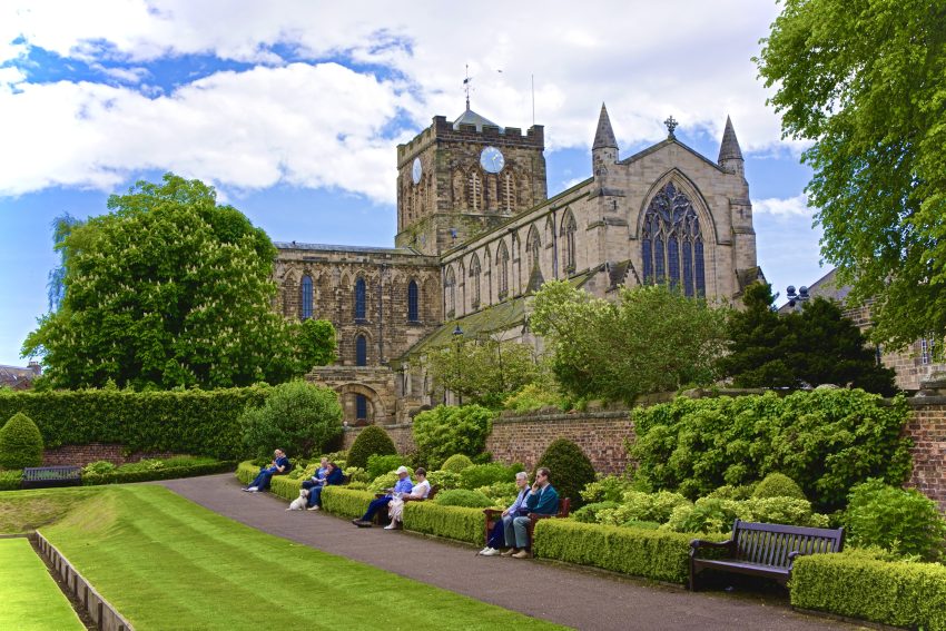
Visiting Hexham
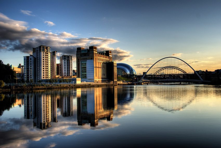
7. Newcastle upon Tyne
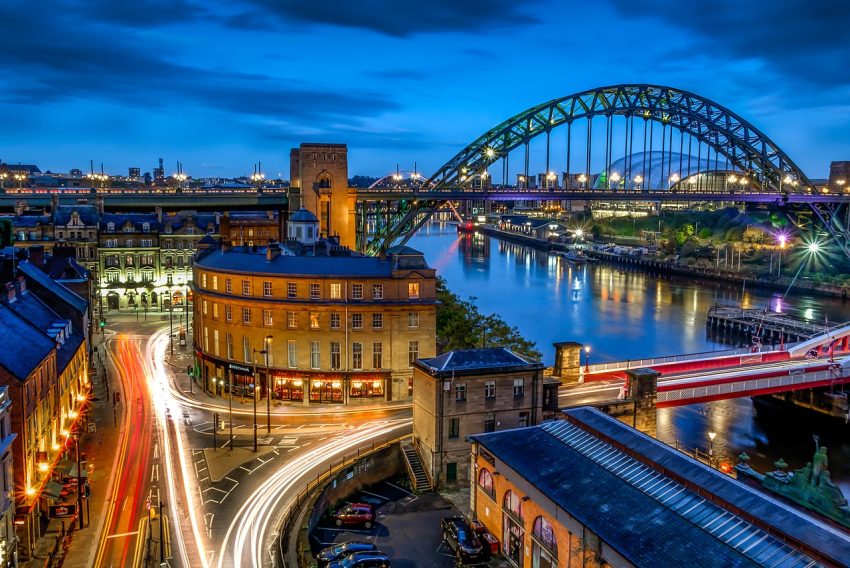
Visiting Newcastle upon Tyne
8. Gateshead
Visiting Gateshead
9. Durham
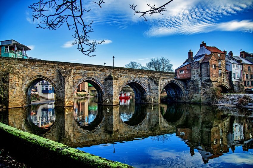
Visiting Durham
10. South Shields
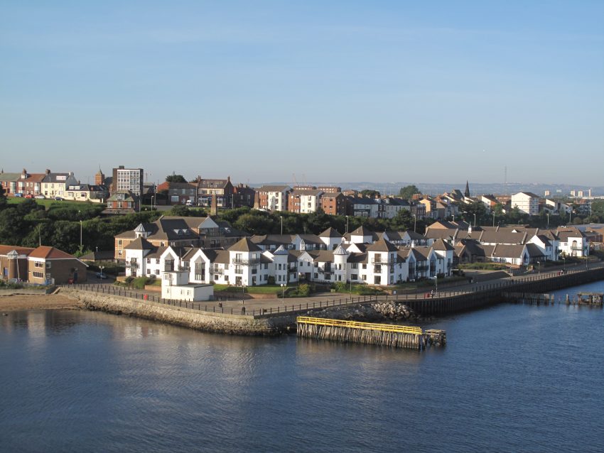
Visiting South Shields
11. Sunderland
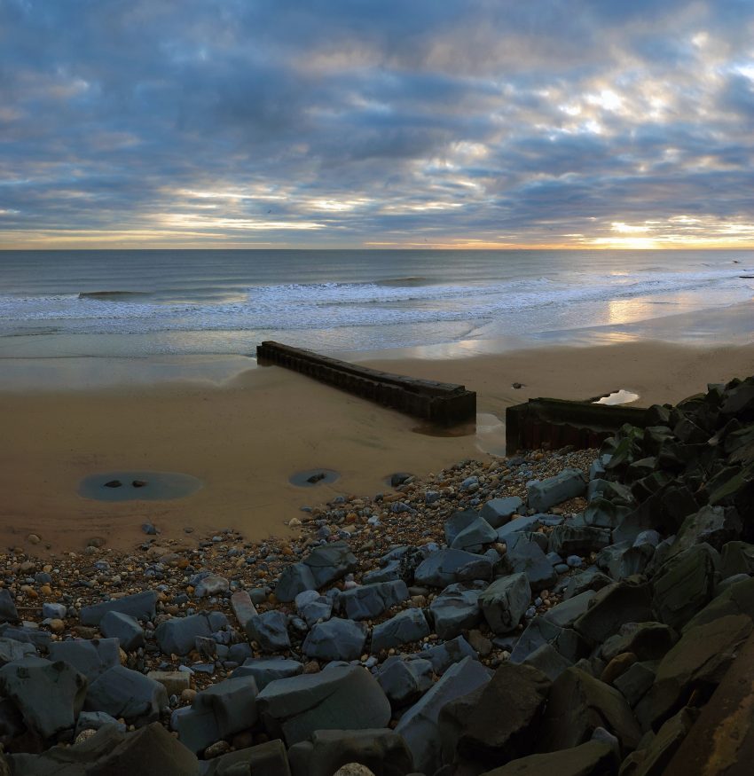
Visiting Sunderland
12. Lancaster
Visiting Lancaster
13. Edinburgh
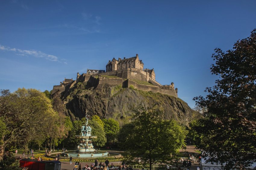
Visiting Edinburgh
Where to Stay in Brampton, Carlisle
Using the our Hotel and Accomodation map, you can compare hotels and short-term rental accommodations in Brampton, Carlisle. Simply insert your travel dates and group size, and you’ll see the best deals for your stay.
Brampton, Carlisle Accommodation Map
Best Time to Visit Brampton, Carlisle
The best time to visit Brampton, Carlisle, largely depends on your preferences for weather and activities. Here’s a breakdown of the seasons:
- Spring (March to May): Spring is a delightful time to visit Brampton, Carlisle, as the weather begins to warm up, and nature comes to life. The countryside around Brampton bursts into bloom with colorful flowers, making it perfect for scenic walks and outdoor activities. Additionally, spring sees fewer tourists, allowing you to explore the area’s attractions, such as Lanercost Priory and Hadrian’s Wall, in relative peace.
- Summer (June to August): Summer is the peak tourist season in Brampton, Carlisle, with warm temperatures and longer daylight hours. This is the best time to enjoy outdoor activities like hiking, cycling, and picnicking in the nearby Lake District National Park. The area’s festivals and events, such as the Brampton Live music festival and the Carlisle Pageant, also take place during the summer months, adding to the vibrant atmosphere.
- Autumn (September to November): Autumn brings cooler temperatures and stunning foliage to Brampton, Carlisle, making it a picturesque time to visit. The surrounding countryside is transformed into a tapestry of red, orange, and gold hues, creating perfect conditions for scenic drives and walks. Autumn is also harvest season, so you can sample local produce at farmers’ markets and food festivals.
- Winter (December to February): Winter is the quietest time to visit Brampton, Carlisle, with fewer tourists and colder temperatures. While the weather may be chilly, the area’s historic sites, such as Carlisle Castle and Naworth Castle, take on a magical quality in the snow. Winter is also a great time to cozy up in a traditional pub with a hearty meal and a pint of local ale.
Ultimately, the best time to visit Brampton, Carlisle, depends on your preferences for weather and activities. Whether you prefer the vibrant atmosphere of summer, the stunning colors of autumn, or the peaceful ambiance of winter, Brampton, Carlisle, offers something for every traveler throughout the year.
Annual Weather Overview
- January 4°C 43°F
- February 7°C 47°F
- March 9°C 51°F
- April 11°C 56°F
- May 13°C 60°F
- June 17°C 66°F
- July 18°C 68°F
- August 17°C 66°F
- September 15°C 62°F
- October 10°C 54°F
- November 8°C 50°F
- December 7°C 47°F