Bowness-on-Solway, England: The Ultimate Travel Guide 2026
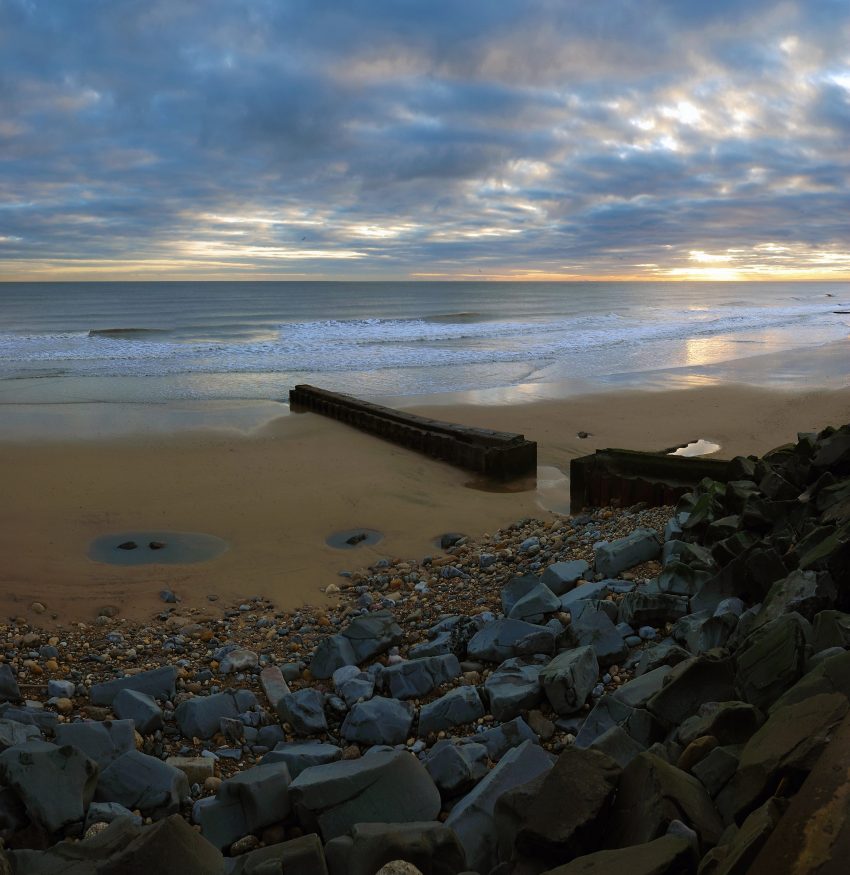
Bowness-on-Solway is a small village of fewer than 100 houses in Cumbria in northwest England. It is situated to the west of Carlisle on the southern side of the Solway Firth estuary separating England and Scotland and has spectacular views across the Solway estuary to Dumfries & Galloway. The village is part of the Solway Coast Area of Outstanding Natural Beauty and home to nationally and internationally important species. It is a great place for walking, cycling, and bird watching and there are several nature reserves nearby.
The parish consists of four villages – Anthorn, Bowness, Glasson and Port Carlisle, and the smaller settlements of Cardurnock, Drumburgh, Easton, Fingland, Longcroft and Whitrigg.
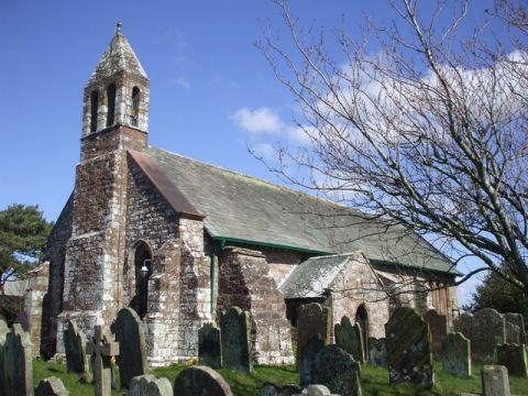
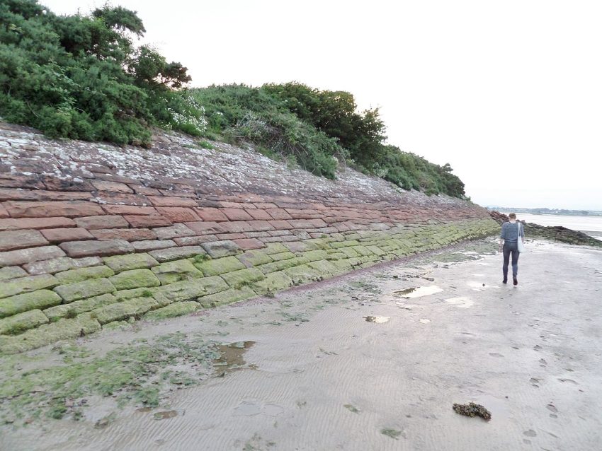
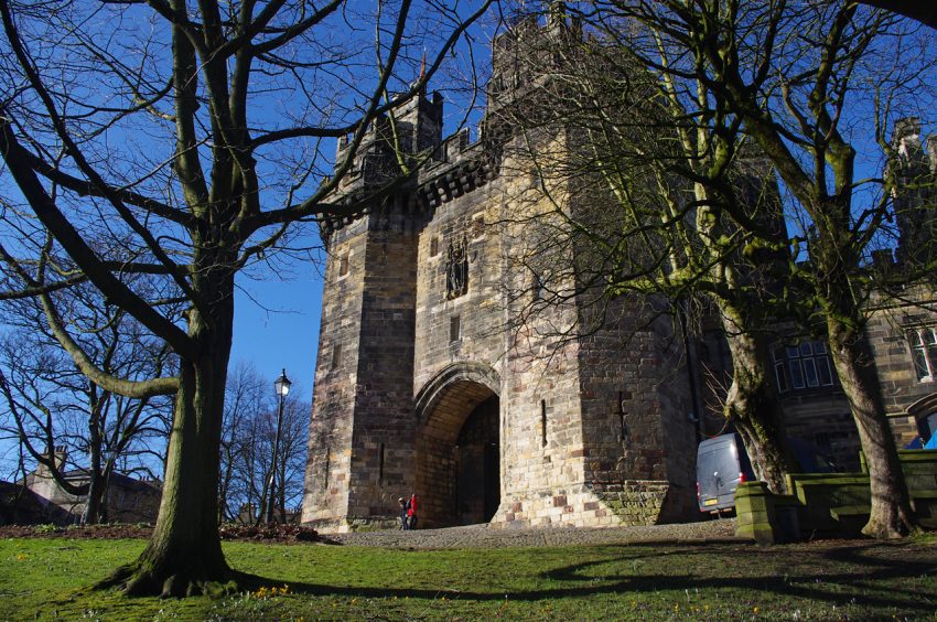
The village is at the western end of Hadrian’s Wall and was the location of the Roman fort Maia which guarded the approach from the Solway. The village is built on the site of the fort and Roman stones can be seen in the local buildings, including the Norman church of St. Michael.
‘Bowness’ means ’rounded’, or bow-shaped headland’, from either the Old English ‘boga’, ‘bow’, and ‘næss’, or, more probably, the Old Norse ‘bogi’ and ‘nes’. The headland at Bowness on Solway once led to a crossing point over the Solway Firth into Scotland, known as a ‘wath’.
Table of Contents
- History of Bowness-on-Solway
- 2 Best places to See in Bowness-on-Solway
- 10 Best Day Trips from Bowness-on-Solway
- Where to Stay in Bowness-on-Solway
- Best Time to Visit Bowness-on-Solway
- Visiting Bowness-on-Solway in Spring
- Visiting Bowness-on-Solway in Summer
- Visiting Bowness-on-Solway in Autumn
- Visiting Bowness-on-Solway in Winter
- How to get to Bowness-on-Solway
History of Bowness-on-Solway
Bowness-on-Solway: Roman Origins
Bowness-on-Solway is located at the western end of Hadrian’s Wall, a significant Roman fortification. The village’s history dates back to the Roman era when it served as a fort known as Maia.
Bowness-on-Solway: Medieval Period
During the medieval period, Bowness-on-Solway developed as a small farming community. The village church, St. Michael’s, built on the site of the Roman fort, became a focal point for the local population.
Bowness-on-Solway: Modern Era
In more recent times, Bowness-on-Solway has maintained its rural charm while becoming a popular destination for visitors exploring Hadrian’s Wall and the surrounding natural beauty.

Moira & Andy
Hey! We're Moira & Andy. From hiking the Camino to trips around Europe in Bert our campervan — we've been traveling together since retirement in 2020!
Visiting Bowness-on-Solway for the first time and wondering what are the top places to see in the city? In this complete guide, I share the best things to do in Bowness-on-Solway on the first visit. To help you plan your trip, I have also included an interactive map and practical tips for visiting!
This website uses affiliate links which earn a small commission at no additional cost to you.

2 Best places to See in Bowness-on-Solway
This complete guide to Bowness-on-Solway not only tells you about the very best sights and tourist attractions for first-time visitors to the city but also provide insights into a few of our personal favorite things to do.
This is a practical guide to visiting the best places to see in Bowness-on-Solway and is filled with tips and info that should answer all your questions!
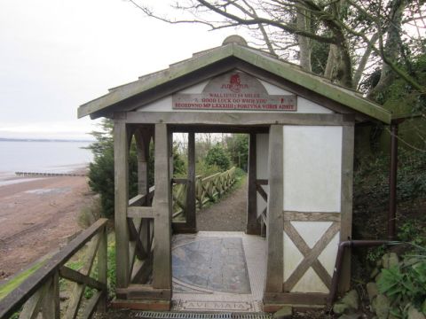
1. St Michael's Church
Location: St Michael's Church, Bowness-on-Solway, Bowness-on-Solway, Wigton, UK | Website | Distance: 0.1km

2. Solway Junction Railway
| Hours: 24 Hours | Price: Free | Distance: 1.1km
Best Day Trips from Bowness-on-Solway
A day trip from Bowness-on-Solway offers the perfect opportunity to escape the urban rhythm and discover the surrounding region's charm. Whether you're drawn to scenic countryside, historic villages, or cultural landmarks, the area around Bowness-on-Solway provides a variety of easy-to-reach destinations ideal for a one-day itinerary.
1. Carlisle
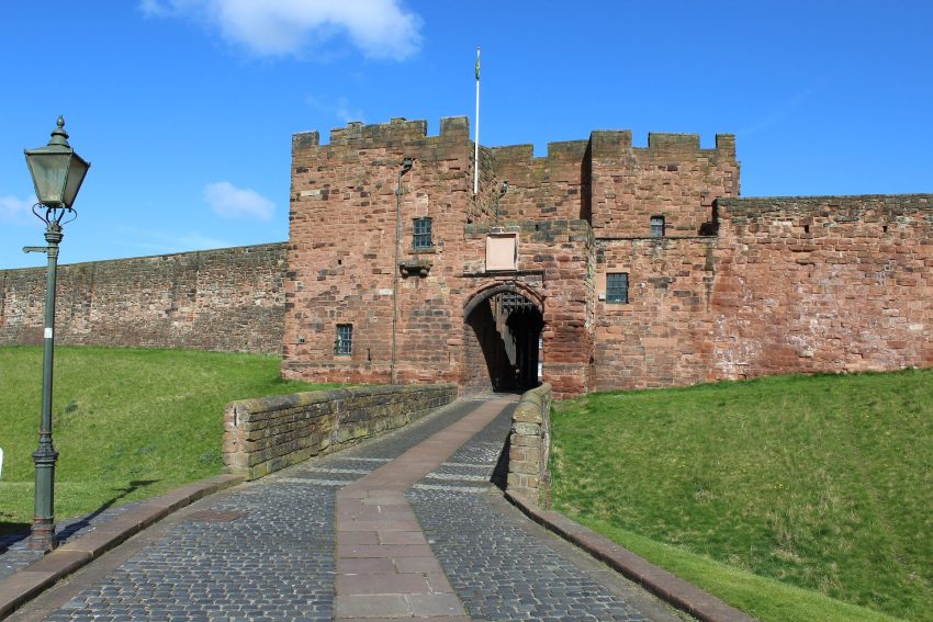
Visiting Carlisle
2. Brampton, Carlisle
Visiting Brampton, Carlisle
3. Hexham
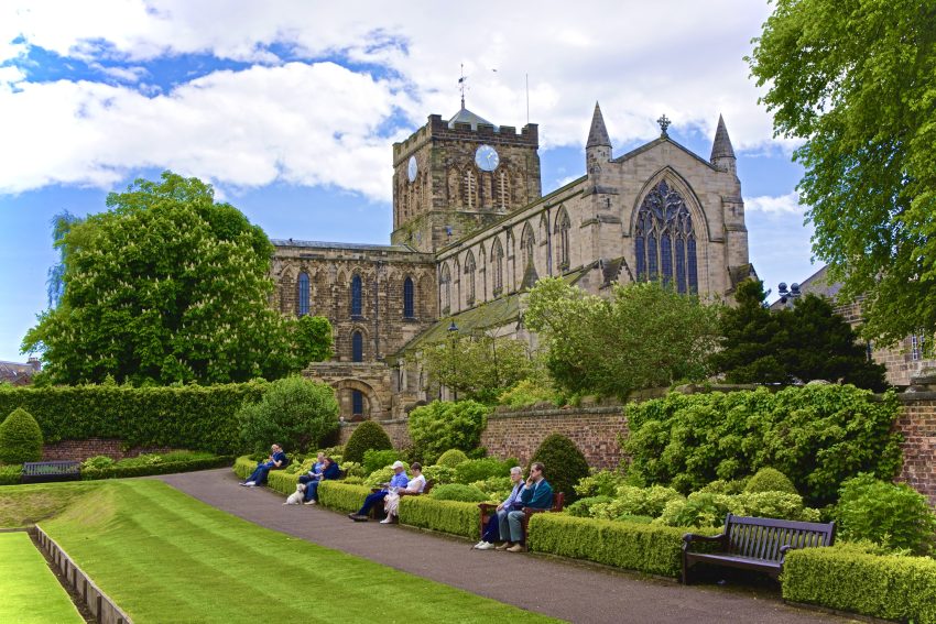
Visiting Hexham
4. Newcastle upon Tyne

Visiting Newcastle upon Tyne
5. Gateshead
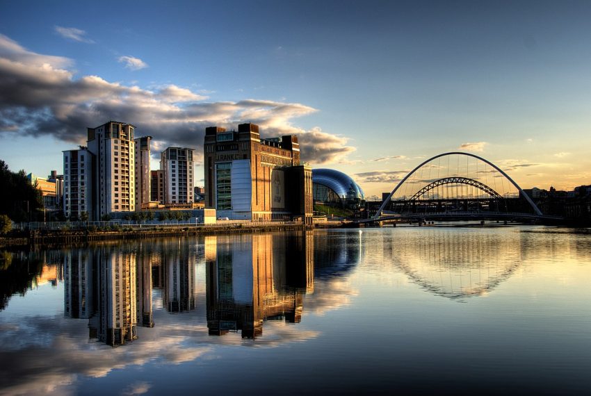
Visiting Gateshead
6. Lancaster
Visiting Lancaster
7. Durham
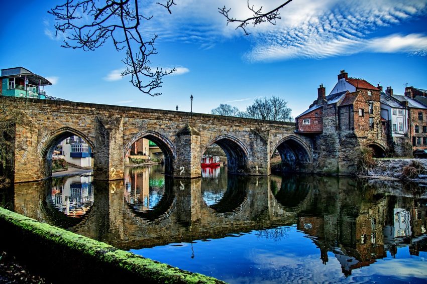
Visiting Durham
8. Edinburgh

Visiting Edinburgh
9. South Shields
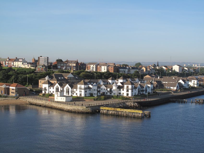
Visiting South Shields
10. Sunderland
Visiting Sunderland
Where to Stay in Bowness-on-Solway
Staying in the village center offers access to local inns and guesthouses near Hadrian’s Wall. For a countryside escape, farm stays or cottages in the Solway Coast area provide a peaceful retreat.
A 1-day stay is enough for visiting Hadrian’s Wall and enjoying coastal walks. A 2-day stay allows for exploring nearby Carlisle or taking scenic drives along the Cumbrian coast.
Using the our Hotel and Accomodation map, you can compare hotels and short-term rental accommodations in Bowness-on-Solway. Simply insert your travel dates and group size, and you’ll see the best deals for your stay.
Bowness-on-Solway Accommodation Map
Best Time to Visit Bowness-on-Solway
Visiting Bowness-on-Solway in Spring
Spring in Bowness-on-Solway brings blooming wildflowers and mild temperatures. It’s a perfect time for walking along Hadrian’s Wall and enjoying the scenic landscapes.
Visiting Bowness-on-Solway in Summer
Summer offers warm weather and longer days, ideal for outdoor activities such as hiking, birdwatching, and exploring the Solway Coast Area of Outstanding Natural Beauty.
Visiting Bowness-on-Solway in Autumn
Autumn provides cooler temperatures and beautiful foliage, making it a great time for scenic drives and enjoying the tranquil atmosphere of the village and its surroundings.
Visiting Bowness-on-Solway in Winter
Winter in Bowness-on-Solway is quiet and peaceful, with crisp air and the potential for picturesque snowfall. It’s an excellent time for cozying up in local inns and experiencing the village’s serene charm.
Annual Weather Overview
- January 5°C 45°F
- February 7°C 49°F
- March 9°C 52°F
- April 12°C 57°F
- May 14°C 61°F
- June 19°C 69°F
- July 19°C 70°F
- August 18°C 68°F
- September 16°C 64°F
- October 12°C 57°F
- November 9°C 52°F
- December 8°C 49°F
How to get to Bowness-on-Solway
Traveling to Bowness-on-Solway by Car
Driving to Bowness-on-Solway is convenient, with well-connected roads from Carlisle and other nearby towns. The village is easily accessible via the A689 and B5307 roads.
Traveling to Bowness-on-Solway by Train
The nearest railway station is in Carlisle, about 14 miles away. From Carlisle, you can take a taxi or a bus to reach Bowness-on-Solway.
Traveling to Bowness-on-Solway by Bus
Regular bus services operate from Carlisle to Bowness-on-Solway, making it accessible by public transportation for those who prefer not to drive.
Traveling to Bowness-on-Solway by Air
The nearest major airport is Newcastle International Airport, approximately 70 miles away. From the airport, you can rent a car or use public transportation to reach the village.