Madeira: Santana and the North Coast
This website uses affiliate links which earn a small commission at no additional cost to you.
The striking peaks of Pico Arieiro and Pico Ruivo, towering at over 1800 meters, provide exceptional hiking opportunities with breath-taking alpine views overlooking the island’s coastlines. This area is a haven for those seeking both scenic beauty and memorable walking experiences.
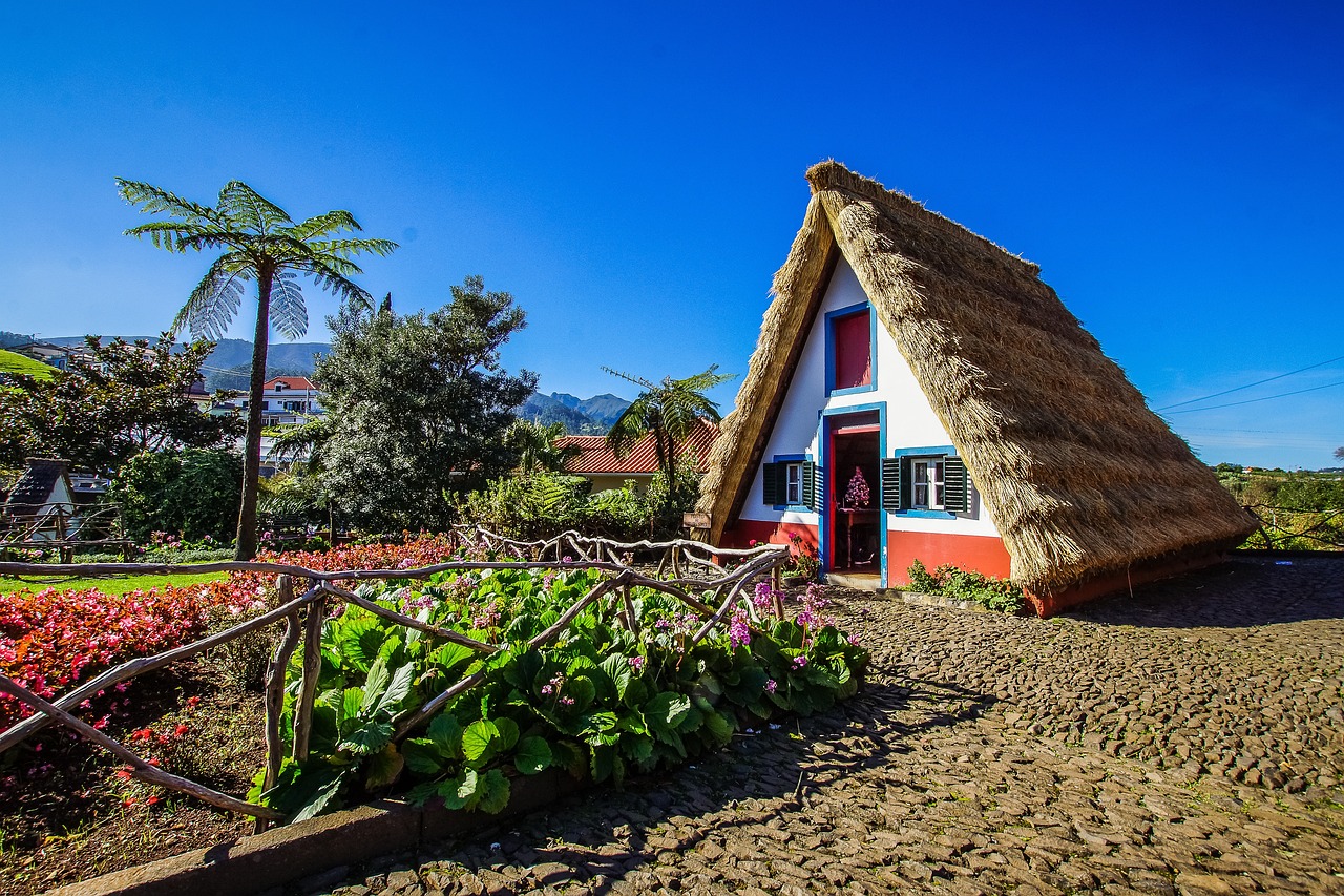
Santana is renowned for its charming triangular-shaped thatched houses known as “Palheiros,” which dot the lush green landscape. These unique structures offer a glimpse into the region’s rich cultural heritage and architectural history.
Parque das Queimadas and Levada do Caldeirão Verde offers yet another opportunity to immerse yourself in the breathtaking waterfalls of Madeira.
Watch the sunrise at Pico do Arieiro

Start the day early and catch the sunrise from Pico do Arieiro. Drive to Parque de Estacionamento Pico do Areeiro. If the weather is clear, consider ignoring the rest of todays tour to hike to Pico Ruivo (6-7 hours return). Either take in the view from Miradouro do Juncal or Miradouro do Ninho da Manta (with fewer crowds).
Pico do Arieiro, the third-highest peak in Madeira, stands as the most easily accessible mountainous destination from Funchal. Nestled within the striking mountain landscapes of Madeira’s interior, Pico do Arieiro offers a spectacle where jagged peaks emerge from lush, forested valleys, and brisk winds create clouds on their upward journey.
On clear days, the panoramic views from Pico do Arieiro are nothing short of spectacular. In certain cloudy conditions, the peaks rise above a sea of clouds, presenting a surreal and enchanting vista. The Miradouro do Juncal viewpoint, situated to the east of Arieiro, is renowned as the best location on Madeira for observing the sunrise. Meanwhile, the Miradouro do Ninho da Manta provides breath-taking views over intricately carved valleys, adding to the allure of this high-altitude destination.
Top Tip: Have a look at the Pico do Arieiro webcam and the weather before visiting to make sure it isn’t completely covered in clouds or raining!
Read more about Pico do Arieiro to Pico Ruivo Hike (PR1 and PR1.2)
Ribeiro Frio & Miradouro dos Balcõe

Ribeiro Frio, situated in the northern part of the island, is a natural park nestled within a deep valley surrounded by mountains. Renowned among both locals and tourists, this picturesque locale is famous for its trout and offers delightful walks along its nature trails.
As you enter the outskirts of Ribeiro Frio you will probably begin to see cars parked on the road, and a the Balcões signed on your left, park where you can to explore the Vereda dos Balcões.
The Vereda dos Balcões is a short 1.5 km long trail (+ 1.5 km return), that takes you to enjoy the views from the Balcões Viewpoint. As you walk along the verada, you’ll encounter various laurel species and endemic plants, contributing to the island’s rich biodiversity. Keep an eye out for rare birds like the pigeon-tocaz, which holds the distinction of being the smallest bird in Madeira, adding to the allure of this natural haven. You soon come to the Balcões viewpoint, which offers wide views over the Ribeira da Metade valley.
Location: Ribeiro Frio, Portugal
Read more about Ribeiro Frio
Visit one of the Triangular Houses of Santana

Stay on the ER103 until you get to the VE1, google may try and take you on a minor road. When you reach roundabout for Santana you could head right to see the Rocha do Navio viewing point, after you have enjoyed to views head for the free parking opposite the Casas Típicas de Santana.
The village of Santana, situated along the northern coast of Madeira, is famed for its traditional Casas de Santana—compact, A-frame houses crafted from timber and thatch. These charming dwellings are characterized by their bright colours, frequently featuring scarlet doors and windows adorned with blue frames. Completing the scenic picture, the houses are often accompanied by well-kept vegetable gardens, adding to their picturesque allure. The Casas de Santana stand as an iconic and quintessentially Madeiran sight, showcasing the island’s unique architectural and cultural charm.
Read our Santana (Madeira) Travel GuideVereda do Pico Ruivo (PR1.2)

Pico Ruivo stands as the highest peak in Madeira, soaring to an impressive elevation of 1,862 meters (6,109 feet). The most convenient path to reach the summit of Pico Ruivo is by embarking on the PR 1.2 Vereda do Pico Ruivo hiking trail. To initiate your journey, you can drive directly to the mountain until you reach Achada do Teixeira, where you can conveniently park your vehicle. From this starting point, the picturesque trail traverses the mountain’s ridge, leading you to the summit, covering a distance of just 2.8 kilometres (1.74 miles) one way. Along the way, you’ll encounter numerous shelters for brief respites, and there’s even a charming small café nestled along the route for added convenience.
Read more about Vereda do Pico Ruivo (PR1.2)
Caldeirão Verde Levada Walk (PR 9)

Levada do Caldeirão Verde (PR 9) offers yet another opportunity to immerse yourself in the breath-taking waterfalls of Madeira. Approximately halfway into the hike, you’ll encounter a striking waterfall, and the grand finale awaits at the end with the impressive Caldeirão Verde, one of the most powerful waterfalls to grace our sight. Prepare for an extraordinary trail that commences from one of the island’s most exquisite gardens, Parque das Queimadas, serving as the starting point for both Levada do Caldeirão Verde and Caldeirão Inferno.
The park itself is a captivating destination, offering an hour’s worth of exploration amidst its charming miniature Santana Houses and the elegant presence of peacocks meandering about. However, the real adventure unfolds on the levada trails! For the more daring souls, an optional continuation to hike the additional Caldeirão do Inferno segment is available, presenting a more exhilarating and challenging experience!
Location: PR9 Levada do Caldeirão Verde, Santana, Portugal
Read more about Caldeirão Verde Levada Walk (PR 9)
View the Eagle Rock at Faial

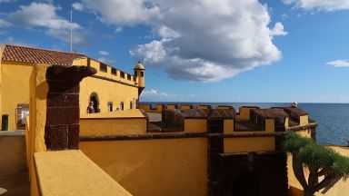
Drive through Santana on the VR1, stopping at Miradouro do Cortado or Miradouro de Nossa Senhora dos Bons Caminhos for photos. As you descend to Faial you can turn left to visit the Fortim do Faial, disappointing as a fort but a great place to view the Eagle’s Nest! Continue on towards the Miradouro do Guindaste and step out over the Atlantic ocean!
Faial is a charming, small village situated along the north-eastern coast of the island, named after a local tree called ‘faia’ or ‘myrica faya.’ The area was initially colonized around 1519, with settlers primarily comprising Moorish and Galician communities. During the early settlement period, when sugar plantation thrived, water mills were constructed along the rivers of Ribeira do Faial and Ribeira Seca to process sugar cane. Today, remnants of these mills can still be observed beneath the bridge, providing glimpses into the historical sugar production activities in the region.
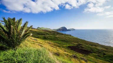
As you look out to sea to your right is the Penha d’Águia massif, splitting up Faial and Porto da Cruz. Penha d’Águia or the Eagle Rock looks inaccessible from all sides with vertical seaward cliffs which continue all the way round the landward sides. However hiking to the summit is possible, although challenging and recommended only for hikers with good physical endurance, the walk is also not really suitable in wet weather as the paths can become treacherously slippery. Drive to the start of the Vereda da Penha d’Águia , read more about the Penha d’Águia route in our blog.
Location: Faial, Portugal
Read more about Faial
This website uses affiliate links which earn a small commission at no additional cost to you.


