Self-Guided Walking Tour of Ghent
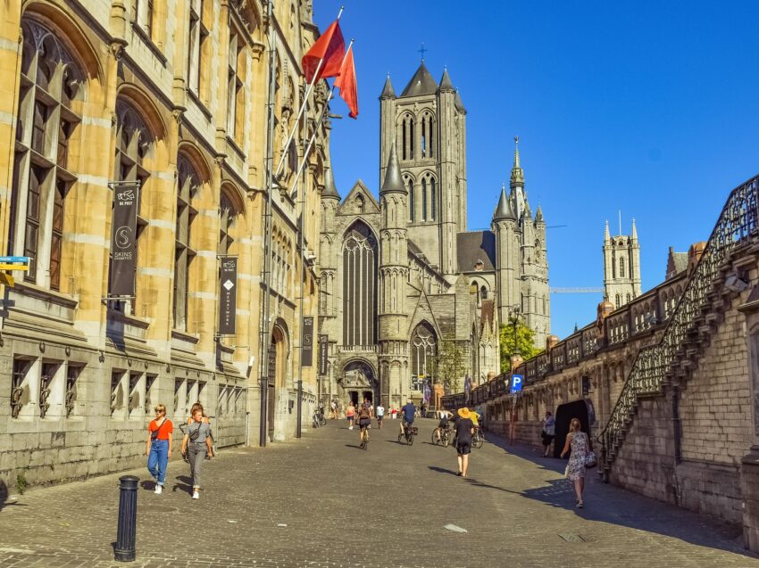
Church in Ghent, on Summer'd Day
Self-Guided Walking Tour of Ghent

This website uses affiliate links which earn a small commission at no additional cost to you.

Ghent is one of Belgium's most historically dense cities: a medieval trading power that grew rich on cloth and river commerce, then carried that civic confidence into an urban core packed with guild architecture, churches, and civic monuments. Its rivers are not just scenic; they explain the city's layout and prosperity, with quays, bridges, and former warehouses still defining how the centre fits together today.

What makes Ghent work for visitors is how tightly the main sights cluster around the old heart of the city, so you can move quickly between big-ticket landmarks and smaller, atmospheric streets without losing the sense of continuity. Expect a mix of imposing stone skyline markers, intimate neighbourhood lanes, and waterfront viewpoints that keep re-framing the same historic core from different angles.

How to get to Ghent

By Air: Fly into Brussels Airport for the most straightforward onward connections, then continue to Ghent by train. Antwerp Airport and Brussels South Charleroi can work depending on routes and price, but they usually mean an extra change and more time overall. For the best deals and a seamless booking experience, check out these flights to Ghent on Booking.com.

By Train: Arriving by rail is one of the easiest ways to reach Ghent, with frequent services from Brussels and strong connections across Belgium and neighbouring countries. Ghent's main station is Gent-Sint-Pieters, and from there you can use a tram, bus, taxi, or a short onward train hop depending on where you're staying. Train tickets and schedules can be found directly on the SNCB/NMBS website for Belgian services. For a more convenient experience, consider using Omio, where you can easily compare prices, schedules, and book tickets in one place.

By Car: Driving is possible, but I treat Ghent as a city where planning matters more than the drive itself-traffic restrictions and parking zones can make central access awkward. If you do come by car, it's usually simpler to park outside the core (or at a hotel with parking) and rely on public transport or walking once you're in. If you are looking to rent a car in Belgium I recommend having a look at Discover Cars, first, as they compare prices and review multiple car rental agencies for you.

How to get around the city: The historic centre is very walkable, and I find that’s the best way to appreciate the details-facades, bridges, small courtyards, and waterside viewpoints. Trams and buses are useful for getting between Gent-Sint-Pieters and the centre, or for reaching neighbourhoods beyond the core, and cycling is common if you want to cover more ground quickly.

A Short History of Ghent

Early Ghent and the Origins of a Trading City

Ghent developed around waterways that made movement and trade practical long before the city looked “medieval” in the way visitors recognise today. Those rivers and canals became the city's economic engine, shaping where people built, traded, and gathered. Even now, the canalside streets and quays feel like the original spine of the city.

Medieval Ghent and the Age of Cloth Wealth

Ghent’s medieval rise was closely tied to the cloth trade, which fuelled the construction of the civic and religious landmarks that still define the skyline. The Belfry and Cloth Hall speak to the city’s commercial confidence and self-government, while major churches like St Bavo’s Cathedral reflect both faith and wealth concentrated into monumental stonework. When I’m in the centre, the density of big buildings in a small area makes this period feel especially tangible.

Fortress, Power, and Civic Identity in Ghent

The presence of Gravensteen Castle is a reminder that Ghent’s prosperity also brought power struggles and the need to project authority. Fortifications and imposing civic architecture weren’t just functional-they were statements about who controlled the city and how it was governed. The Town Hall, with its formal presence, also fits into this long tradition of civic identity and public life centred on prominent buildings.

Later Centuries and a City That Kept Reinventing Itself

As economies shifted, Ghent adapted, and the old mercantile core evolved into a city with multiple layers rather than a single “museum centre.” The canalside façades around the Graslei and Korenlei remain the most iconic face of Ghent, but they sit within a wider city that has kept changing its purpose and pace over time. That mix-medieval skyline with a modern rhythm-is part of what makes Ghent feel so easy to enjoy.

Where to Stay in Ghent

To make the most of visiting Ghent and this walking tour then you consider stay overnight at the centre. If you want the classic “step outside into the postcard” experience, base yourself in the historic core near the canals and main landmarks, where the Belfry area, St Bavo's Cathedral, and the prettiest quays are all close at hand; good, central options include 1898 The Post, Ghent Marriott Hotel, and NH Collection Gent.

If you prefer a slightly quieter, characterful feel while still being minutes from the centre, I like the Patershol and Prinsenhof side of town-historic streets, a calmer evening vibe, and easy access to Gravensteen and the canal edges; consider Pillows Grand Boutique Hotel Reylof as a comfortable base in that direction.

If you’d rather be on the edge of the centre for simpler transport links and a more “local city” feel, the area around Gent-Sint-Pieters is practical for early trains and day trips, while still being a quick tram ride from the sights; for a lively, food-and-bar atmosphere close to the centre, the Zuid/Brabantdam area works well too, with options like Yalo Urban Boutique Hotel Gent and Novotel Gent Centrum.

Your Self-Guided Walking Tour of Ghent

Discover Ghent on foot with our walking tour map guiding you between each stop as you explore its medieval skyline, canalside streets, and landmark squares. As this is a self guided walking tour, you are free to skip places, and take coffee stops when ever you want!

1. Sint-Baafskathedraal
Sint-Baafskathedraal
CC BY-SA 4.0 / Zairon

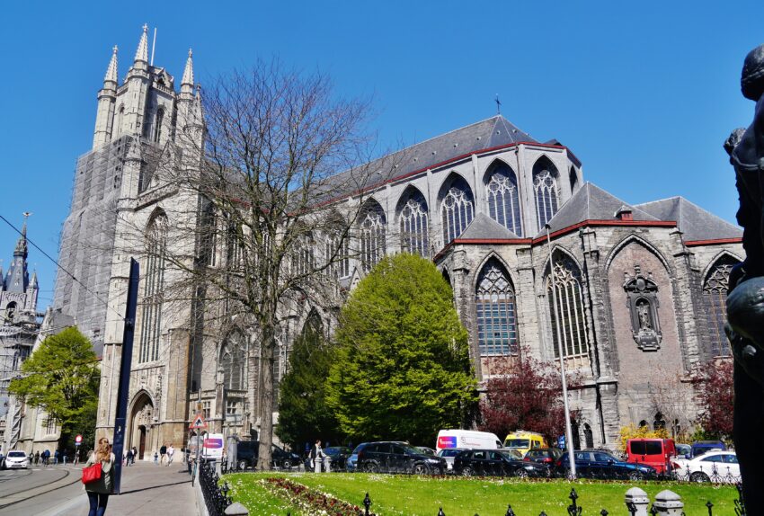
Sint-Baafskathedraal is Ghent’s cathedral best known for its association with the Ghent Altarpiece, one of the defining works of Early Netherlandish art. The polyptych was completed in 1432 by Hubert and Jan van Eyck and has a famously eventful history, including repeated thefts and wartime displacements.

Inside, the main priority is the Ghent Altarpiece (the Adoration of the Mystic Lamb): allow time to understand the panels and the detail work, which repays close viewing. Even if you focus on the altarpiece, it’s worth also looking at the cathedral’s broader interior as a layered record of civic wealth and ecclesiastical patronage.

For a first visit, pace it around three anchors: the altarpiece, the nave and choir as a single long vista, and the side chapels that hold smaller-scale artworks. If you care about technique, the altarpiece’s oil-paint handling and naturalism are central to why it is so celebrated.


Location: Sint-Baafsplein 1, 9000 Gent, Belgium | Hours: Mon - Sat: 8:30 am - 5.30 pm Sun: 1 pm - 5.30 pm | Price: Adults: €16:00 for AR tour | Website

We recommend to rent a car in Belgium through Discover Cars, they compare prices and review multiple car rental agencies. Book your rental car here.

2. Lakenhalle

Lakenhalle
Lakenhalle
CC BY-SA 4.0 / Ricardalovesmonuments

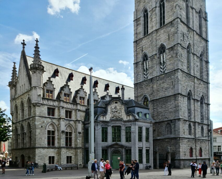
Lakenhalle is physically tied to Ghent’s belfry complex and reflects the city’s medieval-commercial identity. The Cloth Hall was built against the belfry in the 15th century and functioned as a centre where cloth—Ghent’s key export—was inspected, valued, and traded.

What you’re seeing is essentially the architectural footprint of a regulated economy: civic oversight, quality control, and merchant activity concentrated in one place. Its setting beside the belfry is not accidental; these buildings collectively express municipal authority as much as commerce.

When you visit, focus on the relationship between the hall and the belfry, then step back to take in how the ensemble reads as a single “civic statement” in stone. It’s especially rewarding to view it in context with the surrounding squares, where the trading city’s circulation routes still make sense on foot.


Location: Sint-Baafsplein 17, 9000 Gent, Belgium | Hours: 24 Hours. | Price: Free.

Here is a complete selection of hotel options in Ghent. Feel free to review each one and choose the stay that best suits your needs.

3. Belfort

Belfort
Belfort
CC BY-SA 4.0 / FrDr

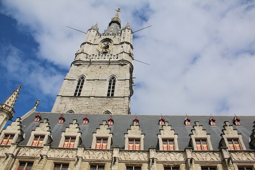
The Belfort is one of Ghent’s clearest symbols of medieval urban independence, and it is recognised as part of the UNESCO-listed belfry tradition. Historically, it was a secure place for safeguarding civic privileges and important documents, underlining that the tower wasn’t just a landmark but an instrument of city government.

A signature detail is the gilded dragon, associated with the belfry since the late 14th century, functioning as both emblem and guardian figure in local symbolism. The tower is also linked to civic warning and timekeeping through its bells and carillon tradition.

What to do on site: prioritise the climb or lift-assisted ascent for the city-wide perspective, then spend a minute with the belfry’s exterior details—the dragon and the tower’s changing silhouettes across building phases. If you time it well, hearing the bells or carillon adds a “living” layer to what can otherwise feel like static architecture.


Location: Belfort van Gent, Sint-Baafsplein, 9000 Gent, Belgium | Hours: Daily: 10am to 6pm | Price: Adults: €13.00 | Website

Traveling to a country with a different currency? Avoid ATM transaction fees and pay in local currency with a Wise Card. Having used it for over 5 years, we've saved loads on fees!

4. Stadhuis

Stadhuis
Stadhuis
CC BY-SA 2.0 / Thomas Quine

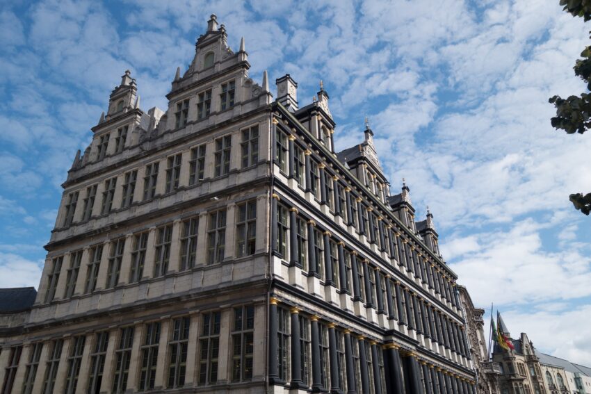
Ghent’s Stadhuis is compelling because it’s intentionally eclectic: the building reads like a timeline of changing taste and power. One façade is flamboyant Late Gothic from the early 16th century, while another wing shifts decisively into Renaissance language with classical columns and palazzo-like composition.

That stylistic contrast reflects how long civic buildings evolved—new administrations built onto old ones, and fashion changed faster than institutions. The result is a complex that’s less “one perfect design” and more an architectural record of how the city governed itself over centuries.

When you visit, look for the seam where the styles transition and treat it like a visual argument between eras. If the interiors are accessible during your visit, they deepen the story: the building was designed to impress not just locals, but visiting dignitaries and rival cities as well.


Location: Botermarkt 1, 9000 Gent, Belgium | Hours: Check official website. | Price: Free.

5. Vrijdagmarkt
Vrijdagmarkt
Vrijdagmarkt
CC BY-SA 3.0 / karel291

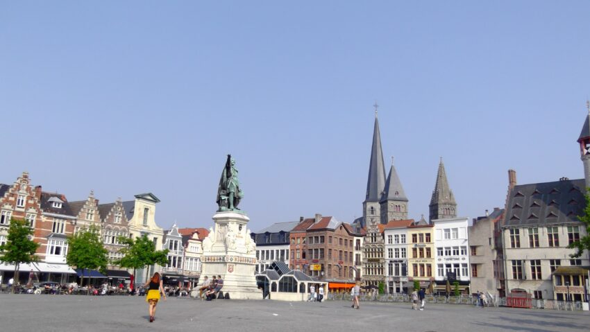
Vrijdagmarkt is one of Ghent’s oldest major squares, anchored by the weekly Friday market tradition and shaped by centuries of civic gathering. The square’s long history includes political theatre and unrest as well as trade, which is typical of major market places in medieval cities.

The central statue of Jacob van Artevelde makes the political dimension explicit: he is linked to Ghent’s 14th-century power struggles and the city’s economic reliance on English wool during the Hundred Years’ War era. The surrounding buildings reinforce the “guild” atmosphere—this is a square that historically belonged to organised trades and public life.

What to do there: visit when the market is active if you want continuity with the square’s original purpose, then return when it’s quieter to read the architecture and sightlines. Look for guild-related buildings and the square’s scale; it’s large enough to feel like an urban “room,” designed for crowds, proclamations, and collective energy.


Location: Vrijdagmarkt, 9000 Gent, Belgium | Hours: 24 Hours. | Price: Free.

6. Dulle Griet
Dulle Griet
Dulle Griet
CC BY-SA 4.0 / EmDee

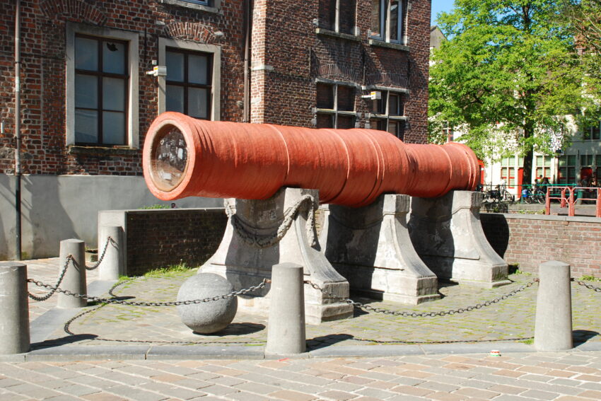
Dulle Griet is a medieval supergun (a large bombard) associated with Ghent, generally dated to the 15th century. It stands as a physical reminder of late-medieval siege warfare and the civic pride attached to military technology in an era when cities defended themselves as political actors.

Its story includes real movement and conflict: it was used in the mid-15th century during the Siege of Oudenaarde and later returned to Ghent in the late 16th century. Even without diving into every disputed detail, the key point is that this is not a decorative replica—it is a surviving artifact of extreme-scale artillery.

When you see it, look closely at the construction and sheer proportions: it’s meant to impress in the same way fortifications do. Place it mentally alongside Ghent’s walls, towers, and castle—Dulle Griet is another facet of the same historical system of civic defence and intimidation.


Location: Vrijdagmarkt 50, 9000 Gent, Belgium | Hours: 24 Hours. | Price: Free.

7. Kraanlei and Patershol Quarter
Kraanlei and Patershol Quarter
CC BY-SA 4.0 / Jiel Beaumadier

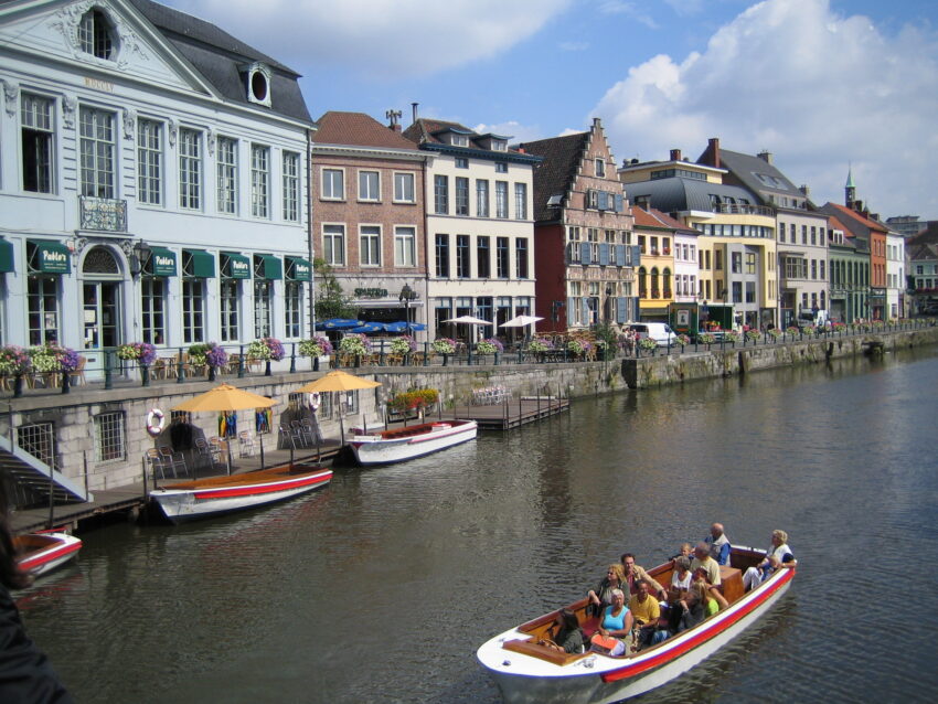
Kraanlei is a riverside street whose name points to its historic function: the “crane” quays where goods were lifted from barges and handled along the waterfront. That working-port history feeds directly into the character of the adjacent Patershol quarter, which preserves a dense, older street pattern close to Gravensteen.

Patershol is often described through its present-day food scene, but the underlying draw is the contrast between intimate medieval-scale streets and the heavier monumental architecture nearby. In other words, it’s a place where the city feels small again, even within a major historic centre.

When you visit, treat it as an “atmosphere” stop with substance: look for the way the river edge and narrow lanes knit together, then pick out surviving older façades and the rhythm of courtyards and corners. It’s also one of the best areas to slow down, because the reward is less a single monument and more the continuity of urban texture.


Location: Corduwaniersstraat 61, 9000 Gent, Belgium | Hours: 24 Hours. | Price: Free.

8. Gravensteen Castle
Gravensteen Castle
Gravensteen Castle
CC BY-SA 4.0 / Davidh820

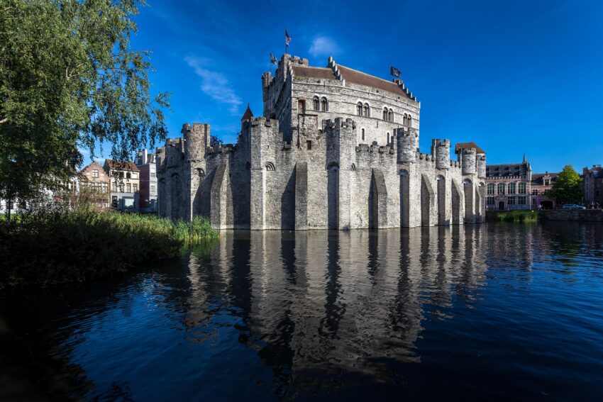
Gravensteen is Ghent’s medieval castle associated with the Counts of Flanders, and the current stone fortress dates to 1180. It was not only a residence but later served pragmatic civic functions over time, including roles as a court and prison, which is part of why it remains so central to the city’s public memory.

The castle’s narrative is overtly about authority: it was built to dominate the urban landscape and to make the count’s power unmissable. That message is still legible in the thick walls, the defensive perimeter, and the elevated viewpoints.

On site, prioritise the ramparts and higher walkways for perspective over the old centre, then work inward through the layered spaces that show how the building was reused across centuries. A good visit alternates between “big picture” (defence and dominance) and “close detail” (stonework, interiors, and the practical architecture of control).


Location: Sint-Veerleplein 11, 9000 Gent, Belgium | Hours: Daily: 10:00 - 18:00 | Price: Adults: €15 | Website

9. Korenlei
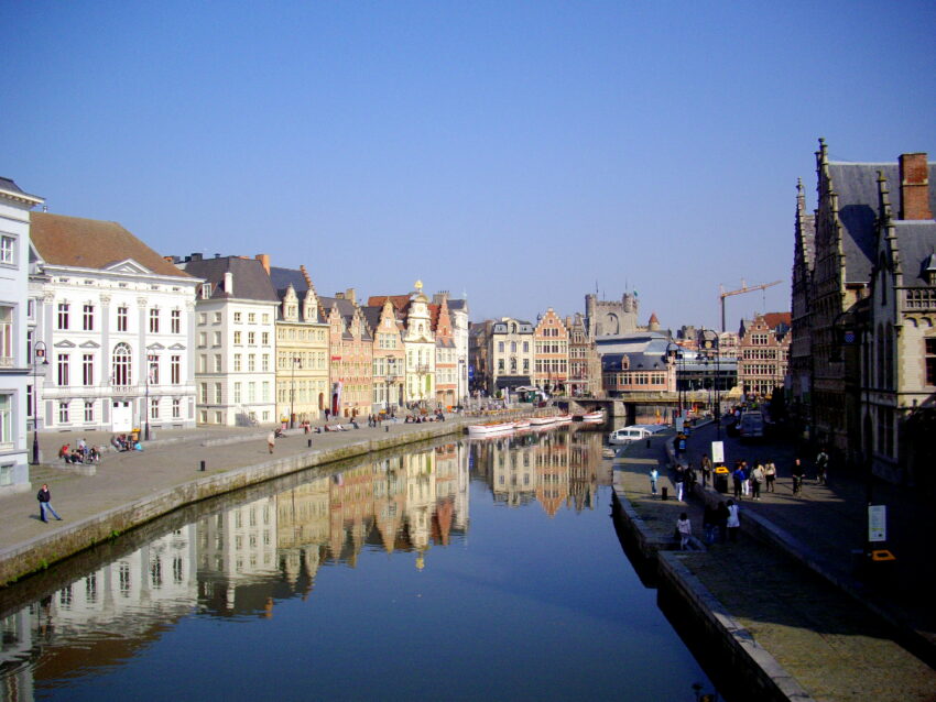
Gaslei & Korenlei
Gaslei & Korenlei
CC BY-SA 2.0 / Marc Ryckaert

Korenlei is the quay running along the River Lys opposite Graslei, and together they form Ghent’s best-preserved medieval riverside frontage. Its name (“Wheat Quay”) reflects the area’s historical role in handling grain and other bulk goods brought into the city by water, when the river functioned as a working transport corridor rather than scenery.

What you see today is a tight sequence of historic façades facing the water, shaped by merchant wealth and guild influence rather than courtly architecture. The value is in the streetscape as a whole: the rhythm of gables and rooflines, how buildings meet the river edge, and how views open toward the bridge crossings and the three-tower skyline.

On site, do it in two passes: first from the Korenlei side to read the façades and river edge up close, then from across on Graslei to understand the full composition and how the quays mirror each other. It’s also worth lingering near the waterline to catch reflections and the changing angles as boats move through, because the river is part of what makes the architecture “work” visually.


Location: Graslei, 9000 Gent, Belgium | Hours: 24 Hours. | Price: Free.

10. St Michael's Bridge
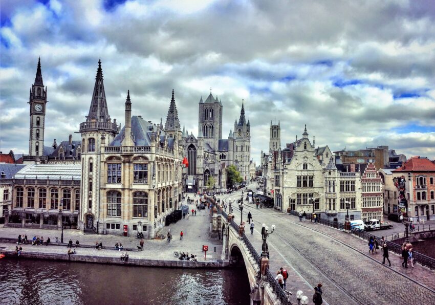
St Michael’s Bridge
St Michael’s Bridge
CC BY-SA 4.0 / Robin.walleghem

St Michael’s Bridge is best understood as a deliberately composed viewpoint, built in the early 20th century to create a monumental crossing and a theatrical city panorama. From here, the skyline aligns in a way that’s become iconic: Sint-Niklaaskerk, the Belfort, and Sint-Baafskathedraal can be framed together as “the three towers.”

Its appeal is partly structural but mostly optical: it’s a place where Ghent’s waterways, stone façades, and vertical landmarks lock into a single image. The bridge’s design and placement make it a civic “stage” as much as an item of infrastructure.

When you go, do two things: first, take the classic skyline view, then turn and read the river edges, where the old quays and guild houses line up. Early morning or late evening light is particularly effective for bringing out the texture in the stone and the reflection patterns on the water.


Location: St Michael's Bridge, Sint-Michielshelling, 9000 Gent, Belgium | Hours: 24 Hours. | Price: Free.

11. Korenmarkt
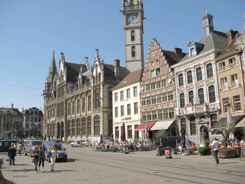
Korenmarkt
Korenmarkt
CC BY-SA 3.0 / Demeester

Korenmarkt is the city-centre square whose name (“Wheat Market”) points to its origins as a trading space, tied to Ghent’s role as a regional cereals hub from as early as the 10th–11th centuries. Its location—between the river and Sint-Niklaaskerk—explains why it became such a durable focal point for movement, commerce, and gathering.

The square is also historically “political” as well as commercial: public announcements and civic theatre have long gravitated to major market places. Today it remains one of the most active nodes in the historic core, surrounded by prominent façades that now host cafés and terraces.

What to do there is straightforward: treat it as a base for reading the city’s layout. Stand where you can see the church, the routes toward the river, and the flow into the main shopping streets; it’s one of the easiest places to understand how medieval trade geography still shapes modern Ghent.


Location: Korenmarkt, 9000 Gent, Belgium | Hours: 24 Hours. | Price: Free.

12. Sint-Niklaaskerk
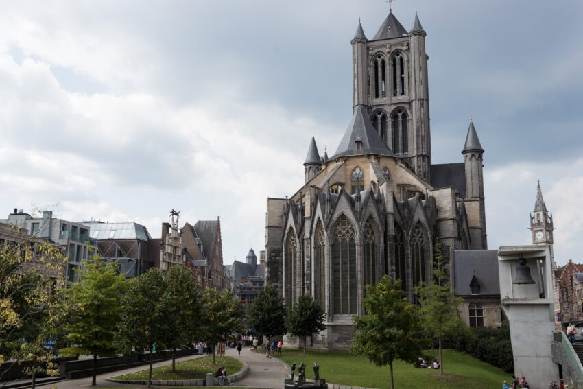
Sint-Niklaaskerk
Sint-Niklaaskerk
CC BY-SA 4.0 / Pierre Goiffon

Sint-Niklaaskerk is one of Ghent’s oldest major churches and a flagship example of Scheldt Gothic, a regional Gothic style associated with the Scheldt basin. Construction began in the early 13th century, replacing an earlier Romanesque church, and its position beside the old commercial core signals its historic link to merchants and guild life.

Architecturally, the church’s massing is distinctive: a substantial tower above the crossing and corner turrets give it a compact, fortress-like skyline presence. The interior is also historically “guild-facing,” shaped by the chapels and devotional spaces tied to trades and civic groups.

On a visit, spend time both outside and in: outside for the stonework and silhouette, inside for how light plays through the crossing and down the nave. It’s a church that rewards slow looking—especially if you pay attention to how worship and commerce sat side by side in medieval Ghent.


Location: Cataloniëstraat, 9000 Gent, Belgium | Hours: 24 Hours. | Price: Free. | Website
Powered by GetYourGuide
Moira & Andy
Moira & Andy

Hey! We're Moira & Andy. From hiking the Camino to trips around Europe in Bert our campervan — we've been traveling together since retirement in 2020!

Read our full story here

This website uses affiliate links which earn a small commission at no additional cost to you.

Walking Tour Summary

Distance: 2 km
Sites: 12
Walking Tour Map

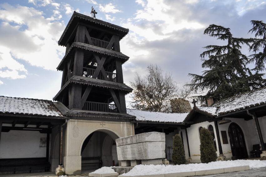
Self-Guided Walking Tour of Skopje

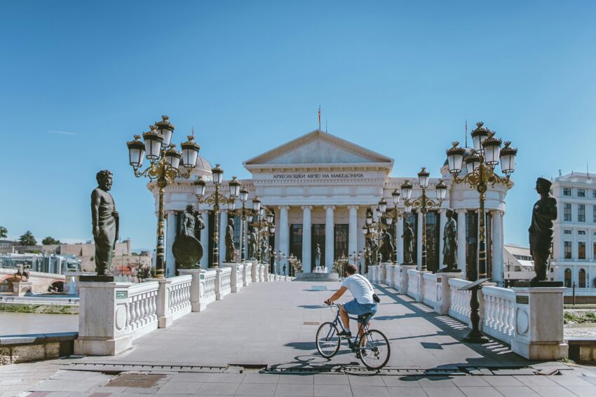
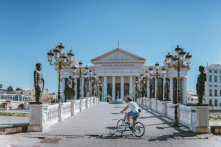
Man on bike riding across bridge to Macedonia Museum
Self-Guided Walking Tour of Skopje

This website uses affiliate links which earn a small commission at no additional cost to you.

Skopje is one of the Balkans’ most distinctive capitals, a city where Ottoman lanes, Byzantine echoes, Yugoslav-era planning, and modern monumental architecture sit side by side. The Stone Bridge over the Vardar links Macedonia Square with the Old Bazaar, giving the city a strong symbolic centre and a clear contrast between its newer civic spaces and older trading quarters. The Old Bazaar itself has been an important commercial district since at least the medieval period, and remains one of Skopje’s most atmospheric areas, with mosques, caravanserais, craft shops, cafés, and narrow streets that reflect the city’s mixed cultural inheritance.

The city also has a deeper historical and emotional significance because of its repeated rebuilding, especially after the destructive 1963 earthquake. Today, visitors find a capital that can feel unusual and sometimes visually surprising, with grand statues and recent civic architecture set close to older landmarks such as Kale Fortress, the Mustafa Pasha Mosque, and the Church of the Holy Salvation. Skopje works well as a city break because it combines walkable central sights with easy access to nearby landscapes, particularly Matka Canyon, while still feeling more lived-in and less polished than many larger European capitals.

How to get to Skopje

By Air: Skopje International Airport is the main airport for the city, with shuttle buses running between the airport and key stops in Skopje. Taxis are also available, and the road transfer into the centre is the simplest option if you are arriving late or carrying luggage. For the best deals and a seamless booking experience, check out these flights to Skopje on Booking.com.

By Train: Skopje has a central railway station, but train travel in North Macedonia is generally more limited than bus travel, so it is worth checking current timetables before planning a rail-based journey. Domestic railway services connect Skopje with several towns, while international rail options can vary by season and timetable changes. Train schedules and bookings can be found on Omio.

By Car: Skopje is straightforward to reach by road from other parts of North Macedonia and from neighbouring Balkan countries, especially if you are combining it with Ohrid, Bitola, Pristina, Sofia or Thessaloniki. Driving gives you flexibility for day trips to Matka Canyon or Mount Vodno, but for the central sights it is usually better to park once and continue on foot, as the main walking route is concentrated around the square, river, bazaar and fortress.

By Bus: Long-distance buses are often the most practical public transport option for reaching Skopje from elsewhere in the region. The city's main bus station handles both domestic and cross-border services, making it useful if you are travelling around North Macedonia or connecting from nearby Balkan cities.

How to get around the city. The centre of Skopje is best explored on foot, especially between Macedonia Square, the Stone Bridge, the Old Bazaar and Kale Fortress. Public buses are useful for longer hops across the city, while taxis can be convenient for reaching places beyond the compact central area.

A Short History of Skopje

Ancient Scupi and Roman Skopje

Skopje’s early history is linked with ancient Scupi, which developed from an Illyrian and Dardanian settlement into an important Roman centre. Under the Roman Empire, Scupi became an important administrative and military settlement, positioned on routes that helped connect the wider region.

This deep antiquity is not always obvious in the modern centre, but it explains why Skopje has repeatedly been rebuilt rather than simply expanded. Archaeological layers, fortress traditions and the wider Vardar route all helped shape the city as a place of movement, defence and administration. Kale Fortress is one of the clearest tourist attractions connected to this long defensive history, even though much of what visitors see today reflects later phases and repairs.

Medieval and Ottoman Skopje

In the medieval period, Skopje passed through different regional powers before becoming part of the Ottoman world. Ottoman rule left a lasting mark on the city’s street pattern, religious buildings, commercial culture and urban identity. The Old Bazaar is the best place to see this inheritance, with its mosques, hans, craft lanes and market spaces.

The Stone Bridge is one of the most important surviving landmarks from this period. It links the newer city centre with the Old Bazaar and is widely associated with the Ottoman era. Its position makes it more than a river crossing: it is the symbolic join between Skopje’s civic square and its older commercial quarter.

Earthquakes and Rebuilding in Skopje

Skopje has been shaped by earthquakes more than once, but the 1963 earthquake became the defining modern disaster. Large parts of the city were destroyed, and the disaster led to major international assistance and a large-scale reconstruction programme.

This catastrophe changed how Skopje looks today. The damaged railway station became part of the city’s memory, while post-earthquake reconstruction brought modernist planning, broad avenues and new civic architecture. When you see the mixture of monumental squares, reconstructed buildings and surviving older quarters, you are seeing a city rebuilt around rupture as much as continuity.

Modern Skopje and the City’s Tourist Landmarks

Modern Skopje is shaped by independence, national identity and a visible programme of urban display. Macedonia Square, the riverside monuments, the Archaeological Museum area and the bridges across the Vardar all contribute to this newer civic image. For visitors, these spaces are often the starting point before crossing into the older bazaar quarter.

The Mother Teresa Memorial House adds another strand to the city’s story. The exhibition follows Mother Teresa’s life from her childhood in Skopje through her later work as a Missionary of Charity. The building stands close to Macedonia Square, making it one of the easiest cultural stops to include in a central city route.

Where to Stay in Skopje

To make the most of visiting Skopje and this walking tour, then you should consider staying overnight in the centre. The most convenient area is around Macedonia Square and the streets just off it, as this keeps you close to the Stone Bridge, the riverfront, the Mother Teresa Memorial House and the start of the Old Bazaar. Good central choices include Skopje Marriott Hotel, Solun Hotel & Spa and Hotel Senigallia.

If you would rather stay closer to the Old Bazaar, look north of the river near Čaršija, where you are better placed for mosque courtyards, traditional restaurants, market streets and Kale Fortress. This area is atmospheric in the evening and works well if the older side of Skopje is the main focus of your trip. Useful options include Hotel De KOKA, Hotel Arka and Bushi Resort & Spa.

Your Self-Guided Walking Tour of Skopje

Discover Skopje on foot with our walking tour map guiding you between each stop as you explore its historic bazaar lanes, riverside bridges, fortress views, museums, squares and cafés. As this is a self-guided walking tour, you are free to skip places, slow down in the Old Bazaar, add museum stops, and take coffee breaks whenever you want.

1. Memorial House of Mother Teresa

Memorial House of Mother Teresa
CC BY-SA 2.0 / John Crane

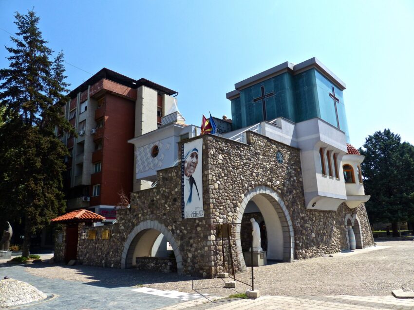
The Memorial House of Mother Teresa commemorates Skopje’s most internationally recognised modern figure, born here in 1910 to an Albanian Catholic family when the city was part of the Ottoman Empire. The original church connected to her early life was lost after the 1963 earthquake, and the memorial was created later to mark both her local origins and her global humanitarian legacy. The site reflects Skopje’s habit of anchoring modern identity through remembrance after periods of upheaval.

Inside, you typically find a small museum-style presentation of her life story—photographs, documents, and contextual material that traces her journey from Skopje to her work in India. The building itself is part of the visit, with a design that aims for a contemplative tone rather than grand scale. Even if you know her biography, the local framing is what makes it distinct.

What to see is the narrative connection between a specific place and a worldwide reputation: it’s as much about Skopje’s history and communities as it is about Mother Teresa herself. If you have time, pause in the quiet areas and read the interpretive panels carefully, because the details are often the most revealing. It’s a compact stop, but it adds depth to understanding the city’s cultural mix.


Location: Macedonia St 1000, Skopje 1000, North Macedonia | Hours: Check official website. | Price: Free.

Here is a complete selection of hotel options in Skopje. Feel free to review each one and choose the stay that best suits your needs.

2. Macedonia Square

Macedonia Square
Macedonia Square

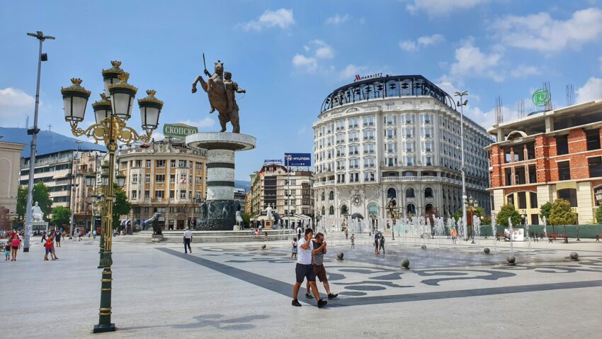
Macedonia Square is Skopje’s main civic square, laid out in its modern form as the city expanded in the late Ottoman and early Yugoslav periods, and then reshaped again after the 1963 earthquake. It has long been the natural gathering point for public celebrations, demonstrations, and everyday city life, so its open plan and broad sightlines are deliberate. In recent decades it has also become the focal point for major urban redevelopment, which has changed its visual character significantly.

What to see here is mainly the panorama: the riverfront edge, the views towards the bridge crossings, and the cluster of major landmarks that radiate out into the centre. The square is best approached slowly so you can read how different eras of Skopje sit side by side—modern commercial façades, post-earthquake planning, and newer monumental elements. If you want a simple orientation point for the city centre, this is it.

Because it’s a large open space, it’s also a good place to notice the rhythm of local life—commuters cutting across it, evening promenades, and seasonal events. If you’re visiting at dusk, the lighting brings out the theatre of the square and the surrounding architecture. It’s not a “single-attraction” stop so much as the place that helps everything else make sense spatially.


Location: Macedonia Square, 1000 Skopje, North Macedonia | Hours: 24 Hours. | Price: Free.

Traveling to a country with a different currency? Avoid ATM transaction fees and pay in local currency with a Wise Card. Having used it for over 5 years, we've saved loads on fees!

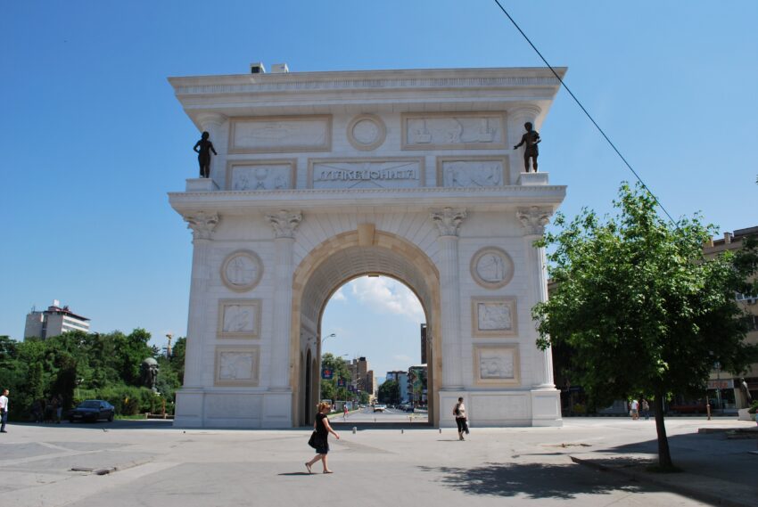
3. Porta Macedonia

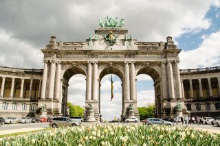
Porta Makedonija, Skopje on a sunny day
Porta Makedonija, Skopje
CC BY-SA 2.0 / Rašo.

Porta Macedonia is a modern triumphal-arch style monument in central Skopje, built in the early 2010s as part of a wider programme of city-centre redevelopment. It was conceived as a highly visible statement piece—less a historic remnant than a deliberately new landmark intended to project a narrative of national continuity and statehood. As a result, it’s often discussed as much for what it represents politically and culturally as for its architecture.

What to see is the sculptural and decorative programme on the exterior, which uses relief panels and symbolic motifs to reference episodes and themes from Macedonian history. Walk around the arch rather than treating it as a single façade, because the detailing changes by side and reads differently depending on light and angle. From certain viewpoints it also functions as a frame for surrounding streets and monuments, which is part of its intended visual impact.

It’s most interesting when you approach it as civic messaging in built form: its classical vocabulary, its scale, and its placement in the modern city plan. If you visit in the evening, the lighting can emphasise the relief work and make the monument feel more theatrical. Whether you see it as impressive or controversial, it has become part of how contemporary Skopje signals identity in public space.


| Hours: The exterior can be viewed at any time. | Price: Free to view from outside

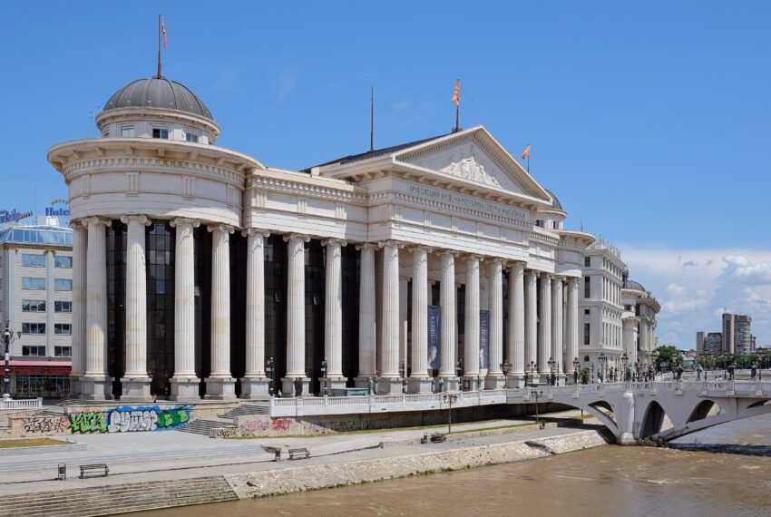
4. National Archaeological Museum Macedonia

National Archaeological Museum Macedonia
CC BY-SA 4.0 / kallerna

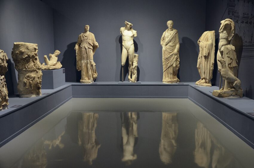
The National Archaeological Museum Macedonia presents the layered story of the region from prehistory through antiquity and into the medieval period, reflecting how the Vardar corridor connected the Balkans to wider Mediterranean and inland trade networks. Archaeology here is inseparable from shifting borders and identities, so museum collecting and interpretation have long carried a civic purpose as well as a scholarly one. In practical terms, it brings together material that helps you place Skopje within the longer arc of Paeonian, Macedonian, Roman, and Byzantine-era life.

What to see depends on your interests, but the highlights are typically stone sculpture, inscriptions, and small finds that reveal everyday patterns—burial practices, religious dedications, and traces of urban life. Look for objects that still carry clear provenance notes, because those details help you connect exhibits to specific ancient sites in the wider country. If you focus on a few well-labelled sections rather than trying to absorb everything, the visit becomes much more coherent.

The building itself can feel monumental, but the best moments are usually the intimate ones: finely worked jewellery, coins that map imperial power, and carved reliefs that show local artistic conventions. Give yourself time to read the contextual panels, because they often explain why a fragment matters, not just what it is. As a stop in the centre, it’s a useful counterbalance to the city’s outdoor monuments and gives you deeper historical grounding before you cross into the older quarters.


Location: Кеј Димитар Влахов 1000, Skopje 1000, North Macedonia | Hours: Tuesday – Sunday: 10:00–18:00. Closed on Monday. Last tickets are sold by 17:00. | Price: 400 MKD for foreign visitors; 200 MKD for students with valid ISIC or Euro 26 cards; 700 MKD for a family ticket. Free entry applies on selected days and for certain visitor categories. | Website

5. Kapan Han

Kapan Han
Kapan Han
CC BY-SA 2.0 / https://commons.wikimedia.org/wiki/File:Kale_Skopje_Fortress.jpg

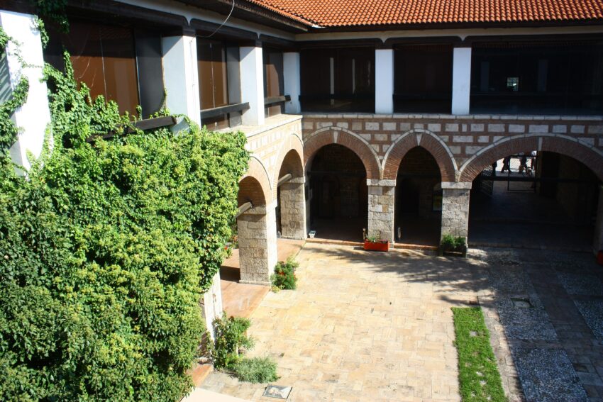
Kapan Han is a classic Ottoman-era caravanserai in the Old Bazaar, built to serve merchants traveling through the Balkans when Skopje was a major regional trading centre. Such buildings functioned as secure inns and warehouses, protecting goods and providing a courtyard-based refuge from the street. Its survival is important because it preserves the commercial architecture that once defined Skopje’s prosperity.

What to see is the enclosed courtyard and the robust, functional layout—thick walls, arched openings, and the sense of an interior world designed for trade logistics. Even if the building’s use has shifted over time, the spatial logic remains clear: arrival, unloading, storage, and rest arranged around a central open space. It’s one of the best places in the bazaar to visualise how commerce worked before modern transport and banking.

Take time to look at masonry details and proportions rather than rushing through. The courtyard is also a good spot to reset between the dense lanes of the bazaar. If you enjoy architectural continuity, this is a strong example of how Ottoman urban life was engineered for movement and exchange.


Location: Grafishte, Shkupi 1000, North Macedonia | Hours: 24 Hours. | Price: Free.

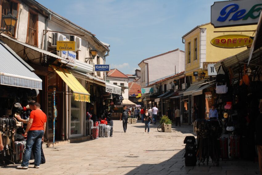
6. Old Bazaar

Old Bazaar
Old Bazaar
CC BY-SA 2.0 / xiquinhosilva

Skopje’s Old Bazaar is one of the largest and most historically continuous marketplaces in the Balkans, rooted in the city’s Ottoman-era role as a trading hub. Over centuries it accumulated mosques, hans, hammams, workshops, and small streets organised by craft and guild. Despite disasters and modern redevelopment elsewhere, the bazaar has retained a dense historic fabric that still functions as a living commercial quarter.

What to see is the street pattern itself—narrow lanes opening into small squares, clusters of traditional trade buildings, and the mix of religious and commercial structures within a few minutes’ walk. Even where businesses have modernised, the underlying urban form remains legible. If you like tangible history, this is where Skopje feels most layered and grounded.

Give yourself time to wander without trying to “cover” it all at speed, because its character comes from accumulation and detail. Look for old stone and brickwork, courtyards tucked behind street fronts, and the transitions between busy and quiet pockets. It’s also a good place to notice the city’s cultural mix expressed through food, crafts, and everyday conversation.


Location: MK, Shkupi 1000, North Macedonia | Hours: 24 Hours. | Price: Free.

7. Suli An

Suli An
Suli An
CC BY-SA 2.0 / Darko Nikolovski

Suli An is another Ottoman-era han in the Old Bazaar, built to support the merchant economy with secure lodging and storage organised around a courtyard. These inns were essential to Skopje’s role as a market city, handling the constant circulation of people, animals, and goods. Over time, many hans adapted to new uses, but their spatial DNA remains a record of how trade was structured.

What to see is the courtyard plan and the repetitive rhythm of arches and rooms, which create a calm interior world away from the streets. The building’s strength is in its clarity: it’s easy to imagine pack animals, traders negotiating, and goods being catalogued and secured. Even if the rooms now host cultural or educational uses, the setting still reads as purpose-built for commerce.

If you enjoy photographing architecture, the courtyard is often one of the most coherent and visually satisfying spaces in the bazaar. Pay attention to textures—stone, plaster, timber—and the way light moves through the arcades. It’s a good place to understand the bazaar not just as streets, but as a network of specialised buildings.


Location: 2C2Q+J3X, Rruga e Bit Pazarit, Shkupi 1000, North Macedonia | Hours: 24 Hours. | Price: Free.

8. Čifte Hammam

Čifte Hammam
Čifte Hammam
CC BY-SA 2.0 / Rašo.

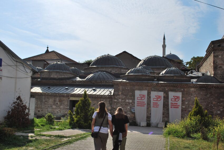
Čifte Hammam is a major Ottoman bath complex, built as part of the public infrastructure that supported urban life—hygiene, socialising, and ritual preparation. The “double” format traditionally served separate sections, reflecting the social norms of the period. Like other hammams in the region, it also demonstrates how civic architecture could be both practical and visually refined through domes, vaults, and careful control of light.

What to see is the architecture: domed rooms, thick masonry, and the way small openings shape a soft interior atmosphere. Even without the original bathing function, the building’s sequence of spaces still makes sense—gradual movement from cooler to warmer areas, with changing acoustics and proportions. If it’s used as a gallery or cultural venue, the contrast between contemporary exhibits and historic structure can be striking.

Take a moment to look upward: the domes are usually the most memorable element, and they explain the building’s engineering logic. Hammams are often overlooked compared to mosques and churches, but they reveal everyday history more directly. This one is a key piece of the Old Bazaar’s civic landscape.


Location: 2C2P+FW7, Arhiepiskop Angelarij, Skopje 1000, North Macedonia | Hours: Monday – Sunday: 10:00–18:00. | Price: Free. | Website

9. Mustafa Pasha Mosque

Mustafa Pasha Mosque
CC BY-SA 2.0 / aiva

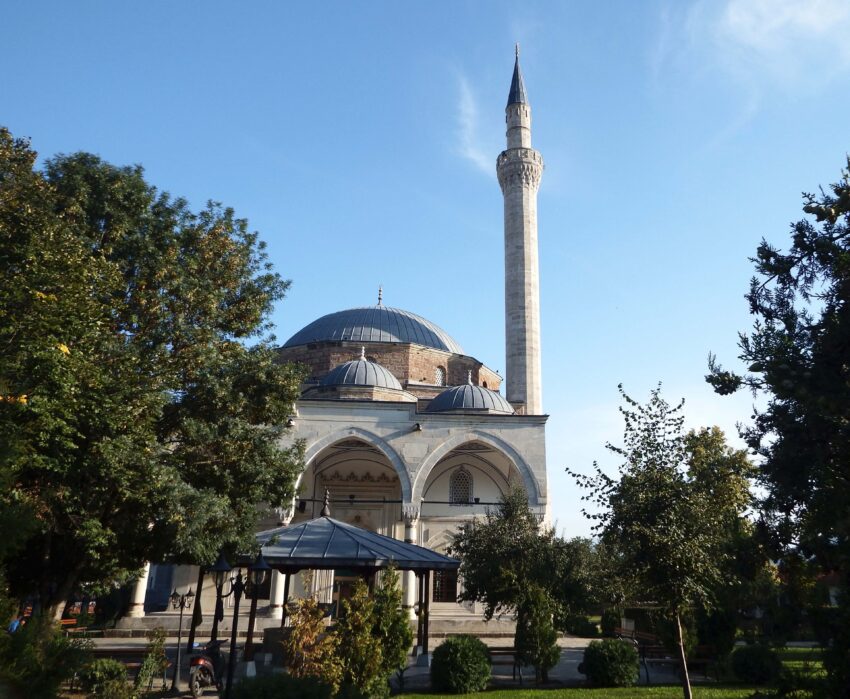
Mustafa Pasha Mosque is one of Skopje’s finest surviving Ottoman mosques, generally dated to the late 15th century and associated with a prominent Ottoman official. Its hilltop position near the Old Bazaar gives it both visibility and a sense of separation from the commercial bustle below. The mosque represents the era when Skopje was integrated into Ottoman administrative and religious networks, leaving a strong architectural imprint.

What to see is the elegant silhouette: the dome, the slender minaret, and the balanced proportions that mark high-quality Ottoman design. If you can go inside, look for the restrained interior decoration and the calm spatial geometry that contrasts with the busier textures of the bazaar. The surrounding grounds can also be part of the experience, offering quieter views back over the district.

This is a good stop for understanding how religious architecture anchored neighbourhood identity. It’s also useful as a vantage point for the relationship between sacred and commercial space in historic Skopje. Visit when the light is softer if you want the building’s stonework to read more clearly.


Location: MK MK, Fort Kale, Мустафа Пашина Џамија, Fort Kale 1000, Shkupi 1000, North Macedonia | Hours: 24 Hours. | Price: Free.

10. Kale Castle

Kale Castle
Kale Castle
CC BY-SA 4.0 / kallerna

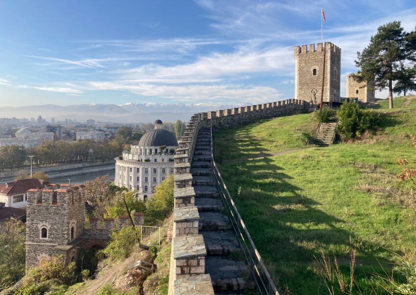
Kale Castle, commonly called Skopje Fortress, occupies the strategic hill above the river and has been used in various forms since antiquity, with major rebuilding and fortification across Byzantine, medieval, and Ottoman periods. Its position explains its importance: whoever held the fortress could monitor movement through the valley and control the city below. The fortress also suffered damage in earthquakes, including the 1963 event, and parts have been restored over time.

What to see is the circuit of walls and gates, which gives you a strong sense of defensive geography even where sections are fragmentary. The biggest draw is the viewpoint: from the ramparts you can read the whole city layout, with the Old Bazaar, river crossings, and modern districts spread out beneath. It’s one of the best places to understand why Skopje developed where it did.

Allow time to explore the perimeter rather than heading to a single point, because different sections offer different sightlines and textures of stonework. The atmosphere changes with weather—clear days emphasize the city’s scale, while cloudier light makes the fortress feel more austere. It’s a historically dense site, but it also works simply as the city’s most useful overlook.


Location: Samoilova, Skopje 1000, North Macedonia | Hours: 24 Hours. | Price: Free.

11. Church of the Ascension of Jesus

Church of the Ascension of Jesus
CC BY-SA 3.0 / Darkocv

The Church of the Ascension of Jesus is one of the Old Bazaar’s most significant Orthodox churches, associated with the period when local Christian communities maintained their institutions under Ottoman rule. Its best-known feature is the richly carved iconostasis, a masterpiece of Balkan woodcarving that reflects both religious devotion and artisan skill. The church’s history is inseparable from Skopje’s multi-confessional past, where different communities lived and traded in close proximity.

What to see is the interior—especially the iconostasis and the icon program—because that is where the church’s artistic importance concentrates. The contrast between a relatively modest exterior and an elaborate interior is typical of the era and the setting, and it makes the reveal feel dramatic. Spend a few minutes letting your eyes adjust and then follow the carved narratives and icon details.

The church also rewards attention to atmosphere: quiet, incense, and the sense of continuity in a district dominated by commerce. If you’re interested in sacred art, it’s one of the most compelling stops in Skopje. Treat it as a place for slow looking rather than a quick checklist.


Location: 2C2P+77Q, Samoilova, Skopje 1000, North Macedonia | Hours: Check official website. | Price: Free; donations appreciated.

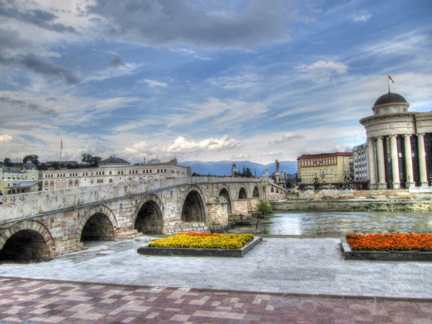
12. Stone Bridge

Stone Bridge
Stone Bridge
CC BY-SA 3.0 / Делфина

The Stone Bridge is Skopje’s most iconic river crossing and a rare piece of continuity in a city repeatedly reshaped by earthquakes, fires, and political change. Its core is generally associated with the Ottoman period, traditionally linked to the reign of Sultan Mehmed II, though the crossing itself likely rests on older precedents. For centuries it connected the commercial and administrative worlds on opposite sides of the Vardar, making it a practical artery as well as a symbol.

What to see is the bridge’s sturdy stone construction and the way it frames views along the river—especially towards the old bazaar side and back toward the modern centre. Walk to the mid-point to appreciate the arches and the slight changes in stonework that hint at repairs over time. It’s also a good place to understand how the city is organised: old trading quarters on one side, newer civic and commercial spaces on the other.

Because it’s central, it can be busy, but that’s part of the point: this is where Skopje flows. Early morning or late evening is best if you want cleaner photos and a calmer sense of the structure. Even a short pause here gives you a strong mental map of the city.


Location: Ura e Gurit, 1000 Shkupi, North Macedonia | Hours: 24 Hours. | Price: Free.
Moira & Andy
Moira & Andy

Hey! We're Moira & Andy. From hiking the Camino to trips around Europe in Bert our campervan — we've been traveling together since retirement in 2020!

Read our full story here

This website uses affiliate links which earn a small commission at no additional cost to you.

Walking Tour Summary

Distance: 3.5 km
Sites: 12
Walking Tour Map

Self-Guided Walking Tour of Ohrid

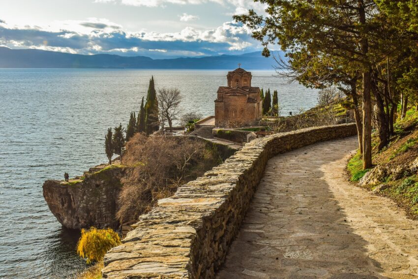
The church, Sveti Jovan Kaneo overlooking the Lake.
Walking Tour of Ohrid

This website uses affiliate links which earn a small commission at no additional cost to you.

Ohrid is a lakeside city of stone lanes, red-roofed houses, old churches and wide views across one of Europe’s most atmospheric lakes. Its historic centre rises from the waterfront into a compact Old Town where cafés, small squares and traditional houses sit close to Byzantine churches, Ottoman-era streets and the remains of ancient and medieval fortifications.

The city’s history gives the walk much of its character. Known in antiquity as Lychnidos, Ohrid later became an important religious and cultural centre, especially during the medieval period when churches, monasteries and scholarship shaped its identity. Today, that layered past can still be seen in places such as the Ancient Theatre, Church of St. Sophia, Plaošnik, King Samoil’s Fortress and the Church of St. John at Kaneo.

How to Get to Ohrid

By Air: Ohrid is served by Ohrid St. Paul the Apostle Airport, which has seasonal and scheduled flight links that vary through the year. Direct routes change by season, so it is worth checking flights before planning around a specific airport connection. If there is no convenient direct service, many travellers fly into Skopje and continue to Ohrid by road. For the best deals and a seamless booking experience, check out these flights to Ohrid on Booking.com.

By Train: Ohrid does not have a direct passenger railway station, so train travel is not usually the simplest way to arrive. The nearest practical rail options are elsewhere in North Macedonia, with onward travel by bus or car needed to reach Ohrid. For most visitors, especially those coming from Skopje, the bus is normally more straightforward than combining rail and road. Train schedules and bookings can be found on Omio.

By Car: Driving to Ohrid gives you the most flexibility, especially if you want to combine the city with Lake Ohrid viewpoints, Struga, the Bay of Bones, Galičica National Park or the Monastery of Saint Naum. Parking is more limited in and around the Old Town, so it is usually better to leave the car near your accommodation or in a designated parking area, then explore the historic centre on foot.

By Bus: Buses are one of the most practical ways to reach Ohrid from Skopje, with regular services usually operating between the capital and the lake. Journey times are commonly around three hours or a little more, depending on the service, road conditions and season. If you are already in the Balkans and plan to bus to Ohrid, here is a list of cities with buses that go directly to Ohrid:

  • From Macedonia: Skopje, Bitola, Kičevo, Struga, Prilep, Veles, Tetovo
  • From Albania: Tirana, Durres, Elbasan
  • From Greece: Thessaloniki
  • From Kosovo: Pristina

How to get around the city: Ohrid’s historic core is best explored on foot. The Old Town has narrow streets, steps, slopes and pedestrian-friendly lanes, while the waterfront is easy to follow at a slower pace. Taxis are useful for reaching the bus station, airport, outlying hotels or lake attractions, but the main sights on this route are close enough together that walking is the most rewarding option.

A Short History of Ohrid

Ancient Ohrid and the City of Lychnidos

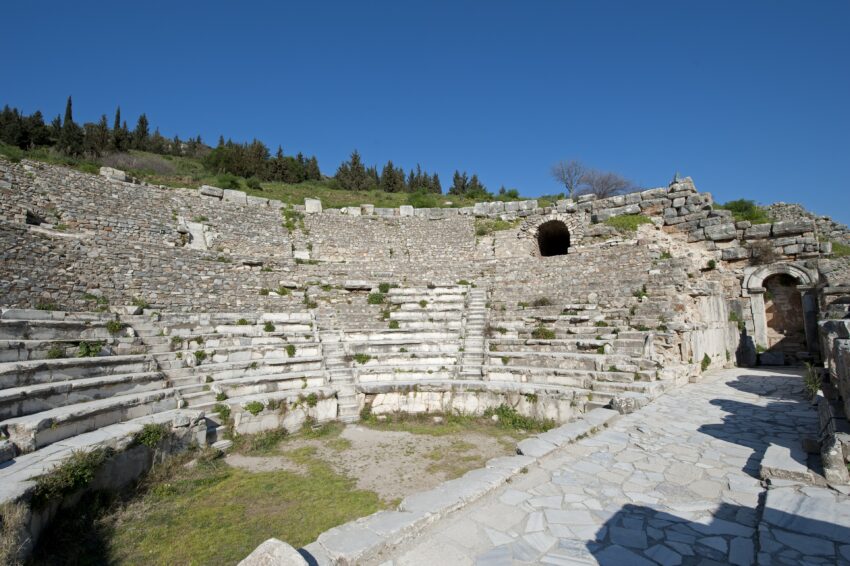
Ohrid’s early history is tied to the ancient city of Lychnidos, a settlement that developed into an important centre long before the medieval churches and fortress walls that now dominate the visitor experience. The Ancient Theatre of Ohrid is the clearest surviving reminder of this older urban world, with its stone seating and hillside setting showing how public life, performance and civic identity were already part of the city’s character in antiquity.

The theatre is usually dated to the Hellenistic period, and later Roman influence reshaped the region’s urban and cultural life. Although much of ancient Ohrid is hidden beneath later layers, the survival of the theatre gives the city a rare point of contact with its pre-Christian past. It also helps explain why Ohrid feels more layered than many small historic towns: the medieval churches did not appear in isolation, but grew over a much older settlement.

This ancient foundation still affects how visitors experience Ohrid today. The climb through the Old Town passes from Ottoman-era streets to medieval churches and then to the theatre, making the city’s history feel compressed into a short distance. Rather than being separated into museum-style zones, Ohrid’s ancient and later monuments sit almost on top of each other.

Early Christian and Byzantine Ohrid

Ohrid became especially important during the Christian and Byzantine periods, when churches, monasteries and religious art shaped the city’s identity. Its exceptional collection of churches, frescoes and icons made it one of the most important spiritual centres in the wider region.

Plaošnik is central to this story. Associated with Saint Clement of Ohrid, it became one of the great religious and scholarly sites of the region, and the reconstructed Church of Saints Clement and Panteleimon now stands above an archaeological area where early Christian and medieval remains overlap. This is one of the places where Ohrid’s role as a spiritual and educational centre is easiest to understand.

The Church of St. Sophia is another major landmark from this period. Its architecture and frescoes reflect Ohrid’s status as an ecclesiastical centre, while the city’s many smaller churches show how deeply religious life shaped its streets and skyline. The Church of St. John at Kaneo, set dramatically above the lake, later became one of Ohrid’s defining images, linking sacred architecture with the landscape itself.

Medieval Ohrid and King Samoil’s Fortress

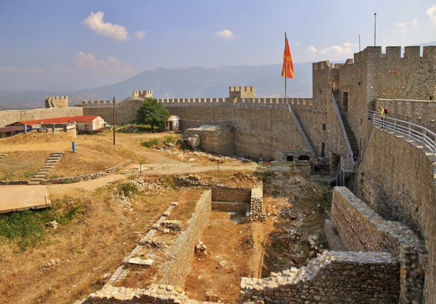
In the medieval period, Ohrid became closely associated with the First Bulgarian Empire and the rule of Tsar Samoil. King Samoil’s Fortress, with its long defensive walls and views over the city and lake, remains the most visible symbol of this era. The fortress did not simply protect the town; it also announced Ohrid’s political and strategic importance.

The city’s upper slopes were shaped by this defensive landscape. Gates, walls, churches and residential quarters developed around the fortified core, creating the layered Old Town that survives today. Moving between the fortress, Plaošnik and the Ancient Theatre gives a strong sense of how closely power, religion and urban life were connected.

For visitors, the fortress is more than a viewpoint. It helps explain why Ohrid grew as a hill town as well as a lake town. Its defensive position gave the city security, while the lake connected it to trade, travel and religious movement. That combination made Ohrid both protected and outward-looking.

Ottoman Ohrid and the Old Bazaar

Under Ottoman rule, Ohrid’s urban life continued to evolve. Mosques, bazaars, workshops and domestic architecture added new layers to the city, especially around the lower town and commercial streets. The Old Bazaar area, Ali Pasha Mosque and traditional lanes show how Ohrid remained an active town rather than becoming only a preserved religious centre.

This period also shaped the everyday rhythm of Ohrid. Streets used for trade, small workshops and local markets linked the waterfront with the residential quarters above. The National Workshop for Handmade Paper reflects this craft tradition in a modern visitor-friendly form, showing how older skills and local production still form part of the city’s identity.

Ottoman Ohrid did not erase the earlier Christian city. Instead, it added another layer beside it. That is why the route through Ohrid can move from mosque to bazaar, from church to fortress, and from lakefront promenade to archaeological site in a relatively short distance.

Modern Ohrid and Its UNESCO Heritage

In the modern period, Ohrid became increasingly valued for both its cultural heritage and its natural setting. The city’s churches, icons, archaeological remains, traditional houses and lakefront views helped establish it as one of the most important heritage destinations in the Balkans.

Tourism has made Ohrid more accessible, but it has also increased pressure on the lake and historic environment. Development, traffic, pollution and the need to protect the region’s historic character remain important issues for the future of the city and lake.

For travellers, this makes responsible visiting important. Staying in the centre, walking between sights, using local businesses and avoiding unnecessary car journeys around the Old Town all help keep the visit low-impact. Ohrid’s appeal lies in the fact that its history, lake and townscape still work together, and that balance is what makes the city so memorable.

Where to Stay in Ohrid

To make the most of visiting Ohrid and this walking tour, you should consider staying overnight in or close to the centre, especially if you want to start early, enjoy the Old Town before the busiest part of the day and return to the lakefront in the evening. The most atmospheric base is the Old Town, particularly around Varosh and the streets near St. Sophia, where places such as Villa Varosh and Villa Sofija put you close to churches, viewpoints, the Ancient Theatre and the upper part of the route.

If you prefer easier access to restaurants, flatter evening strolls and lakefront views, the waterfront and central promenade area are a good choice. Staying here keeps you close to the harbour, main square and lakeside cafés, while still allowing you to walk up into the Old Town when you are ready. Options in this area include Hotel Tino Ohrid and Villa St. Sofija, both useful for travellers who want central access without being too far from the water.

For a slightly quieter stay with more space, the area south-east of the busiest centre can work well, especially if you are combining the walking route with lake time, parking or a more relaxed hotel stay. Unique Resort & Spa is a practical option in this part of the city, with easier road access than the tightest Old Town streets while still being close enough to reach the centre on foot or by short taxi ride.

Your Self-Guided Walking Tour of Ohrid

Discover Ohrid on foot with our walking tour map guiding you between each stop as you explore its lakefront, Old Town lanes, ancient theatre, historic churches, archaeological sites and fortress views. As this is a self-guided walking tour, you are free to skip places, change the order, linger at viewpoints and take coffee stops whenever you want.

1. Ohrid Main Square

Ohrid Main Square is the natural meeting point of the old town, shaped by centuries of trade, civic life, and lakefront commerce. The space has long functioned as a public stage where local markets, announcements, and everyday social life played out under the influence of Byzantines, medieval rulers, and the Ottoman period. Its modern layout reflects a town that has continuously adapted while keeping its historic core walkable and human-scaled.

Architecturally, the square is less about one monument and more about the ensemble: traditional façades, small shops, cafés, and the steady flow between the upper town and the lakeside. It is typically where visitors first sense Ohrid’s layered identity, with old stonework and newer storefronts sitting side by side. The square also acts as a practical orientation point before heading to nearby churches, the bazaar area, or the lake promenade.

What to see is largely in the details and the atmosphere. A slow circuit reveals street-level textures: carved stone thresholds, small courtyards glimpsed through gates, and views that open toward the lake as streets dip downhill. It is also one of the best places to time a visit for changing light, when the surrounding buildings and the hills above the town start to glow.


Location: St. Clement of Ohrid, St Clement of Ohrid, Ohrid 6000, North Macedonia | Hours: 24 Hours. | Price: Free.

Here is a complete selection of hotel options in Ohrid. Feel free to review each one and choose the stay that best suits your needs.

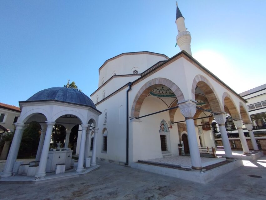
2. Ali Pasha Mosque

Ali Pasha Mosque
Ali Pasha Mosque
CC BY-SA 2.0 /

Ali Pasha Mosque is a reminder of Ohrid’s Ottoman-era urban fabric, when mosques, baths, and bazaars anchored neighbourhood life. While Ohrid is widely associated with early Christianity and medieval churches, the Ottoman centuries left an equally real imprint on the town’s skyline and street plan. Mosques like this were typically placed to serve both worship and community functions, with surrounding lanes supporting small-scale trade.

The building’s presence is often felt through its proportions and position rather than lavish ornament. Ottoman religious architecture tends to communicate calm authority: simple geometric massing, a prayer hall oriented toward Mecca, and the vertical emphasis of a minaret. Even when interiors are restrained, the structure still signals the multicultural history of the town and the daily rhythms that once centred here.

When visiting, the main focus is the exterior context and how it sits within the surrounding streets. Look for the relationship between the mosque, nearby houses, and the flow of foot traffic, which often preserves older patterns of movement. If access is possible, quiet observation of the prayer space and its light is the most meaningful “sight,” more than any single decorative feature.


Location: 4R82+55X, St Clement of Ohrid, Ohrid 6000, North Macedonia | Hours: 24 Hours. | Price: Free.

Traveling to a country with a different currency? Avoid ATM transaction fees and pay in local currency with a Wise Card. Having used it for over 5 years, we've saved loads on fees!

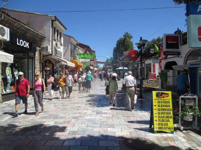
3. Old Bazaar Street

Old Bazaar Street
Old Bazaar Street
CC BY-SA 4.0 / Avi1111

Old Bazaar Street reflects Ohrid’s long-standing role as a local commercial hub, especially during the Ottoman centuries when bazaar districts organised craft guilds and everyday retail. The bazaar tradition is about function first: narrow lanes that stay cooler in summer, shopfronts designed for quick transactions, and a density that encourages browsing. Over time, individual businesses changed, but the street logic of trade remained.

Historically, streets like this were where skilled makers worked within a recognisable ecosystem of workshops, suppliers, and customers. Textiles, metalwork, leather goods, and household items would have been common staples, with social life unfolding alongside commerce. Even today, the mix of small premises and informal street life carries that older bazaar energy.

What to see here is the survival of scale. Notice the tight frontage widths, the way doors and windows are arranged for display, and the occasional older stone or timber elements embedded in later renovations. The street is also valuable as a connector, linking the town’s major sights to the lake-facing areas through an environment that feels lived-in rather than museum-like.


Location: 4Q7X+FV9, St Clement of Ohrid, Ohrid 6000, North Macedonia | Hours: 24 Hours. | Price: Free.

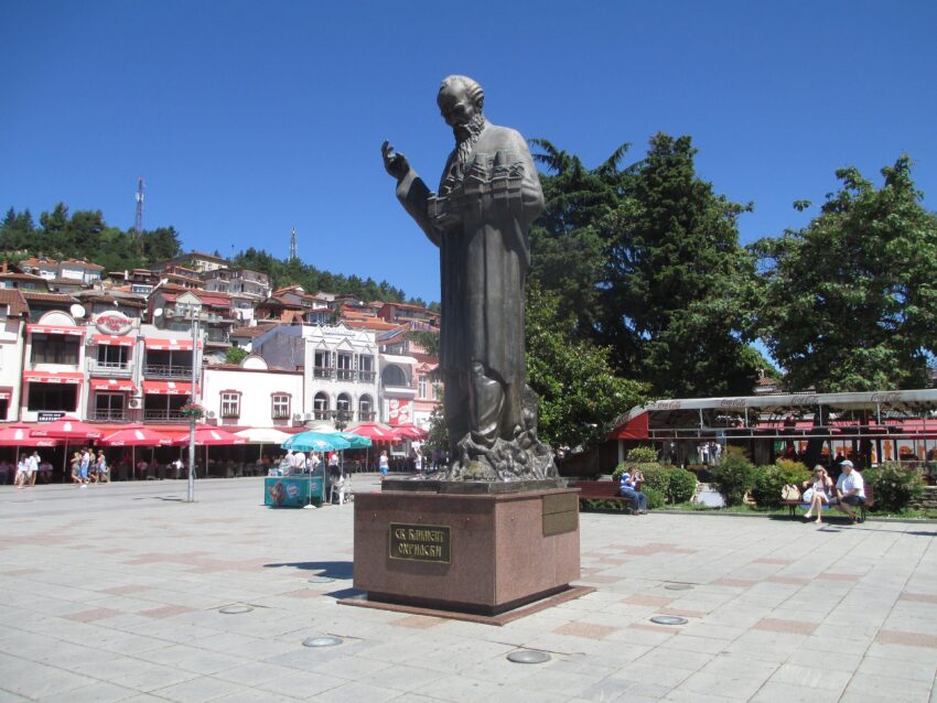
4. St. Clement Monument

St. Clement Monument
CC BY-SA 4.0 / Avi1111 dr. avishai teicher

The St. Clement Monument honours Saint Clement of Ohrid, a pivotal figure in the cultural and religious history of the region. Clement is associated with the spread of Christian learning and the nurturing of Slavic literacy traditions tied to the work of Saints Cyril and Methodius and their disciples. In Ohrid’s historical memory, he represents education, faith, and the idea of Ohrid as a centre of scholarship.

Monuments like this are less about ancient authenticity and more about modern commemoration. They signal how a city chooses to represent its past in public space, turning historical legacy into a visible civic identity. The presence of the monument reflects a broader narrative: Ohrid as a place where religion, language, and education intersected over centuries.

When visiting, look at how the monument is positioned in relation to movement and gathering, because that placement is part of its meaning. The sculpture and inscription details usually carry the message: teaching, blessing, or guidance motifs are common in depictions of Clement. It is also a useful stop for understanding why nearby church sites and archaeological areas carry such weight in Ohrid’s story.


Location: 4Q7X+3RF, Ohrid, North Macedonia | Hours: 24 Hours. | Price: Free.

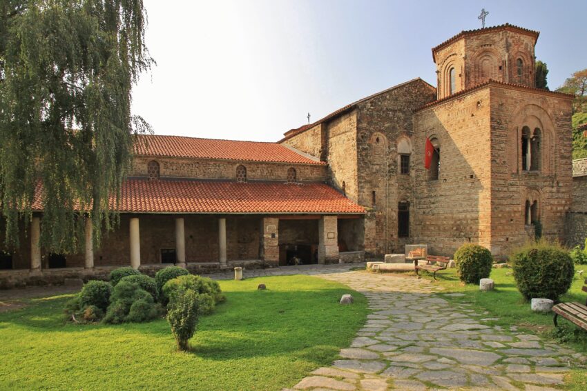
5. Church of St. Sophia

Church of St. Sophia
CC BY-SA 2.0 / Petar Milošević

The Church of St. Sophia is one of Ohrid’s most historically significant churches, associated with the medieval period when the town was a major religious centre. Its importance is closely tied to its surviving frescoes, which are valued for their artistic and theological themes and for what they reveal about Orthodox visual culture. The building’s history reflects shifts in patronage and power, including periods when sacred spaces across the region were repurposed under changing rule.

Architecturally, it has the gravitas of a major ecclesiastical building rather than a small chapel. The interior volume and wall surfaces were designed to carry imagery and ritual, with fresco programmes structured to guide the eye and reinforce doctrine. Even without deep specialist knowledge, the sense of continuity—stone, paint, light, and silence—comes through immediately.

What to see is primarily inside: the fresco layers, the faces and colour tones, and the way the artwork sits within the architecture. Spend time noticing how figures are arranged in registers and how scenes are positioned to match liturgical space. Outside, the church’s setting within the old town makes it a strong reference point for understanding how Ohrid’s medieval core developed around major religious institutions.


Location: Цар Самоил 88, Ohrid 6000, North Macedonia | Hours: 24 Hours. | Price: Free; donations appreciated.

6. Ancient Theatre of Ohrid

Ancient Theatre of Ohrid
CC BY-SA 2.0 / Sharon Hahn Darlin

The Ancient Theatre of Ohrid dates to the Hellenistic era and reflects the spread of Greek-style urban culture through the region. The theatre’s form—tiered seating carved into a hillside—was designed for acoustics and visibility, making performance a shared civic experience. Later centuries brought different uses and attitudes toward such sites, as political and religious contexts shifted.

Archaeologically, theatres often reveal multiple phases: construction, modification, and periods of neglect or reuse. In Ohrid, the surviving structure shows how public entertainment and civic gatherings were built into the landscape. The site also helps ground the town’s story beyond the medieval period, pointing to much older layers beneath the better-known churches.

What to see is the geometry and the setting. Walk the seating lines to understand the scale, then look outward to appreciate how the hillside was selected to carry sound and frame the audience’s view. If the stage area is accessible, it is worth standing there briefly to sense how the space “reads” from performer to crowd.


Location: Ilindenska, Ohrid 6000, North Macedonia | Hours: 24 Hours. | Price: Free.

7. King Samoil Fortress

King Samoil Fortress
CC BY-SA 4.0 / Marcin Konsek

King Samoil Fortress dominates Ohrid’s upper town and is tied to the medieval era when the region was contested by powerful neighbours and local rulers. The fortifications are associated with Tsar Samuil’s period, when strategic strongholds mattered for controlling routes, lakeside access, and regional authority. Like many forts, what survives today reflects rebuilding and reinforcement across different centuries, not a single frozen moment.

The fortress is primarily a military landscape: walls, towers, and lookout points designed for defence and surveillance. Its position explains its purpose immediately, because the view controls approaches by land and water. The structure also frames Ohrid’s medieval identity, placing the better-known religious sites within a broader picture of governance and security.

What to see is the panoramic logic of the place. Walk along accessible wall sections and look for how the fort follows the ridge, using steep slopes as natural protection. The main reward is the viewpoint over Lake Ohrid and the old town rooftops, which makes the relationship between geography and history easy to grasp.


Location: 4Q7R+XCW, Kuzman Kapidan, Ohrid 6000, North Macedonia | Hours: 24 Hours. | Price: Free.

8. Plaošnik Archaeological Site

Plaošnik Archaeological Site
CC BY-SA 4.0 / MadMona

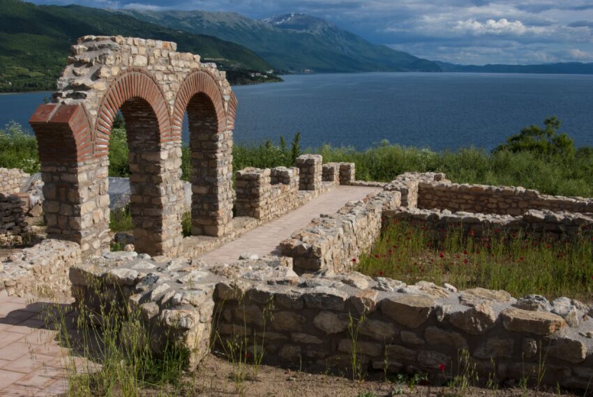
Plaošnik is one of Ohrid’s key archaeological zones, where early Christian history, medieval scholarship, and modern reconstruction converge. The site is closely associated with Saint Clement and with the idea of Ohrid as a centre of learning and church life. Excavations have revealed remains from different periods, showing a long continuum of sacred and communal use rather than a single-era snapshot.

What makes Plaošnik compelling is the density of layers: foundations, walls, and fragments that point to earlier buildings beneath later ones. It illustrates how religious sites were often rebuilt in place, with new structures drawing legitimacy from older sacred ground. The site therefore functions both as archaeology and as a statement about continuity in local identity.

What to see is the site plan and the evidence of successive phases. Pay attention to changes in masonry styles and how footprints of older structures are preserved or marked. The setting also rewards lingering, because the open-air layout helps visitors understand how major ecclesiastical complexes related to the surrounding town and landscape.


Location: 4Q7R+483, Kaneo Plaosnik Pateka, Ohrid 6000, North Macedonia | Hours: 24 Hours. | Price: Free.

9. Church of St. John at Kaneo

Church of St. John at Kaneo
CC BY-SA 2.0 / Klovovi

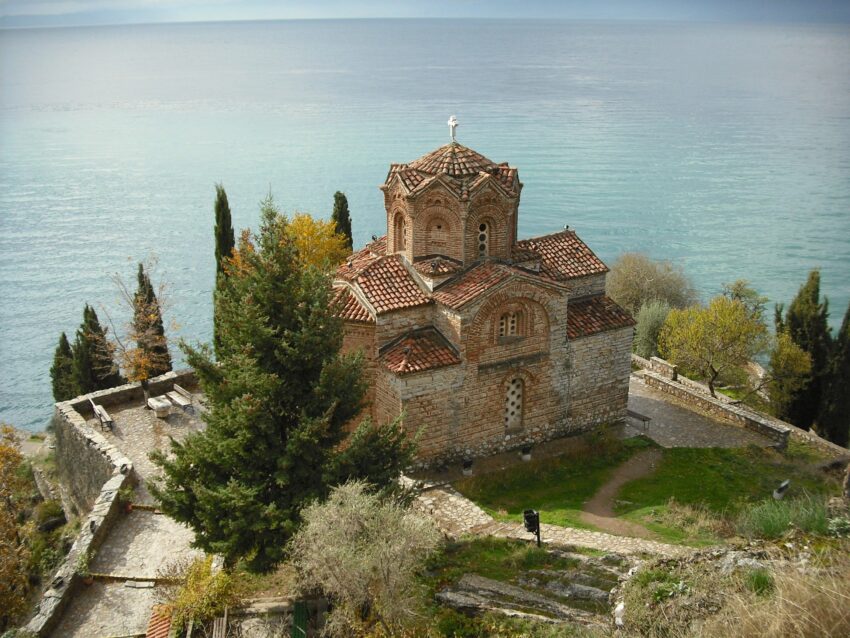
The Church of St. John at Kaneo is iconic for its cliffside position above Lake Ohrid, combining medieval architecture with a dramatic natural setting. The church is typically dated to the medieval period, and its enduring fame comes as much from the silhouette and location as from scale. It represents how sacred spaces were often placed to command views, cultivate contemplation, and anchor communities to the landscape.

Architecturally, it is compact, with a form that reads cleanly against the sky and water. The building’s materials and proportions reflect regional Orthodox church design, adapted to a tight site. Even when interiors are modest, the combination of stonework, light, and quiet makes the place feel deliberate and self-contained.

What to see is the approach and the viewpoint. The best experience is taking time to look back at the church from a slightly lower angle, where cliff, lake, and structure align into a single composition. Once at the church, the primary “sight” is the relationship between architecture and lake horizon, which explains why this small building has become one of Ohrid’s defining images.


Location: 4Q6Q+CGJ, Kocho Racin, Ohrid 6000, North Macedonia | Hours: 24 Hours. | Price: Free; donations appreciated.
Moira & Andy
Moira & Andy

Hey! We're Moira & Andy. From hiking the Camino to trips around Europe in Bert our campervan — we've been traveling together since retirement in 2020!

Read our full story here

This website uses affiliate links which earn a small commission at no additional cost to you.

Walking Tour Summary

Distance: 3.5 km
Sites: 9

Walking Tour Map

Self-Guided Walking Tour of Piran, Slovenia (+ Maps)

Self-Guided Walking Tour of Piran

This website uses affiliate links which earn a small commission at no additional cost to you.

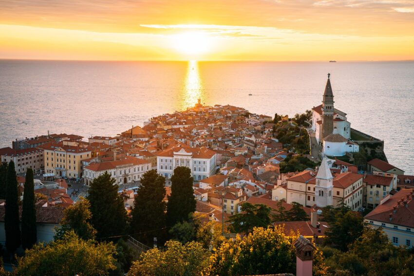
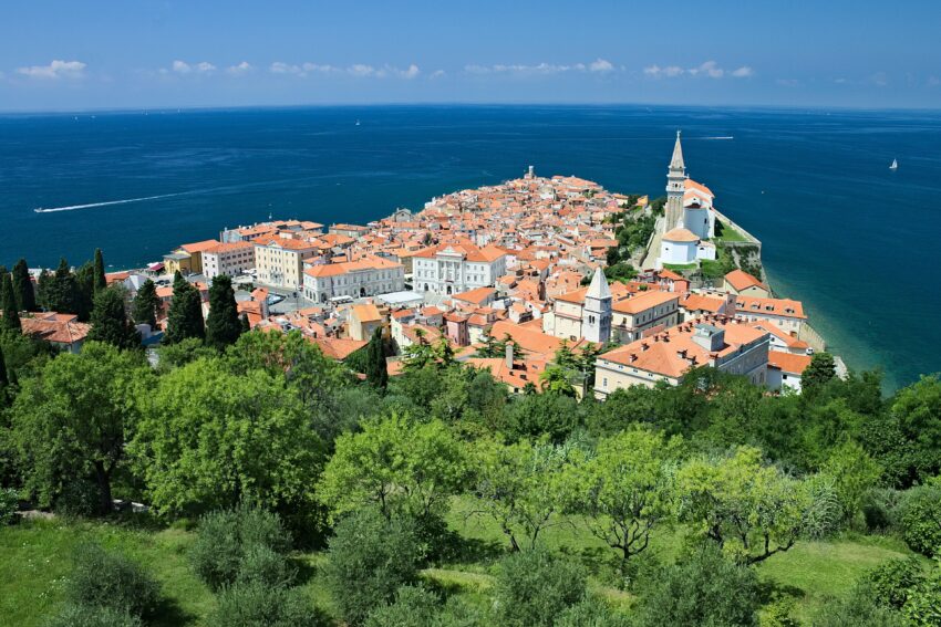
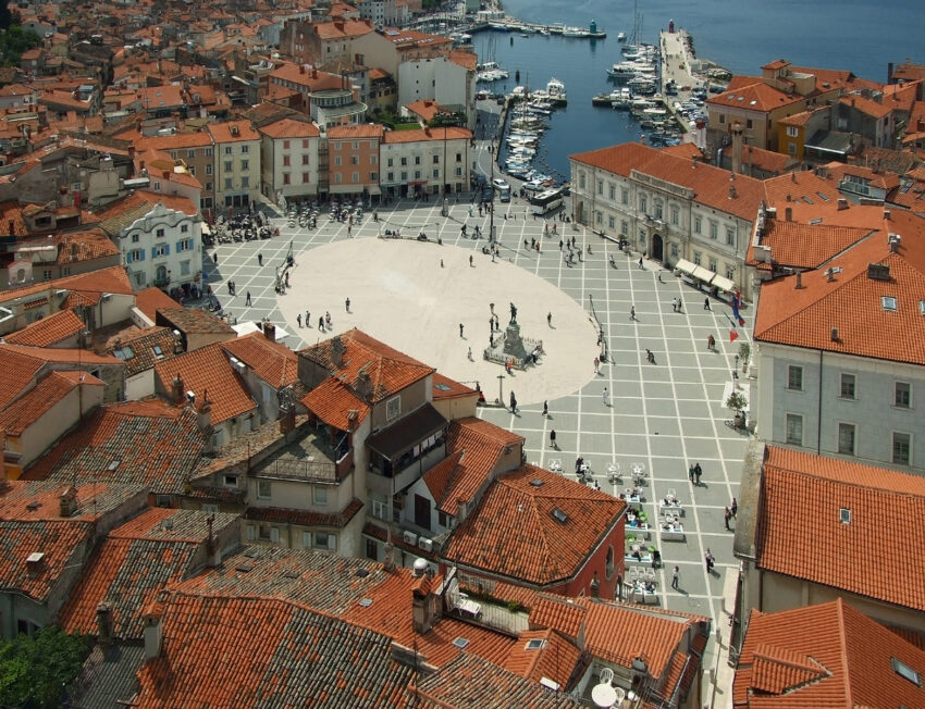
Even though Slovenia's Adriatic coastline is short (around 47 km), it packs in a surprising number of worthwhile stops. The standout and easily one of the most beautiful places to visit in Slovenia is Piran, a charming town perched at the tip of a scenic peninsula. It's the kind of place where Venetian-style facades frame a sunlit main square, narrow stone lanes tumble downhill toward the water, and the salty air follows you from the port to the waterfront promenade.

We came here while travelling up from Croatia in the campervan. It was just going to be a quick stop but we ended up lingering for hours, because almost every lane leads to a postcard view. This is a modified version of the route we took. It is the easiest way to soak up the atmosphere without rushing, and it strings together the best things to see in Piran in a natural loop that feels like you're simply wandering, but with a plan!

How to get to Piran

By Air: The most practical way to reach Piran by air is usually to fly into Slovenia or a nearby airport and continue overland. Slovenia's official tourism guidance notes that travelers can arrive via Ljubljana Jože Pučnik Airport or airports in neighboring countries, which is useful because Piran sits close enough to several cross-border gateways for multi-leg journeys to make sense. From the airport, the final stage is typically by shuttle, bus, hire car or a combination of rail and road transport. For the best deals and a seamless booking experience, check out these flights to Piran on Booking.com.

By Train: Piran does not have its own railway station, so train travel involves arriving elsewhere in Slovenia or in a nearby city and then completing the journey by road. You can easily check schedules and book tickets through the Slovenian Railways. However, for a smoother experience, we recommend using Omio, which simplifies the booking process and lets you compare prices and schedules all in one place.

By Car: The most convenient way to experience Slovenia with this itinerary is by rental car. Driving gives you the greatest flexibility, especially if you want to combine Piran with other stops on the Slovenian coast or nearby parts of Italy and Croatia. Slovenia's tourism guidance highlights that the country is well connected by road and is only a few hours' drive from major regional cities, which makes Piran an easy addition to a broader road trip. Parking is available at the start of the walk.

By Bus: The first time we visited Slovenia, I solely relied on public transportation to get around the country. Bus travel can be a very practical option, particularly if you are arriving from Ljubljana or from nearby airports and regional cities. Official tourism guidance for Slovenia points to a broad coach network, including links with major nearby airports, so buses are often the simplest public transport choice for the final approach to the coast. For many visitors, coach connections are more straightforward than trying to stitch together rail segments for the same journey.

A Short History of Piran

Medieval Piran and the rise of the walled town

Piran’s medieval development can still be read directly in its streets. The town grew as a compact coastal settlement with defensive walls, gates and a religious core on higher ground, and that layered structure remains one of the reasons it is so satisfying to explore on foot today. The preserved walls are not just a surviving monument; they explain why the town feels enclosed, vertical and intimate, with views opening suddenly after narrow, twisting lanes.

One of the key landmarks tied to this early period is the Church of St. George, dedicated to the town's patron saint. The official local tourism material notes that the church was originally built in the 14th century, and its commanding position above the town makes clear how religion, identity and civic pride were closely linked. Even now, climbing toward the church gives you a sense of how medieval Piran would have presented itself: protected, watchful and oriented toward the sea.

Venetian Piran and the shaping of its character

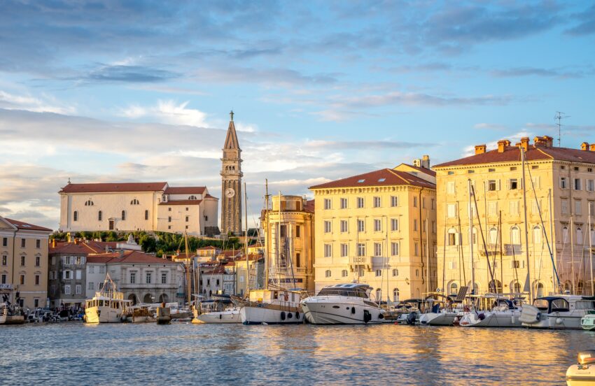
The centuries of Venetian rule left perhaps the strongest visual mark on Piran. The bell tower of St. George's, completed in the 17th century, is described by the local tourism authority as a smaller replica of St. Mark's Campanile in Venice, and that single detail says a great deal about the cultural ambitions of the town during this era. Piran's facades, public spaces and maritime outlook all reflect a period when Venetian style was not an influence at the margins but part of daily civic life.

This is also the period that gives the town much of its romantic appeal for visitors today. The architecture around the central square, the rhythm of the lanes and the visual harmony of stone, shutters and church towers all feel shaped by that long Adriatic connection. When you stand in the main square or look back from the waterfront, you are not seeing isolated historic buildings but the result of a political and commercial world that tied Piran closely to Venice for generations.

Baroque Piran and its landmark skyline

Although medieval foundations remain crucial, some of Piran’s most memorable monuments took on their present form later. The Church of St. George received its Baroque renovation in the 17th century, which gave it much of the appearance visitors see now, including the richly developed interior and the strong visual presence it has above the old town. That renovation shows how the town continued to reshape important buildings rather than simply preserving them unchanged.

The skyline that defines so many views of Piran is therefore not the product of a single age but of adaptation across centuries. The church, the bell tower and the city walls together tell the story of a place that balanced devotion, defense and display. For modern visitors, these are not just beautiful landmarks to photograph; they are the reason the walking tour has such a strong sense of narrative, with each climb and viewpoint connecting architecture to history.

Cultural Piran and the town visitors experience today

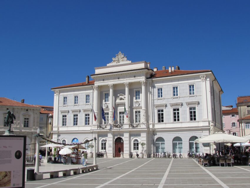
Piran’s later identity has also been shaped by culture and memory, not only by trade and defense. Local tourism material emphasizes museums, galleries and the legacy of Giuseppe Tartini, whose name lives on in the town’s main square and broader cultural atmosphere. That means the town’s history is experienced not as something locked behind museum doors, but as something still active in public spaces, names and local storytelling.

For a walking tour, that matters because the most rewarding stops are often the ones where architecture and memory overlap. The central square, the seafront, the church and the walls are attractive in their own right, but they are even more compelling when understood as pieces of a town shaped by religion, Venetian rule, seafaring and cultural self-confidence. Piran feels coherent because its landmarks were not created at random; each one was influenced by the town's changing role over time.

Where to Stay in Piran

To make the most of visiting Piran and this walking tour then you consider stay overnight at the centre. Staying in or close to the old town means you can start early, enjoy the atmosphere after day-trippers leave, and return easily to your room after climbing the lanes and viewpoints. For the most convenient base, the area around Tartini Square is ideal, with central options such as Art Hotel Tartini and Hostel Piran, both of which place you within easy walking distance of the square, the waterfront and the church approach.

If being right by the sea matters more than being directly on the square, the waterfront is an excellent choice for this walking tour. Hotel Piran is particularly well placed for travelers who want sea views and immediate access to the historic core without sacrificing comfort. It works especially well if you want the old town at your doorstep but also like the idea of ending the day with an open seafront setting rather than a room deeper in the lanes.

For a quieter overnight stay, consider the edge-of-town area around Fiesa, which gives you a little more breathing room while still keeping Piran within walking distance. Barbara Piran Beach Hotel suits travelers who want a calmer base and do not mind approaching the old town from outside the densest historic streets. That can be a smart compromise if your priority is a slower seaside stay first and a walking tour second.

Your Self-Guided Walking Tour of Piran

Discover Piran on foot with our walking tour map guiding you between each stop as you explore its Venetian squares, narrow lanes, hilltop church, old defensive walls and atmospheric seafront corners. As this is a self guided walking tour, you are free to skip places, and take coffee stops when ever you want.

1. Walls of Piran

View of Piran from the Ramparts
City Walls of Piran
CC BY-SA 2.0 / Nicolas Vollmer

The Walls of Piran ae an obvious start as they are next to the car park and from them you can see the town’s whole shape in one glance. The original fortifications date back as early as the 7th century, and they were repeatedly renovated and strengthened right through to the 16th century, which makes sense when you see how exposed this little peninsula can feel.

Up close, you can see that parts of the walls are ruined, but the accessible sections are well maintained and easy to appreciate as real defensive architecture rather than just a leftover fragment. I tend to slow down here and look for the old towers and the way the stonework changes, because that’s usually where you can feel the “built over centuries” story most clearly.

The best thing to do is climb up to one of the towers and take in the views over the red roofs, the curve of the waterfront, and the sea on both sides of the peninsula. It’s one of those places where you get your bearings fast, and the whole day feels easier after that.


Location: Walls of Piran, Ulica IX. korpusa, Piran, Slovenia | Hours: (Summer) Every day: 08:00–21:00. (Winter) Every day: 08:00–18:30. | Price: 2 € per person | Website
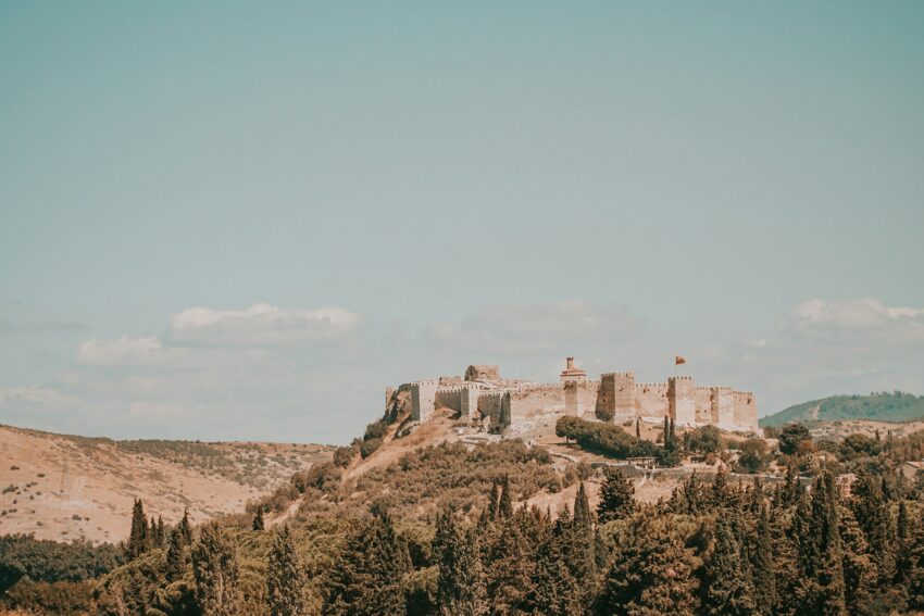
Here is a complete selection of hotel options in Piran. Feel free to review each one and choose the stay that best suits your needs.

2. Tartini Square

Tartini Square from above, Piran
CC BY-SA 3.0 / Plamen Agov

When I step into Tartini Square, it feels like Piran opens up all at once. It’s the town’s main square, unusually broad for such a tight old centre, and it sits right by the waterfront, so you get that mix of grand facades and salty air in the same moment.

Historically, this is where Piran’s public life concentrates—today you can still read that in the layout, with the largest civic buildings facing the open space and cafés and restaurants filling in the edges. I like taking a few minutes just to look up at the colourful fronts and details, because they give the square its distinctly Adriatic, old-town character.

If I have time, I pop into Casa Tartini, the small heritage museum connected with Giuseppe Tartini, the town’s famous composer and violinist. Even if you don’t go inside, this is still the best spot to pause with a coffee, watch the square’s rhythm, and take photos when the light hits the buildings.


Location: Tartini Square, Piran, Slovenia | Hours: 24 Hours. | Price: Free.

Traveling to a country with a different currency? Avoid ATM transaction fees and pay in local currency with a Wise Card. Having used it for over 5 years, we've saved loads on fees!

3. Town Hall

Piran,_Town_Hall
Piran,_Town_Hall
CC BY-SA 1.0 / Ajznponar

The Town Hall is one of the buildings in Piran that makes the square feel properly civic and historic, not just pretty. It’s described as one of the grandest buildings on Tartini Square, and standing in front of it you get that sense of old authority—this is where administration and daily town life would have intersected for generations.

I find it’s worth looking closely at the façade, because public buildings like this are often where a town “shows” its identity. Even without going inside, the positioning on the square tells you a lot: the most prominent civic architecture faces the main public space, exactly where people naturally gather.

Walk a slow loop of the square, then come back to the Town Hall side to decide what’s next. It’s also a useful point to orient yourself before heading down to the port and promenade.


| Hours: Exterior: 24 Hours. Interior: Administrative building; access is limited. | Price: Free to view from outside.

4. Piran Port

View overlooking Piran Port
Piran Port

Piran Port is where the town feels most immediately maritime to me, but in a gentle, everyday way rather than anything industrial. It’s described as charming and filled with smaller boats and yachts, and that’s exactly the mood—water, masts, and a relaxed bustle that suits Piran.

I like wandering along the edge and watching the boats shift and creak, then turning into the nearby streets, which are lined with shops and restaurants. This area has a slightly more touristy energy, but it still feels tied to the sea, and it’s a good place to pick up snacks or linger over something cold if the day’s warm.

For sightseeing, it’s less about “one big monument” and more about the atmosphere and viewpoints back toward the old town. I usually pause for photos looking along the curve of the waterfront, because you can see how tightly the town is built right up to the waterline.


Location: Port Piran Tartinijev trg 1 6330 Piran Slovenia | Hours: 24 Hours | Price: Free

5. Sergej Mašera Maritime Museum

View of Sergej Mašera Maritime Museum from across harbour
Sergej Mašera Maritime Museum
CC BY-SA 4.0 / Isiwal

I see the Sergej Mašera Maritime Museum as the best way to connect Piran’s pretty coastal scenery to the deeper story of life on the Adriatic. Even before you go in, the fact that Piran has a dedicated maritime museum tells you how central seafaring identity has been to the town.

Inside, I approach it as a place to slow down and add context to everything I’ve just seen outside—the port, the boats, the waterfront edges. Museums like this tend to make you notice details you’d otherwise walk past, like why the harbour matters, how coastal towns were defended and supplied, and how maritime routes shaped local culture.

Focus on anything that links directly back to what you can see in the streets: coastal navigation, ship life, and how the sea influenced the town’s economy and everyday routine. It’s a practical stop that deepens the experience without taking over the whole day.


| Hours: (September – June) Tuesday – Sunday: 09:00–17:00. (July – August) Tuesday – Sunday: 09:00–12:00 & 17:00–21:00. Closed on Monday. | Price: Adults 5.00 €; students and pensioners 4.00 €; children 3.00 €; family ticket 12.00 €. | Website

6. Piran Waterfront Promenade

Waterfront Promenade, breakwater on one side and cafes on the other.
Piran Waterfront Promenade
CC BY-SA 2.0 / Selena N. B. H.

The Piran Waterfront Promenade is the stretch I naturally return to again and again because it’s simply easy to enjoy. With the sea on one side and restaurants on the other, it’s described as relaxing, and it really is—the kind of place where you can walk slowly without feeling like you’re “missing” anything.

Historically, promenades like this are where a coastal town’s working edge gradually becomes a social one, and you can feel that transition here. The waterfront is still part of Piran’s identity, but it’s also a stage for modern life: lunch terraces, evening strolls, and the steady pull of the view.

Have a look at the changing colour of the water, the perspective back toward the old town, and the way the peninsula narrows as you continue. I like timing this for later in the day if I can, when the light softens and the whole waterfront starts to glow.


| Hours: 24 Hours. | Price: Free.

7. Piran Lighthouse

Piran lighthouse was attached at the northwest side of Church of Our Lady of Health
Piran Lighthouse
CC BY-SA 4.0 / Isiwal

The Piran Lighthouse is one of my favourite “end-of-the-peninsula” sights because it feels both scenic and historically grounded. It’s described as architecturally significant, and the detail that it’s built on a defensive sandstone tower from around the 16th or 17th century makes it more than just a pretty viewpoint.

When I get there, I like circling the area first and taking in the sea on either side—this is where you really feel Piran’s geography, with water wrapping the town and the horizon opening up. It’s a strong contrast to the tight lanes back in the centre, and that shift is part of the appeal.

If it’s open, you can go inside for a small fee, but even without that, the lighthouse is worth it for the views and the sense of standing on a historic defensive point that later took on a navigational role. It’s a simple stop, but it sticks in my memory.


Location: Piranski svetilnik, Prešernovo nabrežje, Piran, Slovenia | Hours: April: Friday, Saturday, Sunday 11:00 - 17:00 May: Friday, Saturday, Sunday 11:00 - 17:00 June: Friday, Saturday, Sunday 10:00 - 17:00 July: 9:00 - 12:00 and 17:00 - 21:00 August: 9:00 - 12:00 and 16:00 - 20:00 September: 10:00 - 18:00 October: 10:00 - 17:00 | Price: Adults: €3 | Website

8. St. George’s Cathedral

View of St. Georges Cathedral from city walls
St. Georges Cathedral
CC BY-SA 4.0 / Isiwal

St. George’s Cathedral sits at the top of the hill, and for me it’s the place where Piran’s beauty becomes panoramic. The best thing about it is the view over the town and out toward the Mediterranean, and that elevated position is exactly why it’s such a defining landmark.

I like approaching it from below because the climb builds anticipation—rooftops drop away behind you, and the sea keeps appearing between buildings. Once you’re up there, you get a clear sense of how the cathedral influences the town’s “map in your head”: it’s a visual reference point you keep spotting from streets and waterfront corners.

If you want the best viewpoint, you can climb the bell tower for an even higher perspective. I usually spend a while here, because it’s the kind of place where you naturally review everything you’ve seen—square, port, promenade, walls—and understand how all of it fits together on the peninsula.


Location: Cerkev svetega Jurija, Adamičeva ulica, Piran, Slovenia | Price: Free; donations appreciated.
Powered by GetYourGuide
Moira & Andy
Moira & Andy

Hey! We're Moira & Andy. From hiking the Camino to trips around Europe in Bert our campervan — we've been traveling together since retirement in 2020!

Read our full story here

This website uses affiliate links which earn a small commission at no additional cost to you.

Walking Tour Summary

Distance: 2 km
Sites: 8

Walking Tour Map

Self-Guided Walking Tour of Selçuk (+Maps!)

Self-Guided Walking Tour of Selcuk

This website uses affiliate links which earn a small commission at no additional cost to you.

Selçuk is one of Turkey's most rewarding small towns for travelers interested in history, archaeology, and the layered cultures of the Aegean. Best known as the gateway to Ephesus, it offers far more than a practical base: the town sits among remains of Greek, Roman, Byzantine, Seljuk, and Ottoman life, with major landmarks scattered within easy reach. From the Basilica of St. John and Ayasuluk Castle to the İsa Bey Mosque and the surviving column of the Temple of Artemis, Selçuk gives visitors a compact but remarkable introduction to the region's long past.

The town itself has a relaxed, local feel, with cafés, guesthouses, markets, and quiet streets that make it a pleasant place to stay rather than simply pass through. Its location is especially useful, with Ephesus, the House of the Virgin Mary, Şirince village, and the Aegean coast all close by. For many visitors, Selçuk works best as a slower alternative to staying in larger resort towns, combining easy sightseeing with a more grounded sense of place.

How to Get to Selçuk

By Air: The closest major airport is İzmir Adnan Menderes Airport (ADB), which has frequent domestic flights and seasonal international routes. From the airport, the simplest DIY option is to take rail or shuttle/taxi into İzmir and continue south to Selçuk; private transfers are also common if you're traveling as a pair or with luggage. If you're arriving late, consider going straight to Selçuk and starting the walking tour the next morning. For the best deals and a seamless booking experience, check out these flights to Selçuk on Booking.com.

By Train: Selçuk is on the regional rail line connecting İzmir with towns further south, making it a straightforward arrival if you're coming from İzmir city center or from the airport rail connections. Trains are generally comfortable, affordable, and avoid the “where do I park?” problem you'll face on an Ephesus day. Once you arrive, the town is compact enough that most hotels are a short walk or quick taxi from the station. You can use the official TCDD Taşımacılık website to check schedules, compare routes, and purchase tickets for Türkiye’s national and regional trains operated by TCDD. For a more streamlined experience (especially if you prefer an English interface or want to compare across countries), we recommend using Omio, which allows you to easily compare prices, schedules, and book train tickets across Türkiye and the rest of Europe — all in one place.

By Car: Driving can work well if Selçuk is part of a wider Aegean road trip (Kușadası, Șirince, Pamukkale, Bodrum, etc.). Roads are generally good, but the main consideration is parking-especially around Ephesus at peak hours-so aim to arrive early. A car also makes it much easier to add the House of the Virgin Mary or other rural stops without juggling minibuses or taxis. If you are looking to rent a car in Türkiye I recommend having a look at Discover Cars, first, as they compare prices and review multiple car rental agencies for you.

By Bus: Long-distance coaches and regional buses connect Selçuk with İzmir, Kușadası, and other Aegean hubs. Services are frequent in summer, and the bus station is typically an easy taxi ride or a manageable walk depending on where you're staying. If you're arriving by coach with a tight schedule, factor in a short transfer time to drop bags before starting your walk.

How to get around the city: Selçuk itself is walkable, and that's the point of this route-most town sights are within easy strolling distance. For Ephesus and out-of-town stops like the House of the Virgin Mary, you'll usually use a taxi, local minibus (dolmuş), or a short drive if you have a car; many travelers mix walking in town with a taxi hop to Ephesus early, then return to Selçuk for a late lunch and a gentler afternoon.

A Short History of Selçuk

Selçuk and the Ancient World of Ephesus

Selçuk's story is inseparable from nearby Ephesus, which grew into a major Greco-Roman city whose public buildings still define the visitor experience today. The monumental plan of the city-its State Agora and Commercial Agora, civic spaces like the Prytaneion, and entertainment venues such as the Odeon-reflects the wealth and administrative importance the area accumulated over centuries. As you walk Curetes Street, you're following a ceremonial and commercial spine shaped by empire-era priorities: procession routes, water display, and civic grandeur, seen in features like the Trajan Fountain and the imposing Temple of Domitian.

Selçuk and Roman Ephesus at Its Peak

The Roman period left Selçuk’s wider landscape with an almost theatrical concentration of landmarks, designed to impress both citizens and visitors arriving by land or sea. The Library of Celsus became an icon of elite patronage and urban identity, while the Ancient Greek Theater (expanded in Roman times) anchored large-scale performances and public gatherings; nearby, the Theater Gymnasium hints at how daily life blended fitness, culture, and status. Along the same walking logic, practical infrastructure shaped the experience too: the Public Roman Latrines, the Baths of Varius, and the Gate of Mazaeus and Mithridates show how engineered comfort and ceremonial entrances were baked into city planning.

Selçuk, Daily Life, and the Intimate City

Beyond the headline monuments, Ephesus also preserves the texture of private life, which deepens the story for anyone willing to slow down. The Terrace Houses of Ephesus reveal domestic luxury-mosaics, frescoes, and elite layouts-while the Temple of Hadrian, the Memmius Monument, and the passage through Heracles Gate help you picture the rhythm of movement through the city's terraces and streets. Even the more provocative stops-like the House of Pleasure-point to a port-city reality where commerce, entertainment, and travel blended in ways that still feel surprisingly modern.

Selçuk and Late Antiquity to Early Christianity

As the classical world shifted, religious life and legends became central to how the area was remembered and visited. Sites such as the Grotto of the Seven Sleepers tie Selçuk's landscape to enduring Christian tradition, while the House of the Virgin Mary on the wooded slopes above Ephesus became a powerful pilgrimage focus for many visitors. In this period, the meaning of the ruins changed: temples and civic buildings didn't just fade-they were repurposed, quarried, reinterpreted, and woven into new spiritual geographies that still shape modern itineraries.

Selçuk and the Modern Visitor Experience

Modern Selçuk developed as the gateway town for exploring these layers, turning archaeology and heritage into a living local economy of guides, museums, cafés, and small hotels. Newer additions like the Ephesus Experience Museum reflect how storytelling has evolved-moving beyond stones and street grids to immersive interpretation that helps first-time visitors connect names and ruins to real human lives. Today, Selçuk's appeal is precisely this: you can sip coffee in a Turkish town square in the morning, spend midday inside an ancient metropolis of marble and shadow, then finish with sunset views and dinner back in town.

Where to Stay in Selçuk

To make the most of visiting Selçuk and this walking tour then you consider stay overnight at the centre. The town centre is ideal if you want everything on your doorstep-restaurants, cafés, the station, and an easy start for early departures to Ephesus before the crowds arrive. This area suits travelers who like to wander in the evenings and keep logistics minimal, with a mix of characterful guesthouses and small hotels that can help arrange taxis or local tips. Consider options like Ayasoluk Hotel and Cella Boutique Hotel & Spa if you want comfort close to the action, or Kalehan Hotel for a classic garden-hotel feel near the station.

If you prefer a quieter base with postcard views, look around Ayasuluk Hill, where the atmosphere feels more residential and evenings are calmer, while still being walkable to the centre. Staying here can be especially nice if you want sunrise or sunset walks and a slightly slower rhythm between town stops, museum visits, and long lunches. For this style of stay, consider Ephesus Centrum Palace and Livia Hotel Ephesus as convenient, well-located picks.

For a more countryside feel, you can base yourself just outside town toward Șirince or the rural lanes around Selçuk, which works well if you have a car and want evenings to be genuinely quiet. This is best for travelers building a broader Aegean road trip who plan to start early at Ephesus, then retreat to a more scenic setting afterward. In that case, options like Șirince Taș Konak or Nişanyan Houses can pair well with a Selçuk walking day, with the trade-off that you’ll rely on driving or taxis rather than walking everywhere.

Your Self-Guided Walking Tour of Selçuk

Discover Selçuk on foot with our walking tour map guiding you between each stop as you explore its historic streets, lively local corners, and the gateway sights that make this area one of Türkiye's most rewarding heritage hubs. The route is built to feel natural: a relaxed start in town, a smooth build toward the headline attractions, and plenty of opportunities to pause for shade, snacks, and museum time without breaking the flow.

1. Ephesus Archaeological Museum

Ephesus Archaeological Museum
CC BY-SA 2.0 / Carole Raddato

The Ephesus Archaeological Museum was established in 1964 to house and display artifacts from Ephesus and surrounding sites. Its creation is linked to policies of the Turkish Republic that prohibited the export of antiquities and pushed for the return and preservation of objects within the country. The collection also reflects the earlier history of excavation, when many items were sent abroad between 1867 and 1923.

Rather than organising displays strictly by chronology, the museum arranges its collection thematically. Visitors move through galleries that include sculptures from ancient fountains, material from the Terrace Houses, and a coin collection illustrating early currency use. Additional themed sections mentioned include “Ephesus through the Ages,” “The Hall of Imperial Cult,” and “The Hall of the Mother Goddess Cult,” along with a courtyard showing tombs and carved column capitals.

A short 3D simulation video is available before the galleries, described as running about 10 minutes and offered in Turkish, English, and German. Among the highlighted objects are the statue of Ephesus Artemis, the Priapos statue, a sculpted head of Socrates, a figure of an Egyptian priest, and “Eros with a rabbit.” The oldest item mentioned is a stamp from Çukuriçi Mound dated to 6200 BC.


Location: Atatürk, Uğur Mumcu Sevgi Yolu No: 26, 35920 Selçuk/İzmir, Türkiye | Hours: Daily: 08:00–17:30. | Price: Adults: 10 Euro | Website

We recommend to rent a car in Türkiye through Discover Cars, they compare prices and review multiple car rental agencies. Book your rental car here.

Powered by GetYourGuide

2. Byzantine Aqueducts

Byzantine Aqueducts
Byzantine Aqueducts
CC BY-SA 4.0 / Dosseman

The Byzantine Aqueducts of Ephesus were built to carry spring water from near eastern Selçuk and Belevi up to Ayasuluk Hill, supplying Saint John’s Basilica and nearby settlements on higher ground. Their construction reused marble blocks from the ruins of ancient Ephesus and the Temple of Artemis, which reflects both practicality and the layered history of the area. What survives today is part of a later phase of water infrastructure that remained vital after the city’s classical peak.

Although Ephesus already had extensive Greek and Roman water systems, the sections most visible now date to the Byzantine period. Water was first delivered to Ayasuluk Hill and then distributed through pipes and channels for everyday needs such as drinking, bathing, and irrigation. The high abutments, with some rising to around 15 meters, underline the scale and ambition of the engineering.

The most striking remains are the tall stone arches stretching from Ayasuluk Hill toward the modern town center and the train station area, which have become iconic landmarks in Selçuk. Some arches are well preserved while others were lost or dismantled over the centuries, and modern alteration is prohibited. In recent years, the pillars have also become nesting points for Selçuk’s storks, adding a living layer to the ruins.


Location: İsa Bey, Namık Kemal Cd. No:25, 35920 Selçuk/İzmir, Türkiye | Hours: 24 Hours. | Price: Free.

Here is a complete selection of hotel options in Selçuk. Feel free to review each one and choose the stay that best suits your needs.

3. Urban Memory Museum

Urban Memory Museum
Urban Memory Museum
CC BY-SA 4.0 / Satirdan kahraman

The Selçuk Ephesus Urban Memory Museum is housed in a late 19th-century building originally built by a British tobacco company, giving it a distinct place in the town’s modern history. Its origins are tied to global trade shifts, with the American Civil War disrupting tobacco supplies and prompting British interests to establish operations in the region. Today, the restored building serves as a museum focused on Selçuk’s collective memory.

Inside, the museum presents a historical timeline tracing Selçuk’s development from early settlement to the present. While the timeline is described as being in Turkish, the exhibits rely heavily on photographs, artifacts, and visual displays that communicate beyond language. The overall emphasis is on daily life, local traditions, and key social and cultural moments.

The approach blends traditional objects with modern curatorial techniques to create a compact but varied experience. Exhibits cover themes including agriculture, urban development, religious change, and the recent impact of tourism. It’s best seen as a place to understand how modern Selçuk evolved alongside, and in the shadow of, ancient Ephesus.


Location: Efes Antik Kenti, Antik Tiyatro Karşısı, Atatürk, 35920 Selçuk/İzmir, Türkiye | Hours: (Summer) April 1 – October 31; Daily: 08:00–19:30. (Winter) October 31 – April 1; Daily: 08:30–17:00. | Price: Check official website.

Traveling to a country with a different currency? Avoid ATM transaction fees and pay in local currency with a Wise Card. Having used it for over 5 years, we've saved loads on fees!

4. Basilica of Saint John

Basilica of Saint John
CC BY-SA 4.0 / Dosseman

The Basilica of Saint John was one of the great Byzantine churches of the 6th century, built under Emperor Justinian I and Empress Theodora on Ayasuluk Hill, above the believed burial place of John the Evangelist. Long before the grand basilica was raised, a smaller 4th-century chapel stood on the same sacred site, reflecting the early importance of this place for Christian worship. Over time, the basilica became a major pilgrimage destination, closely tied to traditions that John lived, taught, and was buried in Ephesus.

The church was designed on an impressive cross-shaped plan and was once crowned by six domes, with the central dome rising directly above the apostle’s tomb. Although much of the structure is now in ruins, its surviving remains still give a strong sense of its former scale. Visitors can see the tomb area, traces of marble decoration, columns marked with the monograms of Justinian and Theodora, the apse with its synthronon, and a distinctive keyhole-shaped baptistery dating from the 5th century. Mosaics, chapel spaces, and architectural fragments add to the sense that this was once a richly decorated and highly symbolic religious complex.

In later centuries, the basilica was adapted to meet changing needs. During the 7th and 8th centuries, it was strengthened as part of the area’s defences against Arab raids, and by the 10th century it had gained fresco decoration. Its decline came after the Turkish conquest in the 14th century, when it was briefly used as a mosque before earthquake damage left it largely ruined. Today, the Basilica of Saint John is best appreciated for its monumental layout, surviving stonework, and powerful setting, which together reveal the importance of Ephesus as a centre of early Christianity.


Location: Atatürk, St. Jean Cd. No:4, 35920 Selçuk/İzmir, Türkiye | Hours: (Summer) Daily: 08:00–19:00. (Winter) Daily: 08:30–17:00. | Price: Adults: €6 | Website

5. Ayasuluk Castle

Ayasuluk Castle
Ayasuluk Castle
CC BY-SA 4.0 / Dosseman

Ayasuluk Castle, also known as Selçuk Castle, stands on Ayasuluk Hill above the modern town of Selçuk, overlooking the area where ancient Ephesus gradually gave way to a new hilltop settlement. The fortress has its origins in the Byzantine period, with a 6th-century citadel built using stone taken from earlier Greek and Roman structures. As the ancient harbour of Ephesus silted up and the old city declined, the hill became increasingly important, offering a more defensible position and helping to protect the Basilica of Saint John on the southern slope below.

The castle’s surviving fortifications give a strong impression of its former military strength. Its walls are around 4 metres thick in places, stretching for roughly 1.5 kilometres and reinforced by 17 towers. Entry was historically connected with the Gate of Persecution, which led first into the precinct of the Basilica of Saint John before reaching the fortress above. After the Seljuks captured the site in 1090, the castle was repaired and reused, becoming part of a renewed settlement that flourished for a time before further silting of the harbour again reduced the area’s commercial importance.

In later centuries, Ayasuluk Castle continued to serve as a strategic and administrative stronghold under both the Seljuks and the Ottomans, with use as a garrison lasting into the 17th century. Within the walls, visitors can still see traces of this layered history, including the remains of the Kale Mosque, Ottoman-era cisterns, a Turkish bath, and former residential areas. The two main gates are also worth looking out for, with the west gate now serving as the usual visitor entrance. Today, the castle is best appreciated for its commanding position, surviving walls, and the way it brings together Byzantine, Seljuk, and Ottoman history in one compact hilltop site.


Location: İsa Bey, 35920 Selçuk/İzmir, Türkiye | Hours: (Summer) April 1 – October 31; Daily: 08:00–19:30. (Winter) November 1 – March 31; Daily: 08:30–17:00. | Price: Check official website. | Website

6. İsa Bey Mosque

İsa Bey Mosque
İsa Bey Mosque
CC BY-SA 3.0 / rheins

The İsa Bey Mosque was built in 1375 by order of İsa Bey, ruler of the Aydınoğulları Emirate, and is one of the most important early examples of Anatolian mosque architecture. It stands in Ayasuluk, at the base of the hill crowned by Ayasuluk Castle and close to the Basilica of Saint John, placing it within one of Selçuk’s richest historical landscapes. Designed by the Syrian architect Ali ibn al-Dimashqi, the mosque also reflects the long history of the area through its reuse of columns and stone from earlier ancient sites, including Ephesus and the Temple of Artemis.

Architecturally, the mosque is especially striking for its asymmetrical layout, richly decorated western façade, and monumental entrance doorway. The doorway is framed with elegant mouldings and an Arabic inscription, giving the exterior a strong sense of ceremony. The mosque originally had two minarets, though only one survives today after earthquake damage. Inside, visitors can see the colonnaded courtyard with its central ablution fountain, along with a prayer hall arranged around aisles and a central transept. The domed structure, supported by pendentives, shows clear links with wider Islamic architectural traditions, including comparisons with the Great Mosque of Damascus.

Decorative details add greatly to the mosque’s appeal, from muqarnas-style window mouldings to traces of turquoise and blue faience tilework. The building has been restored several times, including major work in 1934, 1970, and 2005, and it remains an active place of worship today. For visitors, the main interest lies in the contrast between the finely cut stone exterior and the layered interior spaces, as well as the visible reuse of classical materials. The İsa Bey Mosque is not only a beautiful historic monument, but also a living reminder of Selçuk’s Byzantine, classical, and Turkish-Islamic heritage.


Location: İsabey mahallesi, 2040. Sk. no:2, 35920 Selçuk/İzmir, Türkiye | Hours: Daily: 08:30–22:00. | Price: Free.

7. Isa Bey Hamam

Isa Bey Hamam
Isa Bey Hamam
CC BY-SA 4.0 / Dosseman

The İsa Bey Hamam is a 14th-century Turkish bath in Selçuk, located close to the İsa Bey Mosque and tied to the period of İsa Bey’s rule. Although its direct patronage is not completely certain, an inscription records that construction was overseen by Hoca Ali in late 1364. His connection to the wider mosque complex is strengthened by a gravestone dated 1378 in the courtyard of the İsa Bey Mosque, suggesting that the hamam formed part of the same historic urban setting at the foot of Ayasuluk Hill.

The building was constructed from cut stone and brick and once had ten domes, five of which survive today, giving the ruins their distinctive beehive-like appearance. Inside, the layout followed the traditional sequence of a Turkish bath, moving from the changing room into the warm room and then the hot room. The hot chamber was arranged beneath a central dome, with a cruciform plan that helped organise the bathing spaces around it. Light entering through openings in the domes would have created a soft, filtered atmosphere, while surviving traces of decoration hint at the care once given to the interior.

Archaeological evidence suggests that the bath was first built for men, with a women’s section added later and provided with its own entrance. Around the main bathing rooms are additional chambers thought to have served as shops, while a northern extension may have been used as a felt-making workshop. Today, the İsa Bey Hamam is partly ruined and fenced, but it remains an atmospheric stop for visitors exploring the historic sites of Selçuk. The uneven ground and exposed setting mean sturdy shoes, water, and sun protection are useful, especially when visiting during the hotter months.


Location: Atatürk, 1055. Sk. No:1, 35920 Selçuk/İzmir, Türkiye | Hours: Check official website. | Price: Check official website. | Website

8. Temple of Artemis

Temple of Artemis
Temple of Artemis
CC BY-SA 3.0 / sailko

The Temple of Artemis, also known as the Artemision, was one of the Seven Wonders of the Ancient World and the great sanctuary of Artemis at Ephesus. Its most famous early monumental phase was commissioned around 550 BCE by Croesus of Lydia, whose wealth helped create a temple celebrated for its immense scale, sculptural decoration, and religious prestige. More than just a place of worship, the sanctuary was central to the identity of Ephesus, drawing pilgrims, patrons, and visitors from across the ancient Mediterranean.

The temple’s history was marked by destruction and rebuilding. In 356 BCE, it was famously burned by Herostratus, an act of arson that became notorious in the ancient world. The Ephesians later rebuilt the sanctuary on an even grander scale, creating a version of the temple that reinforced its reputation as one of antiquity’s most remarkable monuments. Its final major destruction came in 262 CE during a Gothic invasion, after which the temple was never fully reconstructed.

Today, the Temple of Artemis is a quiet but important archaeological site, where visitors can see the foundations and traces of the great temple phases, along with evidence of smaller earlier sanctuaries. Much of the surviving sculptural material, including decorated column fragments, is now held in the British Museum. Although the original cult statue has been lost, surviving copies of the distinctive Ephesian Artemis help convey the unusual character and importance of her worship. The ruins may be modest compared with the temple’s ancient fame, but they remain one of the most historically significant stops in Ephesus.


Location: Atatürk, Park İçi Yolu No:12, 35920 Selçuk/İzmir, Türkiye | Hours: Daily: 08:00–19:30. | Price: Free.

9. Seven Sleepers of Ephesus

Grotto of the Seven Sleepers
CC BY-SA 3.0 / Sailko

The Seven Sleepers, often called the “Seven Sleepers of Ephesus,” is a legend about seven young Christians living in Ephesus in the 3rd century CE, during the reign of the Roman Emperor Decius—a period associated with persecution of Christians. To escape arrest, the youths hid in a cave outside the city around 250 CE. There, they fell into an extraordinary sleep said to last roughly 150–200 years, awakening during the reign of Theodosius II.

Famished, they sent one companion to buy bread, but the ancient coin he offered immediately aroused suspicion. The shopkeeper alerted the authorities, and the young men were brought in for questioning. In the tradition, their story was seen as miraculous, and they came to be regarded as holy figures. Theodosius II reportedly wished to meet them, but by the time he arrived they had died—often explained as the toll of age catching up with them at once. They were then buried in the same cave where they had slept, and in later centuries many sought burial nearby out of reverence.

A parallel version of the story also appears in the Qur’an. While the Qur’anic account does not specify the number of youths, it broadly follows the same outline, and includes an additional detail: a dog said to have accompanied them into the cave and kept watch at the entrance. In Islamic tradition, they are commonly referred to as “The People of the Cave” (Ashab al-Kahf).


Powered by GetYourGuide
Moira & Andy
Moira & Andy

Hey! We're Moira & Andy. From hiking the Camino to trips around Europe in Bert our campervan — we've been traveling together since retirement in 2020!

Read our full story here

This website uses affiliate links which earn a small commission at no additional cost to you.

Walking Tour Summary

Distance: 7 km
Sites: 9

Walking Tour Map
Map of the Self-Guided Walking Tour of Selçuk (+Maps!) walking route with 9 stops in Selçuk.
Preview map of the Self-Guided Walking Tour of Selçuk (+Maps!) route in Selçuk, showing 9 stops. Use the interactive map to zoom and tap markers.

More from this area

Self-Guided Walking Tour of Ephesus

Self-Guided Walking Tour of Ephesus

This website uses affiliate links which earn a small commission at no additional cost to you.

Ephesus is one of the great archaeological sites of the eastern Mediterranean, a place where the scale and confidence of the ancient city are still easy to grasp. Its best-known remains belong largely to the Hellenistic and Roman periods, when Ephesus became a major port, commercial centre, and later the capital of the Roman province of Asia. Visitors can still follow the marble streets past the Library of Celsus, the Great Theatre, public fountains, baths, temples, and terrace houses, giving the site a strong sense of urban life rather than just scattered ruins. UNESCO notes that the wider Ephesus area also includes the Temple of Artemis, once one of the Seven Wonders of the ancient world, although only limited remains survive today.

The site is also important because it reflects several overlapping religious and cultural traditions. The cult of Artemis shaped Ephesus for centuries, while later Christian associations connected the area with the Church of Mary and the Basilica of St. John. This long continuity makes Ephesus more than a Roman ruin: it is a landscape of changing shorelines, shifting power, pilgrimage, trade, and memory. For visitors staying in Selçuk, it is close enough to explore slowly, ideally allowing time for both the main archaeological site and the nearby museum, where finds from Ephesus help put the ruined city back into context.

How to get to Ephesus

By Air: Fly into İzmir Adnan Menderes Airport (ADB), the main gateway for Ephesus, then continue to Selçuk (the nearest town for visiting the ruins). From the airport you can go by train, transfer service, taxi, or rental car depending on your schedule and luggage. For the best deals and a seamless booking experience, check out these flights to Ephesus on Booking.com.

By Train: The practical rail target is Selçuk Station. İzmir has regional train options to Selçuk, and it's also possible to connect via the airport rail/commuter network before finishing on the line that reaches Selçuk. From Selçuk, you can taxi or take local minibuses toward the Ephesus entrances. You can use the official TCDD Taşımacılık website to check schedules, compare routes, and purchase tickets for Türkiye’s national and regional trains operated by TCDD. For a more streamlined experience (especially if you prefer an English interface or want to compare across countries), we recommend using Omio, which allows you to easily compare prices, schedules, and book train tickets across Türkiye and the rest of Europe — all in one place.

By Car: Driving is straightforward and gives you flexibility for add-ons like the House of the Virgin Mary, Şirince, or a sunset stop on the coast. Parking is available near the site entrances, and a car is especially useful if you want to combine Ephesus with Selçuk sights (like the Basilica of St. John and the Temple of Artemis) without watching the clock. If you are looking to rent a car in Türkiye I recommend having a look at Discover Cars, first, as they compare prices and review multiple car rental agencies for you.

By Bus: Long-distance buses and regional coaches run to Selçuk (and also to Kuşadası and İzmir), which can work well if you're coming from other Aegean towns. Once you're in Selçuk, getting around is easy: the archaeological zone is close enough for a quick taxi ride, and local minibuses (dolmuş) run toward the site in peak seasons; within Ephesus itself, you'll be on foot the entire time, so bring water, sun protection, and shoes that handle polished marble.

A Short History of Ephesus

Origins: Greeks, Persians, and Alexander the Great

Founded by Greek settlers in the 10th century BCE on the footprint of an even older settlement, Ephesus became one of the great cities of the ancient world. Its most celebrated monument was the Temple of Artemis-counted among the Seven Wonders-so renowned that the poet Antipater of Sidon ranked it above the other marvels he had seen.

The temple's story, like the city's, was marked by repeated destruction and rebuilding. An early sanctuary was ruined by flooding in the 7th century BCE. In the 6th century BCE the Ephesians rebuilt it on a far grander scale, only for it to be destroyed again-this time by arson. While plans for a third rebuilding were underway, Ephesus came under Persian control, before the city was taken by Alexander the Great.

According to tradition, Alexander admired the temple’s fame so much that he offered to pay for its reconstruction. The Ephesians declined, arguing that it would be improper for a godlike ruler to dedicate a temple to another deity-an answer that flattered Alexander while preserving the city’s religious autonomy.

Roman rule and Christian significance

Under Roman rule Ephesus entered another building boom, with emperors and wealthy patrons financing major projects and monumental architecture. Many of the structures that define the site today date from this period, including the Library of Celsus, one of the largest libraries of the ancient world. Ephesus was also prominent enough to attract elite visitors, with later tradition linking figures such as Mark Antony and Cleopatra to the city's story.

Ephesus also gained a lasting place in early Christian history. As Roman power shifted and the city faced new threats, the Artemis sanctuary was damaged again-most notably during raids in the 3rd century CE. In the centuries that followed, Christian communities grew in importance across the region, sometimes practising discreetly during periods of persecution and using shared symbols to identify one another. Local tradition also holds that Mary, the mother of Jesus, spent her final years nearby, adding another layer of pilgrimage interest to the landscape.

Downfall of the city of Ephesus

In late antiquity a combination of earthquakes, insecurity, and environmental change steadily undermined Ephesus. A major earthquake in 614 CE caused severe damage, and by this stage the great temple was no longer restored; its stone was gradually reused in later buildings. Over time the harbour silted up, trade routes shifted, and the urban centre lost its economic lifeline.

By the later medieval period the population had largely moved away, and Ephesus slipped into ruin, slowly buried under mud and silt from floods and landslides. The site's “rediscovery” in the 19th century reignited global interest, and systematic excavations have continued for well over a century, gradually revealing streets, houses, baths, and monuments.

What makes Ephesus so striking today is the way its layers are still visible: later structures and Christian traces sitting above Roman-era streets and civic buildings, which in turn rest on older Greek foundations. Walking here means stepping across centuries-on pavements worn smooth by ancient crowds-and standing close enough to touch stonework shaped by hands nearly 3,000 years ago.

Where to Stay near Ephesus

To make the most of visiting Ephesus and this walking tour then you consider stay overnight at the centre. The most convenient base is Selçuk, which keeps you close to the gates of Ephesus and also puts you within easy reach of evening meals, museums, and early starts. For a boutique-style stay with a prime location for both Selçuk sights and day trips, consider Ayasoluk Hotel & Restaurant or Akanthus Hotel Ephesus. If you want something relaxed with a classic local feel, Hotel Kalehan is a well-known option in town.

If you'd like a more resort-like base with extra facilities after long days on stone streets, Kuşadası is a common alternative. It's farther from the ruins than Selçuk, but it works well if you want a coastal atmosphere and plenty of dining choices at night. Two reliable choices there are Ilayda Avantgarde Hotel for a central, walkable stay and Charisma De Luxe Hotel if you want a full-service hotel feel by the water.

If you prefer a bigger-city base with the widest transport links and nightlife, İzmir can work, especially if you're stitching Ephesus into a longer Aegean route. The trade-off is a longer day trip and a stricter start time if you want to beat the crowds and the heat, but the rail and road connections make it manageable if you plan well.

Your Self-Guided Walking Tour of Ephesus

Discover Ephesus on foot with a walking tour map that guides you between each stop as you explore its grand civic spaces, temple precincts, and showpiece monuments. The ancient city of Ephesus has a downward-sloping structure from south to north. You can take a more comfortable and less tiring tour by entering from the Upper (South) gate and exiting from the Lower (North) gate. Often taxis and tours will drop you off at the top and pick you up at the bottom. The optional route, takes you from Selçuk and includes additional stops like the Ancient Wonder of the World Temple of Artemis!

1. Harbor Street

Harbor Street
Harbor Street
CC BY-SA 4.0 / Gargarapalvin

Harbour Street, also known as the Arcadiane, was one of the most impressive ceremonial roads in ancient Ephesus. Running for about 500 meters between the Great Theatre and the city’s former harbour, it formed the main processional approach for visitors arriving by sea. The street was first laid out in the 1st century BCE during the Hellenistic era and was later rebuilt and broadened in the 5th century CE under the Eastern Roman Emperor Arcadius, from whom it takes its later name. For merchants, officials, and other distinguished arrivals, this avenue would have provided a grand entrance into the city.

At both ends of the Arcadiane stood monumental triple-arched gateways inspired by Roman triumphal arches. Although the gate near the theatre has not survived, the remains at the harbour end still suggest the scale and splendor the street once possessed. The avenue itself was around eleven meters wide and was bordered by pedestrian porticoes roughly five meters across on each side. Corinthian columns lined these covered walkways, and beneath the paving ran drainage and sewage channels. Behind the porticoes stood rows of shops, while the northern side also included areas associated with athletic use.

One of the most remarkable features of Harbour Street was its lighting, which was highly unusual in the Roman world. Ancient written sources and inscriptions found during excavation indicate that the Arcadiane was illuminated at night by fifty lamps, creating a brightness said to resemble daylight. In the middle of the avenue stood four notable columns, probably erected during the reign of Emperor Justinian in the 6th century CE, which are thought to have supported statues of the Four Evangelists. Their presence emphasized the Christian identity of Ephesus at a time when this part of the city lay beyond the Byzantine walls.


Location: Atatürk, 35920 Selçuk/İzmir, Türkiye | Hours: Monday – Sunday: 08:00–18:00. | Price: Included with Ephesus with Ephesus Experience Museum (40 Euro per person); ​Ephesus with Ephesus Experience Museum + Terrace Houses: 52 Euro p.p. | Website

We recommend to rent a car in Türkiye through Discover Cars, they compare prices and review multiple car rental agencies. Book your rental car here.

2. Theater Gymnasium

Theater Gymnasium
Theater Gymnasium
CC BY-SA 3.0 / sailko

The Theater Gymnasium, standing near the entrance to Harbor Street in ancient Ephesus, was an impressive Roman bath and gymnasium complex dating from the 2nd century AD. It was dedicated to both the goddess Artemis and Emperor Antoninus Pius. The building is known by several names, including the Harbor Gymnasium and the Gymnasium of Vedius, after its benefactors Publius Vedius Antoninus and Flavia Pappiana, but it is most often called the Theater Gymnasium because of its position beside the Great Theatre. As one of the four principal gymnasiums of Ephesus, it was an important center for the education and development of the city’s young men.

In the Roman world, gymnasiums were far more than athletic facilities. At the Theater Gymnasium, young Ephesians would have received training not only in physical exercise but also in subjects such as literature, rhetoric, philosophy, and drama. Because of its location next to the theatre, it is often thought that the complex may also have been used by performers preparing for public appearances. At its core was a large palaestra, or exercise court, measuring about 30 by 70 meters and enclosed on three sides by colonnades. These marble-fronted porticoes provided sheltered space for training, while a tribune with tiered seating on the northern side, along with an area for standing spectators, suggests that displays, contests, or performances may also have taken place there.

The complex also included an extensive bath suite, entrance halls, lecture spaces, and rooms intended for recreation and instruction. One of its most interesting features is the frigidarium, where a cold-water pool was decorated with a statue of the river god Kaistros. Water once flowed from an amphora beneath the arm of the reclining figure into the basin, linking the bathing space symbolically to the natural landscape. Another important part of the complex was the Hall of Emperors, which was decorated with mosaic floors and statues of Roman rulers, many of which are now preserved in the Izmir Archaeological Museum.

Although excavation of the site is still incomplete, parts of the palaestra and sections of the bath walls remain visible today. The Theater Gymnasium is generally regarded as the best-preserved of the gymnasiums in Ephesus and offers valuable insight into the physical training, education, and social life of the city’s elite youth.


Location: Atatürk, 35920 Selçuk/İzmir, Türkiye | Hours: Daily: 08:00–18:00. | Price: Included with Ephesus with Ephesus Experience Museum (40 Euro per person); ​Ephesus with Ephesus Experience Museum + Terrace Houses: 52 Euro p.p. | Website

Here is a complete selection of hotel options in Ephesus. Feel free to review each one and choose the stay that best suits your needs.

3. Ephesus Experience Museum

Ephesus Experience Museum
https://izmir.goturkiye.com/ / GoTurkiye

The Ephesus Experience Museum presents a highly immersive introduction to the ancient city, using contemporary technology to recreate its stories, atmosphere, and cultural memory. Covering around 2,400 square meters and designed to accommodate large visitor numbers each day, the museum combines holographic imagery, multisensory effects, and advanced audio-visual systems to make the world of Ephesus feel immediate and vivid. A narrated guide leads visitors through the exhibition, with audio offered in multiple languages, while sound, light, scent, and mist are used to deepen the sense of immersion.

The visit is structured in three main sections. The first explores the legendary beginnings of Ephesus through the figures of the Oracle of Delphi, the Athenian prince Androclos, and the goddess Artemis. It traces the city’s sacred origins through the succession of temples associated with Artemis, from the earliest sanctuary to the great Artemision, emphasizing her central place in Ephesian identity. Rich visual effects and layered soundscapes help create an atmosphere that evokes the mythic world in which the city’s story began.

The second section shifts to Ephesus at the height of its power and prosperity. Visitors are carried from the coastline into the urban heart of the city, where major spaces such as Arcadian Way, the markets, the terraced houses, and the great theatre are brought back to life. Historical figures including Cleopatra and Mark Antony appear within this narrative, while the city’s evolution under Roman rule is also highlighted. The experience then moves forward into the early Christian era, touching on the influence of St. Paul and the later importance of the Basilica of St. John.

The final space is devoted to Artemis in a more symbolic and emotional way. Surrounded by towering screens and dramatic lighting effects, visitors are brought face to face with a full-scale representation of the goddess, presented as the lasting guardian of Ephesus. This concluding section is designed to leave a strong emotional impression, reinforcing the enduring spiritual and cultural legacy of the city. By combining historical storytelling with immersive design, the Ephesus Experience Museum offers a modern and compelling way to engage with one of the ancient world’s most celebrated places.


Location: Efes Antik Kenti, Antik Tiyatro Karşısı, Atatürk, 35920 Selçuk/İzmir, Türkiye | Hours: (Summer) April 1 – October 31; Daily: 08:00–19:30. (Winter) October 31 – April 1; Daily: 08:30–17:00. | Price: Check official website.

Traveling to a country with a different currency? Avoid ATM transaction fees and pay in local currency with a Wise Card. Having used it for over 5 years, we've saved loads on fees!

4. Commercial Agora

Commercial Agora
Commercial Agora
CC BY-SA 4.0 / Gargarapalvin

The Commercial Agora of Ephesus, also known as the Tetragonos Agora or Lower Agora, was the city’s main center of commerce and one of its busiest public spaces. Set close to the harbor, it occupied a nearly square area measuring about 111 meters on each side. First laid out in the Hellenistic period in the 3rd century BCE, it was repeatedly altered and enlarged over the centuries, especially under Augustus. With three principal entrances, including the monumental Gate of Mazaeus and Mithridates, the agora was easily reached from different parts of the city and stood near major landmarks such as the Library of Celsus and the theater.

The square was enclosed by double-story colonnaded porticoes behind which lay around one hundred rooms used as shops, workshops, storage areas, and meeting places for trade guilds. The porticoes were decorated with statues of speakers, philosophers, and notable citizens, giving the market an atmosphere that was both commercial and civic. Excavations have shown that the site had a much longer history even before the agora was built, with remains of early houses and kilns dating from the 8th to the 4th centuries BCE found underneath it. These discoveries suggest that this part of Ephesus had been active for centuries and may even connect to the city’s earliest traditions.

The Commercial Agora also has a place in early Christian history. It is often linked with the Apostle Paul, who is thought to have worked there as a tentmaker alongside Aquila and Priscilla between about AD 53 and 56. Its location near the harbor may also help explain why Paul later chose not to return to Ephesus, given the tensions that arose after his criticism of the trade in silver shrines of Artemis. Among the agora’s notable features was a horologion, a combined sundial and water clock that served not only to measure time but also to regulate speaking time in legal settings.

The agora was restored and modified during the reigns of Nero, Caracalla, and Theodosius I, surviving repeated earthquakes and remaining in use until the 7th century CE. Even after its role as a major marketplace declined, it continued to host workshops, including glass production. One inscription found there commemorates a market official who stopped an increase in bread prices, a reminder of how central the agora was to the daily life of the city. Once also known for housing one of the largest slave markets in the ancient world, the Commercial Agora remains a powerful reflection of the economic, social, and religious history of Ephesus.


Location: Atatürk, Efes Harabeleri, 35920 Selçuk/İzmir, Türkiye | Hours: Check official website. | Price: Included with Ephesus with Ephesus Experience Museum (40 Euro per person); ​Ephesus with Ephesus Experience Museum + Terrace Houses: 52 Euro p.p. | Website

5. Ancient Greek Theater

Ancient Greek Theater

The Ancient Greek Theatre of Ephesus, usually known as the Great Theatre, is one of the largest and most striking monuments in the ancient city. Cut into the western slope of Mount Pion above Harbor Street, it was first constructed in the Hellenistic period around 250 BCE during the reign of Lysimachos. It was later enlarged and reshaped by the Romans, especially under Claudius, Nero, and Trajan, giving it the monumental form seen today. With a diameter of about 145 meters and room for as many as 25,000 spectators, the theatre reflects the scale, wealth, and prestige of Ephesus in antiquity.

Its design combines Greek planning with Roman architectural development. The auditorium is semi-circular with steep rows of seats that provided excellent sightlines and impressive acoustics, so effective that even a quiet voice from the stage can still carry upward. The stage building, or skene, was originally built with two stories under Nero and later expanded to three in the 2nd century AD. The Romans also added an awning system to shield audiences from sun and weather. Although the theatre itself was open to the sky, its layout was carefully planned to ensure both comfort and visibility.

Over the centuries, the Great Theatre served many functions and was one of the main public venues in Ephesus. It hosted dramatic performances, concerts, political assemblies, religious ceremonies, and gladiatorial shows, making it a focal point of both entertainment and civic life. In this way, the theatre was far more than a performance space; it was one of the places where the social and public identity of the city was expressed most clearly.

Although it was damaged by earthquakes in the 4th century and later partly incorporated into the city’s Byzantine defenses, the theatre still survives as one of the most impressive remains of ancient Ephesus. Excavation and study have revealed both its Hellenistic foundations and its later Roman additions, making it an important monument for understanding how the city evolved over time.


Location: Acarlar, Atatürk, 35920 Selçuk/İzmir, Türkiye | Hours: (Summer) April 1 – October 31; Daily: 08:00–19:30. (Winter) October 31 – April 1; Daily: 08:30–17:00. | Price: Included with Ephesus with Ephesus Experience Museum (40 Euro per person); ​Ephesus with Ephesus Experience Museum + Terrace Houses: 52 Euro p.p. | Website

6. Library of Celsus

Library of Celsus
Library of Celsus
CC BY-SA 2.0 / shankar s.

The Library of Celsus was built in the early 2nd century AD by the consul Gaius Julius Aquila in memory of his father, Gaius Julius Celsus Polemaeanus, a former governor of Asia Minor. It was conceived not only as a library but also as a monumental tomb, with Celsus buried in a white marble sarcophagus placed in a crypt beneath the structure. This unusual combination of memorial and cultural institution made the building one of the most distinctive monuments in Ephesus.

Its two-story façade, richly decorated with carved marble and soaring columns, remains one of the most celebrated architectural features of the ancient city. The design uses a subtle visual trick to heighten its impact: the central columns are slightly larger than those at the ends, creating the illusion that the building is taller and more imposing than it really is. This careful manipulation of proportion added to the sense of grandeur that visitors would have experienced on approach.

The façade was decorated with four statues symbolizing the virtues of Wisdom, Goodness, Thought, and Knowledge. These figures, now preserved in the Ephesus Museum in Vienna, reflected both the qualities associated with Celsus and the moral ideals expected of Roman officials. Visitors climbing the nine-step staircase would have encountered richly ornamented columns and finely carved marble details, including decorative scenes drawn from mythology such as Bellerophon on Pegasus and episodes connected with Apollo.

Inside, the library once housed around 12,000 scrolls, making it one of the largest libraries of the ancient world after Alexandria and Pergamum. Its design was also highly practical, with a gap of about one meter between the inner and outer walls to help protect the scrolls from moisture and changes in temperature. Although the building suffered extensive damage over the centuries, its famous façade was carefully reconstructed in the 1970s by the Austrian Archaeological Institute, restoring one of Ephesus’s greatest landmarks.


Location: Atatürk, 35920 Selçuk/İzmir, Türkiye | Hours: Daily: 08:00–18:00. | Price: Adults: ₺150.

7. Gate of Mazaeus and Mithridates

Gate of Mazaeus and Mithridates
CC BY-SA 4.0 / Dudva

The Gate of Mazaeus and Mithridates, sometimes called the Gate of Augustus, is one of the finest surviving examples of Roman monumental architecture in Ephesus, near modern Selçuk in Türkiye. Built in AD 40 by two freedmen, Mazaeus and Mithridates, it was dedicated to Emperor Augustus, Livia, Julia, and Marcus Agrippa. Both men had been slaves who were later freed by Augustus and assigned to oversee imperial estates in Ephesus, and the gate appears to have been their public expression of gratitude and loyalty. Standing at the southeastern corner of the Commercial Agora, beside the Library of Celsus, it formed an important entrance into one of the busiest parts of the city.

The structure is notable for both its scale and its refined decoration. It consists of three arched openings with vaulted ceilings and is embellished with details such as ivy-scroll friezes and sharply cut cornices. The side facing the Library of Celsus is made of dark marble, which creates a dramatic contrast with the white marble used on the opposite face. Above, an ornate attic level crowns the monument, while the slightly recessed central arch gives the façade a greater sense of depth. A partly preserved Latin inscription, once highlighted with bronze letters, records the dedication to Augustus and his family and emphasizes the devotion of its donors.

Beyond its architectural and symbolic importance, the gate also had a practical place in the public life of Ephesus. The open area before it functioned as a kind of gathering space where speeches, notices, and public addresses could be delivered. The steps of the nearby Celsus Library likely served as seating for those attending such events, turning the area into a lively civic setting. The gate is especially remarkable for having survived the major earthquake of 23 CE, which helps explain why it remains one of the best-preserved monuments associated with the Augustan transformation of the city.


Location: Atatürk, Efes Harabeleri, 35920 Selçuk/İzmir, Türkiye | Hours: (Summer) April 1 – October 31: 08:00–19:30; Ticket office closes 19:00. (Winter) November 1 – March 31: 08:30–17:00; Ticket office closes 16:30. | Price: Included with Ephesus with Ephesus Experience Museum (40 Euro per person); ​Ephesus with Ephesus Experience Museum + Terrace Houses: 52 Euro p.p. | Website

8. House of Pleasure

House of Pleasure
House of Pleasure
CC BY-SA 2.0 / shankar s.

The House of Pleasure, often called the Love House or brothel, is one of the most talked-about stops for visitors exploring ancient Ephesus. Built in the first century AD, it stood in a prime position near Curetes Street, close to major public landmarks such as the Baths and the Celsus Library. The structure included a central hall with a series of surrounding rooms, which are thought to have been used for different forms of leisure, companionship, and entertainment. Its sophisticated heating and cooling system, sometimes described as an early form of air conditioning, reflects the comfort and refinement that characterized Roman urban design.

Part of the site’s enduring appeal comes from the well-known marble carving nearby, often described as one of the earliest examples of advertising. Showing a foot, a woman’s head, and a heart, it is widely interpreted as a sign directing potential clients toward the establishment. Inside, mosaics linked to Dionysian celebrations have strengthened the argument that the building functioned as a brothel. Although such imagery was common in Roman decorative art and does not provide absolute proof, the sensual themes and depictions of female figures have helped support that view.

Prostitution was common across the Roman Empire and was generally accepted as part of everyday city life, even if it was associated with the lower ranks of society. Many prostitutes were enslaved women, freedwomen, or poor women with few alternatives. Rather than being hidden away, brothels were often placed near busy public spaces such as baths and theaters and could be openly promoted.

The Love House appears to have been more than a simple brothel. Archaeological evidence suggests it may also have included wine storage, ovens, bedrooms, pools, and possibly rooms used for social gatherings. This points to a broader role as a place of leisure and social interaction. Its location near the Celsus Library has also invited the idea that it represented a Roman blend of intellectual and physical pleasure.


Location: Atatürk, 35920 Selçuk/İzmir, Türkiye | Hours: (Summer) Daily: 08:00–19:00. (Winter) Daily: 08:00–18:00. | Price: Included with Ephesus with Ephesus Experience Museum (40 Euro per person); ​Ephesus with Ephesus Experience Museum + Terrace Houses: 52 Euro p.p. | Website

9. Temple of Hadrian

Temple of Hadrian
Temple of Hadrian
CC BY-SA 4.0 / Gargarapalvin

The Temple of Hadrian is one of the most recognizable and elegant monuments in ancient Ephesus. Excavated in 1956 by the Austrian Archaeological Institute and reconstructed soon afterward in 1957–1958, it was reassembled largely from its surviving original pieces, with modern materials added where needed to complete the structure. A further conservation campaign, funded in part by the J. M. Kaplan Fund, was completed in 2014 and helped restore the temple’s appearance while securing its long-term preservation. Although relatively small at roughly 10 by 10 meters, the monument’s rich decoration and graceful design have made it one of the standout sights on Curetes Street, directly opposite the Scholastica Baths.

The building was long identified as a neocorate temple dedicated to Emperor Hadrian, but its exact purpose has become the subject of debate. Its inscription states that P. Vedius Antoninus Sabinus dedicated it to Artemis Ephesia, Emperor Hadrian, and the people of Ephesus. More recent scholarship, particularly the work of Ursula Quatember, has questioned whether it was ever an official imperial cult temple in the strict sense. On the basis of its architecture and inscriptional evidence, the structure may date slightly earlier than once believed, around 117–119 CE, and may have been planned as part of the neighboring Varius Baths rather than as an entirely separate shrine devoted to emperor worship.

Architecturally, it is a finely executed tetrastyle prostyle building, with two Corinthian columns and two side piers supporting an ornate architrave and a curved Syrian-style pediment. The pediment is decorated with floral motifs and a relief of Tyche, the goddess of fortune, shown with a mural crown symbolizing the city. Beyond the entrance lies the pronaos, whose doorway is framed by a tympanum carved with a Medusa head set among acanthus scrolls. The cella behind it is relatively simple and may once have housed a statue of Hadrian. After suffering earthquake damage in the 4th century, the monument was altered with additional decorative elements, including four relief panels in the pronaos showing mythological and historical scenes, as well as four statues often thought to have represented the tetrarchs, though the originals no longer survive.

In later centuries, the Temple of Hadrian was dismantled and many of its stones were reused in a retaining wall along Curetes Street. Its present form is the result of careful archaeological reconstruction in the 20th century, followed by modern conservation work. Today it remains one of the most admired buildings in Ephesus, valued not only for its beauty but also for the questions it raises about religion, architecture, and public patronage in the Roman city.


Location: Atatürk, 35920 Selçuk/İzmir, Türkiye | Hours: (Summer) April 1 – October 31; Daily: 08:00–19:30. (Winter) October 31 – April 1; Daily: 08:30–17:00. | Price: Included with Ephesus with Ephesus Experience Museum (40 Euro per person); ​Ephesus with Ephesus Experience Museum + Terrace Houses: 52 Euro p.p. | Website

10. Terrace Houses of Ephesus

Terrace Houses of Ephesus
CC BY-SA 4.0 / Dosseman

The Terrace Houses of Ephesus, often called the Slope Houses, provide one of the clearest and most personal views into the lives of the city’s Roman elite. Set close to Curetes Street and opposite the Temple of Hadrian, these richly appointed homes were occupied between the 1st and 7th centuries AD. Built according to the city’s grid-based Hippodamian plan, they had private entrances, access to running water, and highly refined interiors. Since the 1960s, archaeologists have been excavating seven of these residences, which once belonged to senior officials, governors, and wealthy merchants. The site was opened to visitors relatively recently and remains an active excavation zone, so it is still possible to see conservation and archaeological work in progress.

The complex is arranged in two main parts, known as the Eastern and Western Complexes. The Eastern Complex covers roughly 2,500 square meters and includes houses spread over three terraces, among them an especially grand domus on the second terrace. This substantial two-story residence contains a peristyle courtyard framed by Ionic columns, a reception hall with a marble fountain niche, and even a private basilica. The Western Complex includes at least five luxurious villas, many of which preserve impressive frescoes and detailed mosaic pavements. These homes were made up of vestibules, kitchens, reception rooms, and private bathing spaces, and they were decorated with imagery drawn from mythology, including figures such as Herakles, Ariadne, and Dionysos.

What makes the Terrace Houses especially remarkable is the quality of their interior decoration. Frescoes showing Apollo and the Muses, Socrates, Eros, animals, and floral designs have survived in striking condition, giving a vivid sense of Roman taste and domestic display. The site also contains the richest group of Roman mosaic floors in western Türkiye, many of them formed from black and white stones in a Roman-Italian style with geometric designs. Among the most notable finds is a shattered glass mosaic from a villa niche that has been carefully restored, adding another layer to the artistic richness of the complex.


Location: Atatürk, Efes Harabileri, 35920 Selçuk/İzmir, Türkiye | Hours: (Summer) April 1 – October 31; Daily: 08:00–19:30. (Winter) October 31 – April 1; Daily: 08:30–17:00. | Price: Included with Ephesus with Ephesus Experience Museum (40 Euro per person); ​Ephesus with Ephesus Experience Museum + Terrace Houses: 52 Euro p.p. | Website

11. Public Roman Latrines

Public Roman Latrines
CC BY-SA 2.0 / Carole Raddato

The Public Roman Latrines of Ephesus provide an unexpectedly vivid window into daily life in the Roman city. Built in the 1st century CE, they formed part of a broader architectural complex linked to the nearby Scholastica Baths. The facility was set above a channel of continuously running water, while forty-eight marble toilet seats, each formed by a simple opening cut into long benches, lined three sides of the room. At the center was an open pool that gathered rainwater and helped cool the space in summer, while a wooden roof supported by columns protected users from the weather. Mosaic floors added an element of decoration, showing that even practical public spaces could be given an elegant finish.

For most Romans, public latrines were an everyday necessity, since private toilets were generally limited to the wealthy. Although communal use may seem unusual from a modern perspective, in the Roman world these places often doubled as social spaces where men talked, exchanged news, discussed business, and sometimes even recited poetry. In winter, the latrines were warmed by an underfloor heating system connected to the baths, making them more comfortable than might be expected. Ancient sources and later accounts even suggest that servants could be sent ahead to warm the marble seats for richer visitors.

Instead of toilet paper, users cleaned themselves with a sponge fixed to a stick, known as a tersorium, which was washed in running water or vinegar water after use. While this system was practical for its time, it was far from hygienic by modern standards. Studies of mineralized waste from Ephesus have revealed the presence of intestinal parasites such as roundworm and whipworm, pointing to wider problems of sanitation, hand hygiene, and food contamination, even in a city as advanced and prosperous as Ephesus, the capital of the Roman province of Asia.

Even so, the public latrines remain an impressive example of Roman engineering and urban organization. Deep waste channels carried refuse away from the city, demonstrating a high level of planning and technical skill. Use of the facility required payment, but in return visitors had access not only to running water and heating but also to a setting that was architecturally refined and socially active. Today, the original marble benches still survive, offering visitors a direct and memorable link to one of the most ordinary yet revealing aspects of life in ancient Ephesus.


Location: Atatürk, 35920 Selçuk/İzmir, Türkiye | Hours: (Summer) April 1 – October 1; Daily: 08:00–19:00. (Winter) October 1 – April 1; Daily: 08:00–18:00. | Price: Included with Ephesus with Ephesus Experience Museum (40 Euro per person); ​Ephesus with Ephesus Experience Museum + Terrace Houses: 52 Euro p.p. | Website

12. Trajan Fountain

Trajan Fountain
Trajan Fountain
CC BY-SA 4.0 / Dosseman

The Trajan Fountain was one of the most impressive monuments on Curetes Street and combined practical engineering with a clear message of imperial power. Built in the early 2nd century AD in honor of Emperor Trajan, who ruled from AD 98 to 117, it stood near the Temple of Hadrian at the northern end of the street. The fountain was once crowned by a colossal statue of the emperor, shown holding a staff or pennant and standing over a globe to symbolize Roman dominion and military success. Of that statue, only one foot and the globe survive today.

This was among the most elaborate fountains in Ephesus and was designed with two decorative basins. In the upper basin, framed by Corinthian columns, stood the main statue of Trajan. Water flowed from beneath the statue’s base and then descended into a lower, narrower pool bordered by Composite columns. Beyond its visual effect, the fountain also played a practical role by supplying water and helping keep the marble-paved street clean, demonstrating the efficiency and sophistication of Roman urban planning.

The lower basin was richly decorated with statues drawn from mythology, local tradition, and the imperial household. These included figures of Aphrodite, Dionysos in both draped and nude form, Androklos, the legendary founder of Ephesus, portrayed as a young hunter, as well as members of Emperor Nerva’s family and a satyr. Although these sculptures no longer stand at the fountain itself, many have been preserved and transferred to the Archaeological Museum of Ephesus.

The monument originally measured about 20 meters long and 10 meters wide, making it a major landmark in the cityscape of ancient Ephesus. What visitors see today is a partial reconstruction on a reduced scale, and restoration work has continued to improve understanding of its original appearance.


Location: Atatürk, 35920 Selçuk/İzmir, Türkiye | Hours: (Summer) April 1 – October 31; Daily: 08:00–19:30. (Winter) November 1 – March 31; Daily: 08:30–17:00. | Price: Included with Ephesus with Ephesus Experience Museum (40 Euro per person); ​Ephesus with Ephesus Experience Museum + Terrace Houses: 52 Euro p.p. | Website

13. Curetes Street

Curetes Street
Curetes Street
CC BY-SA 4.0 / Murat Beşbudak

Curetes Street was one of the three principal streets of ancient Ephesus and ran between the Library of Celsus and the Heracles Gate. Its importance lay not only in its impressive architecture but also in its religious significance. The street originally formed part of a ceremonial route leading toward the Temple of Artemis and was named after the Curetes, a body of priests and priestesses associated with sacred rituals in the city. Their duties included tending the eternal flame at the Prytaneion and performing ceremonies linked to the birth of Artemis. Though the Curetes were rooted in myth as semi-divine figures, they later became an established religious order closely tied to the spiritual life of Ephesus.

The street dates back to the Hellenistic period and stood out from the usual grid plan of the city by cutting diagonally through the urban layout. It followed the valley between Panayir Hill and Bülbül Hill, linking the political center of the Upper Agora with the commercial hub of the Lower Agora. In antiquity it was probably known as the Embolos, meaning “wedge,” a name supported by inscriptions and by its position between the hills. Over time, repeated earthquakes caused heavy damage, and the street was rebuilt several times, especially after the 4th century. Many of these restorations reused pieces from earlier ruined buildings, which explains the visible differences in style among some of the columns today.

Curetes Street was lined with monuments, fountains, statues, shops, and elegant homes belonging to the wealthier residents of Ephesus. Along the slopes, these grand houses overlooked colonnaded galleries decorated with mosaics, while the covered shopfronts below offered shelter for people walking through the city. Some of the shops, especially on the south side, even rose to a second story, showing both the prosperity of the area and the ambitious character of Ephesian urban design.


Location: Éphèse, Ancient City of Ephesus,, Atatürk, 35920 Selçuk/İzmir, Türkiye | Hours: (Summer) April 1 – October 31: 08:00–19:30. (Winter) October 31 – April 1: 08:30–17:00. | Price: Included with Ephesus with Ephesus Experience Museum (40 Euro per person); ​Ephesus with Ephesus Experience Museum + Terrace Houses: 52 Euro p.p. | Website

14. Heracles Gate

Heracles Gate
Heracles Gate
CC BY-SA 2.0 / Bernard Gagnon

The Heracles Gate on Curetes Street marked both a physical and symbolic boundary between the upper and lower parts of Ephesus. It takes its name from the hero Heracles, known in Roman tradition as Hercules, whose image appears on the two surviving columns. These reliefs, showing Heracles wearing the skin of the Nemean lion, are generally dated to the 2nd century AD, while the gate itself is thought to have been rebuilt in the 4th century AD using reused material from older structures. This later reconstruction seems to have coincided with changes in the street’s function, as the narrowed passage would have restricted wheeled vehicles and helped turn this section of Curetes Street into a more pedestrian space.

In mythology, Heracles was celebrated for extraordinary strength and for the series of heroic labors he completed. The lion skin shown in the reliefs refers to his defeat of the Nemean lion, a creature said to have an impenetrable hide. According to the myth, he overcame it through sheer force and wore its skin as a sign of triumph. Placing his image on the gate gave the monument a strong association with power, endurance, and protection, all qualities that carried deep meaning in the Greco-Roman world.

The gate was originally far more elaborate than what survives today. It is thought to have been a two-story structure with six columns on each level, creating an impressive entrance along the street. Now only the two side columns remain standing, while other elements, including the central arch, have disappeared. Some sculptural fragments believed to belong to the monument, including the famous relief of the winged goddess Nike, are now displayed in Domitian Square.


Location: Atatürk, Efes Harabeleri, 35920 Selçuk/İzmir, Türkiye | Hours: (Summer) April 1 – October 31; Daily: 08:00–19:30. (Winter) November 1 – March 31; Daily: 08:30–17:00. | Price: Included with Ephesus with Ephesus Experience Museum (40 Euro per person); ​Ephesus with Ephesus Experience Museum + Terrace Houses: 52 Euro p.p. | Website

15. Temple of Domitian

Temple of Domitian
Temple of Domitian
CC BY-SA 2.0 / Bernard Gagnon

The Temple of Domitian in Ephesus, dating from the 1st century AD, was among the city’s earliest temples associated with the imperial cult. Although it was long identified as a temple dedicated to Emperor Domitian, more recent research has suggested that it may instead have honored his brother Titus. Whatever its original dedication, the temple represented an important distinction for Ephesus, since permission to build a monument of this kind signaled close ties with Rome and elevated civic standing. In the Roman world, cities often dedicated grand buildings to emperors as a way of expressing loyalty and gaining political advantage.

The temple stood at the southern end of Domitian Square on a massive vaulted platform that created a terrace roughly 50 by 100 meters in size. On the northern side, the terrace rose to a height that appears almost two stories tall, and it was approached by an imposing staircase that can still be seen today. The building followed a prostyle plan, with thirteen columns along the longer sides, eight on the shorter sides, and four columns at the front of the cella. Beneath the raised terrace were practical rooms that likely served as shops or storage spaces. A large U-shaped altar once stood on the northern side of the complex and is now preserved in the Izmir Museum.

Domitian’s rule later became notorious for its authoritarian character and for persecution associated in later tradition with early Christians, including the exile of John the Apostle to Patmos. After Domitian was assassinated, his memory was publicly condemned, and the people of Ephesus removed his name from inscriptions throughout the city. At the same time, they were careful not to lose the prestige attached to the sanctuary, so the temple was rededicated to his father Vespasian. In doing so, Ephesus retained its position as a neocoros, an officially recognized center of emperor worship.


Location: Atatürk, 35920 Selçuk/İzmir, Türkiye | Hours: (Winter) Monday – Sunday: 08:00–18:00. | Price: Included with Ephesus with Ephesus Experience Museum (40 Euro per person); ​Ephesus with Ephesus Experience Museum + Terrace Houses: 52 Euro p.p. | Website

16. Memmius Monument

Memmius Monument
Memmius Monument
CC BY-SA 3.0 / rheins

The Memmius Monument, on the north side of Domitian Square, is one of the most distinctive Roman-era structures in Ephesus and reflects the city’s connection to imperial power. Built in the 1st century AD during the reign of Augustus, it was commissioned by Memmius, an important Ephesian citizen who was also the grandson of the Roman dictator Lucius Cornelius Sulla. The monument was designed to celebrate Sulla’s role in freeing Ephesus from Pontic control during the Mithridatic Wars and to underline the city’s renewed loyalty to Rome.

In 87 BCE, Mithridates VI of Pontus led a major revolt against Roman domination, presenting himself as a champion against heavy Roman taxation under the slogan “Asia for the Asiatic.” During this uprising, large numbers of Romans were killed and Ephesus fell under Pontic rule. Rome responded through Sulla, who reconquered the city and restored Roman authority. His victory was remembered as a turning point for Ephesus, and communities that had remained loyal to Rome were rewarded afterward. The Memmius Monument was erected to preserve the memory of that restoration and to honor the Roman leader who made it possible.

The monument itself took the form of a four-sided triumphal arch decorated with relief sculpture and statuary celebrating military success and Roman virtue. Although many of its inscriptions and carved elements have disappeared over time, partly because stones were reused in later buildings, surviving blocks still show figures identified as Sulla and his son Caius, who was the father of Memmius. The design also included three stairways set between the supporting columns, and its sculptural program once appears to have featured Roman soldiers and scenes of victory.

Several centuries later, in the 4th century AD, the monument was adapted again when a square fountain was added to its northwest side. This later feature included four Corinthian columns and a narrow basin bordered by statue bases. These once supported statues of the emperors Diocletian, Maximian, Constantius Chlorus, and Galerius, which help date the fountain addition and show how the monument continued to be incorporated into the changing urban life of Ephesus.


Location: Atatürk, 35920 Selçuk/İzmir, Türkiye | Hours: (Summer) April 1 – October 31; Daily: 08:00–19:30. (Winter) November 1 – March 31; Daily: 08:30–17:00. | Price: Included with Ephesus with Ephesus Experience Museum (40 Euro per person); ​Ephesus with Ephesus Experience Museum + Terrace Houses: 52 Euro p.p. | Website

17. State Agora

State Agora
State Agora
CC BY-SA 2.0 / Warren LeMay

The State Agora in Ephesus, often called the Upper Agora, was one of the city’s most important public spaces and served as its main political center. It stood in the southeastern part of Ephesus, separate from the Commercial Agora in the northwest. The site was first laid out in the 4th century BCE over an earlier necropolis, showing how the city expanded beyond its older limits. Excavations in the northeastern section uncovered burials from the 7th and 6th centuries BCE, as well as an archaic terracotta sarcophagus, confirming its earlier use as a cemetery. During the Hellenistic and early Roman eras, the area took on a more formal urban layout, including major paving works around 65 BCE carried out by Timon, the agoranomos, or market official. Additional rebuilding at the beginning of the 1st century CE reinforced its importance as a place for government, ceremony, and public life.

Measuring about 160 by 73 meters, the State Agora was enclosed on three sides by stoas, covered colonnades that provided shade and shelter for civic discussion, philosophical teaching, and official business. The western side was defined by a finely built ashlar wall lined with monuments. One of the most notable buildings here was the Stoa Basilica, a two-story structure with Ionic columns decorated with bull-head carvings. These ornaments symbolized power and sacred meaning, but they were also practical, helping support the architrave while allowing wider gaps between the columns. The basilica may also have had a religious function, which reflects the way civic and sacred life often overlapped in ancient Ephesus.

At the center of the State Agora stood a temple devoted to the Egyptian goddess Isis, built in the 1st century CE. With ten columns along its longer sides and six along the shorter ones, it was an impressive monument that reflected the cultural links between Ephesus and Egypt. Its pink granite columns were especially striking, since that stone had to be imported rather than quarried locally in Anatolia. The temple was later torn down during the rule of Emperor Augustus because of its Egyptian associations and was not rebuilt. Sculptures from its façade, including scenes from the story of Odysseus and Polyphemos, survived and are now kept in the Ephesus Museum.


Location: Atatürk, Efes Harabeleri, 35920 Selçuk/İzmir, Türkiye | Hours: (Summer) April 1 – October 31: 08:00–19:30. (Winter) November 1 – March 31: 08:30–17:00. | Price: Included with Ephesus with Ephesus Experience Museum (40 Euro per person); ​Ephesus with Ephesus Experience Museum + Terrace Houses: 52 Euro p.p. | Website

18. Prytaneion

Prytaneion
Prytaneion
CC BY-SA 4.0 / Aw58

The Prytaneion of Ephesus was one of the city’s most important civic and sacred buildings, serving as both an administrative center and a place of worship. Built in the 3rd century BCE during the rule of Lysimachos, it operated as a kind of city hall where official meetings, banquets, and ceremonial receptions were held. At its spiritual center burned the eternal flame of Hestia, goddess of the hearth, which symbolized the life and continuity of the city. This sacred fire was maintained by the Curetes, priestly attendants associated with her cult.

In appearance, the Prytaneion was designed much like a large house, but its functions were distinctly public. It contained rooms for administration, an assembly space, dining areas, and the city archives. The front of the building was framed by plain Doric columns inscribed with the names of the Curetes. Behind them lay a courtyard decorated with mosaic flooring, while to the northeast was the shrine of Hestia Boulaia. This cult area included distinctive double columns with heart-shaped forms at the corners and a ceremonial hearth, still traceable today through red floor markings and the remains of an altar base. The eastern part of the complex was aligned with this altar, underlining the importance of the sacred space within the building.

The Prytaneion was altered several times over the centuries. In the 1st century BCE, a southern courtyard with three façades was added, and in the 3rd century CE the cult room received its decorative double columns. By the 4th century CE, however, the building had fallen out of use, and some of its materials were later reused in other monuments, including the Scholastica Baths. During 20th-century excavations, two statues of Artemis were found in the sanctuary, one of them apparently buried for protection during the Christian period. These statues are now preserved in the Ephesus Museum.


Location: Atatürk, 35920 Selçuk/İzmir, Türkiye | Hours: (Summer) April 1 – October 31; Daily: 08:00–19:30. (Winter) October 31 – April 1; Daily: 08:30–17:00. | Price: Included with Ephesus with Ephesus Experience Museum (40 Euro per person); ​Ephesus with Ephesus Experience Museum + Terrace Houses: 52 Euro p.p. | Website

19. Odeon

Odeon
Odeon
CC BY-SA 4.0 / Dosseman

The Odeon of Ephesus is a relatively small semi-circular building from the 2nd century AD that played an important role in both the political and cultural life of the city. It was commissioned by the wealthy Publius Vedius Antonius and his wife Flavia Paiana, and served not only as a performance venue but also as the Bouleuterion, or council chamber. With space for around 1,500 people, it functioned as a gathering place for members of the elite as well as an intimate setting for concerts, recitals, and other public events.

Ephesus was administered through two principal political bodies. The larger assembly, known as the Demos, met in the great theater and represented the wider citizen body, while the Bouleia, or senate, gathered in the Odeon. This council was made up of influential upper-class citizens who were responsible for many of the city’s most important affairs, including taxation, public works, religion, justice, and administration. Decisions made within the Odeon would have had a direct impact on the running and development of Ephesus.

In architectural terms, the Odeon included a two-story stage building that was once sheltered by a wooden roof. A narrow podium rose about a meter above the orchestra and was linked to the stage by three doorways. The seating area was arranged in a semi-circle and divided into upper and lower sections by a diazoma, or horizontal walkway. The seats nearest the front were broader and intended for high-ranking citizens, making the building’s social hierarchy visible in its design. Some of these areas, including parts of the seating and podium, have been restored and help visitors understand the original arrangement.

Access to the upper seating tiers was provided by two side corridors, which led into arched passageways known as vomitoria, a term derived from the Greek word for “mouth.” These entrances allowed people to move efficiently into the auditorium while preserving order within the space. Although it was far smaller than the city’s main theater, the Odeon was one of the most significant buildings in Ephesus, reflecting how closely civic life and public entertainment were connected in the Roman world.


Location: Atatürk, Efes Harabeleri, 35920 Selçuk/İzmir, Türkiye | Hours: (Summer) April 1 – October 1; Daily: 08:00–19:00. (Winter) October 1 – April 1; Daily: 08:00–18:00. | Price: Included with Ephesus with Ephesus Experience Museum (40 Euro per person); ​Ephesus with Ephesus Experience Museum + Terrace Houses: 52 Euro p.p. | Website

20. Baths of Varius

Baths of Varius
Baths of Varius
CC BY-SA 2.0 / Warren LeMay

The Baths of Varius is one of the most impressive surviving monuments in Ephesus, dating to the 2nd century AD. Built mainly from carefully cut marble blocks, the complex stands as a strong example of Roman skill in engineering and public design. Although its origins go back to the Hellenistic period, the baths were restored and altered several times over the centuries. Like many Roman bathhouses, it was arranged around three main sections: the frigidarium for cold bathing, the tepidarium for warm bathing, and the caldarium for hot bathing. Moving through these rooms formed part of the bathing routine and reflects the Roman concern for cleanliness, comfort, and communal life.

The baths are closely associated with the sophist Flavius Damianus, who is said to have financed the building and even included a private chamber for himself and his wife. Later, the wealthy Ephesian family of Vedius Antonius and Vedia Faedrina sponsored further additions, reinforcing the connection between grand public buildings and elite prestige. In the 4th century, a Christian woman named Scholastica paid for major restoration work, and the structure was modified again during the Byzantine period in the 5th century. Among the most striking features from these later phases is a mosaic-lined corridor about 40 meters long, which remains one of the site’s most memorable elements.

Even after centuries of decay, the Baths of Varius survives in relatively strong condition, particularly in its vaulted areas. The complex also preserves evidence of a hypocaust system, the Roman underfloor heating method that circulated hot air beneath the floors and through the walls to warm both rooms and water. In addition to the bathing chambers, the site included areas for sitting, resting, and reading, showing that it functioned as more than just a place to wash. It was also a lively social space where people met, talked, and spent time together. Ongoing excavations continue to reveal more about the complex and the everyday life of Roman Ephesus.


Location: Atatürk, 35920 Selçuk/İzmir, Türkiye | Hours: (Summer) April 1 – October 31; Daily: 08:00–19:30. (Winter) November 1 – March 31; Daily: 08:30–17:00. | Price: Included with Ephesus with Ephesus Experience Museum (40 Euro per person); ​Ephesus with Ephesus Experience Museum + Terrace Houses: 52 Euro p.p. | Website

21. Ephesus Archaeological Museum

Ephesus Archaeological Museum
CC BY-SA 2.0 / Carole Raddato

The Ephesus Archaeological Museum in Selçuk brings together objects excavated from Ephesus and nearby sites, helping explain what the ruins once looked like in daily life. It opened in 1964, at a time when Türkiye’s heritage policies increasingly emphasized keeping antiquities in the country and building local museums to house major finds. As a result, the museum became the main home for many important pieces that remained in Türkiye after earlier excavation eras.

The displays are arranged by theme rather than strict chronology, which makes it easy to connect objects to places you’ll recognise from the site. Galleries focus on topics such as Ephesus through different periods, the imperial cult, and local religious traditions, alongside finds from areas like the Terrace Houses and monumental fountains. There is also an outdoor courtyard where architectural fragments and tomb-related pieces help round out the picture of the ancient city.

The standout works are the large statues of Artemis of Ephesus, which capture the distinctive local form of the goddess and the city’s identity around her cult. You’ll also see a varied mix of sculpture, small finds, and coins that reflect Ephesus as a wealthy port city with long-running civic and religious life. One of the oldest items on display is a stamp from the Çukuriçi Mound, dated to around 6200 BC, which pushes the story far earlier than the classical city.


Location: Atatürk, Uğur Mumcu Sevgi Yolu No: 26, 35920 Selçuk/İzmir, Türkiye | Hours: Daily: 08:00–17:30. | Price: Adults: 10 Euro | Website
Powered by GetYourGuide

22. Temple of Artemis

Temple of Artemis
Temple of Artemis
CC BY-SA 3.0 / sailko

The Temple of Artemis, or Artemision, was one of the Seven Wonders of the ancient world and the most famous sanctuary of Ephesus. A major version of the temple was commissioned around 550 BCE by Croesus of Lydia, and it became celebrated for its scale and rich decoration. More than a single building, it was a long-lived sacred complex that anchored Ephesian identity around Artemis as the city’s protector.

Its history is marked by destruction and rebuilding. In 356 BCE, the temple was burned in an act of arson associated with Herostratus, and the Ephesians rebuilt it on an even grander plan with a forest of Ionic columns. The sanctuary suffered its final major ruin in 262 CE during a Gothic raid and was not rebuilt afterward.

What you see today is the low, waterlogged outline of foundations and scattered architectural fragments, but the emptiness itself helps you grasp how vast the precinct once was. Excavations have identified remains of multiple phases, including earlier, smaller temples beneath later construction. Many sculpted fragments, especially from columns, ended up in collections such as the British Museum, while the site at Selçuk offers a quiet, sobering contrast to the sanctuary’s former reputation.


Location: Atatürk, Park İçi Yolu No:12, 35920 Selçuk/İzmir, Türkiye | Hours: Daily: 08:00–19:30. | Price: Free.

23. Grotto of the Seven Sleepers

Grotto of the Seven Sleepers
CC BY-SA 3.0 / Sailko

The Grotto of the Seven Sleepers sits near Ephesus on the slopes of Pion Mountain and is tied to a legend honoured in both Christian and Islamic tradition. In the Christian story, seven young men flee persecution under Emperor Decius (249–251 CE) and hide in a cave, where they fall into a miraculous sleep. They are said to awaken in the time of Theodosius II, discovering that Christianity has become dominant.

Over time, the place became a pilgrimage site and a burial ground. The surrounding area developed into a Byzantine necropolis with rock-cut tombs and later additions, reflecting the desire to be buried close to a location believed to be holy. Architectural traces suggest the cave was adapted for Christian use, with elements that indicate a small rock-cut church or chapel form.

The Qur’anic version, told in Sura 18, shares key themes while leaving some details open and adding the motif of a dog guarding the entrance. The Ephesus grotto is one of several claimed locations, but it remains one of the best known because of its proximity to a major late antique city and the dense burial landscape around it. Among notable finds are terracotta oil lamps from the 4th and 5th centuries CE, some showing a mix of Christian and pagan imagery that hints at the complexity of religious life in the period.


Powered by GetYourGuide
Moira & Andy
Moira & Andy

Hey! We're Moira & Andy. From hiking the Camino to trips around Europe in Bert our campervan — we've been traveling together since retirement in 2020!

Read our full story here

This website uses affiliate links which earn a small commission at no additional cost to you.

Walking Tour Summary

Distance: 2.5 km
Sites: 23

Walking Tour Map
Map of the Self-Guided Walking Tour of Ephesus, Türkiye (+Maps) walking route with 23 stops in Ephesus.
Preview map of the Self-Guided Walking Tour of Ephesus, Türkiye (+Maps) route in Ephesus, showing 23 stops. Use the interactive map to zoom and tap markers.

More from this area

Self-Guided Walking Tour of Kusadasi, Türkiye

I Love Kusadasi, with cruise ship in background
Self-Guided Walking Tour of Kusadasi

This website uses affiliate links which earn a small commission at no additional cost to you.

Kuşadası is one of the Turkish Aegean's best-known resort towns, combining a busy waterfront, beaches, marina life, and easy access to some of western Turkey's most important historic sites. Its position on the coast of Aydın Province has made it a major tourism centre, and its port is especially significant for cruise passengers visiting Ephesus and Selçuk. The town's name is closely associated with Güvercinada, or Pigeon Island, a small fortified island connected to the mainland by a causeway, which remains one of its most recognisable landmarks.

For visitors, Kuşadası works best as a practical coastal base rather than a quiet historic town. The centre has restaurants, shops, markets, hotels, and a lively holiday atmosphere, while nearby beaches and boat trips give it strong appeal for a sun-and-sea break. Its main advantage is location: Ephesus, the House of the Virgin Mary, Şirince, Didyma, Miletus, and other Aegean sites can all be reached from the area, making Kuşadası a useful choice for travelers who want beach time without giving up cultural sightseeing.

How to get to Kusadasi

By Air: The nearest major airport is İzmir Adnan Menderes (ADB), with onward travel typically done by shuttle, private transfer, or a combination of rail/bus via Selçuk or İzmir city. If you're arriving in Türkiye through Istanbul, you can connect onward to İzmir by domestic flight and then continue to Kuşadası. For the best deals and a seamless booking experience, check out these flights to Kusadasi on Booking.com.

By Train: Kuşadası doesn't have a central intercity rail station, so the usual approach is to travel by train to Selçuk (for Ephesus) or to İzmir and then transfer to a bus or shuttle to reach the coast. This is often a comfortable option if you're already moving through western Türkiye and want to avoid driving. You can use the official TCDD Taşımacılık website to check schedules, compare routes, and purchase tickets for Türkiye’s national and regional trains operated by TCDD. For a more streamlined experience (especially if you prefer an English interface or want to compare across countries), we recommend using Omio, which allows you to easily compare prices, schedules, and book train tickets across Türkiye and the rest of Europe — all in one place.

By Car: Driving works well if you're exploring the Aegean coast, because Kuşadası sits within an easy road network linking İzmir, Selçuk, and other seaside towns. Parking can be tight around the harbour and Old Town at peak times, so consider leaving the car at your hotel and walking into the centre for the tour. If you are looking to rent a car in Türkiye I recommend having a look at Discover Cars, first, as they compare prices and review multiple car rental agencies for you.

How to get around the city: The centre of Kuşadası is walkable, especially between the harbour, Old Town, and the waterfront promenade. For longer hops (or in hot weather), local minibuses (dolmuş) and taxis make it easy to reach beaches and outer neighbourhoods, but for this itinerary you’ll get the most value by staying on foot and using cafés as natural rest stops.

A Short History of Kusadasi

Kusadasi in Early Coastal Trade and Settlement

Kusadasi's story begins as a practical one: a protected stretch of Aegean coastline that drew movement, exchange, and seasonal seafaring activity. The harbour-facing layout you notice today reflects that long relationship with the sea, where arriving and departing has always shaped the town's daily rhythm. Even now, the Kusadasi Cruise Pier is a modern continuation of an older pattern-Kusadasi as a threshold between inland routes and the water.

Kusadasi Under Ottoman Influence and Urban Life

As the town grew into a more defined urban centre, the Ottoman period left a mark through the kinds of civic buildings and neighbourhood institutions that anchored everyday life. Places like the Okuz Mehmed Pasha Inn hint at the older travel economy of merchants and caravans, while Kaleici Camii reflects the way faith, community, and local identity were woven into the street plan. Wandering through the Old Town Bazaar area today, you can still feel how trade and foot traffic naturally concentrate in the same core spaces, even as what’s being sold has changed.

Kusadasi’s Defensive Coastline and the Island Stronghold

Like many Aegean ports, Kusadasi also developed with an eye on security and control of the waterfront. Kuşadası Castle, positioned to watch over the harbour approaches, captures that strategic instinct-protect the anchorage, manage access, and project stability. In a town where the sea is both opportunity and exposure, the relationship between shoreline, lookout points, and sheltered moorings becomes part of the town's historical logic.

Kusadasi in the Turkish Republic and a Growing Seafront Identity

In the modern era, Kusadasi's public spaces and symbols reflect a more civic, forward-facing identity tied to national reforms and an expanding visitor economy. Landmarks like the Ataturk Monument sit naturally within the central flow, and the Kuşadası Clock Tower reads as the kind of focal point that helps organize a busy town centre. The Kusadasi Promenade represents a shift toward leisure and open waterfront access-less about purely working harbour functions, more about spending time by the sea.

Kusadasi Today: Tourism, Waterfront Landmarks, and Public Art

Today's Kusadasi layers practical movement with photo-friendly markers that help visitors “read” the town. The Kuşadası Lighthouse continues the maritime theme at the edge of the water, while modern additions like the Pigeons in Hand Sculpture signal a town comfortable mixing everyday life with visitor-focused storytelling. This is the version of Kusadasi you experience on a walking route: historic nodes, a lively commercial core, and a coastline designed for lingering.

Where to Stay in Kusadasi

To make the most of visiting Kusadasi and this walking tour then you consider stay overnight at the centre. The central/harbour area is the most convenient base if you want to step straight out into the Old Town lanes, the bazaar streets, and the seafront without relying on taxis. Good options here tend to suit walkers who value location over having the largest resort footprint, such as Ilayda Avantgarde Hotel and Suhan Seaport Hotel, with Efe Boutique Hotel as another practical pick for being close to the action.

If you want a calmer feel while still staying walkable (or a short taxi ride) from the tour start, look around the northern seafront and the Kadinlar Denizi (Ladies Beach) side, where you can balance beach time with town access. This area suits travelers who like a morning swim or sunset stroll and don't mind a slightly longer walk back after dinner, with stays like Le Bleu Hotel & Resort and Ramada Resort by Wyndham Kusadasi offering a more resort-style setup.

For a quieter, more spread-out base (especially if you're combining Kusadasi with day trips and prefer space), consider staying on the southern/out-of-centre side where larger properties are common and parking is simpler. You'll trade instant access for breathing room, but it can work well if your plan is “walk the tour once, then explore wider,” with options such as Korumar Deluxe Hotel and Charisma De Luxe Hotel.

Your Self-Guided Walking Tour of Kusadasi

Discover Kusadasi on foot with our walking tour map guiding you between each stop as you explore its Old Town streets, waterfront viewpoints, and harbour landmarks. As this is a self guided walking tour, you are free to skip places, double back for a better photo angle, and take coffee stops whenever you want-treat the route as a framework rather than a rulebook, and let the sea breeze (and your appetite) decide the pace.

1. Kusadasi Cruise Pier

Kusadasi Cruise Pier
CC BY-SA 4.0 / Roy Egloff

Kuşadası’s cruise pier is best known today as Ege Port Kuşadası, the modern passenger terminal that became a major gateway for cruise traffic in the early 2000s. The port’s operating rights were transferred to Global Ports Holding in July 2003, marking the start of a new, purpose-built cruise terminal era for the town. On arrival, the first thing to notice is how quickly the port feeds into town life: cafés, shops, and the waterfront are immediately close, and day-trippers can be on the seafront within minutes. It also functions as the main sea link for ferries to nearby Greek islands (notably Samos), reinforcing its role beyond cruise calls. For sightseeing, treat the pier as a starting point for the old harbor edge: you can see Güvercinada (Pigeon Island) across the bay, and you’re within easy reach of the bazaar streets and the Ottoman caravanserai. Even if you don’t linger, it’s worth stepping outside the terminal for the first wide view of the bay and the town’s coastal skyline.


Location: Istanbul Denizcilik, Yeni Yolcu Terminali - Ege Port, Camikebir, 09400 Kuşadası/Aydın, Türkiye | Hours: 24 Hours. | Price: Free. | Website

We recommend to rent a car in Türkiye through Discover Cars, they compare prices and review multiple car rental agencies. Book your rental car here.

2. Ataturk Monument

Ataturk Monument
Ataturk Monument
CC BY-SA 3.0 / Rabe!

The Atatürk Monument in Kuşadası is part of a wider national pattern: prominent public memorials to Mustafa Kemal Atatürk, the founder of modern Türkiye, placed where civic life and visitors naturally gather. In Kuşadası, guide descriptions emphasize it as both a tribute and a viewpoint-oriented meeting point above the sea. On site, you’re primarily there for two things: the symbolism (often described with youthful figures alongside Atatürk, reflecting republican ideals) and the setting, which frames the town and the Aegean. It’s not an “in-depth museum” stop; it’s a short, reflective pause that helps you read the town’s modern identity alongside its older Ottoman layers. To get the most out of it, combine it with nearby harbor-edge stops rather than treating it as a destination in isolation. Spend a few minutes taking in the view, then head back toward the seafront where the promenade, port, and old-town streets reconnect.


Location: Yavansu, Nötestik, 09400 Kuşadası/Aydın, Türkiye | Hours: 24 Hours. | Price: Free.

Here is a complete selection of hotel options in Kusadasi. Feel free to review each one and choose the stay that best suits your needs.

3. Kusadasi Promenade

Kusadasi Promenade
Kusadasi Promenade
CC BY-SA 4.0 / Slyronit

Kuşadası’s promenade is the town’s public “front stage,” running along the waterfront where the port, marina energy, and evening strolling culture meet. It’s not a single historic construction with a founding plaque; its character comes from how the town uses the edge of the Aegean as shared space—daytime views, evening social life, and constant movement. What you’ll see is the rhythm of a coastal resort town: cafés and music spilling outward, sea walls and viewpoints over the harbor, and a steady flow of locals and visitors doing the same simple thing—walking by the water. The promenade is also where Kuşadası’s modern landmarks (like seafront sculptures and harbor viewpoints) make the most sense, because they’re designed to be encountered in motion. For a good visit, time it for late afternoon into dusk, when the light over the bay turns warmer and the atmosphere shifts from practical to leisurely. It’s also the easiest place to orient yourself: from here you can spot Güvercinada across the water and understand how the town wraps around its harbor.


Location: Istanbul Denizcilik, Yeni Yolcu Terminali - Ege Port, Camikebir, 09400 Kuşadası/Aydın, Türkiye | Hours: 24 Hours. | Price: Free.

Traveling to a country with a different currency? Avoid ATM transaction fees and pay in local currency with a Wise Card. Having used it for over 5 years, we've saved loads on fees!

4. Old Town Bazaar

Old Town Bazaar
Old Town Bazaar
CC BY-SA 3.0 / Vikimach

Kuşadası’s Old Town Bazaar is less a single building and more a network of narrow shopping streets near the port, shaped primarily by the town’s modern tourism economy. It’s repeatedly described as being right by the cruise-terminal area, which explains its mix of souvenir shops, leather goods, textiles, and small cafés aimed at short-stay visitors. Because it’s a street bazaar rather than a historic covered market with a fixed founding date, the “history” you’ll feel is the older Mediterranean pattern of port towns evolving marketplaces where sea traffic meets local trade. The atmosphere is lively and intensely commercial, and bargaining is a normal part of the experience—expect persistent sales pitches and a lot of overlapping storefronts. To make the visit worthwhile, go in with a plan: treat it as a place to browse and people-watch, pick up small, easy-to-carry items, and then step out to the seafront when you’ve had enough. If you’re looking for something more grounded than souvenirs, hunt for local food products and everyday Turkish goods tucked among the tourist-heavy lanes.


Location: Camikebir, Bozkurt Sk., 09400 Kuşadası/Aydın, Türkiye | Hours: Check locally; shop hours vary by vendor. | Price: Free.

5. Kaleici Camii

Kaleici Camii
Kaleici Camii
CC BY-SA 2.0 / Bpierreb

Kaleiçi Camii (the Old Town Mosque) is widely described as Kuşadası’s oldest mosque, dating to the early 17th century and associated with Öküz Mehmed Pasha’s program of rebuilding in the port area. Sources commonly place its construction around 1617–1618, at a moment when Ottoman patronage was reshaping the town’s civic and religious core. What makes it interesting on-site is the way it “anchors” the old quarter: it isn’t isolated, but woven into the everyday streets around it. Look for the sense of scale inside (it’s noted for accommodating a large congregation for a town mosque) and the calm contrast it offers against the surrounding commercial lanes. When you visit, be respectful of prayer times and dress expectations, and focus on the details that signal Ottoman-era craftsmanship rather than spectacle. It’s a place to see living continuity—an active religious site that also happens to be one of the clearest surviving markers of Kuşadası’s Ottoman townscape.


Location: Camikebir, Barbaros Blv., 09400 Kuşadası/Aydın, Türkiye | Hours: 24 Hours. | Price: Free.

6. Okuz Mehmed Pasha Inn

Okuz Mehmed Pasha Inn
CC BY-SA 4.0 / CeeGee

Öküz Mehmed Pasha Inn (the Öküz Mehmed Pasha Caravanserai) is one of Kuşadası’s defining Ottoman landmarks, commissioned by the statesman Öküz Mehmed Pasha and built between 1615 and 1618. Its original purpose was practical: a fortified trading inn where merchants could rest, store goods, and conduct business close to the port. Architecturally, it’s built around a rectangular courtyard with thick outer walls, a layout designed for security as well as comfort. Walking inside, you can still read the building’s logic in the two-storey arcades and the inward-facing rooms that once sheltered travelers and cargo. Today, the experience is about atmosphere as much as history: after a major renovation in the 1990s, it operates as a hotel, so you’re seeing a living monument rather than a sealed museum piece. Even if you only visit from the outside, it’s worth pausing to take in the heavy walls and courtyard form, which make clear how important Kuşadası was as a coastal stop on regional trade routes.


Location: Dağ, Atatürk Blv., 09400 Kuşadası/Aydın, Türkiye | Hours: Check official website. | Price: Check official website.

7. Kuşadası Clock Tower

Kuşadası Clock Tower
CC BY-SA 4.0 / Zeynel Cebeci

Kuşadası Clock Tower is a modern landmark, completed in 1996, and it’s important to treat it as such: it doesn’t claim deep antiquity, but it has become a recognizable focal point in the town’s everyday geography. Its design is typically described as a four-storey square plan with a prominent clock face and a pyramidal roof. What to see is the way it functions as a local “marker” rather than a monument: it’s the kind of place people use for meeting, orienting themselves, or starting an evening out. Because it’s newer, the interest is more about urban atmosphere—how modern Kuşadası presents itself—than about craftsmanship from a distant era. If you’re already moving between the bazaar streets and the waterfront, it’s an easy quick stop. Snap a photo, note the surrounding streets for shopping and cafés, and then continue on to the older, more historically dense sites like the caravanserai and the mosque.


Location: Camikebir, 09400 Kuşadası/Aydın, Türkiye | Hours: 24 Hours. | Price: Free.

8. Kuşadası Castle

Kuşadası Castle
Kuşadası Castle
CC BY-SA 3.0 / Lutz Langer

Kuşadası Castle sits on Güvercinada (Pigeon Island), guarding the harbor from a small rocky outcrop connected to the mainland by a causeway. Its story is layered: it’s widely discussed as having Genoese roots (linked to medieval trading and fortifications), then strengthened and reworked in the Ottoman era as coastal defense priorities shifted. What you see today is largely the defensive logic: walls encircling the island and towers positioned for watchkeeping over approaches to the bay. Some sources attribute major Ottoman construction phases to figures associated with 16th-century naval defense, and the site has been positioned in recent years within heritage discussions (including Türkiye’s Tentative List context for Genoese trade-route fortifications). Visiting is about views and atmosphere as much as masonry: from the walls you get a clean read of Kuşadası’s waterfront curve, the port activity, and the promenade line. Go with comfortable shoes, take your time on the ramparts, and treat it as the best single place to understand why this bay mattered strategically as well as commercially.


Location: Hacıfeyzullah Mh, Güvercinada Cd. 14/2, 09400 Kuşadası/Aydın, Türkiye | Hours: Daily: 08:30–17:30. | Price: Adults (foreign visitors): €10; Ages 6–18 (foreign visitors): €5; Adults (local visitors): 70 TL; Under 7 (local visitors): free. | Website

9. Kuşadası Lighthouse

Kuşadası Lighthouse
Kuşadası Lighthouse
CC BY-SA 3.0 / Vikimach

The Kuşadası Lighthouse is commonly identified as Pigeon Island Light (Güvercin Adası Light), positioned in the harbor area associated with Güvercinada. It represents the practical, modern continuation of the same coastal watchkeeping function that the island’s fortifications served in earlier centuries. What to see is the setting: lighthouse, sea wall, and the short approach across the causeway, with the castle nearby framing the harbor mouth. Some guide descriptions note the light’s navigational role with a clearly defined flash pattern and long visibility range, which is why it feels like a “working” landmark rather than a purely scenic one. For the best experience, visit in late afternoon when the sun drops toward the water and the white structure stands out against darker blues. Pair it with time at Kuşadası Castle so you get both sides of the same story: defense and navigation sharing the same strategic rock in the bay.


Location: Türkmen, İstiklal Cd., 09400 Kuşadası/Aydın, Türkiye | Hours: 24 Hours. | Price: Free. | Website
Powered by GetYourGuide
Moira & Andy
Moira & Andy

Hey! We're Moira & Andy. From hiking the Camino to trips around Europe in Bert our campervan — we've been traveling together since retirement in 2020!

Read our full story here

This website uses affiliate links which earn a small commission at no additional cost to you.

Walking Tour Map
Map of the Self-Guided Walking Tour of Kusadasi, Türkiye (+Maps!) walking route with 9 stops in Kusadasi.
Preview map of the Self-Guided Walking Tour of Kusadasi, Türkiye (+Maps!) route in Kusadasi, showing 9 stops. Use the interactive map to zoom and tap markers.

More from this area

Self-Guided Walking Tour of Český Krumlov (+Maps!)

Self-Guided Walking Tour of Český Krumlov

This website uses affiliate links which earn a small commission at no additional cost to you.

Český Krumlov is one of the Czech Republic's most atmospheric historic towns, set around a tight bend of the Vltava River and dominated by its vast castle complex. Its UNESCO-listed historic centre is valued for the way its medieval street plan and Gothic, Renaissance, and Baroque architecture have survived with unusual completeness. The town grew around a 13th-century castle and later became an important aristocratic seat, especially under the Rosenberg and Schwarzenberg families, whose wealth shaped much of its architectural character.

Today, Český Krumlov is best experienced slowly, by wandering between the castle courtyards, the old town lanes, river viewpoints, and Svornosti Square. The castle, gardens, Baroque theatre, museums, cafés, and riverside paths make it more than a simple day-trip stop, although it is compact enough to explore on foot. It is especially appealing for visitors who want a smaller, more romantic alternative to Prague, with strong historic atmosphere, good photography, and easy access to the South Bohemian countryside.

How to get to Český Krumlov

By Air: The closest major airport for most international arrivals is Prague Václav Havel Airport, where you can connect onward by bus, shuttle, or a combination of train and local transport. If you're coming from elsewhere in Central Europe, you may also find workable flights into Vienna or Linz, then continue overland to South Bohemia. Plan for the final leg to be slower than it looks on a map, since the last stretch is about timing connections rather than distance. For the best deals and a seamless booking experience, check out these flights to Český Krumlov on Booking.com.

By Train: Train travel is comfortable, but it’s not usually a single direct hop. Many routes connect via České Budějovice, then continue onward with a regional service and a short local transfer to reach the historic center. If you like predictable travel days, trains are a good option-just keep an eye on connection windows and the difference between the station area and the Old Town. Train schedules and bookings can be found on Omio.

By Car: Driving gives you flexibility, especially if you're combining Český Krumlov with countryside stops, viewpoints, or smaller towns. The trade-off is parking: the Old Town core is not designed for cars, so you'll typically park at Parking P1 slightly outside the center and walk in with a small bag. If you’re staying overnight, check whether your accommodation can arrange access or advise the most convenient lot for your side of town.

How to get around the city: Český Krumlov is best done entirely on foot, and this walking tour assumes you'll be walking on cobbles, slopes, and occasional stairs-particularly around the castle levels. Taxis are useful mainly for arrival/departure with luggage, not for sightseeing. If mobility is a concern, focus your route around Namesti Svornosti, Radnice, the riverfront, and the Latrán side, then choose a single, manageable ascent into the castle rather than trying to cover every terrace in one go.

A Short History of Český Krumlov

Český Krumlov in the Medieval Town-Building Era

The shape of the town was defined early by trade, craft, and the river’s looping geography, which naturally encouraged a compact, walkable center. Namesti Svornosti emerged as the civic heart, and the Radnice (town hall) reflects that long tradition of local administration and public life centered on the main square. Streets like Siroka Ulice developed as practical connectors-wide enough for movement and commerce-while river-adjacent working sites such as Krumlov Mill anchored the town’s everyday economy, turning waterpower into flour and livelihood.

Český Krumlov Through Faith, Plague, and Public Memory

As the town matured, churches and religious institutions became both spiritual anchors and markers of status and patronage. Kostel Svateho Vita (St. Vitus Church) dominates the skyline beyond the castle, embodying the town’s prosperity and the civic pride that funded ambitious building campaigns. Smaller sacred spaces such as Kostel Svateho Josta add another layer: they speak to community devotion and the way religious life was woven into neighborhoods rather than isolated to one monumental site. The Plague Column stands as a blunt reminder that prosperity came with vulnerability-when epidemics hit, public monuments became a way to record survival, grief, and gratitude in stone at the center of daily life.

Český Krumlov as a Monastic and Cultural Center

Religious orders also shaped the town’s cultural footprint and street-level rhythm. The Minoritsky Klaster (Minorite Monastery) represents a quieter form of influence: education, charity, art, and the slow accumulation of civic memory. Nearby, the Regionalni Muzeum helps translate that layered past into a coherent story, connecting craft traditions, local governance, and the realities of town life beyond the postcard view. Even sites like Mestsky Pivovar (the historic brewery) fit this cultural tapestry-beer production wasn’t just leisure, it was part of urban supply, social space, and local identity that carried through centuries.

Český Krumlov and the Rise of the Castle City

What makes the town unmistakable is how completely it is dominated by Zamek Cesky Krumlov, a complex that isn’t a single building but a whole stacked world of courtyards, gates, and districts. The Latran Houses show how the castle’s power spilled outward into an adjacent quarter shaped by service, trade, and the needs of a major residence. Features like The Red Gate signal controlled entry and status, while Medvedi Prikop (the Bear Moat) mixes spectacle with defense and tradition-an architectural flourish that also reinforced the idea of the castle as a place apart.

Český Krumlov in the Early Modern Baroque Transformation

Over time, the castle evolved into a theater of power as much as a fortress. The split between the Lower Castle and Upper Castle helps you read that evolution on foot: each level reflects changing priorities, from control and administration to ceremony and display. The Castle Museum and Castle Tower are especially revealing-tower climbs and curated interiors tell you how rulers wanted to be seen, and how the town below was meant to look from above. The Plastovy Most (Cloak Bridge) is a signature expression of this era: dramatic, elevated, and functional, tying different parts of the complex together while turning movement into a visual statement.

Český Krumlov and the Performing Arts Legacy

One of the most distinctive survivals is the Castle Baroque Theater, which points to a period when cultural prestige became a form of political capital. Court entertainment wasn’t a side note; it was a language of influence, a way to host, impress, and project sophistication. This performing-arts legacy also changes how you experience the site today: instead of only thinking in terms of walls and defense, you start noticing stagecraft-sightlines, processional routes, and spaces designed for an audience, whether that audience stood in a hall, a courtyard, or the town itself.

Český Krumlov in the Landscape-and-Gardens Age

As fortification became less central, landscaped space gained importance. The Castle Gardens embody that shift: they extend the castle's identity beyond stone into planned nature, viewpoints, and promenades that reframe the town as scenery. This is where Český Krumlov feels most deliberately composed-less about surviving threats and more about controlling experience, turning walking routes into a sequence of reveals. Even if you only visit briefly, finishing your history-minded walk here makes sense, because it shows how the castle's relationship with the town changed from command to curation.

Where to Stay in Český Krumlov

To make the most of visiting Český Krumlov and this walking tour then you consider stay overnight at the centre. The Old Town around Namesti Svornosti is the most convenient base for an early start and a late finish, because you're steps from the square, the Radnice, and the main lanes leading toward Siroka Ulice and the riverfront. For a classic, right-in-the-middle stay, consider Hotel Dvořák Český Krumlov, Hotel Ruže, or Hotel Oldinn-all well-placed for looping back for breaks without losing time crossing the town.

If you want the castle district on your doorstep, base yourself on the Latrán side, where the Latran Houses lead naturally toward the gates and courtyards. This area is ideal if your priority is the climb into Zamek Cesky Krumlov early (before day-trippers peak) and a relaxed return in the evening. Good options here include Hotel Latrán, Hotel Bellevue, and Hotel Konvice, which keep you close to the bridge crossings and the castle approach.

For something quieter while still walkable, look just outside the busiest core along the river bends and the edges of the historic zone. You’ll still be within an easy stroll of Krumlov Mill, the Plague Column, and the lanes leading to Kostel Svateho Vita, but with a calmer feel at night and often easier luggage access. Consider Pension Galko, Hotel Arcadie, or Hotel Gold for a practical base that doesn’t sacrifice the walking-tour flow.

Your Self-Guided Walking Tour of Český Krumlov

Discover Český Krumlov on foot with our walking tour map guiding you between each stop as you explore its storybook Old Town lanes, riverside turns, and castle-front viewpoints. The route links the big-name sights-Namesti Svornosti, Kostel Svateho Vita, and the castle complex-with the details that make the town feel real, from working landmarks like Krumlov Mill to cultural layers like the Minorite monastery and museum stops.

As this is a self guided walking tour, you are free to skip places, and take coffee stops when ever you want. Use the map as a backbone, then shape the day around your pace: linger at the Castle Museum and Castle Tower if you love interiors and panoramas, push onward to the Plastovy Most for dramatic angles, or finish in the Castle Gardens when you want the town to feel like a painted backdrop rather than a checklist.

1. Namesti Svornosti

Namesti Svornosti
Namesti Svornosti
CC BY-SA 3.0 / Walter Klosse

Náměstí Svornosti is Český Krumlov’s main square, formed as the planned “inner town” market space as the settlement expanded beyond the older Latrán quarter. It became the civic heart of the town, framed by burgher houses that were rebuilt and re-faced over centuries. The square’s defining monument is the Marian plague column (1714–1716), created as a public act of faith and thanks after plague outbreaks affected the town. Around it sits the stone fountain enclosure added in the 19th century, which turned the monument into the square’s visual centre. When you’re there, look up at the façades for coats-of-arms and period decorative details, then step closer to the column to see the ring of saints associated with protection and patronage. The square is also where you get the cleanest “all-in-one” sense of the old town’s layout before you slip into the smaller lanes leading toward the river and castle.


Location: nám. Svornosti, 381 01 Český Krumlov-Český Krumlov 1, Czechia | Hours: 24 Hours. | Price: Free.

Here is a complete selection of hotel options in Český Krumlov. Feel free to review each one and choose the stay that best suits your needs.

2. Radnice

Radnice
Radnice
CC BY-SA 3.0 / SchiDD

Český Krumlov’s Town Hall stands on Náměstí Svornosti and has operated on this spot since 1597. It was created by joining several older Gothic houses into a single municipal complex, later unified with a Renaissance-style façade. This building is a practical symbol of the town’s self-government as Český Krumlov grew wealthy under its noble rulers and regional trade. Architectural layers are part of the appeal here: medieval fabric underneath, then early-modern civic “front-of-house” presentation facing the square. On-site, the main thing to see is the façade’s heraldic programme and the building details that hint at its earlier life as separate houses. Even without going inside, it’s worth pausing in the entrance area to notice the civic-scale craftsmanship typical of prosperous South Bohemian towns.


Location: nám. Svornosti 1, 381 18 Český Krumlov-Krumau, Czechia | Hours: Monday: 08:00–17:00. Tuesday: 08:00–17:00. Wednesday: 08:00–17:00. Thursday: 08:00–17:00. Friday: 08:00–12:00. Saturday: Closed. Sunday: Closed. | Price: Free. | Website

Traveling to a country with a different currency? Avoid ATM transaction fees and pay in local currency with a Wise Card. Having used it for over 5 years, we've saved loads on fees!

3. Plague Column

Plague Column
Plague Column
CC BY-SA 2.0 / Ray Swi-hymn

The plague column on Náměstí Svornosti is a Baroque monument built in 1714–1716, tied to the town’s memory of epidemic periods and the desire to publicly mark protection and recovery. Its sculpture decoration is associated with Matěj Václav Jäckel, and the ensemble centres on the Virgin Mary with saints connected to plague protection and local patronage. In the 19th century, the square’s stone fountain enclosure was built adjoining the column, replacing an earlier Renaissance fountain and reshaping how the monument sits in the public space. The result is what you see today: a devotional monument that also functions as the square’s focal “urban furniture.” When you visit, circle the column slowly and read it like a sculpted story: figures, symbols, and the deliberate choice of saints. Then step back to view it in context with the surrounding façades, because the column was designed to be seen as part of a complete civic stage-set.


Location: nám. Svornosti 10, Vnitřní Město, 381 01 Český Krumlov-Český Krumlov 1, Czechia | Hours: 24 Hours. | Price: Free.

4. Krumlov Mill

Krumlov Mill
Krumlov Mill
CC BY-SA 2.0 / piotr iłowiecki

Krumlovský mlýn is one of the town’s oldest buildings, with origins mentioned as early as 1347 in connection with the Rosenberg domain. Its riverside position reflects how medieval Krumlov depended on the Vltava and water-powered industry for daily life and local economies. Over time, the mill’s role evolved beyond basic grain processing, and the building’s later layers show adaptation rather than a single “frozen” medieval form. It’s a good example of how essential service buildings in historic towns often survived by changing purpose while keeping their prime location. Today, what to see is the setting first: the river frontage and how the structure sits in the old-town fabric. The site is also associated with displays tied to motoring history in the mill premises, which adds a modern collecting-and-exhibiting layer to a medieval industrial landmark.


Location: Široká 80, Vnitřní Město, 381 01 Český Krumlov-Český Krumlov 1, Czechia | Hours: Monday – Saturday: 11:00–22:00. Sunday: 11:00–21:00. | Price: Adults: 100 Kč; Children: free. | Website

5. Mestsky Pivovar

Mestsky Pivovar
Mestsky Pivovar
CC BY-SA 4.0 / Андрей Романенко

Beer has been brewed in Český Krumlov since at least the 14th century, and brewing rights and “mile law” privileges were part of how the town’s economy was organised under its lords. The local brewery tradition later became strongly associated with the Eggenbergs and then the Schwarzenbergs, reflecting shifts in aristocratic ownership and regional power. The Eggenberg-era brewery history is closely tied to the broader story of the Krumlov estate after the Rosenbergs, including later nationalisation and post-1989 ownership changes. Modern accounts of the brewery’s corporate transitions note major restructuring in the 1990s and the end of Eggenberg-branded operations at the site in the early 21st century. When you’re there, treat it as both an industrial-heritage place and a “town story” in brick and courtyards: look for older fabric that signals long production continuity. If you’re interested in local history, the brewery tradition is a direct line into how medieval privilege, noble patronage, and modern economics all shaped the same site.


Location: Pivovarská 27, Latrán, 381 01 Český Krumlov-Český Krumlov 1, Czechia | Hours: Monday – Sunday: 11:00–22:00. | Price: Restaurant entry: Free; food and drinks are paid. Brewery tours/exhibitions: Check official website. | Website

6. Siroka Ulice

Siroka Ulice
Siroka Ulice
CC BY-SA 3.0 / Martin Furtschegger

Široká Street is described as the town’s broadest street, and the name has been in use since the 18th century. Because of its width, it has served as a market space from the Middle Ages onward, which tells you a lot about how Český Krumlov organised trade within constrained medieval streets. Historically, streets like this were the “working rooms” of the town: places where goods moved, stalls appeared, and civic life spilled out beyond the main square. Even as the town changed hands and styles shifted, the street’s practical function helped preserve its role in the urban plan. What to see is the street as a piece of urban design: sightlines, façades, and how it connects into smaller lanes and toward the river. If you pause and look back along the street, you can read how market space and pedestrian flow were planned into the medieval-and-later townscape.


Location: Široká, 381 01 Český Krumlov-Český Krumlov 1, Czechia | Hours: 24 Hours. | Price: Free.

7. Kostel Svateho Vita

Kostel Svateho Vita
Kostel Svateho Vita
CC BY-SA 3.0 / Bjalek Michal

The Church of St. Vitus is one of Český Krumlov’s key late-Gothic monuments, built in the period 1407–1439 on foundations of an earlier building dated to 1309. It remained important enough to be modified and extended in later centuries, which is why you’ll notice layers beyond the core Gothic structure. As a parish church, it reflects the town’s rise and the civic identity of Krumlov’s inner community, not just the castle elite. Its later furnishings and additions show how each era “updated” the interior while the Gothic shell continued to define the building’s character. When visiting, focus on the Gothic form first—its overall massing and portals—then move inside to pick out contrasting elements like later altars and the pulpit noted in descriptions of the interior. It’s also a good place to understand how a UNESCO-level town is anchored by major ecclesiastical architecture, not only the château complex.


Location: Kostelní 381 01, 1 Český Krumlov 1, Czechia | Hours: Check official website. | Price: Free; donations appreciated.

8. Regionalni Muzeum

Regionalni Muzeum
Regionalni Muzeum
CC BY-SA 4.0 / Rene Cortin

The Regional Museum in Český Krumlov presents the historic development of the region and town from prehistory to the end of the 19th century as a core permanent exposition. Its framing is explicitly regional—helpful in Krumlov, where the castle story can otherwise dominate everything you read. By anchoring the narrative in archaeology, settlement, and everyday life, it places the town within a longer South Bohemian timeline rather than treating it as a picturesque “one-era” place. The museum’s stated scope also makes it a practical companion to church-and-castle visits, because it fills in the social and economic background. What to see: start with the permanent galleries for the long view, then look for any rotating exhibitions that deepen specific periods or themes. If you want one stop that explains why this landscape produced a town like Krumlov at all, this is the most direct, curated option.


Location: Horní 152, 381 01 Český Krumlov-Český Krumlov 1, Czechia | Hours: Tuesday – Sunday: 09:00–12:00 & 12:30–17:00. Closed on Monday. | Price: Adults: 60 Kč; Concessions: 30 Kč; School groups: 30 Kč; Family ticket: 100 Kč. | Website

9. Kostel Svateho Josta

Kostel Svateho Josta
CC BY-SA 4.0 / Андрей Романенко

St. Jošt Church began as a chapel linked to a hospital complex established before 1334 by Peter I of Rosenberg, showing how welfare, religion, and noble patronage intersected in medieval Krumlov. In the late 16th century, Petr Vok initiated a Renaissance reconstruction, and the building’s use became entangled with confessional tensions, including a period of Protestant use before restrictions were imposed. Later, reforms under Joseph II led to decommissioning and closure in the late 18th century, which is a familiar Central European story of institutional consolidation and secularisation. The structure that remains preserves traces of the earlier Gothic fabric while also reflecting later rebuilding phases. When you visit, look for the “palimpsest” effect: medieval origins, Renaissance reshaping, and later practical changes. It’s also worth reading it as part of Latrán’s history—this wasn’t a remote chapel, but a community-linked place connected to care for the poor and sick.


Location: Latrán 6, Latrán, 381 01 Český Krumlov-Český Krumlov 1, Czechia | Hours: Check official website. | Price: Check official website. | Website

10. Minoritsky Klaster

Minoritsky Klaster
Minoritsky Klaster
CC BY-SA 4.0 / Palickap

The former Minorite monastery complex in Český Krumlov is unusual for its “triple monastery” character, historically involving multiple religious communities within one broader ensemble. Today it is presented as a major cultural centre with permanent exhibitions and seasonal programming, which reflects how monastic complexes have been repurposed across the region. Architecturally, the site is approached through a Baroque gate from Klášterní Street into a courtyard known as Tramín, which then connects to the principal parts of the complex. Descriptions of the ensemble emphasise the church (Božího těla / Corpus Christi) and adjoining convent areas, plus the enclosed garden spaces. What to see: the courtyard sequence and the way the complex “opens” from street to cloister-like spaces, then whatever exhibitions are running at the time. Even if you only do a partial visit, it’s a strong counterpoint to the castle: quieter, community-scaled, and built around daily religious life rather than dynastic display.


Location: Klášterní Dvůr 97, 381 01 Český Krumlov-Český Krumlov 1, Czechia | Hours: Tuesday – Sunday: 10:30–18:00. Closed on Monday. | Price: Adults: 150 CZK; Reduced: 100 CZK; Family: 300 CZK; Under 4: free. | Website

11. Latran Houses

Latran Houses
Latran Houses
CC BY-SA 2.0 / Herbert Frank

Latrán is the older part of Český Krumlov’s historic core, formed spontaneously beneath the castle and only later integrated into the town’s administration. It represents the lived-in, working settlement that grew alongside castle service, craft, and trade rather than the planned “inner town” inside the river meander. The Latrán streetscape is defined by closely packed historic houses, many of which carry long, documentable ownership and occupational histories (a common theme in the town’s building encyclopaedia entries). That continuity is the point: you’re looking at centuries of adaptation within the same urban shell. What to see is the rhythm of façades, gates, and the way the street runs toward the castle approach, including how domestic architecture sits right up against monumental power. Slow down at entrances and corners, because small details—old portals, courtyard glimpses, and rooflines—often tell the most about Latrán’s character.


Location: Latrán 56, Latrán, 381 01 Český Krumlov-Český Krumlov 1, Czechia | Hours: 24 Hours. | Price: Free.

12. Zamek Cesky Krumlov

Zamek Cesky Krumlov
Zamek Cesky Krumlov
CC BY-SA 3.0 / Bjalek Michal

Český Krumlov Castle dates back to the 13th century (with an early castle referenced from 1253), and it developed over centuries into one of Central Europe’s major aristocratic complexes. Its fabric preserves a long sequence of architectural layers from the 14th to the 19th century, which is why it feels less like one building and more like a small city of courtyards and wings. The castle’s history tracks the town’s great ruling lines: the Rosenbergs (who drove major Renaissance changes), then the Eggenbergs (associated with Baroque additions including the theatre), and later the Schwarzenbergs. In the 20th century it transitioned into state ownership, and the broader historic centre and castle were recognised within the UNESCO listing (1992). What to see depends on how you like to read history: towers and viewpoints for the landscape logic, courtyards for the “chronology in stone,” and the theatre and gardens for high Baroque ambition. Even without entering every interior, the passage from Latrán through gates and across moats makes the castle’s defensive origins and later representational goals very clear.


Location: Zámek, 381 01 Český Krumlov-Český Krumlov 1, Czechia | Hours: (Summer) April 1 – October 31; Tuesday – Sunday: 09:00–17:00. (Winter) November 1 – December 20; Tuesday – Sunday: 09:00–15:30. | Price: From 80 CZK to 400 CZK depending on the route; Tour Route I: 300 CZK; Castle Museum & Tower: 280 CZK; Baroque Theatre: 400 CZK; Children 0–5: free. | Website

13. The Red Gate

The Red Gate
The Red Gate
CC BY-SA 4.0 / Palickap

The Red Gate is the entrance from Latrán into the first courtyard of Český Krumlov Castle, acting as a threshold between the town quarter and the castle precinct. Official descriptions place it between specific castle-numbered buildings at the courtyard entrance, underlining that this is a functional gate within a larger operating complex, not just a decorative arch. As an approach feature, the gate expresses the castle’s controlled access: you move from street life into the curated sequence of courtyards. It also sets up the spatial drama of the castle, where the route keeps unfolding—courtyard after courtyard—rather than revealing everything at once. When you’re there, look at it as a framing device: the view forward into the first courtyard and the way the town compresses behind you. It’s one of the simplest places to feel how Latrán and the castle were designed to interlock, economically and physically.


Location: Zámek, 381 01 Český Krumlov 1, Czechia | Hours: 24 Hours. | Price: Free. | Website

14. Medvedi Prikop

Medvedi Prikop
Medvedi Prikop
CC BY-SA 4.0 / Rosa-Maria Rinkl

The bear moat tradition at Český Krumlov Castle is closely tied to Rosenberg identity-making and a claimed link to the Italian Orsini family, using the bear motif as heraldic theatre. Official castle history explains the symbolic logic directly: “orsa” (she-bear) and the use of bears as shield-bearers in Rosenberg imagery. Over time, the moat became one of Krumlov’s most distinctive “living” features, and it remains a debated heritage practice in modern times. The key historical point, though, is that the bears are not random decoration—they are part of the dynasty narrative the castle projected. When you visit, the best way to see Medvědí příkop is from the bridges and edges where you can understand the moat’s defensive shape as well as the symbolism layered onto it. It’s also a useful pause point before you enter deeper courtyards, because it literally sits between the outer approach and the castle’s inner world.


Location: 381 01 Český Krumlov-Český Krumlov 1, Czechia | Hours: 24 Hours. | Price: Free. | Website

15. Lower Castle

Lower Castle
Lower Castle
CC BY-SA 2.0 / Ray Swi-hymn

The Lower Castle (Dolní hrad) is described in town history as the older castle building, later extended by the Upper Castle as the complex grew around 1300 and into the early 14th century. In practice, it’s part of how the château evolved from an early medieval stronghold into a multi-courtyard residence. As you pass into this section, you’re moving through some of the castle’s oldest spatial logic: compact courtyards, defensive separations, and the gradual climb toward the more representational upper areas. Even summaries of the castle complex emphasise the sequence—crossing moats and moving from one functional zone to another. What to see here is the “bones” of the complex: how walls, passages, and courtyard proportions still feel closer to a fortress than a palace. It’s also where the transition to the more monumental upper sections becomes legible, because the route keeps pulling you inward and upward.


Location: Zámek 59, 381 01 Český Krumlov-Český Krumlov 1, Czechia | Hours: Check official website. | Price: Castle Garden: Free; paid tickets apply for interior routes and selected exhibitions (e.g., Tour Route I: 300 CZK; Baroque Theatre: 400 CZK; Castle Museum & Tower: 280 CZK). | Website

16. Castle Museum and Castle Tower

Castle Museum and Castle Tower
CC BY-SA 3.0 / Martin Furtschegger

The Castle Museum and Tower sit within the Český Krumlov château grounds, with the tower’s viewing gallery positioned as the classic overview point for the town and river bends. The museum component is described as drawing on château depositories and includes a small cinematograph presentation, linking the aristocratic site to later cultural history. The tower belongs to the castle’s long story of visibility and control: from here, you understand why the castle dominates the town’s form. In heritage terms, it’s one of the most efficient places to “read” the UNESCO townscape—rooflines, church spires, and the castle’s own courtyards arranged along the rocky spur. When you visit, treat the climb as part of the experience: each level shifts the perspective on the Vltava and the old town’s tight street grid. Then use the museum rooms to ground the view with objects and curated context, so the panorama doesn’t stay purely “pretty,” but becomes historical.


Location: Latrán 3, Latrán, 381 01 Český Krumlov-Český Krumlov 1, Czechia | Hours: (Summer) April 1 – May 31: Monday – Sunday: 09:00–16:30; June 1 – August 31: Monday – Sunday: 09:00–17:30; September 1 – October 31: Monday – Sunday: 09:00–16:30. (Winter) November 1 – December 20: Tuesday – Sunday: 09:00–15:30. | Price: Adults: 280 CZK; Seniors (65+): 220 CZK; Youth (18–24): 220 CZK; Children (6–17): 80 CZK; Children (0–5): free. | Website

17. Upper Castle

Upper Castle
Upper Castle
CC BY-SA 4.0 / Stanislav Ferzik

The Upper Castle (Horní hrad) represents the expansion of the complex beyond the older lower structures as the Krumlov seat grew in ambition and comfort. Descriptions of the castle’s development stress the multi-century layering that preserved material and layout from the 14th through the 19th centuries. Historically, this is where the château most clearly becomes an aristocratic residence rather than a purely defensive site, especially during major Renaissance and Baroque phases under the Rosenbergs and Eggenbergs. It’s also the section connected by major structures (like the Cloak Bridge) to performance spaces and gardens, which signals a shift toward representation and leisure. What to see is the change in atmosphere: broader courtyards, more palace-like wings, and deliberate viewpoints. If you pay attention to how corridors and bridges link spaces, you can see how the castle was designed to move people between state rooms, theatre, and garden as one continuous experience.


Location: Zámek 59, 381 01 Český Krumlov-Český Krumlov 1, Czechia | Hours: (Summer) April 1 – October 31; Daily: 07:00–19:00. (Winter) Daily: 07:00–17:00. | Price: Castle grounds/courtyards: Free. Castle Museum & Castle Tower: Full 280 CZK; Reduced 220 CZK; Children (6–17) 80 CZK; Children (0–5) free. Baroque Castle Theatre: Full 400 CZK; Reduced 320 CZK; Children (6–17) 120 CZK; Children (0–5) free. | Website

18. Plastovy Most

Plastovy Most
Plastovy Most
CC BY-SA 4.0 / Michal Klajban

Plášťový most (the Cloak Bridge) is one of the castle’s signature Baroque structures, a multi-level covered bridge that links key parts of the complex across a deep moat. Official descriptions note its functional split: a lower passage connecting the Masquerade Hall toward the theatre, and an upper passage linking the castle gallery to the gardens. The bridge’s construction history is tied to the castle’s Baroque cultural programme, when the complex was reshaped to support courtly display, including theatre and grand garden space. It’s architecture as infrastructure: not just something you look at, but something that made the castle’s ceremonial life possible in bad weather and formal dress. When you’re there, see it from two angles: from below, where it reads like an extra castle wing spanning empty space, and from within, where the corridors frame views outward. It’s also the cleanest physical link between “indoor culture” (hall, gallery, theatre) and “outdoor culture” (gardens).


Location: 381 01 Český Krumlov-Český Krumlov 1, Czechia | Hours: 24 Hours. | Price: Free. | Website

19. Castle Baroque Theater

Castle Baroque Theater
CC BY-SA 4.0 / VitVit

The Castle Theatre is one of the complex’s most celebrated survivals, positioned behind moats on the castle’s upper courtyards and physically linked by corridor connections from other ceremonial spaces. It is widely described as exceptionally well preserved as a Baroque theatre, with the castle’s official material emphasising its location and integrated access routes within the château. Its existence reflects the Eggenberg-era cultural ambitions at Krumlov, when performance moved from multi-use halls into a dedicated theatre environment. In other words, it marks the point where the castle’s identity becomes explicitly “courtly culture,” not only administration and defence. What to see is the theatre as a working historical mechanism: the room proportions, the relationship to adjacent halls via the bridge, and the sense of a self-contained performance world inside the larger château. Even outside the theatre itself, the surrounding courtyards make clear how the building was positioned as a destination within the castle route.


Location: Státní hrad a zámek Český Krumlov, Zámek 59, Latrán, 381 01 Český Krumlov-Český Krumlov 1, Czechia | Hours: Tuesday – Sunday: 10:00–16:00. Closed on Monday. | Price: Full: CZK 200 (Czech) / CZK 300 (foreign language); Reduced: CZK 130 (Czech) / CZK 200 (foreign language); Family: CZK 490 (Czech) / CZK 740 (foreign language); Children up to 6: free. | Website

20. Castle Gardens

Castle Gardens
Castle Gardens
CC BY-SA 3.0 / h_laca

The Castle Gardens extend the château’s story into landscape design, with the cascade fountain as the main artistic landmark, built roughly mid-18th century (1750–1765) based on a design attributed to Andrea Altomonte and with sculpture by named artists. The originals are preserved in the castle lapidary while copies stand in place, which is a typical conservation approach for outdoor Baroque sculpture. In the 20th century, the gardens gained another layer of identity through the revolving auditorium installed in the late 1950s, which affected later garden plans and restorations. The castle’s own garden history notes how the presence of the auditorium constrained what could be completed in certain areas. When you visit, make the fountain your anchor point, then use paths and terraces to pick up changing views back toward the château and over the town. The gardens are where Krumlov’s Baroque “total artwork” idea becomes easiest to grasp: architecture, sculpture, water, and staged viewpoints working together.


Location: Zámek 59, Latrán 381 01, 1 Český Krumlov 1, Czechia | Hours: Daily: 07:00–17:00. | Price: Free. | Website
Powered by GetYourGuide
Moira & Andy
Moira & Andy

Hey! We're Moira & Andy. From hiking the Camino to trips around Europe in Bert our campervan — we've been traveling together since retirement in 2020!

Read our full story here

This website uses affiliate links which earn a small commission at no additional cost to you.

Walking Tour Summary

Distance: 2.5 km
Sites: 20

Walking Tour Map
Map of the Self-Guided Walking Tour of Český Krumlov (+ Maps!) walking route with 20 stops in Český Krumlov.
Preview map of the Self-Guided Walking Tour of Český Krumlov (+ Maps!) route in Český Krumlov, showing 20 stops. Use the interactive map to zoom and tap markers.

More from this area

Self-Guided Walking Tour of Zell am See

Self-Guided Walking Tour of Zell am See

This website uses affiliate links which earn a small commission at no additional cost to you.

Zell am See is one of Austria's classic lake-and-mountain resorts, set on the shore of Lake Zell with the Schmittenhöhe rising directly above the town. Its appeal comes from this compact combination of old town, lakeside promenade, alpine scenery, and year-round outdoor activity. In summer, visitors come for swimming, boat trips, cycling, hiking, and panoramic mountain routes, while in winter the town becomes a ski base with pistes descending close to the centre.

The town has a polished but relaxed holiday atmosphere, with cafés, hotels, shops, and walking routes clustered around the lake and historic centre. It works well for visitors who want Alpine scenery without being isolated in a mountain village, as Zell am See also has useful transport links and easy access to nearby Kaprun, the Kitzsteinhorn glacier, and the wider SalzburgerLand region. For many travelers, its strength is that it feels equally suited to a short scenic stop, a summer lake holiday, or a longer alpine break.

How to Get to Zell am See

By Air: The closest major airports are Salzburg (often the easiest) and Munich (with more long-haul options), with onward transfers by train, shuttle, or rental car. If you're flying into Vienna, it's still straightforward but usually longer door-to-door. When you land, aim to connect to Zell am See Bahnhof (the main station) or directly to your accommodation in the centre for the easiest start to the walking route. For the best deals and a seamless booking experience, check out these flights to Zell am See on Booking.com.

By Train: Train travel is one of the simplest ways to arrive, especially if you're coming from Salzburg, Innsbruck, Munich, or Vienna. Zell am See's station is walkable to many central hotels, and once you're checked in you can do most of this itinerary entirely on foot. If you're travelling with luggage, consider a short taxi hop from the station to avoid hauling bags over any uneven streets. You can easily check timetables and book train tickets through the ÖBB (Austrian Federal Railways) website. However, for a smoother experience, we recommend using Omio, which simplifies the booking process and lets you compare routes, prices, and departure times all in one place.

By Car: Driving gives you flexibility for side trips and scenic approaches, but parking is the main consideration once you arrive. If you want a walking-tour-first stay, choose an accommodation with parking included, then leave the car parked and explore the centre and lakeside on foot. In winter conditions, factor in alpine road rules and allow extra time for mountain routes. If you are looking to rent a car in Austria I recommend having a look at Discover Cars, first, as they compare prices and review multiple car rental agencies for you.

By Bus: Regional buses connect nearby towns and valleys, and local services can be useful if you're staying outside the centre. How to get around the city: Zell am See is very walkable, and the core sights are close together, but you can mix walking with short bus rides or taxis if the weather turns or you want to save your legs. If you're planning to add viewpoints or lift stations around your walk, check seasonal operating times and last-return options so you don't get stranded at the wrong end of town.

A Short History of Zell am See

Early Zell am See and the Roots of a Market Town

Long before Zell am See became a holiday name, it developed as a small community shaped by movement-of people, goods, and seasonal work-through the valley. Over time, a recognisable town centre formed, with civic functions and local trade giving it a stable rhythm. The older urban fabric you experience today-compact streets, traditional façades, and a walkable core-reflects that steady growth from practical beginnings into a more organised settlement.

Medieval Zell am See and the Rise of Parish Life

In the medieval period, church life anchored daily routines and influenced the town's layout. St. Hippolytus Pfarrkirche became a defining landmark, not just spiritually but visually, setting a focal point you still sense when you approach the centre on foot. Around it, administrative and community structures strengthened, laying the groundwork for later civic buildings and the idea of Zell am See as a place with local authority and identity rather than just a waypoint.

Zell am See in the Early Modern Era and Civic Confidence

As the town matured, more formal administration and “public presence” became visible in the streetscape. Buildings associated with governance and regional oversight-such as the Bezirkshauptmannschaft-represent that shift toward clearer civic organisation. This period also helps explain why Zell am See’s centre feels cohesive: rather than sprawling outward randomly, it consolidated around recognisable institutions and the practical needs of residents, traders, and visitors passing through.

Resort-Era Zell am See and the First Grand Hotels

The arrival of modern tourism reshaped Zell am See’s identity, turning natural scenery into an economic engine and the lakeside into prime public space. The Grand Hotel and Hotel Lebzelter speak to this transformation: accommodation became part of the town’s architecture and story, not just a background service. Strolling today, you can read this era in the façades and in the way the waterfront is treated as a destination in its own right-an experience refined over generations of guests.

Modern Zell am See: Culture, Public Space, and Contemporary Landmarks

In more recent decades, Zell am See has continued investing in culture and public life alongside tourism. The Ferry Porsche Congress Center signals a modern, event-focused dimension, while the Elisabeth-Promenade reinforces how central the lakeside walk has become to the town's identity. Features like the Hundertwasser Osterreich-Brunnen show a taste for distinctive public art and design, and green spaces such as Stadtpark underline an emphasis on making the centre pleasant to linger in, not merely pass through.

Zell am See Today: Heritage on Display as You Walk

Today's walking route threads together “everyday history” and curated heritage. The Vogtturm Stadtmuseum is a natural anchor for understanding how the town evolved, while smaller details-traditional shopfronts, older inns, and re-used historic buildings-fill in the gaps between headline sights. Places referenced in local lore and built heritage, including Schloss Rosenberg and the Ginhouse, add texture to the story you're walking through: Zell am See isn't frozen in time, but it does a good job of keeping its past visible in the present.

Where to Stay in Zell am See

To make the most of visiting Zell am See and this walking tour then you consider stay overnight at the centre. If you base yourself around the Old Town and the streets between the station and the lake, you can start walking straight from your door, dip back to your hotel between stops, and enjoy the promenade in the early morning or after dinner when the crowds thin out. Solid central options include Grand Hotel Zell am See for a classic lakeside base, and Hotel Lebzelter if you want to be right in the historic core with everything close at hand.

If you’d rather prioritise waterfront atmosphere, look along the lake-facing stretches near the Elisabeth-Promenade, where you can weave the lakeside sections of the route into your day in short, scenic loops. This area is ideal if you want sunrise or sunset walks without committing to a long outing, and it’s still easy to reach the church, museum, and central squares on foot. For a quieter feel while staying connected, consider accommodation just outside the tight centre but still walkable, such as Hotel Tirolerhof or Hotel Salzburgerhof-both are typically convenient for walking while giving you a bit more breathing room.

If you’re arriving by car or want a more retreat-like stay, the edges of town can work well-especially if your accommodation includes parking and you’re happy to do a 10-25 minute walk into the centre each day. This approach suits travellers planning to add day trips or mountain excursions around the walking tour. A good “basecamp” style choice is Schloss Prielau Hotel & Restaurants, which leans more toward destination-stay vibes while still letting you reach the town sights when you’re ready.

Your Self-Guided Walking Tour of Zell am See

Explore Zell am See on foot with our walking tour map guiding you from one stop to the next as you trace the lakeside, cut into the Old Town for its landmarks, and pause in parks and small squares along the way. Because this is a self-guided walk, you can shape it around your pace-skip anything that doesn't interest you, linger where the views are best, and build in coffee or pastry breaks whenever you feel like it. The route is designed to be flexible, so you can do it as one continuous stroll or treat it as a set of easy mini-walks that fit around the rest of your day.

1. Vogtturm Stadtmuseum

The Vogtturm is Zell am See’s medieval town tower, and today it houses the city museum in the very heart of the old town. The museum itself began as a local “Heimatmuseum” founded in 1973 by historically minded residents, and it later moved into the Vogtturm in 1984, giving the collection a fitting historic setting. Inside, the experience is designed as a compact journey through the region’s past, from early artefacts through medieval life and later civic culture. Because it’s set across multiple levels in a tower, you get that satisfying “up through time” rhythm as you climb, with different themes unfolding floor by floor. When you visit, focus on the blend of local history and material culture rather than expecting a single headline masterpiece. It’s also worth taking a moment outside to appreciate why a defensive and administrative tower became such a strong symbol of the town’s identity over the centuries.


Location: Stadtpl. 8, 5700 Zell am See, Austria | Hours: January 7, 2026 – April 3, 2026: Wednesday – Sunday: 13:00–18:00. April 4, 2026 – May 12, 2026: Closed. May 13, 2026 – June 28, 2026: Wednesday – Sunday: 13:00–18:00. July 1, 2026 – August 31, 2026: Tuesday – Sunday: 10:00–18:00. September 1, 2026 – October 31, 2026: Wednesday – Sunday: 13:00–18:00. | Price: Adults: €10; Reduced: €7; Teenagers (10–18): €5; Children under 10: free; Families: €22. | Website

We recommend to rent a car in Austria through Discover Cars, they compare prices and review multiple car rental agencies. Book your rental car here.

2. Bezirkshauptmannschaft

Bezirkshauptmannschaft
Public Domain / BestZeller

The Bezirkshauptmannschaft is the district administrative authority, and in Zell am See it sits right on the Stadtplatz in a building with a long civic history. Sources describing the building note origins before 1500, with later phases when it functioned as an administrative centre and was substantially remodelled in the 19th century. Architecturally, it reads as a “working” historic building: a town-centre façade that has adapted to changing governmental roles rather than a monument built for display. That continuity is part of the interest—this is the sort of place that anchors how the town has been run, taxed, and regulated across generations. For visitors, the value is mostly exterior: notice its placement on the main square and how it relates to the surrounding historic core. If you’re paying attention to urban history, it’s a useful stop for understanding how administration and public life clustered around the Stadtplatz.


Location: Stadtpl. 1, 5700 Zell am See, Austria | Hours: Monday – Friday: 08:00–12:00. | Price: Free. | Website

Here is a complete selection of hotel options in Zell am See. Feel free to review each one and choose the stay that best suits your needs.

3. Schloss Rosenberg

Schloss Rosenberg
Schloss Rosenberg
CC BY-SA 4.0 / GT1976

Schloss Rosenberg sits right in the centre of Zell am See and is closely tied to the town’s civic story, because it functions today as the Rathaus (town hall). Local historical notes describe it as being built in the late 16th century by the Rosenberger brothers, and over time it passed through different owners and uses before becoming an administrative seat. That pattern—private prestige building to public function—is part of what makes it interesting. Its later roles have included government-related uses (such as courts and offices, depending on the era), which is typical of prominent central buildings in Alpine market towns as power structures shifted. For what to see, focus on the exterior massing and the way it commands the townscape rather than expecting an open-palace interior. It’s best appreciated as a landmark you read from the square: the building that signals where local decision-making physically lives.


Location: Brucker Bundesstraße 2, 5700 Zell am See, Austria | Hours: Monday, Wednesday: 08:00–12:00 & 13:00–17:00. Tuesday, Thursday, Friday: 08:00–12:00. Saturday: Closed. Sunday: Closed. | Price: Free. | Website

Traveling to a country with a different currency? Avoid ATM transaction fees and pay in local currency with a Wise Card. Having used it for over 5 years, we've saved loads on fees!

4. Ferry Porsche Congress Center

Ferry Porsche Congress Center
CC BY-SA 3.0 / K-led88

The Ferry Porsche Congress Center is a modern landmark in Zell am See’s centre, created as a purpose-built events venue rather than an adapted historic structure. Its own background material describes a rapid development timeline culminating in a grand opening in September 2007, giving the town a contemporary civic stage for conferences and large events. Historically, its significance is about Zell am See’s evolution into a year-round destination: a place that needs indoor cultural and business infrastructure alongside seasonal outdoor tourism. The building represents the “modern resort town” layer of the local story—investment in capacity, architecture, and event programming that complements lake-and-mountain appeal. When you visit, the best approach is to treat it as architecture and atmosphere unless you’re attending something. Step inside if it’s open to the public, look for the main hall scale and the way the venue is designed to flex between formats, then pair it with the surrounding town-centre streets for contrast between old and new Zell am See.


Location: Brucker Bundesstraße 1a, 5700 Zell am See, Austria | Hours: Monday – Friday: 08:00–12:00. | Price: Prices vary by show. | Website

5. St. Hippolytus Pfarrkirche

St. Hippolytus Pfarrkirche
CC BY-SA 3.0 / Chmee2

The parish church of St. Hippolytus is one of Zell am See’s oldest sacred sites, with sources placing parts of its fabric back to the early medieval period. What remains especially notable is the survival of an early crypt, while the main church reflects later expansions and stylistic layers, including Romanesque and Gothic development. This is the kind of building where the “history” is literally visible in stonework, proportions, and the way different parts meet. Instead of a single construction moment, you’re seeing centuries of religious life, rebuilding, and artistic taste accumulating as the town grew in importance. When you go inside, slow down and look for those older structural elements (especially anything connected to the earliest surviving sections), then take in the overall basilica form. Even a short visit gives a strong sense of continuity—how the town square and the church have anchored each other over time.


Location: Stadtpl. 5b, 5700 Zell am See, Austria | Hours: Check official website. | Price: Free; donations appreciated. | Website

6. Elisabeth-Promenade

Elisabeth-Promenade
Elisabeth-Promenade
CC BY-SA 4.0 / Steffs88

The Elisabeth-Promenade is the classic lakeside promenade line in Zell am See, linking views, parkland, and a distinctly “holiday town” rhythm along Lake Zell. It’s closely associated with Elisabethpark, which local destination history connects to changes around the lakeshore and railway development, and the name references Empress Elisabeth (“Sisi”) and her association with the town. Promenades like this are part of how late-19th-century and early-20th-century resort culture shaped Alpine towns: scenery was curated into an experience, with paths, viewpoints, and social spaces turning the lake edge into a civic living room. In Zell am See, that tradition remains visible in how the promenade frames the water and mountains as the main event. For what to see, it’s about small moments: the changing light over the lake, the boats coming and going, and the way the park and promenade infrastructure encourages lingering. If you catch activity at the lakeside pavilion area in season, it can add a lively local touch to an otherwise calm, scenic stretch.


Location: Elisabeth-Promenade 4, 5700 Zell am See, Austria | Hours: 24 Hours. | Price: Free. | Website

7. Grand Hotel

Grand Hotel
Grand Hotel
Public Domain / BestZeller

The Grand Hotel Zell am See is a flagship piece of the town’s tourism history, tied to the era when Alpine lake resorts began attracting affluent summer visitors. The hotel’s own history narrative traces origins to a late-19th-century lakeside hotel story (with early openings and expansions in the 1870s–1880s) and a reopening in 1896 that established the recognisable “Grand Hotel” identity on its peninsula setting. Its significance is bigger than the building: it represents Zell am See’s shift into an international leisure destination, with the lakefront becoming a stage for fashionable travel and long-stay holidays. That pre–World War I “summer retreat” culture is part of why the lakeside architecture here feels intentionally elegant and outward-facing. When you visit, the defining feature is the location—directly at the water, where the hotel reads almost like a ship at anchor. Even if you’re not a guest, viewing it from the lakeside and nearby promenade points makes it easy to understand why this spot became one of the town’s iconic images.


Location: Esplanade 4-6, 5700 Zell am See, Austria | Hours: Daily: 09:00–19:30. | Price: Check official website. | Website

8. Hundertwasser Osterreich-Brunnen

Hundertwasser Osterreich-Brunnen
CC BY-SA 3.0 / Holger.Ellgaard

The Österreich-Brunnen in Zell am See is a Hundertwasser-designed landscape fountain concept commissioned by the Grand Hotel, and it sits right by the lake near the hotel. Hundertwasser’s description frames it as an ecological installation where water circulates through vegetation in a closed cycle, flowing from the lake into the fountain system and cascading back down. In historical terms, it reflects a late-20th-century layer of Austrian public art: playful, organic forms and environmental motifs introduced into prominent public-facing spaces. It’s also notable as an example of how a private patron (connected to a landmark hotel) can shape the cultural character of a lakeside townscape. When you’re there, look closely at how the fountain is integrated into its surroundings rather than treating it as a single sculpture-on-a-plinth. The experience works best up close, where you can follow the water’s movement and notice the intentionally irregular, nature-forward design language Hundertwasser is known for.


Location: Seegasse 5700, 5700 Zell am See, Austria | Hours: 24 Hours. | Price: Free. | Website

9. Stadtpark

Zell am See’s Stadtpark is a small but important piece of lakeside public space, set right on the waterfront where the town meets Lake Zell. It’s the sort of park that grew in importance as the lakefront became central to leisure culture—providing shade, paths, and a calm counterpoint to the busier streets around the centre. Although it’s not presented as a single “historic monument,” parks like this are part of the modern civic history of resort towns: they formalise access to scenery and give locals and visitors a shared place to pause, meet, and linger. In Zell am See, that matters because the lake is the town’s visual anchor, and the park is one of the easiest ways to experience it at human pace. What to see is simple and satisfying: lakeside promenading, benches with wide views, and the everyday life of the waterfront. If you’re travelling with kids or just want a low-effort break, the park setting is designed for exactly that—quiet time with the lake and mountains doing the heavy lifting.


Location: Esplanade 16, 5700 Zell am See, Austria | Hours: 24 Hours. | Price: Free.
Powered by GetYourGuide
Moira & Andy
Moira & Andy

Hey! We're Moira & Andy. From hiking the Camino to trips around Europe in Bert our campervan — we've been traveling together since retirement in 2020!

Read our full story here

This website uses affiliate links which earn a small commission at no additional cost to you.

Walking Tour Summary

Distance: 2 km
Sites: 9

Walking Tour Map
Map of the Self-Guided Walking Tour of Zell am See (+Maps!) walking route with 9 stops in Zell am See.
Preview map of the Self-Guided Walking Tour of Zell am See (+Maps!) route in Zell am See, showing 9 stops. Use the interactive map to zoom and tap markers.

More from this area

Self-Guided Walking Tour of Zagreb

Self-Guided Walking Tour of Zagreb

This website uses affiliate links which earn a small commission at no additional cost to you.

Zagreb is Croatia's capital and one of the country's most rewarding city-break destinations, with a character that feels more Central European than coastal Adriatic. Its historic core is usually understood through the contrast between the Upper Town and Lower Town: the Upper Town preserves the older medieval atmosphere around St Mark's Church, the Stone Gate, and narrow cobbled streets, while the Lower Town is shaped by museums, theatres, parks, and broad 19th-century avenues. Ban Jelačić Square, Dolac Market, Zagreb Cathedral, and the short funicular help give the centre a compact, walkable structure.

The city is also appealing because it feels lived-in rather than purely touristic. Café terraces, tram routes, markets, galleries, and green spaces give Zagreb an easy rhythm, while places such as the Croatian National Theatre, the Museum of Broken Relationships, Maksimir Park, and nearby Medvednica Mountain add variety beyond the old town streets. It works well for travelers who want museums, food, architecture, and local urban life without the heavier crowds found in Croatia's better-known coastal cities.

How to get to Zagreb

By Air: Most visitors arrive via Zagreb Airport (Franjo Tuđman Airport), with regular connections to major European hubs and seasonal routes that increase in peak travel months. From the terminal you can reach the centre quickly by airport bus/shuttle and taxi or rideshare, and it's generally straightforward even with luggage. If you're aiming to start your walking tour soon after arrival, plan for a short transfer and check-in, then begin around Ban Jelačić Square so you're immediately in the middle of things. For the best deals and a seamless booking experience, check out these flights to Zagreb on Booking.com.

By Train: Zagreb's main station, Glavni kolodvor, is well placed for arriving straight into the heart of the city, especially if you're coming from elsewhere in Croatia or nearby capitals and regional cities. The approach into town is part of the experience, and once you step out you're already close to the Lower Town's boulevards and parks, with easy tram links if you want to save your steps for the tour itself. It's a convenient option if you prefer to travel in a way that drops you into the centre rather than the outskirts. Train schedules and bookings can be found on Omio.

By Car: Driving to Zagreb is manageable, but the historic core is not where you'll want to spend time hunting for parking. If you're arriving by car, it's usually best to choose accommodation with parking or aim for a garage on the edge of the centre, then do the walking tour on foot and by funicular as needed. Zagreb's central streets are busy, and once you're parked you'll enjoy the city far more without worrying about one-way systems and tram lanes.

By Bus: Coaches are common for cross-border and domestic routes, and the main bus station connects easily to the centre by tram or taxi. It’s a practical choice if you’re hopping between cities and want frequent departures, and it often delivers good value compared with last-minute flights.

How to get around the city: For this itinerary you'll mostly walk, with one smart assist-Zagreb Funicular-when you want to save your legs on the steepest part of the climb. Trams are excellent for short hops if you want to reposition (for example, returning to your hotel after the tour), but the core sights are close enough that walking is the best way to catch the details, detours, and café culture that define the city.

A Short History of Zagreb

Zagreb’s Medieval Roots and the Upper Town Story

Zagreb's identity was shaped early by the rise of a fortified hilltop community, which still explains why places like Kamenita Vrata feel more like a protective threshold than a simple archway. In the medieval mindset, gateways mattered: they controlled access, signalled authority, and offered safety during uncertain periods. That's why walking through Kamenita Vrata today still carries a sense of passing into an older Zagreb, where the Upper Town's streets were built for defence, not traffic.

The medieval and early civic era also left a legacy of compact squares and churches that anchored everyday life. Saint Mark's Church and Square became a symbolic centre of power and public identity, and the Upper Town's layout reflects a time when politics, religion, and community were physically intertwined. When you stand here now, you're seeing how the city's early institutions concentrated influence into a small, walkable core-one that still defines the “old Zagreb” experience.

Zagreb Under Habsburg Influence and the Making of a Capital City

As Zagreb developed under Habsburg rule, the city grew more structured and outward-looking, with a clear push toward the kind of civic order you can still feel in its formal spaces and ceremonial routes. Ban Jelačić Square embodies that shift: it's not just a meeting point, but a statement of urban confidence, designed to be the place where the city's public life happens-markets, announcements, celebrations, and protest alike. Over time it became the stage where Zagreb's identity was displayed and negotiated.

This period also encouraged commercial energy and street life, which is part of why Ilica Street matters historically. It's long been a key artery for trade and daily movement, evolving from practical thoroughfare to the city's main shopping spine. When you walk Ilica now, you're tracing the line where Zagreb modernised-where wealth, retail, and transport reshaped how people used the city.

Zagreb’s Religious Landmarks, Earthquakes, and Endurance

Zagreb Cathedral is a powerful lens on the city's resilience because its story is inseparable from damage, repair, and reinvention. Major rebuilding campaigns over the centuries-often after destructive events-left the cathedral with a layered, “rebuilt” character that mirrors Zagreb's wider pattern: disruption followed by determined restoration. Seeing it up close is a reminder that the city's most famous skyline isn't just heritage-it's evidence of survival and renewal.

Dolac Market, just a short walk away, shows the other side of that endurance: everyday continuity. While grand buildings record political eras, markets record ordinary life, and Dolac has long anchored the daily rhythm of the centre. It’s the kind of place that persists through change because people keep needing it-fresh food, conversation, routine-making it one of the best places to feel the city’s living history rather than only its monumental past.

Zagreb in the 19th and Early 20th Century: Culture, Streets, and Social Life

As Zagreb expanded and modernised, street culture became part of its identity, and that's where places like Tkalčićeva Street fit into the story. Once tied to practical, working-city functions, the area gradually transformed into a social corridor-proof that cities don't just grow; they repurpose themselves. Today's cafés and evening buzz are the modern layer on streets that have seen very different versions of urban life.

Lotrščak Tower also took on new meaning as the city’s civic rituals developed. Historically tied to defence and timekeeping, it remains a symbol of Zagreb’s Upper Town authority and continuity, connecting the medieval skyline to a later civic pride that embraced public customs and shared routines. It’s one of those landmarks that helps you understand how old structures survived by becoming part of the city’s cultural habits, not just its history books.

Zagreb After WWII to Today: Memory, Identity, and a City You Can Still Walk

In more recent history, Zagreb's story includes shifting political realities and the constant renegotiation of identity in public spaces. Ban Jelačić Square again becomes important here because modern Zagreb has repeatedly used it as a focal point for gathering, expression, and change. Cities leave their marks not only in stone, but in the way people claim and use their central squares, and Zagreb is a clear example.

Modern Zagreb also embraced a newer kind of landmark: cultural spaces built around personal stories and contemporary ideas. The Museum of Broken Relationships represents that shift-less about grand national narratives, more about human-scale memory and shared emotion. Pair that with the Zagreb Funicular, which keeps the Upper Town connected to daily life, and you see a city that preserves its historic layers while staying practical, walkable, and present-tense.

Where to Stay in Zagreb

To make the most of visiting Zagreb and this walking tour then you consider stay overnight at the centre. If you base yourself around Ban Jelačić Square and the nearby streets, you can start early at Dolac Market, pop back to your hotel between Upper Town and Lower Town sections, and finish the day with an easy evening stroll without relying on transport. Good central options include Hotel Dubrovnik, The Westin Zagreb, and Canopy by Hilton Zagreb City Centre.

For a more atmospheric base close to the Upper Town, look around the quieter lanes near Kamenita Vrata and Saint Mark’s Church and Square, where mornings feel calm and you can reach viewpoints like Lotrščak Tower quickly. Staying here makes the historic portion of the walk feel like it begins the moment you step outside. Consider Hotel Jägerhorn and Hotel Academia.

If you prefer a slightly calmer sleep with quick access to trams and the main station area, the Lower Town around Glavni kolodvor and the parks can be a solid compromise: you’ll still reach the walking route easily via a short tram ride or an enjoyable stroll down Ilica Street, and you’ll have wide boulevards and classic city architecture on your doorstep. Options worth checking include Esplanade Zagreb Hotel and Sheraton Zagreb Hotel.

Your Self-Guided Walking Tour of Zagreb

Discover Zagreb on foot with our walking tour map guiding you between each stop as you explore its lively squares, hilltop streets, and café-lined lanes. You'll move naturally from the city's everyday heart at Ban Jelačić Square to the local colour of Dolac Market, then climb toward the Upper Town where gateways like Kamenita Vrata and landmarks such as Saint Mark's Church and Square reveal Zagreb's oldest layers.

As you continue, the route strings together Zagreb's signature mix of history and modern culture. From the solemn presence of Zagreb Cathedral to the playful, contemporary storytelling of the Museum of Broken Relationships, you'll see how the city balances tradition with new ideas. Viewpoints around Lotrščak Tower give you a satisfying “big picture” moment, while streets like Tkalčićeva Street deliver the atmosphere that makes the walk feel relaxed rather than box-ticking.

As this is a self guided walking tour, you are free to skip places, and take coffee stops when ever you want! Use the Zagreb Funicular if you feel like saving energy, linger on Ilica Street if shopping is part of your day, and treat the route as a framework rather than a schedule-the best Zagreb memories usually happen in the pauses between the landmarks.

1. Ban Jelačić Square

Ban Jelačić Square
Ban Jelačić Square
CC BY-SA 2.0 / Nick Savchenko

Ban Jelačić Square has been Zagreb’s central meeting point since the 17th century, evolving from a trading space into the city’s main civic stage. It took its modern name from Ban Josip Jelačić, a 19th-century Croatian leader whose monument has anchored the square since the Austro-Hungarian era, with later removals and restorations reflecting shifting politics. The square’s role as a “front room” for public life has only grown as Zagreb expanded around it.

Architecturally, the square is a snapshot of Zagreb’s late-19th and early-20th-century prosperity, with grand façades, arcades, and landmark corners that mark historic commercial development. It also functions as a transport hinge, linking the Lower Town’s straight boulevards with the older hilltop Upper Town. Because so many streets converge here, it’s one of the best places to get a feel for how the city is laid out.

When you visit, the key sight is the central statue and the open vista down the main axes of the city, which makes for classic Zagreb photos. Take time to look up at the surrounding buildings—details like ornamental balconies and decorative cornices are easy to miss at street level. If you want a simple “Zagreb moment,” linger for a few minutes and watch the rhythm of commuters, students, and street life pass through.


Location: Trg bana Josipa Jelačića, 10000, Zagreb, Croatia | Hours: 24 Hours. | Price: Free.

Here is a complete selection of hotel options in Zagreb. Feel free to review each one and choose the stay that best suits your needs.

2. Dolac Market

Dolac Market
Dolac Market
CC BY-SA 2.0 / Jorge Franganillo

Dolac Market has long been Zagreb’s most important everyday marketplace, formalizing the city’s tradition of open-air trade in the early 20th century as the capital modernized. It became the place where rural producers and city buyers met, reinforcing Zagreb’s role as a regional hub for food supply and commerce. Over time, it has remained a living institution rather than a museum piece—still used by locals for daily shopping.

The market’s location just behind the main square is significant: historically, trade clustered near the city’s core, and Dolac continues that pattern. The complex combines outdoor stalls with covered sections, reflecting practical urban planning for a four-season city. The recognizable arcaded structure and stepped approach give it a distinct sense of place and make it easy to identify even if you’re new to Zagreb.

What to see is the market in motion: the outdoor produce stalls and the indoor sections where you’ll typically find more sheltered vendors. Even if you’re not buying, it’s worth walking through for the atmosphere and the chance to see what’s in season locally. If you do purchase anything, small edible souvenirs like fresh fruit or market-bought snacks are an easy way to experience Zagreb’s food culture without committing to a full meal.


Location: Dolac, 10000, Zagreb, Croatia | Hours: Monday – Saturday: 07:00–15:00. Sunday: 07:00–13:00. | Price: Free. | Website

Traveling to a country with a different currency? Avoid ATM transaction fees and pay in local currency with a Wise Card. Having used it for over 5 years, we've saved loads on fees!

3. Zagreb Cathedral

Zagreb Cathedral
Zagreb Cathedral
CC BY-SA 4.0 / Rangan Datta Wiki

Zagreb Cathedral is the city’s most prominent church and a symbol of the historic Kaptol district, tied to Zagreb’s medieval ecclesiastical power. While the site’s religious importance goes back centuries, the cathedral’s present look is largely shaped by major rebuilding in the Gothic Revival style, particularly after the devastating 1880 earthquake that transformed much of the city. Its twin spires became a defining feature of Zagreb’s skyline as restoration and redesign brought new grandeur.

The cathedral’s story is tightly linked to the city’s identity: Kaptol developed as a church-centered settlement, distinct from the civic settlement on the neighboring hill, and the cathedral sat at the heart of that ecclesiastical world. Successive repairs and restorations have been part of its ongoing history, demonstrating how Zagreb has repeatedly rebuilt after disasters and political change. The building also reflects broader Central European architectural currents, adapted into a Croatian context.

Inside and around the cathedral, the main draw is the scale and verticality typical of Gothic-inspired interiors, along with chapels and memorial elements that connect to Croatian religious life. Outside, look at the sculptural details and the setting within the historic quarter, where the cathedral dominates surrounding streets. It’s also worth stepping back to view it from a short distance so you can take in the full height and symmetry of the façade.


Location: Kaptol 31, 10000, Zagreb, Croatia | Hours: Daily: 08:00–19:00. | Price: Free; donations appreciated. | Website

4. Tkalčićeva Street

Tkalčićeva Street
Tkalčićeva Street
CC BY-SA 2.0 / Damien Smith

Tkalčićeva Street runs through a corridor that historically marked the boundary between Zagreb’s twin medieval settlements, with a stream once dividing the two communities. Over time, that waterway was covered and the area shifted from a practical edge zone into one of the city’s liveliest urban streets. Its transformation is a small but telling example of how Zagreb turned medieval geography into modern city space.

The street’s development reflects Zagreb’s gradual unification and the expansion of everyday life beyond fortified hilltops. As the city modernized, spaces that once served as boundaries and working zones became social corridors lined with businesses. The mix of older building footprints and newer renovations gives the street a layered feel, even when the mood is contemporary.

What to see here is the streetscape itself: a narrow, energetic stretch where the rhythm of façades, shopfronts, and terraces creates a strong sense of Zagreb’s urban character. Look for traces of older architecture embedded among later adaptations, especially around corners and side passages. It’s a good place to absorb the city’s atmosphere, with plenty of chances to pause and take in the flow of local life.


Location: Ul. Ivana Tkalčića, 10000, Zagreb, Croatia | Hours: 24 Hours. | Price: Free.

5. Kamenita Vrata

Kamenita Vrata
Kamenita Vrata
CC BY-SA 4.0 / Miroslav.vajdic

Kamenita Vrata, or the Stone Gate, is one of the few surviving gateways of Zagreb’s medieval fortifications and a powerful symbol of the Upper Town’s history. The gate gained special significance after a major fire in the 18th century, when a revered image of the Virgin Mary was said to have survived, turning the passage into a place of devotion. Since then, it has functioned both as a historic structure and as an active shrine.

Its endurance matters because much of Zagreb’s early defensive system has disappeared as the city expanded and walls became obsolete. Kamenita Vrata remains as a tangible marker of the era when entry points were controlled and the Upper Town was a fortified community. The blending of civic history and religious tradition here is typical of Central European old towns, where political and spiritual life often shared the same spaces.

When you visit, you’ll see the stone passage itself and the small shrine area within, often with candles and quiet visitors. Pay attention to the masonry and the sense of transition as you move through the gateway—it still reads as a threshold between different parts of the city. Nearby streets in the Upper Town make it easy to combine the gate with other historic sights without needing to plan much.


Location: Kamenita ul. 1, 10000, Zagreb, Croatia | Hours: 24 Hours. | Price: Free. | Website

6. Saint Mark's Church and Square

Saint Mark’s Church and Square
CC BY-SA 4.0 / Larisa Uhryn

Saint Mark’s Church is one of Zagreb’s most recognizable historic buildings, rooted in the medieval Upper Town and closely connected to the city’s civic evolution. The church has been rebuilt and modified over centuries, and its current appearance reflects both medieval foundations and later restorations that shaped its identity. It stands in a square that became the political heart of historic Zagreb.

The surrounding square is significant because it concentrates institutions tied to governance and public life, reinforcing the Upper Town’s role as the city’s historic power center. Over time, the area shifted from a fortified community space into a symbolic civic stage. The church’s presence anchors that continuity, linking the medieval town to the modern capital.

The key things to see are the church exterior and the square’s setting, which together create one of Zagreb’s classic views. Spend a moment to take in the composition: the church, the open space, and the surrounding official buildings that frame the scene. Even without going inside, the site works well as a “history in one glance” stop that captures Upper Town character.


Location: Trg Sv. Marka 5, 10000, Zagreb, Croatia | Hours: Monday – Friday: 18:00–19:00. Saturday: 07:30–08:30. Sunday: 10:30–11:30 & 18:00–19:00. | Price: Free; donations appreciated. | Website

7. Museum of Broken Relationships

Museum of Broken Relationships
CC BY-SA 2.0 / Patty Ho

The Museum of Broken Relationships is a modern Zagreb institution that emerged from a contemporary cultural idea rather than a traditional collecting mission. It grew from the concept of preserving personal objects and stories from ended relationships, turning private experience into a public exhibition format. Its rise reflects Zagreb’s strong modern arts and museum scene, especially in the post-20th-century cultural landscape.

What makes it historically interesting is how it represents a shift in what museums can be: not only guardians of national heritage or fine art, but curators of everyday human narratives. It also fits Zagreb’s broader reputation for inventive, accessible cultural spaces that appeal to both locals and visitors. The museum’s success helped cement it as one of the city’s best-known contemporary attractions.

When you visit, what to see is the object-driven storytelling: donated items displayed with short accounts that explain their emotional context. The experience tends to be intimate and varied, moving from humorous to quietly heavy depending on the story. Give yourself time to read—this is a museum where the text is as central as the objects.


Location: Ćirilometodska ul. 2, 10000, Zagreb, Croatia | Hours: (Summer) June 1 – September 30; Daily: 09:00–22:00. Last entry: 21:30. (Winter) October 1 – May 31; Daily: 09:00–21:00. Last entry: 20:30. Closed on Christmas Eve, Christmas, New Year’s Day, Easter & All Saints’ Day. New Year’s Eve: 10:00–18:00. | Price: Adults: €9; Pupils, students (full-time with ID), people with disabilities, seniors (65+): €7; Groups (15+): €7 per person. | Website

8. Lotrščak Tower

Lotršcak Tower
Lotršcak Tower
CC BY-SA 2.0 / Jorge Láscar

Lotrščak Tower is a medieval defensive structure from the Upper Town’s fortification system, built to protect one of the city’s key approaches. Its role was practical: watch, warning, and control, at a time when Zagreb’s hilltop settlement needed protection. Over centuries, the tower remained a defining landmark even as the city’s military needs faded.

The tower’s endurance reflects how Zagreb’s Upper Town preserved parts of its defensive identity while modern life expanded into the Lower Town. Historic towers often became symbolic rather than strategic, serving as recognizable points on the skyline and as reminders of earlier urban forms. Lotrščak fits that pattern, sitting at the edge of the Upper Town where the sense of elevation and outlook is part of its meaning.

What to see is the tower itself and the immediate surroundings, where you can feel the geometry of the old fortified town. The location is also valued for viewpoints across central Zagreb, since the Upper Town ridge gives a natural vantage. Even if you don’t spend long, it’s a high-impact historic stop that quickly communicates “this is the old city.”


Location: Strossmayerovo šetalište 9, 10000, Zagreb, Croatia | Hours: Tuesday – Friday: 09:00–19:00. Saturday – Sunday: 11:00–19:00. Closed on Monday. | Price: Adults: €3; Children (7–18): €2. | Website

9. Zagreb Funicular

Zagreb Funicular
Zagreb Funicular
CC BY-SA 3.0 / Qaalvin

The Zagreb Funicular is one of the city’s most distinctive pieces of urban infrastructure, created to link the Lower Town with the Upper Town efficiently on a steep slope. Built in the late 19th century, it reflects the period when Zagreb was modernizing public services and improving access between different levels of the city. It’s a practical solution that became a cultural symbol over time.

Historically, this connection mattered because Zagreb’s daily life increasingly depended on movement between the commercial, planned Lower Town and the older civic core above. The funicular is part of the broader story of European cities adopting new technologies to solve urban topography. Its continued operation also shows how a small transport system can become part of a city’s identity.

When you visit, what to see is the compact route and the way it frames the transition between two very different urban environments. Pay attention to how quickly the character of the streets changes from below to above, which is part of the funicular’s charm. It’s also worth noting the station areas, which act as natural gateways into Upper Town sights.


Location: Uspinjača, 10000, Zagreb, Croatia | Hours: Daily: 06:30–22:00. | Price: Check official website. | Website

10. Ilica Street

Ilica Street
Ilica Street
CC BY-SA 3.0 / lienyuan lee

Ilica Street is one of Zagreb’s main thoroughfares, long associated with commerce and the city’s westward expansion from the historic core. As Zagreb grew in the 19th and early 20th centuries, streets like Ilica became essential corridors for shops, workshops, and everyday urban services. Its length and centrality make it a useful lens for understanding how the city’s modern layout developed.

The street reflects Zagreb’s layered urban history: older building lines, later renovations, and continuous retail activity that has adapted to changing economic life. In many Central European cities, major streets like this carry the story of modernization—public transit, changing storefront culture, and the shift from local craft to broader retail patterns. Ilica plays that role for Zagreb, connecting central districts and feeding into important squares and side streets.

What to see is the streetscape: façades, shopfronts, and the steady flow of city life that makes it feel like a working artery rather than a set-piece attraction. Look for architectural details above eye level, where older decorative elements often survive even when ground floors have changed. It’s also a good street for getting your bearings, since it naturally leads you through core neighborhoods and into the fabric of everyday Zagreb.


Location: Ilica, Zagreb, Croatia | Hours: 24 Hours. | Price: Free.
Powered by GetYourGuide
Moira & Andy
Moira & Andy

Hey! We're Moira & Andy. From hiking the Camino to trips around Europe in Bert our campervan — we've been traveling together since retirement in 2020!

Read our full story here

This website uses affiliate links which earn a small commission at no additional cost to you.

Walking Tour Summary

Distance: 2.5 km
Sites: 10

Walking Tour Map
Map of the Self-Guided Walking Tour of Zagreb (+Maps!) walking route with 10 stops in Zagreb.
Preview map of the Self-Guided Walking Tour of Zagreb (+Maps!) route in Zagreb, showing 10 stops. Use the interactive map to zoom and tap markers.

More from this area