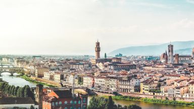
Oukaïmeden is a ski resort in the Atlas mountains near the Toubkal mountain, about 80 kilometres (50 mi) from Marrakesh, Morocco. The skiing area is at an altitude of between 2,600 metres (8,500 ft) and 3,200 metres (10,500 ft) and has six ski lifts. There are some hotels and ski rental facilities nearby. Oukaimeden has a warm-summer Mediterranean climate (Csb) with short but warm summers and long, chilly winters with a great amount of snowfall.
Visiting Oukaimeden
Duration: 20 minutes
Tours and Activities from High Atlas Mountains (Western)
At the end of the tarred road in the Ourika Valley is the village of Setti Fatma, which was rebuilt after devastating floods in 1995 and now has a mix of modern concrete housing blocks and traditional homes. Despite the development, the village’s setting among grassy terraces, walnut groves, and mountain peaks is still beautiful and makes it a good starting point for treks to Jebel Toubkal and the surrounding area. The moussem of Setti Fatma, one of the most important festivals in Morocco, takes place over four days every August.
What to see in Setti Fatma Village
A 30-minute scramble up the rocky foothills above Setti Fatma leads to a series of waterfalls (called cascades by the locals) with cafes nearby. The lower falls are easy to access, but the higher ones may be more challenging. Guides are available to take visitors to the higher falls. Ignore the numerous faux guides and book the official guides instead which have their office on the main street.
How to get to Setti Fatma Village
Drive south on road P2017 and continue straight at the Oukaimeden exit near Aghbalou. Setti Fatma is located at the end of the road just after Asgaour. Ignore everyone that tries to show you where to park and settle for a spot along the river.
When to visit Setti Fatma Village
Setti Fatma is a beautiful place to visit in early March when the cherry and almond trees are in full bloom. If you prefer to visit during the summer, the town hosts a four-day moussem in August which includes a fair and market at the koubba of Setti Fatma. However, the town can be very crowded and lively during this time. If you are looking for a more peaceful experience, you might consider visiting the neighboring valleys of Zat and Ouirgane instead.
Treks from Setti Fatma
The Ourika Valley cuts into the High Atlas Mountains, which are visible as soon as you leave Marrakesh. The town of Setti Fatma is located in this valley and offers stunning views of the surrounding peaks, including the Toubkal mountain range, which is popular for trekking and climbing. There are several routes to Toubkal from Setti Fatma, including a trek through Timichi and Oukaïmeden or a more challenging route directly from Timichi to Tachddirt. Other adventurous treks from Setti Fatma include the Djebel Yagour, with its many prehistoric rock carvings, Adrar Meltzen via Tourcht, and the secluded Oued Zat region reached by the Tizi n’Tilst. These treks require proper equipment, supplies, and planning, and it is advisable to enlist the help of a guide from Imlil for the more challenging options.
Visiting Setti Fatma Village, Atlas Mountains
Duration: 20 minutes
Tours and Activities from High Atlas Mountains (Western)
Ouirgane is a peaceful village, nestled in the tranquil foothills of the High Atlas Mountains in the heart of the Toubkal National Park lays the pretty Berber village of Ouirgane (pronounced Weer-gan).
About 90 minutes drive from Marrakech, it has a gentle winter climate and moderate in summer. This village provides an alternative and lesser-visited village base for walking, horse riding and mountain biking trips in the Atlas. It is also a good place to stop on a trip between Marrakech and Taroudannt or as an alternative day trip from Marrakech.
Wonderful views of the Toubkal range, a wide variety of bird life and a fresh and invigorating altitude of 1,000 metres await the traveller who makes it here.
Where is Ouirgane Village Located?
Ouirgane is located on the valley floor of the Oued Nfis (river Nfis), and spring is a fantastic time to visit when the almond blossoms are absolutely breathtaking. Imlil village makes for an interesting trip and a clear sight of Mount Toubkal.
What to do at Ouirgane Village
There are many easy walks around the village, some with views of Lake Yacoub el Mansour, created in 2008 with the construction of the Ouirgane Dam. The village’s two hotels can help visitors organize mountain biking (100dh per day), horseback riding (500dh for a half-day), and treks with a local guide (250dh per half-day) and mules (50dh per hour). The hotels also offer fine dining. The village is located 15km (91 miles) southwest of Asni, 63km (39 miles) south of Marrakech, and 158km (98 miles) northeast of Taroudannt.
You can also discover the Muslim sanctuary of Moulay Brahim near Asni (15 km) or the Jewish sanctuary of Rabi Haim ben Diwan near Anraz (2.5 km). Tin Mal mosque is a major place of interest and makes a pleasant morning trip with spectacular views en route.
Local Berber markets
Three Berber markets are within easy reach – Asni (Saturdays, 15 km), Talat n’ Yacoub (Wednesdays, 35 km) and Ouirgane itself (Thursdays).
Visiting Ouirgane Village, Atlas Mountains
Duration: 20 minutes
Tours and Activities from High Atlas Mountains (Western)
This picturesque lochside village provides great opportunities for fishing, walking, climbing and sailing. As soon as you’re off the beaten track on one of the many walking routes in the area, there’s a good chance you’ll catch sight of red squirrels, pine marten, deer, eagles or seals. The narrows at Strome (An Sròm; meaning the current, from Norse) create strong tidal currents resulting in rich marine communities – bottlenose dolphins can sometimes be seen in the loch and it’s a great place for underwater photography – the flame shell reef here was recently declared a Marine Protected Area. The exposed estuary at low tide also makes it a great place for the keen bird watcher and oystercatcher, curlew, redshank and greenshank are regularly found here. The village offers a range of local services and the Lochcarron Producers’ days (last Friday of every month, April – October) offers a chance to buy top quality local produce. There’s a vibrant community in Lochcarron and the community-owned Kirkton Woodland and Smithy Hub provide many facilities and activities for visitors and locals alike.
The village of Shieldaig is in a superb location and is perhaps best viewed from across the loch on the Applecross coast road. From here the village can be seen sitting below the mighty mountains of Torridon. Shieldaig was established in 1800 as a planned fishing village to encourage families into fishing and to build up a stock of trained seamen for the Royal Navy, during the Napoleonic wars. Grants from the Admiralty for house and boat building stopped in 1815 but Shieldaig continued to grow because the loch was well-known for its herring. The distinctive pine trees on Shieldaig Island, were planted to provide poles for drying fishermen’s nets but now provide a nesting site for a pair of white-tailed eagles (sometimes called sea eagles). From the front of Shieldaig village common seals can be seen at close quarters, along with eider ducks, oystercatchers and shags. The village has a range of tourist services and marine wildlife watching tours can be taken from the pontoon. From the north of the village there is a good path that takes you around the Shieldaig peninsula. Allow around an hour for the walk which has many lovely spots to admire the shoreline and look for otters and herons.
Burgh by Sands is a village situated near the Solway Firth and Carlisle in the north of England.
It is the site of a Roman Fort of Hadrian’s Wall called Aballava. The village has been occupied continuously since Roman times. Following the end of the Roman Empire in 410AD stones from the wall provided a stones for buildings all around, from St. Michael’s Church, to manors, farmhouses and barns.
The powerful Medieval King, Edward I of England also known as ‘Edward Longshanks’ or ‘The Hammer of the Scots’ died here in 1307. When he arrived, on his way to war against the Scots and Robert the Bruce, he was in poor health. He had camped on the marsh in a place where his army could cross to Scotland at low tide and died on 7th July . King Edward’s body lay in St Michael’s Church in Burgh by Sands until it was taken to Westminster Abbey. A monument was erected in 1685 on Burgh Marsh marks the spot where he died. After a period of decay another was erected by the late Earl of Lonsdale, in 1803. On the 700th Anniversary of his death a statue was of Edward was also erected in the village.
This 12-century St. Michael’s Church was probably erected upon the foundations of an earlier building. The stone carvings of mythological beasts in the undercroft are thought to be Anglo Saxon. In the 14th century with almost continuous cross-border warfare the inhabitants decided to build the west tower of the Church as a place of refuge from attack. The western end housed the bells, while the eastern tower protected the priest from Scottish raids! Later, in the 16th century, the notorious Border Reivers terrorized the area, from both sides of the border – the word “bereaved” being derived from their title.
It has been suggested that Burgh by Sands could be the location of Avalon and where King Arthur died. While many say the link is tenuous at best, there are some interesting clues that could point to it being a contender. The famous Welsh historian, Geoffrey of Monmouth, wrote in his “Historia Regum Brittaniae” where he described Avalon as “a magical place, rich in apples”. The Roman fort name Aballava also derives from apple. It’s also been suggested that Excalibur was forged there.
To provide the best experiences, we use technologies like cookies to store and/or access device information. Consenting to these technologies will allow us to process data such as browsing behavior or unique IDs on this site. Not consenting or withdrawing consent, may adversely affect certain features and functions.
Functional
Always active
The technical storage or access is strictly necessary for the legitimate purpose of enabling the use of a specific service explicitly requested by the subscriber or user, or for the sole purpose of carrying out the transmission of a communication over an electronic communications network.
Preferences
The technical storage or access is necessary for the legitimate purpose of storing preferences that are not requested by the subscriber or user.
Statistics
The technical storage or access that is used exclusively for statistical purposes.The technical storage or access that is used exclusively for anonymous statistical purposes. Without a subpoena, voluntary compliance on the part of your Internet Service Provider, or additional records from a third party, information stored or retrieved for this purpose alone cannot usually be used to identify you.
Marketing
The technical storage or access is required to create user profiles to send advertising, or to track the user on a website or across several websites for similar marketing purposes.